This site is in beta — data may be incomplete and features are still being added.
Council Meeting/Documents/Natural Asset Management: brief introduction
Presentation

Natural Asset Management: brief introduction

February 17, 2026Pages 5–1410 sectionsOriginal PDF

Slide presentation providing an overview of natural asset management and its benefits for local governments.

6.a R. Brooke, Natural Assets Initiative, Re: Natural Asset Management
February 2026Natural Assets InitiativeDistrict of Saanich natural assets value: $21 - $125 million per year

Natural Asset Management: brief introduction

February 2026

Page 5–14

Purpose

Provide information on natural asset management in response to following motion:

Whereas climate change is a leading driver of increased costs and disruptions at the local government level that requires action from all levels of government,

Therefore, be it resolved that Council direct staff to commence work towards completing a 2026 Municipal Natural Asset Inventory for the TOVR and direct staff to include natural assets in any updates to the corporate Asset Management Policy.

Also, be it resolved that appropriate funds be dedicated for an MNAI in the 2026 budget and that staff also apply for funding from all potential sources such as FCM.

Photo of a narrow stream running between natural vegetation and multi-story residential buildings
Page 5–14

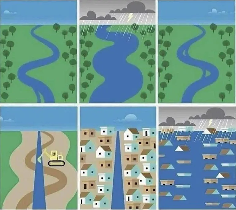
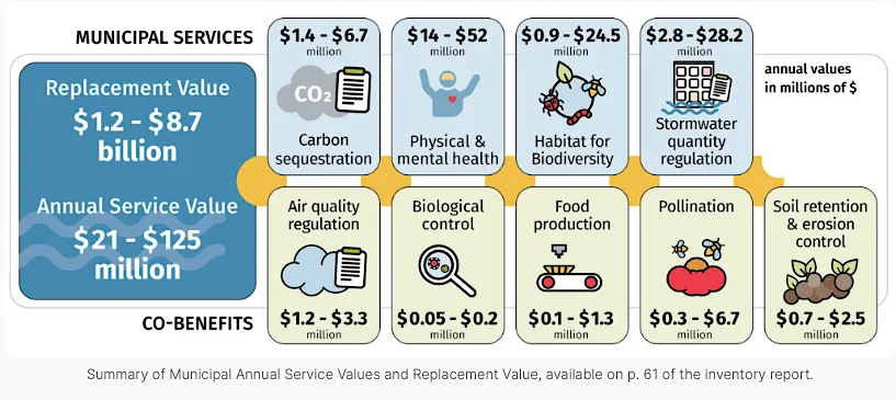
Nature can provide many solutions

  1. Nature: multiple services, manage risk, no end of useful life, ‘plasticity’
  2. Actions suggest otherwise. Nature seen as “green” amenity; nature-based solutions mostly disconnected pilots
  3. Converging crises. Some specific, some broad (infrastructure gap, resilience climate, biodiversity).
  4. Natural asset management: A scalable no-regrets approach to bring nature into decision-making for risk, service delivery + other benefits.
Six-panel illustration comparing the flood management of a natural meandering river with trees versus a straightened, urbanized channel
Page 5–14

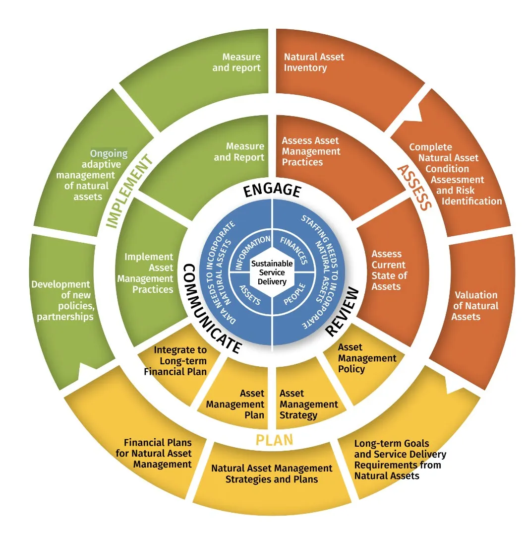
What it looks like for local governments

Resulting actions span acquisition, restoration, HR, planning & development charges ...

Circular diagram detailing the Natural Asset Management framework, organized into phases of Engage, Assess, Plan, and Implement, surrounding a core of Sustainable Service Delivery
Page 5–14

Partner communities in the CRD

Growing NAM interest and activity across the Capital region.
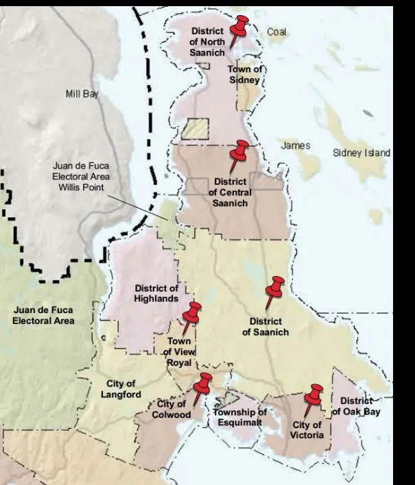
Map of the Capital Regional District (CRD) on southern Vancouver Island with red pins marking various municipalities including North Saanich, Sidney, Central Saanich, Saanich, Victoria, Oak Bay, Esquimalt, View Royal, Colwood, and Highlands
Page 5–14

District of Saanich

Infographic for the District of Saanich showing Replacement Values of $1.2 - $8.7 billion and Annual Service Values of $21 - $125 million, with breakdowns for carbon sequestration, physical/mental health, habitat, stormwater, air quality, biological control, food production, pollination, and soil retention

Report:

QR code linking to the District of Saanich natural asset inventory report
Page 5–14

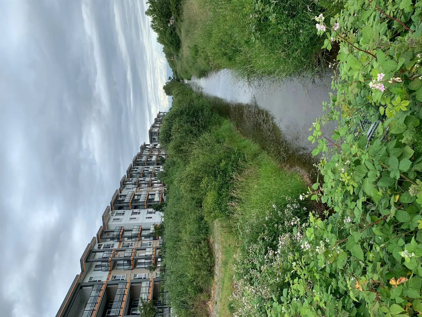
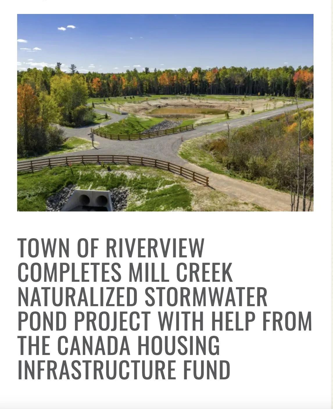
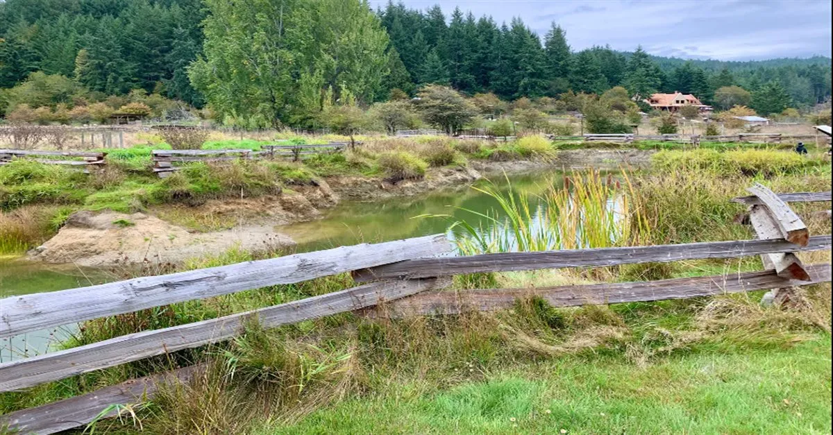
Housing-Enabling Natural Infrastructure: Riverview, NB

The Mill Creek Naturalized Stormwater Pond will:

  • Reduce local flood risks by collecting & managing stormwater
  • Enable almost 1,000 new housing units
  • Support affordability and density by allowing multi-unit housing developments and rezoning applications to move forward.
  • Improve environmental outcomes through a naturalized design that enhances water quality, supports biodiversity, and reduces erosion over time.

Supported by $800,000 through CHIF

Composite image showing a photo of the Mill Creek project site and a text box detailing the project's completion with help from the Canada Housing Infrastructure Fund
Page 5–14

Information and opportunities

Roadmap Program — high-level guidance, good intro to NAM

  • Over ~4 months, participants from cross-functional teams work with NAI to assess their current level in (and opportunities for) natural asset management, build shared awareness across departments, and co-develop concise roadmap of practical short- to medium-term actions to advance NAM

Nature is Infrastructure Workshop Series

  • Practical, 4-part virtual training designed to help local government staff include natural assets into formal asset management planning.
  • Workshops focus on priority services, condition assessments, risk identification, and valuation approaches

Other options include inventories, NAM plan development support

QR code for information on Training & Programs
Page 5–14

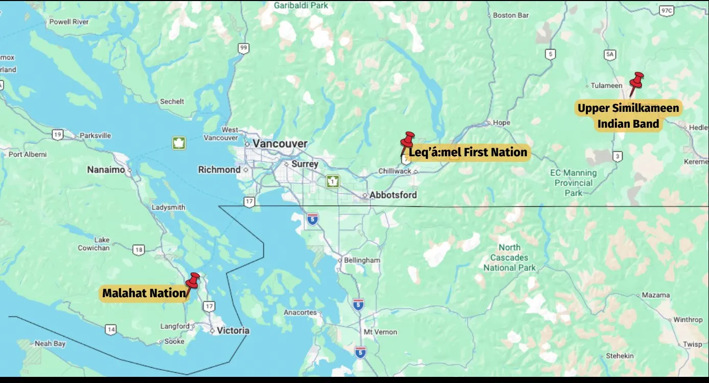
NAM and First Nations

Map of British Columbia with red pins indicating partner First Nations locations
Detailed regional map of southern British Columbia marking the locations of Malahat Nation, Leq'á:mel First Nation, and Upper Similkameen Indian Band
Page 5–14

Discussion & Contacts

Roy Brooke, Executive Director, NAI RoyB@naturalassetsinitiative.ca naturalassetsinitiative.ca

Photo of a wetland area with tall grass and a rustic wooden fence in the foreground
Page 5–14

Document Images

(3)
Document image
Document image
Document image
Extracted from: 2026 02 17 Council Meeting - Agenda - Pdf(168 pages total)