Official Community Plan Review and Update: Western Gateway Workshop (Background Report)
A comprehensive background report summarizing community engagement, road networks, and three proposed growth scenarios (High, Medium, and Low) for the Western Gateway Corridor.
Special Council Meeting February 24, 2026
Official Community Plan Review and Update: Western Gateway Workshop
What Is An Official Community Plan?
An Official Community Plan (OCP) is a municipal bylaw that outlines the community’s long-term vision over 10 to 20 years. It is also a reflection of the community’s values, interests, and aspiration for what the community wants to be, which is informed by feedback provided throughout the engagement process from residents, community stakeholders, Council, and committees.
The OCP also serves as a guiding document that manages growth, development, and investment in the community, that contribute to broad based community decisions that contribute to positive community change that affects social, economic, cultural, and environmental outcomes.
OCP Review & Update Components:
- Community Values & Interests
- Regional Growth Strategy
- Community Stakeholders
- Future Opportunities
- Provincial Legislation
- Residents Present and Future
- Council and Committee’s
- Emerging Challenges
Why Are We Updating the OCP?
The OCP is a living document, intended to be updated periodically to stay relevant as the community evolves and grows, and community interests and values change over time.
The OCP is also updated to ensure consistency with the Regional Growth Strategy, which guides broad land use planning, growth, and investment strategies, including: housing, transportation, the environment, and economic development.
In addition to local and regional alignment, the OCP must align with provincial legislation.
In 2024, the Town completed updates to the Zoning Bylaw to permit Small-Scale, Multi-Unit Housing (SSMUH). In 2025, the Town completed amendments to the OCP to ensure consistency with housing legislation and the Town’s Interim Housing Needs Report, which identified the required number of housing units over a 5 and 20 year period. As part of this update, the land use designation map in the OCP was amended to include a Hospital Transit-Oriented Area, Neighbourhood Village, and SSMUH land use designations, to ensure the Town had the capacity necessary to facilitate new housing units.
What Information Needs To Be In An OCP?
An OCP must adhere to the requirements outlined in the Local Government Act. The Act requires that an OCP provide statements of objectives and policies that guide planning and land use management. The OCP must also detail how the municipality will exercise its powers through development permitting processes to regulate the use and development of land, and the protection of environmentally sensitive, and hazardous areas.
Requirements of an OCP
An OCP is required to include statements and map designations for the following:
- Residential development required to meet anticipated housing needs over a 20-year period.
- Present and proposed commercial, industrial, institutional, agricultural, recreational, and public utility land uses.
- Present and proposed public facilities, including schools, parks and waste treatment and disposal sites.
- Sand and gravel deposits, suitable for future sand and gravel extraction.
- Phasing of any major road, sewer, and water systems.
- Restrictions on the use of land that is hazardous or sensitive to development.
- Targets for the reduction of greenhouse gas emissions, and policies and actions of the local government proposed to achieve those targets.
- Housing policies for affordable housing, rental housing, seniors, families, supportive housing, and special needs housing.
- Consider alignment with small-scale, multi-unit housing (SSMUH) and transit-oriented areas.
Optional Content in an OCP
An OCP may include the following content:
- Policies used by the local government relating to social needs, social well-being, and social development.
- A regional context statement, consistent with the rest of the plan, and how matters in the regional growth strategy are dealt with in the plan.
- Policies that address maintenance and enhancement of farming on land in a farming area or in an area designated for agricultural use.
- Policies related to the preservation, protection, restoration and enhancement of the natural environment, its ecosystems, and biological diversity.
- Policies related to alternative forms of transportation, and transportation demand management.
How Did We Get Here? OCP TIMELINE 2024 - 2026
- October 8, 2024 - Committee of the Whole
- Presented proposed project scope for the OCP review and update and draft Communications and Engagement Strategy for the project.
- The project scope and strategy were revised in response to Committee feedback.
- December 3, 2024 - Council
- Council awarded the OCP contract to Urban Systems Limited.
- January 13, 2025 - OCP Review Advisory Committee
- Staff presented a draft vision and guiding principles survey, based on feedback from OCP Review Advisory Committee.
- Council’s feedback was also incorporated.
- January 2025 - Project Launch
- January 24 - February 18, 2025 - Engagement on OCP Vision and Guiding Principles
- February 4, 2025 - Council
- Staff presented the project scope for the OCP’s Mixed-Use and Mixed Employment Analysis project scope to Council for feedback prior to the consultants starting the analyses.
- February 11, 2025 - Committee of the Whole
- Staff presented the project scope for the OCP’s Mixed-Use and Mixed Employment Analysis for feedback prior to the consultants embarking on analyses for the OCP.
- February 24, 2025 - OCP Review Advisory Committee
- The Committee reviewed and provided feedback on a draft land use and housing survey (i.e., Community Growth Survey).
- March 4, 2025 - Council
- Staff presented the draft Community Growth Survey and Engagement Plan for Council’s review and feedback.
- March 6, 2025 - Business Mixer and Consultation
- March 7 - April 4, 2025 - Engagement on Community Growth Framework
- April 1, 2025 - Council
- Staff presented the What We Heard Report for the Vision and Guiding Principles Survey, and the Business Mixer Workshop.
- May 5, 2025 - OCP Review Advisory Committee
- Staff presented the What We Heard Report on the Vision and Guiding Principles Survey, Community Growth Survey, and the Business Mixer Workshop.
- Staff also presented on the Housing Capacity Analysis and Land Use Scenario Memos, and provided an update on the next round of engagement.
- May 13, 2025 - Council
- Staff presented a draft vision statement and goals to reflect what we heard during engagement for Council’s review and consideration. Council provided comments to inform a subsequent survey with three draft vision statements and eleven draft goals.
- Staff presented a What We Heard Report on the Community Growth Survey, and comments from the open houses and workshops.
- Staff presented a report on a proposed third round of engagement scheduled to take place between May 16 and June 8, 2025. Council had the opportunity to provide feedback on engagement methods and activities.
- Staff presented the Land Economics Study Update and Housing Capacity Analysis and three proposed Land Use Scenarios for consultation with the public.
- June 2, 2025 - OCP Review Advisory Committee
- Staff presented on the OCP Phase 1 process update and the draft Vision and Land Use Survey.
- June 10, 2025 - Committee of the Whole
- Staff presented the draft Vision and Land Use Survey for Committee review and feedback.
- Staff also presented a Phase 1 Process Update report. The Committee recommended changes to project scope related to OCP land use designations by only considering amendments to the OCP land use designations for Small-Scale, Multi-Unit Housing (SSMUH) properties, properties within the Hospital Transit-Oriented Area (HTOA), and properties along the Western Gateway Corridor.
- It was also recommended to remove reference to Town Centre in the OCP.
- No other proposed changes to existing land use designations in the 2011 OCP would be considered.
- July 8, 2025 - Committee of the Whole
- Following changes to project scope, staff presented a report requesting an adjustment to the project budget by allocating some of the 2026 budget to 2025 to allow staff and consultants to begin work on Phase 2 of the OCP project in 2025 that was planned for 2026.
- Staff presented a report on a Council motion to implement a requirement for commercial space or public use space in any new developments above four-storeys.
- July 15, 2025 - Council
- Staff presented the draft vision survey to seek feedback from Council prior to launching the survey.
- July 18 - September 7, 2025 - Engagement on Draft Vision Statements and Eleven Goals
- August 25, 2025 - OCP Review Advisory Committee
- Staff provided an update on the project scope and timeline.
- Staff also presented the draft Western Gateway Corridor Survey for the Committee’s review and feedback.
- September 9, 2025 - Committee of the Whole
- Staff presented the draft Western Gateway Corridor Survey for Committee review and feedback.
- Staff also presented the proposed amendments to the OCP to align the OCP with the Interim Housing Needs Report and Zoning Bylaw (i.e., SSMUH zoning and Transit Oriented Area schedule).
- October 7, 2025 - Council
- Staff presented a report on the proposed amendments to the OCP to align the OCP with the Interim Housing Needs Report and Zoning Bylaw (i.e., SSMUH zoning and Transit-Oriented Area schedule) prior to first and second reading.
- October 10 to November 7, 2025 - Engagement on Western Gateway Corridor
- November 3, 2025 - OCP Review Advisory Committee
- Staff presented on the draft Objectives and Policies Review Survey based on the 50% draft for Committee’s review and feedback. Staff also provided the Committee with an update on next steps in the project.
- November 4, 2025 - Council & First Public Hearing
- First public hearing on the proposed OCP bylaw amendments (Bylaw No. 1156) to align OCP with the Interim Housing Needs Report and Zoning Bylaw.
- Following the Public Hearing, staff presented a report on the proposed OCP bylaw amendments (Bylaw No. 1156) prior to third reading of the bylaw.
- Third reading was not given at this Council meeting, and further amendments were requested by Council.
- November 7 to November 30, 2025 - Engagement on 50% Draft Policies
- November 18, 2025 - Council
- As per Council’s motion, staff presented a report to rescind second reading of Bylaw No. 1156 and give a new second reading to an amended Bylaw 1156 and set a new public hearing date for December 2, 2025.
- December 2, 2025 - Council & Second Public Hearing
- Second public hearing on the proposed OCP bylaw amendments (Bylaw No. 1156) to align OCP with the Interim Housing Needs Report and Zoning Bylaw.
- Council gave third reading and adoption on Bylaw No. 1156.
- December 2025 - February 2026 - Preparation of the First Draft OCP
- January 13, 2026 - Committee of the Whole
- Staff presented What We Heard Reports on the Vision Survey, Western Gateway Community Corridor Survey, workshops and open houses, and the Policy Review Survey and open houses.
- February 10, 2026 - Committee of the Whole
- Staff presented the 2026 OCP framework.
- The Committee passed a motion to schedule a Council workshop on the Western Gateway Corridor.
- February 24, 2026 - Special Council Meeting - Workshop
- Staff to present on the Western Gateway Corridor land use designations and mapping, and decision points to date.
- Council and OCP Review Advisory Committee to provide decision points on details to inform updates to the First Draft of the OCP.
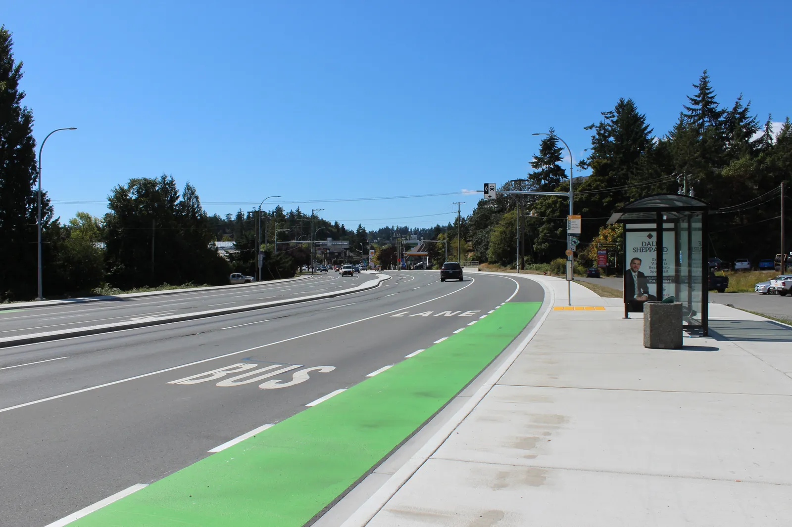
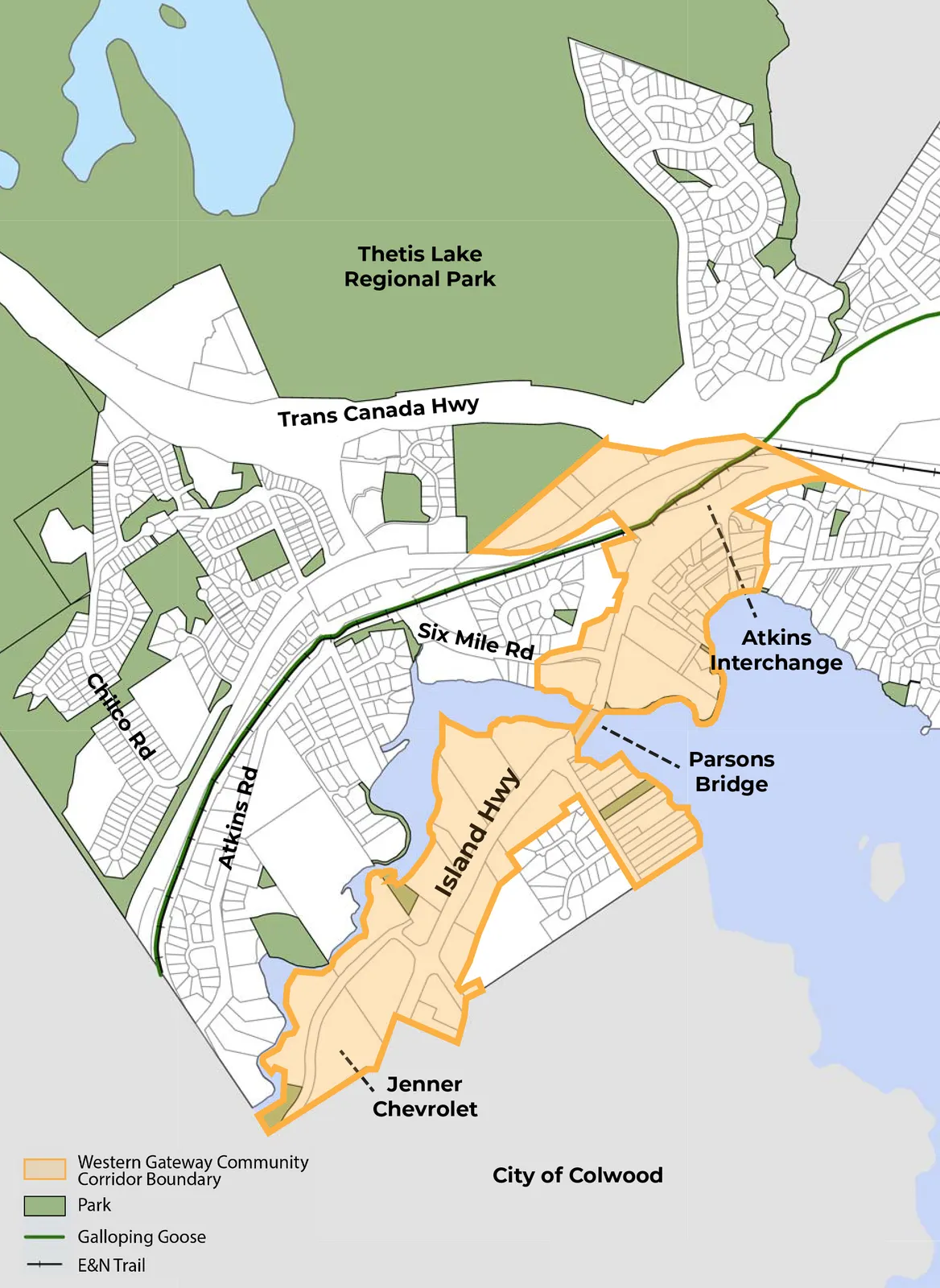
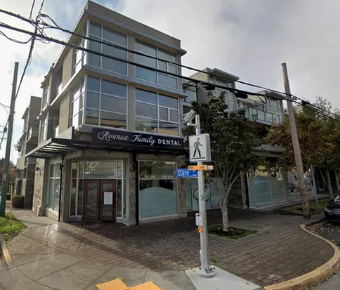
The Western Gateway Corridor
The Western Gateway Corridor includes lands along Island Highway between the Atkins Interchange and Colwood City border. Council expressed an interest in exploring this area further as part of the OCP review and update during the June 10, 2025, Council meeting. The interest was to consider this area as an employment hub, one that provides a mix of commercial, tourist accommodation, some light industrial, and residential uses.
In consideration of this direction, the first draft of the OCP is proposing commercial and light industrial land uses south of Parsons Bridge, and focuses on mixed-use commercial and residential land uses north of Parsons Bridge.
Engagement Summary for the Western Gateway Corridor
The Town has completed three separate engagement touchpoints on the Western Gateway, between January 2025 and December 2025. The following is a summary of the findings.
Vision and Guiding Principles Survey: January 24 - February 18, 2025
The Vision Survey was the first engagement touchpoint for the OCP review and update and focused on getting a sense of the community’s values, interests and aspirations of the future, which would help inform the creation of a vision statement and supporting goals.
As part of this survey, participants were asked to drop ‘pins’ on a map of View Royal and identify areas they would like to preserve, enhance, and change.
- Preserve: participants would like to preserve 1700 and 1720 Wilfert, and other green spaces in the corridor.
- Enhance: participants identified the need to enhance this area, with a focus on vacant property and underutilized lands. Participants were interested at the possibility of providing additional services, including mixed use commercial and residential development, and light industrial uses. Participants felt that higher density was appropriate for the area.
- Change: participants identified the need for protected bike lanes, improvements to the waterfront greenspace, and felt that there was more opportunities for higher density development, with commercial and light industrial uses.
Business Mixer Workshop: March 6, 2025
The project team held a workshop with business owners in the community at the Scottish Cultural Community Centre. Participants were asked three questions to help inform the project team on the opportunities and challenges that local business face in the community.
What is View Royal doing well that helps growth of your business?
- Participants identified the possibility to develop, the proximity of transit services and housing, and walkability as key factors.
Are there any challenges, specific to View Royal, that are affecting your business?
- Participants identified traffic congestion and volume, access, the permitting process, and a lack of commercial and mixed-use development spaces, and community spaces and events.
What can be improved in View Royal to facilitate economic growth?
- Participants identified the need for improvements to transit service, more mixed use development, more space for restaurants, grocery stores, developments similar to Eagle Creek, community events and destinations, and improvements to walkability and gathering spaces.
Community Growth Survey: March 7 - April 4, 2025
The project team launched an online survey to hear from residents how they would like to see the community grow, develop, and change in the future.
To facilitate future growth over the next 20 years, would you support expansion of our existing Community Corridors, to support transit and transit-oriented development?
- 83% of participants supported the expansion of the Western Gateway Community Corridor, whereas 12% did not.
How should the Town’s Western Gateway Community Corridor develop in the future?
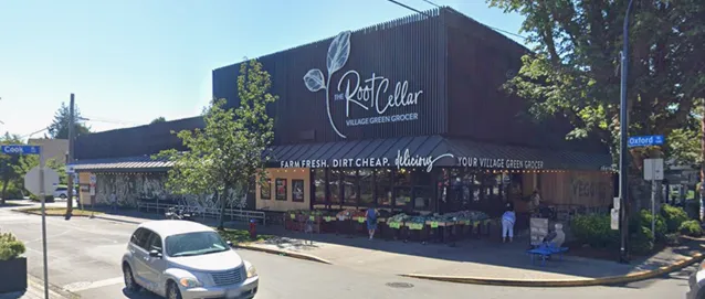
- 51% of respondents indicated an interest in mixed-use development, with a focus on commercial, light industrial, and some residential uses.
- 18% of respondents had identified an interest in only commercial and light industrial uses.
- 10% of respondents identified an interest in having only residential development.
Please indicate your support to increase the height of buildings within the Town’s existing Western Gateway Community Corridor?
- 78% of respondents indicated that they support an increase in the height in the Western Gateway Community Corridor, whereas 17% of respondents did not.
- Of the 78% of respondents that indicated a support for an increase to the height from 4 storeys: 21% of respondents supported an increase of 10+ storeys or more, 33% supported up to 10 storeys, and 24% supported up to 6 storeys.
Top Five Identified Themes from Written Responses:
- Building and Site Design (33%)
- Density (29%)
- Building Character/Height Transition (23%)
- Affordable Housing (16%)
- Preserving Existing Form and Character of View Royal (16%)
Western Gateway Corridor Engagement: October 7 - November 21, 2025
Engagement Overview:
- Western Gateway Corridor Survey (October 7 - November 21, 2025)
- Community Workshop (October 18, 2025)
- Open Houses (October 18, 2025 and October 22, 2025)
- Focus Group: Business & Land Owner Workshop (October 21, 2025)
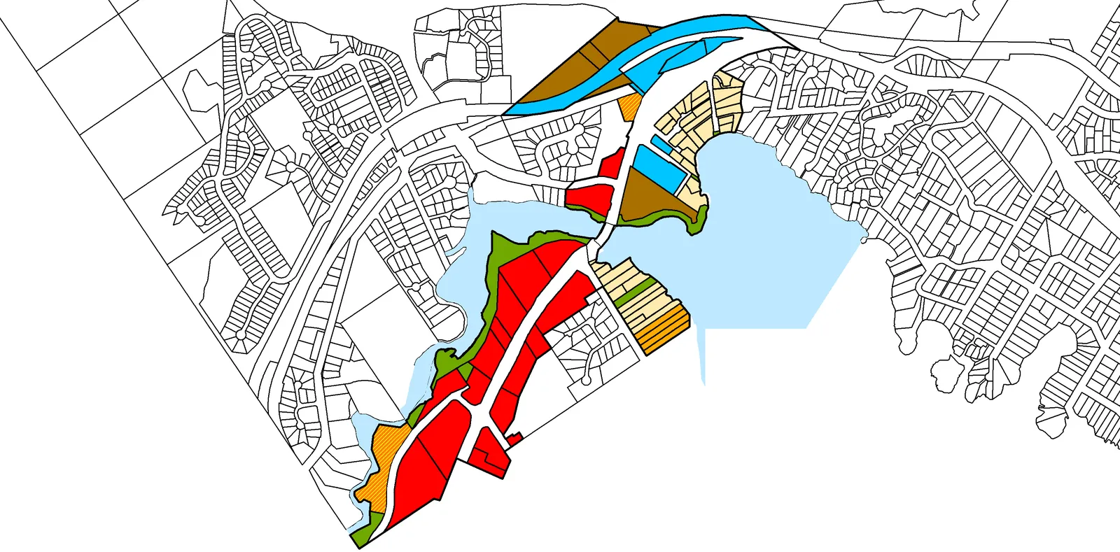
Participants were able to provide feedback on three land use scenarios, a high density, medium density, and low density option. The low density option was the existing land use designations for the area, taken from the 2011 OCP.
Visioning and Values for the Western Gateway:
- Participants indicated that their primary purpose for visiting or travelling through the corridor was for shopping, dining, or personal services.
- Participants indicated that the value of the Western Gateway Corridor right now is its ability to act as a gateway between communities, and its ability to provide multi-modes of transportation.
- Participants felt strong that heavy traffic and congestion is the biggest drawback to the corridor right now, and that they are concerned this will remain an issue in the future.
- Participants felt that improvements to transit, cycling, and walking infrastructure should be prioritized for this area.
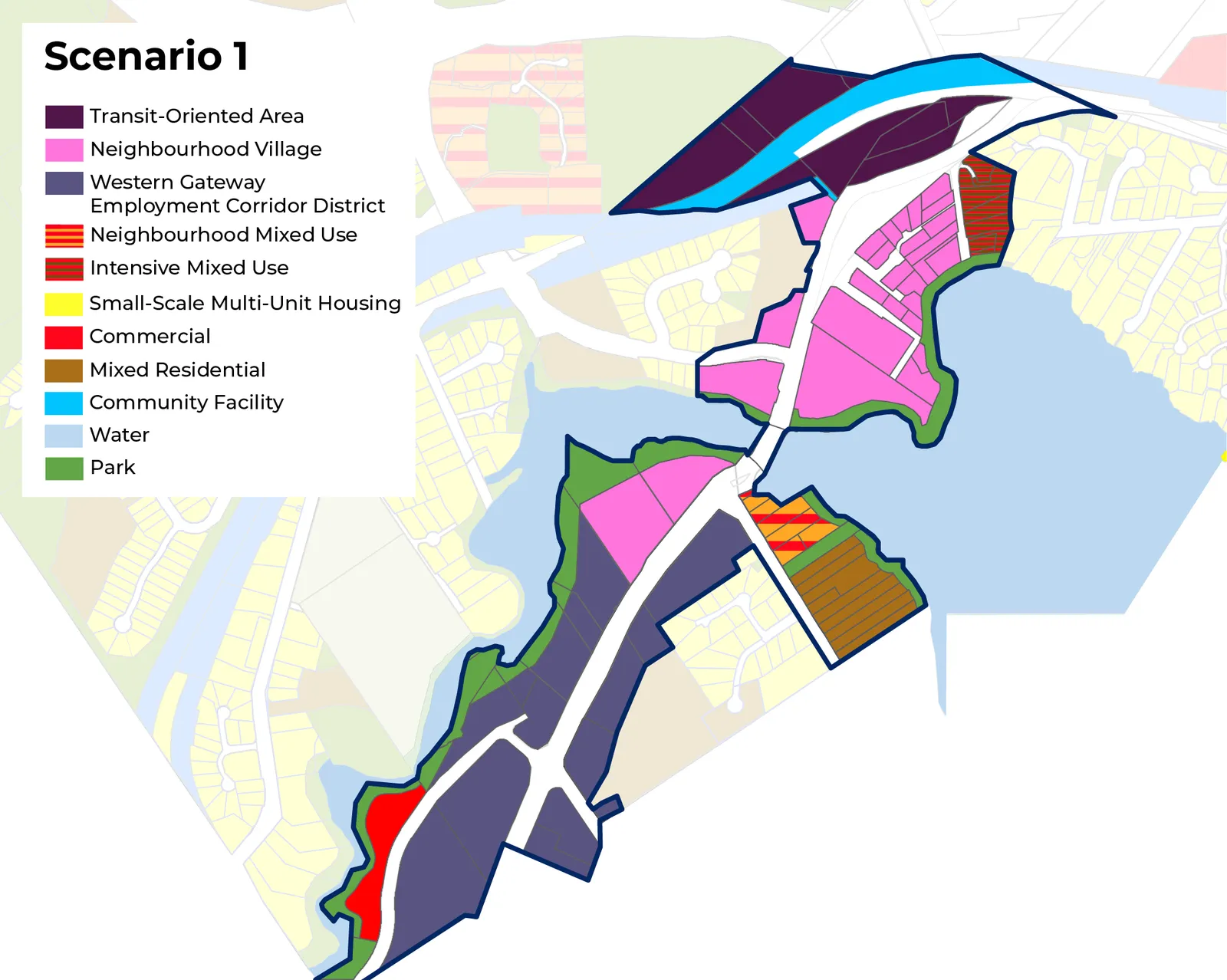
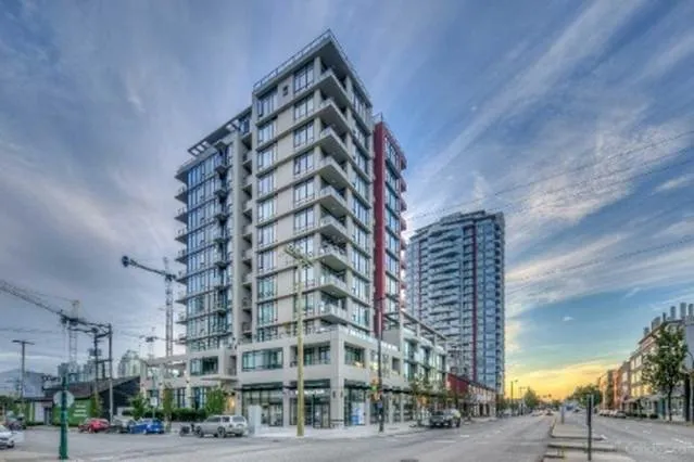
Scenario 1: High Growth
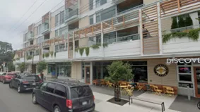
This scenario focuses on creating a high-density employment hub with a mix of commercial, light industrial, and community uses.
KEY FEATURES:
- Establishes a new Employment Corridor District supporting commercial, light industrial, civic, and arts and culture uses
- Introduces two mixed-use growth areas: Transit-Oriented Area and Neighbourhood Village
- Includes public gathering spaces and improved connections to transit and active transportation
- Waterfront park land designated for long term parks and trails planning and flood protection
POTENTIAL GROWTH AND DEVELOPMENT:*
- Residential units: 2200 (up to 5,375)
- Population: 5100 (up to 12,300)
- Commercial floor area: 238,500 m²
- Light industrial floor area: 160,400 m²
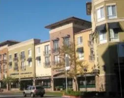
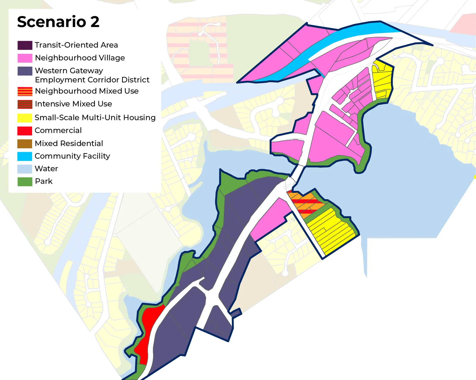
Scenario 2: Medium Growth
This scenario focuses on creating a medium-density employment hub with a mix of commercial, light industrial, and community uses.
KEY FEATURES:
- Establishes a new Employment Corridor District supporting commercial, light industrial, civic, and arts and culture uses
- Introduces a new growth area: Neighbourhood Village
- Introduces public gathering spaces and improved connections to transit and active transportation
- Waterfront park land designated for long term parks and trails planning and flood protection
POTENTIAL GROWTH AND DEVELOPMENT:*
- Residential units: 1700 (up to 3,800)
- Population: 3900 (up to 8,700)
- Commercial floor area: 204,200 m²
- Light industrial floor area: 155,500 m²
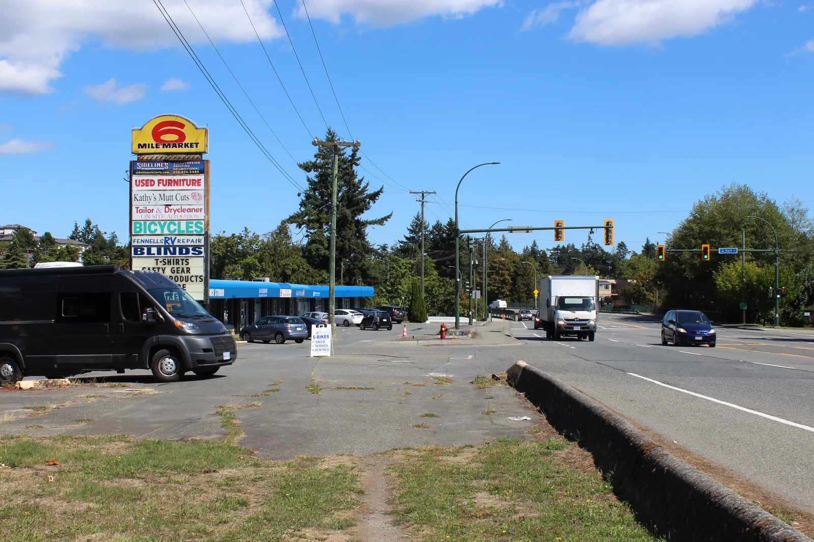
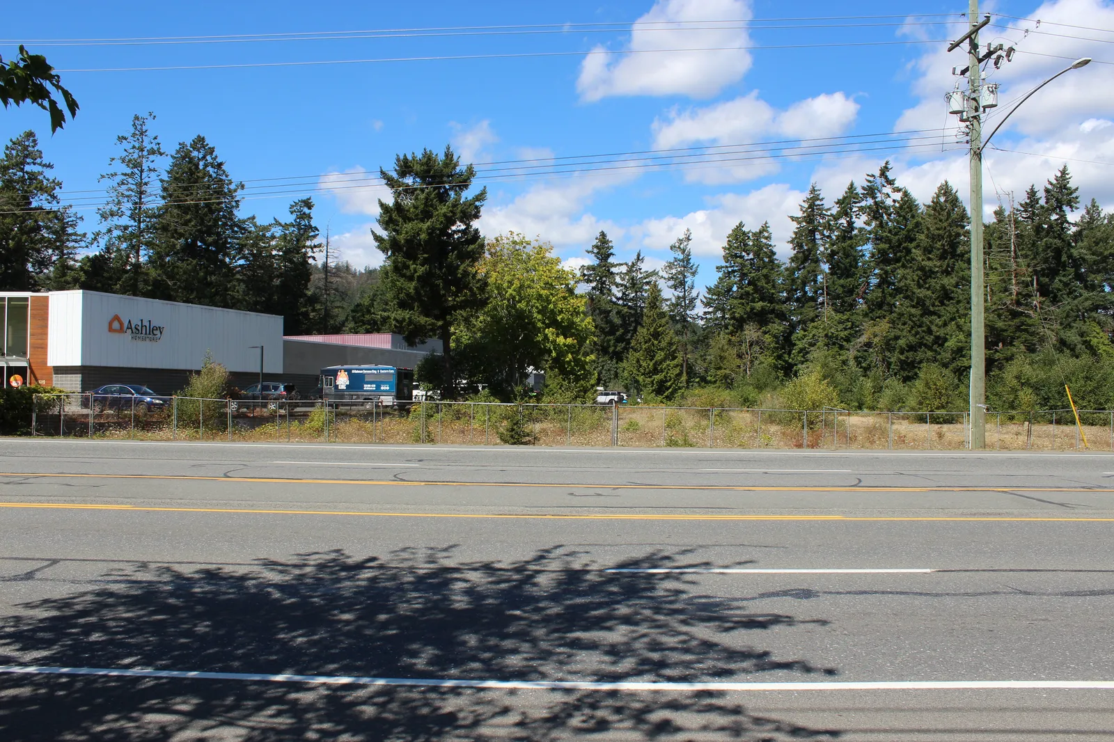
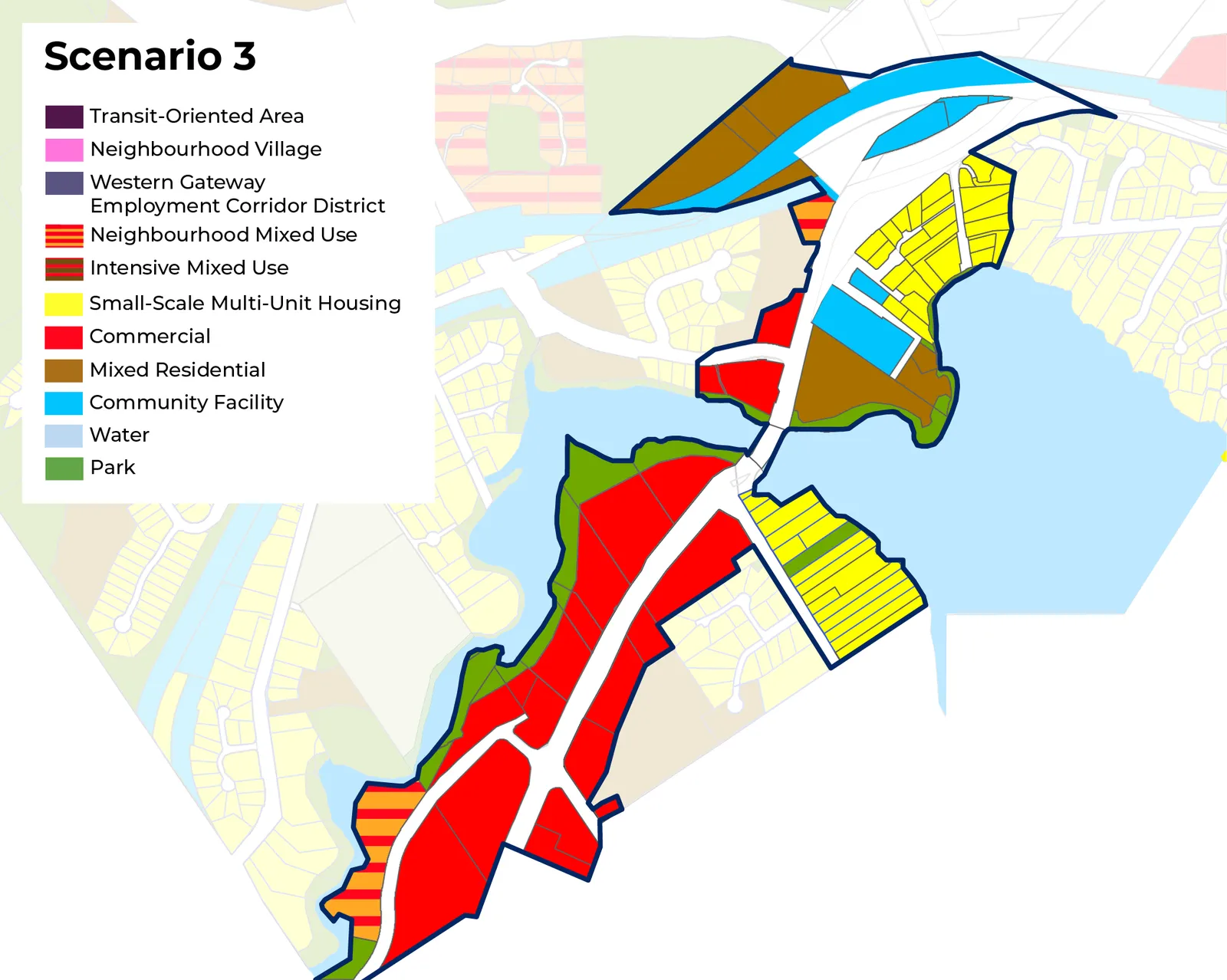
Scenario 3: Low Growth (2011 OCP Land Uses)
This scenario is unchanged from the 2011 Official Community Plan, and continues to focus on providing a mix of commercial uses along Island Highway with some low density housing around the Atkins Interchange.
KEY FEATURES:
- Continues to permit a mix of commercial uses including general retail and service commercial
- Would not permit new land uses, such as light industry and civic uses, and would have limited potential to permit higher density mixed-use and residential development
- Does not include designated park land along the waterfront in all areas of the Western Gateway Community Corridor
POTENTIAL GROWTH AND DEVELOPMENT:*
- Residential units: 1400 (up to 2,200)
- Population: 3300 (up to 5,075)
- Commercial floor area: 311,600 m²
- Light industrial floor area: 0 m²
Preferred Land Use Scenario
The project team completed a comprehensive review of all feedback provided to determine the preferred land use scenario.
- Scenario 2: Medium Growth (39%)
- Scenario 1: High Growth (27%)
- Hybrid of the scenarios (17%)
- Scenario 3: Low Growth (14%)
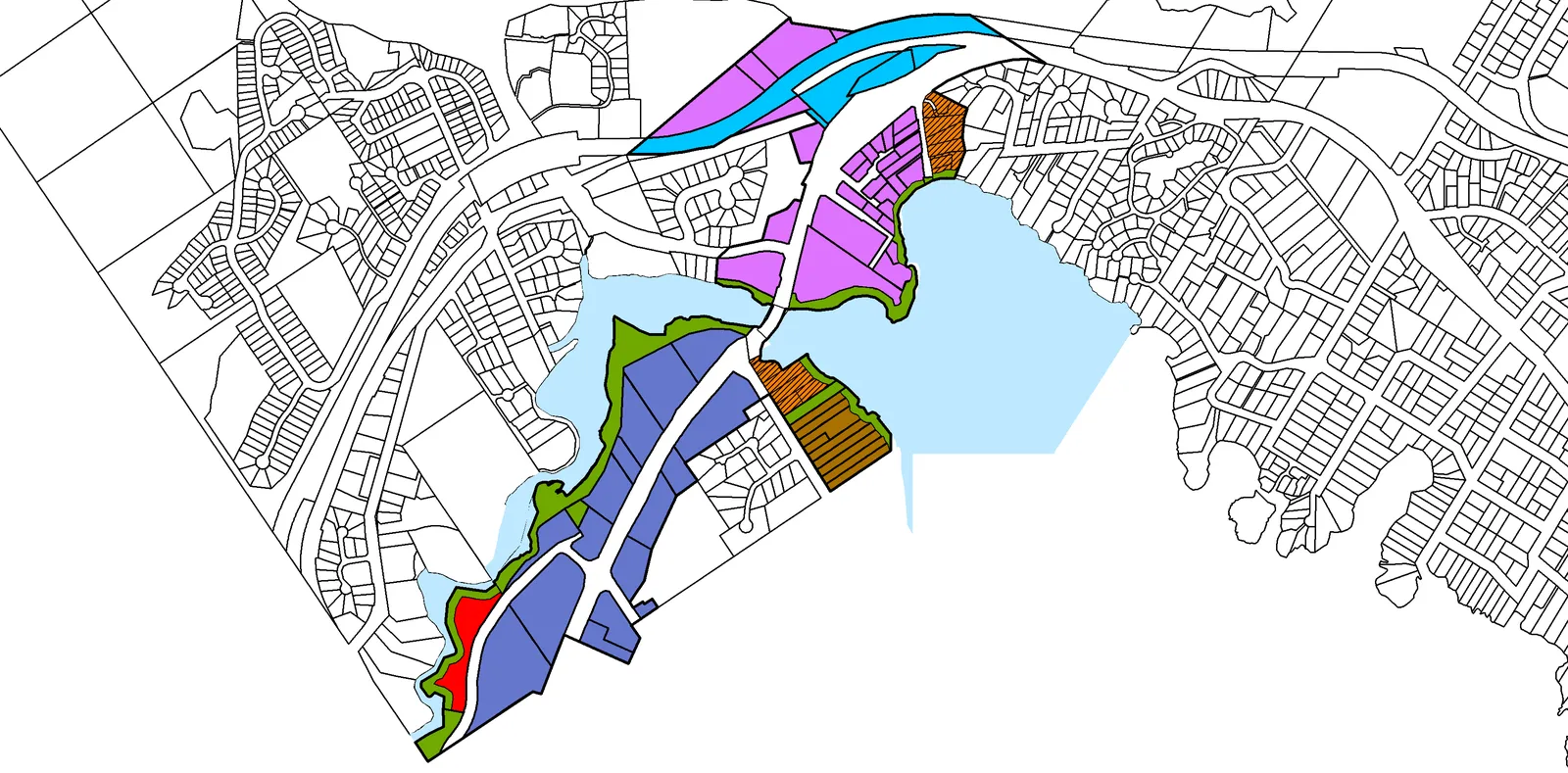
Developing the First Draft OCP Western Gateway Corridor Scenario:
The project team moving forward with a modified version of Scenario 2: Medium Growth, taking elements of this scenario, and of Scenario 1: High Growth. The majority of responses supported a clear increase in density with a focus on commercial, light industrial, and mixed-use development.
Development Context:
2011 Official Community Plan Land Use Designations
| Land Use Designation | Height and Density | Examples |
|---|---|---|
| Small-Scale, Multi-Unit Housing (SSMUH) Uses include Detached and Attached Dwellings, such as Detached Residential, Duplex, Secondary Suite, Garden Suite, Rowhouse, Townhouse, Houseplex, and Apartments |
• Up to 3 storeys • Up to 3 or 4 units OR • Up to 6 dwelling units if within 400 metres of a prescribed transit stop |
 |
| Mixed Residential Small Lot Detached Houses, Townhouses and Low-Rise Apartments |
• Up to 3 Storeys/1.25 FSR • 4 Storeys/1.6 FSR for Apartments |
 |
| Neighbourhood Mixed Use Commercial with Townhouses and Low-Rise Apartments |
• Up to 3 Storeys/1.25 FSR • 4 Storeys/1.6 FSR for Apartments |
 |
| Intensive Mixed Use Commercial with Townhouse and Low-Rise Apartment NOT AN EXISTING USE WITHIN THE WESTERN GATEWAY CORRIDOR |
• Up to 4 Storeys • 2.5:1 Floor Space Ratio |
 |
| Commercial Retail, Office, Technology and Service Commercial |
• Up to 4 Storeys • 2.5:1 Floor Space Ratio |
 |
| Neighbourhood Centre Commercial with Apartments NOT AN EXISTING USE WITHIN THE WESTERN GATEWAY CORRIDOR |
• Up to 6 storeys • 3.0 FSR Permitted |
 |
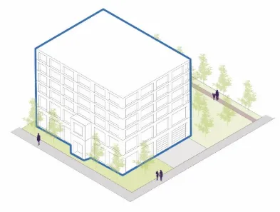
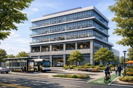
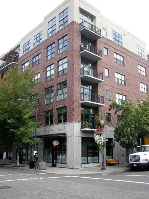
| Transit-Oriented Area Includes mixed-use development with apartments, visitor accommodations, restaurants, retail, office spaces, and civic uses. NOT AN EXISTING USE WITHIN THE WESTERN GATEWAY CORRIDOR |
• Up to 10 Storeys • 3.5:1 Floor Space Ratio |
 |
| Neighbourhood Village Small-scale, mixed-use development that permits multi-unit housing, commercial, and civic uses. NOT AN EXISTING USE WITHIN THE WESTERN GATEWAY CORRIDOR |
• Up to 6 Storeys • 2.5:1 Floor Space Ratio |
 |
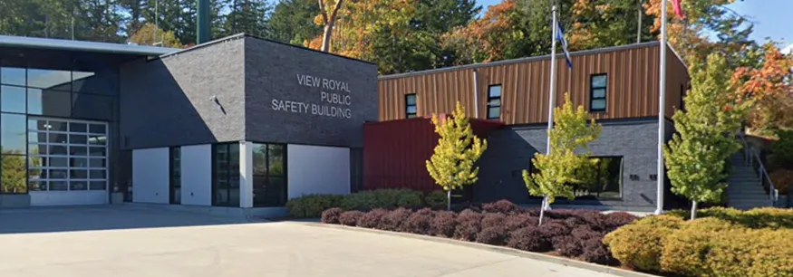
| Community Facility Government buildings and land used to provide service delivery to the community and surrounding region |
• Heights vary | |
| Park Local and Regional Trails |
• N/A | |
| Rural Agricultural, Recreation and Large Lot Residential NOT WITHIN THE WESTERN GATEWAY CORRIDOR |
• Up to 2 Storeys and 1 Unit per 10 hectares |
Western Gateway Corridor - Proposed Land Use Designations in First Draft of the Official Community Plan
| Land Use Designation | Height and Density | Major Shifts |
|---|---|---|
| Small-Scale, Multi-Unit Housing (SSMUH) | Up to 3 or 6 storeys (see criteria) | Replaced with Neighbourhood Village, Mixed Residential, and Intensive Mixed Use in the corridor. |
| Mixed Residential | Up to 3 or 4 storeys | New area designated along waterfront on Hart Road; existing single parcel redesigned as Neighbourhood Village. |
| Neighbourhood Mixed Use | Up to 3 or 4 storeys | Land use removed and replaced by Commercial and Neighbourhood Village. |
| Intensive Mixed Use | Up to 4 Storeys; 2.5:1 FSR | Added in two locations: Atkins Interchange and south of Parson Bridge. |
| Commercial | Up to 4 Storeys; 2.5:1 FSR | Replaced with Western Gateway Employment District Corridor; single parcel remains designated Commercial. |
| Western Gateway Employment District Corridor | Up to 6 storeys; 2.5 FSR | New designation for commercial, tourist accommodations, and light industrial uses. |
| Neighbourhood Village | Up to 6 Storeys; 2.5:1 FSR | Replaces existing SSMUH, Community Facility, and Mixed Residential designated properties. |
| Community Facility | Heights vary | Properties along south side of Island Highway redesigned as Neighbourhood Village. |
| Park | N/A | Additional park land designated along the waterfront throughout the Corridor. |
Land Use Capacity Analysis
The Town completed an internal land use capacity analysis to calculate the potential density increase of the Western Gateway Corridor.
Key Information:
- Total land area: approx. 282,000 m²
- Maximum height: 6 storeys
- Maximum FSR: 2.5
| Metric | 2011 OCP Review | First Draft Review |
|---|---|---|
| Gross Floor Area | 475,000 m² | 636,000 m² |
| Total Retail Area | 312,000 m² | 225,000 m² |
| Total Industrial Area | 0 m² | 152,000 m² |
| Total Residential Area | 147,000 m² | 255,000 m² |
| Total Number of Retail Parking Spaces | 10,410 | 7,510 |
| Total Number of Industrial Parking Spaces | 0 | 2,940 |
| Total Number of Residential Parking Spaces | 3,090 | 6,275 |
| Total Number of Residential Units | 2,200 | 4,480 |
| Total Number of Residents | 5,075 | 10,310 |
The first draft OCP considers additional density and new land use designations, which permit new uses in the area. The addition of light industrial uses in the first draft OCP, create opportunities to change the existing land use within the corridor and the distribution of commercial uses.
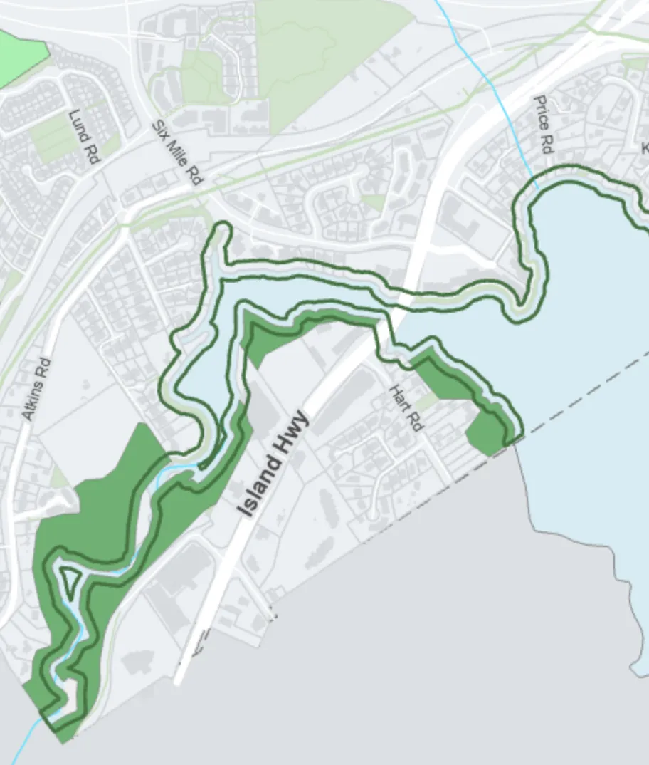
Existing Environmental Protections: Development Permit Areas
The Town has two Environmental Development Permit Areas within the Official Community Plan:
- Natural Water Course and Shoreline area
- Sensitive Terrestrial Ecosystems area
The Watercourse and Shoreline Development Permit Area applies to lands 15 m upshore from the ocean, and 30 m from the bank of streams and watercourses. A development permit is required to remove vegetation or alter land within these areas.
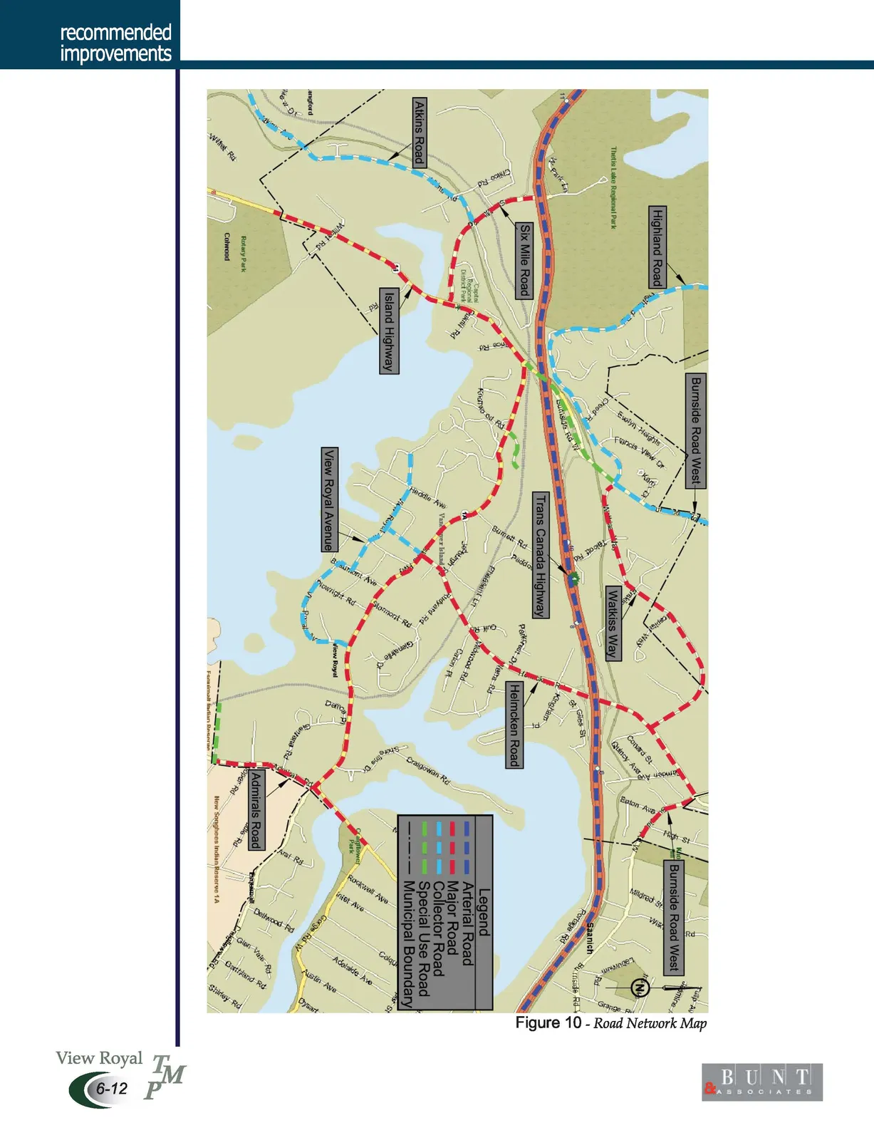
View Royal Road Network Map
Transit Service Operation and Service Demand
| Typical Operating Environment | Average Density (Population and Jobs/Hectare) |
|---|---|
| Rapid: Operates primarily on arterial streets with investments in transit priority. | > 50 |
| Frequent: Operates on arterial streets, potentially with some route parts serving neighbourhoods. | > 50 |
| Standard: Operates on a mixture of arterials and neighbourhood streets. | 30-50 |
| Basic: May operate on arterials and serve commercial areas for short periods. | < 30 |
| Targeted: Varies based on service type. | |
| Express: Varies based on service type. | |
| On-Demand: Operates primarily in neighbourhoods and rural areas. | < 30 |
| Custom: Serves all operating contexts based on customer need. | N/A |
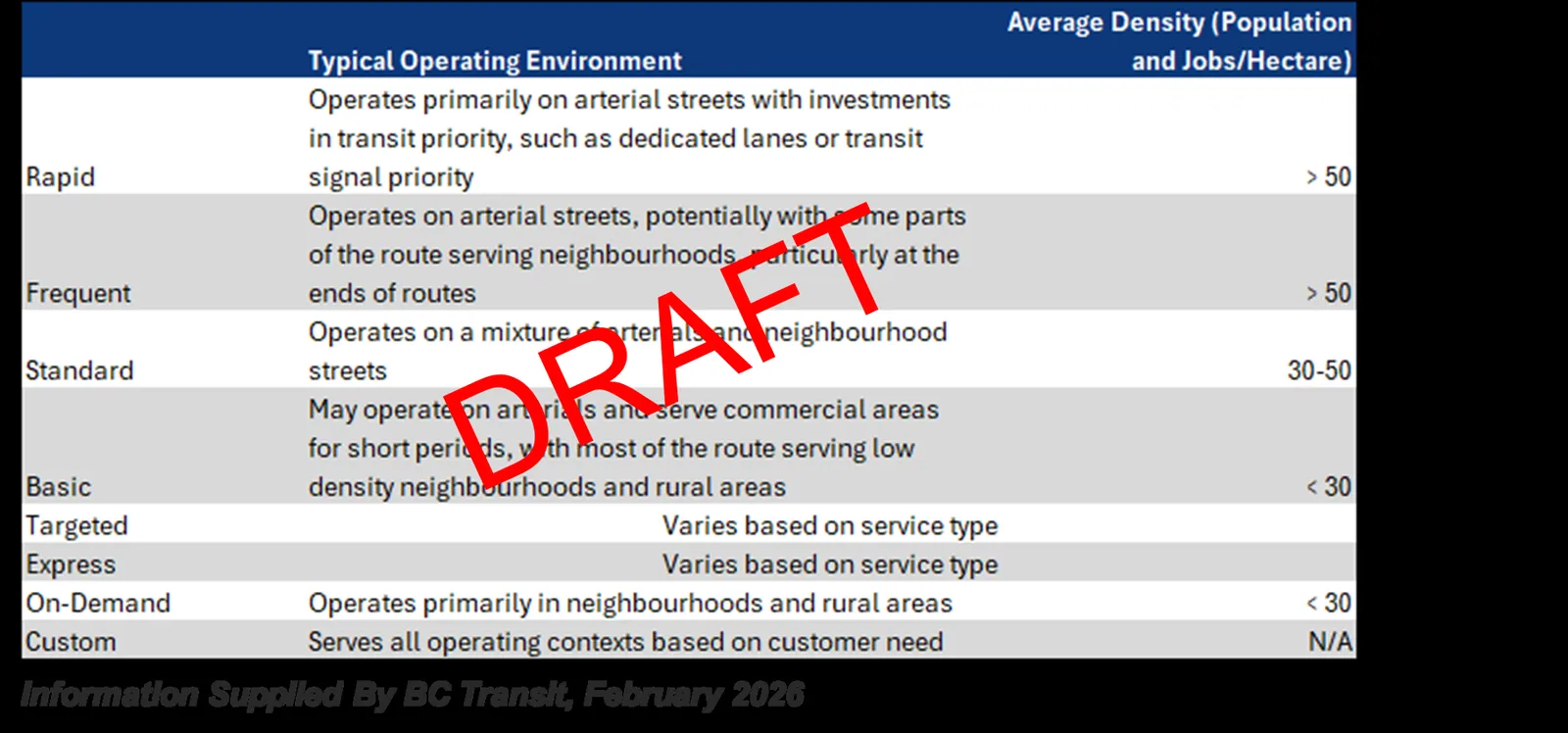
Information Supplied By BC Transit, February 2026