Attachment 2: View Royal 2050: Our Future View Official Community Plan DRAFT
The full draft text of the new Official Community Plan, including land use designations, housing and transportation policies, and development permit areas.
View Royal 2050: Our Future View
Official Community Plan DRAFT
Territorial Acknowledgement
The Town of View Royal humbly acknowledges that it is situated upon the unceded traditional territories of the lək̓ʷəŋən (Lekwungen) Peoples, known today as the Xʷsepsəm and Songhees Nations. We honour and respect the history, languages, ceremonies, and culture of the First Nations peoples, including the Xʷsepsəm and Songhees Nations, as well as the Métis, Inuit, and Non-Status Aboriginal Peoples whose presence and culture enrich the community.
These lands have been stewarded by the lək̓ʷəŋən Peoples since time immemorial, and their connection to the land and waters and Title and rights in these territories remain intact. As a local government, we are settlers and guests on these lands and acknowledge our responsibility to the land, its resources, and its people. We give thanks to the lək̓ʷəŋən People—past, present, and future—for their stewardship, care, and leadership on these lands.

Contents
Part One: The Plan Context
1.0 Plan Overview 1.1 What is an OCP? 1.2 How We Got Here 1.3 How to Use This OCP 2.0 View Royal 2050 2.1 Overview 2.2 Vision 2.3 Goals 3.0 Reconciliation 3.1 Context 3.2 Songhees Nation Today 3.3 Xʷsepsəm Nation Today 4.0 Context of View Royal 4.1 Physical Setting 4.2 Community Traits 4.3 Regional Trends 4.4 Community Profile 4.5 Community Growth
Part Two: Land Use
5.0 Land Use 5.1 General Framework and Considerations 5.2 Western Gateway Employment District Corridor Designation 5.3 Hospital Transit-Oriented Area Designation 5.4 Neighbourhood Village Designation 5.5 Neighbourhood Centre Designation 5.6 Commercial Designation 5.7 Intensive Mixed Use Designation 5.8 Neighbourhood Mixed Use Designation 5.9 Mixed Residential Designation 5.10 Small-Scale Multi-Unit Housing Designation 5.11 Residential Designation 5.12 Large Lot Residential Designation 5.13 Rural Designation 5.14 Community Facility Designation 5.15 Parks, Trails and Open Space Designation 5.16 Urban Reserve Designation
Part Three: Policies
6.0 Housing 6.1 Context 6.2 Objectives 6.3 Policies 7.0 Transportation and Mobility 7.1 Context 7.2 Objectives 7.3 Policies 8.0 Community Infrastructure and Services 8.1 Context 8.2 Objectives 8.3 Policies 9.0 Economic Development 9.1 Context 9.2 Objectives 9.3 Policies 10.0 Natural Environment 10.1 Context 10.2 Objectives 10.3 Policies 11.0 Climate Action and Sustainability 11.1 Context 11.2 Objectives 11.3 Policies 12.0 Parks, Trails and Recreation 12.1 Context 12.2 Objectives 12.3 Policies 13.0 Community Well-Being and Culture 13.1 Context 13.2 Objectives 13.3 Policies 14.0 Reconciliation 14.1 Context 14.2 Objectives 14.3 Policies
Part Four: Implementation
15.0 Action Plan 15.1 Context 15.2 Short-Term Actions 15.3 Medium-Term Actions 15.4 Long-Term Actions 15.5 Plan Monitoring and Evaluation 16.0 Regional Context Statement 16.1 Context 16.2 Regional Context Statement Alignment
Part Five: Development Permit Areas
Glossary
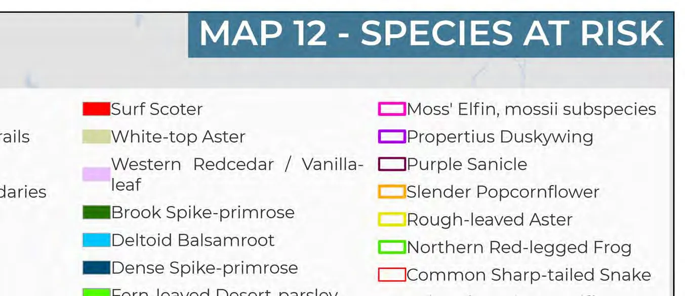
Table of Maps
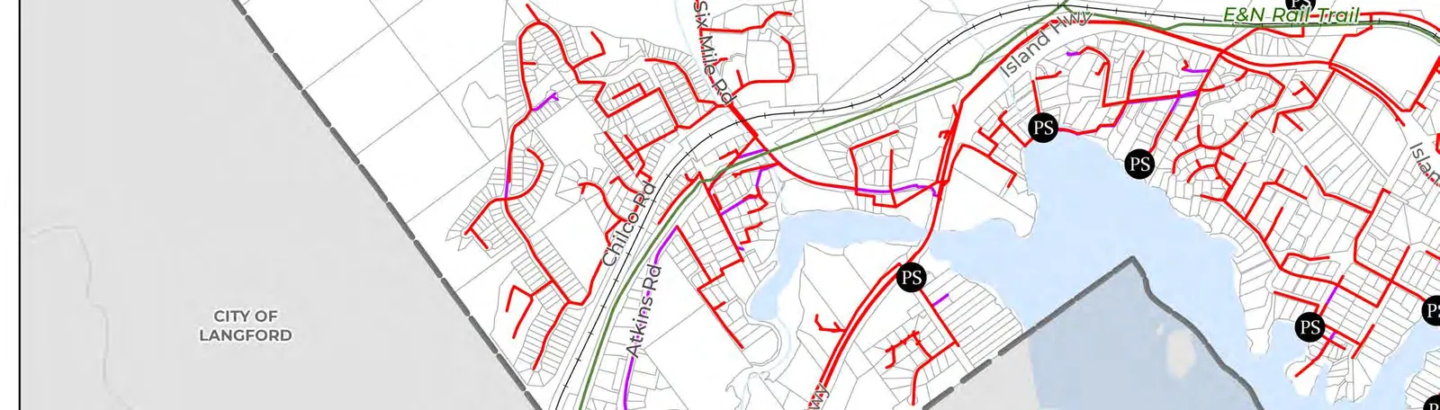
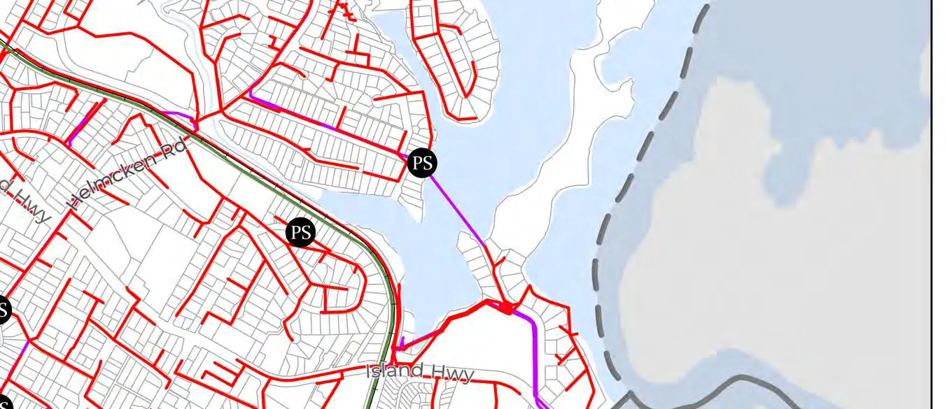
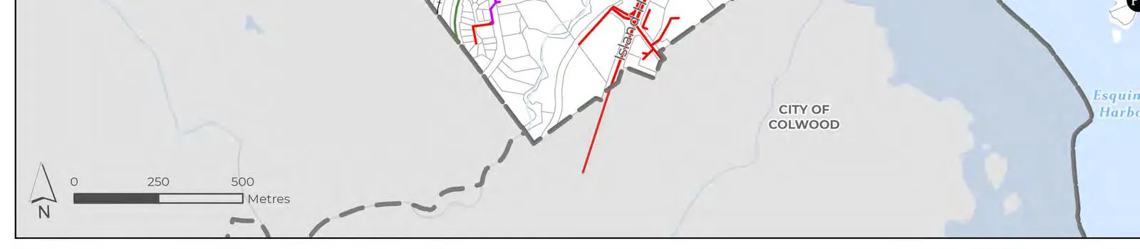
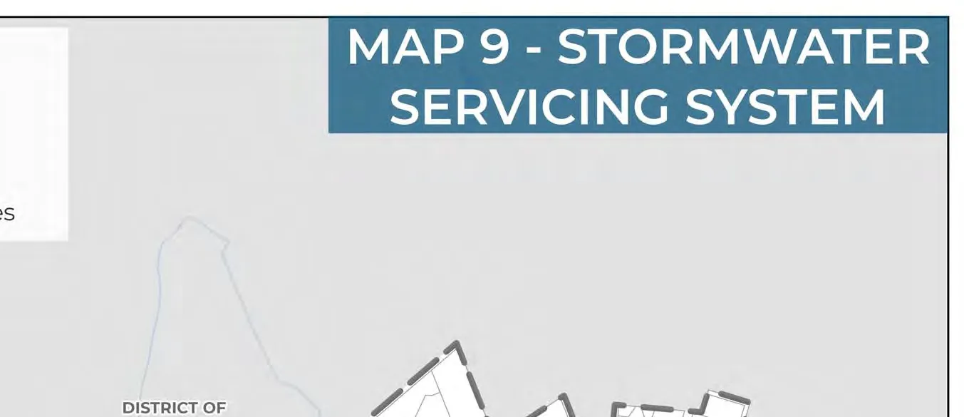
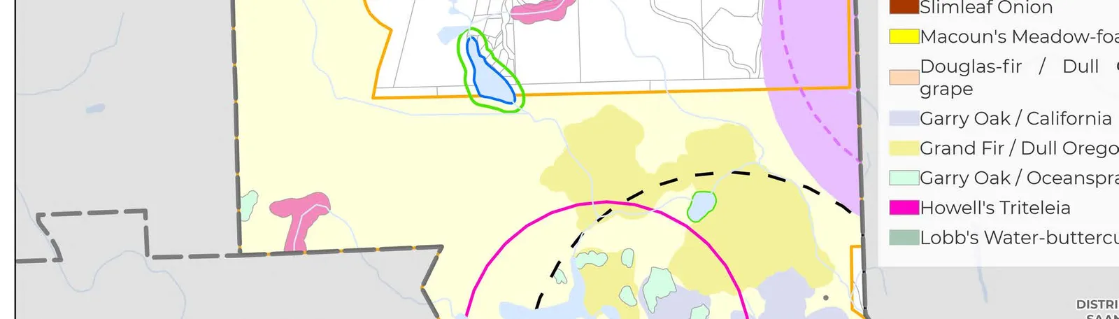
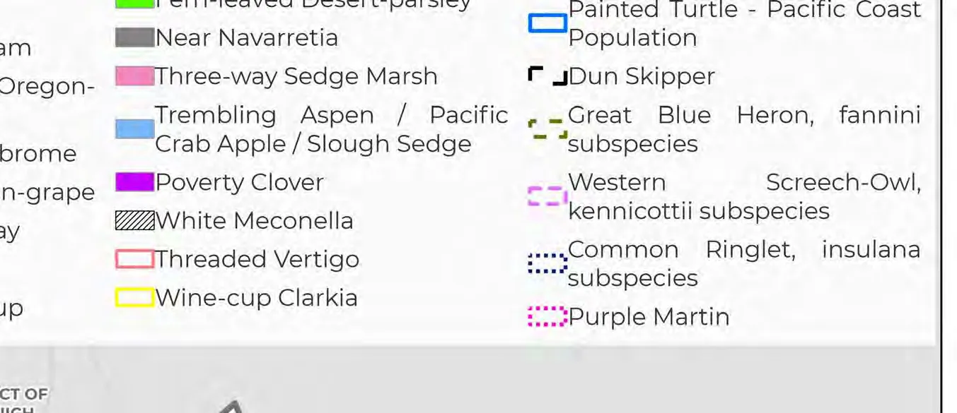
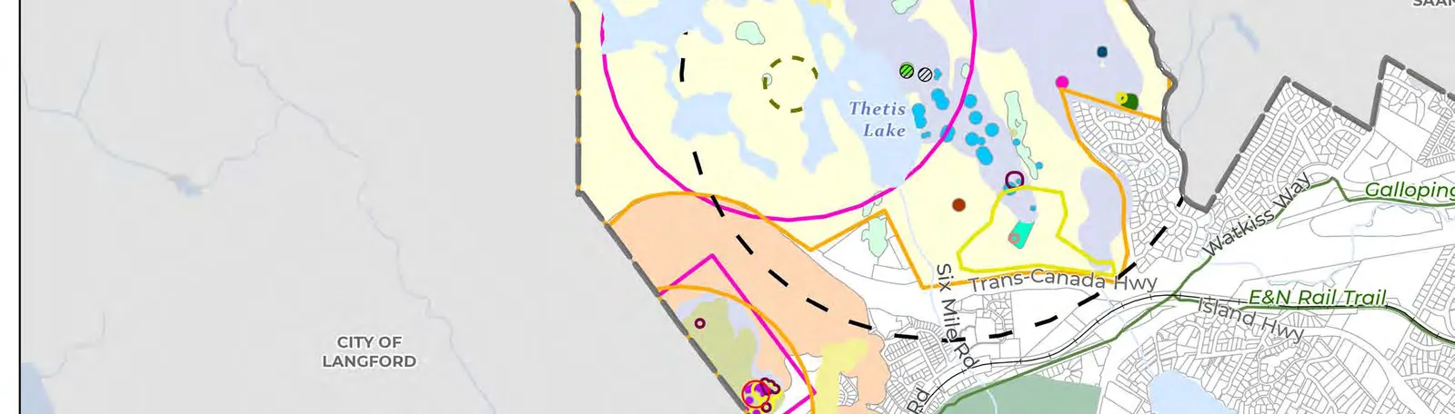
Map 1: Land Use Map 2: Agricultural Land Reserve Lands Map 3: Mobility Map 4: Existing Active Transportation Network Map 5: Future Pedestrian Network Map 6: Future Cycling Network Map 7: Street Classification Map 8: Sewer Servicing System Map 9: Stormwater Servicing System Map 10: Water Servicing System Map 11: Environmentally Sensitive Areas Map 12: Species at Risk Map 13: Steep Slopes Map 14: Tsunami Hazard Zones Map 15: Parks, Open Spaces, Trails, and Community Facilities
Part One: The Plan Context
1.0 Plan Overview
1.1 WHAT IS AN OCP?
This Official Community Plan (OCP) titled, View Royal 2050: Our Future View, represents the Town’s vision and goals for the coming decades. It is a comprehensive, long-term policy document that sets out the key policy direction for how the community will grow and respond to key opportunities for the community. The OCP provides direction for land use decisions and addresses the provision of community services and amenities. This plan ensures that future changes and growth align with the community’s values and priorities, supporting a sustainable and vibrant View Royal for generations to come.
Typically, all local government master plans, policies, and bylaws are updated following the adoption of a new OCP to ensure consistency in policy direction across documents. This consistency allows for ease of decision-making by Town Council and Staff, in addition to priority setting during annual strategic planning and budgeting cycles.
The OCP is intended to serve as a living document, updated every 5 years to remain relevant as the community evolves and grows, in addition to amendments from time-to-time. View Royal’s last comprehensive OCP review and update occurred in 2011 and much has changed globally, regionally, and locally since then. This OCP addresses the context of View Royal in the years 2025 and 2026.
LEGISLATIVE REQUIREMENTS
Local governments in British Columbia are granted the authority to adopt an OCP under the Local Government Act. This legislation outlines what must be discussed in an OCP, along with other items that a local government may choose to include. It also outlines requirements for public and interest holder consultation, such as provincial agencies, school districts, and Indigenous communities.
In November 2023, the provincial government released legislation requiring municipalities to review and update their OCPs and zoning bylaws by December 31, 2025, following the development of an Interim Housing Needs Report. An additional update is required by December 31, 2028 and every five years thereafter. The new legislation requires that municipalities update their OCPs to accommodate anticipated housing needs, as identified in the Housing Needs Reports, to identify the 5- and 20-year housing need projected for the community over the next 20 years.
REGIONAL PLANNING FRAMEWORK
As a member municipality within the Capital Regional District, View Royal’s OCP must be consistent with the Regional Growth Strategy per requirements outlined in the Local Government Act. Conformity to the Regional Growth Strategy is discussed in greater detail in section 16.0 Regional Context Statement.
The Capital Regional District’s Regional Growth Strategy sets the vision for the Capital Region’s future. It guides decisions on regional issues related to transportation, population growth, and the environment, amongst others. It was adopted in 2018.
1.2 HOW WE GOT HERE
A SUMMARY OF THE PROCESS
The Official Community Plan update is being carried out in three phases, each phase focusing on specific content in the document. The work completed between January 2025 and the summer of 2026 focused on the completion of the first two phases, with the third phase scheduled for completion in 2027.
Phase 1 (January 2025 to December 2025) The first phase focused on establishing a new vision for the Official Community Plan, a foundational element of the document that provides a forward thinking target for where the community envisions it will be in the future. This vision statement is supported by 12 new goals, which act as guiding principles for decision-making.
This phase also required that the Town align its 2024 Interim Housing Needs Report with the Official Community Plan by December 31, 2025, a date established through provincial legislation. The alignment required that the land use map be updated to provide capacity to meet the anticipated 20-year housing need, and to establish housing policies that addressed each of the six housing needs in the community.
Phase 2 (October 2025 to July 2026) The second phase shifted focus to a review of the nine policy chapters in the Official Community Plan. Each policy chapter is built on a series of objectives, which outline the overall purpose of the policies. The policies inform decision making processes in the Town which aid in development and planning processes, operations, budgeting, and additional plan and policy development.
To support each of the policy chapters, actions were created to clearly identify what is required to achieve desired outcomes, the timing, and which municipal department is responsible. This phase also required a review and update of the Regional Context Statement, to ensure alignment with the Regional Growth Strategy.
Phase 3 (Fall 2026 to 2027) The final phase will focus on updating Form and Character and Environmental Development Permit Areas and guidelines. In addition, this phase will also consider the opportunity to develop new Development Permit Areas, including hazard areas prone to wildfire and flooding.
A SUMMARY OF ENGAGEMENT
The update of the Official Community Plan has provided multiple engagement touchpoints to inform updates to the Plan. The phased approach outlined above has supported a comprehensive process that balances technical analysis with community feedback to shape a vision, goals, and policies that reflect the needs and aspirations of View Royal residents.
Throughout the process, Council, the Committee of the Whole, and the Town’s Official Community Plan Review Advisory Committee have provided input and perspectives on key issues related to the OCP update. Together, they have participated at key milestones by reviewing draft materials, sharing community insights, and providing feedback on engagement activities, and emerging policy directions.
Official Community Plan Review Advisory Committee: A group of community members appointed by Council to assist with the review and provide feedback on draft content and engagement material.
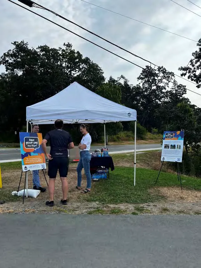
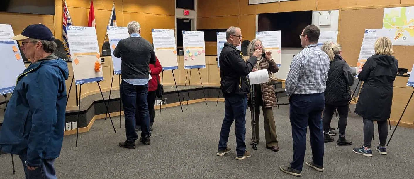
Across these engagement touchpoints, residents participated through surveys, open houses, workshops, pop ups, and stakeholder meetings. Feedback from each phase was summarized in What We Heard Reports and shared with Council and the OCP Advisory Committee to help inform the evolving draft, which is a reflection of the cumulative input received through each stage of engagement.
The draft OCP reflects five rounds of community engagement, each focused on a different component of the Plan.
ENGAGEMENT AT A GLANCE
2025
- January 13: OCP Advisory Committee Meeting #1
- January 24: View Royal 2050 website launch
- January 24 – February 18: Vision and Guiding Principles Survey
- February 5, 8, 10, 13: Vision and Guiding Principles Pop-ups
- February 21 – 28: Youth Vision Survey
- February 24: OCP Advisory Committee Meeting #2
- March 6: OCP Business Mixer Workshop
- March 7 – April 4: Community Growth Survey and Social Mapping Activity
- March 26, 28: Community Growth Engagement Pop-ups
- March 8: Community Growth Open House and Workshop
- March 12: Community Growth Open House
- March 13: Community Growth Virtual Workshops (2)
- May 5: OCP Advisory Committee Meeting #3
- June 2: OCP Advisory Committee Meeting #4
- July 18 – September 7: Vision and Goals Survey
- August 20: Vision and Goals Pop-up
- August 25: OCP Advisory Committee Meeting #5
- October 7 – November 12: Western Gateway Community Corridor Survey
- October 18: Western Gateway Community Corridor Open House and Workshop
- October 21: Western Gateway Corridor Focus Group: Business & Land Owner Workshop
- October 22: Western Gateway Community Corridor Open House
- November 3: OCP Advisory Committee Meeting #6
- November 8 – November 30: Policy Review Survey
- November 8, 13: Policy Review Open Houses
2026
- February 24: Special Council Meeting on the Western Gateway Corridor
ENGAGEMENT TOUCHPOINT #1: VISION AND GUIDING PRINCIPLES (JANUARY - FEBRUARY 2025) Participants were asked to provide input on the future vision of View Royal. Feedback was collected through an online survey and pop-ups.
Key Takeaways:
- 2 surveys
- 1 workshop
- 4 pop-up events
- Participants identified the following foundation values for their future community: protecting parks and natural areas; maintaining safe and walkable neighbourhoods; improving transportation options; and supporting diverse and affordable housing.
Who Participated:
- 130 survey participants
- 86 youth survey participants
- 36 workshop participants
- 158 pop-up event participants
How People Heard:
- 1,158 Engage View Royal project website visits
- 9 Facebook posts, 2 Instagram posts, and 6 Bluesky posts
- 250 stakeholder emails
- 30 posters
- 1 View Royal e-newsletter
- 1 newspaper ad
- 1 View Royal News Release
- 1 project video
- 4 pop-up events
- 2 View Royal e-newsletters
- 1 newspaper ad
- 4 View Royal News Releases
- 2 pop-up events
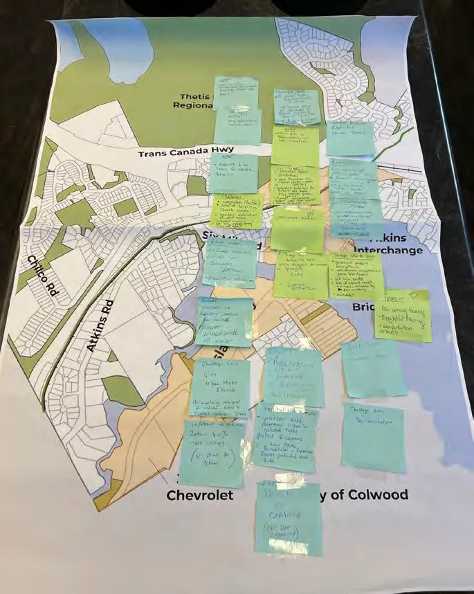
ENGAGEMENT TOUCHPOINT #2: HOW WE GROW ENGAGEMENT (MARCH – APRIL 2025) Participants were asked to provide feedback on how and where the community may grow and change over the next 20 years. Participants were asked to consider the Town’s existing growth areas and corridors, and provide feedback on potential opportunities for additional housing, services, employment space, and amenities.
Key Takeaways:
- 1 survey
- 1 online mapping activity
- 2 pop-up events
- 2 virtual community workshops
- 1 open house
- Participants indicated overall support for an increase in residential height and density and mixed-use development in both existing growth areas and along corridors in the community.
Who Participated:
- 176 survey responses
- 54 social map responses
- 42 open-house participants
- 11 virtual workshop participants
- 16 pop-up event participants
How People Heard:
- 930 Engage View Royal project website visits
- 19 Facebook posts, 19 Instagram posts, and 19 Bluesky posts
- 250 stakeholder emails
- 17 posters
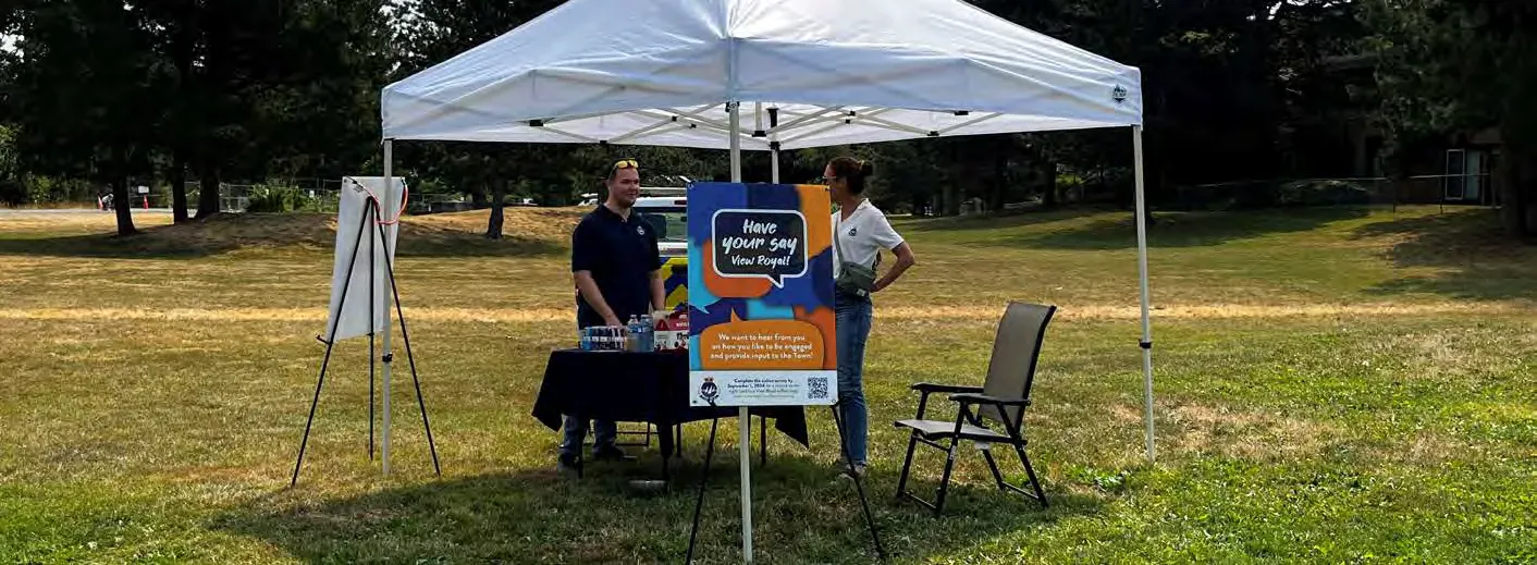
ENGAGEMENT TOUCHPOINT #3: VISION SURVEY (JULY - SEPTEMBER 2025) Participants were asked to provide feedback on three draft vision statements and 11 community goals, developed from earlier feedback.
Key Takeaways:
- 1 survey
- 1 pop-up event
- Participants preferred vision statement that focused on the community’s relationship with nature and green space, and the need to be forward thinking as a community leader to ensure action is taken on environmental stewardship, climate action, affordable housing, and economic development.
Who Participated:
- 85 survey responses
- 16 pop-up event participants
How People Heard:
- 886 Engage View Royal project website visits
- 11 Facebook posts, 11 Instagram posts, and 8 Bluesky posts
- 250 stakeholder emails
- 17 posters
- 1 View Royal e-newsletter
- 1 pop-up event
ENGAGEMENT TOUCHPOINT #4: WESTERN GATEWAY COMMUNITY CORRIDOR (OCTOBER - NOVEMBER 2025) The Western Gateway Corridor was identified as a key growth area with opportunities for new housing, businesses, services and employment space. Participants were asked to provide feedback on the three growth scenarios for the Western Gateway Corridor, including low, medium, or high potential development scenarios.
Key Takeaways:
- 1 survey
- 2 workshops
- 2 open-houses
- Participants preferred a medium growth scenario that focused on the development of the Western Gateway south of Parson’s Bridge as a commercial and light industrial area, and the area north of Parson’s Bridge as a mixed-use neighbourhood village. Feedback provided through engagement informed a proposed land use scenario for the Corridor area.
Who Participated:
- 59 survey responses
- 11 workshop participants
- 7 focus group business workshop participants
- 43 open house participants
How People Heard:
- 668 Engage View Royal project website visits
- 9 Facebook posts, 9 Instagram posts, and 7 Bluesky posts
- 250 stakeholder emails
- 10 posters
- 2 View Royal e-newsletters
- 1 newspaper ad
- 1 View Royal News Releases
- 1 newspaper ad
- 50 hand delivered notices to residents
- 50 (approximately) notices to businesses
ENGAGEMENT TOUCHPOINT #5: POLICY REVIEW ENGAGEMENT (NOVEMBER 2025) Participants were asked to provide feedback on draft policies from each of the policy chapters in the draft Plan. This gave participants an early snapshot of draft content. Early feedback helped shape and further revise new draft policies on major topic areas, such as housing, transportation and mobility, economic development, parks and recreation, environment, climate action, and infrastructure.
Key Takeaways:
- 1 survey
- 2 open house events
- The survey respondents indicated that they support the draft policies overall. However, there are some policies that respondents provided mixed feedback on, indicating that further review and revisions could be required if desired.
- Participants identified the challenges with traffic congestion, the need to provide more diverse and accessible employment opportunities and services in the community, and more affordable housing. The preservation and enhancement of the Town’s parks and natural spaces is also important to the community.
Who Participated:
- 43 survey responses
- 16 open house participants
1.2.1 HOW PEOPLE HEARD:
- 579 Engage View Royal project website visits
- 11 Facebook posts, 11 Instagram posts, and 8 Bluesky posts
- 250 stakeholder emails
- 1 View Royal e-newsletters
- 1 newspaper ad
- 1 View Royal News Releases
- 2 newspaper ads
ENGAGEMENT TOUCHPOINT #6: FIRST DRAFT REVIEW (MARCH TO APRIL 2026) Participants have been invited to participate in a final round of engagement prior to consideration of the adoption of the Official Community Plan bylaw. * This section to be completed following engagement.
1.3 HOW TO USE THIS OCP
The primary objective of this OCP is to establish a clear framework for decision-making that guides View Royal Council and Staff, residents, partners, agencies, developers, and other interest holders in the Town. All sections are interconnected and considered through the lens of the document’s vision statement and twelve goals, which are referenced in section 2.0 View Royal 2050. When evaluating concepts within the OCP and determining how policies apply to specific developments, projects, or decisions, it is crucial to acknowledge the broad scope of the document and how the initiative would be considered holistically across all policy areas of the OCP.
Navigating the OCP requires consideration of its five parts, descriptions for which are provided below.
Part One: The Plan Context
The Plan Context encompasses introductory elements of the plan, including what an OCP is, presentation of the community’s vision and goals for the year 2050, discussion on the Town’s commitment to ongoing reconciliation with the Songhees and Xʷsepsəm Nations, and providing context on the community related to its geography, traits, and community statistics, along with context on regional trends that were factors considered at the time of writing this plan.
Part Two: Land Use
This section outlines how View Royal will develop over time and how land may be used. A number of land use designations are identified that apply to different areas of the community, each with their own set of guidance related to the overarching intent of the designation and permitted heights and densities. This section also includes general policies for growth and development that will be reviewed as part of the development approvals process.
Part Three: Policies
The policy section provides high-level direction across areas within the scope of a local government. These policies cover a diverse range of topics, including Housing, Transportation and Mobility, Community Infrastructure and Services, Economic Development, the Natural Environment, Climate Action and Sustainability, Parks, Trails, and Recreation, Community Well-Being and Culture, and Reconciliation.
Part Four: Implementation
This section describes how the Town may transform the policy direction outlined in Parts Two and Three into concrete actions. Actions are categorized into one of three timeframes for implementation (short-, medium-, and long-term) with relevant policies and implementing parties referenced. This section also includes the Regional Context Statement, which explains how the OCP aligns with the Capital Regional District’s Regional Growth Strategy.
Part Five: Development Permit Areas
This section includes the Town’s two Development Permit Areas that aim to protect essential environmental features and reduce any risks to public safety deriving from natural hazards.
2.0 View Royal 2050
2.1 OVERVIEW
The OCP’s vision and goals are intended to guide the community to the year 2050. The policy direction of this plan stems from these key guiding statements. The vision and goals were informed by input received from the community as part of engagement undertaken in 2024 and 2025.
2.2 VISION
The following statement outlines the Town’s aspirations to the year 2050 and beyond:
View Royal is a thriving, welcoming, inclusive community where people live close to nature, services, and amenities that foster health and well-being.
2.3 GOALS
1. MOBILITY & CONNECTIVITY
Goal: Provide a variety of transportation options within a well-connected network to support mobilizing all ages and abilities.
While private vehicles are still the primary method of travel, the Town continues to strive towards the creation of an improved transportation network. Developing a well-connected regional network will ensure that residents are able to get where they need to go via different modes: walking, cycling, rolling, transit, and vehicular use. The Town will work closely with the Capital Regional District and nearby municipalities to address ongoing traffic challenges and streamline local and regional connections.
2. DIVERSE AND AFFORDABLE HOUSING
Goal: Provide diverse, attainable, and affordable housing types and tenures for all residents.
Encouraging the development of a wide range of market and non-market housing options will ensure existing and future residents can continue to call the Town home. Emphasis will be placed on housing that supports aging-in-place, multi-generational households, and the creation of more rental and home ownership opportunities. Where possible, these options will be within close proximity to everyday services and amenities.
What is affordable and attainable housing? What constitutes ‘affordable’ is directly tied to a household’s gross annual income. Households who spend less than 30% of their income on housing are deemed to have ‘affordable’ housing. Attainable housing considers what a household needs in terms of size and type of housing, as well as what level of housing costs may be appropriate for a household given the cost of living in a community.
3. GROWTH MANAGEMENT & COMMUNITY CHARACTER PRESERVATION
Goal: Allow for thoughtful, fiscally responsible growth and development throughout the community that complements View Royal’s existing character.
As a desirable community to live in, View Royal must balance opportunities for growth and the need for infrastructure services while ensuring the character of the community is considered to complement or inspire new development. Natural amenities comprise much of the Town’s existing character these attributes are highly valued by the community. New development will give consideration to these amenities to ensure they can be appreciated by existing and new residents alike.
4. NATURAL AMENITIES
Goal: Preserve, protect, and expand the Town’s natural assets and amenities.
Parks, trails, and green space are regularly identified as some of the greatest benefits of living in the Town. Ensuring the coastal and forested landscapes are preserved and protected for the enjoyment of current and future generations is a community priority. These efforts will include ensuring a balanced approach to growth and adopting strong climate change adaptation and mitigation strategies.
Natural amenities are place-based attributes created by the environment that provide local benefits. Examples of natural amenities may be parks where community members can hike, lakes where kayaking can be enjoyed, trees that clean the air, and creeks that support with managing drainage.
5. COMMUNITY WELL-BEING
Goal: Enhance community well-being by providing safe, inclusive, and accessible spaces, while integrating arts and culture into everyday life.
Community well-being is achieved when every member feels safe, included, and has access to essential services and opportunities. It means embracing diversity and ensuring that all voices are heard and valued, creating a sense of belonging for everyone. Integrating arts and culture enriches our community by celebrating creativity and heritage, fostering a vibrant and dynamic environment that brings people together and enhances the quality of life for all.
6. COMMUNITY SAFETY & SECURITY
Goal: Foster a safe and secure community that is prepared for emergencies.
Community safety and security is achieved when people feel that their needs and quality of life are a priority. It means working collaboratively to better understand what community safety and security means to View Royal residents and business owners. Preparing and responding to health and climate emergencies, such as pandemics, climate disasters, earthquakes, etc., will strengthen the community over the long-term.
7. CLIMATE ACTION AND RESILIENCE
Goal: Undertake climate adaptation and mitigation initiatives to support the community’s resiliency.
As a forested coastal town, View Royal is particularly vulnerable to wildfires, coastal storms, flooding, and sea level rise attributable to the changing climate. In response, the Town is taking initiative to become a low carbon community, reduce its greenhouse gas emissions, and adopt climate adaptation and mitigation strategies to continue maintaining a high quality of life for everyone.
Greenhouse gas emissions, commonly known as GHGs, are gases released by human activities such as the burning of fossil fuels. These gases trap heat in the atmosphere and impact the global climate.
8. ECONOMIC DEVELOPMENT
Goal: Identify and incentivize opportunities for tourism and mixed-use and non-residential development to support local and regional economic priorities.
Encouraging non-residential growth through development incentivization and policy amendments will support View Royal’s economy and further develop employment lands, including the Western Gateway Employment District Corridor and Transit-Oriented Development areas. By attracting investment and business into the Town, this additional economic activity will support local demand for shops, restaurants, and services within walking distance of neighbourhoods and create more opportunities for regional economic growth in adjacent communities. In addition, many opportunities exist to expand and enhance tourism in View Royal due to its central location within the Capital Regional District.
9. RECONCILIATION
Goal: Build strong relationships with the Xʷsepsəm and Songhees Nations to collaborate on key priorities and decision-making, and continue to advance the Town’s reconciliation efforts.
View Royal is located on the traditional, ancestral, and unceded territories of the lək̓ʷəŋən speaking peoples. To support community interest in advancing reconciliation efforts, the Town will continue to build a relationship with the Xʷsepsəm and Songhees’ peoples. Emphasis will be placed on facilitating increased collaboration, celebrating values and culture, and fostering synergies between these communities to better understand where alignment exists on core values.
Reconciliation is the ongoing process of establishing and maintaining mutually respectful relationships between Indigenous and non-Indigenous peoples.
10. COMMUNITY INPUT AND GOVERNANCE
Goal: Ensure View Royal community members are meaningfully involved in the advancement of community goals and priorities.
As View Royal grows and evolves, the Town will continue to seek feedback and input from the community. Through good governance, community leaders will steward decision-making processes and ensure they remain transparent.
11. REGIONAL PARTNERSHIPS
Goal: Continue to strengthen the Town’s relationships with partners and stakeholders, including member municipalities, on regional matters.
View Royal is a gateway community bordering seven jurisdictions within the Capital Regional District. Maintaining strong relationships with these local governments and First Nation communities is important to ensure alignment on regional priorities, such as the enhancement of regional transportation management and connectivity.
12. SUSTAINABLE SERVICE DELIVERY AND ASSET MANAGEMENT
Goal: Maintain and manage the full lifecycle costs of the Town’s assets to ensure the long-term provision of sustainable service delivery to meet the needs of the community.
The Town provides a wide range of services in the form of physical and natural assets (e.g. roads, culverts, parks). Recognizing the importance of ensuring a high level of service for future generations, emphasis will be placed on sustainable service delivery through the careful balancing of cost, level of service, resources, and risk considerations to achieve an equitable and fiscally responsible approach to asset management.
Asset management is an integrated approach to planning, operating, and maintaining physical infrastructure and amenities, such as roads, sewer systems, and treatment facilities, amongst others.
3.0 Reconciliation
3.1 CONTEXT
In 2007, the United Nations passed the United Nations Declaration on the Rights of Indigenous Peoples (UNDRIP), a legally non-binding resolution. In 2015, Canada’s Truth and Reconciliation Commission (TRC) released 94 Calls to Action. Five actions specifically call upon municipal governments to take action:
- Action 43: fully adopt and implement UNDRIP as the framework for reconciliation;
- Action 47: repudiate concepts used to justify European sovereignty;
- Action 57: provide education to public servants on the history of Aboriginal Peoples and intercultural competency skills-based training;
- Action 75: develop and implement strategies and procedures for the ongoing identification, documentation, maintenance, commemoration, and protection of residential school cemeteries or other sites at which residential school children were buried; and
- Action 77: work collaboratively with the National Centre for Truth and Reconciliation to identify and collect copies of all records relevant to the history and legacy of the residential school system.
The United Nations Declaration on the Rights of Indigenous Peoples, commonly referred to as UNDRIP, was adopted in 2007 as a tool to support the rights of Indigenous peoples. It provides guidance on matters related to self-determination, culture, and land rights, and serves as a framework for reconciliation within Canada. The Province of British Columbia aims to endorse UNDRIP through its Declaration on the Rights of Indigenous Peoples Act.
In 2019, the Province of British Columbia enacted the Declaration on the Rights of Indigenous People Act (DRIPA), becoming the first jurisdiction in Canada to formally adopt the internationally recognized standards. The Declaration Act provides the framework for reconciliation in British Columbia, focusing on four themes:
- the right to self-determination;
- the right to be recognized as distinct Peoples;
- the right to free, prior, and informed consent; and
- the right to be free from discrimination.
The journey of Truth and Reconciliation for municipalities in relation to the United Nations Declaration on the Rights of Indigenous Peoples adoption and implementation begins after foundational groundwork has been established. View Royal is committed to integrating a reconciliation-centric approach to current and future planning initiatives, as evident in the policy direction threaded throughout this OCP, and particularly in section 14.0 which aims to establish a joint vision for reconciliation. The Town aims to take concrete and meaningful actions towards reconciliation, beginning with incremental trust-building measures. View Royal is committed to creating opportunities to collaborate with the Xʷsepsəm and Songhees Nations to ensure municipal planning is grounded in the history, land stewardship, and enduring presence of the lək̓ʷəŋən Peoples. The recognition of the Xʷsepsəm and Songhees Nations remains central to View Royal’s planning for both the present and the future.
3.2 SONGHEES NATION TODAY
Songhees Nation are a lək̓ʷəŋən People with a longstanding and ongoing presence in the region. The Nation has approximately 690 members, with over half living on the Songhees Reserve located immediately adjacent to the Town of View Royal and Xʷsepsəm First Nation. The community is approximately 60 hectares and is developed with a mix of residential and commercial areas.
The Songhees community is comprised of five main families and several smaller families descended from the Lək̓ʷəŋən speaking signatories of the Douglas Treaties in 1850. Traditional governance is by consensus among extended family heads, guided by their families. Today, the community is still guided by consensus among families represented by advisory committees, focus groups and an elected Chief and Council. Referendums and ratification votes are held for important Community decisions.
The Nation’s mission, vision, and values are significant, serving as a reflection of the relationship that View Royal seeks to establish and its intent to encapsulate the core principles upheld by the Nation.
The Nation’s mission is: Songhees Nation strives to achieve community vision through good governance, delivering programs and pursuing projects and initiatives for the benefit of the Songhees People.
The Nation’s vision is: A healthy, self-reliant, progressive community that honours tradition and culture and invests in future generations.
The Nation’s Values are: With One Heart and One Mind, we commit to help one another, to forgive one another and to love one another with respect, honesty and courage.
3.3 XʷSEPSƏM NATION TODAY
Xʷsepsəm Nation, also spelled Xwsepsum, is a nation located on the waters of Esquimalt Harbour, immediately adjacent to the Songhees Nation and Town of View Royal. The Nation has approximately 385 members who are descendants of the lək̓ʷəŋən People, with close to half living in the main community on the Esquimalt reserve.
The Nation’s connection with the land and resources of its large territory goes back thousands of years. In that time, Xʷsepsəm Nation have learned to live in a finely balanced relationship with the seasons, the lands, the tides, and the seasons of their lives that have sustained them. Xʷsepsəm has repaid the land through their commitment to stewardship and through ceremonies which are understood as their Sacred Trust. The Sacred Trust has been transmitted through oral teachings, usually contained in the stories of the Nation, and they articulate a set of Natural Laws. The Sacred Trust determines the relationships between the land, water, and resources, the Community and the Spiritual Path.
Xʷsepsəm Nation’s mission statement is rooted in a desire for promoting the importance of traditional teaching and values, and importantly for View Royal, a desire of the Nation to work with their partners for beneficial goals. It is important that the Town cultivates a respectful and meaningful partnership with Xʷsepsəm Nation through its commitment to reconciliation.
The Nation’s mission is:
Our mission is to build a legacy for present and future generations of Esquimalt Nation members by ensuring our work is rooted in the teachings and natural laws that flow from the Sacred Trust. We will promote and advance holistic health, self-sufficiency and safety of Esquimalt Nation members by offering meaningful programs and services, and working with our partners for mutually beneficial goals.
4.0 Context of View Royal
4.1 PHYSICAL SETTING
View Royal is located on Southern Vancouver Island in the Capital Regional District. It is situated between the West Shore – comprising Sooke, Metchosin, Colwood, Highlands, and Langford – and the region’s core area, comprising Victoria, Esquimalt, Xʷsepsəm Nation, Songhees Nation, Oak Bay, and Saanich. Its geographic location and major transportation corridors such as the Trans-Canada Highway, regional Island Highway, and regional trails (Galloping Goose and E&N Trail) allow the community to function as a transitional area and an integral connection between the West Shore and the core areas of Greater Victoria. While View Royal’s location presents various opportunities for the community’s future growth and development, its location also poses local and regional challenges.
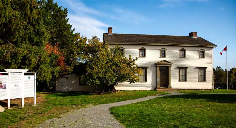
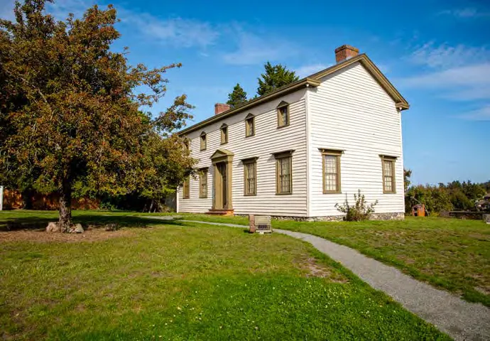
The Town is a growing community of over 11,500 people. It is largely residential, though offers a high standard of living with natural amenities like the Esquimalt Harbour, Portage Inlet, Thetis Lake Regional Park, and Craigflower and Millstream Creeks. View Royal is shaped by a rich variety of ecosystems, including its marine environments, estuaries, and freshwater lakes, as well as terrestrial environments from moist Douglas Fir forests to Garry Oak meadows. View Royal also hosts historic structures, the most notable being Craigflower Manor.
4.2 COMMUNITY TRAITS
Since incorporation in 1988, the Town of View Royal has been transforming from a quiet suburb into a distinct and vibrant community, complete with its own unique neighbourhoods, commercial services, and highly desired parks and green spaces. View Royal is home to the regionally critical Victoria General Hospital; a growing development node supporting health care and services in the Capital Regional District. Residents enjoy recreation services through West Shore Parks and Recreation, which oversees the Juan de Fuca Recreation Centre, along with the many parks and natural green spaces located throughout the Town. The Western Gateway Employment District Corridor straddles the View Royal/Colwood border, offering a mix of business, as well as much future development potential. The community is serviced by two other large commercial hubs, including the Eagle Creek Shopping Centre, located just east of Victoria General Hospital and Admirals Walk, located along Admirals Rd.
4.3 REGIONAL TRENDS
GROWTH AND DEVELOPMENT TRENDS
The Greater Victoria Region has experienced notable population growth across its municipalities. From 2016 to 2021, populations grew by 7.1% in Victoria, 3.1% in Saanich, 31.8% in Langford, and 12.5% in Colwood. By comparison, View Royal’s population grew by 11.2% since 2016 (see Section 4.5). While Victoria and Saanich continue to grow steadily, Colwood and View Royal are experiencing medium growth, and Langford is rapidly developing, making it one of the fastest-growing municipalities in British Columbia. Proximity to Langford’s rapid expansion means View Royal may experience spillover effects, resulting in increased housing demand, traffic, and economic activity in View Royal.
View Royal and other communities in the West Shore continue to attract new residents as the community offers a high standard of living, housing options that are generally more affordable relative to Victoria and Oak Bay, access to natural amenities and recreational activities, and benefits from proximity to major transport routes and growing economic opportunities. Continued growth could drive further residential and commercial developments, reinforcing the Town’s dynamic evolution from a quiet suburb to a vibrant community with amenities located within close proximity to where people live.
HOUSING TRENDS
The Greater Victoria Region, along with the rest of British Columbia, faces a housing affordability crisis, prompting both provincial and municipal governments to implement measures aimed at increasing housing supply and diversity. Nine of the thirteen local governments in the Capital Regional District received Ministerial Housing Target Orders, including the Town of View Royal. The ministerial orders require local governments to meet annual targets as well as a five-year cumulative target, representing 75% of the housing needs for the municipality. The Province set a target for View Royal to construct 585 new homes over five years, as announced in July 2024.
Bill 47 Housing Statutes (Transit-Oriented Areas) Amendment Act, 2023 mandates some municipalities to designate Transit-Oriented Areas near transit hubs. Based on the Provincial regulations, the area west of the Victoria General Hospital around the existing bus exchange has been designated as a Transit-Oriented Area, as discussed further in section 5.3 Hospital Transit-Oriented Area Designation. Higher densities are planned to be accommodated to help provide more housing in this area.
SOCIAL TRENDS
The cost of living continues to rise in Greater Victoria, leading to an increased number of vulnerable populations within communities. These vulnerable groups often concentrate around essential resources, creating pockets of need that require targeted support. While these populations are largely located in Victoria, since the COVID-19 pandemic, the CRD has been experiencing increased concentrations of those experiencing homelessness in other municipalities.
Advancing climate action goals is a priority, with local governments actively seeking to reduce emissions and promote sustainable practices. There is a growing interest in food security, although implementing economically viable solutions remains challenging. Efforts to strengthen relationships with the Xʷsepsəm and Songhees Nations and advance reconciliation are also gaining awareness, reflecting a broader commitment to inclusivity, reconciliation, and social justice. Tourism remains a robust economic driver, contributing significantly to the region’s economic health, in addition to post-secondary institutions, health care, and government/civic employment opportunities.
ENVIRONMENTAL TRENDS
Communities in the West Shore, including View Royal, place a high value on access to green spaces, recognizing their importance for recreation, mental health, environmental preservation, and overall quality of life. However, the region is facing environmental challenges due to more frequent extreme weather events and drier weather patterns, which could impact future water supply and necessitate more efficient water management practices. Additionally, rising sea levels and storm surges pose significant risks to coastal areas which includes all CRD communities. Regional collaborative efforts will be crucial for maintaining the health of marine ecosystems and protecting infrastructure from the adverse effects of climate change.
4.4 COMMUNITY PROFILE
DEMOGRAPHICS
Population The 2021 Census reports a total population for View Royal of 11,575 residents, representing a 11.2% increase (1,167 persons) since the 2016 Census. BC Stats estimates that the total population in 2024 was 12,979 residents, which would be an increase of 12.1% from the 2021 Census.
Table 1. Census Population (Totals) in View Royal, Greater Victoria, and British Columbia
| View Royal | Greater Victoria (CMA)¹ | British Columbia | |
|---|---|---|---|
| Total Population (2016) | 10,408 | 367,770 | 4,648,055 |
| Total Population (2021) | 11,575 | 397,237 | 5,000,879 |
| 5-Year Percentage Change (2016 to 2021) | 11.2% | 8% | 8% |
| 10-Year Percentage Change (2011 to 2021) | 23.4% | 15.3% | 13.7% |
¹Per the Census, the Greater Victoria Census Metropolitan Area (CMA) includes: District of Saanich, City of Victoria, City of Langford, City of Colwood, District of Oak Bay, Township of Esquimalt, District of Central Saanich, District of Sooke, Town of Sidney, District of North Saanich, Town of View Royal, Juan de Fuca Electoral Area (Part 1), District of Metchosin, District of Highlands, New Songhees 1A (Reserve), East Saanich 2 (Reserve), South Saanich 1 (Reserve), Cole Bay 3 (Reserve), T’Sou-ke (Reserve), Beecher Bay 1 (Reserve), Esquimalt (Reserve), Union Bay 4 (Reserve).
Age Based on the 2021 Census data, the median age in View Royal is 44.8 years, which remains unchanged between 2016 and 2021. This aligns with the regional median age in Greater Victoria of 44.8 years but represents a slightly older population than British Columbia as a whole, which reported a median age of 42.8 years in 2021.
The population pyramid represented in Figure 1 below shows that 19% of the population is aged 19 and younger, 46% aged 20-54, and 36% aged 55 years and older. Of these broader age groups, the largest cohorts are 35-39 (8% of the total population), 40-44 (8%), and 50-54 (8%) years of age, amounting to 24% of the total population within the ‘middle-aged and/or family years. This distribution is similar for Greater Victoria as a whole.
The majority of the population in the 55+ age cohort are those aged 55-74, representing 28% of the View Royal’s population. Those in the 75 years and older cohort represent another 8% of the population. The growth of the 55-74 cohort is evident between Census years (2016 and 2021), given that the Town’s population aged 65 years and over increased by 3.2% in this time period. By contrast, there was a slight decrease to the Town’s youth population of those aged 9 and under of 1.9%; however, the 10-14 age cohort saw growth of 6.6%.
As a result, both the Town and Greater Victoria will likely feel the effects of an ageing population over the next 24 years, or the lifespan of this Official Community Plan.
HOUSEHOLDS
The average household size decreased from 2.4 persons to 2.3 persons between 2016 and 2021. However, the number of persons in private households increased from 9,910 to 11,260 (13.6% increase) within that same period. The decrease in the average household size and the number of persons in private households can likely be attributed to View Royal’s ageing population and an increase in smaller household sizes (e.g., couple-family households without children), which may be influenced by both retirement-aged and working professionals without children choosing to live in the community.
As noted in Table 2 below, View Royal’s average household size aligns closely with that of the region.
Table 2. Household Sizes in View Royal and Greater Victoria (2021)
| View Royal | Greater Victoria | |
|---|---|---|
| Average Household Size | 2.3 | 2.2 |
| Number of Persons in Private Households | 11,260 | 388,290 |
As indicated in Figure 2 below, the most common household type in the Town is one-census-family² households without additional persons (60%), largely comprising of couple-family households without children. The next largest household type grouping is one-person households (28%).
²Per Statistics Canada, a one-census family is defined as a married couple and the children, if any, of either and/or both spouses; a couple living common law and the children, if any, of either and/or both partners; or a parent of any marital status in a one‑parent family with at least one child living in the same dwelling and that child or those children. All members of a particular census family live in the same dwelling. Children may be biological or adopted children regardless of their age or marital status as long as they live in the dwelling and do not have their own married spouse, common‑law partner or child living in the dwelling. Grandchildren living with their grandparent(s) but with no parents present also constitute a census family.
CULTURAL CHARACTERISTICS
Citizenship & Ethnic Groups As indicated in the 2021 Census, 93% of View Royal residents are Canadian citizens, with 57.7% of the total population identifying as third (or more) generation.³ This is similar to the regional citizenship rate of 92.8%, with 55.7% of the total population being third generation or more.
Table 3. Citizenship in View Royal and Greater Victoria (2021)
| View Royal | Greater Victoria | |
|---|---|---|
| Percentage of Population that are Canadian Citizens | 93.0% | 92.8% |
| Generation Status | ||
| First Generation | 21.0% | 22.9% |
| Second Generation | 21.3% | 21.5% |
| Third Generation or More | 57.7% | 55.7% |
³Based on a 25% sample size.
In the 2021 Census, View Royal residents reported European, East and South Asian, Indigenous North American, and non-Indigenous North American ethnic or cultural ancestries. The most highly reported ancestries were of European origins, including English (3455 instances), Scottish (2615 instances), and Irish (1915 instances).
Within View Royal, 775 residents (25% sample size of the total population) identify as having Indigenous ancestry, whether solely Indigenous ancestry (160 residents) or having mixed Indigenous and non-Indigenous ancestry (615 residents).
Languages Spoken The most prominent language spoken in View Royal private households is English at 93.1%. By contrast, 0.5% of households speak French most commonly at home and 6.3% of residents speak non-official languages. The most prominent non-official languages include Punjabi, Spanish, Mandarin, Cantonese, and Vietnamese.
ECONOMIC PROFILE
Income Based on 2020 Census income data,⁴ the largest household after-tax income groups in View Royal are $100,000-$124,999 and $150,000 and over, with each representing 15% of all households, or 30% combined. The smallest household after-tax income group is $5,000-$9,999, which accounts for 0.4% of View Royal households.
⁴For the 2021 Census, the reference period for income data is the 2020 calendar year.
The average gross income of View Royal households in 2020 was $111,400. This average is influenced by the 48.6% of Town households earning more than $100,000 a year. Comparatively, the average gross income of households in Greater Victoria in 2020 was slightly lower at $107,000, which was largely driven by 41.2% of households earning over $100,000 a year.
By contrast, the median gross income of View Royal households in 2020 was $98,000, as compared to the median gross income of $85,000 in Greater Victoria households. These statistics highlight the relative prosperity of View Royal households when compared to the region.
Table 4. Average and Median Gross Incomes in View Royal, Greater Victoria, and British Columbia (2021)
| View Royal | Greater Victoria | British Columbia | |
|---|---|---|---|
| Average Gross Income of Households in 2020 | $111,400.00 | $107,000.00 | $108,600.00 |
| Median Gross Income of Households in 2020 | $98,000.00 | $85,000.00 | $85,000.00 |
Education
Table 5. Secondary (High) School Diploma Holders in View Royal (2021)
| Category | Count | % of Total |
|---|---|---|
| Total – Secondary (High) School Diploma or Equivalency Certificate for the Population Aged 25 to 64 Years in Private Households (25% Sample Data) | 6265 | - |
| No High School Diploma or Equivalency Certificate | 485 | 7.7% |
| With High School Diploma or Equivalency Certificate | 5780 | 92.3% |
Of residents aged 25 to 64 years in View Royal, over two-thirds (72.4%) have obtained a post-secondary certificate, diploma, or degree. As shown in Figure 5 below, 67.5% of residents aged 25 to 64 years have completed post-secondary level education. Nearly all (92.3%) of residents aged 25 to 64 in the Town have achieved a secondary (high) school diploma or equivalency certificate. Of the residents who completed a secondary school diploma, 21.5% of residents aged 25 to 64 years have not attained post-secondary level education.
Employment Of the total population surveyed by the 2021 Census, nearly two-thirds (61.1%) of the population in the labour force is currently employed, which is higher than the percentage of the regional population in Greater Victoria (59%). The Town’s unemployment rate also trends lower than Greater Victoria’s (3.6%, compared to 4.4% regionally).
Table 6. Labour Force Status, View Royal Residents (2021)
| In the Labour Force | View Royal (% of Population) | Greater Victoria (% of Population) |
|---|---|---|
| Not in the Labour Force | 35% | 36% |
| In the Labour Force: Unemployed | 3.6% | 4.4% |
| In the Labour Force: Employed | 61.1% | 59% |
Place of Work Over a quarter (26%) of View Royal residents work from home, which is similar to the proportion of the regional population that works remotely (27%). The proportion of View Royal residents working from home, at their usual place of work (i.e., at a specific, fixed address), or with no fixed workplace address aligns very closely with the region.
There was a large shift between place of work between the 2016 and 2021 Censuses, which is perhaps attributable to the Covid-19 pandemic. In 2016, 8% of the population in both View Royal and Greater Victoria worked from home. This number increased by 18% and 19%, respectively, in the Town and the region in 2021. Consequently, the percentage of the local and regional population working at their usual fixed place of work decreased by 19% among View Royal residents and regionally. The proportion of workers employed outside of Canada and with no fixed workplace address largely remained the same across both Census years.
*Table 7. Place of Work, View Royal Residents (2021) **
| Place of Work | View Royal (% of Population) | Greater Victoria (% of Population) |
|---|---|---|
| Worked at home | 26% | 27% |
| Worked outside Canada | 0% | 0% |
| No fixed workplace address | 13% | 13% |
| Usual place of work | 61% | 60% |
*25% Sample Data
Industry According to the 2021 Census, most View Royal residents work in the following industries as identified through the National Occupational Classification (NOC; 2021):
- Sales and Service Occupations (24.3%);
- Business, Finance, and Administration Occupations (18.8%);
- Occupations in Education, Law and Social, Community, and Government Services (16.6%); and,
- Natural and Applied Sciences and Related Occupations (10.1%).
A detailed breakdown of the population within each occupational industry is provided in Figure 6.
The NOC system was updated after the 2016 Census to employ different classifications; the only substantive change was to the “Legislative and Senior Management Occupations” category, which was previously “Management Occupations.” This change meant that all middle management unit groups were relocated in their broad occupational category, resulting in a substantial decrease in the retitled Legislative and Senior Management Occupations (-11.5%) and slight increases to all other occupations.
Prior to the changes in the NOC system, the largest occupational category in 2016 was Sales and Service Occupations (20.6%); this occupational category was still the largest in 2021, along with the other top occupational categories of 2016:
- Business, Finance, and Administration Occupations (17.9%);
- Occupations in Education, Law and Social, Community and Government Services (13.8%);
- Management Occupations (12.8%); and,
- Trades, Transport and Equipment Operators and Related Occupations (12.1%).
HOUSING PROFILE
Dwelling Typologies In View Royal, over one-third (36%) of the population resides in a single-detached house. The next most common housing typology are rowhouses, which house one-fifth (20.1%) of the total population. There are more residents occupying low-rise (fewer than five storeys or an apartment/flat in a duplex⁵) apartments (18.3%) than there are residents in high-rise apartments greater than five storeys (3.4%). Compared to the 2016 Census, there has been an increase in the percentage of residents living in row houses (+2.9%), low-rise apartments (fewer than 5 storeys; +3.2%), and high-rise apartments (+1.4%). Conversely, there has been a decrease in residents living in single-detached houses (-3.9%) and apartments or flats in a duplex (-3.3%).
In the near future, the proportion of residents in apartments may shift as more multi-unit residential properties are expected to be completed.
⁵An apartment or flat in a duplex is defined by Statistics Canada in the 2021 Census as “one of two dwellings located one above the other. Apartments or flats in duplexes attached to triplexes, other duplexes or other non-residential structures (e.g., a store) are also classified as apartments or flats in a duplex.” This definition includes secondary suites.
Housing Tenure and Affordability Approximately two-thirds of View Royal’s households own their home as of 2021 (67.4%; 3,315 households). As per the 2021 Census, the median monthly shelter costs total $1600, which is similar to the average monthly shelter costs of $1698. The median value of dwellings was reported as $800,000 and the average value was noted as $848,000.
The remaining one-third of the Town’s households rent their home as of 2021 (32.6%; 1,600 households). The 2021 Census notes that the median monthly shelter costs for rented dwellings is $1560 and the average monthly shelter costs are $1578.
4.5 COMMUNITY GROWTH
DEVELOPMENT TRENDS
The following section reviews the Town’s residential development permit data. Based on development permit data available between 2011 and 2024, an average of 127.6 units is permitted each year. However, some years have seen more activity than others; in 2021 and 2022, the Town saw the highest number of applications, where a total of 428 and 419 units were permitted, respectively. Overall, there was an uptick in issued permits from 2016 to 2022, with a decrease in activity over 2023 and 2024. It is expected that a few major developments will be completed in the Town over the next few years.
There is less non-residential (commercial, industrial, institutional) building activity in the Town, with an average of 2.8 building permits issued each year (based on data from 2011 to 2024). Of these permits, the majority (89%) are for commercial or institutional uses; in the last five years, there has been a steady stream of approvals for these development types. There have been no building permits issued for industrial uses since 2011.
POPULATION PROJECTIONS
Table 8 and Figure 10 below outline the low, medium, and high population growth scenarios for the Town. The low growth scenario was prepared using projection data available from BC Stats. The medium and high growth scenarios were based on available population data from BC Stats and the 2001, 2006, 2011, 2016, and 2021 Censuses, and aligned to match growth trends across these Census years. Other references included the Town’s 2024 Interim Housing Needs Report, which forecasts the projected number of units needed to meet household growth. Regional growth rates from the IHNR were also considered as part of scenario preparation but not factored into the final scenarios.
The medium growth scenario (2.2%) will be used to inform policy direction and land use designations of this OCP, as it is best aligned with historic annual population growth trends in View Royal over a period of 20-years. Both the low (1.1%) and high (3.3%) growth scenarios were prepared as supplementary information to reflect historical fluctuations in population rates and acknowledge the potential variations in growth over the next 25 years. The medium growth scenario (2.2%) anticipates the population of View Royal will be approximately 22,513 people in the year 2050.
Table 8. Population Projections (2025-2050)
| Year | Low (1.1%) | Medium (2.2%) | High (3.3%) |
|---|---|---|---|
| 2025 | 13,085 | 13,085 | 13,085 |
| 2026 | 13,227 | 13,372 | 13,517 |
| 2027 | 13,370 | 13,666 | 13,963 |
| 2028 | 13,515 | 13,965 | 14,424 |
| 2029 | 13,661 | 14,272 | 14,900 |
| 2030 | 13,809 | 14,585 | 15,391 |
| 2031 | 13,958 | 14,905 | 15,899 |
| 2032 | 14,110 | 15,232 | 16,424 |
| 2033 | 14,262 | 15,566 | 16,966 |
| 2034 | 14,417 | 15,908 | 17,526 |
| 2035 | 14,573 | 16,257 | 18,104 |
| 2036 | 14,731 | 16,614 | 18,702 |
| 2037 | 14,890 | 16,978 | 19,319 |
| 2038 | 15,051 | 17,351 | 19,956 |
| 2039 | 15,214 | 17,731 | 20,615 |
| 2040 | 15,379 | 18,120 | 21,295 |
| 2041 | 15,546 | 18,518 | 21,998 |
| 2042 | 15,714 | 18,924 | 22,724 |
| 2043 | 15,884 | 19,340 | 23,474 |
| 2044 | 16,056 | 19,764 | 24,248 |
| 2045 | 16,230 | 20,198 | 25,048 |
| 2046 | 16,406 | 20,641 | 25,875 |
| 2047 | 16,583 | 21,094 | 26,729 |
| 2048 | 16,763 | 21,557 | 27,611 |
| 2049 | 16,944 | 22,030 | 28,522 |
| 2050 | 17,128 | 22,513 | 29,463 |
HOUSING NEEDS
Core Housing Need As defined by the Canada Mortgage and Housing Corporation and the University of British Columbia’s Housing Assessment Resource Tools, a household is deemed to be in core housing need if they are spending over 30% of its before-tax income on median shelter costs and if housing does not meet one or more of the following standards:
- Adequacy – does not require any major repairs.
- Suitability – has enough bedrooms for the household’s residents.
Extreme Core Housing Need has the same standards as Core Housing Need, except a household is spending over 50% of their before-tax household income on shelter costs.
Table 9 below identifies the total number of owner (with a mortgage) and renter households in Extreme Core Housing Need in 2021, along with the forecasted number of units required for View Royal to provide suitable, affordable, and adequate housing for this group in a 20-year time period.
Table 9. Number and Proportion of Owner and Renter Households in Extreme Core Housing Need (2021)
| Total Households | 2021 Households | Average ECHN Rate | Households in ECHN |
|---|---|---|---|
| Owners | 3,315 | N/A | N/A |
| Owners with a Mortgage | - | 0.90% | 30.00 |
| Renters | 1,600 | 9.02% | 144.36 |
| Total New Units to Meet ECHN – 20 Years | 174.36 |
Short- and Long-Term Housing Needs The following tables include information from the Interim Housing Needs Report, which projects the total number of new units required to meet household growth needs in the short- (5 year) and long- (20 year) term.
Table 10 below uses an average of the municipal and regional growth projections to determine the total new units required to meet anticipated household growth needs in 2041.
Table 10. New Units Needed to Meet Anticipated 20-Year Household Growth Needs (2021-2041)
| Growth Scenarios | Regional Growth Rate | Households 2021 | Households 2024 | New Units |
|---|---|---|---|---|
| Local Household Growth | N/A | 4,915 | 7,198 | 2,283 |
| Regionally Based Household Growth | 37.57% | 4,915 | 6,761.53 | 1,846.53 |
| Scenario Average | 2,064.76 | |||
| Total New Units to Meet Household Growth Needs – 20 Years | 2,064.76 |
The above information informs the summary of new units in Table 11 (the total from Table 10 is a line item below). Altogether, the Interim Housing Needs Report indicates that a total of 842 units would be required over 5 years and 2,889 over 20 years to 2041 to meet housing needs related to extreme core housing, persons experiencing homelessness, suppressed household formation, anticipated growth, rental vacancy rate adjustment, and local demand in View Royal.
Table 11. Total Number of New Units Needed in the Short- and Long-Term
| Housing Need Component | 5 Year Need (2026) | 20 Year Need (2041) |
|---|---|---|
| Extreme Core Housing Need | 43.59 | 174.36 |
| Persons Experiencing Homelessness | 28.32 | 56.65 |
| Suppressed Household Formation | 35.56 | 142.24 |
| Anticipated Growth | 621.66 | 2,064.76 |
| Rental Vacancy Rate Adjustment | 11.57 | 46.28 |
| Additional Local Demand | 101.11 | 404.44 |
| Total New Units – 5 Years | 842 | |
| Total New Units – 20 Years | 2,889 |
The Interim Housing Needs Report was completed in 2021. As of November 2024, a total of 706 new dwelling units are expected to be completed within the next 2 years, which includes 471 rental units and 235 strata units. Two multi-unit buildings totalling 158 dwelling units are partially occupied and are no longer included as they are nearing completion. When summed together, these 864 total new units will help the Town meet its short-term need of 842 units by 2027.
Extrapolating to 2050 Using Table 11 as a reference point, extending the IHNR totals of 842 units (forecasted need over 5 years to 2026) and 2,889 units (forecasted need over 20 years to 2041) to align with the OCP time horizon and meet housing needs in View Royal will mean that a total of 4,189 units would be required to capture the additional growth expected between 2041 and 2050. Looking only at the span of 2041 to 2050 (10 years), 1,444.5 additional units would be required in addition to the 2,889 units required from 2021-2041 to meet the Town’s expected housing needs.
These numbers are derived from reducing the 20-year total of 2,889 units to an average annual unit demand that was then multiplied out by either 10 or 29 years, as appropriate.
EMPLOYMENT LANDS PROJECTIONS
Commercial Projections
Retail and Service Projections A market demand study was completed in 2021 that provided locally oriented retail and service space demand projections for View Royal. Projections were calculated under two scenarios:
- Lower Capture Scenario: View Royal captures about 50% of the future trade area⁶ local-oriented retail and service growth throughout the projection period from 2025 to 2050.
- Higher Capture Scenario: The higher scenario assumes that the proportion of future trade area local-oriented retail and service growth by View Royal increases from 50% in 2025 to 75% from 2030 onwards.
These projections have been updated accordingly to reflect the current market context of View Royal, with results shown in Tables 12 and 13 below.
⁶Trade area refers to two:
- The local trade area, which includes View Royal, Esquimalt, and Vic West. This area captures spending from residents of these communities who will likely conduct most of their day-to-day shopping (i.e., spending at supermarkets, pharmacies, services) within this trade area.
- The subregional commercial trade area, which includes View Royal, Esquimalt, Vic West, Colwood, Langford, Highlands, and Metchosin. This area is created to understand demand for retail spaces within the local trade area, as well as demand for larger or specialized businesses that will draw in residents from outside of the local trade area.
Table 12. Local Oriented Retail/Service Demand Projections - Lower Scenario
| 2025-2030 | 2030-2035 | 2035-2040 | 2040-2045 | 2045-2050 | 2025-2050 | |
|---|---|---|---|---|---|---|
| View Royal Projected Supportable Local Orientated Retail Floor Space Growth (SF) | 13,500 | 17,500 | 17,000 | 15,000 | 17,500 | 80,500 |
| View Royal Projected Subregional Orientated Retail Floor Space Growth (SF) | 11,000 | 10,900 | 7,100 | 5,450 | 10,750 | 45,200 |
| View Royal Projected Total Retail/Service Floor Space Growth (SF) | 24,500 | 28,400 | 24,100 | 20,450 | 28,250 | 125,700 |
| Average Projected Yearly Retail/Service Growth Per Time Period (SF) | 4,900 | 5,680 | 4,820 | 4,090 | 5,650 | 5,028 |
| 2025 | 2030 | 2035 | 2040 | 2045 | 2050 | |
| View Royal Supportable Retail/Service Floorspace (SF) | 528,950 | 553,300 | 581,700 | 605,800 | 626,250 | 654,500 |
Table 13. Local Oriented Retail/Service Demand Projections - Higher Scenario
| 2025-2030 | 2030-2035 | 2035-2040 | 2040-2045 | 2045-2050 | 2025-2050 | |
|---|---|---|---|---|---|---|
| View Royal Projected Supportable Local Orientated Retail Floor Space Growth (SF) | 20,250 | 26,250 | 25,500 | 22,500 | 26,250 | 120,750 |
| View Royal Projected Subregional Orientated Retail Floor Space Growth (SF) | 22,000 | 21,800 | 14,200 | 10,900 | 21,500 | 90,400 |
| View Royal Projected Total Retail/Service Floor Space Growth (SF) | 42,250 | 48,050 | 39,700 | 33,400 | 47,750 | 211,150 |
| Average Projected Yearly Retail/Service Growth Per Time Period (SF) | 8,450 | 9,610 | 7,940 | 6,680 | 9,550 | 8,446 |
| 2025 | 2030 | 2035 | 2040 | 2045 | 2050 | |
| View Royal Supportable Retail/Service Floorspace (SF) | 528,950 | 571,200 | 619,250 | 658,950 | 692,350 | 740,100 |
The projections show that the supportable total retail and service floorspace in View Royal could increase by about 125,700 square feet (11,678 sq. m) and 211,150 square feet (19,616 sq. m.) between 2025 and 2050. This is equivalent to annual retail and service growth of about 5,030 square feet to 8,450 square feet per year on average.
Office Space Projections Recent development indicates that the suburban share of Greater Victoria’s office space is down from 35% in 2019 to 33% (as it was in 2006). Trends in office development suggest that the Town should re-evaluate office space growth to 2031 to a much lower share of growth, and more modest thereafter to 2050. Based on this information, two projection scenarios were prepared:
- Lower Growth Scenario (Table 14): Suburban office growth share is 33%, with View Royal’s remaining at 7.7% (as it was in 2001)—both figures kept consistent from 2025-2050.
- Higher Growth Scenario (Table 15): Same 7.7% of suburban growth for the 2025-2030 period and increasing by 1% for each subsequent 5-year period beyond 2030 to 2050.
Across both scenarios, the overall growth in floor space will remain the same; according to Colliers, the Greater Victoria market saw approximately 150,000 sq. ft. (13,945 sq. m.) of new office space under development in 2024, a figure confirmed by the net annual growth in office space between 2019 and 2023 prepared by CoStar.
Table 14. Office Space Projections, Lower Growth Scenario
| Average Annual Office Development (SF) | 2019-2025 | 2025-2030 | 2030-2035 | 2035-2040 | 2040-2045 | 2045-2050 |
|---|---|---|---|---|---|---|
| Greater Victoria | - | 135,000 | 135,000 | 135,000 | 135,000 | 135,000 |
| Suburban Office Market Share | - | 33.0% | 33.0% | 33.0% | 33.0% | 33.0% |
| Suburban Office Market | - | 44,000 | 44,000 | 44,000 | 44,000 | 44,000 |
| View Royal Share | 0.0% | 7.7% | 7.7% | 7.7% | 7.7% | 7.7% |
| View Royal | - | 3,400 | 3,400 | 3,400 | 3,400 | 3,400 |
| Projected Total Office Floorspace | 2019 | 2025 | 2030 | 2035 | 2040 | 2045 |
| Greater Victoria⁷ | 12,898,405 | 13,798,405 | 14,548,405 | 15,298,405 | 16,048,405 | 16,798,405 |
| Suburban Office Market Share | 35.3% | 35.1% | 35.0% | 34.9% | 34.9% | 35.0% |
| Suburban Office Market⁸ | 4,551,601 | 4,845,601 | 5,090,601 | 5,345,601 | 5,605,601 | 5,875,601 |
| View Royal Share | 3.2% | 3.0% | 3.3% | 3.5% | 3.8% | 4.1% |
| View Royal | 146,910 | 146,910 | 165,910 | 187,910 | 212,910 | 241,910 |
| View Royal Growth from 2025 (sf) | n/a | - | 19,000 | 41,000 | 66,000 | 95,000 |
⁷BC Assessment ⁸The suburban office market is the Greater Victoria office market excluding the City of Victoria
Table 15. Office Space Projections, Higher Growth Scenario
| Average Annual Office Development (SF) | 2019-2025 | 2025-2030 | 2030-2035 | 2035-2040 | 2040-2045 | 2045-2050 |
|---|---|---|---|---|---|---|
| Greater Victoria | 150,000 | 150,000 | 150,000 | 150,000 | 150,000 | 150,000 |
| Suburban Office Market Share | 33.0% | 33.0% | 34.0% | 35.0% | 36.0% | 37.0% |
| Suburban Office Market | 49,000 | 49,000 | 51,000 | 52,000 | 54,000 | 55,000 |
| View Royal Share | 0.0% | 7.7% | 8.7% | 9.7% | 10.7% | 11.7% |
| View Royal | - | 3,800 | 4,400 | 5,000 | 5,800 | 6,400 |
| Projected Total Office Floorspace | 2019 | 2025 | 2030 | 2035 | 2040 | 2045 |
| Greater Victoria⁹ | 12,898,405 | 13,798,405 | 14,548,405 | 15,298,405 | 16,048,405 | 16,798,405 |
| Suburban Office Market Share | 35.3% | 35.1% | 35.0% | 34.9% | 34.9% | 35.0% |
| Suburban Office Market¹⁰ | 4,551,601 | 4,845,601 | 5,090,601 | 5,345,601 | 5,605,601 | 5,875,601 |
| View Royal Share | 3.2% | 3.0% | 3.3% | 3.5% | 3.8% | 4.1% |
| View Royal | 146,910 | 146,910 | 165,910 | 187,910 | 212,910 | 241,910 |
| View Royal Growth from 2025 (sf) | n/a | - | 19,000 | 41,000 | 66,000 | 95,000 |
⁹BC Assessment ¹⁰The suburban office market is the Greater Victoria office market excluding the City of Victoria
Overall, it is anticipated that office floorspace growth in View Royal could increase by 85,000 square feet (7,897 sq. m.) to 127,000 square feet (11,799 sq. m.) between 2025 and 2050. Due to View Royal’s proximity to the Victoria General Hospital, it is anticipated that this demand will be for medical-related office space (e.g., professional and personal services).
Industrial Projections Since 2011, the Town has not seen any new building permits for industrial development, except for one building addition that is a mixed-use commercial and industrial development. Given historic building permit and construction trends for industrial development in View Royal, it is anticipated that there will be little to no growth in industrial land uses if designations are to remain as-is and/or market conditions remain.
Institutional Projections Based on historic building permit data for public/institutional land uses from 2011 to 2024, it is anticipated that there will be approximately 8,008 square feet (744 sq. m.) of institutional development constructed in the Town each year, or an estimated total of 200,112 square feet (18,591 sq. m.) of new institutional development over a 25-year period.
Part Two: Land Use
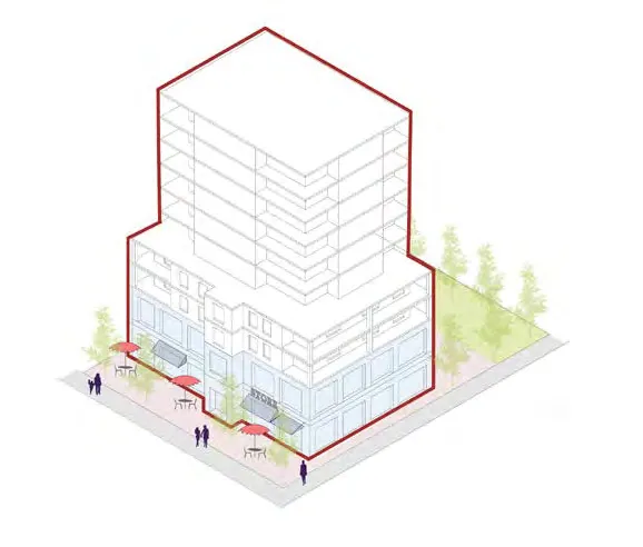
5.0 Land Use
Land Use determines the physical framework of the community, providing direction for how and where View Royal will grow in the future. This plan provides guidance on the approach and priorities for where development and growth are supported and in what form.
5.1 GENERAL FRAMEWORK AND CONSIDERATIONS
5.1.1 CONTEXT
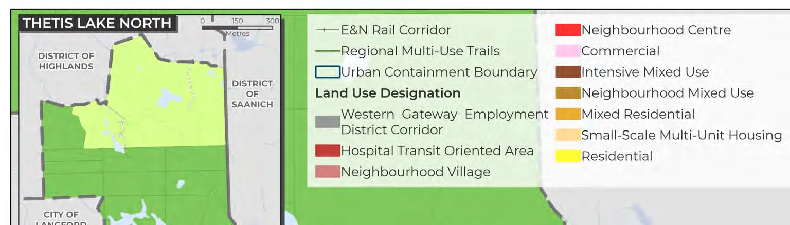
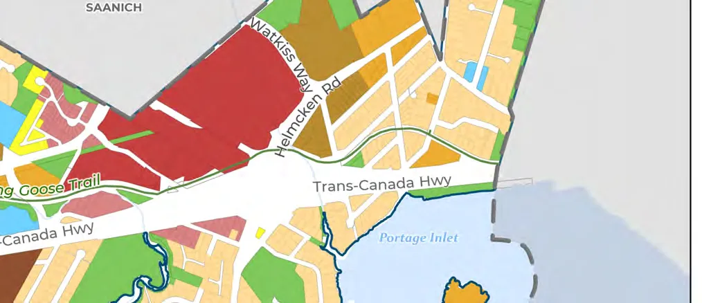
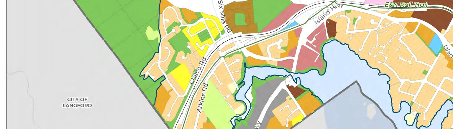
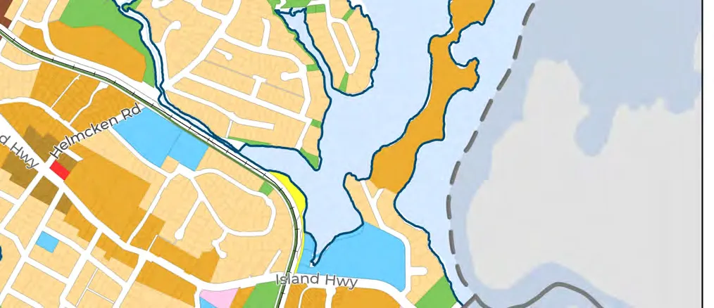
While View Royal started as a suburban community, it has since transformed into a vibrant community with local and regional services. New subdivisions are near completion along Six Mile Road near Thetis Lake. Most of the land within View Royal has been developed with no remaining vacant sites for development within the Urban Containment Boundary (see Map 1). Future growth will occur through redevelopment and infill of existing lands.
Thetis Lake Regional Park is an expansive natural regional amenity on the north side of View Royal, providing a buffer between the urban development of View Royal and the predominantly rural area to the north of Thetis Lake Regional Park, characterized by low-density housing and preserved green spaces.
Higher residential density and commercial activity in View Royal is currently concentrated along Island Highway, Admirals Road, Helmcken Road, and major intersections. There are some small pockets of neighborhood services that offer opportunities for enhancement, and areas along major transportation routes with potential for further infill development.
In recent years, commercial and institutional development in View Royal as well as apartments and condos near these of nodes and has steadily increased, highlighting the growing demand for business and services in View Royal. For example, the Eagle Creek Shopping Centre, east of the Hospital Transit-Oriented Area (see Section 5.3), has recently undergone major redevelopment. The area has been transformed into an important node with mixed use, providing key commercial, office, retail, restaurant, healthcare related services, and other local amenities.
View Royal has two mobility hubs – the Atkins Mobility Hub and the Hospital Mobility Hub – which serve as key intersections of land use and transportation. These mobility hubs act as central community gathering spots that promote connection and access to community amenities (see Map 3).
The vision for View Royal is to provide more amenities and services to a growing community in the form of mixed use development focused along the four major corridors (as shown in Figure 11), including Admirals Road, Helmcken Road, Island Highway, and the Western Gateway Employment District Corridor. The intersection of Helmcken Road and Island Highway has the opportunity to become a node, providing neighbourhood level, mixed use amenities and services.
Nodes refer to community focal points, such as intersections or transit hubs, that act as key centres of activity. They typically include higher density, mixed use areas that are community focused, provide services and amenities, and enhance transit service.
Mixed use is a development typology that accommodates a variety of uses with clear and convenient connections to the public realm. Mixed Use developments typically have retail, commercial, civic, or industrial uses located on the ground level and lower floors, and residential or office units occupying the upper floors. Mixed Use developments provide conveniently located amenities and services accessed by multi-modal transit within a neighbourhood.
Mobility Hubs are mobility-oriented development areas that offer seamless access to multiple transportation modes, connecting people to key destinations, employment, and services with quality public spaces and clear wayfinding. Mobility Hubs are the strategic intersection of frequent transit corridors and shared mobility infrastructure supported by high-density residential and employment land uses.
The following OCP Goals may be achieved through the policy direction provided in this section:
- Mobility and Connectivity
- Diverse and Affordable Housing
- Growth Management and Community Character Preservation
- Economic Development
- Reconciliation
Corridors are primary transportation routes where increased development density is generally encouraged to maximize accessibility for vehicles, public transit, and pedestrians. In View Royal, key corridors include Admirals Road, Helmcken Road, Island Highway, and the Western Gateway Employment District Corridor.
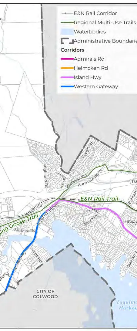
5.1.2 OBJECTIVES
- Spaces for Sustainable, Compact, and High-Density Development: Create a more complete and sustainable community by directing most new growth to the corridors and mobility hubs which focus on mixed use, transit-oriented development and design.
- Small-Scale, Multi-Unit Housing and Infill Development: Encourage the development of new compact housing near amenities, services, and transit-serviced routes within existing Small-Scale Multi Unit Housing areas inside the Urban Containment Boundary as desirable forms of small-scale infill development.
- Quality and Complementary Built Form: Support high-quality development that complements existing built forms and achieves sustainable urban and building design, safety, and dynamic public and private spaces.
- Community Connections: Continue to advance opportunities to enhance existing connections and identify opportunities to establish new connections between neighbourhoods and mobility hubs.
- Manage Development and the Natural Environment: Manage development to protect known and future green and blue spaces that make up the community’s natural environment and recognize these spaces as vital physical features that define the Town. These spaces include the Town’s parks and trails, shoreline, watercourses, waterbodies, and ecologically sensitive terrestrial areas.
- Functional, Connected Green Spaces: Establish a functional and interconnected greenspace and trail network in the Western Gateway Corridor, focusing on the areas along Millstream Creek and Esquimalt Harbour. This network will support ecological connectivity, recreational opportunities, and enhanced access for residents, while integrating within the Town’s broader system of parks, trails, and natural spaces.
- Spaces for People: Enhance the social fabric of the community by planning and designing public and private spaces that meet the diverse daily needs of residents to foster a sense of community, encourage social cohesion, and interaction through planned and unplanned events and activities.
5.1.3 GENERAL POLICIES
A. Create viable conditions for local businesses to thrive and provide for the diverse needs of residents by directing higher levels of housing and employment densities to the mobility hubs and corridors. B. Strengthen connections between existing residential neighbourhoods, corridors, and mobility hubs by: i) Providing multi-modal trails and pathways; ii) Creating linear parks; and iii) Enhancing public spaces and streetscape improvements (i.e. street trees, landscaping, wide sidewalks, street furnishings, pedestrian scale lighting, etc.). C. Integrate existing neighbourhood characteristics into the design of new developments p to acknowledge the unique social, cultural, and environmental characteristics of the Town. D. Encourage the development of public gathering places such as parks, plazas and landscaped seating areas near activity-generating uses, corridors, and mobility hubs. E. Development of four storeys or greater should incorporate commercial or public use space. F. Prohibit the subdivision of waterfront lots to protect the integrity of the shoreline, aquatic environments, and ecologically sensitive areas. G. The Town will not support aggregate extraction activities within its boundaries and will source aggregate materials from neighbouring regional communities to meet development needs, given the non-existence of these resources within View Royal. H. Explore the viability of density bonusing for the Hospital Transit-Oriented Area and Western Gateway Employment District Corridor to determine building heights that are viable for development. Findings could be integrated into the Zoning Bylaw and OCP. I. Apply Universal Access Design principles and guidelines to public space design and improvements. J. Maintain the Urban Containment Boundary, as shown on Map 1, by continuing to direct urban development and improvements to areas within the boundary, thereby preserving agricultural land, natural areas, and rural characteristics. K. Integrate community safety principles and best practices into all design guidelines.
5.1.4 MOBILITY HUB POLICIES
A. Establish the Atkins Park and Ride and the Hospital Transit-Oriented Area as View Royal’s mobility hubs, as shown in Map 3, that create conditions for the following: i) Centralized access to a range of services and amenities; ii) Connections to and/or the provision of transportation services such as bus stops, sidewalks, bike lanes, trail connections, car share options, amongst others; iii) Encourage and support local economic development; and iv) Integrate and enhance public spaces that meet local community needs. B. Encourage transit supported uses and medium to high densities, including mixed use community-wide destination retail, small format retail, health services, community and social services, recreation facilities, educational, and arts and cultural spaces. C. Promote walkability and a strong public realm by: i) Providing convenient links to transit, cycling routes, and local and regional multi-use trails; ii) Including bike parking, passenger loading, accessible parking, and access to shared mobility options; and iii) Integrating public spaces and amenities into site design such landscaping features, wide sidewalks, public art, and seating elements. D. Lands within mobility hubs should be designed in a manner that enables connection between developments within the hub, including public open spaces.
5.1.5 REDEVELOPMENT POLICIES
A. Consider incorporating provisions for density bonusing to secure community and neighbourhood amenities associated with new development such as parks, plazas, playgrounds, community meeting spaces, heritage retention, and frontage improvements. B. Consider financial tools to collect funds for community amenities where growth is planned, including community centres, recreation facilities, libraries, childcare facilities, landmarks, and public spaces. C. Maintain alignment of the Development Cost Charges Bylaw with market trends and to ensure the costs of providing infrastructure services associated with community growth are recovered. D. Where heritage, archeological or cultural assets that may be significant to the Songhees and Xʷsepsəm Nations are potentially impacted by redevelopment, require applicants to protect, rehabilitate, restore, and/or formally designate these assets as appropriate, such as through registration of a covenant on title. E. Support the reuse or retrofit of historically significant buildings, structures, and sites identified in the Town’s Heritage Register in a manner that preserves the heritage significance of the building, structure, or site. F. Explore opportunities to establish a standard for required professional reporting requirements for development applications. G. Explore the opportunity to integrate Development Approval Information authority into the Development Application Procedures Bylaw to give Town staff the authority to request additional information about a development proposal, such as environmental reports, renderings, etc. that will aid the Town in its evaluation. H. Notwithstanding the permitted heights within the Land Use Designations, consideration for increased building heights for rezoning and amendments to the Official Community Plan where proposed developments achieve one or more of the following may be considered: i) Advance overall plan objectives; ii) Are on sites with substantial grade differences; iii) Meet specified density bonus zoning provisions; iv) Achieve retention of high value trees or natural features and increased on-site open space; v) Demonstrate site design and architectural excellence; or vi) Provide a significant public benefit including securing non-market or supportive housing and/or parks or community facilities. I. Expand housing choice by supporting sensitive and strategic infill development, ensuring that new housing integrates seamlessly with the existing character, scale, and livability of established residential areas. J. Consider the following criteria when reviewing applications for new forms of housing in areas where small-scale multi-unit housing and mid- to high densities are proposed: i) Access to transportation options (e.g., transit, bike routes, trails); ii) Proximity to parks, schools and other community amenities; iii) Preservation of trees; and iv) Connection to infrastructure servicing. K. To ensure new development is thoughtfully integrated into existing neighbourhoods, consider developing Infill Design Guidelines.
Density describes the intensity of people, jobs, housing units, or commercial units within a defined area. Building height and Floor Space Ratio are common measures of density. In View Royal, density is classified as follows:
- Low-density – buildings with heights up to 3 storeys
- Medium-density – buildings with heights between 4 and 7 storeys
- High-density – buildings with heights greater than 8 storeys
Maximum density is expressed as Floor Space Ratio or FSR, which is the ratio of built (or buildable) area to land area. FSR is a tool used by planners, designers, and developers to model building mass in relation to lot. Density regulations and FSR exclusions for all land uses are specified in the Zoning Bylaw.
5.1.6 LAND USE DESIGNATIONS SUMMARY
The following land use designations shall apply to lands within View Royal, as shown in Map 1:
| Designation | Description | Maximum Height/Density |
|---|---|---|
| Western Gateway Employment District Corridor | Development includes a mix of flexible and adaptable building forms that support a range of employment functions suitable for commercial, light industrial, arts and culture, or tourist accommodations. Commercial space in the form of retail, restaurants, visitor accommodations, artist studios, and offices is permitted. Light industrial space that includes distribution and repair, light manufacture and processing are permitted. Arts, innovation, and technology are also permitted. | • 6 storeys • FSR: 2.5 FSR* *Development on these lands may be subject to density bonus and inclusionary zoning provisions if and when they are adopted. |
| Hospital Transit Oriented Area | Uses include mixed use with apartments, visitor accommodations, restaurants, retail, office, institutional (i.e. hospital), and civic use (e.g., daycares, libraries, public gathering and amenity spaces). | • 10 storeys • FSR: 3.5 FSR* *Development on these lands may be subject to density bonus and inclusionary zoning provisions if and when they are adopted. |
| Neighbourhood Village | Uses include mixed use buildings, such as multi-unit housing and community serving commercial and civic uses. This may include schools, offices, restaurants, retail, grocery store, and community spaces. | • 6 storeys • FSR: 2.5 |
| Neighbourhood Centre | Areas allowing for small-scale mixed use development that serve local neighbourhood needs. These areas encourage walkability through providing multi-unit housing forms and community-serving commercial and civic uses. This may include schools, offices, restaurants, retail, small grocery stores, and community spaces. | • 6 storeys • FSR: 3.0 FSR |
| Commercial | Development that permits a variety of commercial uses, including retail, office, technology, services, and restaurants. | • 4 Storeys • FSR: 2.5 FSR |
| Intensive Mixed Use | Low-rise mixed use development in the form of townhouses and low-rise apartments, designed to include ground-floor commercial space and upper-floors designated for residential dwellings. Ground-floor commercial space may include one or more of the following: retail, restaurants, medical offices, offices, and civic uses (e.g. daycares, libraries, public gathering and amenity spaces). | • 4 Storeys • FSR: 2.5 FSR |
| Neighbourhood Mixed Use | Uses include low-rise mixed use development in the form of townhouses and low-rise apartments, designed to include ground-floor commercial space and upper-floors designated for residential dwellings. Ground-floor commercial space may include one or more of the following: retail, restaurant, medical office, office, civic uses (e.g. daycares, libraries, public gathering and amenity spaces). | • 3 storeys • FSR: 1.5 FSR permitted |
| Mixed Residential | Uses include detached and attached dwellings, such as duplexes, secondary suite, garden suite, rowhouse, townhouses, house-plex developments, and apartments. | Apartments: • 4 storeys • FSR: 1.6 All other uses: • 3 storeys • FSR: 1.25 |
| Small-Scale Multi-Unit Housing | Uses include detached and attached dwellings, such as detached residential, duplex, secondary suite, garden suite, rowhouse, townhouse, house-plex, and apartments. | • 3 storeys • A maximum of 6 dwelling units |
| Residential | Residential areas consisting of detached houses, rowhouses, townhouses, and house-plexes that are accessed via separate entrances at the ground-level. Uses include detached and attached dwellings, such as detached residential, duplex, secondary suite, and garden suite. | • 2.5 storeys • FSR: 0.6 FSR permitted for appropriate infill |
| Large Lot Residential | Residential areas consisting of detached homes that are located on large lots. Uses include detached homes, on large lots and yards. | • 2.5 storeys |
| Rural | Lands that permit large lot residential uses, as well as recreation, and agriculture. | • 2 storeys • 1 unit per 10 hectares permitted |
| Community Facility | Government buildings and publicly-owned facilities providing a range of services, amenities, and utilities for the community including health care facilities, emergency service buildings, community halls, libraries, treatment plants and facilities, and schools. | Varies |
| Parks, Trails and Open Space | Active and passive parks, trails, natural and green spaces, and outdoor recreation facilities. | N/A |
| Urban Reserve | Land to be transferred to Xʷsepsəm Nation within the lifespan of this OCP. | N/A |
5.2 WESTERN GATEWAY EMPLOYMENT DISTRICT CORRIDOR DESIGNATION
5.2.1 CONTEXT
The Western Gateway Employment District Corridor is a medium-density corridor located along Island Highway to the south of Parsons Bridge, as shown in Map 1. This area is an extension of the employment corridor located to the south in the City of Colwood. It is the vision of both local governments that this corridor transforms into a medium- to high-density, employment hub for the respective communities, the West Shore, and the broader region. In addition, this corridor will support the Atkins Mobility Hub located to the north (see Map 3) which is designated as Neighbourhood Village and Community Facility in Map 1. The corridor will also support other surrounding residential areas by providing an abundance of employment opportunities and services.
Employment opportunities facilitated through the integration of a mix of light industrial, commercial, arts and culture, and hospitality uses will be encouraged. As discussed in section 9.0, the Town aims to support new and existing businesses in the tech sector, as well as those that support tourism and the healthcare industry, such as commercial hotels, research labs, and biomedical services, amongst others. Given the Town’s central location within the region and its existing healthcare assets, such as Victoria General Hospital, such investment opportunities are highly supported in the Western Gateway Employment District Corridor.
Development in the corridor is intended to support pedestrian-oriented activity, enable non-auto-oriented travel decisions, and increase connections to the Millstream Creek greenway, as well as access to the nearby waterfront area. Urban design that supports a strong public realm will be highly encouraged for new development, with connections to transit, trails, pedestrian-friendly streetscapes, and bike lanes provided wherever possible, particularly those that support the objectives of the Town’s transportation and mobility objectives outlined in section 7.0.
5.2.2 PERMITTED HEIGHTS AND DENSITIES
A. Heights and densities permitted in this land use designation are as follows: i) Maximum height: 6 storeys ii) Maximum floor Space Ratio: 2.5* * Development on these lands may be subject to density bonus and inclusionary zoning provisions if and when they are adopted by the Town.
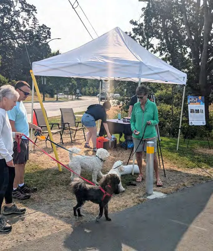
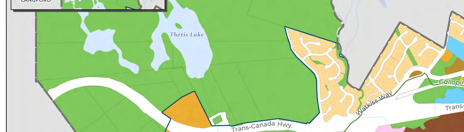
5.2.3 POLICIES
A. Collaborate with the City of Colwood to establish the Western Gateway Employment District Corridor as a regional employment hub, prioritizing economic development and attracting business investment. B. Encourage redevelopment of lands designated as Western Gateway Employment District Corridor to promote medium-density mixed-use development, with an emphasis on commercial, light industrial, arts and culture, and hospitality uses and high-quality urban design. Development in the Western Gateway Employment District Corridor should aim to achieve: i) A mix of employment uses including office, retail, hotel, research labs, community / civic use, and light industrial (e.g. light manufacturing and processing of goods, distribution). ii) Strong public realm design and a pedestrian-friendly streetscape that is designed to attract visitors to the area through orienting buildings towards the street, using landscaping features such as plantings and seating to welcome in users to the space, providing sidewalk and trail connections to transportation options, Millstream Creek, the waterfront, and other key businesses in the corridor, and supporting the nearby Atkins Mobility Hub. iii) Compatibility with nearby residential development through thoughtful design and landscape buffers, where appropriate. iv) Long-term protection of Millstream Creek and shoreline by dedicating park land for green space and / or recreational trails wherever possible. v) Enhanced economic development opportunities for the Town, particularly local businesses and investments in emerging industries. C. Enable the provision and viability of industrial development through establishing conditions that allow for flexibility in the design and configuration of buildings with industrial uses, such as exploring opportunities to support stacked development and buildings with high ceiling heights on the first two storeys, amongst others.
5.3 HOSPITAL TRANSIT-ORIENTED AREA DESIGNATION
5.3.1 CONTEXT
Provincial regulations have designated the area west of Victoria General Hospital around the existing bus exchange as a Transit-Oriented Area, as shown in Map 3. In addition, the hospital is expected to expand its services and undergo physical expansion in the coming decade, ideally co-locating with primary care facilities and ancillary medical service providers. As a result, higher density residential in the form of apartments have started developing in recent years and are planned to continue to be accommodated along Watkiss Way to provide more housing and support the expanding amenities and services and take advantage of current and future investments in bus rapid transit.
The Victoria General Hospital Transit Exchange is presently served by a single frequent transit service route. However, there is potential to expand frequent transit service and provide rapid transit service if the lots within the Transit-Oriented Area surrounding the hospital are developed to densities that can support such service. The Victoria General Hospital Transit Exchange is ideally located to become a major mobility hub for the community. It is located near the Helmcken Park and Ride, Galloping Goose Regional Multi-Use Trail, and Highway 1, all providing inter- and intra-municipal connections. Helmcken Road is one of the key corridors connecting neighbourhoods in View Royal and the neighbouring District of Saanich, as shown on Figure 11.
The Hospital Transit-Oriented Area is envisioned as a vibrant, high-density mixed use community that integrates residential, medical, and commercial spaces to support the Victoria General Hospital and regional rapid transit system. Transit, cycling, and walking are envisioned to be the primary modes of transportation in this area to encourage active transportation connections, enhance the public realm, and create a safe, pedestrian-friendly environment for residents and visitors alike.
5.3.2 PERMITTED HEIGHTS AND DENSITIES
A. Heights and densities permitted in this land use designation are as follows: i) Heights: 10 storeys ii) Floor Space Ratio: 3.5* * Development on these lands may be subject to density bonus and inclusionary zoning provisions if and when they are adopted by the Town.
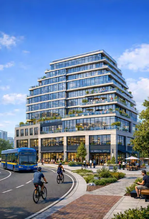
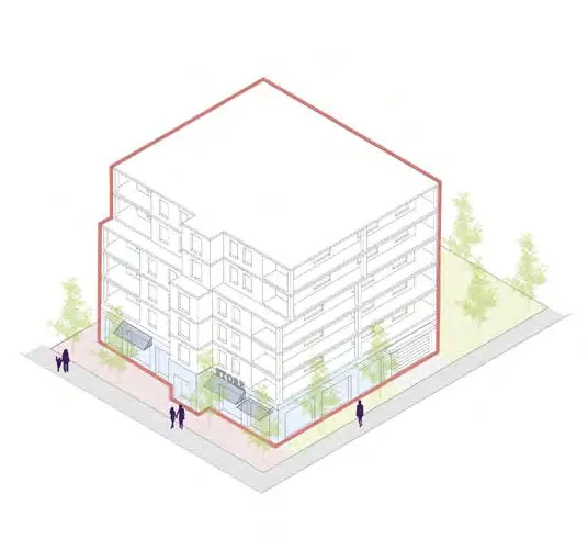
5.3.3 POLICIES
A. Encourage redevelopment of lands designated as Hospital Transit-Oriented Area. B. Prioritize high-density, mixed use development in the Hospital Transit-Oriented Area that aims to provide, or create conditions for, the following: i) New residential dwellings, medical-related office spaces, tourist accommodations, and retail uses that benefit from and support the Victoria General Hospital. ii) Diverse employment and commercial services that strengthen the local economy and support or complement existing local businesses and services. iii) Rapid and frequent transit service routes. iv) Ground floor commercial space. v) Underground or sub-surface parking facilities that promote a safe and enjoyable pedestrian environment. vi) Improved access and traffic circulation within the area. vii) Construction of, or partnership with the Town to provide, active transportation infrastructure to connect new development to the Hospital bus terminal, Galloping Goose Regional Trail, Trans-Canada Highway, the Eagle Creek development west of Victoria General Hospital, and the established residential area southeast of Helmcken Road. C. Promote increased housing options to diversify housing stock, including opportunities for supportive housing or affordable housing developments.
Two types of transit service exist in View Royal:
1. Rapid Transit Service Type: Rapid Transit routes are designed to move large volumes of passengers between major destinations and stop less often than Frequent Transit service. Frequency: Customers can expect buses to arrive at least every 15 minutes between 7:00 a.m. and 10:00 p.m. every day of the week.
2. Frequent Transit Service Type: Frequent Transit routes operate at a 15 minute frequency between a specific period of time. Routes generally operate on arterial roads, serve corridors with mixed land use and provide connections between urban centres. Frequency: Customers can expect buses to arrive every 15 minutes or better service, 7:00 a.m. to 7:00 p.m., Monday through Friday.
5.4 NEIGHBOURHOOD VILLAGE DESIGNATION
5.4.1 CONTEXT
Neighbourhood Villages are situated near the lands comprising and surrounding the Atkins and Hospital Mobility Hubs to create density conditions that support rapid and frequent transit service, as shown in Map 3. The Neighbourhood Village designation includes mixed use buildings, such as multi-unit housing and community serving commercial and civic uses such as schools, offices, restaurants, retail, grocery store, and community spaces.
To comply with the provincially legislated Housing Statues (Transit-Oriented Areas) Amendment Act, the Neighbourhood Village designation applies to lands within 201-400 meters of the Hospital Transit-Oriented Area’s prescribed bus exchange (Map 3). It is acknowledged that many lands in this designation are already built out or are under development, reducing the likelihood of redevelopment within the lifespan of this OCP.
5.4.2 PERMITTED HEIGHTS AND DENSITIES
A. Heights and densities permitted in this land use designation are as follows: i) Height: 6 storeys ii) Floor Space Ratio: 2.5* * Development on these lands may be subject to density bonus and inclusionary zoning provisions if and when they are adopted by the Town.
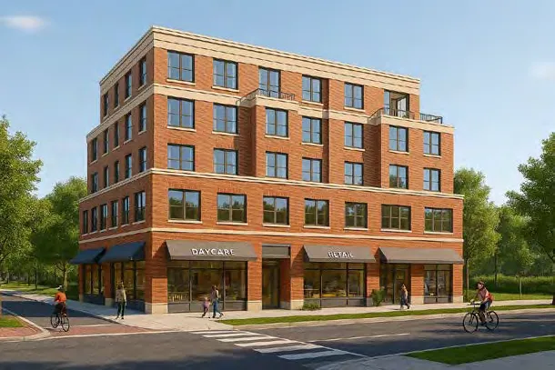
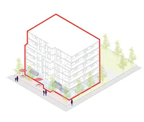
5.4.3 POLICIES
A. Encourage redevelopment of lands within the Neighbourhood Village designation to support a variety of uses, including multi-unit mid-rise residential buildings, and commercial and civic uses that support the broader area. B. Support commercial and civic uses such as schools, offices, restaurants, retail, grocery store, and community spaces. C. Enable better transit service and connections of mobility hubs through increased densities and public realm design. D. Create strong and safe linkages to the surrounding neighbourhoods, parks, and trails at the following locations: i) The Neighbourhood Village designated area surrounding the Atkins Mobility Hub linking to the Western Gateway Employment District Corridor and Price Bay. ii) The Neighbourhood Village designation within the Hospital Transit-Oriented Area providing access to Craigflower Creek, the Galloping Goose Regional Trail, View Royal Park, and other existing parks. E. Promote Neighbourhood Villages as vibrant hubs that provide outdoor seating and/or public gathering space.
5.5 NEIGHBOURHOOD CENTRE DESIGNATION
5.5.1 CONTEXT
The Neighbourhood Centre Designation allows for small-scale, mixed use development that serve local neighbourhood needs. The designation applies a single lot at the intersection of Island Highway and Helmcken Road, as shown in Map 1, which has been partially redeveloped. This area is envisioned to encourage walkability by providing multi-unit housing forms and community-serving commercial and civic uses.
5.5.2 PERMITTED HEIGHTS AND DENSITIES
A. Heights and densities permitted in this land use designation are as follows: i) Height: 6 storeys ii) Floor Space Ratio: 3.0
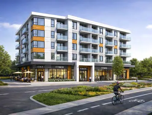
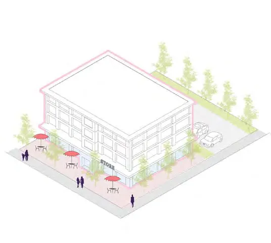
5.5.3 POLICIES
A. Encourage mixed use residential and commercial development at the intersection of the Island Highway and Helmcken Road Corridors to support greater transit service and mobility and also provide greater access to daily needs for surrounding established neighbourhoods. B. Ground floor commercial and civic uses may include schools, offices, restaurants, retail, small grocery stores, and community spaces. C. Mixed-use development should be reviewed to consider the following: i) Opportunity to establish connections across Island Highway and Helmcken Road to enhance pedestrian safety. ii) Pedestrian-friendly street frontages that are designed for the comfort of those arriving by all modes. iii) Strong and safe connections to surrounding residential areas, the waterfront, Helmcken Road, and View Royal Elementary School. iv) Opportunities to consolidate and rezone lots fronting Island Highway to accommodate higher residential densities.
5.6 COMMERCIAL DESIGNATION
5.6.1 CONTEXT
Lands in the commercial designation will seek to provide more local jobs as View Royal grows, while providing services and amenities to residents. The designation permits a variety of commercial uses, including retail, office, technology, services, and restaurants. Commercial services are primarily located along the Admirals Road and Island Highway Corridors.
5.6.2 PERMITTED HEIGHTS AND DENSITIES
A. Heights and densities permitted in this land use designation are as follows: i) Heights: 4 storeys ii) Floor Space Ratio: 2.5
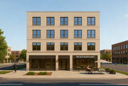
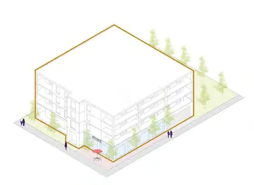
5.6.3 POLICIES
A. Promote the commercial lands along the Admirals Road Corridor (see Figure 11) as a commercial centre that supports a mix of employment uses, including retail, office, technology, services, and restaurants. B. Encourage new development along Admirals Road and adjacent areas to facilitate the conditions for strong connections to development along Admirals Road. Development applications should be reviewed to consider opportunities for: i) Incorporating high quality urban design features in buildings and public spaces; ii) Strong and safe pedestrian and cycling connections; and iii) Active street frontages. C. Support public space enhancements along Admirals Road, Hallowell Road, and the Island Highway to create a safe and enjoyable pedestrian environment, and to reinforce the Admirals Road Corridor as View Royal’s eastern gateway. Enhancements may include: i) Sidewalk widening and improvements; ii) Coordinated street furnishing and lighting standards; iii) Public art, banners and gateway features; iv) Wayfinding signage; and v) Improved bike facilities and crossings.
5.7 INTENSIVE MIXED USE DESIGNATION
5.7.1 CONTEXT
The Intensive Mixed Use designation is intended to provide low-rise mixed use development in the form of townhouses and low-rise apartments, designed to include ground-floor commercial space and upper-floors designated for residential dwellings. Lands with this designation are primarily located on the current site of the Fort Victoria RV Park, as well as a few lots within the Western Gateway Employment District Corridor and near the Atkins Mobility Hub, as shown in Map 1. Council and the community expressed support development up to four storeys within this designation. At the time of writing this OCP, mixed use developments are generally more financially viable for projects with six storeys or more, however, it is acknowledged that market conditions can change over the life span of this plan, which may favour developments of lower scale.
5.7.2 PERMITTED HEIGHTS AND DENSITIES
A. Heights and densities permitted in this land use designation are as follows: i) Height: 4 storeys ii) Floor Space Ratio: 2.5
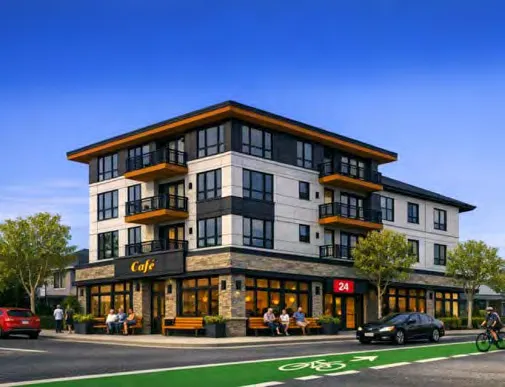
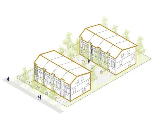
5.7.3 POLICIES
A. Support low-rise mixed use development in the form of townhouses and low-rise apartments, with ground-floor commercial space. B. Ground-floor commercial uses may include retail, restaurants, medical offices, offices, and civic uses (e.g. daycares, libraries, public gathering and amenity spaces). C. Mixed-use development should be reviewed to consider the following: i) Pedestrian-friendly street frontages that are designed for the comfort of those arriving by all modes. ii) Strong and safe connections to surrounding residential areas, the Western Gateway Employment District Corridor, the Atkins Mobility Hub, the local and regional multi-use trails, and Island Highway.
5.8 NEIGHBOURHOOD MIXED USE DESIGNATION
5.8.1 CONTEXT
The Neighbourhood Mixed Use designation supports the development of nodes, corridors, and mobility hubs with low-rise multi-unit residential, commercial, and civic uses serviced by active and public transportation infrastructure. As View Royal grows, mixed use development will be crucial for creating a community where residents can easily access daily needs such as work, education, childcare, recreation, and health services without passenger vehicles.
Key Neighbourhood Mixed Use areas include the Helmcken Corridor (Eagle Creek Village), Island Highway at the intersection of Helmcken Road, and Lakeside Village south of Thetis Lake along Six Mile Road, as shown in Map 1. The proximity of the Neighbourhood Mixed Use area at Eagle Creek to the Hospital Transit-Oriented Area will support the View Royal’s vision of a vibrant mixed use transit-supported mobility hub. It is acknowledged that most of Eagle Creek and Lakeside Village are built out at this time, reducing the likelihood of redevelopment within the lifespan of this OCP.
5.8.2 PERMITTED HEIGHTS AND DENSITIES
A. Heights and densities permitted in this land use designation are as follows: i) Height: 3 storeys ii) Floor Space Ratio: 1.5
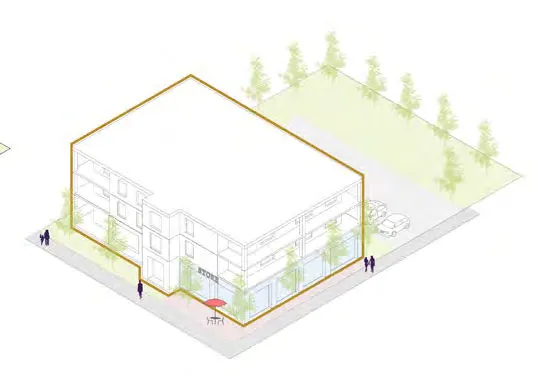
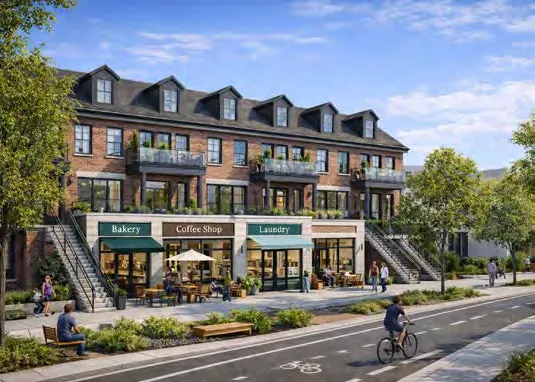
5.8.3 POLICIES
A. Support low-rise mixed use development, such as townhouses and low-rise apartments with ground-floor commercial space and upper-floors designated for residential dwellings. B. Ground-floor neighbourhood-serving commercial uses may include one or more of the following: retail, restaurant, medical office, office, and civic use (e.g., daycare, library, amenity space). C. Encourage mixed use development along the Island Highway and Helmcken Road node to support greater transit service and mobility. D. Mixed-use development should be reviewed to consider the following: i) Opportunity to establish connections across Island Highway and Helmcken Road to enhance pedestrian safety. ii) Pedestrian-friendly street frontages that are designed for the comfort of those arriving by all modes. iii) Strong and safe connections to surrounding residential areas, the waterfront, Helmcken Road, and View Royal Elementary School. iv) Opportunities to consolidate and rezone lots fronting Island Highway to accommodate higher residential densities.
5.9 MIXED RESIDENTIAL DESIGNATION
5.9.1 CONTEXT
The Mixed Residential designation permits detached and attached dwellings, such as duplexes, secondary suite, garden suite, rowhouse, townhouses, house-plex developments, and apartments. Its purpose is to increase housing choices along key corridors and in areas where services and amenities are concentrated. Mixed Residential is primarily located along Island Highway, Christie Point, to the west of Admirals Corridor, and in several other areas as shown on Map 1. Medium-density development in these areas will help improve mobility, especially for lots near the Atkins Mobility Hub that are designated as Mixed Residential.
5.9.2 PERMITTED HEIGHTS AND DENSITIES
A. Heights and densities permitted in this land use designation are as follows: i) Apartments: • Height: 4 storeys • Floor Space Ratio: 1.6 B. All other uses: • Height: 3 storeys • Floor Space Ratio: 1.25
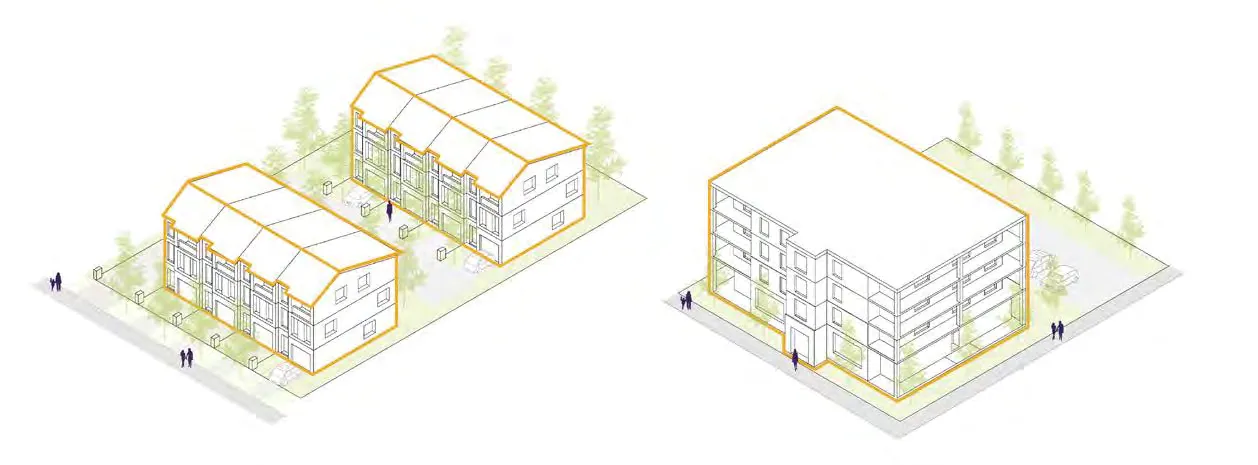
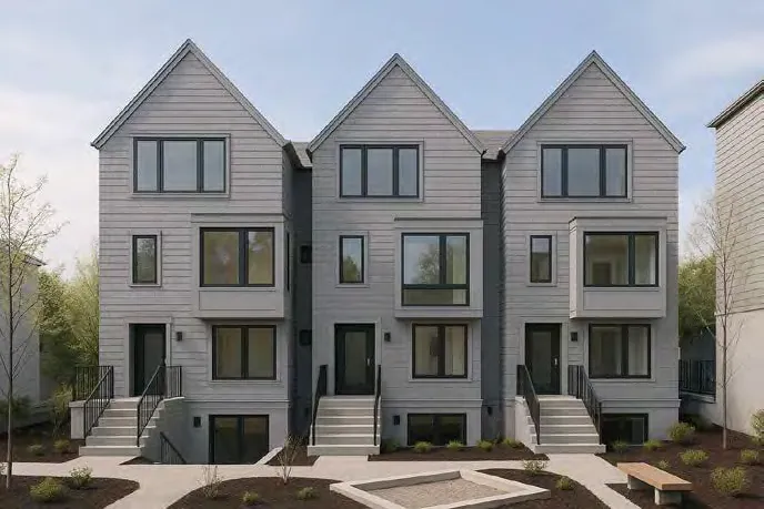
5.9.3 POLICIES
A. Support a variety of housing options, including opportunities for infill and gentle density in the form of duplexes, secondary suite, garden suite, rowhouse, townhouses, house-plex developments, and apartments in existing established neighbourhoods. B. Mixed Residential development along corridors should be carefully reviewed to consider the following: i) Right-of-way conditions and pedestrian safety, including connections across the Island Highway and Helmcken Road. ii) Pedestrian-friendly street frontages that are designed for the comfort of those arriving by all modes. iii) Strong and safe connections to surrounding residential areas, the waterfront, Helmcken Road, and View Royal Elementary School. C. Consider opportunities to consolidate and rezone lots fronting Island Highway to accommodate higher residential densities. D. Explore opportunities to facilitate the long-term natural restoration of Christie Point to pre-development conditions in response to sea-level rise. Carefully review development applications to ensure that development is limited within areas susceptible to flooding, potential sea-level rise concerns are addressed, and road access from the Island Highway remains safe and efficient.
5.10 SMALL-SCALE MULTI-UNIT HOUSING DESIGNATION
5.10.1 CONTEXT
The Small-Scale Multi-Unit Housing designation supports a variety of housing types in residential neighbourhoods such as detached and attached dwellings, duplex, secondary suite, garden suite, rowhouse, townhouse, houseplex, and apartments up to three storeys in height. This designation applies in many of the established low-density neighbourhoods in the community. Small-Scale Multi-Unit Housing is an opportunity to integrate gentle density that offers greater housing choices and attainability and will be key for addressing the demand for ground-oriented housing in View Royal.
5.10.2 PERMITTED HEIGHTS AND DENSITIES
A. Heights and densities permitted in this land use designation are as follows: i) Building heights up to 3 storeys ii) Maximum density of up to 6 dwelling units
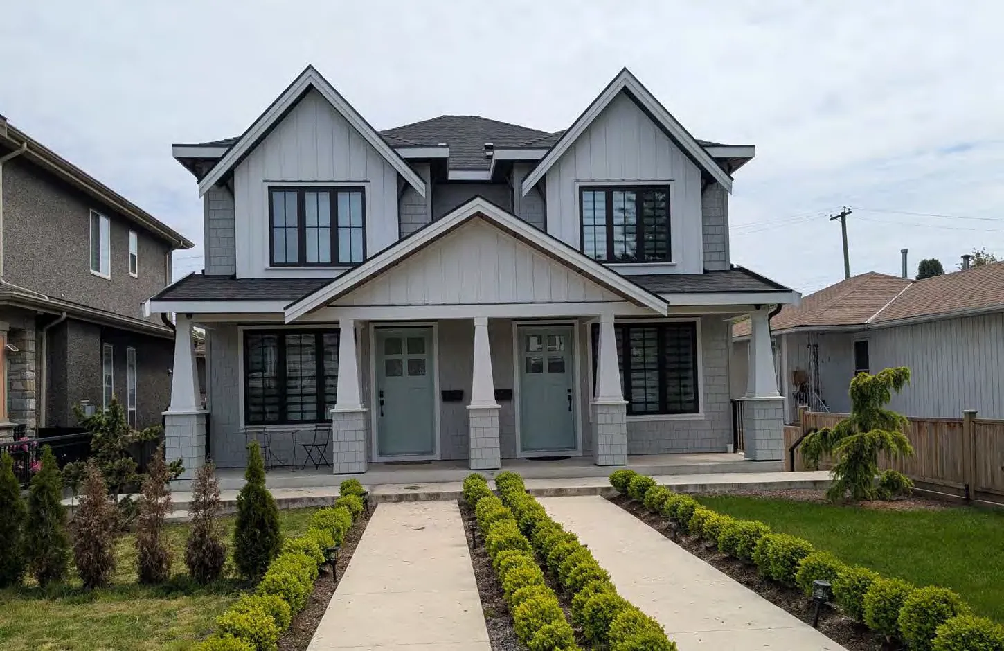
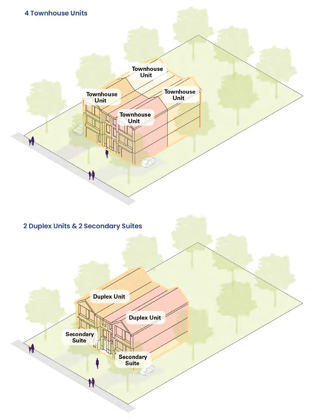
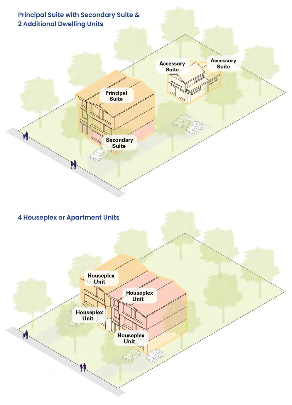
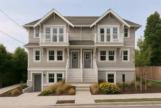
5.10.3 POLICIES
A. Support Small-Scale Multi-Unit housing forms in existing residential neighbourhoods, such as detached homes, duplexes, house-plexes, townhouses, garden suites, and secondary suites. B. New development should be designed in a way that complements the existing surrounding neighbourhood. C. Strengthen connections between existing residential neighbourhoods and the mixed use centres through urban design, public space improvements, pedestrian, bike, and transit supportive facilities. D. When reviewing applications for infill developments, adhere to the redevelopment policies outlined in section 5.1.5.
5.11 RESIDENTIAL DESIGNATION
5.11.1 CONTEXT
The Residential designation consists of detached houses, rowhouses, townhouses, and house-plexes that are accessed via separate entrances at the ground-level. This designation differs from Small-Scale Multi-Unit Housing as these lots do not meet provincial legislative criteria.
5.11.2 PERMITTED HEIGHTS AND DENSITIES
A. Heights and densities permitted in this land use designation are as follows: i) Building heights up to 2.5 storeys ii) Maximum density of up to 0.6 Floor Space Ratio for appropriate infill
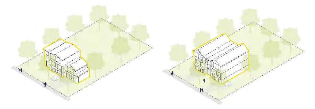
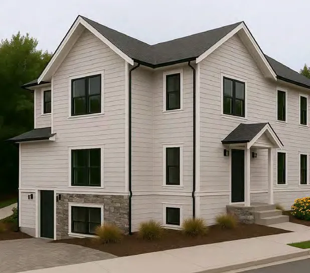
5.11.3 POLICIES
A. Support low-density housing forms in existing residential neighbourhoods, including detached and attached dwellings, such as detached residential, duplex, secondary suite, and garden suite. B. New development should be designed in a way that complements the existing surrounding neighbourhood. C. Strengthen connections between existing residential neighbourhoods and the mixed use centres through urban design, public space improvements, pedestrian, bike, and transit supportive facilities. D. When reviewing applications for infill developments, adhere to the redevelopment policies outlined in section 5.1.5.
5.12 LARGE LOT RESIDENTIAL DESIGNATION
5.12.1 CONTEXT
Large Lot Residential consists of detached homes that are located on large lots within established neighbourhoods. Limited redevelopment is anticipated for these lots.
5.12.2 PERMITTED HEIGHTS AND DENSITIES
A. Heights and densities permitted in this land use designation are as follows: i) Building heights up to 2.5 storeys
5.12.3 POLICIES
A. Support detached homes and secondary suites in existing residential neighbourhoods. B. New development should be designed in a way that complements the existing surrounding neighbourhood.
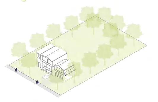
5.13 RURAL DESIGNATION
5.13.1 CONTEXT
The Rural designation applies to lands used for agriculture, recreation, or for large lot residential uses. These lands are primarily located north of Thetis Lake Regional Park, with the exception of two lots on Atkins Road, as shown in Map 1. There is limited servicing available to lots designated as rural and therefore, development potential is limited.
5.13.2 PERMITTED HEIGHTS AND DENSITIES
A. Heights and densities permitted in this land use designation are as follows: i) Building heights up to 2 storeys ii) Maximum density of up to 1 unit per 10 hectares
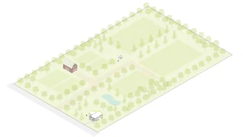
5.13.3 POLICIES
A. Support the retention of rural lands north of Thetis Lake Regional Park through adherence to the Urban Containment Boundary. B. Maintain farming, agriculture, and low-density residential as the predominant land use on rural lands. C. Prioritize maintaining the rural character of the area. D. Support home-based businesses that fit with the character of the rural neighbourhood.
5.14 COMMUNITY FACILITY DESIGNATION
5.14.1 CONTEXT
The Community Facility designation applies to existing government buildings and publicly-owned facilities providing a range of civic and institutional services, amenities, and utilities for the community including health care facilities, emergency service buildings, community halls, libraries, supportive housing, places of worship, schools, public childcare, transit facilities such as park and rides and bus exchanges, and utility services such as water, sanitary sewer, and hydro. Three schools, two community halls, municipal buildings, the Victoria General Hospital, and two park and ride facilities make up most of the Town’s public facilities. The Atkins Mobility Hub, currently a park and ride site, will be serviced in the future by bus rapid transit, as shown in Map 3.
5.14.2 PERMITTED HEIGHTS AND DENSITIES
A. Heights and densities permitted in this land use designation vary from site to site.
5.14.3 POLICIES
A. Promote a variety of public, non-profit, or utility uses, including community halls/centres, schools, public health facilities, community care facilities, supportive housing, emergency facilities, libraries, government buildings, childcare, and schools. B. Retain existing Community Facility lots and seek opportunities to expand and consolidate lots to accommodate future growth. C. Ensure all community facilities provide accessibility infrastructure at all existing and new community facilities to ensure these spaces may be reasonably accessed by all. D. Support the development of the Atkins Mobility Hub as a Community Facility that will provide rapid transit service and support the growth of surrounding land uses. E. Encourage institutional landowners to preserve on-site open space and make it publicly accessible where possible. F. In cases where redevelopment is being considered on Community Facility land: i) Prioritize the retention of ownership of the property as community or non-profit, including through supporting partnerships and incentives. ii) Support the use of the site for non-profit rental housing and/or non-market housing with a mix of community facility, small-scale commercial, and other compatible uses.
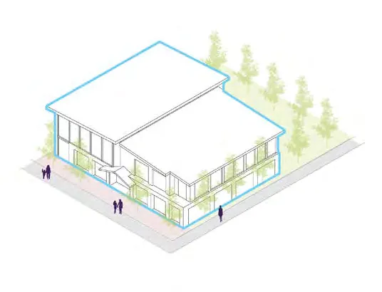
5.15 PARKS, TRAILS AND OPEN SPACE DESIGNATION
5.15.1 CONTEXT
The Parks, Trails and Open Space designation applies to active and passive parks, trails, natural conservation areas, green spaces, waterfront areas, and outdoor recreation facilities. Parks, Trails, and Open Spaces provide opportunities to facilitate transportation connections to key areas within the community, including mobility hubs.
The Parks, Trails and Open Space designation may apply to Provincial Agricultural Land Reserve lots, which are intended for long-term farm use to support the local economy and food security. There are currently three lots with the Agricultural Land Reserve in View Royal – View Royal Park, the road right-of-way for the Trans-Canada Highway, and Chilco Park, as shown in Map 2. The Town may consider excluding these lots from the Agricultural Land Reserve in future as they no longer serve the intended purpose of the Agricultural Land Reserve designation, however, no immediate action is planned.
5.15.2 PERMITTED HEIGHTS AND DENSITIES
A. Heights and density permissions are not applicable for this land use designation.
5.15.3 POLICIES
A. Enhance on-site green space by considering the needs of green space requirements over parking space requirements, when considering a development variance permit, development permit, temporary use permit, official community plan amendment or zoning bylaw amendment. B. Protect the natural environment along Millstream Creek and support opportunities for fish habitat, wildlife corridors, historic interpretation signage, public access to the shoreline, and connection to the Western Gateway Employment District Corridor and nearby Neighbourhood Village. C. Continue to support the preservation of Thetis Lake and Mill Hill Regional Parks as important recreational amenities and significant natural resources. D. Improve local and regional access and connections to Thetis Lake and Mill Hill Regional Parks from surrounding neighbourhoods. E. Collaborate with the Capital Regional District to expand regional park boundaries as appropriate. F. Ensure that current and future use of land designated as Agricultural Land Reserve (Map 2) is compliant with Agricultural Land Commission legislation and regulations.
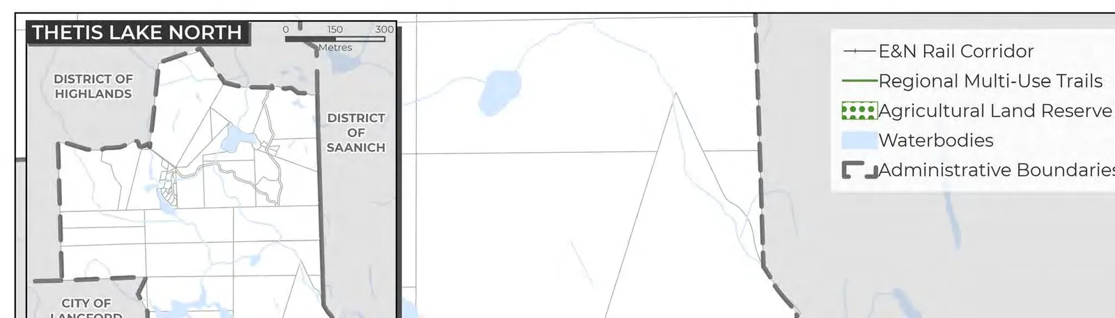
5.16 URBAN RESERVE DESIGNATION
5.16.1 CONTEXT
The land designated as Urban Reserve is adjacent to Xʷsepsəm Nation reserve 644 and is planned to be transferred to Xʷsepsəm Nation within the lifespan of this OCP, as shown in Map 1. This follows the Province of British Columbia’s plan to transfer Thetis Cove to Xʷsepsəm Nation.
5.16.2 PERMITTED HEIGHTS AND DENSITIES
A. Heights and density permissions are not applicable for this land use designation.
5.16.3 POLICIES
A. Collaborate with Xʷsepsəm and Songhees Nations to return the land to Xʷsepsəm Nation to advance reconciliation efforts. B. Review the Town’s boundary following the transfer of the reserve lands to Xʷsepsəm Nation.
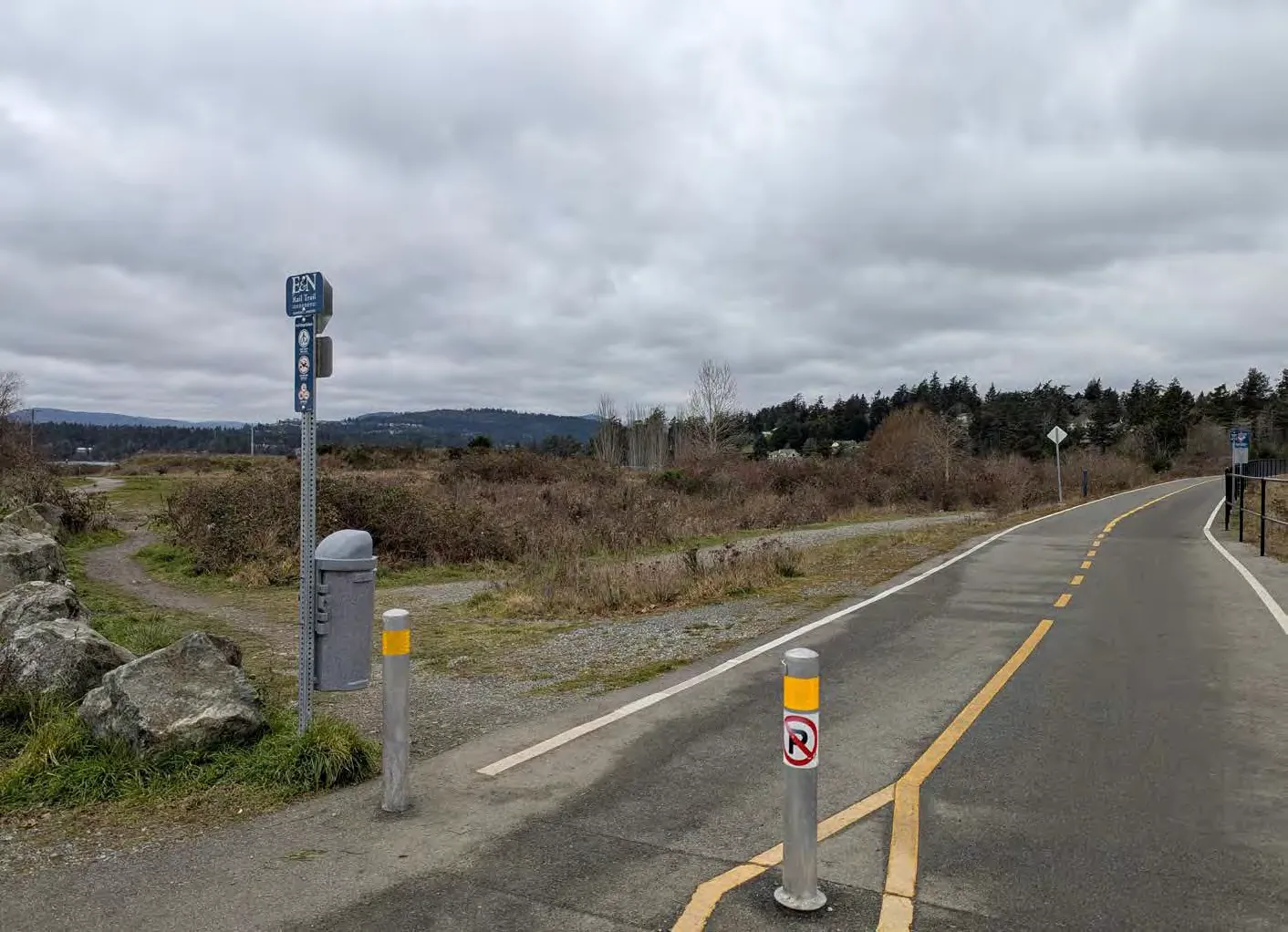
Part Three: Policies
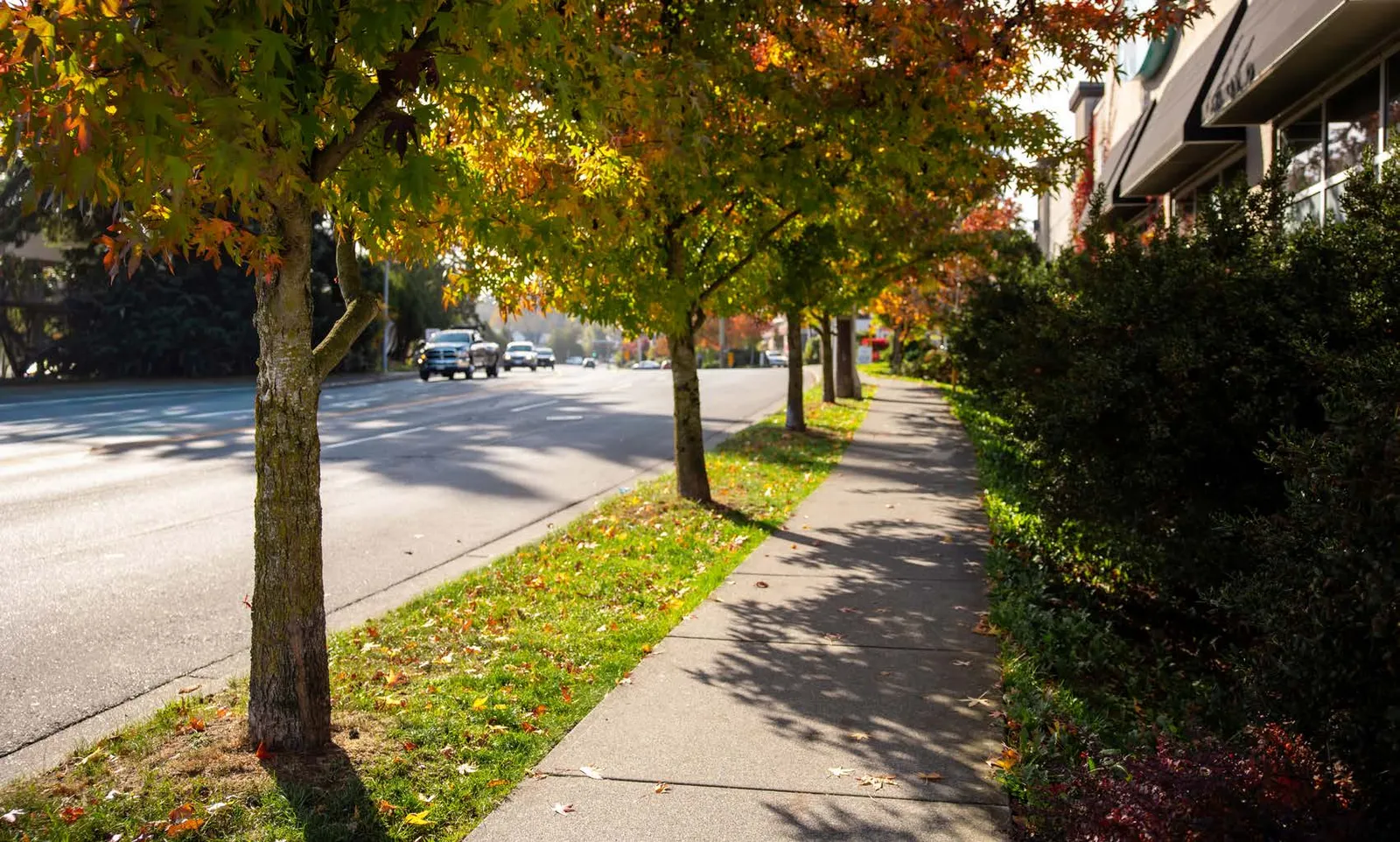
6.0 Housing
6.1 CONTEXT
Housing in View Royal and the Capital Regional District as a whole is increasingly challenged by rising land and construction costs, demographic shifts, and limited land available for new development. Many residents are living in housing that is no longer suitable for their needs, including older adults seeking to downsize and families seeking attainable, appropriately sized homes. Inadequate housing options and growing risks of homelessness further highlight the need for greater diversity in housing types and tenures.
The 2024 View Royal Interim Housing Needs Report outlined the most current housing conditions in the community. The report highlighted the following Core Housing Need by housing tenure in 2021:
- 0.90% of owner households
- 9% of renter households were in Core Housing Need.
It is estimated that an additional 174 suitable, affordable, and adequate homes are necessary to meet this need by the year 2041. A further 842 units are necessary to address extreme core housing, persons experiencing homelessness, suppressed household formation, anticipated growth, rental vacancy rate adjustment, and local demand in View Royal. Considering the lifetime of this OCP extends beyond the year 2041 to 2050, a total of 4,189 units may be necessary to meet the needs identified in the HNR.
With little vacant land remaining within the Town’s Urban Containment Boundary, most new residential development will occur through redevelopment of older housing stock and infill within existing neighbourhoods. Addressing community housing needs and desires will require an expanded supply of ground‑oriented, family‑friendly housing, such as townhouses, secondary and garden suites, duplexes, and house-plexes, and detached homes that occupy a smaller building footprint.
The purpose of this section is to provide policy direction that supports suitable, attainable, and affordable housing forms for all View Royal residents.
The following OCP Goals may be achieved through the policy direction provided in this section:
- Diverse and Affordable Housing
- Regional Partnerships
The Town’s 2024 Housing Needs Assessment Report identifies the breakdown of existing housing need in View Royal and the type of housing that is required to address this need.
6.2 OBJECTIVES
6.2.1 HOUSING DIVERSITY AND SUPPLY
Support the diversification and overall supply of housing throughout the Town, including affordable, supportive and non-market rental housing.
6.2.2 AGE-FRIENDLY HOUSING
Encourage accessible housing design that allows residents to age-in-place and enables residents to live and remain in their community, despite differences in individual lifestyle, income, and health.
6.2.3 PRESERVE STABLE LONG-TERM RENTALS
Seek opportunities to preserve long-term rental housing stock that is suitable, adequate, and affordable, to ensure long-term housing stability and affordability in the community.
6.2.4 HOUSING FOR PEOPLE
Continue to support the provision of a diverse range of housing types and tenures to meet the diverse needs of current and future View Royal residents, including families, seniors, people with diverse abilities, physical disabilities, and low-income households.
6.2.5 HOUSING PARTNERSHIPS
Explore opportunities to develop new partnerships and strengthen existing partnerships with non-profit housing providers, BC Housing, and Capital Regional Housing Commission to ensure View Royal can continue support affordable housing initiatives in the community.
6.3 POLICIES
6.3.1 GENERAL
A. Update the Housing Needs Report every five years using the provincial standardized Housing Needs Report Method, following the timeline and requirements specified in the Local Government Act to inform housing priorities. B. Prioritize the review of development applications that meet one or more of the following criteria for approval by Council or Staff for permit issuance: i) Below-market housing developments; ii) Purpose-built rental housing; iii) Supportive housing; iv) Age-friendly housing; v) Provide significant public benefit, including parks, and/or community facilities; vi) Housing led by non-profit organizations; or vii) Advance the overall OCP objectives. C. Require in the Zoning Bylaw shared amenity space that is available for public use in multi-unit residential developments.
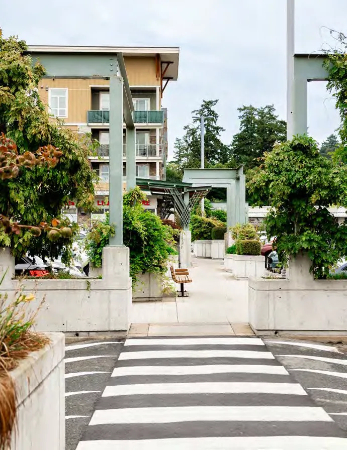
6.3.2 HOUSING SUPPLY
A. Continue to consider opportunities to facilitate an increase in housing supply by expediting development approval and permitting processes through the delegation of authority from Council to Staff, where appropriate, such as the authority to issue development permits and minor development variance permits, as specified in the Local Government Act. B. Research what forms of non-traditional housing ownership and building construction types (e.g. market rental, cooperatives, mixed market and non-market projects, mass timber, prefabrication) are needed, desired, and may be viable in View Royal. C. Review annual housing starts data to identify opportunities for increasing housing supply in View Royal and progress towards meeting housing goals. D. Continue to review, monitor and enforce zoning regulations that regulate Short-Term Rental accommodations to increase the availability of long-term rental housing supply, and prevent the commercialization of residential dwellings. E. Consider identifying sites with a high likelihood of redevelopment for potential pre-zoning for multi-unit residential in the next Zoning Bylaw update to support the Town’s goal of increasing and diversifying the community’s housing supply. F. Promote ground-oriented residential development through expanding zoning permissions and enhancing flexibility within terminology and development regulations (e.g. density, building height, lot coverage, etc.). G. Consider exempting residential developments, where two units or less are proposed, from form and character development permit area requirements, including: duplexes and garden suites.
6.3.3 AFFORDABLE AND RENTAL HOUSING
A. Undertake financial feasibility analyses to identify if density bonusing and inclusionary zoning are viable tools for the Town to utilize in the Zoning Bylaw to increase affordable market and non-market rental housing supply. B. Encourage multi-residential market developments with 6 or more storeys to provide a minimum of 5% below-market ownership and rental units as amenity contributions. Collect of in-kind and cash in-lieu contributions towards affordable housing, where possible through the establishment of relevant tools, including reserve funds and amenity contribution policies. C. Protect affordable rentals where redevelopment of existing ground-oriented rental and cooperative housing units is proposed through consideration of how to: retain rental units of the same quantity, size, and where possible, maintain the same monthly rental rate for tenants. D. Ensure the Town’s Tenant Assistance Policy is designed to mitigate the loss of existing affordable units and protect tenants who are displaced during redevelopment or renovation of older rental buildings through regular reviews. E. Investigate further measures to protect tenants displaced by the redevelopment or renovation of purpose-built rental housing, such as regulations that ensure existing tenants have adequate time to find new housing, are provided compensation where applicable, and receive priority for new housing. F. Advocate and seek support from senior levels of government through legislation, guidelines, and grant programs for affordable housing projects and initiatives, including: i) Encouraging senior governments to continue programs to assist landlords with residential upgrades and rehabilitation to upgrade the existing rental housing stock; and ii) Advocating to senior levels of government to review taxation-related barriers and disincentives and establish programs to promote and facilitate the development of market rental units. G. Explore the provision of incentives for the retention, renewal, and development of non-market housing through municipal tools such as: i) Offering time-limited property tax exemptions; ii) Reducing parking requirements; iii) Establishing criteria to prioritize review of development applications where non-market housing is proposed; and iv) Waiving or reducing application fees, Amenity Cost Charges/Community Amenity Contributions, Development Cost Charges, and other municipal fees and costs if: a. The housing development is led by a non-profit organization; b. There is an agreement with CMHC, BC Housing, or the Province of BC for affordable housing; c. The project qualifies for provincial and/or federal housing subsidies; or d. Affordable housing thresholds, as set by CMHC, are met. H. Explore opportunities to secure affordable housing in new residential developments in a manner that is reflective of market conditions.
6.3.4 FAMILY HOUSING
A. Support family-oriented housing by requiring new multi-unit residential developments of four or greater storeys, with the exception of seniors housing, supportive housing, and affordable rental housing projects, to allocate a proportion of units as follows: i) a minimum of 30% of units with two bedrooms or more; and ii) a minimum of 10% of units with three bedrooms or more B. Investigate how family housing needs can be better addressed in View Royal, including access to supports and amenities such as child care facilities, schools, and parks.
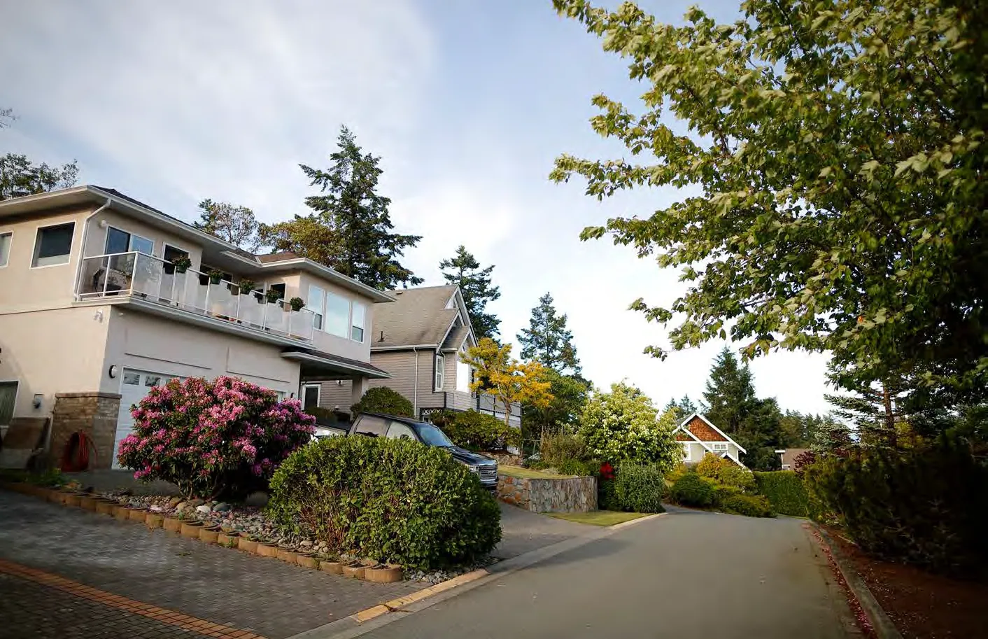
6.3.5 ACCESSIBILITY IN HOUSING
A. Promote the incorporation of Universal Access Design principles in the design of common and amenity spaces, such as entryways, hallways, stairwells, patios, and multi-purpose rooms, amongst others. B. Aim to achieve 10% of units in all new multi-unit housing developments of four or more storeys to be dedicated as accessible or adaptable units, particularly in below-market developments, and at a least be designed and constructed in accordance with the BC Building Code, or an equivalent standard. These units should be provided on the ground floor or first storey wherever possible.
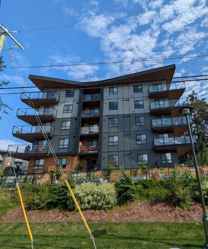
6.3.6 COORDINATION AND PARTNERSHIPS
A. Strengthen partnerships to deliver more affordable housing and supportive housing. B. Build capacity to support the development of affordable housing, including by connecting non-profits with funding streams, land opportunities, and market developers. C. Work in partnership with housing agencies, stakeholders, and senior levels of government to identify sites and collaborate, where possible, on the provision of supportive housing projects. Continue annual financial contributions to the Regional Housing Trust Fund, administered by the Capital Regional District Housing Secretariat, to support the acquisition, development and retention of housing that is affordable to households with low or moderate incomes. D. Continue to collaborate with the Capital Regional District and other regional stakeholders to implement the Regional Housing Affordability Strategy and continue to support and contribute to regional housing initiatives and programs.
7.0 Transportation and Mobility
7.1 CONTEXT
The transportation and mobility choices existing within a community define how community members get around. View Royal’s central location with the Capital Regional District and as the gateway to the West Shore makes it well-connected to the broader region. The Trans-Canada Highway (owned and maintained by the Ministry of Transportation and Transit), Island Highway, the Galloping Goose Regional Trail, E&N Rail Trail, and BC Transit’s 95 Blink Rapid Bus and number 14 (Vic General / UVic) bus routes all traverse View Royal and provide connections to key destinations within adjacent communities and beyond.
Within View Royal, there are four key corridors along which amenities and services are concentrated, as shown in the figure below: Island Highway, Admirals Road, Helmcken Road, and the Western Gateway Employment District Corridor.
These corridors also serve key transportation functions in terms of moving goods and people within the Town and providing connections to neighbouring communities. It is anticipated that higher levels of density will be concentrated along these corridors to enable alternate modes of transport beyond the private car and to ensure that residents can easily access the services and amenities they need daily within close proximity of their home. The foundation for this is embedded within the OCP’s land use policy, included in Part Two.
Each of the corridors noted are also supported by one of View Royal’s two mobility hubs. As shown on Map 3, these are located at the site of the provincially-designated Hospital Transit-Oriented Area, which comprises the existing Hospital Transit Exchange, and the Atkins Park-and-Ride. Both mobility hubs are located within proximity to the Galloping Goose Regional Trail and the Trans-Canada Highway which provide opportunities for travel within the region by cycling, rolling, walking, or car. In addition, they are each serviced by transit routes that provide connections within View Royal and beyond, with future plans for increased levels of service. A bus rapid transit route already serves the Atkins Mobility Hub and increased connections are anticipated for the Hospital Transit-Oriented Area, as shown on Map 3. Increased densities are permitted in and around these mobility hubs in an effort to further promote travel via alternate modes of transport through enhanced public realm design that creates a pedestrian-friendly environment and provides connections to key active transportation infrastructure such as trails.
The objectives and policies included in this section aim to enhance mobility options for getting around View Royal and travel through the community by employing strategies that encourage alternate transportation behaviours and choices. Such strategies will address primary concerns of residents related to traffic congestion along major routes such as the Trans-Canada Highway and Island Highway through creating a smoother travel experience. In addition, reduced reliance on the automobile yields reduced greenhouse gas emissions, cleaner air, and healthier community members.
The following OCP Goals may be achieved through the policy direction provided in this section:
- Mobility & Connectivity
- Community Well-Being
- Climate Action and Resilience
- Regional Partnerships
- Sustainable Service Delivery and Asset Management
Mobility Hub means a strategic location offering access or connections to multiple modes of transport, including transit, cycling, walking, rolling, and private vehicles. These hubs are usually central to concentrations of medium- to high-density development. View Royal has two mobility hubs - the provincially designated Hospital Transit-Oriented Area which comprises the existing transit exchange located at Victoria General Hospital and the Atkins park-and-ride located adjacent to Island Hwy and the Galloping Goose trail.
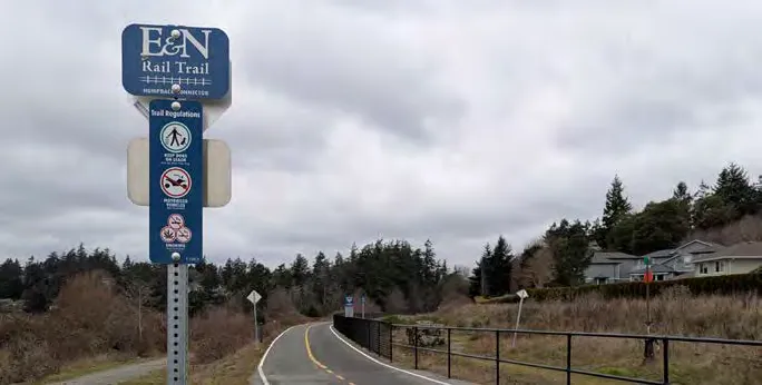
7.2 OBJECTIVES
Transportation in all forms connects our people and places and plays a significant role in residents’ daily lives, getting to work, school, or their place of employment. View Royal’s transportation network also advances climate action, supports affordability, and can encourage equity in View Royal.
7.2.1 BUILDING A CONNECTED MULTIMODAL COMMUNITY
Support and encourage the development of View Royal’s active transportation network, which includes pedestrian, cycling, and public transit networks as part of an interconnected multi-modal transportation system within the community.
7.2.2 STRENGTHEN TRANSPORTATION CONNECTIONS AND REGIONAL DESTINATIONS
Strengthen transit and active transportation connections to key regional destinations to and from View Royal by collaborating with neighbouring municipalities and regional partners to improve multi-modal connections to parks, regional trails, schools, commercial and institutional centres, the Department of National Defence, and Victoria General Hospital.
7.2.3 EQUITABLE, SAFE, AND EFFICIENT MOBILITY
Continue to work towards a future transportation and mobility network that provides equitable opportunities for all, and allows users to travel safely, efficiently, and comfortably throughout the community regardless of their mode of travel.
7.2.4 PRIORITIZE RESIDENT NEEDS
Recognize the unique challenge that View Royal faces as a connection point between Victoria, the Saanich Peninsula communities, and the West Shore, and continue to prioritize the needs of residents to move around the Town and mitigate the traffic congestion impacts of regional commuters.
7.2.5 AFFORDABLE, EQUITABLE TRANSPORTATION OPTIONS
Continue to support and encourage programs and tactics that aid the Town in achieving its mode share targets and mitigate local transportation impacts by supporting safe and comfortable multi-modal transportation choices. Moving forward, a greater emphasis on walking, cycling, and transit, over private vehicles should be prioritized.
7.2.6 CLIMATE ACTION THROUGH TRANSPORTATION CHOICE
Reduce greenhouse gas emissions by supporting efficient and accessible transit service and active transportation options.
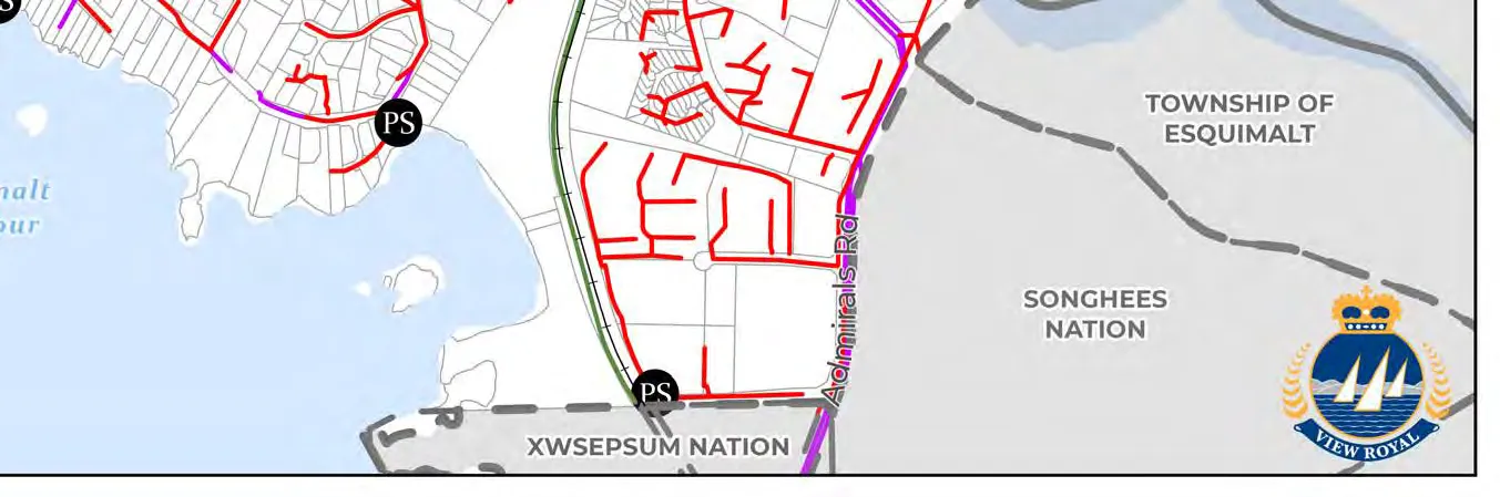
7.3 POLICIES
7.3.1 GENERAL
A. To support safe and efficient multi-modal systems for the movement of people throughout View Royal, in accordance with the priorities and strategies established in the Transportation Master Plan and Active Transportation Network Plan, priority of transportation infrastructure investments should be based on the following modal hierarchy: i) Foundation Access – Pedestrians, people using mobility aids, and emergency personnel and equipment ii) High-Capacity, Low-Impact Mobility - Transit iii) Active and Low-Speed Mobility – Cycling and micro-mobility devices iv) Efficient Shared Use – Shared vehicles v) Economic Backbone – Commercial vehicles vi) Low Priority – Private vehicles
Micro-mobility means transport via a small, typically electric, lightweight device that allows for individual human transport, such as a scooters, hoverboards, bicycles, and skateboards.
Mode share means the proportion of trips using a particular type of transportation to get around, such as walking, cycling, transit, scooting, ride share, or private vehicles.
B. Pursue the following mode share targets by 2050:
| Mode | Mode Share (2022) | Mode Share Target (2050) |
|---|---|---|
| Walking, Cycling and Micro-mobility | 12% | 25% |
| Public Transit | 6% | 15% |
| Private Vehicle | 80% | 60% |
7.3.2 ACCESSIBILITY AND INCLUSIVITY
A. Apply universal access design principles in transportation infrastructure design wherever possible to allow all people, including people with disabilities, to use sidewalks, trails, and transit. B. Prioritize transportation improvements in locations with higher concentrations of equity-deserving people to support safe and comfortable access essential goods and services.
7.3.3 TRANSIT
A. Collaborate with BC Transit and neighbouring local governments to establish safe, accessible, and high-quality transit service with improvements prioritized in: i) High-demand and high-density neighbourhoods; and ii) Areas with higher densities of equity-deserving people, such as seniors, low-income households, and youth, amongst others. B. Advocate to and collaborate with BC Transit to ensure transit service is enhanced and prioritized in areas of View Royal where the highest population densities are anticipated, as discussed in Part Two, and as shown in the mobility hub and future transit route locations identified on Map 3. C. Ensure that bus stops and stations are planned and designed in accordance with BC Transit’s infrastructure design guidelines and include seating, shade and weather protection, lighting, signage, and accessible paths to and from the stop. D. Pursue transit-supportive infrastructure to facilitate reliable transit service in View Royal and collaborate with the Ministry of Transportation and Transit and BC Transit on similar improvements on provincial corridors.
7.3.4 ACTIVE TRANSPORTATION
A. Eliminate barriers to active transportation by creating an extensive active transportation network that supports walking, rolling, cycling, and transit opportunities for all ages and abilities (as shown on Maps 4, 5, and 6), improving key intersections along transportation routes to support safe and efficient travel, and providing end-of-trip facilities. B. Separate active transportation users from vehicular traffic on busy streets, where possible, and seek out low-speed and low-volume streets where people are safe and comfortable as an alternative to travelling on busy streets. C. Develop high-quality active transportation connections to the Mobility Hubs identified on Map 3 to encourage multi-modal trips. D. Ensure transportation infrastructure is designed to reflect community needs and best practices in accessible design, with reference to the British Columbia Active Transportation Design Guide and relevant regional design guidelines. E. Advocate for trail widening and separated facilities for different user groups and lighting along the Galloping Goose Regional Trail within View Royal to improve safety and comfort for all active modes. F. Provide accessible wayfinding within View Royal to connect residents to active transportation networks and encourage the use of View Royal’s active transportation corridors. G. Collaborate with neighbouring municipalities and regional authorities to align active transportation networks and develop safe and comfortable inter-community active transportation connections. H. Develop infrastructure and programs that encourage active travel for students, parents, and staff.
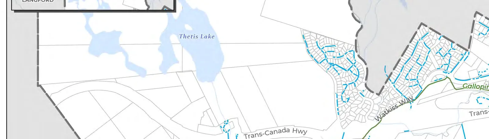
7.3.5 STREET NETWORK
A. Reduce serious injuries and fatalities on View Royal streets through infrastructure improvements, targeted enforcement, and education to reinforce safe behaviours. B. Investigate opportunities to improve road safety where vehicle collisions or collisions involving vulnerable road users are most common. C. Support safe vehicle speeds, reduce cut-through vehicle traffic, and provide safe and efficient movement for people walking, cycling, and driving on View Royal streets. D. Plan, design and maintain streets in View Royal according to the network classifications identified on Map 7 and as described below: i) Highway - Major corridors serving regional and inter-regional trips. Highways are under B.C. Ministry of Transportation & Transit (MOTT) jurisdiction. ii) Arterial – Streets that support View Royal residents making longer-distance trips outside the community. Arterial streets typically support higher traffic volumes and higher travel speeds, separated active transportation facilities, and high-order public transit service, with limited driveway and local street access. iii) Collector – Streets that support both mobility and access, connecting neighbourhoods to the Arterial and Highway street network. Collector streets are intended to support transit service, goods movement and emergency response, and active transportation. iv) Local – Streets that connect neighbourhoods to more major streets (Arterial, Collector), best suited to limited traffic volumes and slow travel speeds to support safe streets and neighbourhoods. E. Transportation investment and planning decisions will consider resident needs over regional traffic and minimize the negative impacts of through traffic on View Royal neighbourhoods. F. Continue to address traffic congestion in View Royal, including collaborating with regional partners, such as the Ministry of Transportation and Transit, Capital Regional District, BC Transit, and neighbouring municipalities. G. Actively collaborate with the Ministry of Transportation and Transit to mitigate the impact of provincial transportation corridors and regional travel on the Town’s transportation network. H. Support designated goods movement and emergency service corridors to ensure safe and efficient movement of these vehicles within the transportation network. I. Enhance and beautify View Royal’s streets through landscaping, street trees, placemaking, and other appropriate measures to improve comfort and safety and support multi-faceted use of public rights-of-way using fiscally sustainable levels of service delivery. J. Collaborate with the City of Colwood to improve multi-modal transportation along the Western Gateway Employment District Corridor designated on Map 1 and to nearby destinations. Future design of the corridor should consider improving the pedestrian and cyclist experience, reducing traffic congestion, enhancing intersection safety, and beautifying the streetscape.
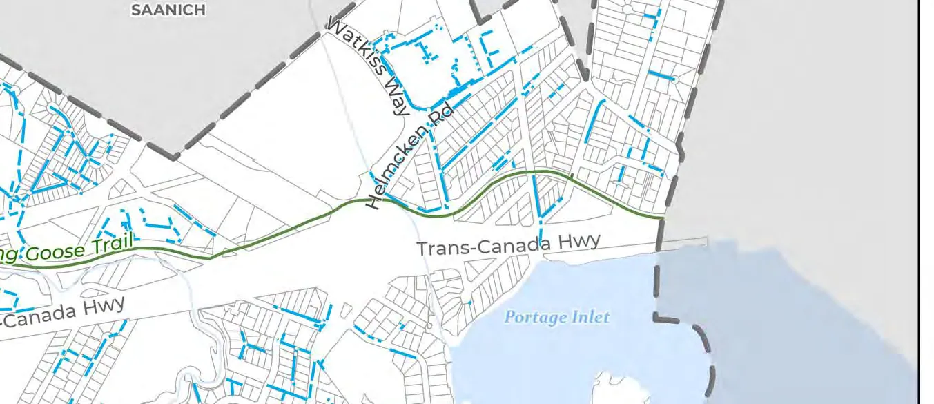
7.3.6 REGIONAL TRANSPORTATION PROJECTS
A. Continue to collaborate with the Island Corridor Foundation, Capital Regional District, Songhees and Xʷsepsəm Nations, municipal partners, and senior levels of government to establish a vision for the future use of the E&N corridor. B. Continue to advocate for and explore opportunities for the potential of regional Light Rail Transit and collaborate with the Island Corridor Foundation, Capital Regional District, Songhees and Xʷsepsəm Nations, the Province, and neighbouring municipalities. C. Support the new Regional Transportation Service and due consideration of key corridors and priorities in View Royal as part of the Regional Multi-modal Network.
7.3.7 PARKING + TRANSPORTATION DEMAND MANAGEMENT
A. Seek to meet site transportation demand through appropriate on-site parking supply and transportation demand management measures that reduce reliance on private vehicles. B. Prioritize accessible parking and loading, and ensure that commercial and light industrial parking supports the functional needs of businesses. C. Support reduced off-street vehicle parking supply where additional sustainable transportation infrastructure and services are provided and accessible parking supply is not impacted.
Transportation Demand Management comprises strategies that seek to improve the movement of people and goods, reduce dependence on the private car, and encourage travel via modes of alternate transport, such as transit, cycling, walking, rolling, and car share. Common desired outcomes of implementing transportation demand management strategies are reduced traffic congestion, lowered demand for parking, and cleaner air. Examples of transportation demand management strategies include shared mobility service programs such as e-scooter and e-bike rentals, transit subsidies, and car share programs, amongst others.
D. Optimize the Town’s public curb space to appropriately value different uses including mobility, parking, commercial uses, public space, and waste collection, among others. E. Manage on-street parking to best serve public needs, considering local parking demand, surrounding land use, and the need to accommodate other curbside functions. F. Collaborate with major employers in View Royal, such as Victoria General Hospital and the Capital Regional District, to support sustainable transportation and mitigate traffic and parking impacts. G. Work with regional partners to implement electric vehicle charging infrastructure, informed by the Capital Region EV Infrastructure Road Map and Capital Region Public Electric Vehicle Charging Guide, to increase the supply of EV charging infrastructure in new development, public parking lots, and on-street, where appropriate.
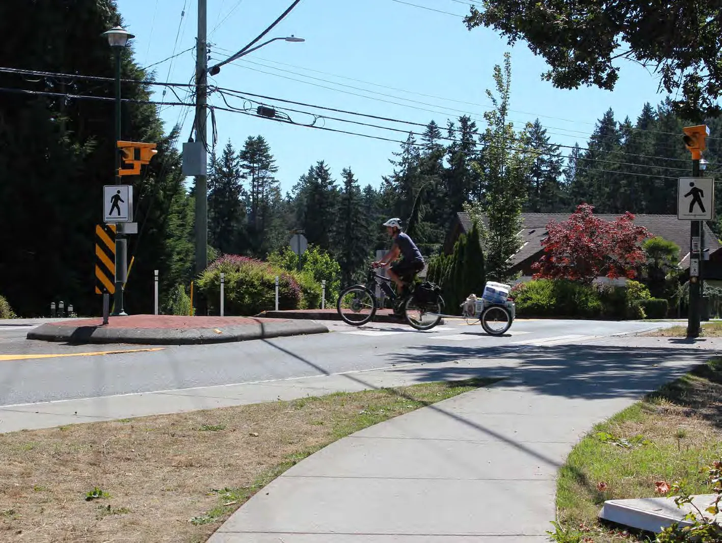
8.0 Community Infrastructure and Services
8.1 CONTEXT
Community infrastructure such as water, sewer, and drainage systems, roads, and parks are all significant investments for local governments to provide and maintain. Infrastructure services in View Royal are provided by both the Town and the Capital Regional District. The Town provides and manages sewer and drainage services, manages natural assets, and is responsible for collection of curbside waste and organics, including lawn and garden waste. Drinking water for the community is the responsibility of the Capital Regional District. Roads and parks, while the responsibility of the Town, are discussed in their own unique sections (sections 7.0 and 12.0, respectively). The Town seeks to provide infrastructure and services to meet the needs of the population and plan for impacts of both climate change and development on these systems as the community grows.
SEWER SYSTEM
The Town’s sewer system, as shown on Map 8, comprises a number of pump stations that are electronically monitored. Some lands are located lower than the gravity sewer system, and so grinder pumps are located on these properties. The pump stations all work together to pump sewage waste from the Craigflower Pump Station to McCauley Point in Esquimalt, both of which are operated and maintained by the Capital Regional District. The system provides services to lands located within the Town’s Urban Containment Boundary shown on Map 1, leaving those located north of Thetis Lake to be serviced by on-site private septic systems.
STORMWATER SYSTEM
The Town’s stormwater system, commonly referred to as ‘drainage’, as shown on Map 9, largely comprises of open ditches and culverts that drain into Craigflower and Millstream Creeks or directly into Portage Inlet and Esquimalt Harbour.
WATER SYSTEM
View Royal is connected to the regional water distribution system that is owned, operated, and maintained by the Capital Regional District. Buildings within the Town are connected to a water metering system that measures water consumption. Areas located within the Town’s Urban Containment Boundary have sufficient water supply for both potable water and fire protection purposes, while those located north of Thetis Lake have more limited capacity. Many properties in this area of View Royal rely on alternative water supply sources for this reason. Four water supply mains exist within the Town’s boundary, as shown on Map 10. These mains carry water from the Sooke Reservoir to the Town and the jurisdictions located beyond.
SOLID WASTE
Household waste is collected on a weekly basis by a company contracted by the Town to provide this service. Waste classified as garbage is disposed of at the regional Hartland Rd Landfill, operated and owned by the Capital Regional District. Organic waste is taken to a composting facility. Recycling is a regional service provided through the Capital Regional District’s Blue Box Recycling Program.
Community members desire to see infrastructure and assets provided and maintained in a manner that is both environmentally and fiscally responsible. The objectives and policies of this section aim to ensure that this vision is achieved in the provision of community infrastructure and services.
The following OCP Goals may be achieved through the policy direction provided in this section:
- Growth Management & Community Character Preservation
- Regional Partnerships
- Sustainable Service Delivery and Asset Management
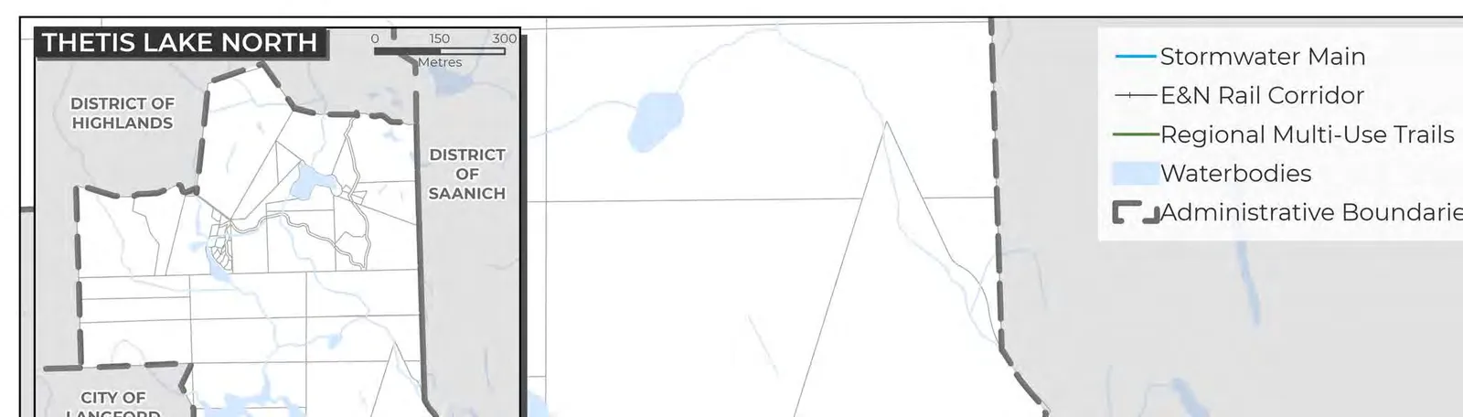
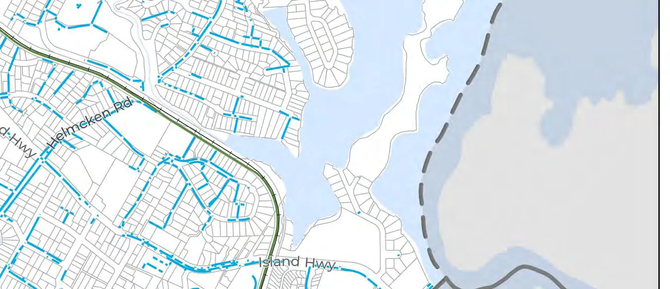
8.2 OBJECTIVES
8.2.1 SUSTAINABLE INFRASTRUCTURE
Ensure that infrastructure investments and renewal decisions are guided by achievable asset management programs, policies and plans. Asset management programs will consider organizational-wide approaches that maximize the value and services from infrastructure assets.
8.2.2 FISCAL RESPONSIBILITY AND DECISION MAKING
Ensure that infrastructure and service delivery are planned and implemented in a fiscally responsible manner, and that reserves are funded so that investments are equitably funded by current and future generations.
8.2.3 SERVICE DELIVERY
Continue to provide a high level of service for critical infrastructure systems to align with community expectations.
8.2.4 INFRASTRUCTURE INVESTMENT, GROWTH, AND COORDINATION
Continue to coordinate infrastructure investments, including renewals, upgrades, maintenance, and improvements to maintain sustainable service delivery, and consider alignment with existing and future land use and growth considerations.
8.2.5 NATURAL ENVIRONMENT
Consider the preservation of the natural environment’s integrity and protection of human health in infrastructure and service delivery when making decisions. Growth should be balanced with the capacity of natural systems.
8.2.6 CLIMATE CHANGE IMPACTS
Consider ongoing studies and review of climate projections in the design, upgrade, operations, and maintenance of new and existing infrastructure to make informed decisions on the optimal method of service delivery.
8.3 POLICIES
8.3.1 GROWTH MANAGEMENT AND DEVELOPMENT
A. Plan new infrastructure and services to support compact and sustainable development, and prioritize investments that support new housing, employment, and civic uses. B. Ensure that development will only occur if appropriate infrastructure systems (water, wastewater, and sewer) with sufficient capacity are in place or provided as part of a development. Infrastructure upgrades should be planned for and installed through municipal finance initiatives. C. Extend infrastructure services into un-serviced areas only when such services will be built in tandem with new development and such development will finance the service extension. Extension of infrastructure services in areas outside the Urban Containment Boundary or for developments that are not in conformance with the policies of this plan will not be supported. D. Plan new infrastructure in conjunction with roads, community facilities, parks, and other public spaces. Planning considerations should include: • Stormwater management • Watershed systems and functions • Opportunities to integrate parks, greenways, natural systems, and tree canopy improvements • Pedestrian, cyclist, and transit connections.
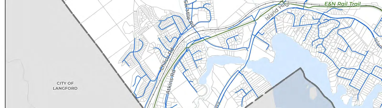
8.3.2 INFRASTRUCTURE INVESTMENT
A. Use the Town’s Asset Management Program as a guide to identifying future infrastructure priorities and understand required reserve contributions for on-going service demand and delivery. B. Prioritize infrastructure and services investments that best address local needs and maximize community benefits. C. Guide infrastructure upgrades through master plans that identify investment priorities. D. Ensure that the cost of infrastructure investments is borne by those that benefit the most from the provision of the service; with the cost of new or upgraded systems being funded by the developments that trigger them or affected property owners.
8.3.3 INFRASTRUCTURE STANDARDS
A. Ensure infrastructure is designed in a manner that aligns with the community’s goals and desired levels of service, as well as adheres to the latest Master Municipal Construction Documents where appropriate to ensure that all infrastructure in View Royal is being constructed to a standard that aligns with best engineering practice. B. Aim to advance green infrastructure (e.g., natural assets, enhanced assets, and engineered assets) practices. C. Consider the full life cycle of infrastructure services, including operations, maintenance and service levels, when designing new systems and upgrades. D. Facilitate adequate operation and maintenance programs to maximize the life of infrastructure systems, reduce the frequency of replacement, and ensure proper functionality. Continue to explore strategies and solutions to understand and reduce the inflow and infiltration of stormwater into the sanitary sewer system. E. Continue to explore strategies and solutions to understand and reduce the inflow and infiltration of stormwater into the sanitary sewer system.
8.3.4 INFRASTRUCTURE FOR A HEALTHY ENVIRONMENT
A. When considering infrastructure renewal priorities, considerations will be given to upgrades to infrastructure and services that will enhance the resiliency to the risks and impacts of climate change and disasters. B. Continue to explore opportunities to establish a natural asset inventory while supporting the protection, maintenance, and enhancement of existing natural assets and amenities. C. Work with adjacent jurisdictions in the Capital Regional District and other organizations to advance efforts in watershed management and drinking water protection that align with the Drinking Water Protection Act and Regulation. D. Support stormwater management practices that emphasize infiltration and detention, where possible, to minimize the negative effects (erosion, sediments and contaminants) of stormwater discharge into Portage Inlet, the Gorge Waters, Esquimalt Harbour, Craigflower Creek, Hospital Creek, Millstream Creek and other natural watercourses and water bodies.
Green infrastructure refers to natural and semi-natural engineered systems that support with managing drainage. Examples include green roofs, permeable pavements, and rain gardens, amongst others.
E. Consider implementation of stricter source control measures to reduce runoff from private property mitigating downstream drainage impacts and potential upgrades. F. Continue to prioritize sewer infrastructure upgrades and inflow and infiltration reduction to reduce overall sewer flows in the system mitigating the risk of liquid waste overflowing into the natural environment. G. Investigate opportunities to mitigate downstream drainage impacts, in alignment with regional and provincial standards, and the level of service expected of the public. Opportunities could include rainwater collection, greywater reuse (including treated water for irrigation purposes), and dual piping systems.
8.3.5 SOLID WASTE MANAGEMENT
A. Continue to work with the Capital Regional District and the private sector to maintain three-stream waste separation systems (garbage, recycling, composting) as a means of reducing the amount of solid waste reaching the landfill. Ensure that all collection programs are convenient and well promoted to increase participation at the unit level, building level, in businesses and public institutions. B. Support small-scale composting on appropriate residential properties and community gardens. C. Support regional initiatives to reduce construction waste and encourage sustainable waste reduction. D. Investigate opportunities to address waste collection for multi-unit residential developments comprising greater than four units.
9.0 Economic Development
9.1 CONTEXT
A strong and diverse local economy is essential to View Royal’s long-term resilience. New and existing businesses provide employment opportunities to residents of both the Town and broader region. These businesses also provide the community with key services that are necessary for everyday life. Historically, economic development has not been a priority for the Town; however, the Town is aiming to collaborate with the community and Songhees and Xʷsepsəm Nations to understand what is possible for the local economy and to leverage View Royal’s full economic potential.
View Royal has significant potential to become a regional economic hub—it has many existing conditions that contribute to a strong local economy. This includes its central location within the Capital Regional District and prime access to major transportation routes such as the Trans-Canada Highway (Hwy 1), regional Island Highway, the Galloping Goose regional trail, and the E & N Rail Trail. In addition, View Royal is home to the Victoria General Hospital which has plans for future growth and expansion, as expressed by Island Health. Further, the lands surrounding the hospital have been designated by the Province as a transit-oriented area that will support the highest levels of density in the community and increased levels of transit service. Such conditions may support growth in both the tourism and health services sectors, amongst others, resulting in strong demand for commercial tourist accommodations.
Part 2 aims to establish further conditions that will support new and existing businesses in View Royal, through supporting higher density forms of development in areas that are close to existing or planned transit services and active transportation infrastructure. Concentrating populations will allow for a stronger client base for new and existing businesses, leading to greater economic vitality, and in turn, providing residents with access to the services they need within close proximity of their home.
The objectives and policies in this section aim to support the future creation of an economic development vision for View Royal, in addition to supporting new and existing businesses.
The following OCP Goals may be achieved through the policy direction provided in this section:
- Economic Development
- Regional Partnerships
9.2 OBJECTIVES
9.2.1 LOCAL INVESTMENT AND ECONOMIC GROWTH
Continue to create conditions that attract local investment and economic growth in the Town, particularly within the Town’s high-density land use designations, as discussed in section 5.0 and shown on Map 1, including the Hospital Transit-Oriented Area, Neighbourhood Village, and Western Gateway Employment District Corridor.
9.2.2 CREATING A DESTINATION COMMUNITY
Support development and local investments that make View Royal more than a drive-through community, but a destination that provides unique and interesting local and regional tourist destinations for visitors.
9.2.3 CAPITALIZE ON REGIONAL CONNECTIONS
Explore, identify, and capitalize on opportunities that strengthen the community’s central location as a gateway to the West Shore and the Greater Victoria area, to attract and support entrepreneurs and new businesses.
9.2.4 SUPPORT FOR LOCAL BUSINESS
Understand and support the changing needs of local businesses to create a supportive and economically viable market to thrive in the long-term. Consider the needs of traditional fixed businesses and flexible business models, such as farmers, artisans, and mobile vendors.
9.2.5 INVEST IN COMMUNITY HEALTH AND WELL-BEING
Recognize and explore the complex relationship between community health and well-being, and the local economy. Consider opportunities to expand the health industry and increase access to local health services and locally-grown food sources.
9.2.6 RECREATIONAL TOURISM
Consider opportunities to support recreational tourism and economic development that capitalizes on the Town’s parks and trails and proximity to regional recreational amenities. Focus on attracting hotel development in the Town to support leisure and business travel.
9.2.7 PARTNERSHIPS
Create strong, dynamic partnerships with the business community and related organizations, educational institutions, and regional and provincial governments to drive economic development, foster innovation, and attract transformative investment opportunities that establish View Royal as a thriving economic hub.
9.3 POLICIES
9.3.1 STRENGTHENING THE LOCAL ECONOMY
A. Engage the local business community, Songhees and Xʷsepsəm Nations, and related stakeholders to identify the economic vision for View Royal and the broader community. B. Identify opportunities for economic innovation, attracting and retaining new business, and stimulating new investment to advance the Town’s commitment to creating a more diverse, equitable, and inclusive community. C. Leverage existing community assets and destinations such as Portage Park, Thetis Lake Regional Park, the Galloping Goose and E&N trails, as well as Victoria General Hospital to generate new economic and tourism opportunities for View Royal and the broader region. D. Explore opportunities for expanding the health services industry throughout View Royal, but particularly in the area surrounding Victoria General Hospital, to create a medical services hub through provision of medical offices, pharmacies, research labs, and related services. E. Collaborate with the Songhees and Xʷsepsəm Nations, and tourism organizations such as Destination Greater Victoria, to understand how View Royal can become a leading destination for visitors in the region. F. Collaborate with the West Shore Chamber of Commerce to identify opportunities to better support new and existing businesses. G. Consider how best to respond to emerging business sectors in the community. H. Identify opportunities to streamline processing times for business licenses, particularly for small or locally-owned businesses. I. Concentrate growth and economic investment along the Town’s corridors as shown in Figure 11. J. Understand the economic and land use conditions necessary to support the viability of light industry and similar employment uses on lands designated as Western Gateway Employment District Corridor on Map 1 to identify what action the Town can take to facilitate these conditions, given the benefits that light industry will generate for the local economy, such as a diversified tax base and living wages for residents. K. Continue to liaise with the local business community to understand how the Town can better support local business. L. Leverage the Town’s existing assets to support the region’s tourism sector. M. Explore opportunities and partnerships to attract hotel development and other accommodation uses to View Royal. N. Explore incentives to attract hotel development, including but not limited to, density bonusing, parking reductions, streamlined application processes, and flexible zoning to allow for a variety of uses to support hotel development. O. Encourage hotel development near Victoria General Hospital and along the Western Gateway Corridor where there is a high demand for hotel accommodation to service both the healthcare sector and broader visitor market. P. Support compatible home-based businesses in areas where residential use is permitted to promote the continued provision of alternative employment options, reduced commutes, and more local services. Q. Continue to collaborate with the South Island Prosperity Partnership, Capital Regional District, neighbouring municipalities, Songhees and Xʷsepsəm Nations, local businesses, and other relevant interest holders on matters related to regional economic cooperation. R. Understand how to better support high-tech uses in View Royal.
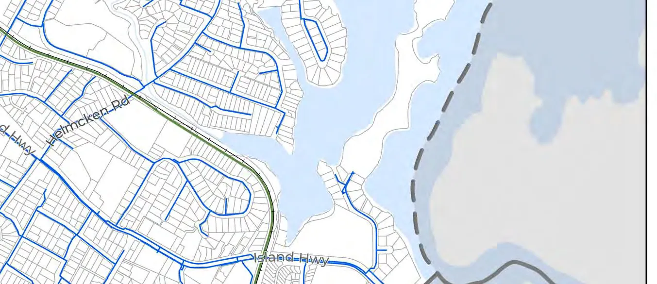
10.0 Natural Environment
10.1 CONTEXT
View Royal comprises a diverse array of marine, freshwater, and terrestrial ecosystems and habitats, as shown on Map 11. Marine ecosystems comprise of Esquimalt Harbour and Portage Inlet, including their coastal shorelines. Freshwater ecosystems merge with the salt waters of these two water bodies in the estuaries of Craigflower, Hospital, and Millstream Creeks. Thetis, Prior, Pike, and McKenzie Lakes all comprise freshwater ecosystems that include foreshore and riparian areas. Terrestrial ecosystems exist throughout the Town, though are particularly prevalent in Thetis Lake and Mill Hill Regional Parks, in the form mature Coastal Douglas Fir forests along with rocky outcrops and Garry Oak meadows. These natural spaces provide important habitat for wildlife and species at risk (see Map 12).
In addition to providing habitat for many species, the natural environment also poses some natural hazards such as flooding, tsunamis, steep slopes exceeding 30%, and wildfires. These hazards all pose risks to public safety and potential impacts to the built environment. Construction activities occurring within any zones where the risk to public safety is deemed high as a result of a natural hazard is subject to Development Permit Area Guidelines included in Part 5 of this OCP. This includes restrictions on development in areas where slopes are equal to or greater than 30% and flooding or instability due to a tsunami. Steep slopes and the tsunami inundation zone areas are shown on Maps 13 and 14, respectively. This section discusses considerations and strategies for emergency response to events occurring as a result of such natural hazards, plus wildfires and earthquakes.
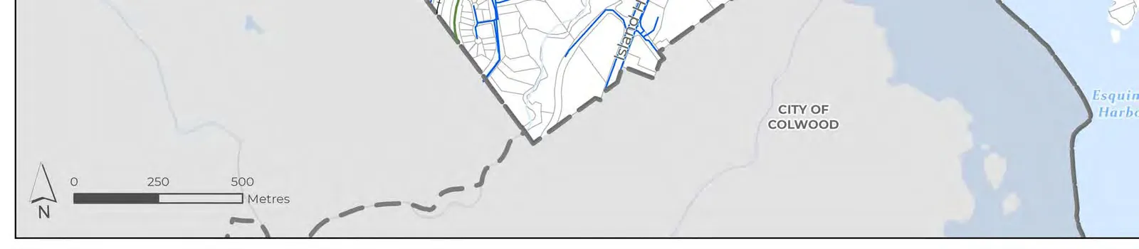
Access to the natural environment is a key priority for the View Royal community. Overall health and well-being may be correlated with the level of access that community members have to the natural environment, whether that be through public green space or on privately-owned lands. This section aims to work in tandem with sections 12 and 13 of the OCP to recognize that protection of the natural environment as places for people to recreate, both passively and actively, will positively impact the physical and mental health of residents. Many natural features and habitats shown on Maps 11 and 12 are designated as parkland on Map 15.
It is also important to note the key role that trees play in protecting the natural environment, mitigating the impacts of climate change, and improving overall community health and well-being. Many studies discuss the benefits that trees can provide for both physical and mental health, in terms of their ability to provide shade, clean air, and connection to the natural environment. Areas of high tree canopy coverage may also act as corridors connecting wildlife habitat areas. The Town’s Urban Forest Strategy endorsed by Council in 2026 aims to recognize the important of trees in View Royal through establishing a tree canopy coverage goal of 30%. This section aims to further support the vision of the strategy and recognize the role of the urban forest in protecting the natural environment.
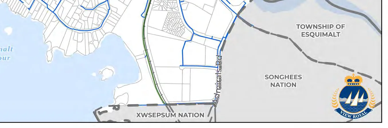
The following objectives and policies outline how View Royal can strengthen the long-term resilience of the Town’s natural environment and reduce community risk from natural hazards. Together, they support protection from flooding, tsunamis, landslides, wildfires, and earthquakes, while safeguarding environmentally sensitive areas, urban forests, and aquatic environments from potential impacts of development.
The following OCP Goals may be achieved through the policy direction provided in this section:
- Natural Amenities
- Community Well-Being
- Community Safety & Security
- Climate Action and Resilience
- Reconciliation
- Regional Partnerships
- Sustainable Service Delivery and Asset Management
Environmentally sensitive areas are ecosystems and/or habitats that provide high value to the natural environment through their ability to support biodiversity, animal and plant species, and natural systems such as purifying the air and water. View Royal has a number of sensitive and significant terrestrial, aquatic, and riparian ecosystems that provide habitat for many species. Examples include:
- Terrestrial ecosystems: old growth and mature forests such as those found in Thetis Lake and Mill Hill Regional Parks
- Aquatic ecosystems: saltwater habitats provided in large waterbodies and their shorelines such as the Portage Inlet
- Riparian ecosystems: freshwater streams and lakes that have the potential to support fish habitat, such as Craigflower Creek and Thetis Lake
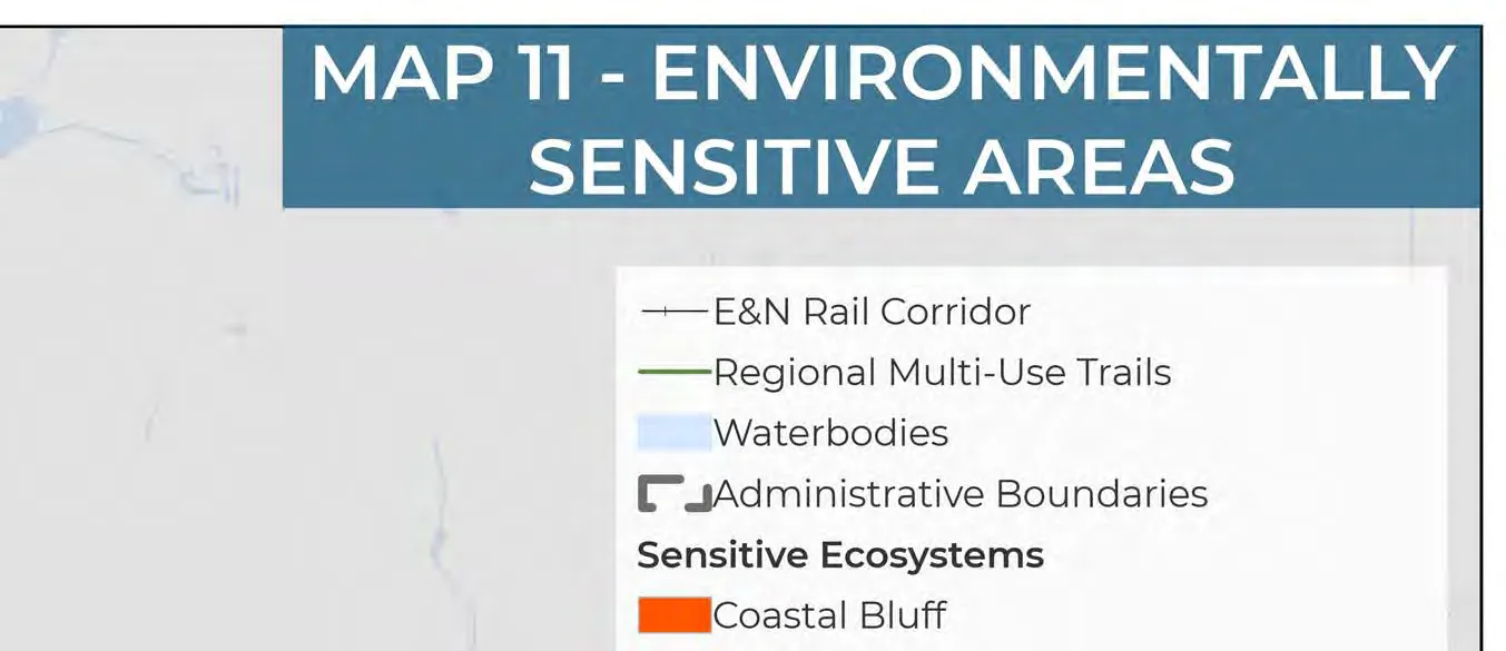
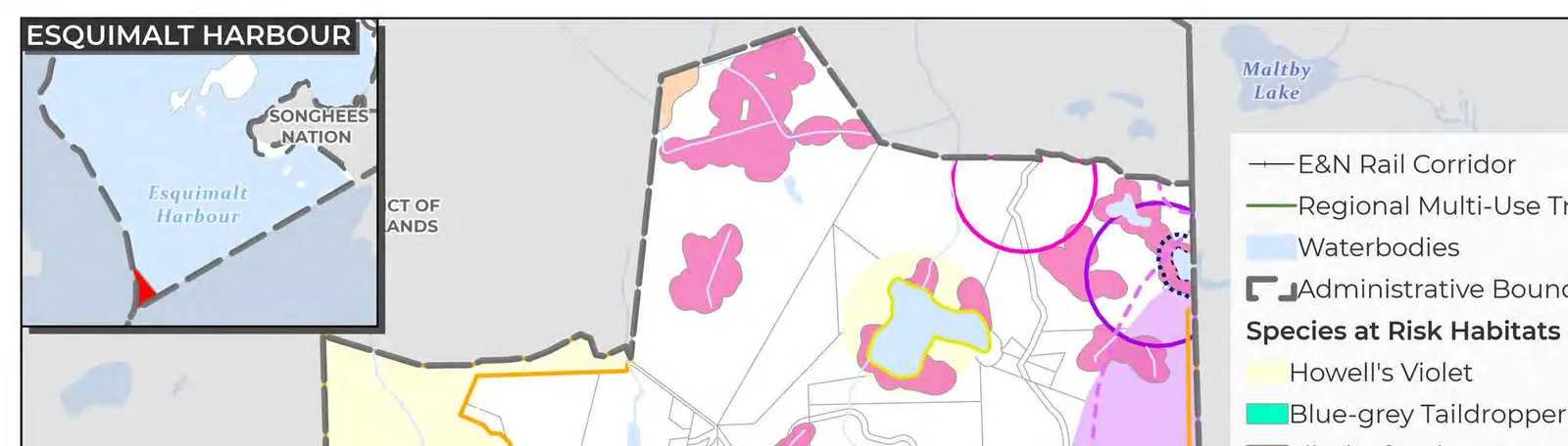
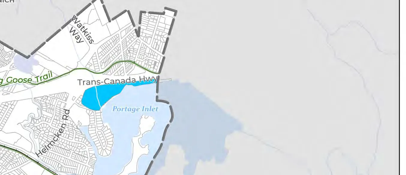
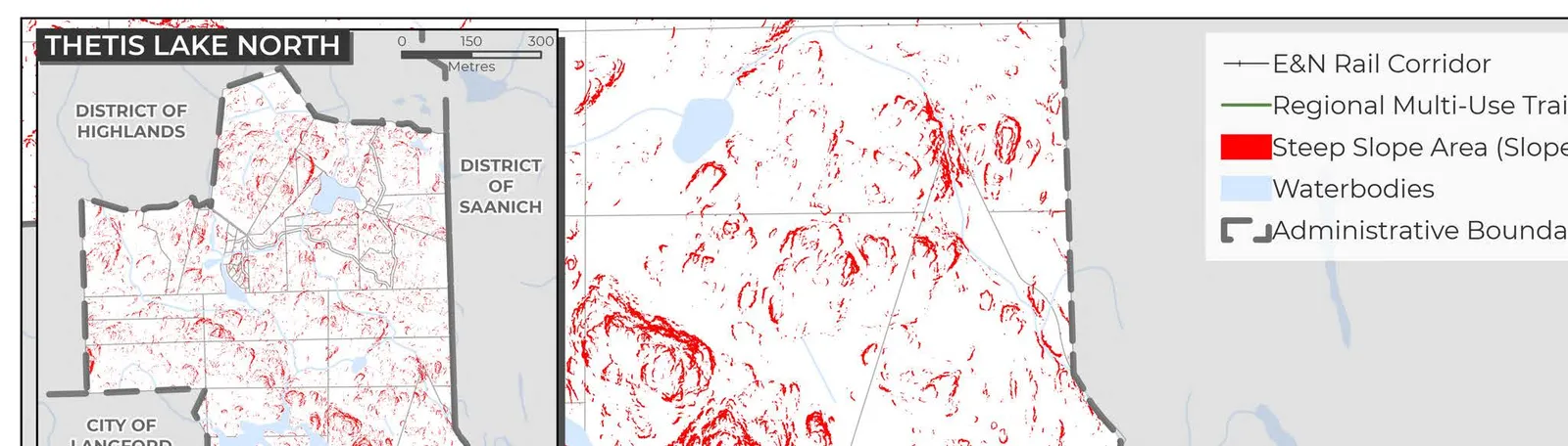
10.2 OBJECTIVES
10.2.1 BALANCED GROWTH AND NATURAL ENVIRONMENT PROTECTION
Continue to find balance between development opportunities and protecting the Town’s distinct natural beauty to ensure these valued natural assets are thoughtfully maintained.
10.2.2 PUBLIC SAFETY AND HAZARDS
Mitigate public safety risks associated with natural hazards, including flooding, tsunamis, landslides, wildfires, and earthquakes.
10.2.3 TERRESTRIAL AREAS, NATURAL SHORELINES AND WATERCOURSES
Protect sensitive terrestrial areas, watercourses, and shorelines to preserve their long-term ecological and hydrological functions and continue to recognize their contributions toward overall community health, recreation, and climate resilience.
10.2.4 URBAN FORESTS
Identify, protect, and enhance the Town’s urban forest and tree canopy to support ecological functions, biodiversity, climate resilience, community health, and economic growth.
10.2.5 FIRST NATIONS KNOWLEDGE AND HISTORY
Integrate First Nations knowledge and perspectives into environmental planning by working in partnership with the Songhees and Xʷsepsəm Nations.
10.3 POLICIES
10.3.1 GENERAL
A. Encourage residents, businesses, schools, and community groups to get involved in conserving the health of the natural environment. Community-based initiatives such as the following are encouraged: i) Habitat restoration and monitoring ii) Construction of community gardens iii) Habitat clean-up days iv) Tree planting programs B. Continue to collaborate with the federal and provincial governments, the Capital Regional District, other municipalities, Songhees and Xʷsepsəm Nations, schools, and local organizations to strengthen local and regional resilience against natural hazards, conduct community engagement and public education related to emergency management, and develop and distribute environmental conservation and community stewardship information to the public.
10.3.2 ENVIRONMENTAL PROTECTION AND RESTORATION
A. Protect and conserve the long-term health and sustainability of important terrestrial, aquatic, and riparian ecosystems, species of concern, and environmentally sensitive areas (see Maps 11 and 12). Protection and conservation strategies may include: i) Development Permit Area designations. ii) Park land acquisition at the time of subdivision or rezoning. iii) Application of Section 219 covenants to prohibit development. B. Prioritize land acquisitions and/or dedications over section 219 covenants to conserve, protect, and restore natural areas for the future. C. Consider the management of natural assets that provide municipal services through the Town’s Asset Management Program. D. Advocate for the management of natural assets, such as natural green space and watercourses, within the Town’s boundaries that provide non-municipal services. E. Continue to identify, review, and designate environmentally sensitive areas as Development Permit Areas in Part 5 to ensure that these lands are adequately protected from new development. F. Support adaptive ecosystem management, evidence-based decision making, and the procurement of current information and datasets to inform ecosystem and urban forest management in View Royal. G. Ensure the protection of aquatic habitat, riparian ecosystems and shorelines. Protection and conservation strategies should be in accordance with the current Riparian Area Protection Regulation. H. Limit resource extraction, agriculture, and related uses north of Thetis Lake Regional Park and ensure that any resource extraction activity does not threaten the long-term integrity of the natural environment. I. Pursue a collaborative approach to environmental conservation and management by partnering with the federal and provincial governments, the Capital Regional District, Songhees and Xʷsepsəm Nations, and local organizations to protect and enhance the natural environment in View Royal. J. Explore opportunities to limit pet access and activities that have detrimental impacts on environmentally sensitive areas. K. Consider opportunities to manage resident access to Environmentally Sensitive Areas and natural areas by providing defined access opportunities that protect native vegetation and do not harm the health of ecosystems. L. Consider opportunities to reduce or ban the use of pesticides, herbicides, and other toxins like microplastics. M. Explore opportunities to undertake further studies and research to identify initiatives that can contribute to enhancing air quality in the community (i.e., prohibiting woodburning stoves), while also supporting the Town’s goal of net zero greenhouse gas emissions.

10.3.3 HABITAT PROTECTION AND ENHANCEMENT
A. Identify opportunities to establish new, and protect existing, wildlife corridors that facilitate the movement of wildlife and greater biodiversity across View Royal through the pursuit of a wildlife corridor study. B. Acknowledge the role of trees within the road right of way in providing habitat for species and acting as wildlife corridors. C. Continue to protect, restore and enhance habitats and ecosystems that support migratory, rare and endangered species, and species at risk as shown on Map 12, and address threats to biodiversity, such as invasive species, disease, and climate change. D. Strive to enhance wildlife habitat areas (e.g. in-stream works, new habitat creation) by considering proposals from applicants for new development on a lot where a habitat exists and a net benefit to the habitat can be demonstrated through completion of a Qualified Environmental Professional. E. Protect the integrity of watersheds and riparian areas to preserve biodiversity, support healthy habitats, and mitigate flood risk.
10.3.4 WATERSHEDS
A. Work collaboratively with the Capital Regional District, neighbouring municipalities, Songhees and Xʷsepsəm Nations, and other organizations to protect and enhance local and regional watersheds and the Capital Regional District Gorge Waterway Initiative. B. Support the implementation of the Capital Regional District’s watershed plans for Millstream Creek, Hospital Creek, and Craigflower Creek. C. Identify opportunities to daylight channeled watercourses and culverts, where possible.
10.3.5 URBAN FOREST
A. Pursue the protection and enhancement of View Royal’s urban forest in alignment with the Urban Forest Strategy. B. Continue to identify, explore, and understand the role of the Town’s urban forest, and its relationship with the Town’s parks, urban spaces, active transportation network, and open spaces. C. Continue to identify and explore the complex role that the Town’s urban forest has in ecology, the natural environment and its many systems, climate change mitigation, the economy, and the community’s well-being and health. D. Continue to build, enhance, and increase the Town’s urban forest, to achieve a 30% canopy coverage target for the Town by 2045, in alignment with the Town’s Urban Forest Strategy. E. Consider opportunities to protect and retain trees that are affected by development, where possible, and explore the possibility of relocating affected trees, or undertake alternative methods of development and construction. F. Support and encourage the protection of trees that contribute to the Town’s natural and cultural heritage through implementation of the Urban Forest Strategy and the Tree Protection Bylaw. G. Enhance the pedestrian transit service experience by prioritizing the installation of new boulevard trees and identify opportunities to protect existing trees within 400 m of a prescribed frequent transit stop, along highways, and arterial and collector roads in the Town.
10.3.6 VEGETATION AND LANDSCAPING
A. Protect existing and plant new climate adaptive native plants and trees in alignment with the Tree Protection Bylaw, the Urban Forest Strategy, and Development Permit Area Guidelines through the pursuit of educational programs, incentives, and regulations. B. Actively promote the removal of invasive vegetation and species to restore natural habitats. C. Consider opportunities to plant climate adaptive native plants and trees on municipal lands. Exceptions may be allowed for seasonal projects, such as hanging baskets and targeted annual gardens. D. Consider establishing landscaping standards for public and private lands that considers current and anticipated climate stresses that may impact the viability of certain vegetation and tree species.

10.3.7 NATURAL HAZARDS RISK MITIGATION AND EMERGENCY RESPONSE PRACTICES
A. Continue to designate lands susceptible to natural hazards (wildfire, tsunamis, floods, steep slopes greater than 30%), such as those shown on Maps 13 and 14, as Development Permit Areas to protect the public and development from potential threats to safety. B. Integrate FireSmart principles into Town policies, regulations, and practices wherever possible and applicable. C. Review and consider opportunities to implement recommendations from the Community Wildfire Resiliency Plan. D. Continue to assess, monitor and educate on vegetation structure ignition, and where possible, continue to reduce risk to homes within the community. E. Consider opportunities to improve urban resilience to wildfire threats through programming, educational opportunities, and adaptive design. F. Prioritize emergency access and egress routes to areas within the community and ensure they are properly maintained in the event of a natural hazard such as flooding, tsunami, landslide, wildfire, or earthquake. G. Consider the provincial Flood Hazard Area Land Use Management Guidelines in the preparation of land use planning policies, regulations, and bylaws and for subdivision and development in flood-prone areas. H. When considering land use and planning decisions where a concentration of high-value or high population density uses are proposed or exist, consider a 2.0 m global sea level rise (approximately 200 years) relative to the year 2000 sea level. I. Protect public safety from risks posed by development on steep slopes and in or near flood hazard areas identified on Maps 13 and 14. J. Explore opportunities to identify flood-prone areas as special planning areas with tailored flood plain construction levels, policies for risk mitigation, infrastructure adaptation and emergency preparedness. K. Promote climate-resilient development by encouraging elevation of structures, use of flood-resistant materials, and incorporation of green infrastructure. L. Support managed retreat or land use transition in areas where long-term flood risk is incompatible with continued development. M. Support the identification and mapping of community assets and infrastructure that are susceptible to natural hazards, including municipally-owned buildings, roads, and bridges. Explore options to enhance the resilience of these assets and infrastructure to mitigate possible negative effects. N. Collaborate with the Capital Regional District, Province, Crown Corporations (i.e., BC Hydro), and private service providers (Fortis BC, Telus, Shaw, etc.) that provide or operate key infrastructure in the Town, such as roads, communications, gas, electricity, to identify and map the location of these assets, to be able to identify and understand the risks from natural hazards. Key stakeholders include the Capital Regional District, Ministry of Transportation and Transit, BC Hydro, and Fortis BC, Telus, and Shaw. O. Continue to promote and educate residents on the use of West Shore Alert to notify residents of natural hazards such as flooding, tsunamis, landslides, wildfires, earthquakes, and major storm events.
11.0 Climate Action and Sustainability
11.1 CONTEXT
The impacts of climate change are evident in View Royal through previously unprecedented events that are occurring more frequently, such as poor air quality due to wildfire smoke, extreme heat, and rising sea levels. These impacts underscore the need for proactive adaptation and mitigation. As a signatory to the BC Climate Action Charter, the Town is committed to becoming a carbon-neutral and climate-resilient community.
View Royal can contribute significantly to adapting and mitigating the effects of climate change. Municipal decisions regarding land use, development, transportation, infrastructure, and waste management significantly impact greenhouse gas emissions and working to reduce emissions. Additional key actions include supporting the construction of green buildings, supporting the shift to low-carbon heating systems (e.g. heat pumps), and encouraging building retrofits that support lower energy consumption.
Climate change is intertwined with all aspects of a community, making it a prominent theme throughout this OCP. This section outlines the objectives and policies that guide View Royal’s efforts in climate change adaptation, mitigation, awareness, and sustainability.
The following OCP Goals may be achieved through the policy direction provided in this section:
- Community Safety & Security
- Climate Action and Resilience
- Regional Partnerships
11.2 OBJECTIVES
11.2.1 NET-ZERO EMISSIONS
Advocate to senior levels of government and collaborate with neighbouring municipalities and community members to achieve a net-zero emissions level by 2050.
11.2.2 CLIMATE CONSCIOUS DECISION MAKING
Acknowledge the role that municipal decisions have in impacting and shaping local and regional climates and consider decision-making through a climate conscious approach. Allocate resources accordingly to undertake initiatives to adapt to the changing climate and mitigate risks.
11.2.3 COASTAL CLIMATE ADAPTATION AND RESILIENCE
Continue to develop an understanding and approach to respond to the unique challenges that View Royal faces as a coastal community and the impacts of coastal flooding and sea-level rise due to climate change and global warming.
11.2.4 CLIMATE CONSCIOUS DEVELOPMENT
Approach development through a low-carbon climate lens that prioritizes sustainable development and reduces greenhouse gas emissions related to transportation and the built-form.
11.2.1 COMMUNITY HEALTH AND WELL-BEING
Acknowledge the strong link between community health, well-being, and climate change and ensure that View Royal is prepared to mitigate any potential negative impacts on public health resulting from this linkage.
11.2.6 PARTNERSHIPS
Pursue constructive, impactful, and collaborative partnerships with the Capital Regional District, other local governments and First Nations in the region, senior levels of government, community groups, and other agencies to pursue comprehensively action related to all facets of climate change mitigation, adaptation, and resilience.
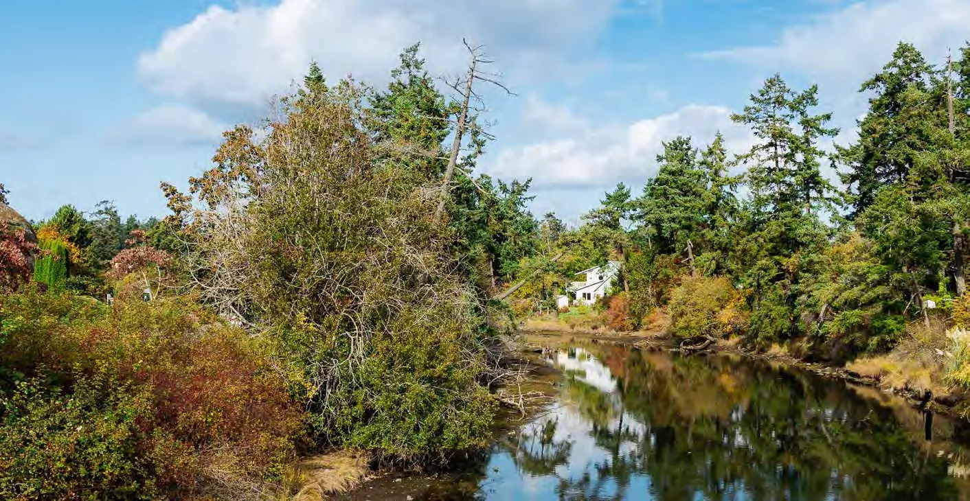
11.3 POLICIES
11.3.1 TAKING ACTION
A. Continue the Town’s commitment as a signatory to the 2007 BC Climate Charter. B. Continue to understand the impacts and effects of climate change in recognition of the Town’s declaration of a climate emergency and identify opportunities to develop climate actions in strategic plans to work towards carbon neutrality.
11.3.2 REDUCTION OF GREENHOUSE GAS EMISSIONS
A. Achieve or exceed the provincial targets for community-wide GHG emissions including a 45% reduction in emissions below 2007 levels by 2030 and a 100% reduction in emissions below 2007 levels by 2050. B. Explore opportunities to collaborate with other municipalities in the Capital Regional District, senior levels of government, public agencies, and organizations to reduce GHG emissions through initiatives related to land use, building energy efficiency and transportation planning, infrastructure design, water and energy conservation, solid waste management, and green procurements. C. Advocate to senior levels of government to support View Royal in meeting the Town’s climate goals and targets, as well as its natural hazard (e.g. flooding, wildfire) mitigation and response objectives. This support may include legislation, policy, programs, and data that provides the Town with the funding and resources necessary to address the climate emergency. D. Explore the creation of a Corporate Energy and Emissions Strategy for the Town that identifies opportunities for reducing GHG emissions caused by Town operations, transport, facilities, and waste management. E. Investigate opportunities to transition the Town’s fleet of vehicles to electric and low emission vehicles. F. Consider the adoption of a “buy-clean” procurement policy that prioritizes the purchasing of low- and no-carbon materials and products for the Town. G. Continue to consider options for diverting organic waste from landfills, as guided by the Community Climate Action Strategy.
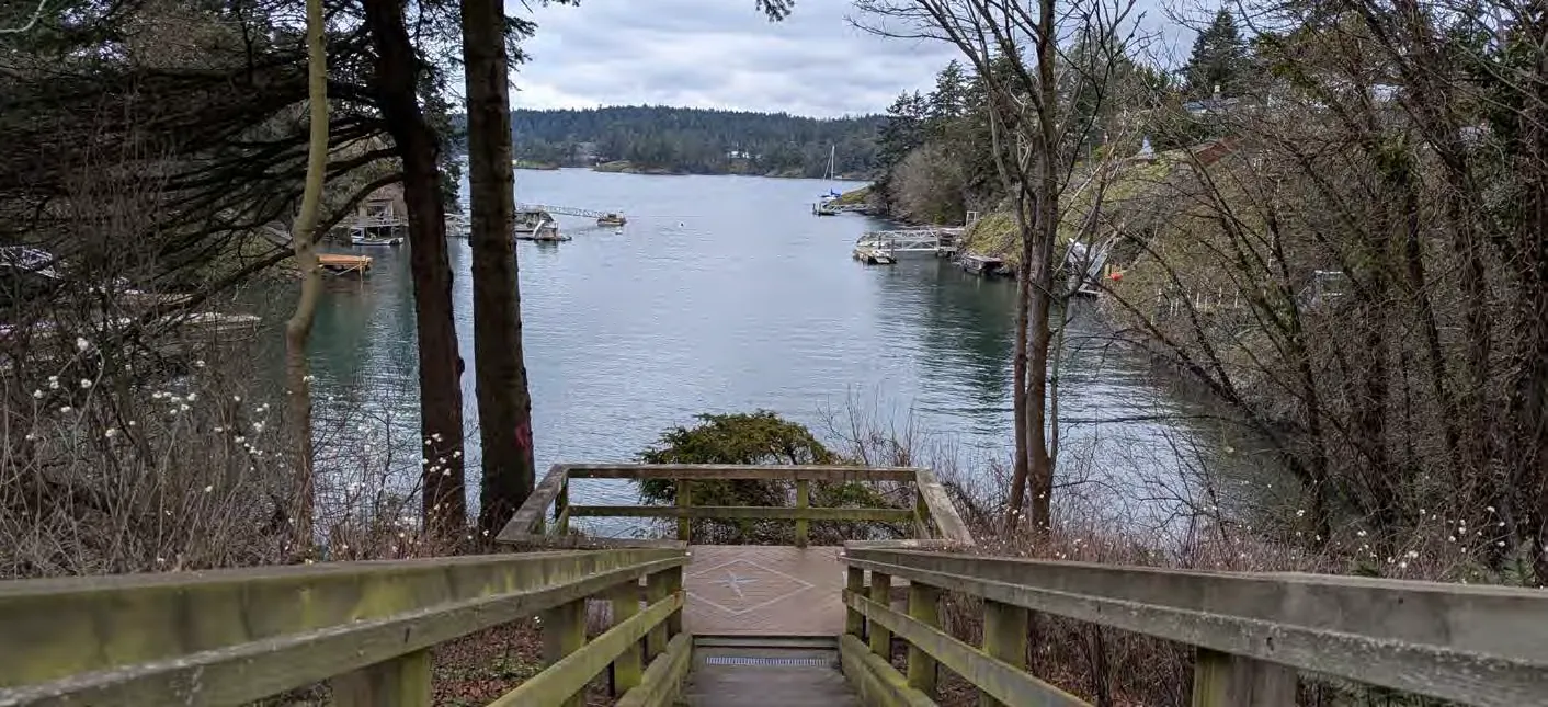
11.3.3 BUILT ENVIRONMENT
A. Explore options to incorporate sustainability considerations into the Town’s Development Permit Area guidelines, Building Bylaw, and Zoning Bylaw, such as enhanced landscaping requirements to improve tree canopy coverage, more broadly permitting urban agriculture to advance food security goals, and increasing requirements for bike parking, amongst others. B. Continue to support enhanced energy efficiency and low carbon heating in new buildings by requiring new development to meet or exceed the requirements of the BC Energy and Zero Carbon Step Codes. C. Encourage new development to exceed the requirements of the BC Energy and Zero Carbon Step Codes. D. Determine the viability of reusing building demolition materials for construction purposes. E. Consider adoption of policies and programs to encourage decarbonization of existing buildings, such as supporting deep energy retrofits and fuel switching.
The BC Energy and Zero Carbon Step Codes are provincially-legislated measures that aim to achieve zero carbon and net-zero energy ready buildings.
11.3.4 INFORMATION AND EDUCATION
A. Identify opportunities to involve youth in climate change planning and action by collaborating with local youth organizations and schools. B. Support climate change education at View Royal Schools to increase awareness and promote future sustainability.
11.3.5 CLIMATE ADAPTATION
A. Continue to work with neighbouring municipalities, the Capital Regional District, and Songhees and Xʷsepsəm Nations on the development and implementation of strategies to mitigate the impacts caused by climactic events, such as sea-level rise, increased wildfire risk, altered seasonal temperatures and precipitation, air pollution, and waterborne contaminants. B. Consider the development of new regulations and policies to protect and enhance the safety of the public during natural hazard events, that may be a result of climate change. C. Continue to develop and implement strategies to mitigate wildfire risk in View Royal by: i) implementing recommendations from the Community Wildfire Resiliency Plan ii) maintaining the View Royal FireSmart Program iii) integrating FireSmart principles into the Town’s bylaws and policies iv) applying a Wildfire Interface Hazard Development Permit Area to the Wildfire Urban Interface areas of the community where wildfire risk is high and incorporate FireSmart principles within the guidelines accordingly. D. Prepare and maintain an Emergency Management Plan for the community to prepare for, prevent, mitigate, respond to, and recover from the effects of natural disasters, hazards, and climate change. E. Explore opportunities to create a Climate Adaptation and Mitigation Strategy with the Songhees and Xʷsepsəm Nations to integrate traditional knowledge into climate action policy and decision-making, identify local and regional climate action, and partner on the implementation of these actions together. F. Contemplate a review and update to the Community Heat Resilience Plan to enhance the Town’s preparedness for extreme heat events. G. Consider the development of a Comprehensive Sea Level Rise Adaptation Plan to guide the long-term resilience of View Royal through: i) Identifying assets, infrastructure, and populations vulnerable to sea level rise. ii) Evaluating adaptation options across physical, ecological, and policy domains. iii) Prioritizing actions based on risk, feasibility, and community values; and iv) Establishing timelines and funding strategies for implementation. H. Integrate the findings of the Coastal Hazard Mapping and Risk Assessment Report into Town regulations and policy to proactively address the risk of sea level rise and coastal flooding in View Royal.
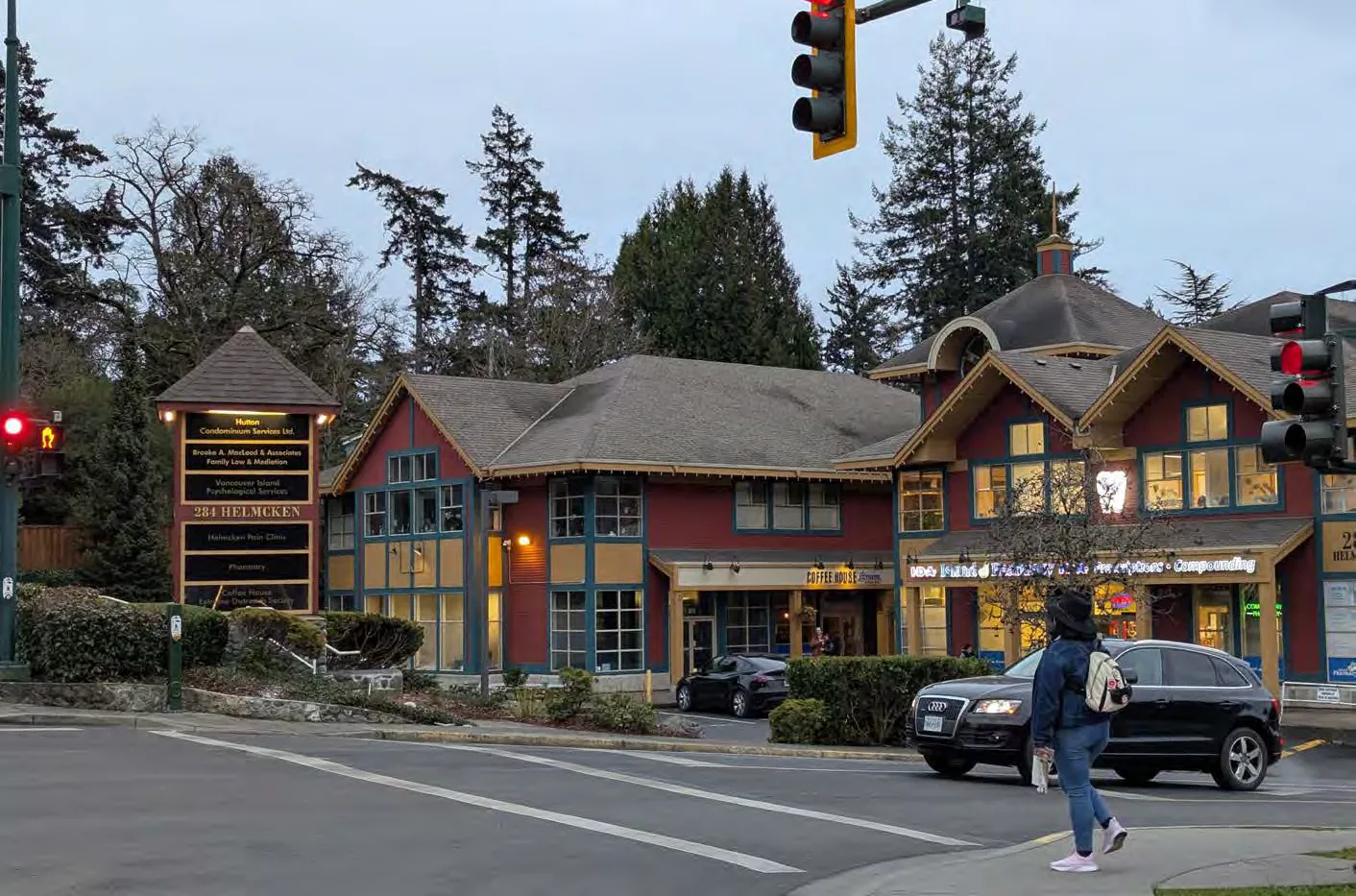
12.0 Parks, Trails and Recreation
12.1 CONTEXT
Parks, trails, and recreation spaces offer opportunities for play, exploration, exercise, and connection. For View Royal community members, access to green space and recreation opportunities is an essential part of daily life. View Royal’s many parks, green spaces, and trails contribute to the community’s appeal. These amenities comprise a substantial portion of the Town, encouraging active lifestyles, supporting local ecosystems, and providing recreational options that benefit both locals and visitors.
The community boasts a wide range of amenities, including regional parks such as Thetis Lake and Mill Hill, neighbourhood parks like View Royal Park and Portage Park, shoreline access points, and the Galloping Goose and E&N regional trails. Through regional partnerships, community members also enjoy recreational services and programming provided at the Juan de Fuca Recreation Centre located in Colwood and the Pearkes Recreation Centre located in Saanich. View Royal’s public schools also function as community programming spaces. These amenities are shown on Map 15.
The Town’s Parks Master Plan outlines the vision and specific actions for parks and green spaces in View Royal. The objectives and policies outlined in this section aim to further implement the vision established in the master plan, as well as provide guidance for new priorities relating to parkland acquisition and improvements, trails, and recreation that have emerged since its completion with a forward-looking lens as the community grows over the lifespan of this OCP.
The following OCP Goals may be achieved through the policy direction provided in this section:
- Mobility & Connectivity
- Natural Amenities
- Community Well-Being
- Regional Partnerships
- Sustainable Service Delivery and Asset Management
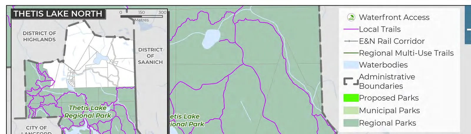
12.2 OBJECTIVES
12.2.1 HEALTHY, EQUITABLE, AND SAFE PARKS, TRAILS, AND RECREATION FACILITIES
Continue to promote parks, trails, and recreation facilities as contributors to the overall health and well-being of residents and visitors, and explore opportunities to expand, design, and maintain these amenities for all ages and abilities to support a healthy and active lifestyle.
12.2.2 ACCESSIBLE PARKS, TRAILS, AND RECREATION FACILITIES
Continue to explore opportunities to provide parks, trails, and recreation amenities that meet the diverse social, recreational, and wellness needs of current and future residents. Consideration of the type and location of these amenities should be considered at a community-wide and neighbourhood level, and within the Town’s financial and service capacity.
12.2.3 PROTECT ECOLOGICAL AND ENVIRONMENTAL FUNCTIONS
Continue to recognize and protect the role parks play in maintaining the ecological integrity of our environment and contributing to climate change adaptation, mitigation, and resilience.
12.2.4 PARTNERSHIP AND COLLABORATION
Continue to strengthen existing partnerships and consider opportunities for new partnerships with local and regional governments and non-profit organizations to expand local and regional recreational opportunities.
12.2.5 LEVEL OF SERVICE
Achieve a sustainable level of service delivery for parks, trails, and recreation services that reasonably addresses community demand for access to public spaces and is within the Town’s financial and resource capacity levels.
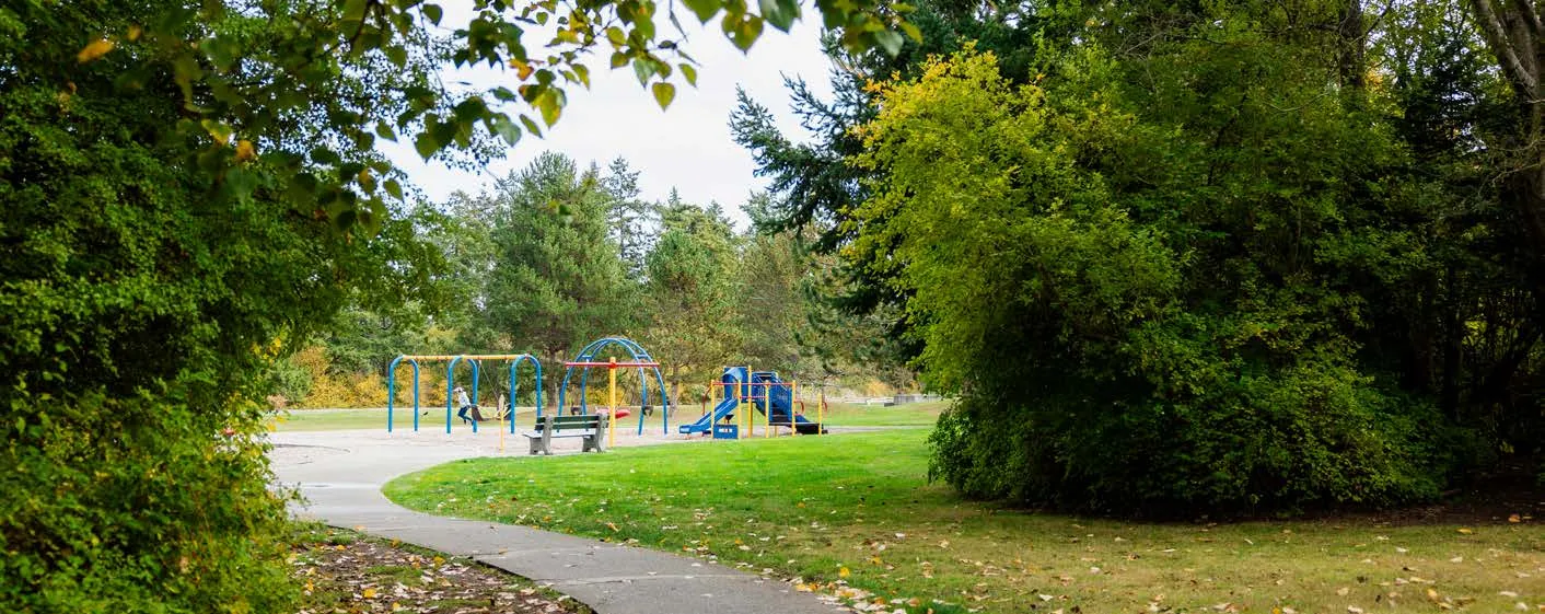
12.3 POLICIES
12.3.1 GENERAL
A. Consider the evolving needs of residents for parks, trails, and recreation services and identify priorities and actions accordingly. B. Apply an equitable, diverse, and inclusive approach to the delivery of parks, trails, and recreation services in View Royal through the consideration of resident ages and abilities in the identification of priorities and the design of such spaces and infrastructure. C. Ensure parks, trails, and recreation planning are integrated with broader community planning efforts in the Town, including land use and transportation decisions, and public realm design. D. Continue to identify and understand gaps in the Town’s parks, trails, and recreation offerings, and opportunities to enhance these amenities so that they are more adequate, usable, and accessible for all residents. E. Aim to achieve a minimum of 5.0 hectares (10 acres) of parkland per 1,000 people, or residents living within a 400 m radius or 5-minute walk of usable park space excluding regional parks and schools, while considering other significant factors affecting acquisition and access to parkland, such as transportation corridors and the Trans-Canada Highway. F. Continue to explore opportunities to remove barriers and improve access for people of all ability levels to parks, recreational facilities, public waterfront areas, viewpoints, and greenways while remaining sensitive to the preservation of natural habitat areas. G. Incorporate universal access design principles into parkland and trail design wherever possible. H. Support the safety and comfort of parks and recreation facility users by applying design principles and practices that address crime prevention in public spaces.
Universal access design (UAD) ensures that the built environment is designed in a manner that is accessible to most people, regardless of their ability to move around within a space.
12.3.2 PARKLAND ACQUISITION
A. Prioritize parkland acquisition in neighbourhoods where supply is deficient. Special attention should be given to areas with high concentrations of underserved demographic groups, children and teenagers, and other groups with unique recreation and access needs. B. Pursue the acquisition of parkland through dedication at the time of rezoning or subdivision. Considerations should include parkland size, location, access, topography, presence of any hazardous conditions, treed areas, native ecosystem integrity, and maintenance requirements to determine if the proposed parkland is appropriate for public use. C. Explore how to integrate urban park types into the existing parks system to enhance streetscapes, such as pocket parks, road ends, and plazas, particularly in or near areas of high pedestrian activity. In reviewing development proposals for waterfront sites, encourage new public water and shoreline accesses, parks, and boat launches depending on current Flood Hazard Land Management Guidelines to consider a 2.0 global sea level rise (approximately 200 years) relative to the year 2000 sea level.
12.3.3 PARK IMPROVEMENTS
A. Partner with community organizations, West Shore Parks and Recreation, and the Capital Regional District where possible to acquire, improve, and manage parkland amenities. B. Continue to maintain and enhance existing parks and consider the development of new facilities as needed. C. Support investment in View Royal Park as the Town’s primary park to enhance access to recreation activities that attract a broad range of users. D. Explore opportunities to provide weather-protection infrastructure in public parks and gathering spaces, including shade and rain coverage features. Explore the feasibility of providing public washrooms in Town parks. E. Prioritize parkland improvements in areas of the community with high concentrations of underserved demographic groups, children and teenagers, and other groups with unique recreation and access needs. F. Emphasize aspects of historical and cultural significance in View Royal parks through collaboration with the Songhees and Xʷsepsəm Nations.
12.3.4 RECREATION
A. Continue to support the Town’s inter-municipal facility sharing agreement for the West Shore Recreation Centre. Explore options for increasing local benefits from this partnership. B. Explore opportunities for partnerships with the Capital Regional District, School District 61, West Shore Parks and Recreation, and community organizations to deliver additional recreational opportunities for View Royal residents. C. Support non-motorized water recreation in View Royal and continue to explore opportunities to improve access to the water for non-motorized vessels in Esquimalt Harbour and Portage Inlet at key waterfront locations.
Non-motorized vessels are human-propelled watercraft such as kayaks, stand-up paddleboards, and canoes, amongst others.
D. Enhance recreational amenities within the parks without compromising critical habitat or sensitive species.
12.3.5 IMPROVING CONNECTIONS BETWEEN PARKS AND RECREATION FACILITIES
A. Improve connections between parks, greenspaces, recreation facilities, schools and residential areas by enhancing linear parks, public trails, active transportation corridors, transit, and sidewalk connections. B. Explore options for improving access to parks via all modes of transportation. C. Explore opportunities to increase accessibility to recreation facilities and infrastructure by transit to ensure all ages and abilities have equitable access to these services and amenities.
12.3.6 PARKS AND THE NATURAL ENVIRONMENT
A. Preserve and restore Environmentally Sensitive Areas within parks wherever possible. B. Acknowledge the role that trees play in providing ecosystem services, stormwater management, temperature regulation, and climate resilience in View Royal Parks by maintaining and enhancing the tree canopy in these spaces. C. Explore opportunities to educate the community on the natural systems within parks through interpretive signage and information boards. D. Protect ecosystems in natural parks through sensitive management and minimal construction, ensuring that any works shall be carried out in an environmentally sensitive manner with proper consultation with a qualified environmental professional. E. Rehabilitate areas affected by invasive plants and species to restore climate adaptive native vegetation and trees in View Royal parks. Where feasible, implement preventative measures to protect native habitats. F. Consider the criteria required to develop construction standards for trails that aim to avoid and mitigate harmful impacts on the natural environment.
13.0 Community Well-Being and Culture
13.1 CONTEXT
Community well-being in View Royal is shaped by the social, cultural, and economic conditions that support residents’ health, safety, belonging, and ability to participate in society. As View Royal grows and diversifies, the Town’s role in supporting social needs continues to evolve, with an emphasis on equity, inclusion, accessibility, and collaboration with the Songhees and Xʷsepsəm Nations and other partners across the region.
COMMUNITY HEALTH AND WELL-BEING
Community health is important to residents and the character of a community is directly related to the quality of life and social, mental and physical well-being experienced by its residents. As the host for one of the region’s two major hospitals (Victoria General Hospital), View Royal also plays a key role in providing healthcare services for local and regional residents alike, with a desire to expand the services provided at this facility in the future.
Community well-being extends far beyond mental and physical health services. It encompasses various community facilities and spaces, including parks, trails, and recreational facilities, as shown in Map 15. Schools and daycares in View Royal are essential, offering education for youth, opportunities for social, educational, and recreational enrichment, and support for local families. Parks, trails, and recreation areas (see section 12.0) play a significant role in supporting the mental, physical, and social health of the community through access to nature and opportunities for connection and exercise.
Contemplating and addressing the needs and abilities of residents across demographic groups is essential for ensuring the well-being of all community members. Prioritizing accessibility is key to creating a more equitable community, allowing everyone to safely, comfortably, and fully participate in life in View Royal. Accessibility for an ageing population is of increasing importance for the Town given the median age of 44.8 years in the last Census period (2021), which slightly exceeds the provincial median of 42.8 years. As the community grows older, meaningful steps must be taken to support the ability of residents to age in place.
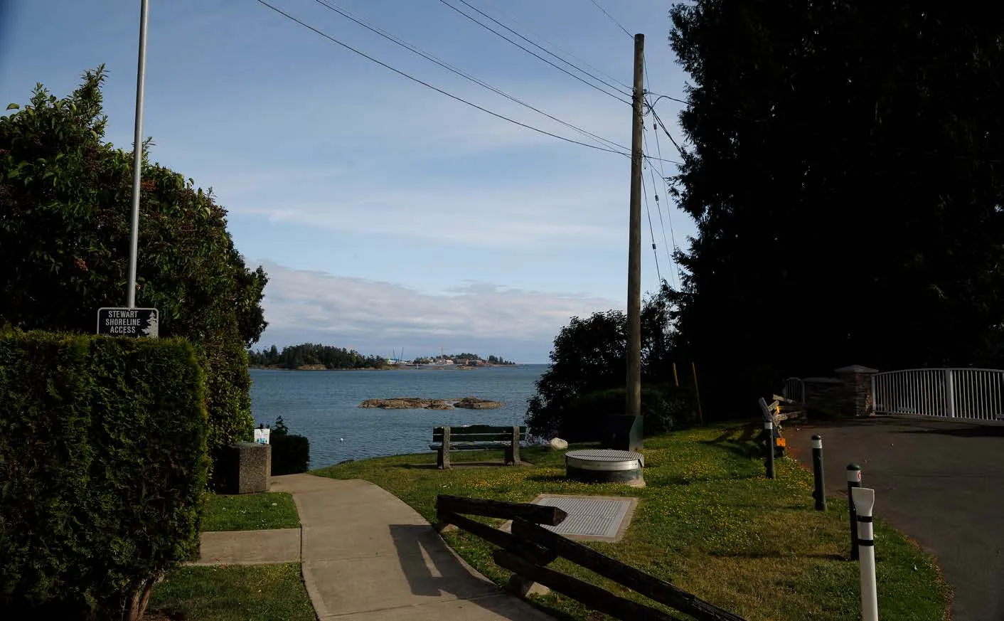
COMMUNITY CULTURE
View Royal’s heritage resources, cultural spaces, creative sector, and community organizations also help foster a safe, welcoming, and inclusive community with a strong sense of place. View Royal is home to some of the oldest buildings in the Capital Regional District and some of Canada’s National Historic Sites. The Craigflower Manor site, completed in 1856, is one of the four original farms the Hudson’s Bay Company set up in the Greater Victoria Area. The Town is a full participant in the Capital Regional District Arts Service, which provides operating and project grants to local festivals, performing arts, general arts, and visual arts of non-profit organizations such as the Art Gallery of Greater Victoria, Ballet Victoria, the Victoria Jazz Society, and the Victoria Symphony. This partnership aims to acknowledge the key role that arts and culture play in fostering a sense of place and community and contributing to overall well-being. It is a priority of the Town to partner with the Songhees and Xʷsepsəm Nations to integrate aspects of Indigenous culture into the community fabric wherever possible, such as public art, interpretive signage, and the hosting of public events and festivals, amongst others.
This section aims to advance objectives and policies that strengthen community health and well-being, cultural identity, enhance accessibility and inclusion, protect heritage, and expand opportunities for youth, families, and seniors, while fostering a safe, connected, and culturally rich community where all residents can thrive.
The following OCP Goals may be achieved through the policy direction provided in this section:
- Community Well-Being
- Community Safety and Security
- Community Input and Governance
- Regional Partnerships
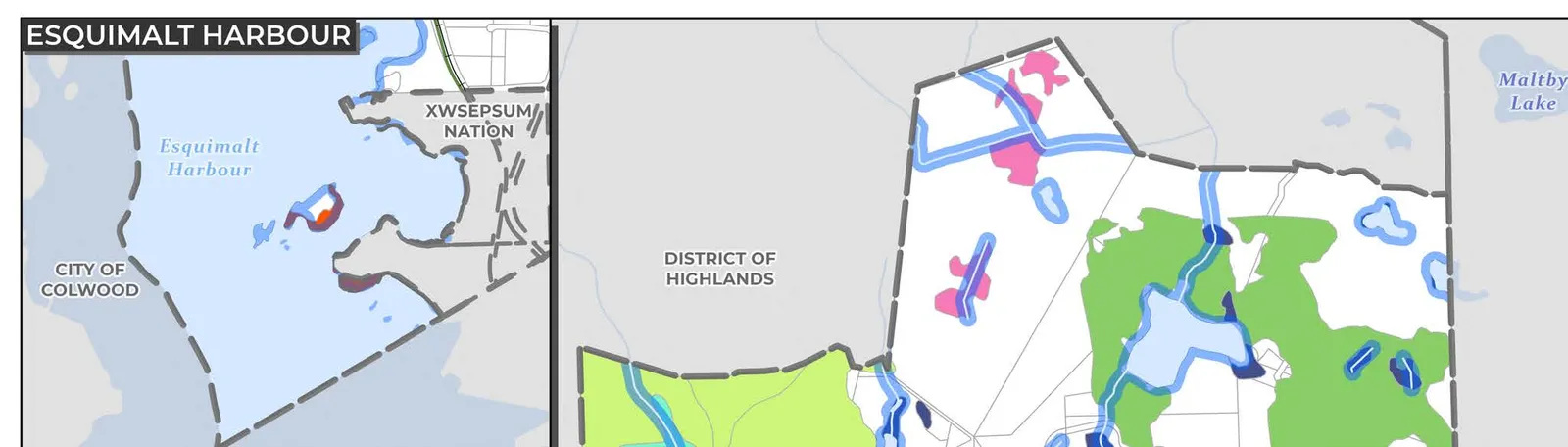
13.2 OBJECTIVES
13.2.1 HISTORIC AND CULTURAL IDENTITY
Celebrate the diverse heritage of View Royal by identifying, recognizing, protecting, and celebrating natural, cultural, and built heritage resources, including those of significance to the Songhees and Xʷsepsəm Nations.
13.2.2 ARTS AND COMMUNITY REPRESENTATION
Support the enrichment of arts, culture, and heritage by attracting artists through the provision of spaces and events, programs, and policies. Collaboration with Songhees and Xʷsepsəm Nations and neighbouring municipalities is encouraged.
13.2.3 CREATING A DIVERSE, EQUITABLE, AND INCLUSIVE COMMUNITY
Enhance the quality of life for all residents by fostering an environment where diversity, equity, and inclusion are promoted and embedded in Town policies, programs, and spaces. Successful implementation of a diverse, equitable, and inclusive approach recognizes and addresses the evolving needs of View Royal’s residents and understands and respects the diverse needs of persons of all ages, abilities, identities, and backgrounds.
13.2.4 COMMUNITY AND IDENTITY
Strengthen the sense of belonging, shared identity, and emotional connections within View Royal to establish a strong sense of place and community.
13.2.5 COMMUNITY SAFETY AND SUPPORT
Ensure that View Royal is a safe community by working with emergency services, community and volunteer groups, and residents with diverse lived experiences that wish to advance community safety, health, and well-being.
13.2.6 THE IMPORTANCE OF YOUTH, FAMILIES, AND FUTURE LEADERS
Attract and retain youth and families in the community and foster an environment that encourages growth, support, and enrichment for future community leaders. The success of youth and families relies heavily on the investments and resources provided to them in their neighbourhoods and broader community.
13.2.7 COMMUNITY EMPOWERMENT THROUGH KNOWLEDGE AND INVOLVEMENT
Identify and develop innovative approaches to civic engagement to ensure that all community members have an opportunity to participate in the Town’s decision-making processes. Opportunities to empower community members through education and volunteerism are encouraged.
13.3 POLICIES
13.3.1 BUILT, NATURAL, AND CULTURAL HERITAGE
A. Continue to identify and add heritage properties to the Town’s Heritage Register. B. Clarify and evolve heritage protection in View Royal through creation of a Heritage Protection program. C. Encourage adaptive reuse of heritage buildings, where appropriate. Work with property owners to find innovative solutions that will permit change while minimizing the impact on heritage values. D. Recognize the role of the View Royal Community Archives as an important resource for local history through advancing and encouraging volunteerism, grants, material donations, and collaborating with the Songhees and Xʷsepsəm Nations. E. Continue to advocate and support the Province with the preservation of Craigflower Manor as a provincial heritage asset by ensuring its ongoing maintenance, restoration, and integration into the community’s cultural landscape. F. Collaborate with Songhees and Xʷsepsəm Nations and community organizations to support increased public education and awareness of the history of View Royal. This may include educational campaigns and exhibits, collaborations with local schools, installations of historical plaques or markers, permanent displays, and public events or meetings. G. Encourage the creation of new, and enhancement of existing public gathering spaces. Such as plazas, parks, community halls, schools, outdoor performance areas, waterfront areas, and streets. H. Encourage the hosting of local cultural events and activities, such as annual celebrations, fairs and festivals, outdoor markets, and arts and sports events. Partner with the organizations that host these events, where possible. I. Encourage opportunities for First Nations art to be included in the design and construction of new development.
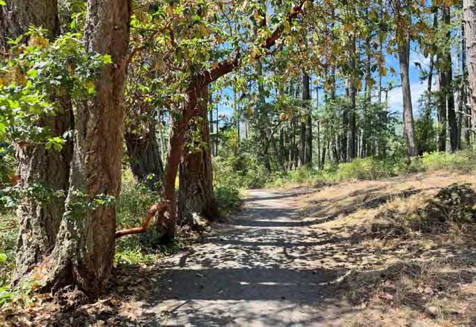
13.3.2 LOCAL GOVERNANCE AND CIVIC ENGAGEMENT
A. Continue to implement the Community Engagement Strategy that applies the International Association of Public Participation principles and an equity-focused approach for seeking participation from all demographic and socioeconomic groups in the community, with specific attention placed on participation from equity-deserving peoples. B. Support and build neighbourhood capacity in strengthening social connections, climate action, and community resilience through neighbourhood-driven initiatives. C. Commit to transparent, ongoing public dialogue about growth management strategies, emphasizing how proactive planning can protect established neighbourhoods and guide change in a manner that benefits the entire community. D. Encourage applicants proposing development to consult with stakeholders and the broader public prior to the statutory consultation phase of a development application. E. Consider opportunities to improve knowledge of and access to volunteering opportunities within the Town. F. Explore opportunities and actions that seek to strengthen civic engagement, especially among underrepresented community members, by building their capacity and knowledge of municipal processes to generate diverse involvement in Town initiatives.
The International Association of Public Participation (IAP2) is a global organization that instills best practices of public participation amongst entities in service of the public interest. The Town has endorsed IAP2’s pillars of engagement.
13.3.3 SUPPORTING YOUTH AND SENIOR POPULATIONS
A. Investigate opportunities to enhance access to childcare spaces as a public amenity in new development. B. Ensure that youth interests are appropriately integrated into Town initiatives, events, and activities. This may involve conducting outreach in View Royal Schools, disseminating information regarding youth initiatives through Town update channels such as RSS feeds and social media, and adapting Town programs and activities to accommodate the needs of youth when applicable. C. Continue to support opportunities for youth to be involved in leadership roles in recreational and leisure activities, as a municipal member of West Shore Parks and Recreation. D. Undertake efforts to understand how the Town can partner with community organizations, public agencies, and the Province to better accommodate an aging population. E. Ensure that the interests of seniors are fully considered in Town initiatives, events, and activities. This can include support services, housing that facilitates aging in place, and engaging with and supporting caregivers who assist seniors.
13.3.4 COMMUNITY HEALTH AND SAFETY
A. Collaborate with Island Health to enhance health care services, ancillary services, and access to clinics, as well as the redevelopment of existing facilities where appropriate. B. Explore opportunities to increase the number of medical clinics and other health care services in the Town to support community needs. C. Continue to advocate for and support community-based and public agency initiatives to prevent crime and reduce potential harm to individuals, such as neighbourhood watch, school, and RCMP community-outreach programs. D. Ensure the Town is equipped to respond to any local and regional states of emergency. E. Enhance the delivery of fire protection services. F. Continue to coordinate policing matters with the West Shore RCMP. G. Enhance community knowledge of fire prevention and life safety measures.
13.3.5 CREATING AN INCLUSIVE COMMUNITY
A. Improve navigation to key destinations to ensure residents and visitors of all ages, abilities and incomes can easily access Town locations. B. Ensure all public buildings and spaces integrate principles of universal access design to allow anyone in the community to enjoy time in a space, regardless of their abilities or age. C. Continue to seek out and provide equitable access to a broad range of inclusivity measures in the public realm that support the mental and physical health of residents of all ages and abilities. This includes people with visible or invisible disabilities. D. Explore the feasibility of obtaining community meeting space through new mixed use, multi-unit residential development. E. Advocate and collaborate with property owners and management groups to provide access to community meeting spaces, where possible, that are both safe and accessible. F. Attract and retain businesses and jobs that offer livable, household-sustaining wages, support community wealth, and enable View Royal residents to live and work locally. G. Advocate and collaborate with the Capital Regional District and the Province to address local social needs and issues, such as the needs of equity-deserving peoples, homelessness, poverty, food security, substance use and addiction, and mental health.
13.3.6 SCHOOLS
A. Recognize public schools as important community gathering places, education centres, recreational, and cultural activity spaces in View Royal. B. Strengthen relationships between the Town and individual schools, the School District, and groups operating within the schools to support the further development of these facilities as community resources. This may include facility upgrades, school development projects, and the long-term use of surplus facilities or land, amongst others.
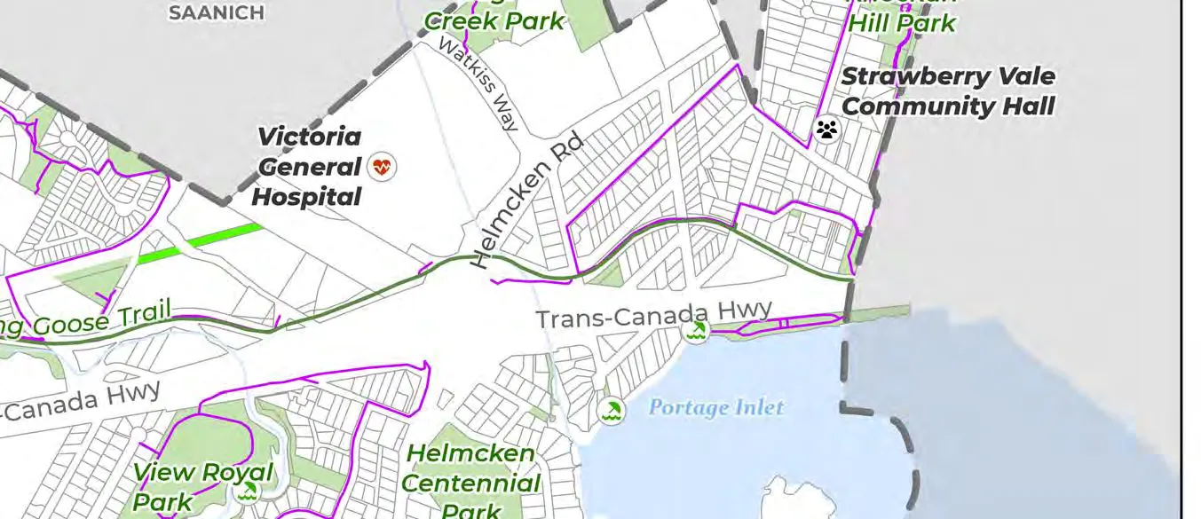
13.3.7 FOOD SECURITY
A. Ensure all members of the community have access to affordable, healthy, and local food. B. Encourage the development of small-scale, healthy and affordable food retail options such as year-round and seasonal farmers markets, small to mid-size locally-owned grocery stores, mobile food vendors, bakeries, and restaurants. C. Support opportunities to for urban agriculture on privately and publicly owned lands. D. Support priority access to community gardens for View Royal residents who do not have access to a private garden. E. Collaborate with Songhees and Xʷsepsəm Nations to identify, protect, and restore lands and waters in support of gathering and harvesting traditional foods. F. Engage and collaborate with Songhees and Xʷsepsəm Nations, where there is interest, to develop Indigenous gardens and harvesting areas that focus on cultivating culturally important plant species for food, ceremony, and medicinal purposes. G. Engage and collaborate with the Songhees Nation and Xʷsepsəm Nations to celebrate and bring awareness to traditional foods through collaboration in festivals, markets, and other appropriate events.
14.0 Reconciliation
14.1 CONTEXT
View Royal approaches reconciliation as a long-term priority grounded in relationship-building, learning, collaboration, accountability, and action. View Royal is committed to integrating a reconciliation-centric approach to current and future Town initiatives. This includes recognizing the impacts of colonization on the community as it is today and acknowledging the injustices experienced by the Indigenous Peoples whose lands the Town is located upon. It will take time and commitment for View Royal to advance decolonizing practices and build respectful, meaningful relationships with the Xʷsepsəm and Songhees Nations.
Given the influence of OCPs on long-term community initiatives and decision-making processes, this section focuses on practical and achievable policy direction to support ongoing reconciliation, collaboration, partnership, and relationship-building initiatives with the Xʷsepsəm and Songhees Nations so that community planning and priorities reflect the enduring presence and stewardship of the lək̓ʷəŋən Peoples.
The following OCP Goals may be achieved through the policy direction provided in this section:
- Community Well-Being
- Economic Development
- Reconciliation
- Regional Partnerships
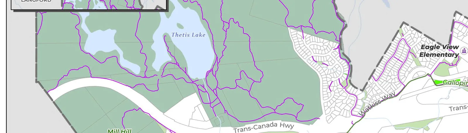
14.2 OBJECTIVES
14.2.1 GOVERNMENT-TO-GOVERNMENT RELATIONSHIPS AND RECONCILIATION IN DECISION-MAKING
Build respectful, government-to-government relationships with the Xʷsepsəm and Songhees Nations, and integrate reconciliation frameworks into Town community planning initiatives, particularly for decisions impacting the Nations’ interests and self-determination goals.
14.2.2 INDIGENOUS PRESENCE, IDENTITY, AND CULTURAL EXPRESSION
Recognize, respect, and enhance the presence of Indigenous peoples by promoting an inclusive atmosphere for those identifying as Indigenous in View Royal, and ensure that representation of Indigenous communities reflects their historical, continuing, and enduring significance within the community.
14.3 POLICIES
14.3.1 GENERAL
A. Identify a joint vision for reconciliation in View Royal in partnership with the Xʷsepsəm and Songhees Nations. B. Continue to develop and implement existing Memorandums of Understanding and/or protocol agreements with the Xʷsepsəm and Songhees Nations around shared commitments.
14.3.2 COMMITMENT TO CULTURAL AWARENESS AND LEARNING
A. Align municipal policies with the United Nations Declaration on the Rights of Indigenous Peoples & the provincial Declaration on the Rights of Indigenous Peoples Act to ensure Indigenous rights are explicitly recognized. B. Work with Xʷsepsəm and Songhees Nations to identify and deliver appropriate public education and reconciliation programming for View Royal residents and staff. C. Respect Indigenous data governance and sovereignty including through application of principles for Ownership, Control, Access, and Possession of data principles, and collaborate with Xʷsepsəm and Songhees Nations on municipally based data gathering.
14.3.3 ADVANCING RECONCILIATION IN LAND USE DECISIONS
A. Proactively engage and collaborate meaningfully with Xʷsepsəm and Songhees Nations on land use initiatives and decisions by which they may be affected to respect rights recognition and shared decision making. B. Promote awareness of the responsibility of property owners to protect archeological sites and artifacts, including those of Indigenous significance, and encourage compliance under the Heritage Conservation Act.
14.3.4 UNDERSTANDING INDIGENOUS LAND AND WATER MANAGEMENT
Work with Xʷsepsəm and Songhees Nations to learn about Indigenous land and water stewardship practices, values, and rights. Collaborate to integrate Indigenous knowledge systems with Western science for habitat restoration, culturally informed ecological management, resilient food systems, and conservation of natural assets.
14.3.5 SUPPORTING ECONOMIC RECONCILIATION AND RIGHT TO SELF-DETERMINATION
Collaborate with Xʷsepsəm and Songhees Nations to identify and pursue opportunities for Indigenous led land and economic development initiatives, such as Nation-led housing, mixed use, and economic projects.
Support Indigenous-led economic initiatives through locally-forged business partnerships with Xʷsepsəm and Songhees Nations and support Indigenous business development and Indigenous development corporations.
14.3.6 CELEBRATING INDIGENOUS IDENTITY WITHIN VIEW ROYAL
Expand Indigenous cultural representation in public space, by supporting public art from Xʷsepsəm and Songhees artists, seeking opportunities for Indigenous naming of parks, facilities, and streets, and exploring opportunities to develop interpretive materials co-authored with Xʷsepsəm and Songhees Nations to reflect the current presence of lək̓ʷəŋən People.
Part Four: Implementation
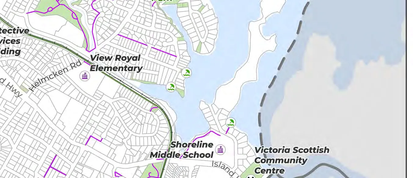
15.0 Action Plan
15.1 CONTEXT
To support the implementation of the View Royal Official Community Plan, a comprehensive set of actions have been identified from the policies contained in Parts Two and Three. These actions are intended to advance View Royal’s vision to the year 2050.
The Implementation Plan translates policy direction into actionable steps that can be undertaken by the Town and its partners over time. To support prioritization and decision-making, the actions are organized into short-, medium-, and long-term timeframes.
- Short-term actions (2026 – 2028) reflect initiatives that can reasonably be achieved within a single municipal election term and focus on the most pressing needs in the community.
- Medium-term actions (2029 – 2032) are those that may be completed in the latter half of the first election cycle following plan completion or in the second. These actions comprise initiatives that require additional coordination and are of a medium-priority to the Town.
- Long-term actions (2033 and beyond) are initiatives that require additional consideration, or actions that are still valuable but may not be practical for completion prior to the next update to this OCP.
15.2 SHORT-TERM ACTIONS
| Action | Relevant Policy No. | Timeframe for Implementation | Implementing Departments and/or Agencies |
|---|---|---|---|
| Section 5.0 – Land Use | |||
| Undertake a density bonus analysis for the Hospital Transit-Oriented Area and Western Gateway Employment District Corridor to: Identify how community amenities associated with new development could be provided; and Determine what level of density may be viable for development to provide such amenities. Integrate the outcomes of the analysis into the Zoning Bylaw and OCP accordingly. | 5.1.3 (h) 5.1.5 (a) | Short-Term | View Royal Development Services |
| Develop an Amenity Cost Charge Bylaw to collect funds for community amenities such as community centres, recreation facilities, libraries, childcare facilities, landmarks, and public spaces. The bylaw should address the types of development subject to amenity cost charges, how the charge is calculated, the timing of collection, and conditions for waivers for reductions. | 5.1.5 (b) | Short-Term | View Royal Engineering, Development Services, and Finance |
| Review and update the Development Cost Charges Bylaw in the year 2028, and every 5 years thereafter. | 5.1.5 (c) | Short-Term | View Royal Engineering, Development Services, and Finance |
| Create a Terms of Reference that outlines the scope of content to be included within professional reports required as part of the submission of development applications. | 5.1.5 (f) | Short-Term | View Royal Development Services |
| Amend the Development Application Procedures Bylaw to designate Development Approval Information Authority. | 5.1.5 (g) | Short-Term | View Royal Development Services |
| Create special zoning for the Western Gateway Employment District Corridor that allows for: a mix of employment uses, and flexibility in building design for industrial uses. | 5.2.3 (b) 5.2.3 (c) | Short-Term | View Royal Development Services |
| Review and update the landscaping requirements in the Zoning Bylaw accordingly to ensure that sufficient landscape buffers are provided for non-residential lands abutting residential zoned properties. | 5.2.3 (c) v. | Short-Term | View Royal Development Services |
| Review and update the frontage requirements in the Subdivision and Development Servicing Bylaw to specify public realm infrastructure as part of new development applications, such as sidewalk improvements, bike facilities, lighting, street furniture, public art, and wayfinding signage. | 5.6.3 (b) | Short-Term | View Royal Engineering and Development Services |
| Review and update zones of lots fronting Island Highway in the Zoning Bylaw to accommodate higher residential densities. | 5.9.3 (c) | Short-Term | View Royal Development Services |
| Review Development Permit Areas for potential inclusion of Christie Point as an environmental site that recognizes potential for shoreline flooding and considers mitigation. | 5.9.3 (d) | Short-Term | View Royal Development Services |
| Section 6.0 – Housing | |||
| Update the Housing Needs Report in the year 2028, and every 5 years thereafter. | 6.3.1 (a) | Short-Term | View Royal Development Services |
| Review existing shared amenity space regulations in the Zoning Bylaw and update accordingly to require shared amenity space for public use in multi-unit residential developments. | 6.3.1 (c) | Short-Term | View Royal Development Services |
| Update the Development Procedures Bylaw to delegate authority from Council to Staff for the approval of minor development variance permits and development permits. | 6.3.2 (a) | Short-Term | View Royal Development Services |
| Create a comprehensive Housing Strategy to identify gaps in the provision of non-market and market housing options and clearly establish affordable housing priorities, strategies, and targets. | 6.3.2 (b) | Short-Term | View Royal Development Services |
| Amend Short-Term Rental regulations as part of the Zoning Bylaw review and update to increase the availability of long-term rental housing supply. | 6.3.2 (d) | Short-Term | View Royal Development Services |
| Undertake a likelihood of redevelopment analysis to identify potential multi-unit residential pre-zoning sites in the Zoning Bylaw update. | 6.3.2 (e) | Short-Term | View Royal Development Services |
| Incorporate regulations and terminology that allow for greater flexibility in promoting ground-oriented forms of development as part of the Zoning Bylaw review and update. | 6.3.2 (f) | Short-Term | View Royal Development Services |
| Undertake a financial feasibility analysis to determine if density bonusing and inclusionary zoning are viable tools for the Town to utilize in the Zoning Bylaw to increase affordable market and non-market rental housing supply. | 6.3.3 (a) | Short-Term | View Royal Development Services |
| Update the Town’s Tenant Assistance policy to expand protection for redevelopment of existing ground-oriented rental and cooperative housing. | 6.3.3 (c) | Short-Term | View Royal Development Services |
| Review the Town’s Tenant Assistance Policy in the year 2026, and every two years thereafter. | 6.3.3 (d) | Short-Term | View Royal Development Services |
| Create a Tenant Protection Bylaw. | 6.3.3 (e) | Short-Term | View Royal Development Services |
| Integrate inclusionary zoning regulations into the Zoning Bylaw or establish a new bylaw to secure affordable housing units. | 6.3.3 (h) | Short-Term | View Royal Development Services |
| Section 7.0 – Transportation and Mobility | |||
| Complete the update to the Transportation Master Plan in the year 2026, and every 5 years thereafter to support the development of a connected network of mobility hubs, corridors, and neighbourhoods. | 7.3.1 (a) 8.3.2 (c) 8.3.3 (b) | Short-Term | View Royal Engineering |
| Review and update transportation and land use policy and regulations accordingly to support and implement the Town’s mode share targets for 2050. | 7.3.1 (b) | Short-Term | View Royal Development Services and Engineering |
| Integrate requirements for transit stops into the Subdivision and Development Servicing Bylaw, where appropriate. | 7.3.3 (c) | Short-Term | View Royal Engineering |
| Explore opportunities to integrate end-of-trip facility requirements for new development into the Zoning Bylaw. | 7.3.4 (a) | Short-Term | View Royal Development Services |
| Update the Active Transportation Network Plan to identify priority projects for improving active transportation infrastructure in the Town. | 7.3.4 (c) | Short-Term | View Royal Engineering |
| Undertake a road safety study to identify high collision locations within the Town and make recommendations for improvement. | 7.3.5 (b) | Short-Term | View Royal Engineering and Development Services |
| Review and update the Zoning Bylaw to integrate requirements for electric vehicle ready charging infrastructure, where appropriate. | 7.3.7 (g) | Short-Term | View Royal Development Services |
| Section 8.0 – Community Infrastructure and Services | |||
| Update the Sanitary Master Plan in the year 2026, and every 5 years thereafter. | 8.3.2 (c) 8.3.3 (b) | Short-Term | View Royal Engineering |
| Update the Water Master Plan in the year 2026, and every 5 years thereafter. | 8.3.2 (c) 8.3.3 (b) | Short-Term | View Royal Engineering |
| Undertake an assessment to identify how stormwater is infiltrating into the Town’s sanitary sewer system and identify recommendations for resolving this matter accordingly. | 8.3.3 (e) | Short-Term | View Royal Engineering |
| Section 9.0 – Economic Development | |||
| Review existing zoning regulations to identify opportunities for expanding health services permitted uses. | 9.3.1 (d) | Short-Term | View Royal Development Services |
| Undertake a business licensing process review. | 9.3.1 (h) | Short-Term | View Royal Development Services |
| Undertake a land economics study for industrial lands in the Western Gateway Employment District Corridor to determine how to support the viability of employment lands. | 9.3.1 (j) | Short-Term | View Royal Development Services |
| Continue to host annual business mixers and roundtable meetings with members of the local business community. | 9.3.1 (k) | Ongoing | Office of the Mayor & CAO and WestShore Chamber of Commerce |
| Review the Zoning Bylaw’s existing home-based business regulations to identify opportunities to more broadly permit home-based businesses in View Royal and expand permissions, where appropriate. | 9.3.1 (o) | Short-Term | View Royal Development Services |
| Section 10.0 – Natural Environment and Hazards | |||
| Undertake a review of the Town’s development procedures to identify opportunities where the Town may request or require the submission of an environmental report prepared by a Qualified Environmental Professional. | 10.3.3 (d) | Short-Term | View Royal Development Services |
| Review and update development procedures to require pre-development hydrological flows within and immediately adjacent to retained natural features to substantially match post-development flows for development applications adjacent to lands with a watercourse. | 10.3.3 (e) | Short-Term | View Royal Development Services |
| Identify and monitor areas identified in Figure 3 of the Urban Forest Strategy to protect areas susceptible to tree canopy loss. | 10.3.5 (c) 10.3.5 (e) | Short-Term | View Royal Engineering and Development Services |
| Apply for tree planting grant programs to support the Urban Forest and climate resiliency. | 10.3.5 (d) | Ongoing | View Royal Engineering and Development Services |
| Develop an urban forest monitoring and tracking system that may be used to monitor the Town’s tree canopy inventory, for the purpose of future reporting on the Town’s 30% canopy cover target. | 10.3.5 (d) | Short-Term | View Royal Engineering and Development Services |
| Review and update the Tree Protection Bylaw to align with the Urban Forest Strategy. | 10.3.5 (e) | Short-Term | View Royal Engineering and Development Services |
| Review and update requirements for new tree plantings in the Zoning Bylaw to enhance tree retention practices and align with the Urban Forest Strategy. | 10.3.5 (e) | Short-Term | View Royal Development Services |
| Integrate clear landscaping standards into the Zoning Bylaw that outline requirements for irrigation, soil volumes for tree planting, soil quality, tree spacing, and surface materials. | 10.3.6 (c) | Short-Term | View Royal Development Services |
| Develop a landscaping bylaw that details landscaping standards for the Town, including public and private lands. The bylaw should consider current and anticipated future climate stresses that may impact the viability of certain species of vegetation and trees. | 10.3.6 (d) | Short-Term | View Royal Engineering and Development Services |
| Develop a new Natural Hazard Wildfire Interface Development Permit Area to guide development in known or susceptible wildfire interface areas in the Town. | 10.3.7 (a) | Short-Term | View Royal Development Services and Protective Services |
| Update Development Permit Areas and associated mapping accordingly to integrate FireSmart principles and delineate the Wildfire Urban Interface. | 10.3.7 (b) | Short-Term | View Royal Development Services and Protective Services |
| Update the Tree Protection Bylaw, Fire Service Bylaw, Parks and Public Places Bylaw, Property Maintenance Bylaw, and Safe Premises Bylaw to integrate FireSmart principles, where applicable. | 10.3.7 (b) 11.3.5 (c) | Short-Term | View Royal Engineering, Development Services, and Protective Services |
| Continue to develop programs, education, and encourage adaptive design to improve urban resilience to wildfire threats. | 10.3.7 (e) | Ongoing | View Royal Protective Services |
| Review Development Permit Area requirements for lands with steep slopes to ensure geotechnical assessments are required prior to development. | 10.3.7 (i) | Short-Term | View Royal Engineering and Development Services |
| Create a new flood hazard development permit area for floodplain construction in accordance with the recommendations in the Coastal Adaptation Plan. Integrate updated flood hazard mapping accordingly. | 10.3.7 (i) | Short-Term | View Royal Engineering and Development Services |
| Undertake communications campaigns to better educate the public about the use of West Shore Alert. | 10.3.7 (o) | Short-Term | View Royal Corporate Administration and Protective Services |
| Section 11.0 – Climate Action and Sustainability | |||
| Develop and implement a Corporate Energy and Emissions Strategy for the Town that identifies opportunities for reducing greenhouse gas emissions caused by Town operations, transport, facilities, and waste management. | 11.3.2 (d) | Short-Term | View Royal Engineering and Corporate Administration |
| Develop and adopt a “buy-clean” procurement policy. | 11.3.2 (f) | Short-Term | View Royal Corporate Administration |
| Undertake analyses of the Building Bylaw, Zoning Bylaw, and Development Permit Area Guidelines to identify opportunities to further promote sustainable development and amend these regulations, where applicable. | 11.3.3 (a) | Short-Term | View Royal Development Services and Engineering |
| Develop a Wildfire Interface Hazard Development Permit Area. | 11.3.5 (c) | Short-Term | View Royal Development Services |
| Prepare an Emergency Management Plan. | 11.3.5 (d) 13.3.4 (d) | Short-Term | View Royal Protective Services |
| Review and update the Community Heat Resilience Plan to enhance the Town’s preparedness for extreme heat events. | 11.3.5 (f) | Short-Term | View Royal Protective Services |
| Update the Zoning Bylaw to restrict development in areas vulnerable to coastal flooding, and consider adaptive design through zoning flexibility for flood resilient building forms and site layouts. | 11.3.5 (h) | Short-Term | View Royal Development Services |
| Section 12.0 – Parks, Trails, and Recreation | |||
| Undertake an update to the Parks and Trails Master Plan in the year 2027, and every 5-years thereafter. Include updates to support the development of a connected network of mobility hubs, corridors, and neighbourhoods. | 12.3.1 (a) | Short-Term | View Royal Engineering |
| Review and update the Development Cost Charges Bylaw to identify opportunities to collect funds from new development to support new parks and parkland improvements. | 12.3.2 (a) 12.3.2 (b) 12.3.2 (e) | Short-Term | View Royal Engineering, Finance, and Development Services |
| Develop a park land and open space acceptance policy to establish what lands may be considered acceptable for use by the Town in considering acquiring new park land and green space. | 12.3.2 (b) | Short-Term | View Royal Engineering and Development Services |
| Review and revise the Town’s existing Amenity List on an annual basis to inform annual capital plan priorities related to parkland improvements. | 12.3.3 (b) | Short-Term | View Royal Engineering and Development Services |
| Identify opportunities to require end-of-trip facilities in all park and civic/institutional zones in the Zoning Bylaw as part of the next comprehensive |