Appendix
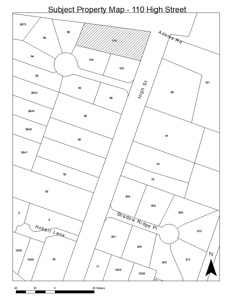
ATTACHMENT 1: Subject Property Map - 110 High Street
September 6, 2022Page 121 section
Map illustrating the location of the subject property and surrounding parcels.
110 High Street
Subject Property Map - 110 High Street
Page 12
Extracted from: 2022 09 06 Public Hearing Agenda - Agenda - Pdf