Appendix
ATTACHMENT 4: Site Context and Survey Plan
September 6, 2022Pages 16–172 sections
Context map and professional land survey showing existing structures and property boundaries.
110 High StreetJanuary 14, 2019 (Survey date)
ATTACHMENT 4
SITE CONTEXT (1)
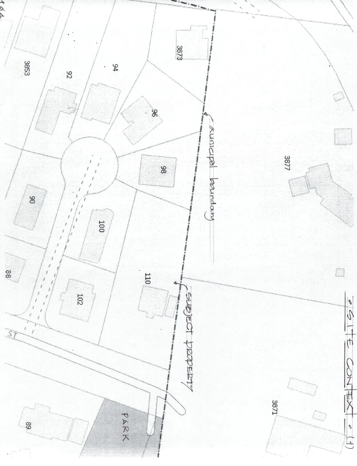
Page 16–17
Site Plan Of: Block 17, Section 9, Esquimalt District, Plan 1407. P.I.D. 007-490-437
Scale: 1:250 Date: 14th day of January, 2019.
Distances and elevations shown are in metres. Elevations are based on an assumed datum.
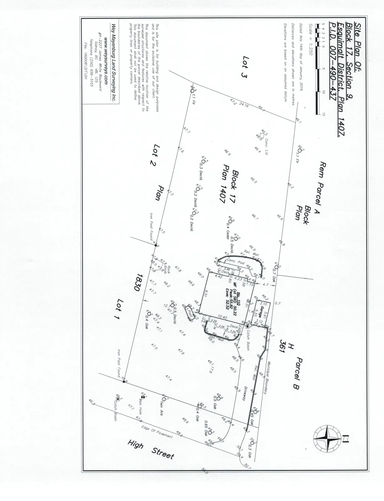
Property Data for No. 110:
- MF (at SW): 50.22
- Peak: 55.82
- Eave: 52.52
Notes: This site plan is for building and design purposes and is for the exclusive use of our client. This document shows the relative location of the surveyed structures and features with respect to the boundaries of the parcel described above. This document shall not be used to define property lines or property corners.
Surveyor Information: Wey Mayenburg Land Surveying Inc. www.weysurveys.com #4-2227 James White Boulevard Sidney, BC V8L 1Z5 Telephone (250) 656-5155 File: 190008\SIT\GH
Page 16–17
Extracted from: 2022 09 06 Public Hearing Agenda - Agenda - Pdf