This site is in beta — data may be incomplete and features are still being added.
Public Hearing/Documents/Attachment 1: Subject Property Map - 1495 Admirals Rd
Appendix

Attachment 1: Subject Property Map - 1495 Admirals Rd

March 17, 2020Page 81 section

Cadastral map showing the location and surrounding lot lines of the subject property at 1495 Admirals Road.

4.1.a Cannabis Retail Store Rezoning - 1495 Admirals Road - Public Hearing for Zoning Bylaw No. 900, 2014, Amendment Bylaw No. 1041
1495 Admirals Rd

Subject Property Map

1495 Admirals Rd
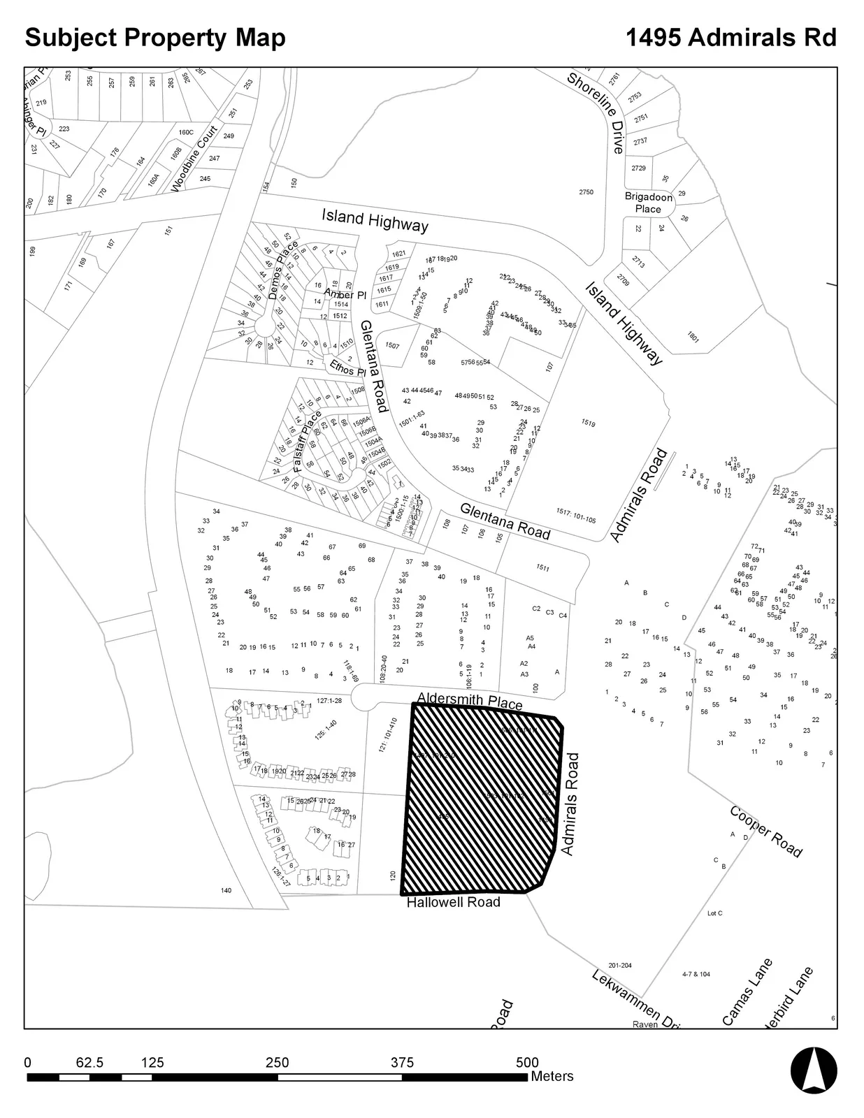
A cadastral map identifying the subject property at 1495 Admirals Rd, which is marked with a black diagonal hatch pattern. The property is bordered by Aldersmith Place to the north, Admirals Road to the east, and Hallowell Road to the south. The surrounding area includes residential lots and streets such as Island Highway, Glentana Road, Shoreline Drive, and Cooper Road. A scale bar at the bottom measures from 0 to 500 meters.
Page 8
Extracted from: 2020 03 17 Public Hearing - Agenda - Pdf