Appendix
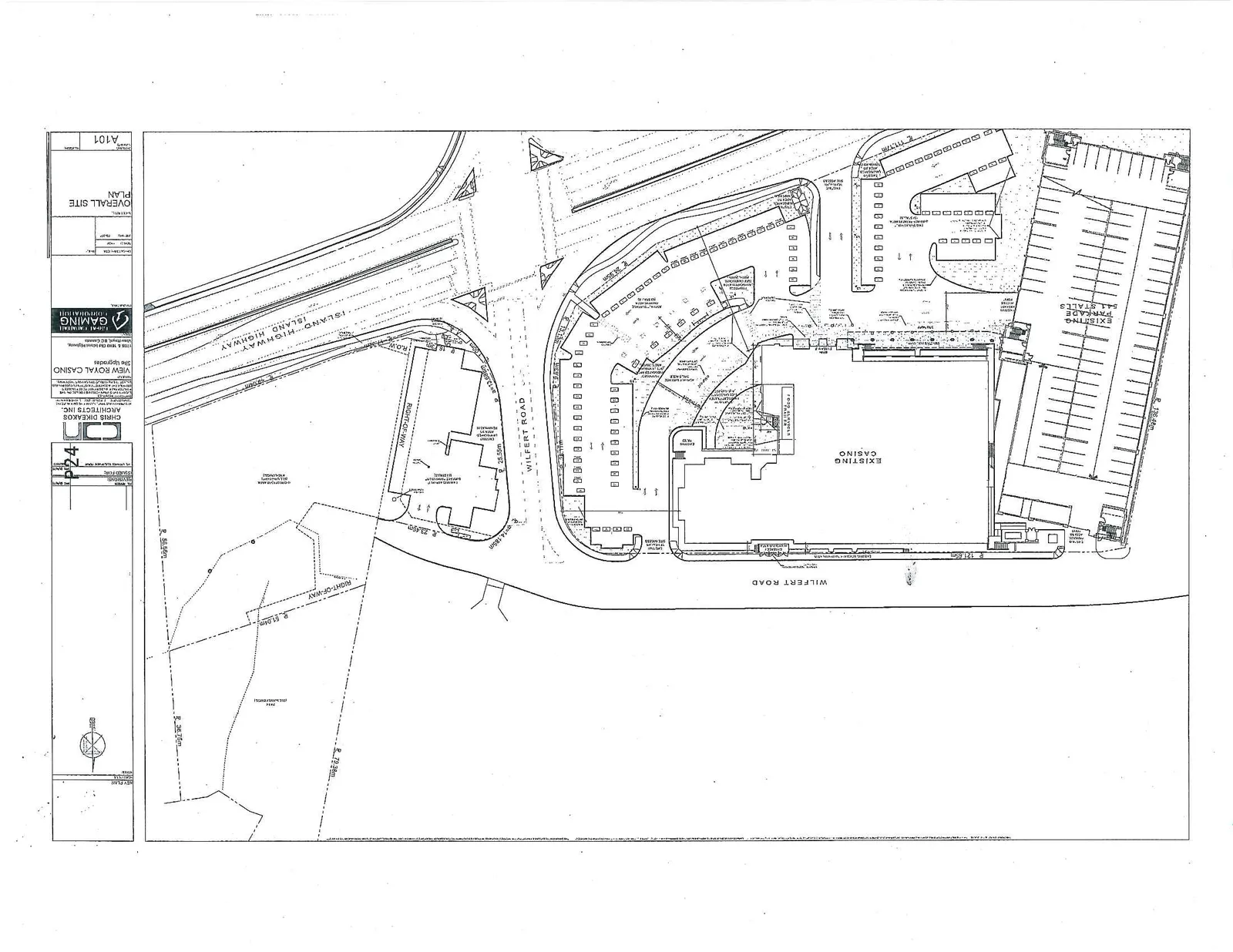
Overall Site Plan - View Royal Casino Site Upgrades
October 1, 2013Page 271 section
Architectural drawing showing the layout of the proposed casino site upgrades.
Sheet A101
OVERALL SITE PLAN
Project Identification
- Project Name: VIEW ROYAL CASINO Site Upgrades
- Project Address: 1708 West Island Highway, Victoria BC Canada
- Client: GREAT CANADIAN GAMING CORPORATION
- Architect: CHRIS DIKEAKOS ARCHITECTS INC.
- Address: Suite 2, 2190 West 4th Avenue, Vancouver, BC V6K 1N6
- Contact: Tel: 604.733.3100, Fax: 604.733.3242
Drawing Information
- Sheet Name: OVERALL SITE PLAN
- Sheet Number: A101
- Project Number: 1555
- Scale: 1:500
- Date: MAY 12, 2017
- Drawn by: SL/MD
- Checked by: CD
Revision Schedule
| No. | Description | Date |
|---|---|---|
| 1 | ISSUED FOR DP | 2017-05-12 |
| 2 | ISSUED FOR DP | 2017-06-07 |
Site Plan Features and Annotations
The site plan includes the following key structures, labels, and technical data:
Major Site Elements:
- EXISTING CASINO
- EXISTING PARKADE - 544 STALLS
- WILFERT ROAD
- ISLAND HIGHWAY
- RIGHT-OF-WAY (multiple locations)
Operational and Parking Areas:
- BUS DROP-OFF
- VALET DROP-OFF
- VALET STATION
- ACCESSIBLE PARKING STALLS
- MOTORCYCLE STALLS (12 STALLS)
- FOOD BLVD TRAILER
- EXISTING ASPHALT PARKING
- PROPOSED ENTRANCE CANOPY (indicated with dashed lines)
Technical Notes and Dimensions:
- Radii Measurements:
- R 121.50m
- R 132.40m
- R 79.35m
- R 36.75m
- R 53.00m
- R 51.04m
- R 14.150m
- R 23.500m
- R 13.500m
- R 28.35m
- R 11.17m
- Distances:
- 25.55m
- Site Notes:
- CONSTRUCTION AREA (REMOVAL)
- EXISTING CURB TO BE REMOVED
- NEW CONCRETE CURB
- PAINTED TRAFFIC ARROWS
- PROPERTY LINE INDICATOR
- KEY PLAN (North arrow)
Page 27
Extracted from: 2013 10 01 Council Agenda