Appendix
ATTACHMENT 4: TOWN OF VIEW ROYAL SECONDARY SUITE POTENTIAL MAP
December 16, 2013Page 1351 section
A municipal map illustrating property parcels color-coded by size to show the potential for secondary suite development under the new regulations.
October 2013Categorizes properties: Under 550m², 550m²-600m², 600m²-850m², and Over 850m²
TOWN OF VIEW ROYAL SECONDARY SUITE POTENTIAL
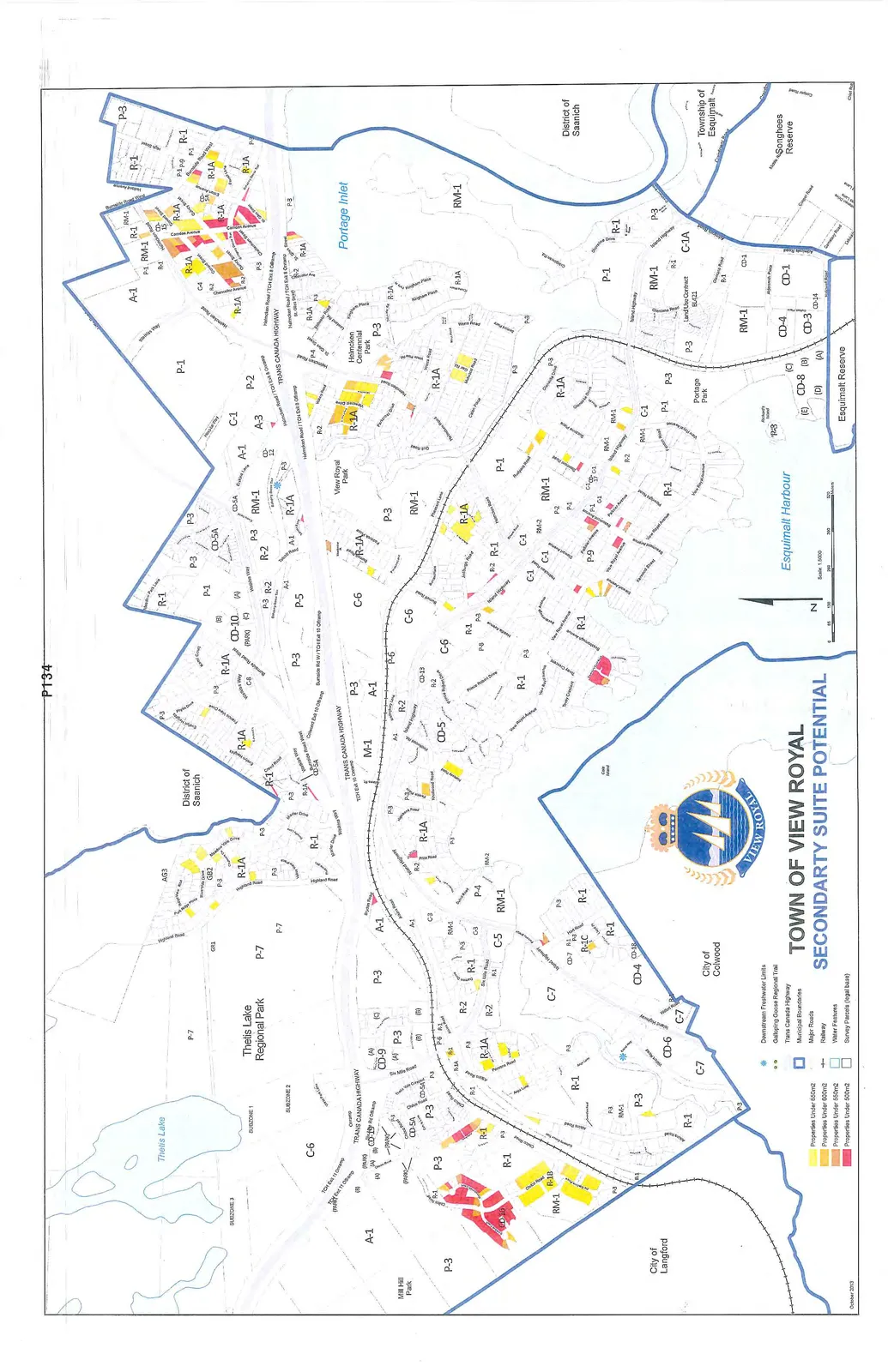
Legend
| Symbol | Description |
|---|---|
| [Yellow Box] | Properties Under 550m2 |
| [Light Green Box] | Properties Under 600m2 |
| [Orange Box] | Properties Under 550m2 |
| [Red Box] | Properties Under 500m2 |
| Blue Dotted Line | Downstream Freshwater Limits |
| Green Dotted Line | Galloping Goose Regional Trail |
| Red Line | Trans Canada Highway |
| Thick Blue Line | Municipal Boundaries |
| Black Line | Major Roads |
| Crossed Line | Railway |
| Blue Shaded Area | Water Features |
| Thin Black Line | Survey Parcels (legal base) |
Geographic Features and Administrative Boundaries
- Surrounding Jurisdictions:
- District of Saanich
- City of Langford
- City of Colwood
- Township of Esquimalt
- Songhees Reserve
- Water Bodies:
- Thetis Lake
- Portage Inlet
- Esquimalt Harbour
- Parks and Notable Areas:
- Thetis Lake Regional Park
- View Royal Park
- Helmcken Centennial Park
- Portage Park
- Major Roadways and Infrastructure:
- Trans Canada Highway (Hwy 1)
- Island Highway
- Helmcken Road
- Burnside Road West
- Watkiss Way
- Admirals Road
- E & N Railway
Zoning Designations
The map identifies numerous land use zones across the municipality, including:
- Residential: R-1, R-1A, R-1C, R-2, R-3
- Multi-Family Residential: RM-1, RM-2
- Commercial: C-1, C-1A, C-4, C-5, C-6, C-7
- Public/Institutional/Park: P-1, P-3, P-5, P-7, P-8
- Comprehensive Development: CD-1, CD-4, CD-5, CD-6, CD-7, CD-8, CD-9, CD-10, CD-13, CD-14
- Other: M-1 (Industrial), AG3, G31, Land Use Contract BL621
Map Details
- Scale: 1:5000
- Date: October 2013
Page 135
Extracted from: 2013 12 16 Council Agenda