Appendix
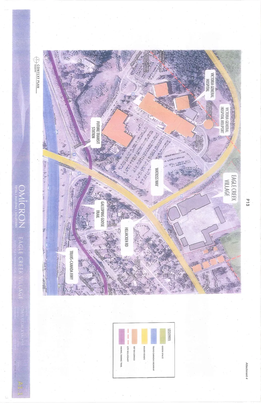
Attachment 4. Plan A1.1 - Contextual Analysis
December 10, 2013Page 181 section
Aerial analysis showing the site's proximity to Victoria General Hospital and the Galloping Goose Trail.
Galloping Goose TrailVictoria General Hospital
EAGLE CREEK VILLAGE - CONTEXTUAL ANALYSIS
Address: Watkiss Way & Helmcken Road, View Royal, BC Date: 4 Feb 2013 Drawing Number: A1.1 Scale: As indicated / NTS
Map Legend
| Item | Description |
|---|---|
| Green Shading | GREEN SPACE |
| Blue Shading | TRANS CANADA HIGHWAY |
| Yellow Shading | MAJOR ROADS |
| Peach Shading | KEY BUILDINGS |
| Red Dashed Line | CITY BOUNDARY |
| Purple Line | HIKING / BIKING TRAIL |
Map Labels
- VICTORIA GENERAL HOSPITAL HELIPORT
- VICTORIA GENERAL HOSPITAL
- EAGLE CREEK VILLAGE
- WATKISS WAY
- HELMCKEN RD
- GALLOPING GOOSE TRAIL
- FUTURE TRANSIT STATION
- TRANS-CANADA HWY
- Camden Ave.
- Rose Hill Estates
- Quincy St.
- Cheltenham St.
Page 18
Extracted from: 2013 12 10 Council Agenda