Appendix
Attachment 7. Plan A1.4 - Pedestrian/Vehicle Circulation Plan
December 10, 2013Page 212 sections
Layout plan detailing pedestrian linkages, vehicle circulation, and truck loading routes within the site.
Attachment 7
EAGLE CREEK VILLAGE
Page 21
PEDESTRIAN & VEHICLE CIRCULATION PLAN
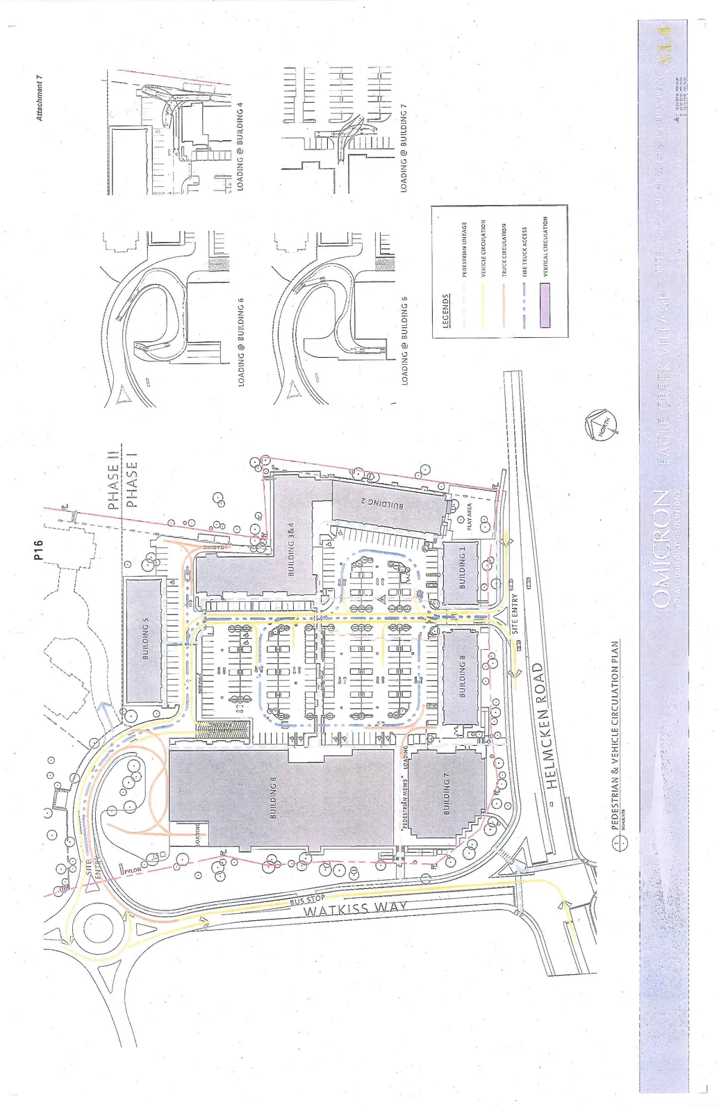
LEGENDS
- PEDESTRIAN LINEAGE: Light blue dashed line
- VEHICLE CIRCULATION: Yellow solid line
- TRUCK CIRCULATION: Orange solid line
- FIRE TRUCK ACCESS: Red dashed line
- VERTICAL CIRCULATION: Purple shaded area
LOADING DETAIL DIAGRAMS
PLAN ANNOTATIONS
- Roads: Watkiss Way, Helmcken Road
- Buildings: Building 1, Building 2, Building 3&4, Building 5, Building 6, Building 7, Building 8
- Key Features:
- Site Entry (Watkiss Way)
- Site Entry (Helmcken Road)
- Bus Stop (Watkiss Way)
- "Pedestrian Mews" (between Building 6 and 7)
- Play Area (near Building 1 and 2)
- Loading zones for Building 6, 7, and 4
- Phasing: Boundary line between Phase I and Phase II
A1.4
Page 21
Extracted from: 2013 12 10 Council Agenda