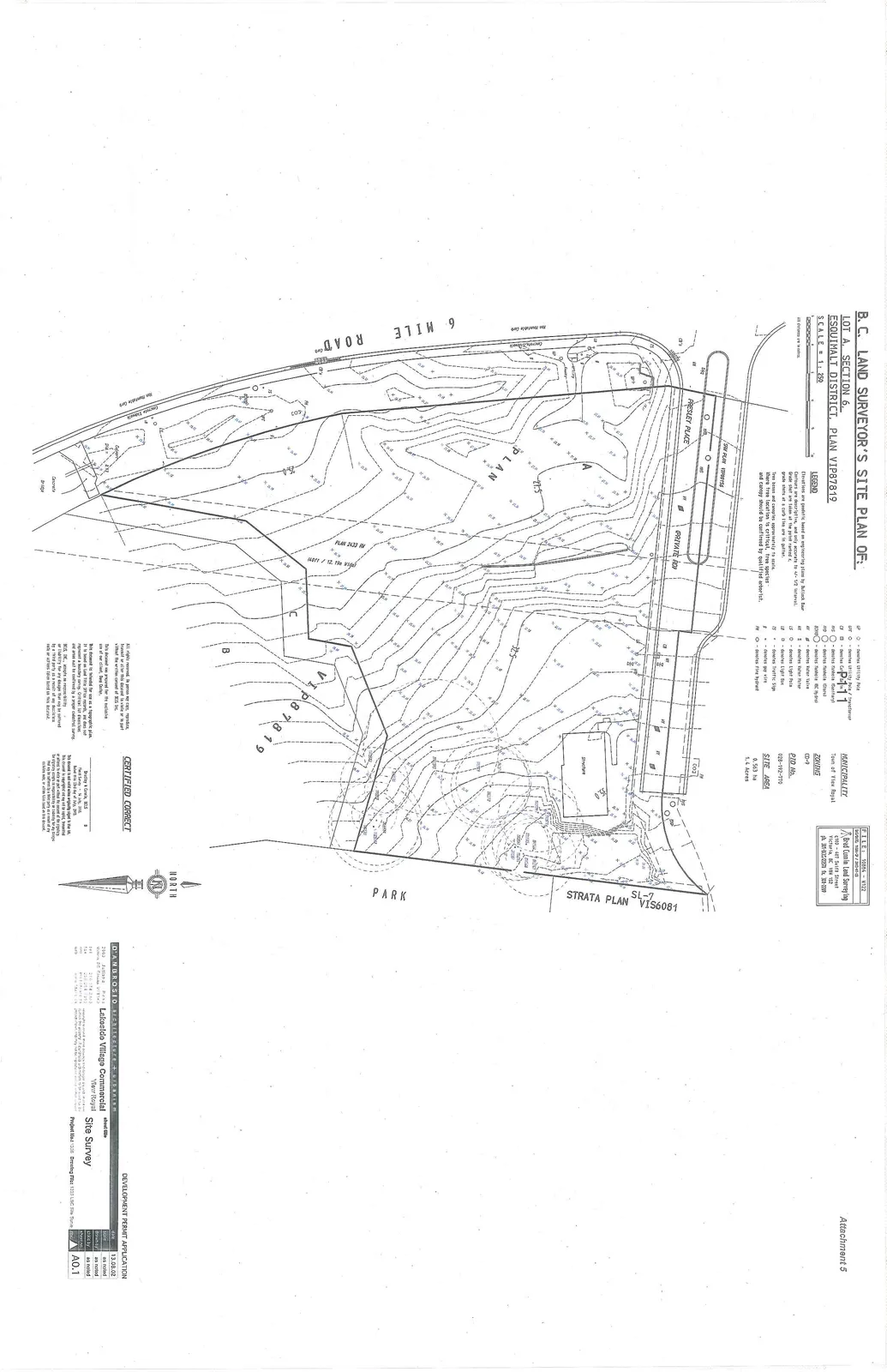
Attachment 5. Plan A0.1 – Site Survey
Surveyor's site plan detailing property boundaries and existing topographical features.
B.C. LAND SURVEYOR'S SITE PLAN OF: LOT A, SECTION 6, ESQUIMALT DISTRICT, PLAN VIP87819
SCALE = 1: 250
Site Information
- MUNICIPALITY: Town of View Royal
- ZONING: CD-9
- PID No.: 028-192-770
- SITE AREA: 0.563 ha (1.4 acres)
Legend
- UP: denotes Utility Pole
- UP/T: denotes Utility Pole w/ Transformer
- CB: denotes Catch Basin
- MH(S): denotes Manhole (Sanitary)
- MH(D): denotes Manhole (Storm)
- BCMH(H): denotes Manhole (BC Hydro)
- WV: denotes Water Valve
- WM: denotes Water Meter
- LP: denotes Light Pole
- LB: denotes Light Box
- TS: denotes Traffic Sign
- G: denotes guy wire
- FH: denotes Fire Hydrant
LEGEND NOTES:
- Elevations are geodetic based on engineering plans by Bullock Baur.
- Contours are descriptive, and only accurate to +/- 0.5 interval.
- Grade shots are taken at the point marked +.
- Grade shots at a curb line are in gutter.
- Tree boxes and canopies approximately to scale.
- Where tree location is critical, tree species and canopy should be confirmed by qualified arborist.
Survey Certification and Notes
All rights reserved. No person may copy, reproduce, transmit or alter this document in whole or in part without the written consent of BCLS INC.
This document was prepared for the exclusive use of our client, New Urban.
This document is intended for use as a topographic plan. It is based on Land Title Office records, and does not represent a boundary survey. Critical lot dimensions and areas must be confirmed by a proper cadastral survey.
BCLS, INC., accepts no responsibility or liability for any damages that may be suffered by a third party as a result of any decisions made or actions taken based on this document.
CERTIFIED CORRECT Bradley W. Gowie, BCLS Field Survey — 16 July, 2012. Dated this 31st day of July, 2012.
FILE INFO: FILE: 10894 - V122 D/S FILE: 10894-S / 305140-S0
SURVEYOR: Brad Cunnin Land Surveying #100 - 491 Swift Street Victoria, BC V8W 1S2 ph. 250-920-0320 fx. 381-1188
Project Details
- Project: Lakeside Village Commercial
- Client: New Royal
- Sheet Title: Site Survey
- Project No.: 1205
- Drawing File: 1205 LVC Site Survey.dwg
- Date: 13.08.02
- Scale: as noted
- Drawn by: as noted
- Checked by: as noted
- Sheet No.: A0.1
- Application: DEVELOPMENT PERMIT APPLICATION
- Architect: D'AMBROSIO architecture + urbanism (2960 Jutland Road, Victoria BC Canada V8T 5K2)