Appendix
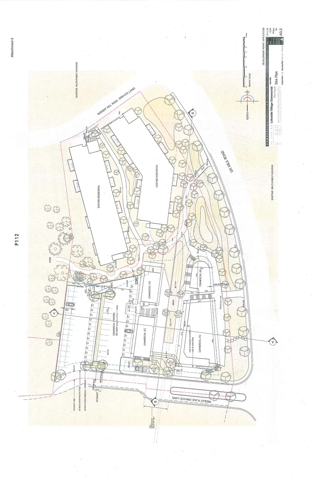
Attachment 6. Plan A0.2 – Site Plan
December 10, 2013Page 1171 section
Architectural site plan for the proposed commercial buildings and parking layout.
November 28, 2013D'Ambrosio Architecture + Urbanism
Site Plan - Lakeside Village Commercial
Project Information
| Field | Details |
|---|---|
| Project | Lakeside Village Commercial |
| Location | View Royal |
| Sheet Title | Site Plan |
| Date | 13.11.28 |
| Scale | 1:250 |
| Project No. | 1303 |
| Drawing File | 1303_LVC_131102 DW |
| Drawn By | d/ng/ng |
| Checked By | fda |
| Revision | A |
| Sheet No. | A0.2 |
| Application Type | DEVELOPMENT PERMIT APPLICATION |
Site Details and Labels
Proposed Structures:
- Commercial (A)
- Commercial (B)
- Commercial (C)
- Commercial (D)
- WC (located between Commercial C and D)
- Bridge (connecting Commercial A/C area to Commercial B/D area)
Parking and Access:
- Commercial Parking: 60 stalls (30 sq m / stall + 1 loading)
- Presley Place (Private Lane)
- Six Mile Road
- Nursery Hill Road (Private Lane)
Existing Context:
- Existing Residential (two large building footprints)
- Existing Multi-Family Housing (located to the north and south of the site)
- Park (located to the northwest)
Site Specifications and Setbacks:
- Property Line
- Setback from Private Road
- Setback from Sidewalk - Proposed
- 4000 Setback
- 4800 Setback
- Hydrant
- Line of Building Footprint
- Line of Roof Edge
- Topographical markers (e.g., 34 FG, 33.5 FG, 23.5 FG)
- North Arrow and Graphic Scale (Meters)
Page 117
Extracted from: 2013 12 10 Council Agenda