Council Meeting/Documents/Attachment II: Overview Map with Proposed Works - Environmental Assessment 138 St Giles St
Appendix
Attachment II: Overview Map with Proposed Works - Environmental Assessment 138 St Giles St
December 10, 2013Page 1841 section
Detailed map highlighting building locations and planned service trenches within the environmental leavestrip.
138 St. Giles Street
Attachment III – Overview Map with Proposed Works
(Red Polygons Indicate Building Locations, Red lines are service trenches within the leave strip)
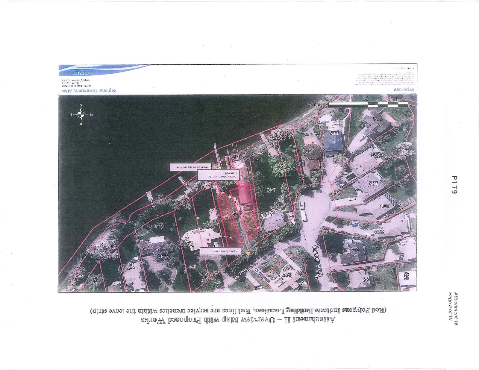
Map Annotations and Labels:
- Street Names: Chancellor Ave, St Giles St
- Property Numbers: 148, 88, 92, 127, 125, 96, 100, 104, 108, 110, 120, 118, 114, 140, 138, 132, 130, 128, 126
- Work Details:
- Proposed house sites
- Existing structure to be removed
- Proposed service trenches
Source Information:
Regional Community Atlas Capital Regional District http://atlas.crd.bc.ca
Important: This map is for visualization purposes only. The Capital Regional District does not warrant that the information is accurate, complete or current. It is for information purposes and should not be used for navigational, legal or other design purposes.
Page 184
Extracted from: 2013 12 10 Council Agenda