Appendix
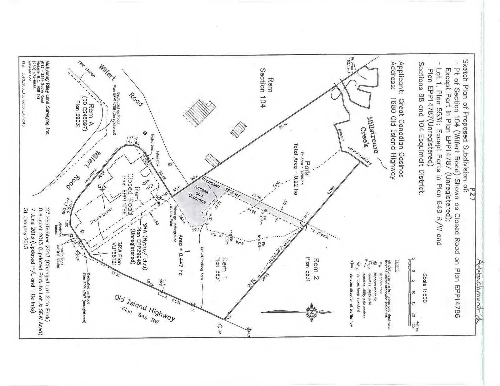
Attachment 2: Sketch Plan of Proposed Subdivision
April 1, 2014Page 311 section
Surveyor's sketch plan showing the proposed subdivision and park dedication area at the casino site.
September 27, 2013 revision0.22 ha total park areaMillstream Creek boundary noted
Sketch Plan of Proposed Subdivision of:
- Pt of Section 104 (Wilfert Road) Shown as Closed Road on Plan EPP14786 - Except Part in Plan EPP14787 (Unregistered);
- Lot 1, Plan 5531; Except Parts in Plan 649 R/W and Plan EPP14787(Unregistered)
- Sections 98 and 104 Esquimalt District.
Applicant: Great Canadian Casinos Address: 1680 Old Island Highway Scale: 1:500
Legend
| Symbol | Description |
|---|---|
| tr | denotes tree |
| (M) | denotes manhole |
| (UP) | denotes utility pole |
| (OUP) | denotes utility pole anchor |
| (LS) | denotes lamp standard |
| ← | denotes direction of traffic flow |
All distances are in metres and decimals thereof unless otherwise indicated.
Surveyor Information
McElhaney Riley Land Surveying Inc. #113 - 2244 Sooke Road Victoria, B.C. V9B 1X1 (250) 474-5538 www.mrls.ca File: 3590_Sub_Application_Jan2013
Revisions
- 27 September 2013 (Changed Lot 2 to Park)
- 8 August 2013 (Updated Park to Lot & SRW Area)
- 7 June 2013 (Updated P/L and Title info)
- 31 January 2013
Page 31
Extracted from: 2014 04 01 Council Agenda