This site is in beta — data may be incomplete and features are still being added.
Council Meeting/Documents/SCHEDULE 1 OF LAND USE BYLAW, 1990, No. 35, AMENDMENT BYLAW No. 759, 2009
Appendix

SCHEDULE 1 OF LAND USE BYLAW, 1990, No. 35, AMENDMENT BYLAW No. 759, 2009

April 1, 2014Page 341 section

Zoning map illustrating Subzone 'A', Subzone 'B', and the dedicated park area for Bylaw 759.

1 CALL TO ORDER
Map identifies 1708 and 1680 Island HighwayShows 'Subzone B' and 'Park' areas

SCHEDULE 1 OF LAND USE BYLAW, 1990, No. 35, AMENDMENT BYLAW No. 759, 2009
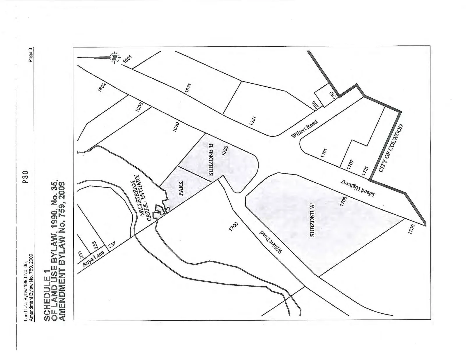
Land use map for Amendment Bylaw No. 759, 2009, detailing Subzone 'A', Subzone 'B', and a Park area. The map shows the intersection of Wilfert Road and Island Highway, as well as Anya Lane and Millstream Creek / Estuary. Property addresses included are 233, 235, and 237 Anya Lane; 1651, 1652, 1658, 1660, 1671, 1680, 1681, 280, 286, and 1700 Wilfert Road; and 1701, 1707, 1708, 1721, and 1730 Island Highway. The boundary for the City of Colwood is also marked.
Page 34
Extracted from: 2014 04 01 Council Agenda