Appendix
Bylaw No. 893 Schedules 1-4: Subject Property Maps
September 16, 2014Pages 51–544 sections
Map schedules identifying specific subject properties affected by OCP Bylaw No. 893, including areas in Thetis Cove and Gibraltar Bay.
Schedule 1: Thetis Cove / Esquimalt HarbourSchedule 2: Palmer Station / Gibraltar Bay DriveSchedule 3: Mill Hill Regional Park areaSchedule 4: 380 Kislingbury Lane
SCHEDULE 1
Subject Property Map
Lot 1, Esquimalt District, Plan 81967 Part of the Bed of Esquimalt Harbour
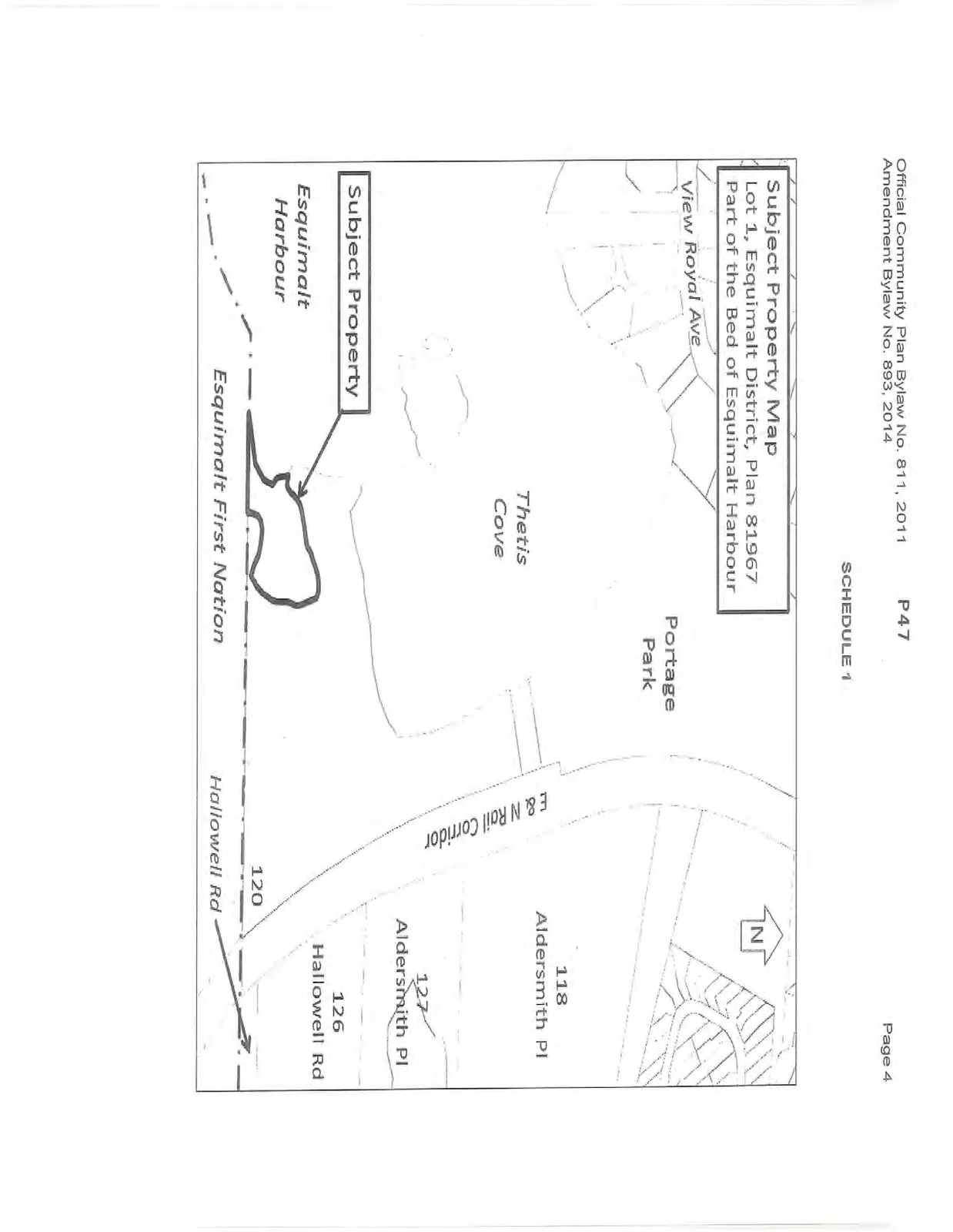
Page 51–54
SCHEDULE 2
Subject Property Map
Common Property, Plan VIS5123
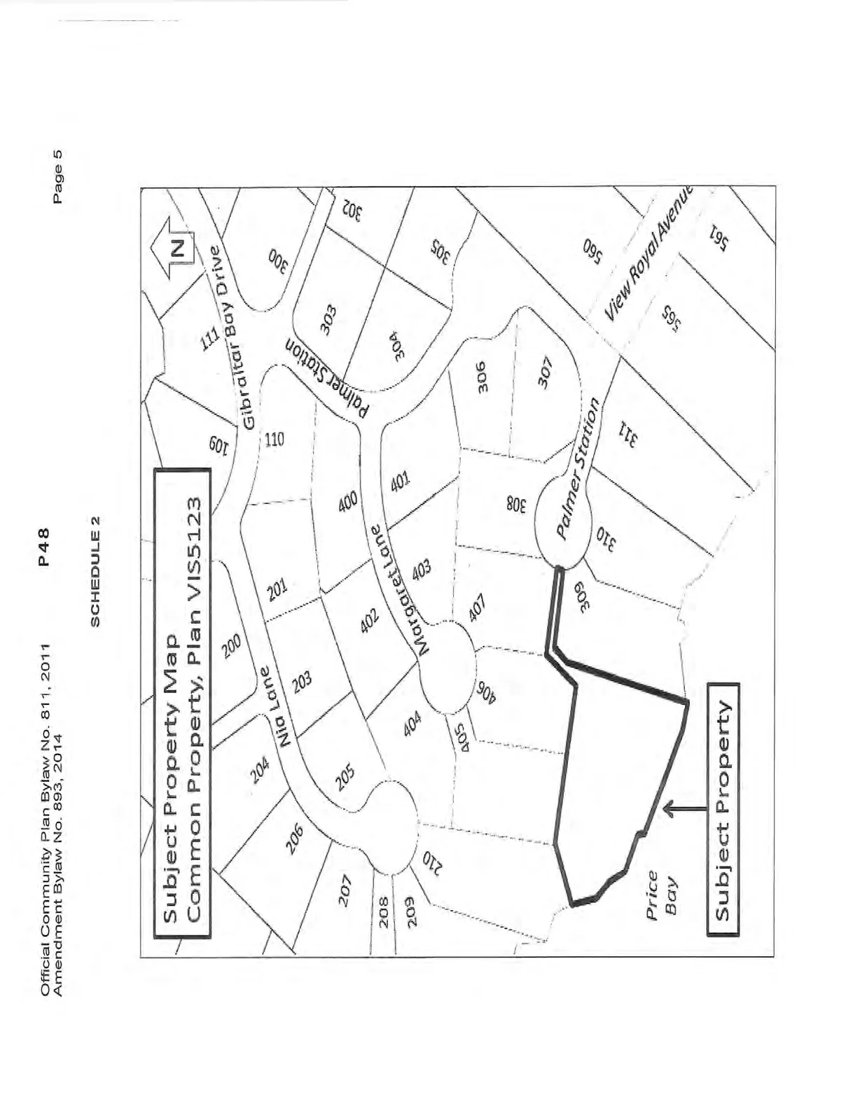
Page 51–54
SCHEDULE 3
Subject Property Map
Lot 35, Sec. 98, Esquimalt District, Plan 748 except Plan VIP71970
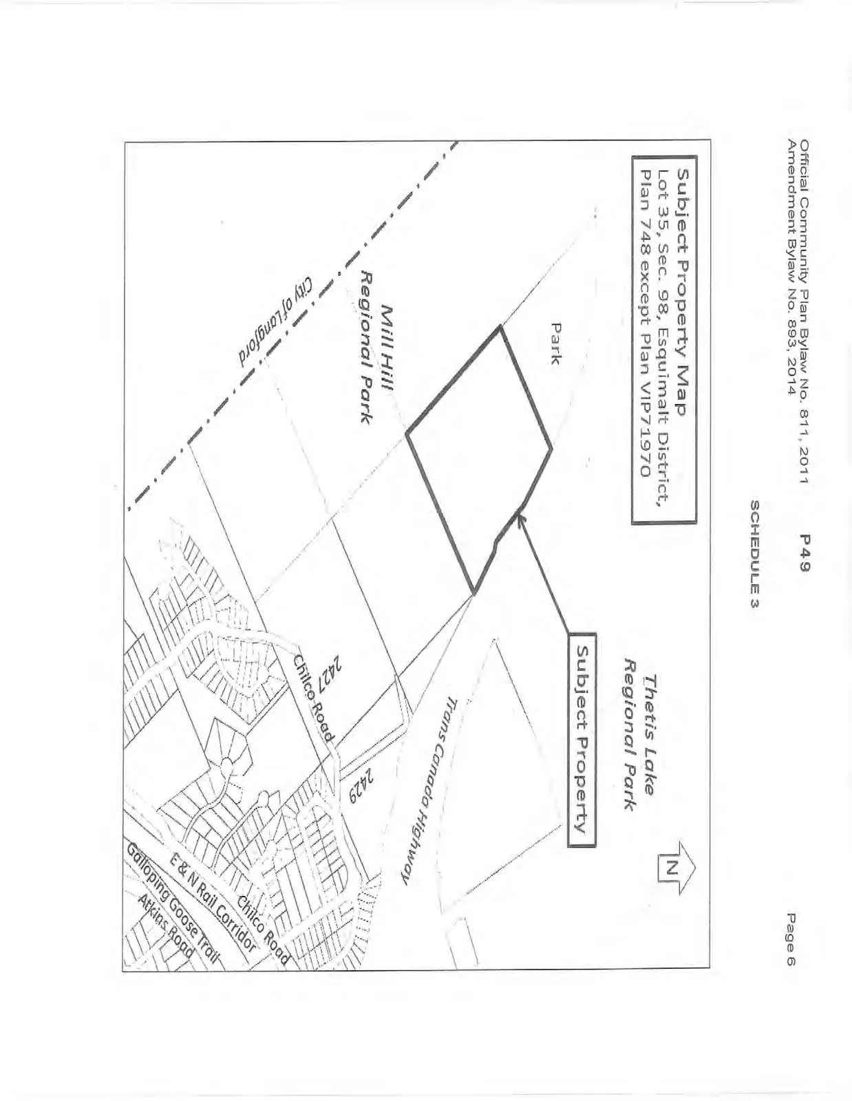
Page 51–54
SCHEDULE 4
Subject Property Map – 380 Kislingbury Lane
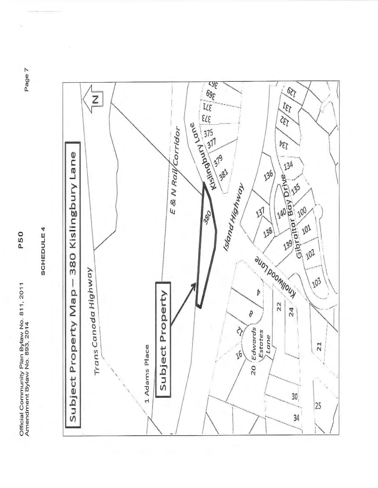
Page 51–54
Extracted from: 2014 09 16 Council Agenda