Appendix
Attachment 2. Thetis Vale Phase 6 - Conceptual Site Plan
July 15, 2014Pages 19–201 section
Conceptual drawing showing the proposed lot layout and road realignment for Phase 6.
Thetis Vale Phase 6Limona Construction
THETIS VALE PHASE 6 - OVERALL SITE PLAN CONCEPTUAL DRAINAGE
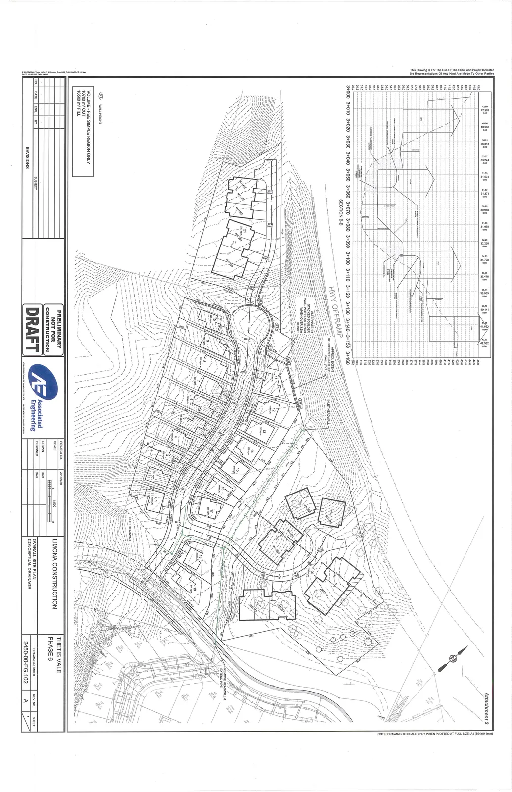
Project Information
| Field | Detail |
|---|---|
| Project | LIMONA CONSTRUCTION |
| Location | THETIS VALE PHASE 6 |
| Drawing Title | OVERALL SITE PLAN CONCEPTUAL DRAINAGE |
| Project No. | 20132400 |
| Drawing Number | 2450-00-FG.102 |
| Revision | A |
| Scale | 1:500 |
| Drawn/Designed | DAH |
| Status | PRELIMINARY NOT FOR CONSTRUCTION DRAFT |
Site Data and Notes
Volume - Fee Simple Region Only
- 10700 m³ CUT
- 16500 m³ FILL
Key Map Labels and Notes
- HWY OFFRAMP: Location of Section B-B profile.
- Alternate 1: Stacked boulder wall with 1.0m bench when over 3.5m height.
- Approx extent of concrete-infilled wall.
- Inlet headwall.
- Remove headwall & extend pipe.
- Wall height markers (referenced with a diamond symbol).
Section B-B Details
A cross-sectional profile titled "SECTION B-B" shows elevation data for the HWY OFFRAMP from station 3+000 to 3+160. Elevations range approximately from 30.0m to 45.0m.
THIS PAGE INTENTIONALLY LEFT BLANK
Page 19–20
Extracted from: 2014 07 15 Council Agenda