This site is in beta — data may be incomplete and features are still being added.
Council Meeting/Documents/Attachment 2 Air photo
Appendix

Attachment 2 Air photo

January 18, 2022Page 1691 section

An aerial photograph highlighting the three lots involved in the rezoning application for 167, 169, and 171 Island Highway.

Aerial view of subject properties

Attachment 2

Air photo
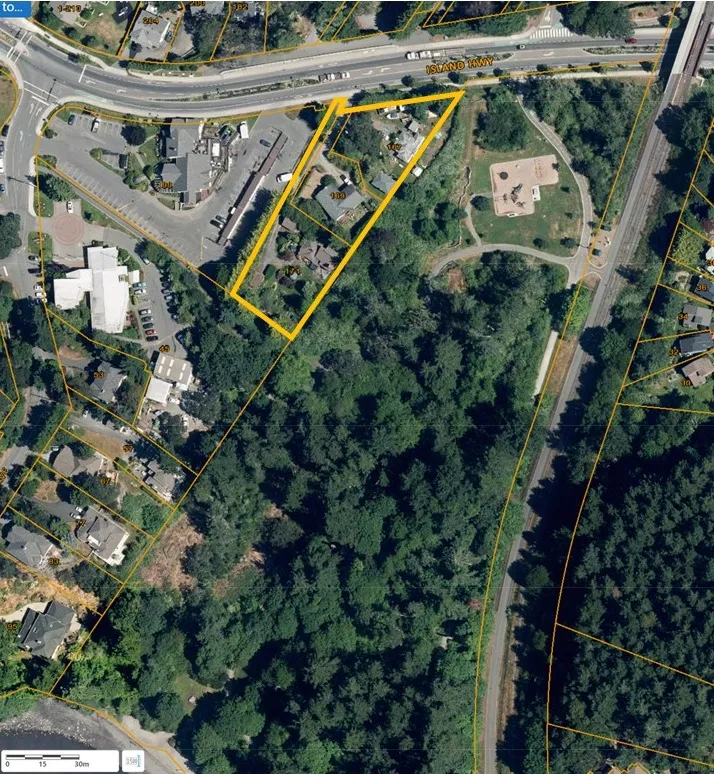
Aerial photograph showing a subject property highlighted with a yellow border, located south of Island Highway and adjacent to a park and forested area.
Page 169
Extracted from: 2022 01 18 Council Agenda - Agenda - Pdf