Attachment 4 Architectural Plans
A set of architectural drawings for 'Portage Park Residences,' including site plans, renderings, elevations, and floor plans.
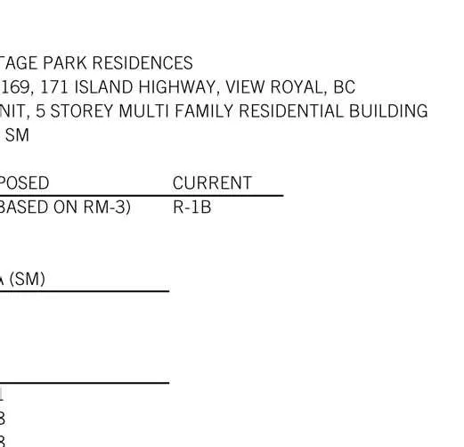
This document details the project proposal for Portage Park Residences, a 5-storey, 82-unit multi-family residential building located at 167, 169, 171 Island Highway, View Royal, BC.
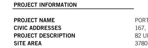
Project Information
- Project Name: Portage Park Residences
- Civic Addresses: 167, 169, 171 Island Highway, View Royal, BC
- Project Description: 82 Unit, 5 Storey Multi-Family Residential Building
- Site Area: 3780 SM
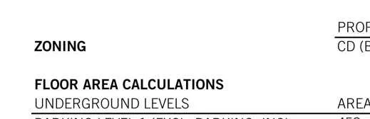
Zoning
- Proposed: CD (Based on RM-3)
- Current: R-1B
Floor Area Calculations
Underground Levels
| Level | Area (SM) |
|---|---|
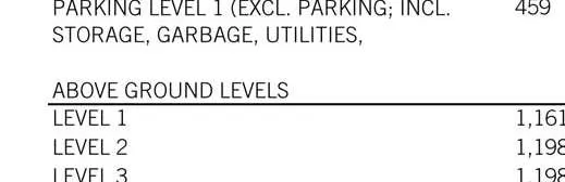
| Parking Level 1 (Excl. Parking; Incl. Storage, Garbage, Utilities) | 459 |
Above Ground Levels
| Level | Area (SM) |
|---|---|
| Level 1 | 1,161 |
| Level 2 | 1,198 |
| Level 3 | 1,198 |
| Level 4 | 1,198 |
| Level 5 | 1,101 |
| Total Above Ground Floor Area | 5,857 |
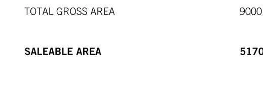
- Total Gross Floor Area (Max 6049): 6026
- Total Gross Parking Area: 2974
- Total Gross Area: 9000
Saleable Area: 51,701 SF Efficiency:
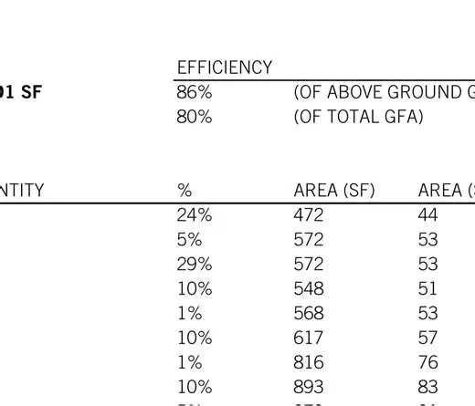
- 86% (of Above Ground GFA)
- 80% (of Total GFA)
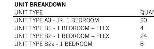
Unit Breakdown
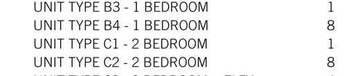
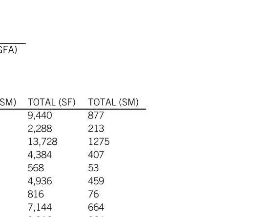
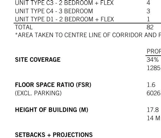
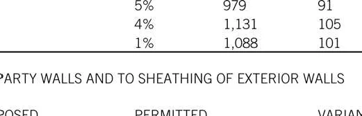
| Unit Type | Quantity | % | Area (SF) | Area (SM) | Total (SF) | Total (SM) |
|---|---|---|---|---|---|---|
| Unit Type A3 - JR. 1 Bedroom | 20 | 24% | 472 | 44 | 9,440 | 877 |
| Unit Type B1 - 1 Bedroom + Flex | 4 | 5% | 572 | 53 | 2,288 | 213 |
| Unit Type B2 - 1 Bedroom + Flex | 24 | 29% | 572 | 53 | 13,728 | 1275 |
| Unit Type B2a - 1 Bedroom | 8 | 10% | 548 | 51 | 4,384 | 407 |
| Unit Type B3 - 1 Bedroom | 1 | 1% | 568 | 53 | 568 | 53 |
| Unit Type B4 - 1 Bedroom | 8 | 10% | 617 | 57 | 4,936 | 459 |
| Unit Type C1 - 2 Bedroom | 1 | 1% | 816 | 76 | 816 | 76 |
| Unit Type C2 - 2 Bedroom | 8 | 10% | 893 | 83 | 7,144 | 664 |
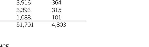
| Unit Type C3 - 2 Bedroom + Flex | 4 | 5% | 979 | 91 | 3,916 | 364 |
| Unit Type C4 - 3 Bedroom | 3 | 4% | 1,131 | 105 | 3,393 | 315 |
| Unit Type D1 - 2 Bedroom + Flex | 1 | 1% | 1,088 | 101 | 1,088 | 101 |
| Total | 82 | 100% | 51,701 | 4,803 | ||
| *Area taken to centre line of corridor and party walls and to sheathing of exterior walls. |
Site Metrics
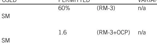
- Site Coverage: Proposed 34% (1285 SM); Permitted 60% (RM-3)
- Floor Space Ratio (FSR): Proposed 1.6 (6026 SM); Permitted 1.6 (RM-3+OCP)
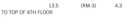
- Height of Building (M): Proposed 17.8 (14 M to top of 4th floor); Permitted 13.5 (RM-3). Variance: 4.3.
Setbacks + Projections
| Metric | Proposed (M) | Permitted (M) |
|---|---|---|
| Front Lot Line | 7 | 9 & 1.5 (RM-3) |
| West Side Lot Lines | 4 | 8.4 (RM-3) |
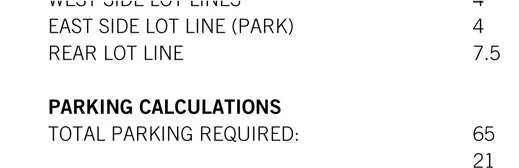
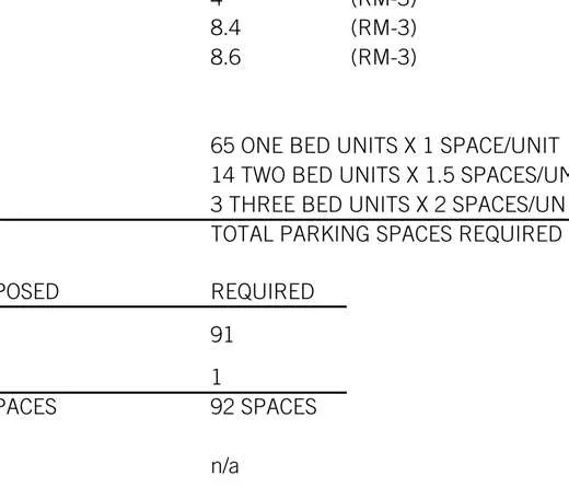
| East Side Lot Line (Park) | 4 | 8.4 (RM-3) |
| Rear Lot Line | 7.5 | 8.6 (RM-3) |
Parking Calculations
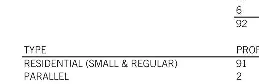
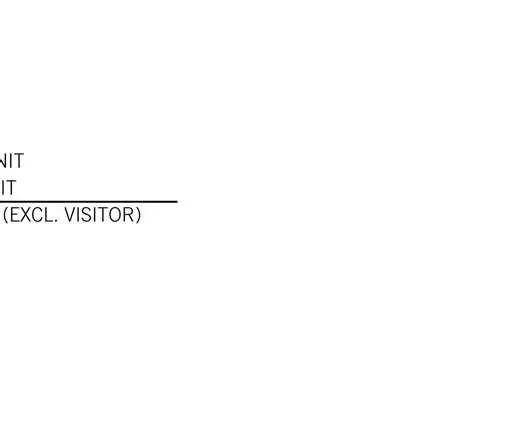
- Total Parking Required: 92 Spaces
- 65 One Bed Units x 1 Space/Unit
- 14 Two Bed Units x 1.5 Spaces/Unit
- 3 Three Bed Units x 2 Spaces/Unit
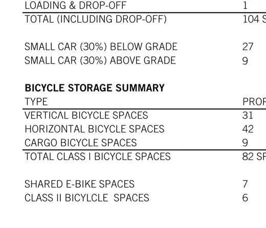
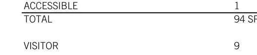
- Total Parking Proposed: 94 Spaces (Residential), 9 Visitor, 1 Loading/Drop-off. Total: 104 Spaces.
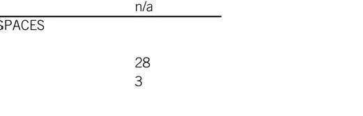
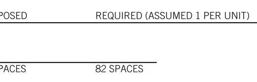
- Bicycle Storage Summary: Proposed 82 Class I spaces (31 vertical, 42 horizontal, 9 cargo), 7 shared e-bike spaces, and 6 Class II spaces.
Building Code Information
- Code: Part 3 2018 BCBC
- Construction Type: Combustible
- Sprinklered: Yes (NFPA 13)
- Fire Resistance Ratings: Floor, Roof, Between Suites, and Corridors all 1 HR.
- Occupant Load: 208
Survey and Context Plans
[Image 37, 38, 39, 40, 43, 44, 46, 48, 54, 55, 59, 62, 63, 64, 65, 66, 68, 70, 71, 72, 73, 76, 77, 78, 79, 81, 82, 108, 111, 112, 113, 116, 117, 118, 119, 120, 121, 122, 125, 126, 127: Tree symbols from topographic survey] [Image 41, 42, 110: Shrub symbols from survey] [Image 49, 50, 51, 52, 53, 83, 84, 85, 86, 87, 88, 89, 90, 91, 92, 93, 94, 95, 96, 97, 98, 99, 100, 101, 102, 104, 105, 106, 107: Vegetative ground cover symbols]
The survey plan covers Lot 2, Lot A, and Lot B of Plan 34942. The context plan shows the site's proximity to the Four Mile House Pub, View Royal Town Hall, and Portage Park.
Site Plan and Sections
The site plan features a building footprint with a parkade entry from Island Highway, an amenity pavilion, and connections to the adjacent park.
Grade Calculation
- Average Existing Grade: 13.6m (based on four perimeter points)
Site Sections
Section 2 shows the height relationship between the proposed building (31.3m top of roof) and the existing Four Mile House (28.8m top of roof).
Architectural Renderings
- Aerial Rendering:
3D perspective showing the building's integration with Portage Park and Island Highway - Southwest Facing: [Image 140, 141, 142: Street-level view of the modern architecture with curved balconies and masonry base]
- East Facing: Street view rendering showing the relationship with the Four Mile House.
Material Palette
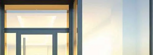
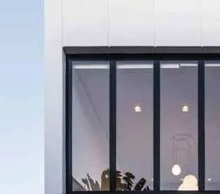
- Glazing: Black vinyl windows [Image 140] and black storefront windows.
- Siding: White fibre cement board & batten [Image 134] and white fibre cement panels [Image 138].
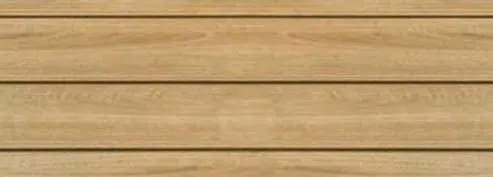
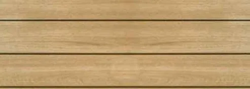
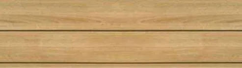
- Accents: Wood soffits [Image 135] for balcony undersides.
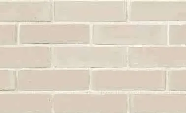
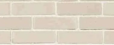
- Masonry: Tan brick veneer [Image 151] for the ground floor level.
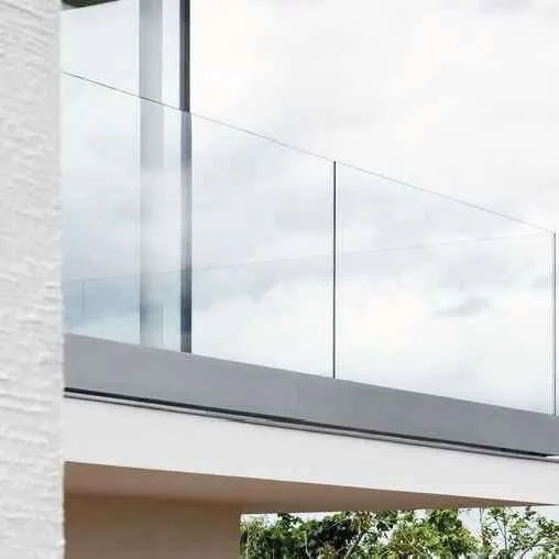
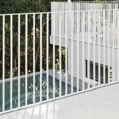
- Railings: Clear glass railings [Image 146] and white metal picket guard rails [Image 147].
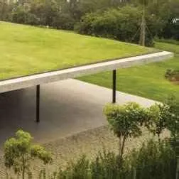
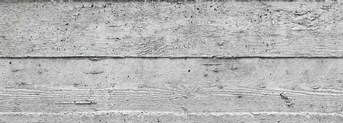
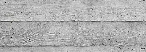
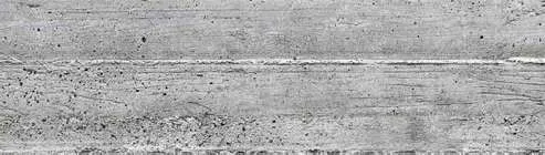
- Landscape: Boardform concrete planters [Image 143] and a landscape pavilion with a green roof [Image 148].
Floor Plans
Level P1 Plan (Parkade)
Contains 94 residential parking stalls, 82 Class I bike spaces, storage lockers, and garbage room. Garbage Room Bin Requirements: 1 Garbage (6yd), 3 Cardboard (3yd), 4 Mixed Containers (360L), 3 Mixed Paper (360L), 4 Food (240L), and 1 Glass (240L).
Levels 1 - 4 Plans
These levels contain a mix of JR 1 Bedroom, 1-Bedroom + Flex, 2-Bedroom, and 3-Bedroom units arranged around a central corridor with balconies for every unit.