Appendix
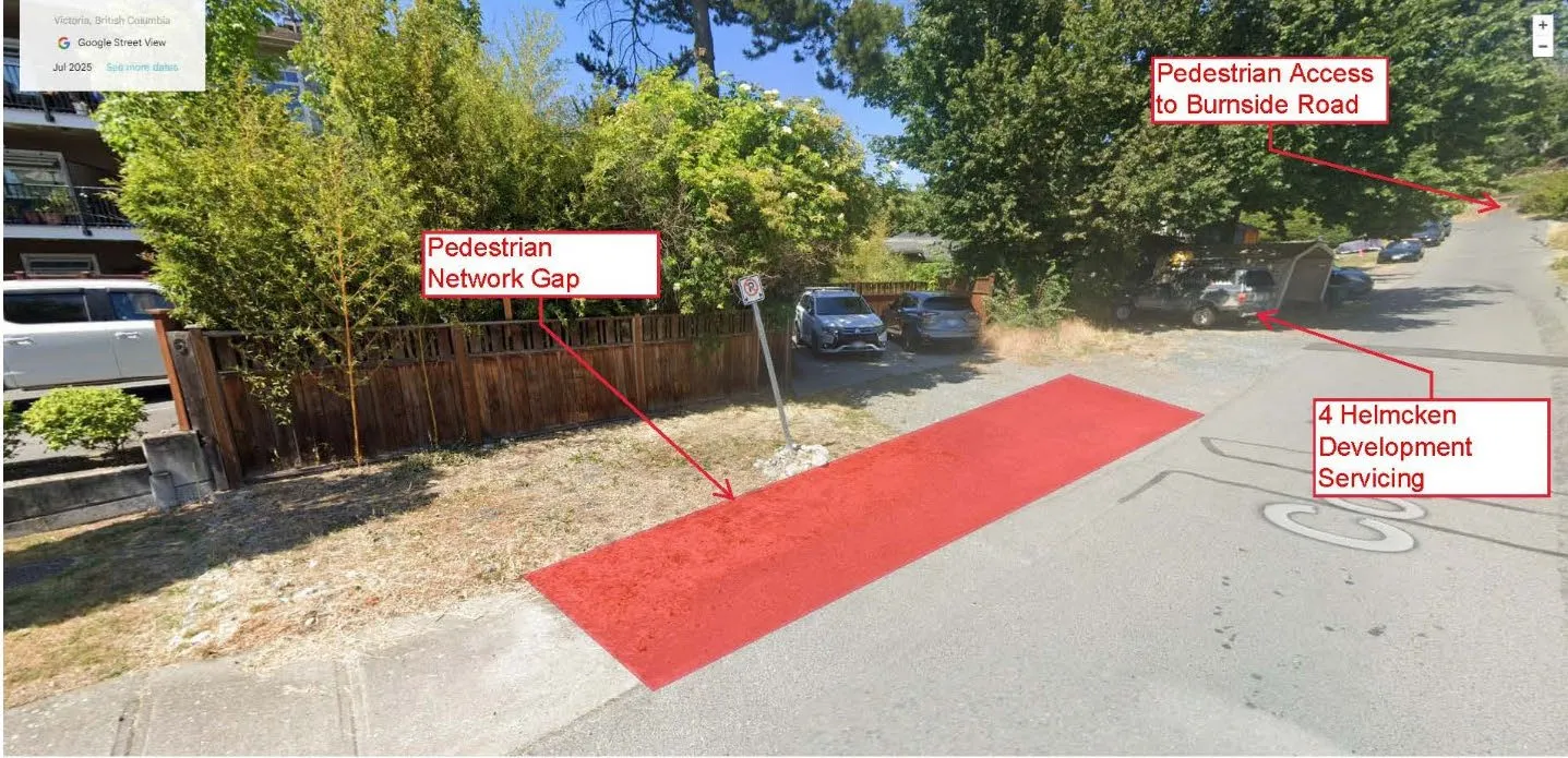
ATTACHMENT 2: PHOTO OF SIDEWALK NETWORK GAP
October 7, 2025Page 721 section
Ground-level photograph illustrating the current gap in the sidewalk network.
Visual confirmation of the unpaved pedestrian gap
Report to Council
Re: Sidewalk Extension Request – Conard Street Meeting Date: October 21, 2025
Page 72
Extracted from: 2025 10 07 Council Agenda - Agenda - Pdf