This site is in beta — data may be incomplete and features are still being added.
Special Council/Documents/Appendix 1 Map 1 (Attachment 3 to May 7 Report)
Appendix

Appendix 1 Map 1 (Attachment 3 to May 7 Report)

June 11, 2024Page 2471 section

Appendix 1 Map 1

TOWN OF VIEW ROYAL

Prescribed Frequent Transit Stops
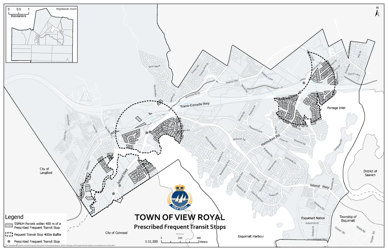
Map of the Town of View Royal illustrating Prescribed Frequent Transit Stops, their 400m buffer zones, and the affected SSMUH parcels. The map includes geographic labels for surrounding areas like the City of Langford, City of Colwood, Esquimalt Harbour, Esquimalt Nation, Township of Esquimalt, District of Saanich, and Portage Inlet, along with an inset for the Highlands area.

Legend

  • SSMUH Parcels within 400 m of a Prescribed Frequent Transit Stop
  • Frequent Transit Stop 400m Buffer
  • Prescribed Frequent Transit Stop

Scale 1:11,500 0, 240, 480 Meters

The boundaries shown on this map are intended to be approximate. Minor changes will be permitted without amendments to this plan.

Page 247
Extracted from: 2024 06 11 Special Council Agenda - Agenda - Pdf