Town of View Royal OFFICIAL COMMUNITY PLAN DRAFT JUNE 2022
The draft version of the Official Community Plan document, providing long-range policies for growth, housing, transportation, and climate action.
Town of View Royal OFFICIAL COMMUNITY PLAN
DRAFT - JUNE 2022
TABLE OF CONTENTS
PART 1: INTRODUCTION
- OVERVIEW
- PLANNING PROCESS
- ABOUT VIEW ROYAL
- COMMUNITY VISION STATEMENT
- UNDERSTANDING VIEW ROYAL’S LOW-CARBON FUTURE
- REGIONAL CONTEXT STATEMENT
PART 2: THEMATIC POLICIES
- LAND USE AND URBAN DESIGN
- OVERVIEW
- VIEW ROYAL TODAY
- COMMUNITY DEVELOPMENT FRAMEWORK
- LAND USE DESIGNATIONS
- COMMUNITY-WIDE OBJECTIVES AND POLICIES
- TRANSPORTATION AND MOBILITY
- OVERVIEW
- VIEW ROYAL TODAY
- OBJECTIVES AND POLICIES
- HOUSING
- OVERVIEW
- VIEW ROYAL TODAY
- OBJECTIVES AND POLICIES
- ECONOMIC DEVELOPMENT
- OVERVIEW
- VIEW ROYAL TODAY
- OBJECTIVES AND POLICIES
- NATURAL ENVIRONMENT, ENERGY AND CLIMATE CHANGE
- OVERVIEW
- VIEW ROYAL TODAY
- NATURAL ENVIRONMENT OBJECTIVES AND POLICIES
- ENERGY AND CLIMATE CHANGE OBJECTIVES AND POLICIES
- PARKS AND RECREATION
- OVERVIEW
- VIEW ROYAL TODAY
- OBJECTIVES AND POLICIES
- COMMUNITY INFRASTRUCTURE AND SERVICES
- OVERVIEW
- VIEW ROYAL TODAY
- OBJECTIVES AND POLICIES
- COMMUNITY FACILITIES AND WELLBEING
- OVERVIEW
- OBJECTIVES AND POLICIES
PART 3: DEVELOPMENT PERMIT AREAS
- JUSTIFICATION AND AUTHORITY
- FORM AND CHARACTER OF DEVELOPMENT
- DEVELOPMENT PERMIT AREA: MIXED RESIDENTIAL
- DEVELOPMENT PERMIT AREA: INTENSIVE RESIDENTIAL
- DEVELOPMENT PERMIT AREA: NEIGHBOURHOOD MIXED RESIDENTIAL USE
- DEVELOPMENT PERMIT AREA: INTENSIVE MIXED-USE
- DEVELOPMENT PERMIT AREA: COMMERCIAL
- DEVELOPMENT PERMIT AREA: NATURAL WATERCOURSE AND SHORELINE AREAS
- DEVELOPMENT PERMIT AREA: SENSITIVE TERRESTRIAL ECOSYSTEMS
- DEVELOPMENT PERMIT AREA: NATURAL HAZARD FIRE INTERFACE ZONE
GLOSSARY OF TERMS APPENDIX SCHEDULES
PART 1: INTRODUCTION
- OVERVIEW
- PLANNING PROCESS
- COMMUNITY VISION STATEMENT
- ABOUT VIEW ROYAL
- COMMUNITY VISION STATEMENT
- CLIMATE ACTION PLAN
- REGIONAL CONTEXT STATEMENT
OVERVIEW
WHAT IS AN OCP AND WHO IS IT FOR?
This Official Community Plan (OCP) is the culmination of a year of work with community members across View Royal. The OCP sets a course of what View Royal will be like in 10 years and beyond, and the steps that will be taken to get there. The OCP also sets the stage for the continued evolution of View Royal, as the community transitions from a suburban community to more urban future that adapts to change and protects what is cherished. This plan recognizes that there will be a need to rise to the significant challenges and opportunities of our time and is grounded in realistic climate actions for View Royal’s future. A commitment to long-term action is reflected in this plan.
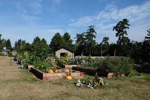
THE OCP INFLUENCES HOW RESIDENTS LIVE, WORK, SHOP, PLAY, ACCESS SERVICES AND MOVE AROUND THE COMMUNITY, AND WITHIN THE REGION. THE OCP REFLECTS VIEW ROYAL’S DESIRED FUTURE DIRECTIONS, AND ITS GREATER REGIONAL CONTEXT IN THE CAPITAL REGION.
The OCP is a bylaw, prepared and adopted by Town of View Royal Council in compliance with the Local Government Act. It is a long-range policy plan that guides View Royal’s decision-making related to growth and development approvals, as well as other community interests such as housing, transportation, climate change, and infrastructure. The plan considers that View Royal is expected to be home to 4,000 more residents – from today’s population of ~11,000 to ~15,000 - by 2036 (BC Stats Population Projections, 2016).
The OCP is a policy document for the Town of View Royal and is to be implemented by all departments. This plan provides strategic direction for Town Council and staff, who apply the OCP vision and policies to a wide range of municipal decisions such as budgeting, servicing, capital projects, and in the review of land use and development applications and proposals. The OCP builds on the Town’s Master Plans and policies to provide higher level strategic direction.
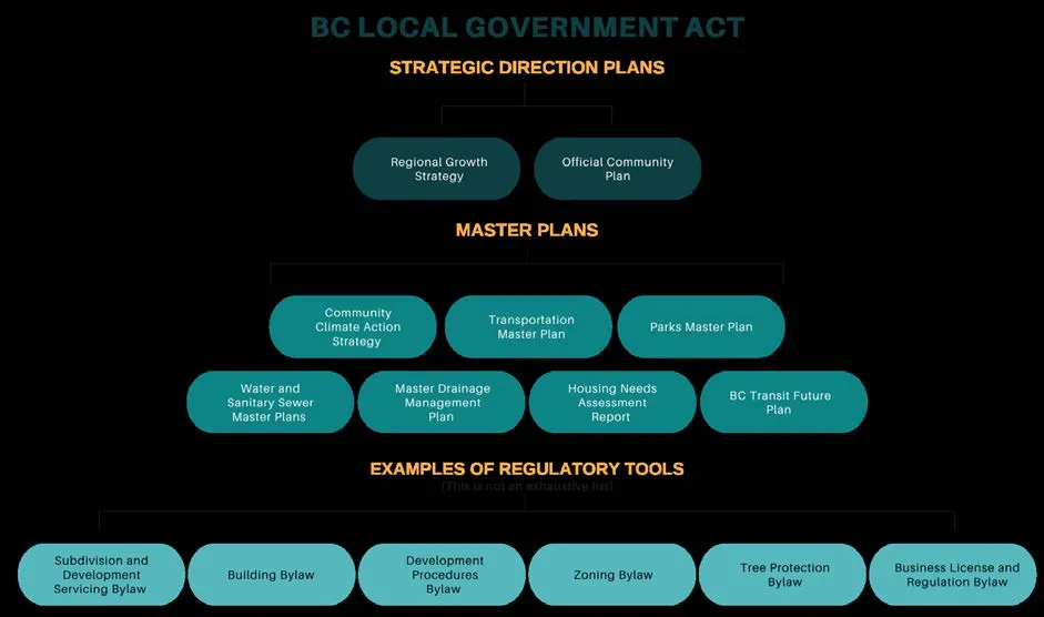
HOW DOES THE OCP FIT INTO THE TOWN OF VIEW ROYAL PLANS AND REGULATORY TOOLS?
The illustration below summarizes the OCP’s context and where it fits in with other plans and regulatory tools:
CREATING THIS PLAN
PLANNING PROCESS
The Town of View Royal thanks all who contributed their voices, perspectives, lived experiences, and time to the OCP review process.
The OCP update was featured on the Town of View Royal’s website and throughout the review, there were social media posts, advertisements, direct mail, signs at park entrances and notices sent through stakeholder networks.
The OCP review occurred over the course of one year, starting in June 2021. Various adjustments were made in the delivery of the consultations to follow current COVID-19 health protocols.
TIMELINE 2021/2022
- SEPT 2021: Topic focused 2-page primers on key issues were prepared to support shared understanding in the public consultations.
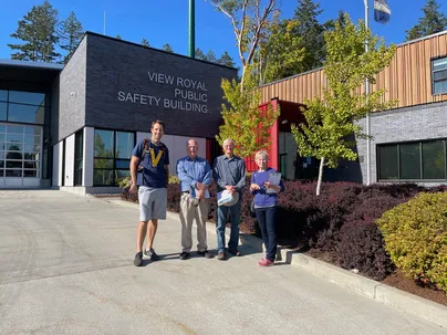
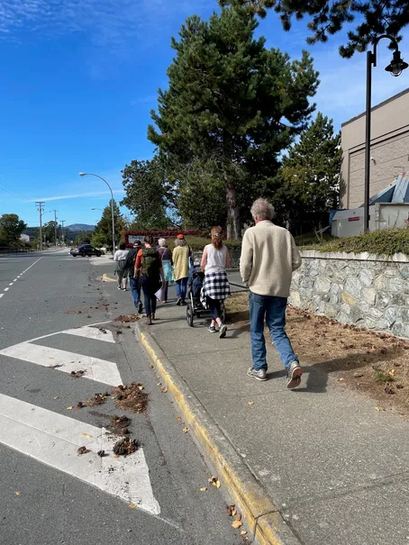
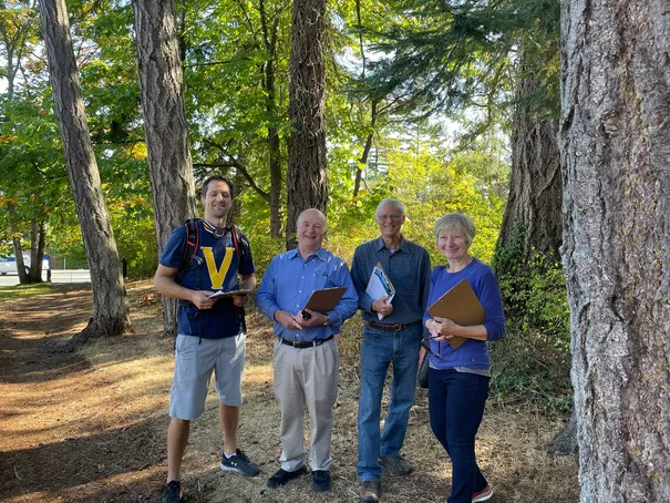
- SEPT 2021: From September 12-29, 10 walkshops were held in 5 neighbourhoods: Admirals Portage, Harbour/ Firehall, Helmcken, Hospital, Island Hwy/ Casino.
- OCT/NOV 2021: 169 community members participated in Phase 2 online survey.
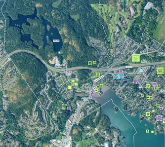
- NOV 2021: 29 people participated in 3 online workshops via Zoom and Mural.
- DEC 2021: What we Heard Phase 1 Consultation Report was completed.
- JAN 2022: Newsletters were mailed to all residents; signs placed in parks for Phase 2 consultation.
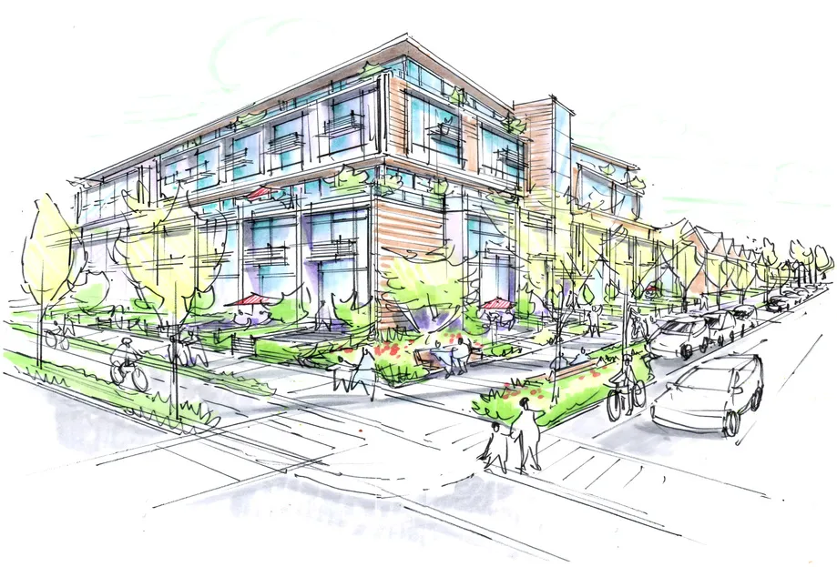
- JAN/FEB 2022: 51 people participated in 3 online workshops focused on gathering views on design and transitions to direct future growth.
- FEB 2022: 308 community members participated in Phase 2 online survey.
- MAR 2022: Meeting with Town Council Committee of the Whole to seek guidance on key directions for updating the OCP.
- MAR/APR 2022: Drafting the OCP.
- JUNE 2022: Draft OCP for Referrals and Legal Review.
- TBD: Final OCP adopted by Council.

ABOUT VIEW ROYAL
This is the homeland of the lək̓ʷəŋən speaking peoples, known today as the Esquimalt Nation and Songhees Nation. Their original village sites and later Reserve lands were in Victoria’s Inner Harbour, but were “moved” to View Royal in 1911. Lək̓ʷəŋən families have gathered and harvested in the area now known as View Royal, since time immemorial, crossing an isthmus, now Portage Park, to harvest seafood in Portage Inlet. Lək̓ʷəŋən is the word for “a place to smoke herring”.
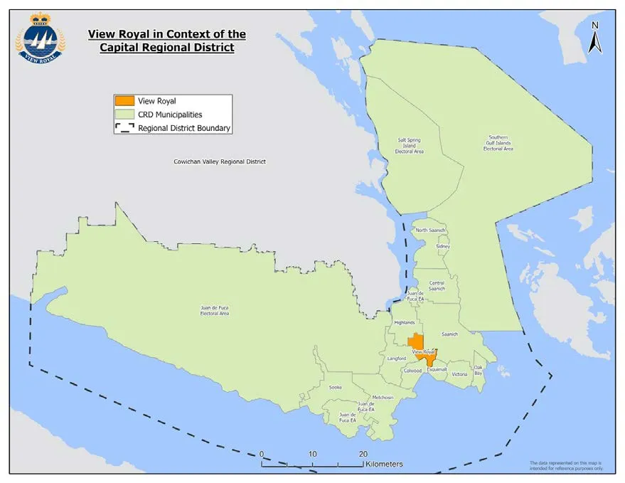
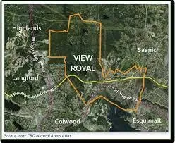
Today, View Royal is a largely residential community of ~11,000 people in the centre-west part of the Capital Region. The Town shares boundaries with several other jurisdictions – Esquimalt Nation and Songhees Nation, Saanich, Langford, Colwood, Highlands. The municipality was incorporated in December 1988; previously, it had been an Electoral Area of the Capital Regional District (CRD).
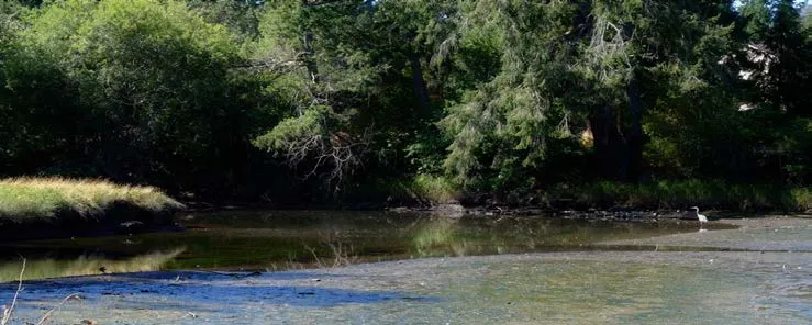
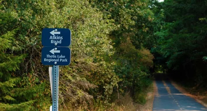
The form and character of View Royal has been shaped by a rich variety of ecosystems and natural environments. Today, close to 40% of the Town’s land base is parks - the largest being Thetis Lake and Mill Hill Regional Parks. View Royal has diverse shorelines including the salt-water environment of Esquimalt Harbour and Portage Inlet, the blending of salt and fresh waters in Craigflower and Millstream Creeks and their estuaries, and the freshwater ecosystems of Thetis, Prior and McKenzie Lakes.
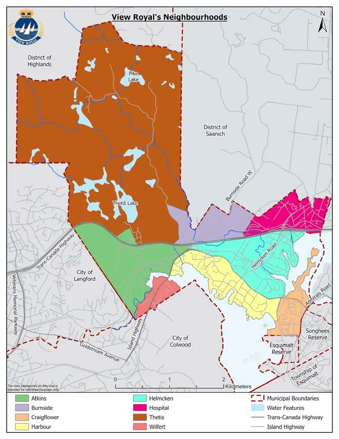
The Town is traversed by three major transportation routes – Highway 1 (Trans-Canada Highway), the Island Highway, and the E & N (Esquimalt and Nanaimo) rail line. These routes have significantly impacted the development patterns of View Royal for several decades. View Royal has historically referred to being formed by 8 neighbourhoods, who’s boundaries are often defined by natural features and roadways.
Urban development in View Royal dates from the 1930’s when homes and cottages were built along Esquimalt Harbour and Portage Inlet. Much of View Royal was developed in the 1960s and 1970s. The lack of sewers postponed development during the late 1980s and early 1990s. In 1998, trunk sewers were extended through View Royal. The extension of services provided opportunity for new development and redevelopment at higher densities in some parts of View Royal.
Victoria General Hospital is centrally located in View Royal. This regional facility accounts for at least one-third of the approximately 4,000 jobs in View Royal. Despite the high number of jobs in View Royal, relatively few people (7.5% of the population) live and work in the Town.
The tax base in View Royal is mostly residential. The residential sector accounts for 74% of the municipal tax base. The business sector accounts for 25%.
The adoption of the 2011 OCP allowed View Royal to manage substantial residential growth. Like many communities, the Town is facing significant housing pressures due to population growth, a rapidly escalating housing market, and changing demographics.
VIEW ROYAL AT A GLANCE
POPULATION, EMPLOYMENT, HOUSING & LAND
POPULATION AND DEMOGRAPHICS
The 2021 census data has View Royal’s population at 11,575 people. The Capital Regional District (CRD) estimates that View Royal’s population will keep growing over the next 20 years at an average growth rate of 1.9%.
POPULATION AGE
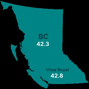
- Average age of the population in View Royal is 42.8 years old compared to 42.3 in the province.
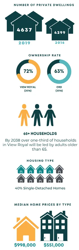
- The Town of View Royal has an aging population— projections show that by 2038 over one-third of households in View Royal will be led by adults 65+.
DEMOGRAPHICS
- Approximately 16% of the population has indicated they are immigrants.
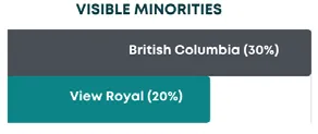
- 20% of the population have indicated they are a visible minority.
- 5% have indicated they are First Nations, Inuit, or Métis.
HOUSEHOLD SIZE
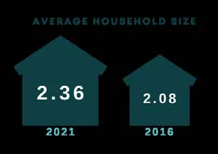
- Average household size in View Royal was 2.36 people in 2019 and is expected to decrease to 2.08 people by 2036.
- ½ of new households by 2040 are expected to be non-family households.
EMPLOYMENT
- There is a 66% participation rate in the labour force with a total working population in View Royal of 5550.
- 64% of View Royal residents are employed, with an unemployment rate of 3.8% (2016).
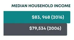
- Median household income has increased from $79,534 in 2006 to $83,968 in 2016.
HOUSING
- View Royal had 4637 private dwellings in 2019.
- The Town has a high ownership rate of 72% (2016), compared to 63% in the CRD.
- Estimated 1,191 renter households in 2019 (approx. 28%).
- Rental housing availability rate is 0.7% (Healthy rate is 3-5%).
- View Royal’s dominant housing stock is single-detached homes at 40%.
- 83% of View Royal’s housing stock is ground-oriented.
- Median single detached home cost is $998,000 and condo/ townhouse median price is $551,000 (2021 BC Assessment).
LAND
- The land area of View Royal is 16.2 square kilometres. Over 40% of the Town land area is protected natural areas or parks.
- The population density was 807.6 people per square kilometre in 2021.
- Future development will largely be redevelopment and infill within the Urban Containment Boundary.
COMMUNITY VISION STATEMENT
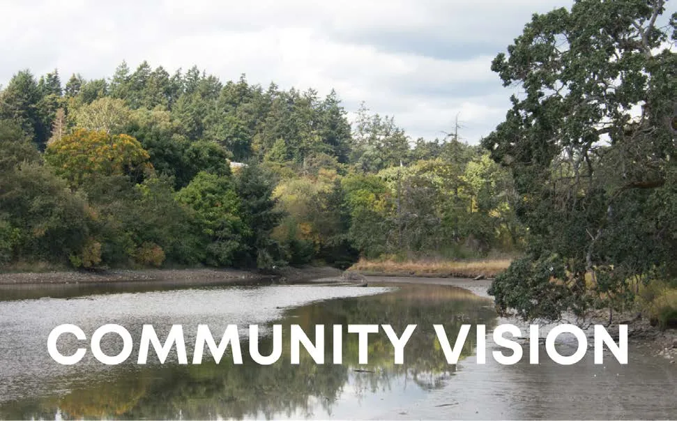
The following statement sets out the community’s aspirations for what type of place View Royal wishes to be in 10 years and beyond. It describes the state of the community that residents wish for View Royal to evolve to in the future.
VIEW ROYAL IS A DYNAMIC AND INCLUSIVE COMMUNITY THAT MANAGES GROWTH, WHILE RETAINING THE CHARM OF ITS NEIGHBOURHOODS. It is home and workplace to people from all walks of life. Its neighbourhoods are attractive, affordable, walkable and safe. Each neighbourhood has an identifiable character and is connected to nearby centres through parks, greenspaces, and pedestrian/cyclist-friendly streets.
VIEW ROYAL RECOGNIZES THE IMPACTS OF CLIMATE CHANGE. The Town, developers, residents, and partners respond collectively by advancing energy-efficient buildings, improving sustainable transportation options, and protecting View Royal’s urban forests, parks, and shoreline environments.
Infill redevelopment, mixed-use developments, increased transit accessibility, and transportation alternative investments will support View Royal in advancing meaningful climate actions. Getting around safely by foot, bike, bus, and train is convenient and enjoyable, and a viable alternative to car travel.
THE LOCAL ECONOMY IS DIVERSIFIED AND STRONG, PROVIDING EMPLOYMENT, SHOPPING, AND SERVICE OPTIONS TO LOCAL AND REGIONAL RESIDENTS. The areas around the hospital and the casino continue to evolve to provide local employment and service opportunities.
THE TOWN IS ENDOWED WITH UNIQUE NATURAL ENVIRONMENTS – Thetis Lake Park, Millstream Creek, Craigflower Creek, Esquimalt Harbour and Portage Inlet. The integrity and beauty of these natural amenities are protected and enhanced.
VIEW ROYAL, IN EMBRACING FISCAL SUSTAINABILITY AND ECONOMIC WELLNESS, “LIVES WITHIN ITS MEANS” AND ADAPTS TO CHANGE.
TEN GOALS EXPAND ON THE VISION:
- Promote a strong sense of community in all areas and neighbourhoods of the Town and create an enhanced sense of place and identity.
- Create an inclusive community that provides housing, transportation and healthy living options and services, and facilities for families and individuals of diverse backgrounds, cultures, ages, and economic means.
- As the community grows, recognize the unique relationship between the highly valued natural and residential characteristics of View Royal, and maintain these values.
- Confirm View Royal as an environmentally responsible community committed to becoming a more sustainable place, taking meaningful actions to address climate change.
- With humility, continue to build trust, meaningful relations and reconciliation with friends and neighbours, Esquimalt Nation and Songhees Nation.
- Recognize, preserve, and protect the substantial historic and cultural resources in View Royal.
- Ensure that community services and amenities can be provided within the financial means of the municipality and strengthen partnerships with regional service providers to increase local opportunities.
- Identify suitable land areas and development incentives for commercial, institutional, and mixed-use activities as a means of supplying local employment opportunities, broadening the municipal tax base, and promoting View Royal as a business-friendly community.
- Recognize the community’s role in the region as a link in major transportation and environmental systems and cooperate with other municipalities and governments to both address regional issues and protect and promote local values and long-term sustainability.
- Ensure all citizens of View Royal have opportunities to be informed and meaningfully involved in planning and decision-making processes.
UNDERSTANDING VIEW ROYAL’S LOW-CARBON FUTURE
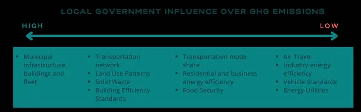
The Town of View Royal has joined over 1,500 jurisdictions around the world in declaring a climate emergency. In 2022, View Royal completed a Climate Action Strategy.
View Royal can reduce its GHG emissions by an estimated 36% below 2007 levels by 2030, and work towards the new long-term target of a reduction of 100% below 2007 levels by 2050.
HOW WE WORK TOGETHER
REGIONAL CONTEXT STATEMENT
The Capital Regional District (CRD) Regional Growth Strategy (RGS) was adopted March 2018 (Bylaw 4017). The View Royal Official Community Plan (OCP) must be consistent with the RGS through its vision, goals, objectives, and policies.
ALIGNMENT WITH THE REGIONAL GROWTH STRATEGY
The Town’s profile within the RGS vision is described as:
“View Royal will have a series of economic centres providing expanded retail, professional financial and convenience services. Single family detached housing will remain the predominant housing form with some provision made for other types of housing. A network of foot and cycle paths will provide neighbourhoods with access to shopping, recreation, and natural open space. Natural amenities associated with shorelines, streams, estuaries, hillsides, and forested areas will be protected.”
The OCP direction is to focus future growth in neighbourhood centres and community corridors, located within the urban containment boundary.
PART 2: THEMATIC POLICIES
- LAND USE AND URBAN DESIGN Community Development Framework; Neighbourhood Centres and Community Corridors
- TRANSPORTATION AND MOBILITY Transportation linkages for priority of movement – pedestrian, cycling, transit, and vehicles
- HOUSING Neighbourhood centres – directing future residential growth, with services and transit.
- ECONOMIC DEVELOPMENT Community corridors – where future businesses opportunities and employment areas will grow.
- NATURAL ENVIRONMENT, ENERGY AND CLIMATE CHANGE Ecological assets. Greenhouse gas emission reduction targets and adapting to changing climate.
- PARKS AND RECREATION Parks and community gathering places. Access to forests and waterfronts.
- COMMUNITY INFRASTRUCTURE AND SERVICES Infrastructure - water, sanitary sewer, drainage, waste management, fire protection and policing.
- COMMUNITY FACILITIES AND SOCIAL WELL-BEING Community and heritage resources. Reflecting diversity of cultures, ages, health, and well-being.
1 | Land Use & Urban Design
OVERVIEW
The Land Use and Urban Design chapter sets out a framework for decision-making on land use and community placemaking. It establishes a new approach to development that focuses growth and development around mixed-use centres, transit, and trails.
GOALS
- Create an inclusive community that provides housing and transportation options and services and facilities for families and individuals of diverse backgrounds, cultures, ages, and economic means.
- Encourage high-quality public space design that supports community gathering and enhances sense of place and identity throughout View Royal.
- As the community grows, protect the unique relationships between the highly valued natural environments and residential characteristics of View Royal.
VIEW ROYAL TODAY
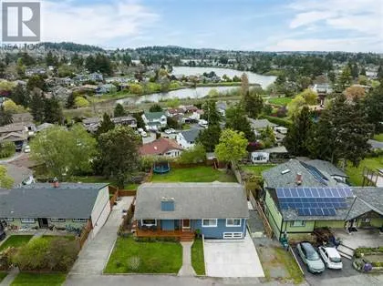
View Royal’s approximate 16.2 square kilometres includes Thetis Lake Regional Park and portions of Esquimalt Harbour and Portage Inlet. Undeveloped and protected land is concentrated in the north half of the community, outside the region’s Urban Containment Boundary.
View Royal has distinct neighbourhoods but does not have an identifiable town core. Currently, commercial uses are limited to more auto-oriented locations along the Island Highway and Admirals Road. View Royal anticipates a shift toward light industrial uses and redevelopment along the Island Highway to serve as important employment lands.
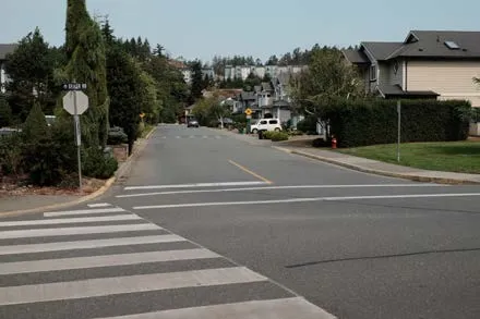
Today most of the developed land in View Royal is designated as residential suburban neighbourhoods. View Royal has no remaining ‘greenfield’ sites for development within the Urban Containment Boundary.
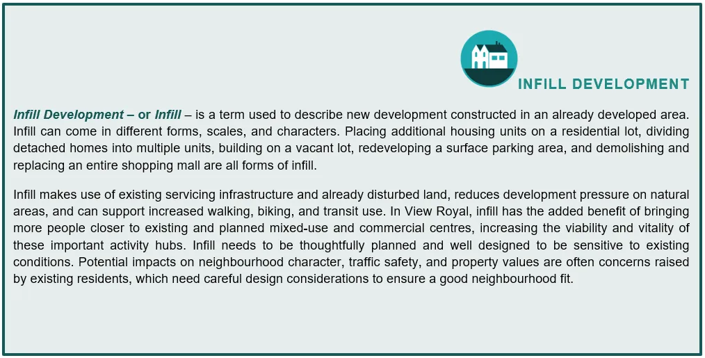
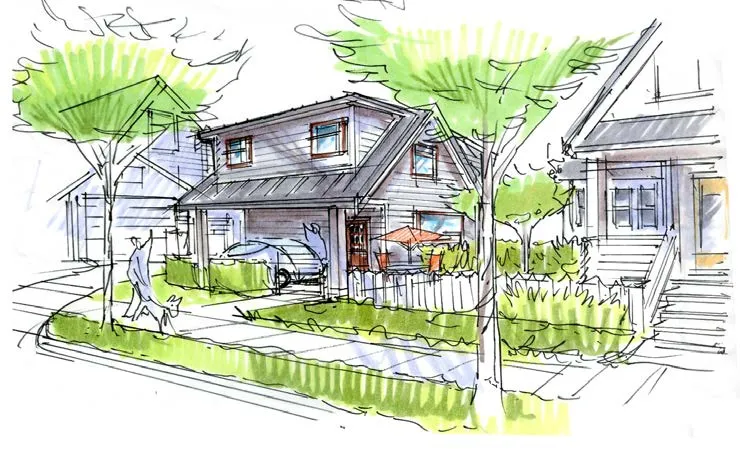
INFILL DEVELOPMENT
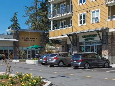
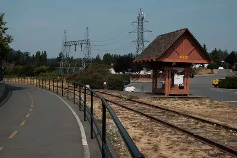
Infill Development – or Infill – is a term used to describe new development constructed in an already developed area. Infill makes use of existing servicing infrastructure and already disturbed land, reduces development pressure on natural areas, and can support increased walking, biking, and transit use.
INTEGRATING LAND USE AND TRANSPORTATION
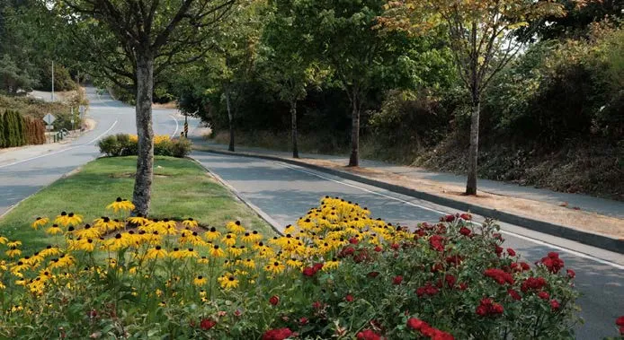
To become a more sustainable community, View Royal must plan land use, infrastructure, and transportation systems together to decrease reliance on private vehicle travel. This means expanding bike and pedestrian facilities and supporting higher density mixed-use development at nodes along main east-west transportation routes.
COMMUNITY DEVELOPMENT FRAMEWORK
The Community Vision promotes compact and walkable places, respects established residential character, adds density for diverse housing, and protects natural resources.
TRANSITION AREAS
Transition Areas are areas where land use and design character transition from one type to another. They are mostly located along major roads in Community Corridors or along Neighbourhood Centres.
OCP Transition Areas:
- Lakeside Village
- Eastern Gateway Community Corridor (Admirals)
- Western Gateway Corridor
- 6 Mile Neighbourhood Centre
- Town Centre (Fort Victoria)
- Harbour-Helmcken Community Corridor
- Hospital
- Northern Gateway Corridor
- Thetis Cove
COMMUNITY DEVELOPMENT FRAMEWORK – NEIGHBOURHOOD CENTRES
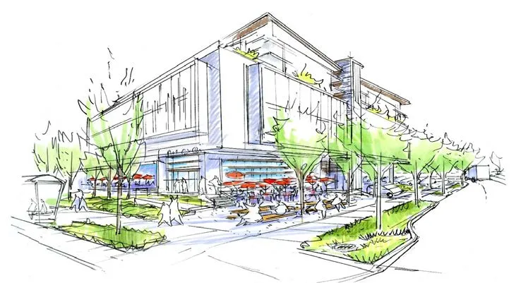
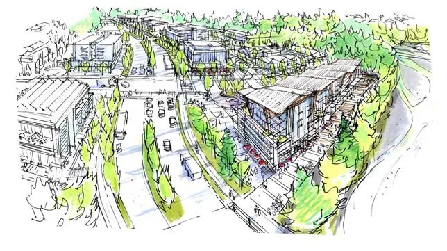
Neighbourhood Centres are local-serving mixed-use activity hubs. Each is intended to be a walkable, people-friendly place.
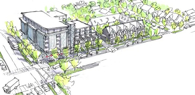
Residential units typically occupy the floors above street level, often with setbacks to diminish perceived height. They can also be street-level townhomes with ground-level access, contributing to 'eyes onto the street.'
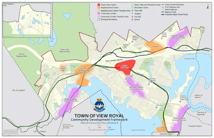
The OCP identifies four mixed-use Neighbourhood Centres:
- LAKESIDE VILLAGE: Located on the east side of Six Mile Road. Includes apartment dwellings and ground-level commercial near Thetis Lake Regional Park.
- SIX MILE: Planned for the area between Highway 1 and the Island Highway, oriented toward a future regional rapid transit exchange and the Galloping Goose Trail.
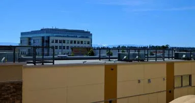
- HOSPITAL: Planned for lands surrounding Victoria General Hospital to create synergies between the hospital, rapid transit, and the Galloping Goose trail.
- THETIS COVE: Land eventually to be under the administration of the Esquimalt Nation. The Town supports development that takes advantage of waterfront views and shoreline access.
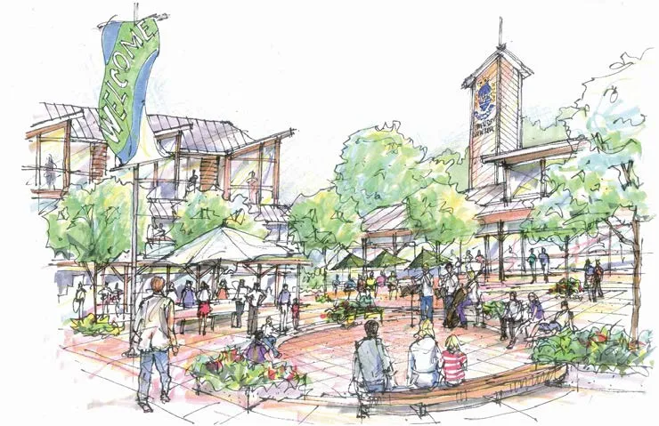
TOWN CENTRE
The Fort Victoria RV Park site is the preferred location for the View Royal Town Centre. The community vision for this site is compact, high-density, transit-oriented development with a diverse mix of residential, commercial, civic, and cultural uses.
COMMUNITY DEVELOPMENT FRAMEWORK - COMMUNITY CORRIDORS
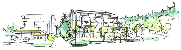
Community Corridors are major transportation corridors that function as destinations and connectors between neighbourhoods. The OCP identifies four mixed-use Community Corridors:
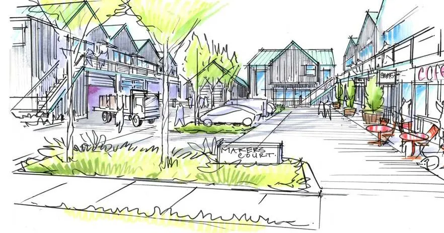
- WESTERN GATEWAY: Stretches from Colwood boundary to Parsons Bridge. Vision includes intensive commercial hubs (high tech, offices).
- NORTHERN GATEWAY: Includes lots fronting Helmcken Road near Burnside. Encourages diverse housing closer to the hospital.
- HELMCKEN-HARBOUR: Located along the Island Highway. Envisioned as a small, walkable activity hub concentrated at the Helmcken/Island Highway intersection.
- EASTERN GATEWAY: Encompasses Admirals Walk, Nelson Square and Canadian Tire shopping centres.
LAND USE DESIGNATIONS
FLOOR SPACE RATIO (FSR)
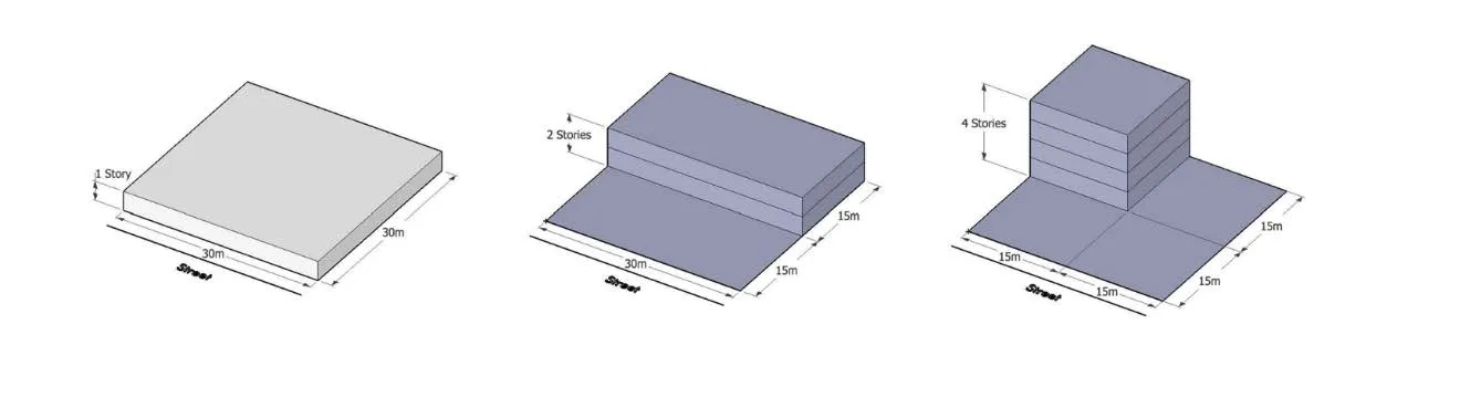
FSR expresses the ratio of built (or buildable) area to land area. It indicates development intensity and provides flexibility for designers.
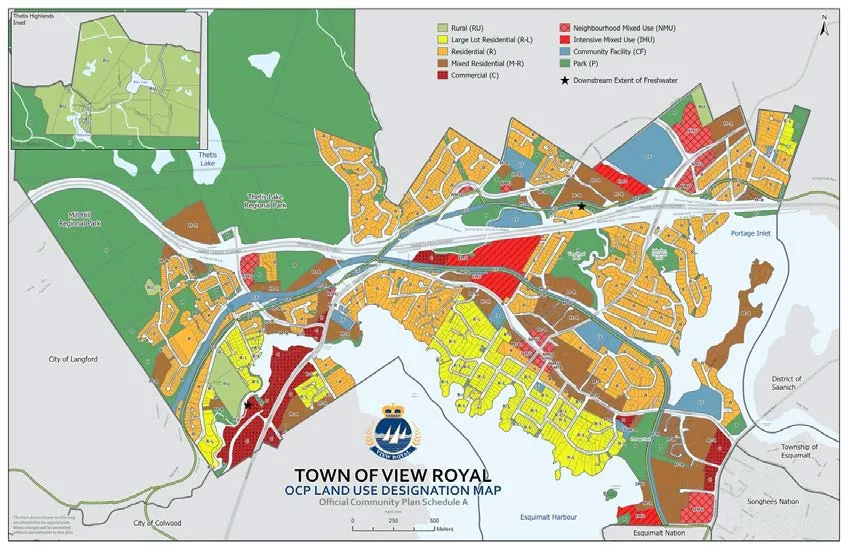
LAND USE DESIGNATIONS TABLE
| LAND USE, FORM & CHARACTER | EXAMPLES |
|---|---|
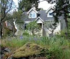
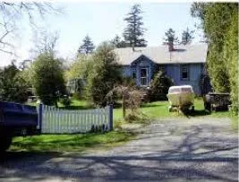
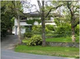
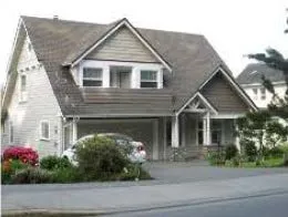
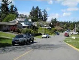
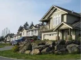
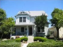
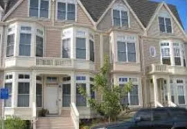
| Large-Lot Residential: Detached Homes; Large Lots and Yards; Up to 40% lot coverage | [Images 44, 45, 46: Photos of single-family homes on large properties] |
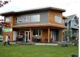
| Residential: Predominantly Detached Houses and Townhouses; Up to FSR 1.25 permitted for appropriate infill | [Images 47, 48, 49: Photos of suburban residential streets and detached homes] |
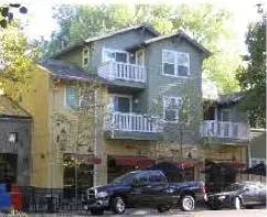
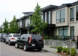
| Mixed Residential: Small Lot Detached Houses, Townhouses and Low-Rise Apartments; Up to 1.4 FSR for Townhouses; Up to 1.6 FSR for Apartments | [Images 50, 51, 52: Photos of modern townhomes and low-rise apartments] |
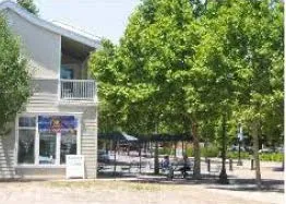
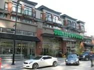
| Neighbourhood Mixed-Use: Commercial with Townhouses and Low-Rise Apartments; Up to 2.0 FSR | [Images 53, 54, 55: Photos of multi-story buildings with storefronts at ground level] |
| Neighbourhood Centre: Commercial with Apartments; Up to 3.0 FSR | [Images 56, 57, 58: Photos of urban-style mixed-use blocks] |
| Intensive Mixed-Use: Commercial with Townhouses and Low-Rise Apartments; Up to 2.5 FSR | [Images 59, 60, 61: Photos of dense commercial/residential streetscapes] |
| Commercial: Retail, Office, Technology and Service Commercial; Up to 2.5 FSR | [Images 62, 63, 64: Photos of commercial shopping centers and office buildings] |
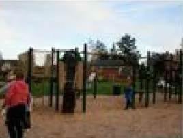
| Park, Open Space, Recreation: Local and Regional Parks and Trails; Protected Natural Areas | [Images 65, 66, 67: Photos of playgrounds, beaches, and hiking trails] |
| Community Facility: Government Buildings & Publicly Owned Facilities (Schools, Community Centres) | [Images 68, 69, 70: Photos of public institutions like hospitals and community halls] |
| Rural: Agricultural, Recreation and Large Lot Residential; 1 unit per 10 hectares | [Images 71, 72, 73: Photos of farms and rural woodland properties] |
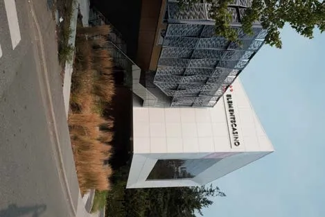
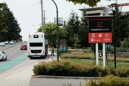
| Comprehensive Development Areas (CDAs): Areas with unique Comprehensive Development Designations | [Images 74, 75, 76: Photos including the Casino and complex apartment developments] |
COMMUNITY-WIDE OBJECTIVES AND POLICIES
OBJECTIVE LU1: Create a more complete and sustainable community by directing most new growth into compact neighbourhood nodes, corridors and mixed-use centres connected by excellent, multimodal transportation infrastructure.
POLICIES
- LU 1.1 Neighbourhood Centres: Create a network of neighbourhood-serving, mixed-use centres.
- LU 1.2 Connected Centres: Ensure each centre is connected by transit, bike and pedestrian pathways.
- LU 1.3 North-South Connections: Provide stronger connections across the Trans-Canada Highway.
- LU 1.4 Diversity of Forms and Uses: Support a variety of housing forms within 400m (10-minute walk) of commercial services.
- LU 1.5 Land Use Designations: Establishes designations for Commercial (2.5 FSR), Intensive Mixed-Use (2.5 FSR), Neighbourhood Mixed-Use (2.0 FSR), Mixed Residential (1.4-1.6 FSR), Residential (1.25 FSR), and others as depicted on Schedule A.
- LU 1.6 Community Amenities: Foster amenities through amenity density bonuses or Phased Development Agreements.
- LU 1.7 Density: Density at the site level determined through the Zoning Bylaw.
- LU 1.8 Temporary Use Permits: Considered on a case-by-case basis.
OBJECTIVE LU2: Preserve the valued ambiance, scale, and character of established residential neighbourhoods while enhancing connections between neighbourhoods and to mixed-use centres.
POLICIES
- LU 2.3 Targeted Residential Infill: Encourage infill as a means of providing ground-oriented family housing.
- LU 2.4 Garden Suites: Consider allowing suites on properties greater than 350m² in size.
OBJECTIVE LU3: Support the development of a new community-serving Town Centre as the economic, cultural, and civic heart of View Royal.
POLICIES
- LU 3.1 Town Centre Site: Recognize the Fort Victoria RV Park site as the preferred location.
OBJECTIVE LU4: Support high-quality development and design that creates safe, dynamic, and sustainable places.
POLICIES
- LU 4.3 Complete Streets: Promote pedestrian/cycling amenities like street trees, wide sidewalks, and bike racks.
- LU 4.10 Universal Design: Apply principles to all public space design.
- LU 4.13 CPTED: Integrate Crime Prevention Through Environmental Design into guidelines.
OBJECTIVE LU5: Protect and enhance natural features and resources and parks.
NEIGHBOURHOOD OBJECTIVES AND POLICIES
- ATKINS: Support completion of developments in the Mill Hill Residential Area (LU 6.1).
- HARBOUR: Support the Harbour-Helmcken Community Corridor concentrating intensification at the Helmcken intersection (LU 7.1).
- HELMCKEN: Support revitalization through connections to View Royal Park and the E&N corridor (LU 8.1-8.2).
- HOSPITAL: Support Northern Gateway mixed-use area and a transit-oriented Neighbourhood Centre west of the hospital (LU 9.1-9.2).
- THETIS: Preserve environmental integrity of Thetis Lake Regional Park and discourage development north of the park (LU 10.1-10.2).
- WILFERT: Support Western Gateway corridor land use intensification with parking located behind buildings (LU 11.1).
2 | Transportation & Mobility
OVERVIEW
Transportation is a major contributor to greenhouse gas emissions. View Royal aims to advance a multi-modal system that supports sustainable development and reduces car use.
GOALS
- Confirm View Royal as an environmentally responsible community taking action to reduce GHG emissions from transportation.
- Create an inclusive community that provides transportation options for all ages and economic means.
- Recognize the regional role of the community as a link in major transportation systems.
VIEW ROYAL TODAY
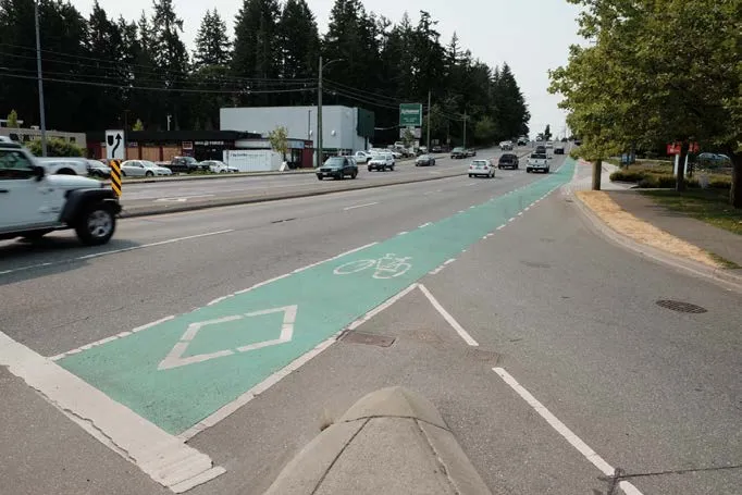
View Royal’s Transportation Master Plan prioritizes pedestrians, active transportation, and public transit, with private vehicles as the lowest priority.
- WALKING AND CYCLING: Significant progress has been made with traffic calming and new sidewalks, but cross-highway connections remain a gap.
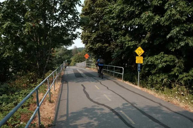
- REGIONAL TRAILS: The Galloping Goose Trail and E&N Rail Trail connect View Royal locally and regionally.
- BUS AND RAPID TRANSIT: The Town works with BC Transit to ensure stops are within a 300m - 500m walk of residences.
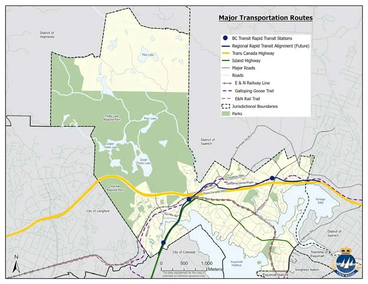
- MAJOR ROADS: Highway 1 and Island Highway traverse the town, creating barriers between neighbourhoods. View Royal prioritizes residents over commuter traffic.
MAJOR TRANSPORTATION ROUTES
- Major Roads: Highway 1, Watkiss Way, Burnside Road, Six Mile Road, Helmcken Road, Admirals Road.
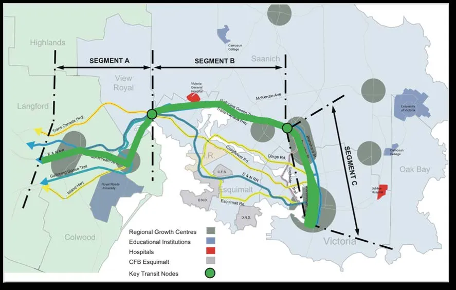
- Rapid Transit: Regional Rapid Transit Alignment is planned.
TRANSPORTATION PLANS
- TRANSPORTATION MASTER PLAN (2016): Prioritizes walking, biking, and transit to reduce auto dependency.
- CRD TRAVELCHOICES STRATEGY: Aims to significantly increase the proportion of people walking and cycling.
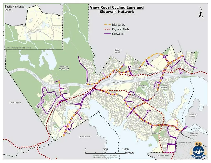
OBJECTIVES AND POLICIES
OBJECTIVE TR1: Recognize walking, cycling and transit as priority modes. Support network expansion to reduce car dependency.
POLICIES
- TR 1.1 Multimodal System: View roads as a "community resource" for all users, not just motor vehicles.
- TR 1.5 Rapid Transit: Work with BC Transit to implement a corridor linking View Royal to Victoria and the West Shore. "Park-and-ride" facilities without other amenities are not supported.
- TR 1.10 Small Boat Launch: Support non-motorized water transportation in Esquimalt Harbour and Portage Inlet.
OBJECTIVE TR2: Plan transportation infrastructure to support a more compact settlement pattern.
POLICIES
- TR 2.5 Density Near Transit: Focus new development within 400 metres of existing transit service.
- TR 2.6 Mixed Use near Transit: Allow mix of uses and prioritize affordable housing adjacent to transit services.
OBJECTIVE TR3: Ensure transportation is safe, comfortable, and efficient.
POLICIES
- TR 3.3 Commuter Traffic: Encourage regional commuter and truck traffic to use Highway 1 rather than local roads.
- TR 3.12 Electric Vehicle Infrastructure: Expand the network for plug-in electric vehicles, e-bikes, and scooters.
- TR 3.13 Electrification: Require new developments to include vehicle and bicycle parking electrification.
- TR 3.14 TDM Incentives: Encourage car-shares and developer-provided transit passes (minimum 5 years) to reduce parking requirements.
3 | Housing

OVERVIEW
View Royal residents face rapidly rising costs for housing. The population is aging, leading to smaller household sizes. The Town needs a greater diversity of housing, including the "missing middle" (townhomes, apartments) and non-market affordable options.
GOALS
- Create an inclusive community with housing options for diverse backgrounds and economic means.
- Protect the relationship between valued natural environments and residential characteristics.
VIEW ROYAL TODAY
- Aging Demographic: By 2038, over one-third of households will be led by adults 65+.
- High Ownership: 72% ownership rate vs 63% in the CRD.
- Rental Shortage: Vacancy rate has remained below 1% since 2013.
- Need for 3+ Bedrooms: 52% of dwellings have 3+ bedrooms, but only 35% of households have 3+ people, indicating potential for seniors to downsize.
- Affordability: Increased housing costs are outpacing income growth.
PLANNING TO MEET OUR HOUSING NEEDS
- Support "missing middle" housing (townhomes, apartments).
- Support supportive housing for seniors and families.
- Encourage infill development within walking distance of services.
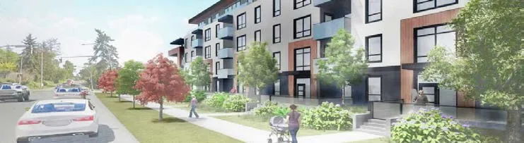
GROUND-ORIENTED HOUSING
Demand for ground-oriented family housing (townhouses, stacked units, duplexes, secondary suites) remains the largest forecasted demand in the region.
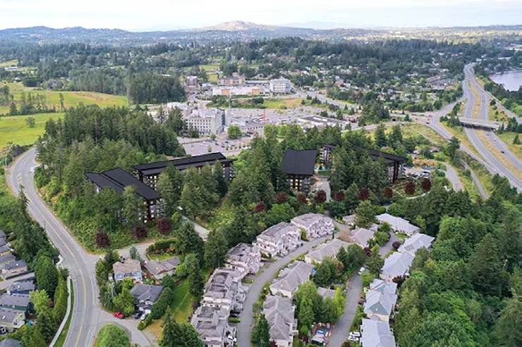
HOUSING AFFORDABILITY
- Core Housing Need: Households spending 30% or more of gross income on housing.
- 2016 Census: 35% of renters and 19% of homeowners in View Royal were in core housing need.
OBJECTIVES AND POLICIES
OBJECTIVE HS1A: Create and maintain a range of housing types and tenures including market rental, co-ops, and non-market projects.
OBJECTIVE HS1B: Increase housing supply affordable to young families.
POLICIES
- HS 1.3 Family Housing: Strongly encourage designs providing 10% of units as 3-bedroom or greater.
- HS 1.4 Aging in Place: Promote 10% of units designed to accessible/adaptable standards.
- HS 1.6 Amenity Contributions: Consider below-market rental units as priority amenities when negotiating CACs.
OBJECTIVE HS2: Protect tenants from rental conversion. Approval is required for converting multi-residential rental to strata if vacancy rates are 4% or lower for two years.
OBJECTIVE HS3: Market Rental Housing Protection.
POLICIES
- HS 3.6 Short-Term Rentals: Limit allowable STRs to operators that meet principal residency requirements.
- HS 3.9 Affordability Through Design: Promote smaller lot subdivisions and multi-unit houses.
OBJECTIVE HS4: Promote sustainable settlement by encouraging housing near amenities and transit.
POLICIES
- HS 4.3 Garden Suites: Consider allowing suites on properties greater than 600m² in size.
4 | Economic Development
OVERVIEW
This chapter focuses on the redevelopment of under-utilized lands along corridors and gateways to expand commercial, light industrial, office, and hotel opportunities. Complete communities allow residents to live, work, and shop within short travel distances.
GOALS
- Encourage economic development in View Royal.
- Provide land and incentives to broaden the municipal tax base.
VIEW ROYAL TODAY
View Royal is home to over 350 businesses. The retail sector has approx. 400,000 sq. ft. of space, 85% of which is local-oriented. Projections indicate a need for up to 370,000 additional sq. ft. of retail space by 2040.
- Office Space: Roughly 147,000 sq. ft. exists, half of which is medical-related.
- Tax Base: 71% of property taxes come from the residential sector (Class 1) and 27% from businesses (Class 6).
- Jobs-to-Population Ratio: View Royal’s ratio is 0.45, well ahead of the West Shore target of 0.36.
DEVELOPMENT INCENTIVES
The OCP aims for a "land lift" objective of receiving 50% of the value from large developments through rezoning to fund community amenities and affordable housing.


KEY AREAS OF ECONOMIC ACTIVITY
- Western Gateway (Wilfert): Shift toward higher commercial and light industrial redevelopment.
- Hospital Neighbourhood: Expansion of medical-related office space and apartment development above offices.
- Helmcken-Harbour: Increased residential and neighbourhood services at the intersection.
OBJECTIVES AND POLICIES
OBJECTIVE ED1: Support commercial and institutional development serving residents and visitors.
POLICIES
- ED 1.1 Mixed-Use: Encourage mixing commercial and residential along arterial development areas.
- ED 1.3 New Businesses: Priority given to development that provides more than a livable wage.
OBJECTIVE ED2: Redevelopment Incentives.
POLICIES
- ED 2.1 Parking Reductions: Consider reductions for developments with TDM reports including car-share or transit enhancements.
- ED 2.3 Density Bonus Policy: Bonus density provided in return for contributions to affordable housing.
- ED 2.4 Island Highway Corridor: Encourage stacked industrial and mixed office development with densities of 2.0 FSR.
- ED 2.7 Hospital Neighbourhood: Encourage redevelopment of vacant properties along Hospital Way with densities between 2.0 and 3.0 FSR.
- ED 2.8 Town Centre: Redesignate for mix of apartment, retail, and mixed-use with densities up to 3.0 FSR.
OBJECTIVE ED3: Provide commercial development meeting daily shopping needs in proximity to residential areas.
OBJECTIVE ED4: Encourage development that generates employment for local residents.
5 | Natural Environment, Energy & Climate Change
OVERVIEW
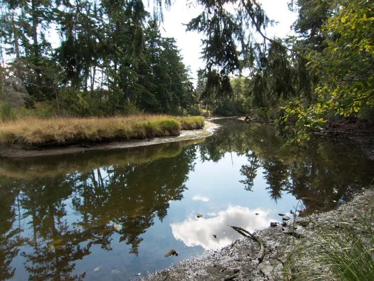
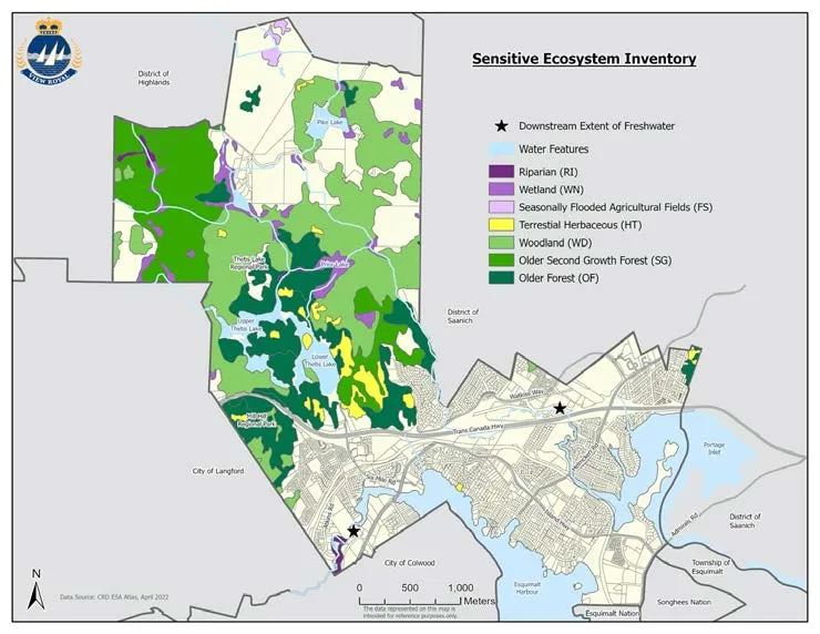
View Royal has an abundance of natural amenities, including Thetis Lake, Millstream Creek, Craigflower Creek, Esquimalt Harbour, and Portage Inlet. It is critical to ensure protection of ecologically sensitive areas (ESAs) and the urban tree canopy to mitigate summer heat and manage stormwater.
GOALS
- Maintain highly valued natural characteristics as the community grows.
- Build resilience for climate change impacts.
- Cooperate with regional partners to protect environmental systems.
VIEW ROYAL TODAY
Environmental stewardship is supported by View Royal’s Tree Protection Bylaw (2022). Development Permit Areas (DPAs) are used to minimize impacts on rare or endangered species.
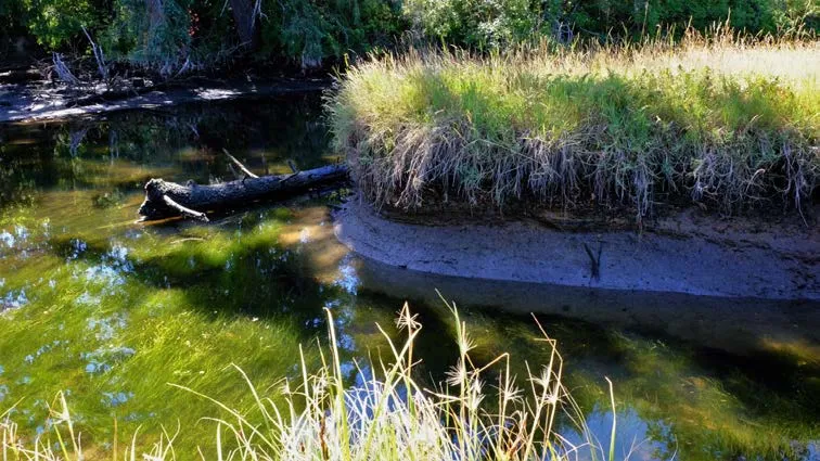
VIEW ROYAL’S ECOSYSTEMS
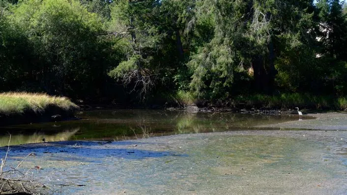
The Coastal Douglas Fir is the primary terrestrial ecosystem. Rare Garry Oak Meadows exist on dry, rocky outcrops. Portions of the Town are within the Gorge Waterway and Esquimalt Harbour regional watersheds.
CLIMATE CHANGE RISKS
- Sea Level Rise: Craigflower, Harbour, and Helmcken neighbourhoods are at risk from storm surge and coastal flooding.
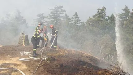
- Wildfire: Developments near "wildland/urban interfaces" need to be FireSmart.
- Changing Climate: Expectation of drier summers and extreme precipitation events in winter.
NATURAL ENVIRONMENT OBJECTIVES AND POLICIES
OBJECTIVE NE1: Conserve and protect sensitive and unique natural ecosystems.
POLICIES
- NE 1.1 Environmental Conservation: Strategies include permissive tax exemptions and Transfer of Development Rights (TDRs).
- NE 1.5 Native Trees: Promote removal of invasive species and use of native species in all municipal landscaping. Cutting down trees of specific species/size requires a permit.
- NE 1.8 Watershed Planning: Support implementation of plans for Millstream, Hospital, and Craigflower Creeks.
- NE 1.9 Community Stewardship: Encourage habitat restoration, clean-up days, and carpooling programs.
OBJECTIVE NE2: Achieve a balance between the living biological environment and the built form.
POLICIES
- NE 2.1 Human-Nature Interface: Limit human and dog access to ESAs where impacts are detrimental.
Document Images
(45)
Graphic comparing average household sizes of 2.36 in 2021 and 2.08 in 2016
Donut chart showing a 64% employment rate
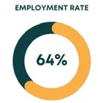
Chart comparing median household income: $83,968 in 2016 and $79,534 in 2006
Infographic summary of housing data including number of dwellings, ownership rates, and median home prices
Tranquil view of Portage Inlet with forested banks
A cyclist riding on a paved trail through a natural area
Cover of the View Royal Transportation Master Plan
Cover of the CRD Regional Pedestrian & Cycling Masterplan
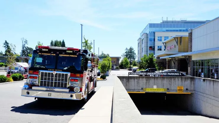
A View Royal fire truck driving past the Eagle Creek medical and commercial building