TOWN OF VIEW ROYAL – OFFICIAL COMMUNITY PLAN (Draft Sections)
Draft sections of the Official Community Plan including policies on the natural environment, climate change, parks and recreation, and community infrastructure.
- Providing educational information and signage to advise the public of habitat and wildlife concerns, the ecological significance of ESAs, regulations, or other relevant information.
- Incorporating FireSmart Wildland/Urban interface management strategies.
- Promoting bird and pollinator friendly design in buildings and landscapes.
- Discouraging herbicides and pesticides.
NE2.2 Access to Nature
Encourage interaction between residents and the Town’s natural environment, including riversides and seashores, by providing defined access opportunities that protect native vegetation and do not harm the health of ecosystems. Develop standards for construction of trails and access installation to ensure avoidance and mitigation of harmful impacts on the natural environment.
NE2.3 Ecological Development
Consider ecological development in planning decisions. Planning considerations for ecological development should include:
- Protecting open space and greenspace.
- Mitigating the detrimental impacts of urban development and infrastructure on ecological features.
- Protecting and enhancing the verges and boulevards of roads as natural spaces, providing shade, shelter, texture and colour, and habitat.
- Planting hedgerows and groves of trees along roadways to absorb noise and the effects of pollution.
- Encourage the planting of native species that are drought tolerant
- Building design and glass treatment that prevents bird collisions and fatality.
- Maintaining important public views to natural areas and scenic vistas.
- Enhancing low impact development standards, rainwater retention and best practices for stormwater management.
- Continuing to locate and eliminate cross-connections between storm and sanitary sewer infrastructure.
- Encouraging the use of renewable energy sources and low carbon energy sources.
NE2.4 Environmental Impacts
Consider the natural limitations of the land when assessing the type and intensity of proposals for development in View Royal. Enact and enforce environmental impact assessment standards for the Town in concert with federal, provincial, and regional governmental agencies, and ensure the proper undertaking and supervision of environmental reviews.
NE2.5 Ecologically Sensitive and Energy Efficient Design
Ensure that all private and public building and infrastructure projects support environmental enhancement practices and the policies contained in this OCP. Encourage development proposals that design “with the land” and employ best practices for ecological sensitivity and energy efficiency. Planning and design considerations should include:
- Integration of natural features and topography into the planning and design.
- Measures to maximize the amount of greenspace and reduce the development footprint.
- Protection of soil and vegetation during construction.
- Use of native landscaping.
- Energy and water efficient building design.
- Bio-retention, alternative energy, and best practices for reducing energy needs, and promoting resource conservation, onsite wastewater management and natural systems.
- Measures to minimize impermeable surface areas.
- Measures to avoid light pollution from artificial lighting and mitigate noise from development, transportation, and other human-generated sources.
- Restriction of utilities to underground corridors wherever possible.
NE2.6 Environmental Inventories
Development application packages should include a complete environmental inventory of existing vegetation, wildlife, topography, soils, and drainage. The resulting detailed understanding of natural factors will provide the basis for comprehensive planning.
NE2.7 Stormwater Discharge
Ensure that the discharge of stormwater does not negatively impact adjacent water quality and that there is no increase in stormwater discharges because of new development. Encourage innovative design techniques that maximize groundwater recharge. Ensure that stormwater management designs for new development take the changing climate in BC into account. Consider the use of covenants to ensure that stormwater management facilities on private properties are regularly maintained.
NE2.8 Ecosystem Restoration
Ensure that ecosystems degraded by construction, drainage, enclosure, contamination, and invasive or introduced plant species are restored to the capacity to sustain themselves indefinitely.
NE2.9 Development Approval Information Bylaw
Adopt a development approval information bylaw to ensure that applicable studies and relevant information are provided to the Town to evaluate the impact of a development proposal. A wide range of development approval information may be required when the development proposal requires Zoning amendment, development permit or temporary use permit.
NE2.10 Amenity Zoning and Density Bonusing
Consider the use of amenity zoning and density bonusing in exchange for environmental protection and restoration. The concept of “amenity zoning”, represented by the clustering of development on parcels to free up greenspace, shall be fully supported in conjunction with the use of parkland dedication to permanently prevent intrusions into such greenspace. Amenity zoning may be applied to detached, single-family homes on downsized, clustered lots and is not restricted to multiple-family residential development. Through the zoning bylaw, a landowner may be entitled to a higher development density than generally allowed in return for the provision of public amenities, such as parks and trails.
NE2.11 Comprehensive Development Zoning
Comprehensive Development zoning may be required in areas that require special care in dealing with difficult terrain, preservation of natural features and access challenges. Due regard should be given to maintaining special natural characteristics.
NE2.12 Urban Containment Boundary
Maintain an Urban Containment Boundary to preserve greenspace and habitat outside of the Boundary and encourage more sustainable development settlement patterns within the boundary.
NE2.13 Pesticides and Integrated Pest Management Strategy
Encourage the use of Integrated Pest Management (IPM) to minimize the non-essential use of pesticides on both public and private lands within View Royal to the benefit of environmental and human health.
NE2.14 Chemical Pesticides
Support regional effort to closely regulate or ban the cosmetic use of chemical herbicides and pesticides. Ensure that regulations enforced in View Royal are based on the best available scientific data.
NE2.15 Resource Areas
Work with higher levels of government to identify, map and regulate resource areas in View Royal. Support limited and sustainably managed resource extraction, agriculture, and related uses north of Thetis Lake Regional Park. Ensure that such uses do not threaten the long-term integrity of the natural environment. There are no known sand or gravel resources within the Town.
OBJECTIVE NE3
Identify natural hazardous areas, and closely regulate any development in these areas to ensure public safety and protect the natural environment.
POLICIES
NE3.1 Natural Hazardous Areas Development Permit Areas
Identify, map, and designate natural hazardous areas as DPAs (See Part 3.). Any application to subdivide, build or alter an existing building may require a Development Permit. This includes areas susceptible to sea level rise, major storm events, overland flooding and wildfires, and lands with steep slopes of more than a 20% grade.
NE3.2 Steep Slopes
Establish and enforce criteria for development and infrastructure projects on steep slopes. Requirements may include: Geotechnical assessments and, subsequently, covenants to be registered to title that indicate that the land may be used safely, subject to conditions contained in the geotechnical report. Specified measures to avoid or remediate the hazard(s) and ensure the protection of surrounding lands and properties. These may include protection of special natural features such as rock outcrops, ridges, and cliffs; restricted removal of soil and rock; minimized disturbance of vegetation; prohibited filling or dumping; and stabilizing slopes with native plants and other erosion prevention strategies.
NE3.3 Wildfires
Develop strategies to prevent and reduce wildfires. This includes the integration of FireSmart principles for vegetation management, the development of defensible space, community firebreaks, and building and landscaping standing standards into Town policies and bylaws.
NE3.4 Natural Disasters
Work with other levels of government to identify areas susceptible to impacts from natural disasters, such as tsunamis and earthquakes. Integrate best practices for regulating development in these areas to reduce or avoid threats to human life, property, and the natural environment.
ENERGY AND CLIMATE CHANGE OBJECTIVES AND POLICIES
This section provides specific objectives and policies for addressing planning issues related to climate change, setting Greenhouse Gas Emissions reduction targets, and promoting energy efficiency.
OBJECTIVE NE4
Plan for climate change mitigation, adaption, and leadership.
POLICIES
NE4.1 Reduction of Greenhouse Gas Emissions (GHG)
Work with other municipalities and levels of government, public agencies, and organizations to reduce GHG emissions through land use, building energy efficiency and transportation planning; infrastructure design; water and energy conservation; solid waste management; and green procurements.
NE4.2 Community Greenhouse Gas Emissions Reduction Targets
Achieve or exceed the provincial targets for community wide GHG emissions from 2007 levels. The baseline figures for these targets are derived from the BC Ministry of the Environment’s Community Energy and Greenhouse Gas Emissions Inventory (CEEI) for View Royal.
- 45% reduction in emissions below 2007 levels by 2030
- 100% reduction in emissions below 2007 levels by 2050
NE4.3 Sector-specific Greenhouse Gas Emissions Reduction Targets
Endeavour to meet or exceed a community-wide 45% reduction of on-road transportation and building source GHG emissions from 2007 levels by 2030.
NE4.4 Corporate Energy and Emissions Strategy
Update the View Royal’s Corporate Energy and Emissions Strategy and include corporate GHG targets.
NE4.5 Corporation Carbon Neutrality
Reduce GHG emissions caused by Town of View Royal operations, transport, facilities, and waste, and continue purchase offsets to pursue carbon neutrality.
NE4.6 Energy Efficiency
Promote greater energy efficiency in new development and through the retrofit of existing buildings and infrastructure. Strategies for encouraging best practices include:
- Consider advancing adoption of steps 4 and 5 of the BC Energy Step Code to implement higher energy efficiency requirements for all new construction.
- Encouraging residential rezoning applications to meet or exceed BuiltGreen® “Gold”, EnerGuide 80 or an equivalent certification for energy efficiency.
- Encouraging low carbon energy systems in buildings.
- Updating municipal bylaws, regulations, and guidelines to encourage energy efficiency and climate change mitigation.
- Supporting the development of local renewable energy production and energy conservation techniques.
NE4.7 Adaptation
Work with other public agencies to identify and plan for the long-term impacts of climate change. This includes developing adaptation strategies to manage impacts caused by sea-level rise, increased fire risk, altered seasonal temperatures and precipitation, air pollution and waterborne contaminants.
NE4.8 Alternative Transportation
In accordance with other sections of this plan, encourage the use of car alternative transportation and support the reduced dependence on private vehicle travel.
NE4.9 Public Education
Gather, develop, and disseminate information on climate change, GHG emissions reduction, and energy conservation and efficiency. This information should be made available to municipal staff, development and building professionals, and community members to increase the shared understanding of these matters and promote sustainable planning.
6 | PARKS AND RECREATION
OVERVIEW
Parks and recreation are defining characteristics of View Royal. Recreation spaces constitute a significant portion of the Town’s land and support an active lifestyle close to nature. View Royal’s natural environment enhances the health of the community, provides valued recreational opportunities to residents and visitors, and supports diverse ecosystems. More accessible and adaptive parks and recreation spaces enhance the well-being of the community. The protection and expansion of existing parks the Town makes have significant impacts on the future well-being of the community and environment and contribute to a thriving economy by attracting visitors and supporting eco-tourism.
Protecting the diversity of the natural environment, creating accessible and connected parks and recreation spaces, and keeping the community involved throughout all require more engaged approaches. The benefits of parks and recreation spaces are threatened by ongoing development, growth, and climate change. Development and growth could reduce the abundance of parks and recreation spaces. Projected sea level rise, storms and fire may impact the health of critical coastal habitats. Connecting people to natural spaces and fostering a healthy natural environment alongside these threats requires adaptation and preparing for change.
GOALS
- Confirm View Royal as an environmentally responsible community committed to sustainability and planning for climate change.
- Design and maintain parks and recreational spaces to encourage residents of all ages and abilities to enjoy a healthy, active lifestyle.
- As the community grows, recognize the unique relationship between the highly valued natural and residential characteristics of View Royal, and maintain these values.
- Ensure that community services and amenities can be provided within the financial means of the municipality and strengthen partnerships with regional service providers to increase local opportunities.
VIEW ROYAL TODAY
Information for this section was obtained from the View Royal Parks Master Plan, 2017.
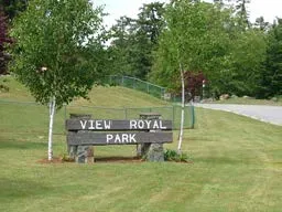
As a community, View Royal is well served by parks and recreation resources. More than 50 parks and water accesses account for approximately 40% of the municipality’s land base. The largest among these is Thetis Lake Regional Park. Over 540 hectares of the 835-hectare park are situated in View Royal. In addition to providing many unique recreation opportunities to local and regional residents, the park also serves to protect environmentally sensitive areas and natural features. The largest local park is the 6.6-hectare (16.3 acres) View Royal Park. Indoor and more structured recreation facilities are largely provided to residents through the Juan de Fuca Recreation Centre, located just outside of View Royal in Colwood. View Royal is one of six jurisdictions that contribute funds to the recreation centre. Residents can access a multitude of facilities and activities including an arena, pool, gym and studio space, sports fields and courts, community and seniors meeting rooms, curling, and a nine-hole golf course. Other recreation facilities frequented by View Royal residents include local schools and the Pearkes Recreation Centre (in the District of Saanich).
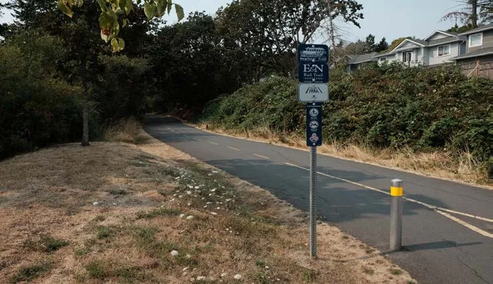
The 55-km Galloping Goose Trail is a regional recreation and commuter trail running east-west through the Town, connecting View Royal to Victoria and other communities. The E&N Rail Trail stretches from Langford through Esquimalt and is currently under construction to further expand it. These long multi-use trails are supported by a local trail system that includes a variety of pedestrian and cycling routes.
REGIONAL PARKS
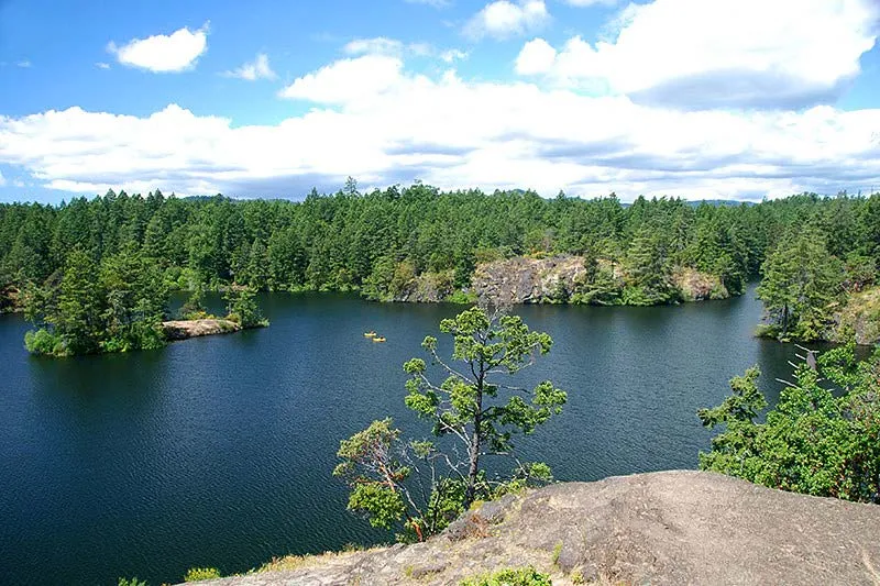
Two regional parks lie within the Town’s boundaries – Thetis Lake Regional Park in the northwest and Mill Hill Regional Park in the west. Thetis Lake Regional Park, established in 1993, encompasses 835 ha of land in View Royal, Highlands, and Saanich, with the vast majority of this located in View Royal. The park contains extensive ecosystems, freshwater lakes, beaches, picnic areas, and hiking trails. Mill Hill Regional Park includes 61 hectares of land in View Royal and Langford, with about 22 ha in View Royal. This park is known for its Garry Oak forests and herbaceous ecosystems and provides hiking trails and expansive viewpoints.
While the regional parks are managed and maintained by the CRD, methods of incorporating these significant areas into View Royal’s recreation system should be considered, with special attention to providing access and connections from other parks, trails, and neighbourhoods. It is important to make these parks accessible to View Royal residents, including those who live in the eastern sections of Town.
MAP : PARKS AND TRAILS
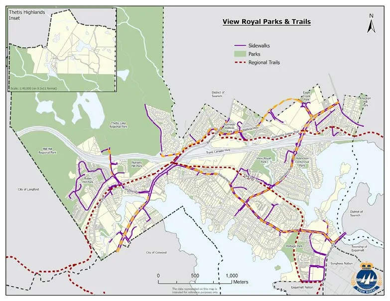
Despite having many exceptional parks, trails, natural areas and other recreation resources, the Town is confronted with challenges in meeting the recreation needs of local residents. The 2017 Parks Master Plan plans to address many of these planning issues including:
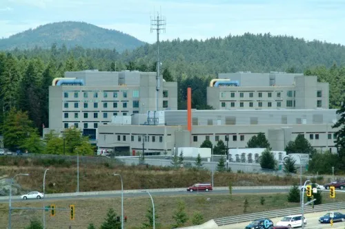
UNDERSERVED NEIGHBOURHOODS. The distribution of parkland in View Royal is not equal throughout the Town. Several neighbourhoods lack sufficient park space and/or access to types of recreation facilities. The Hospital and Harbour neighbourhoods are underserviced with parks and are physically isolated from parks located south of the Trans-Canada Highway and in the northwest portion of the Town. Some neighbourhoods have an adequate amount of parkland but do not have park amenities or facilities designed to meet the needs of local residents. For example, some neighbourhoods are without play areas for small children or recreation features suitable for older youth.
UNDERSERVED DEMOGRAPHIC GROUPS. On average, View Royal has a higher percentage of youth and families than elsewhere in the CRD. However, very few recreation spaces have been designed specifically for teenagers and several neighbourhoods continue to be underserved by play areas for young children. View Royal is also home to many older adults and seniors with their own unique health and recreation needs.
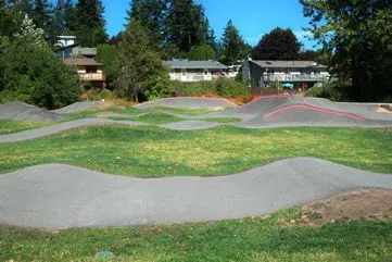
CONNECTIVITY. Fragmentation due to the Trans-Canada Highway, Island Highway, and watercourses makes accessing nearby parks difficult for many residents. Residents in the eastern portion of the Town have the additional challenge of overcoming longer distances to access the regional parks and the Juan de Fuca Recreation Centre. Some gaps in the trail system still exist that further isolate areas and obstruct non-vehicular transportation alternatives.
ECOLOGICAL CONNECTIVITY is also a planning issue within View Royal recreation spaces. Parks and trails provide important habitat for plant species and wildlife. Natural connections between these spaces should be maintained to provide wildlife corridors, support biodiversity, and ensure the overall integrity of the natural environment.
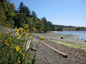
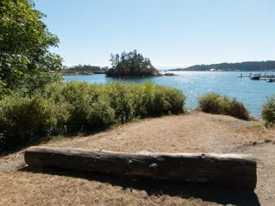
SHORELINE AND WATER ACCESS. Most lands along Millstream and Craigflower Creeks and the shores of Portage Inlet and Esquimalt Harbour are under private ownership. Several of the existing publicly owned accesses are undeveloped, located in inaccessible locations, or do not provide amenities that encourage park use. However, these watercourses and shoreline areas are valuable open space resources for the community. Some of these accesses have potential to be utilized in a manner that protects the fragile waterfront ecosystems, while providing public access to the shoreline.
LAUNCH FACILITIES. The Town is served by a non-motorized launch facility accessed off Shoreline Drive that allow residents and visitors to launch and land their kayaks, canoes, and small boats. A canoe and kayak launch is also available at the end of Stewart Avenue.
COMMUNITY GATHERING PLACE. COVID-19 has highlighted the need for large, sheltered, outdoor public spaces for hosting both small gatherings and community events, festivals, farmers markets that bring together broad sections of the community. View Royal Park, Centennial Park and Portage Park were all mentioned as existing public spaces that could be better designed to facilitate large gatherings and special events. Future opportunities for this type of public space are desired to be distributed throughout the community and the future Town Centre.
WASHROOM FACILITIES. View Royal parks and public spaces are currently underserved by public washroom facilities.
FISCAL SUSTAINABILITY. Developing parks and recreation facilities, and providing amenities and upkeep is resource intensive. The Town will need to look for funding and partnership opportunities and set investment priorities to maintain high standards expected by the community.
PARK CLASSIFICATIONS
To acquire parks and open space through the development and subdivision process, the demand for park space has been classified according to the eight types of parks. Each of the five types of parks has a different function and serves a different user group. It is important that all neighbourhoods have access to the various types of parks, and that there are pedestrian pathways and natural open space linkages between the parks.
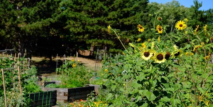
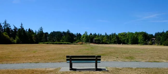
TOWN PARK Large parks with a variety of active recreational facilities that serve the entire population of the municipality. They also provide passive recreation areas, often with special natural features. View Royal Park is an example of this type of park.
COMMUNITY PARK Generally large parks providing passive and active recreation options, with a range of amenities of interest to the entire community. These spaces may also contain significant environmental features.
NEIGHBOURHOOD PARK These are generally smaller in area than community parks and respond to the open space and recreation needs of local residents. Amenities include passive and active recreation uses, along with significant open space
NEIGHBOURHOOD GREENSPACE These are small, open spaces in residential areas, some offering playground equipment intended for use by local residents. Ideally, all residents have access to a Neighbourhood Greenspace within ½ kilometre walking distance from their home.
NATURAL GREENSPACE These areas protect natural systems and preserve sensitive ecosystems. Recreational use is limited to passive enjoyment and pedestrian trails.
SHORELINE ACCESS There are several parks that provide waterfront access, as well as a network of shoreline access points that are in some cases undeveloped or inaccessible to residents.
REGIONAL PARK These parks are managed by the CRD and provide recreational facilities for View Royal residents, citizens of surrounding municipalities, and visitors to the area. These regional parks generally focus on the connection between humans and nature.
LINEAR PARK Linear parks play a role in providing connections between park spaces, as well as providing for walking, hiking, and biking opportunities.
PUBLIC SCHOOL Schools have an important role in providing learning and recreation space to local students during school hours, and community access to sports fields and playgrounds on weekends and evenings. The three public schools in View Royal are owned and maintained by the Greater Victoria School District.
SPECIAL PURPOSE AREAS These areas include points of historical and cultural interest that are of special interest in the Town. Examples of these special purpose areas include Craigflower Manor and the Hart Road Lime Kiln.
TRAIL CLASSIFICATIONS
Four types of trails and trail connections compose the trail network in View Royal.
MULTI-USE TRAIL Multi-use trails are pathways suitable for both walking and cycling. These trails are separate from roads and adjacent land uses. These paths are generally wider that the other pedestrian facilities (sidewalks, trails), and are part of a larger system that connects to significant destinations. Multi-use trails are used by local residents, visitors, and tourists for recreation and commuting.
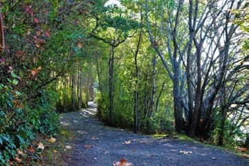
WALKING/HIKING TRAIL Walking/hiking trails provide pedestrian access within parks, natural areas, and neighbourhoods. Walking/hiking trails can vary in width and generally follow the natural contours of the land. These trails provide recreational opportunities and alternative travel options.
SIDEWALK While sidewalks are not trails in a traditional sense, they play a key role in View Royal’s overall pedestrian network. They are separated from vehicular lanes by boulevards and/or curbs, are surfaced with concrete or asphalt. They can connect trails and can run along road rights-of-way without encroaching on private property.
SHARED ROADWAY Shared roadways are routes that incorporate pedestrian and/or cycling movement with vehicular traffic. There are two types:
- Quiet residential or rural roads that provide pleasant cycling and walking opportunities.
- Highways that have wide paved and maintained shoulders, used especially by cyclists.
PARKS, RECREATION AND TRAIL PLANNING
In 2017, the Town completed a Parks Master Plan intended to guide parks and trails development over a ten-year period. This plan contains a significant amount of information regarding current conditions, community needs and parks trends, and recommends a vision, improvement opportunities and implementation process for enhancing community’s park and trail system.
The vision outlined in the Master Plan is as follows: “The parks system is integral to the unique spirit of place of view royal. The park system supports and enhances the health of the community for residents, wildlife, and ecosystems. Maintaining opportunities to connect people to nature and recreation through strategic investment and management is vital to maintaining the high quality of life in view royal.”
The Parks Master Plan also established several priorities to guide enhancements and improvements:
ECOLOGICAL DIVERSITY & HABITAT CONSERVATION. Move beyond preservation of natural systems, to rehabilitation and enhancement.
WATER. Emphasize water as a defining feature of the community.
LINEAR LINKAGES. Link the Town’s natural and recreation resources to form a complete greenspace network. Spaces for Everyone. Provide a variety of open spaces are needed to suit people of different ages, activity levels, abilities, and interests, including washrooms.
SUSTAINABILITY. Ensure ecologically and physical sustainability – that the Town can maintain a high standard of service delivery as the community grows.
HERITAGE. Incorporate View Royal’s rich history into park planning and design.
EQUITABILITY. Locate and service parks so that all residents may benefit from nearby outdoor greenspace.
Other important parks and trails planning documents include the 2018 Regional Growth Strategy, and the Capital Regional District Community Green Map (2016). The Regional District Community Green Map identifies Thetis Lake Regional Park, and Mill Hill Regional Park as significant greenspaces already protected. It suggests that significant greenspaces not currently protected are found in the lands north of Thetis Lake Regional Park. It points out blue spaces that require protection, including the mouth of Millstream Creek, the creek itself, Portage Inlet and Craigflower Creek.
OBJECTIVES AND POLICIES
The objectives and policies in this section will guide Town planning decisions related to parks and recreation.
OBJECTIVE PR1
Provide a variety of parks and recreation amenities that meet the diverse social and recreational needs of current and future residents.
POLICIES
PR1.1 Neighbourhood Greenspace
Provide each neighbourhood with easily accessible greenspace to meet the social and recreational needs of local residents. Prioritize parkland acquisition and improvements in neighbourhoods with an identified shortage of greenspace, such as the Hospital and Harbour Neighbourhoods, or where current parks lack amenities necessary for meeting residents’ needs. Special attention should be given to underserved demographic groups, such as children and teenagers, and other groups with unique recreation and access needs.
PR1.2 Accessibility
Remove barriers and improve access, including ease of access for seniors, people with disabilities and small children, to all parks, recreational facilities, public waterfront areas, viewpoints, and greenways while remaining sensitive to the preservation of natural habitat areas. Support the incorporation of universal design standards into all parks and recreation facilities, including outdoor play areas for children.
PR1.3 Youth Recreation
Increase the number of recreation opportunities for youth throughout View Royal. Encourage the development of new facilities as well and improvements to existing assets. Potential improvements may include:
- Additional playing fields, basketball courts, and active outdoor recreational facilities.
- New mountain bike trails.
- A skateboard or bike park.
- Additional play equipment, including climbing walls.
- Beach and shoreline facilities.
- Interactive water features, swimming facilities or waterpark.
- Asphalt hockey or lacrosse court. Youth oriented facilities should be prioritized in neighbourhoods with high percentages of young families and/or where a school is located, such as the Helmcken, Craigflower and Atkins neighbourhoods. Facilities intended for teen use should be planned to be accessible via transit.
PR1.4 Parkland Standard
As a broad guideline, use a minimum standard of 5.0 hectares (10 acres) of parkland per 1,000 people, and neighbourhood/community parks at a ratio of one hectare (2 acres) for each 1,000 people, excluding regional parks and schools, while considering other significant factors affecting acquisition.
PR1.5 Parkland and Recreation Facilities Acquisition and Development
Consider and use the following methods and strategies to acquire, improve and maintain parks and recreation facilities that meet the needs of current and future residents:
- Depending on the circumstances, at the time of subdivision of land, either acquire parkland of an amount and in a location acceptable to the Town or secure an amount that equals the market value of the land (Section 941, Local Government Act). Acquire parkland or secure an amount that equals market value with the subdivision of land.
- Acquire parkland or recreational facilities in exchange for rezoning for higher density.
- Acquire park improvements or recreational facilities in partnerships with other organizations and levels of government. This may include providing Town-owned land as an incentive for external investments.
- Strengthen partnerships with organizations and governments for park improvements.
PR1.6 Neighbourhood Priorities
The type of park or greenspace to be acquired through any of the methods and strategies set out in Policy PR1.5 should be defined in response to ecological, social, and recreational priorities for each neighbourhood and in accordance with PR1.1.
PR1.7 Minimum size at Time of Subdivision
In relation to the parkland dedication, at the time of subdivision the minimum area must be 1,000 (contiguous) square metres in a location suitable to the Town. If this is not achievable, cash in lieu of land will be required by the Town.
PR1.8 Juan de Fuca Recreation Centre
Continue to support the Town’s inter-municipal facility sharing agreement for the Juan de Fuca Recreation Centre. Explore options for increasing local benefits from this partnership.
PR1.9 Facility Sharing and Partnerships
Consider cost sharing recreational facilities on an inter-municipal basis when:
- It is not economical for the Town to independently develop and manage recreational facilities.
- It is determined to be in the overall best interests of the Town.
PR1.10 Sustainable Investments
Ensure that recreation investments are sustainability over the long-term and that the Town can maintain high quality parks and facilities.
PR1.11 Safety and Crime Prevention
Support the safety and comfort of parks and recreation facility users by employing best practices for crime prevention, play equipment safety, natural, and active surveillance, and public awareness information.
OBJECTIVE PR2
Create an integrated network of parks and trails that facilitate connectivity between Neighbourhood Centres, Community Corridors, neighbourhoods, recreation areas, and schools.
POLICIES
PR2.1 Connectivity
Encourage improved connections between parks, greenspaces, recreation facilities, schools and residential areas via linear parks, public trails, transit, and sidewalk connections. Support the establishment of multi-use corridors that connect neighbourhoods with other areas of the Town and the regional trail system. Recognize that improved connections to parks and recreation facilities will better integrate these assets into the community, increase the walkability of the Town and promote healthy lifestyles. Also recognize that parks themselves can serve as connectors and links between neighbourhoods and residential areas. Ensure Park entries and pathways are designed to connect and benefit all adjacent areas.
PR2.2 Improve Access to parks
Develop a parking and transportation strategy for Community Parks that limits intrusions into residential areas, and explores options for alternative transportation
PR2.3 Connect Major Facilities
On a town-wide basis, prioritize improving connections to the Juan de Fuca Recreation Centre, Thetis Lake Regional Park, and View Royal Park so that all residents have access to and a sense of ownership of these public assets.
PR2.4 Connect People with places and Nature
Implement the View Royal Wayfinding Strategy in parks.
OBJECTIVE PR3
Increase public access to the water and shoreline to provide all residents opportunities to enjoy these natural features.
POLICIES
PR3.1 Water and Shoreline Access
Develop public accesses, identified in the Parks Master Plan, to the water, beach, shoreline areas and significant viewpoints. Planning considerations for development of water and shoreline accesses include:
- Avoiding or minimizing ecological impacts. This may necessitate excluding people and dogs from vegetated shoreline buffers.
- Ensuring safety, convenience, accessibility, and good wayfinding.
- Prioritizing accesses in areas where access is currently most limited or where the greatest public benefit can be achieved.
- Creating connections to other parks and trails.
- Flood construction level that considers both Sea Level Rise and tsunami risk. Design for road ends shall include:
- Chain link fencing to delineate private property, implementation of best practices for shoreline restoration.
- Addition of seating areas.
- Not permit off-leash areas
- Consideration of landscaping to remove invasive species and encourage native habitat
PR3.2 Waterfront Development Sites
In reviewing development proposals for waterfront sites, encourage new public water and shoreline accesses, parks, and boat launches depending on current Flood Hazard Land Management Guidelines to allow for sea level rise to year 2100.
PR3.3 Public Boat Launches
Support the establishment of public launches for non-motorized boats at public waterfront access points. Opportunities for new public launches should be pursued at sites currently owned by the municipality as well as other sites. Boat launch planning should occur in consultation with local residents.
PR3.4 Non-motorized Public Boat Launch
Consider development of a non-motorized launch site for canoes and kayaks at the Portage Inlet Linear Park
OBJECTIVE PR4
Identify and develop spaces for large, outdoor events, festivals, farmers markets and other community gatherings.
POLICIES
PR4.1 View Royal Park
Support investment in View Royal Park as the primary town park. In addition to providing for a range of recreation activities that will attract a broad section of the community, ensure that there is sufficient space and amenities to facilitate large community gatherings such as festivals and group picnics.
PR4.2 Social Gathering Places
Support the development of rain and sun protected outdoor social gathering places in larger parks and public areas and as part of large development proposals.
PR4.3 Public Washrooms
As a guideline, View Royal will work toward providing public washrooms at all Town and Community Parks and will partner with CRD Parks to advance this objective in regional parks.
PR4.4 Parks Programming
Encourage Westshore Parks and Recreation to program a range of events and activities in appropriate parks over the summer months.
OBJECTIVE PR5
Protect and restore ecologically sensitive areas and features within the parks and trail system to ensure the integrity of the natural environment, maintain the natural setting, and preserve these features for the appreciation of future generations.
POLICIES
PR5.1 Green and Blue Spaces
Acquire, develop, manage, and preserve various forms of green/blue spaces in suitable locations throughout the Town that meet the needs of both present and future View Royal residents.
PR5.2 Environmentally Sensitive Areas
Continue to identify and review Environmentally Sensitive Areas (ESA) to ensure that these areas are adequately protected within Development Permit Areas (DPA). Periodically update DPA guidelines to respond to new scientific information and incorporate best practices.
PR5.3 Ecologically Sensitive Planning and Design
Support ecologically sensitive park/trail planning and design. Planning consideration to include:
- Maintaining biodiversity and natural features.
- Designing with natural networks and systems. This includes respecting existing terrain and drainage patterns and identifying the least intrusive approaches to facilitating recreation needs.
- Providing a context for learning and understanding the natural systems within the Town.
PR5.4 Sound Parks Management and Construction Practices
Protect ecosystems in natural parks through sensitive management and minimal construction, ensuring that any works shall be carried out in an environmentally sensitive manner with proper professional consultation.
PR5.5 Parks and Environmental Health
Recognize and support parks as contributors to the environmental health of View Royal and the region through stormwater management, riparian area protection, climate change adaptation and mitigation, increased shade, and CO2 sinks.
PR5.6 Parks and Population Health
Recognize and support parks as contributors to the overall health and well-being of View Royal and regional residents by providing opportunities for fitness and passive enjoyment.
PR5.7 Integrate Parks and Recreation Planning
Ensure Park and recreation planning is integrated with broader Town planning efforts, land use and transportation decisions, and public realm planning and design.
PR5.8 Invasive Species Removal and Habitat Restoration
Support the rehabilitation of areas degraded by invasive plants and species, and the restoration of native vegetation. When possible, employ preventative measures to protect native habitat within View Royal parks.
PR5.9 Support and Enhance the Health of Ecosystems
Encourage the CRD to update Sensitive Ecosystem Mapping.
OBJECTIVE PR6
Implement recommendations from the Parks Master Plan.
POLICIES
PR6.1 Maintain and Improve Existing Parks
Build on the existing Amenity List that specifies a range of infrastructure and actions unique to neighborhoods needs and wants (for example, benches, trees, and bike racks) to inform annual capital plan priorities and to encourage involvement from individuals and groups.
PR6.2 Provide Diverse and Inclusive Recreational Opportunities
Maintain View Royal Park as the primary focal point of the parks system, including additional site furnishings, improved riparian areas, playground upgrades and a community gathering space. Emphasize the historical and cultural significance of Portage Park and other parks. Add interpretive improvements to the park documenting First Nation’s history and early European settlement in the area.
7 | COMMUNITY INFRASTRUCTURE AND SERVICES
OVERVIEW
Decisions made today about View Royal’s infrastructure and services will affect its performance both fiscally and in meeting the climate actions. Better connected, compact neighbourhoods are more cost-effective to service and maintain long term. The servicing and infrastructure investments the Town makes have far-reaching impacts on the community’s future well-being and fiscally responsible management.
Distributing water, treating wastewater, and collecting and treating solid waste all require more energy-efficient approaches. Climate change impacts threaten the reliable functioning of this complex network of infrastructure in View Royal. Projected decreases in precipitation and snowfall may reduce water supplies in the coming years. Increased risks of flooding, storm surges, saltwater ingress, extended drought conditions, and more frequent and severe rainfall events are anticipated to strain municipal infrastructure systems. These changes require planning for adaptation and resiliency.
GOALS
- Confirm View Royal as an environmentally responsible community committed to becoming a more sustainable place and planning for global climate change.
- Ensure that community services and amenities can be provided within the financial means of the municipality and strengthen partnerships with regional service providers to increase local opportunities.
- Recognize the regional role of the community as a link in major transportation and environmental systems and cooperate with other municipalities and other governments to address regional issues while also protecting local values and promoting long-term sustainability.
VIEW ROYAL TODAY
Today, the vast majority of residents and businesses are located inside the Urban Containment Boundary and are connected to urban infrastructure and services. These include urban sanitary sewer, potable water and drainage systems, garbage, composting and recycling collection. A major challenge for the Town is continuing to provide the high-quality infrastructure and services the community expects in a fiscally sustainable manner. The Town also needs to identify and pursue opportunities to incorporate environmentally sustainable technologies and service delivery methods into its established systems. Since the Capital Regional District (CRD) provides many of the community services in View Royal, it will be necessary for the Town to collaborate with the CRD and other agencies in addressing these challenges.
Residents also have access to two library systems and a variety of other community services and opportunities that support social health and community wellbeing.
WATER SYSTEM
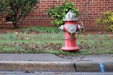
View Royal is connected to the regional water distribution system. The system is owned, operated, and maintained by the CRD Water Department. Residents and businesses in the Town are on metered water services and receive direct billing from CRD for water consumption. The CRD installs fire hydrants at locations requested by the View Royal Fire Department. The cost of installing hydrants is borne by the CRD (most often paid for by new developments). The costs of maintenance, amortization of capital costs, and water consumed are included in the retail water rates.
Water distribution mains to the majority of the Town provide sufficient quantities of potable water for current commercial, institutional and domestic uses, as well as for fire protection purposes. Areas outside the Urban Containment Boundary, in the Thetis neighbourhood, have more limited water service. Several properties rely on alternative sources for both consumable water and fire protection.
Four Water supply (transmission) mains do exist within View Royal. Contrary to the water distribution system, these supply mains carry bulk water from the Sooke Reservoir to the Capital Region. As these supply mains pass through View Royal to service the other Municipalities in the Capital Region, View Royal must be aware of the location of these systems prior to construction activities to avoid disrupting this regional system.
SEWER SYSTEM
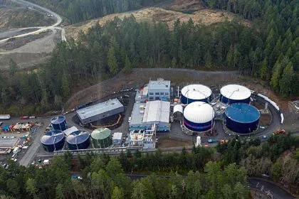
View Royal's sewer system consists of approximately 50 kilometres of pipeline and 17 pump stations, which are electronically monitored on a continual basis. In addition to the Town managed system, there are also privately managed sewer grinder pumps on properties that are lower than the gravity sewer system. All domestic sewage is eventually pumped from the Craigflower Pump Station on Shoreline Drive to McCauley Point in Esquimalt. These last two components of the system are operated and maintained by the CRD. View Royal’s Sanitary Plan outlines the desired upgrades to the sanitary sewer system with a detailed renewal program.
The CRD's Environmental Services Department has a Regional Source Control program aimed at reducing the amount of contaminants discharged into sanitary sewer systems. The program accompanies the CRD's Sewer Use Bylaw, which specifies the types of wastes that are prohibited or restricted for discharge into the sanitary sewer systems. The purpose of these initiatives is to ensure the functionality of the system and protect human and environmental health.
The existing sewer system is adequate for the existing residential and commercial development within the Urban Containment Boundary. However, sewer system upgrading is required for any substantial development or redevelopment to occur.
DRAINAGE SYSTEM
For much of View Royal, stormwater management is addressed through open ditches, culverts, and driveway culverts that drain to either Craigflower or Millstream Creeks or directly into the Esquimalt Harbour or Portage Inlet.
The open ditch drainage system has provided reasonable protection against local flooding; however, this may change due to a changing climate. For example, Provincial Flood Hazard Area Land Use Management Guidelines recommend planning for a Global Sea Level Rise of 0.5m by 2050, 1.0m by 2100 and 2.0m by 2200. Mitigation and adaptation strategies for existing municipal services and other infrastructure vulnerable to Sea Level Rise and storm surge impacts will be needed.
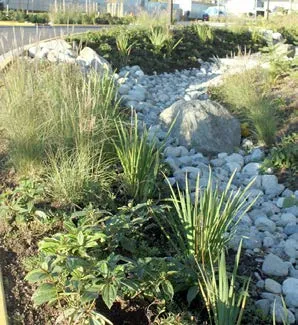
The Town's Master Drainage Plan was developed with consideration of climate change effects, including increased frequency, duration and intensity of storm events and flooding. The Town of View Royal has an aggressive fifteen-year drainage program and has been working systematically to improve the quality of stormwater that reaches Esquimalt Harbour and Portage Inlet. This includes major investments in bioswales and treatment wetlands associated with road improvement projects. In addition, all new development is required to develop a stormwater management plan that addresses stormwater quality and volume issues. This includes both on and off-site strategies and a range of solutions from small rain gardens to infiltration systems, roadside bioswales, and large, constructed wetlands.
GARBAGE, COMPOSTING, AND RECYCLING COLLECTION
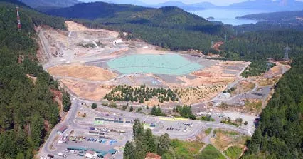
The Town contracts a company to collect residential garbage and household food waste on a weekly basis. These two waste streams are collected in separate colour-coded containers supplied to each household by the company. Residential garbage is disposed of at the Hartland Road Landfill, which is owned and operated by the CRD. Food waste is taken to a composting facility.
The Canteen Composting Facility in Esquimalt is available to View Royal residents free of charge at the gate. Lawn and garden waste is also collected three times per year at the curbside. Weekly curbside recycling is offered to all View Royal residents through the CRD Environmental Services Branch. The CRD also operates a recycling program for condos and apartments.
FIRE PROTECTION
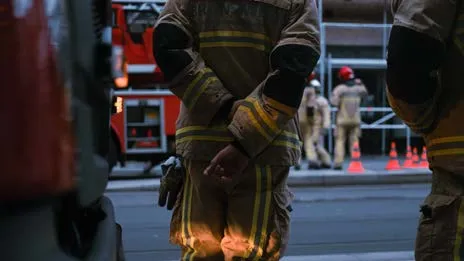
The Town of View Royal has a Fire Department with seven full-time staff and thirty part-time firefighters. In addition to responding to fire and rescue related incidents, the Fire Department provides fire prevention and education, emergency response and life-saving services, code inspections and enforcement, and it participates in regional emergency and safety initiatives. The Fire Department works cooperatively with other municipal departments and adjacent municipalities through mutual and automatic aid to ensure the best available coverage for all area residents and businesses.
TOWN OF VIEW ROYAL EMERGENCY PROGRAM
The View Royal Emergency Program comprises Town staff and dedicated volunteers who serve their community to prepare, respond, and recover from emergencies and disasters that may affect our municipality. It is a dynamic organization run by the View Royal Fire Rescue staff itself in order to meet provincial mandates, comply with the British Columbia Emergency Management System (BCEMS), and the current needs of its residents, businesses and infrastructure. The View Royal Emergency Program encompasses the following areas:
- Emergency Support Services (ESS)
- Neighborhood Emergency Preparedness Programs (NEPP)
- Emergency Radio Communication
- Emergency Operations Centre
- Public Education
- Staff and Volunteer Training
The Emergency Management staff maintains and manages emergency plans, emergency supplies and equipment, Emergency Operations Centre (EOC) and Emergency Reception Centres. We coordinate and facilitate training for staff and volunteers and host emergency preparedness workshops for the public. We are active in regional initiatives and a member of the Local Government Emergency Program Advisory Committee (LGEPAC) and the Regional Emergency Program Advisory Committee (REPAC).
View Royal's Emergency Program works closely with Emergency Management BC (EMBC) and the Federal department, Public Safety and Emergency Preparedness Canada (PSEPC). The Emergency Program also includes Emergency Support Services (ESS). ESS is a community-based provincial emergency response program providing short-term assistance to people forced to leave their homes because of fire, floods, earthquakes, or other emergencies. This assistance includes food, lodging, clothing, emotional support, and family reunification. The ESS provides relief for small to large groups of people for up to seventy-two hours.
POLICE PROTECTION
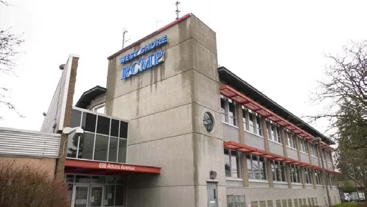
The Town of View Royal is serviced by the West Shore Royal Canadian Mounted Police (RCMP) detachment located at 698 Atkins Avenue in Langford. The detachment provides policing services to four other municipalities including the Cities of Langford and Colwood and the Districts of Metchosin and Highlands. West Shore RCMP also serves the Songhees and Esquimalt Nations and portions of the Malahat. West Shore RCMP has approximately one-hundred and three regular members and more than fifty support staff under the supervision of the Officer in Charge, a Superintendent. The detachment provides 24-hour police service covered by five General Duty Watches and averages more than 25,000 files each year. West Shore RCMP also comprises several specialized units, such as the Police Dog Services, Bike Unit, Uniformed Gang Enforcement Team, Indigenous Policing Services, Serious Crime Unit, Traffic Services, Community Policing Section, Crime Reduction Unit, Drug & Organized Crime Unit, and Special Victim’s Unit.
In addition to the regular policing services provided by West Shore RCMP, the detachment is also dedicated to various community-based services and programs administered by over fifty volunteers. These services and programs include Keep in Touch, Restorative Justice, Speed Watch, Victim Services referrals, Community Policing Advisory Committee, and the Auxiliary Constable program.
OBJECTIVES AND POLICIES
This section contains the Town’s objectives and policies related to providing and maintaining community infrastructure and services in View Royal.
OBJECTIVE IS1
Coordinate infrastructure and services with land use planning – Ensure that infrastructure and services investments are planned to coincide with the community Vision and long-term land-use planning priorities. This includes supporting compact development near existing infrastructure and protecting natural areas and ecosystems.
POLICIES
IS1.1 Resilience
Ensure that infrastructure and services are resilient to the risks and impacts of climate change and disasters.
IS1.2 Sustainable Development Pattern
Plan new infrastructure and services to support compact and sustainable development. Prioritize investments that support new housing, commercial and facility development within the planned Town Centre, Neighbourhood Centres, and Community Corridor areas. Extension into un-serviced areas will only be built in tandem with new development and will be financed by development projects. Extension of services in areas outside the Urban Containment Boundary or for developments that are not in conformance with the policies of this plan will not be supported.
IS1.3 Adequate and Appropriate Infrastructure
Ensure that development will only occur if appropriate infrastructure systems (water, wastewater, and sewer) and standards are in place and designed to the satisfaction of the Town. Work with developers and regional agencies to ensure adequate systems that promote conservation and expand only as necessary to accomplish goals and policies within this plan. The presence of adequate infrastructure is not in itself a justification for development.
IS1.4 Servicing Standards
Municipal infrastructure projects follow the Master Municipal Construction Documents (MMCD) and aim to advance green infrastructure practices.
IS1.5 New Development
Ensure that developments utilize best practices for infrastructure design, operations, and maintenance. Developers will be required to meet the Town’s standards and should be encouraged to incorporate innovative strategies, such as:
- On-site stormwater management and surface stormwater treatment.
- Net-zero runoff policy, with raw land as starting measuring point.
- Underground services.
- Water conservation and wastewater reduction.
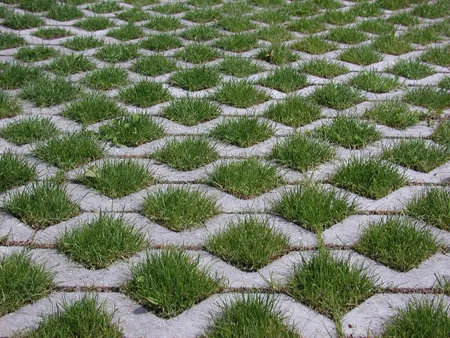
- Use of pervious surfaces and permeable landscaping materials.
IS1.6 Comprehensive Drainage Studies
Require comprehensive drainage studies that include drainage improvement recommendations and implementation procedures for all major developments.
IS1.7 Curbs and Gutters
Curbs and gutters will be required for new development in all commercial, mixed residential and mixed-use areas. The Town may adjust this requirement if a development proposal includes alternative approaches to stormwater management that support sustainable development, protect the natural environment, and are designed and implemented to the satisfaction of the Town.
IS1.8 On-site Sewage Disposal
Require strict adherence to the Vancouver Island Health Authority and Ministry of Environment guidelines for on-site sewage disposal and private wells in areas not served by the Town’s sewer system.
IS1.9 Emergency Access
Require developments to make adequate provision for emergency vehicle access and manoeuvrability and ensure that the infrastructure necessary to support fire protection activities is in place.
IS1.10 Fire Protection
Ensure fire protection is an important element in site and building design, with the view to shifting the burden of fire suppression to the developer and property owner.
IS1.11 Coordinate Public Projects
Plan new infrastructure in conjunction with roads, community facilities, parks, and other public spaces. Planning considerations should include:
- Stormwater management.
- Watershed issues.
- Integration of parks, greenways, and natural systems.
- Pedestrian, cyclist, and transit connectivity.
OBJECTIVE IS2
Environmental sustainability and protection – Preserving the integrity of the natural environment and protecting human health should be a major determinant in all infrastructure and services decisions. Ensure that new growth is balanced with the capacity of natural systems.
POLICIES
IS2.1 Environmentally Sensitive Design
Ensure that infrastructure and services are designed and located to be sensitive to surrounding land uses and reduce or eliminate run-off and adverse impacts on the natural environment. Design considerations should include:
- High energy efficiency building retrofits and new construction
- Utilizing natural features and systems such as trees, vegetation, and riparian areas for natural stormwater absorption and treatment
- Mimicking and incorporating natural systems
- Strategies to minimize the amount of stormwater entering the sewer system
- Sustainable approaches to wastewater management, such as site-specific wastewater infrastructure for private developments
- Utilizing pervious surfaces on driveways, parking lots and access roads
- Xeriscaping, infiltration basins, and green roofs as a means of reducing stormwater runoff and the heat island effect.
IS2.2 Green Infrastructure
Expand green infrastructure systems throughout the Town. Green infrastructure includes existing natural watercourses and drainage systems, engineered bioswales and groundwater recharge areas, green roofs, permeable surfaces, etc.
IS2.3 Sustainable Standards
Establish sustainable infrastructure standards for the Town of View Royal that incorporate innovative technologies and green infrastructure and ensure long-term resiliency and stability of services.
IS2.4 Water Conservation
Support strategies and develop incentives for reducing water consumption and wastewater generation. Strategies could include rainwater collection, greywater reuse (Including treated water for irrigation purposes) and dual piping systems.
IS2.5 Safe Water Supply
Work with the CRD and other agencies to protect the drinking water supply and prevent water contamination.
IS2.6 Stormwater Discharge
Ensure that the discharge of stormwater does not negatively impact adjacent water quality. Diverted stormwater collection and discharge systems require provision for grease, oil, hydrocarbon, and sedimentation removal facilities and ongoing maintenance of these facilities. Such systems shall be engineered to the satisfaction of the Town. Where a net benefit for fish habitat can be demonstrated, the Town may consider proposals from applicants to enhance fish habitat, including in-stream works or the creation of wetland areas, as part of alternative design options for development projects. These projects may be subject to approval from applicable provincial and federal government authorities.
IS2.7 Infiltration and Detention
Support stormwater management practices that emphasize infiltration and detention to minimize the effect of stormwater discharge into Esquimalt Harbour, Craigflower Creek, Millstream Creek and other natural watercourses.
IS2.8 Siltation Prevention
Ensure construction and other human activities are carried out to minimize siltation effects.
IS2.9 Waste Reuse
Recognize waste as a viable resource. Work with the CRD, other agencies and businesses to develop strategies to reuse solid waste, liquid waste and wastewater generated in View Royal.
IS2.10 Systems Longevity
Facilitate adequate operation and maintenance programs in order to maximize the life of infrastructure systems, reduce the frequency of replacement, and ensure proper functionality.
OBJECTIVE IS3
Fiscal sustainability— Ensure infrastructure and services are planned within the financial means of the Town and that investments continue to meet the high standards expected by the community.
POLICIES
IS3.1 Prioritize Investments
Prioritize infrastructure and services investments throughout the Town to best address local needs and maximize community benefit.
IS3.2 New Development Costs
Require that the cost of system upgrades to accommodate new development be borne by developers.
IS3.3 Local Improvements
Encourage the use of local improvements financing for systems upgrades and improvements in residential areas. “Local Improvements” refers to those works and services that directly benefit a local area or neighbourhood and not necessarily the community at large. Property owners may petition Council to undertake local improvements, whereupon Council would determine an appropriate proportionate sharing of the cost (e.g., 100% local area, 60% - 40%, etc.).
OBJECTIVE IS4
Solid waste management – Reduce the amount of solid waste entering the landfill from View Royal.
POLICIES
IS4.1 Waste Separation
Continue to work with the Capital Regional District and the private sector to maintain three-stream waste separation systems (garbage, recycling, composting) as a means of reducing the amount of solid waste reaching the landfill. Ensure that all collection programs are convenient and well-promoted to increase participation at the unit level, building level, in businesses and public institutions.
IS4.2 Household Food Waste Collection
Explore the expansion of the household food waste collection program to condos and apartments.
IS4.3 On-site Composting
Support small-scale composting on appropriate residential properties and in community gardens.
IS4.4 Construction Waste
Support regional initiatives to reduce construction waste and encourage sustainable waste reduction practices.
OBJECTIVE IS5
Protective services—Maintain a high level of protective services presence and programs in View Royal to ensure community safety and security.
POLICIES
IS5.1 Safety and Policing
Coordinate directly with the West Shore RCMP on safety and policing matters. Enhance the community’s sense of safety, security, and confidence in its police service by ensuring that:
- Emergency calls and complaints are consistently handled in an appropriate professional manner.
- Traffic control and the response to traffic accidents are as effective as possible.
- Bylaw enforcement is consistently carried out.
- Citizen participation in crime prevention activities is improved.
- The principles of Crime Prevention Through Environmental Design (CPTED) are systematically applied to ongoing and future development in View Royal.
IS5.2 Fire Protection
Maintain a composite Fire Department comprised of career and part-time firefighters. Continue the Fire Department’s commitment to providing the highest level of life and property safety with caring professionalism through effective training in the delivery of fire prevention, control, rescue, and public education services. Enhance the delivery of fire protection services through a well-coordinated approach to infrastructure improvements and review of development projects.
IS5.3 Comprehensive Emergency Plan
Enhance disaster preparedness through the ongoing review and implementation of a comprehensive emergency plan.
IS5.4 Sea-level Rise and Flood Planning
Plan for the safety of people and property in the occurrence of major flood events:
- Require assessment of minimum flood construction elevation by a qualified professional for new waterfront developments.
- Identify flood-prone areas and discourage development within floodplains.
- Require buildings located in areas susceptible to flooding to be adequately flood-proofed.
- Collaborate with adjacent municipalities to establish a routing strategy for major storm events.
- Coordinate flood planning with the CRD and other agencies.
- Establish Development Permit area guidelines for flood-prone areas that follow current Flood Hazard Land Management Guidelines for all new developments, subdivisions, and zoning to allow for sea-level rise to the year 2200.
8 | COMMUNITY FACILITIES AND SOCIAL WELLBEING
OVERVIEW
This chapter addresses community, cultural, and heritage resources in View Royal and establishes goals, objectives, policies and implementing actions for protecting these resources and better integrating them as assets into the community’s social and physical landscape.
The chapter also includes general statements related to well-being. Community facilities support social connections and increase community resilience, mental and physical health, and connection to place. Through its authority to plan and make decisions within its jurisdiction, the Town will have a significant influence on social and community well-being. The Town can also support the efforts of other governments, public agencies, and service providers in a collective effort to work towards social sustainability.
GOALS
- Honouring and building relationships with the Esquimalt Nation and Songhees Nation in the spirit of Reconciliation.
- Identify, preserve, and protect the historic and cultural sites in View Royal.
- Provide or facilitate community services and facilities that meet the needs of View Royal’s residents of all ages, abilities, and cultural backgrounds.
- Enhance the quality of life for the full diversity of View Royal residents.
- Identify ways to better engage youth and families.
- Promote a strong sense of community in all areas and neighbourhoods of the Town and create an enhanced sense of place and identity throughout.
COMMUNITY WELL-BEING
Communities are much more than buildings, parks, and infrastructure. The character of a community is directly related to the “quality of life” and “social, mental and physical well-being” experienced by its residents. Community well-being is reflected in the achievement of:
- Personal and public health.
- Satisfaction of basic material needs such as access to water, food and shelter.
- Economic security and opportunity.
- Protection from violence, threat, abuse, and discrimination.
- Reduced vulnerability to the effects of climate change.
- Mobility and ease of access for all ages and abilities.
- Sense of identification, belonging and connections to the past.
- Availability of choices and self-determination.
- Active participation in decision-making in community life and larger societal processes.
- Access to knowledge and personal skill development.
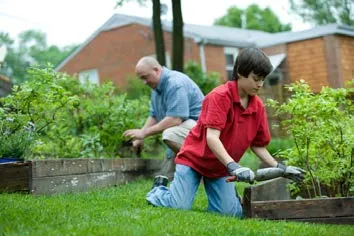
The Town of View Royal has not traditionally taken a proactive role in identifying and addressing residents’ social needs. Policy leadership and funding have generally been done by social, health and educational providers. The Community Social Planning Council has undertaken considerable community-based research on matters related to the quality of life and social inequities. However, as View Royal continues to grow, its demographic make-up changes, and the resources of other levels of government become more constrained, the Town recognizes that it can make a positive contribution to addressing social issues and concerns.
A diverse community is a vibrant community, and View Royal is welcoming to all. 2016 Census data of View Royal shows that approximately 20% of the resident population is visibly ethnically diverse, with 4.4% Indigenous population and 15.9% visible minorities or new immigrants. Of that 15.9%, approximately 40% identify as South Asian, 19% as Chinese, and 9.5% as Black. Different population groups have different opportunities and needs in their communities, and the Town recognizes the importance of being inclusive in supporting diverse needs. Equity, diversity, and inclusion are key considerations for the Town of View Royal because traditional planning practices have resulted in policies, programs, and regulations that can disproportionally impact and stymie the progress of some groups of people, thereby affecting their health, safety, and wellbeing. The OCP strives to ensure that equity considerations are embedded throughout and are specifically highlighted in this chapter.
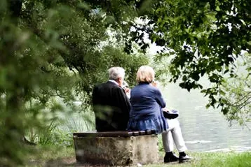
As is the case throughout the region and Canada, the population in View Royal is expected, on average, to become older. An aging population also creates demands for health and social services that serve seniors effectively. Similarly, the Town recognizes the specific needs of persons with disabilities, both visible and not. The OCP planning process identified the need to accommodate View Royal residents of all ages and abilities to age in place and have equitable access to services and opportunities for recreation, wellbeing, and quality of life.
From a jurisdictional perspective, the role that View Royal has will focus on facilitation, advocacy, and information exchange. Of relevance are matters related to accessibility for persons with visible and invisible disabilities, childcare, family support, access to health care, life-long education, literacy, and food security. A number of these matters in this section are also referenced in other parts of the Plan. This involves recognizing and accommodating all our resident’s transportation and mobility needs, housing choices and recreation abilities and interests.
HERITAGE
The story of View Royal can be traced back and retained through the tangible and intangible acts of storytelling, writing, photography, acts of celebration and festivals, our physical and natural structures. lək̓ʷəŋən peoples, known today as the Esquimalt Nation and Songhees Nation and that their historic connections to these lands continue to this day. Their presence in View Royal goes back to time immemorial, and the Town’s colonial history can be traced back to the 1850s.
The Town has a rich history, with specific links to well-known historic points, including the Hudson Bay Company, the Royal Navy, and the presence of industries like lumber, farming and agriculture, and hospitality. Today, limited lands in View Royal are rural, farmed or designated within Agricultural Land Reserve.
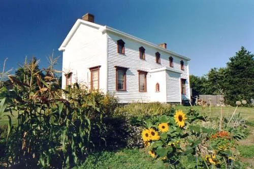
View Royal is home to some of the oldest buildings in the Capital Region and some of Canada’s National Historic Sites. The Craigflower Manor site, completed in 1856, is one of the four original farms the Hudson’s Bay Company set up as part of their obligations in settling on Vancouver Island. As Victoria grew in population, people built seasonal cottages along the Town’s shoreline for getaways. Many of these historic structures remain and have been converted into year-round residence.
CULTURAL RESOURCES
Cultural resources in View Royal include local schools, daycares, places of worship, public art and streetscaping, local events and celebrations, community groups, and arts and sports organizations.
Schools and daycares play a vital role in the community. They provide essential education for youth, social and educational enrichment opportunities, recreation spaces, and community meeting and gathering places. Shoreline Community Middle School, Eagle View Elementary School and View Royal Elementary School are located within the Town’s boundaries. High schools in Colwood, Saanich and Esquimalt also serve local students. Since the 2011 OCP, View Royal has had several large daycares open to support the families who reside here.
The Town of View Royal is a member of the Greater Victoria Public Library (GVPL). This membership allows View Royal residents free access to all the GVPL branches, the closest of which is located at the Juan de Fuca Recreation Centre Complex in Colwood. In addition, the Town has its own reading centre. The View Royal Reading Room is free to all View Royal residents and offers a circulating collection for all ages of over 15,000 materials. The Reading Room participates in the provincial inter-library loan system, allowing patrons to request and borrow books from any library in British Columbia.
Cultural resources include visual and performing arts, and heritage resources. The Craigflower Manor Site has been re-activated as a cultural resource site and is recognized as a National Historic Site of Canada. View Royal has a thriving arts community, with visual and performing arts being central to many in their day-to-day lives. The Town is a full participant in the Capital Regional District Arts Service, which provides operating and project grants to the festivals, performing arts, general arts, and visual arts of non-profit organizations such as the Art Gallery of Greater Victoria, Ballet Victoria, the Victoria Jazz Society, and the Victoria Symphony. View Royal also holds festivals like the Light Up View Royal, the Highland games and Canada Day celebrations held at the Craigflower Manor. The Town collaborates with neighbouring municipalities for other celebrations and important dates.
OBJECTIVES AND POLICIES
The objectives and policies in this section provide a long-range framework for protecting heritage resources, promoting heritage conservation, meeting community and social needs, involving youth, and supporting and strengthening View Royal’s cultural assets.
OBJECTIVE CH1
Identify and protect significant cultural and heritage resources.
POLICIES
CH1.1 Municipal Heritage Register
Continue to identify and add heritage properties to the Town’s Heritage Register.
CH1.2 Protection of Heritage Structures and Sites
Encourage the protection, restoration and upkeep of heritage structures and sites in View Royal to support the long-term sustainability of these assets.
CH1.3 View Royal Community Archives
Continue to promote the View Royal Community Archives as an important local heritage resource. Encourage volunteerism, grants, and donations as other mechanisms for maintaining the Archives.
CH1.4 Heritage Organizations
Develop and strengthen relationships with heritage organizations in the region to support the research of heritage matters in View Royal.
CH1.5 Archaeological Sites Referrals
Continue to refer development applications on or adjacent to archaeological sites to the B.C. Archaeology Branch.
CH1.6 Temporary Protection
Consider establishing temporary protection of property having potential heritage significance when alterations or redevelopment are proposed for such a property that has not been designated for protection. The temporary protection of the property should be carried out in accordance with the Heritage Act for the specific purpose of determining if the property should be designated as a heritage property.
CH1.7 Heritage Revitalization Agreements
Consider adopting a bylaw authorizing a Heritage Revitalization Agreement (HRA) as a means of approving the redevelopment of a heritage property. The goals of enabling an HRA include:
- Ensuring the protection of heritage features
- Supplementing or varying existing bylaws
- Providing incentives for heritage conservation and innovation reuse of a heritage property
- Establishing and enforcing the term of heritage conservation
OBJECTIVE CH2
Integrate View Royal’s cultural heritage and cultural assets into the social and physical landscape of the Town to communicate the community’s past, strengthen its sense of place, and increase public awareness.
POLICIES
CH2.1 Public Education and Awareness
Support increased public education and awareness of the Town’s history and culture, including local First Nations history and culture. This may include educational campaigns and exhibits, collaborations with local schools, installations of historical plaques or markers, permanent displays, and specific events or meetings.
CH2.2 Adaptive Reuse
Encourage adaptive reuse of heritage buildings. Work with the development community and owners of heritage buildings to find innovative solutions that will permit change while minimizing the impact on heritage values and finding uses that recognize the existing cultural function of heritage buildings.
CH2.3 Culture and Heritage Integration
Support the integration of heritage and cultural features into the public realm as landmarks and points of interest. Encourage planning and design that responds to local heritage features and includes cultural expressions.
CH2.4 Design Compatibility
Consider design compatibility of proposed developments adjacent to sites containing buildings or features identified as having heritage significance.
CH2.5 Local First Nations
Advocate for and be welcoming to respectful integration of local First Nations culture through relationship building and participation of Songhees Nation and Esquimalt Nation community members through the participation of Songhees Nation and Esquimalt Nation peoples in cultural exchange, like public art initiatives, public meetings, and local celebrations.
OBJECTIVE CH3
To facilitate, advocate and share information on community needs, equity, diversity and inclusion, and emerging social issues.
POLICIES
CH3.1 Collaboration
Encourage a coordinated approach to the identification of community needs and responses to these needs through collaboration with government and non-profit social agencies/organizations, as well as with View Royal’s policing agency, the West Shore RCMP.
CH3.2 Communication
Communicate and collaborate regularly with a full range of public and non-profit providers of health and social services, including early childhood educators and those working as support workers in caregiving roles.
CH3.3 Capacity Building
As time and resources permit, assist in building community capacity among community groups in relation to social and community needs.
CH3.4 Equity, Diversity, and Inclusion
Seek input from equity-priority and under-represented groups on how they would like to participate in engagement processes safely and comfortably; create an engagement strategy accordingly. View Royal will consider the use of a range of formal and informal citizen and stakeholder advisory bodies such as but not limited to standing and select committees of Council, task forces, citizen assemblies, review panels and advisory councils.
CH3.5 Advocacy Positions
Advocate to other levels of government in relation to local social needs and issues. In an advocacy role, the Town will ensure that its position is supported by thoroughly documented research, whether undertaken by the Town or others.
CH3.6 Access to Government Programs
Assist residents of View Royal to access grants or funding from other levels of government in relation to social needs by providing access to current information at the Town Hall, in newsletters, and on the Town’s website.
CH3.7 Crime and Harm Prevention Initiatives
Support community-based and agency initiatives to prevent crime and reduce potential harm to individuals. Advocate for the continuation and promotion of RCMP community-outreach programs, including drug awareness and other programs offered through elementary schools, neighbourhood watch, speed watch, and the “Keep in Touch” program for seniors living alone.
OBJECTIVE CH4
Lands supporting traditional foods are protected, and traditional practices are celebrated.
POLICIES
CH4.1 Traditional Foods
Collaborate with lək̓ʷəŋən peoples to identify, protect, and restore lands and waters in support of gathering and harvesting traditional foods
CH4.2 Traditional Plants
Engage and collaborate with knowledge-keepers, where there is interest, to develop Indigenous gardens and harvesting areas that focus on the cultivation of culturally important species of plants for food, ceremony and medicine and include public education and awareness opportunities.
CH4.3 Celebrating Foods
Look for opportunities to collaborate with the Songhees Nation and Esquimalt Nation to celebrate traditional foods through collaboration in festivals, markets, and other appropriate events.
OBJECTIVE CH5
To facilitate the creation of dedicated space for community needs.
POLICIES
CH5.1 Child Care Spaces
Work with other agencies to promote and encourage larger employers to provide on-site space for community childcare and before and after school care.
CH5.2 Community Meeting Spaces
Consider the development of a policy to require new commercial, business, and larger multi-unit residential development to provide common meeting space areas for use by the local community and/or areas to be used by public and non-profit service providers.
CH5.3 Public Markets
Support the development of farmers and artisan markets to support local access to food and support of the local economy
OBJECTIVE CH6
To provide youth with access to facilities, programs and other opportunities that help to encourage a life-long interest in community, social and civic issues.
POLICIES
CH6.1 Engaging Schools
Continue to involve the administrations of View Royal Elementary, Eagle View Elementary and Shoreline Community Secondary schools in the Town’s planning initiatives.
CH6.2 Hospital
Engage with the Victoria General Hospital in future planning for expanded care services, ancillary services, and facilities redevelopment.
CH6.3 Consider Needs of Youth
Ensure that the interests of youth are fully considered in Town-initiated planning initiatives, events, and activities.
CH6.4 Youth Recreation and Leadership
As a municipal member of West Shore Parks and Recreation, continue to support opportunities for youth to be involved in leadership roles in recreational and leisure activities.
OBJECTIVE CH7
To be an inclusive community that values all people through facilitating equitable access to facilities, programs, and other opportunities to support their ongoing involvement in community, social, and civic issues.
POLICIES
CH7.1 Consider Needs of Seniors
Ensure that the interests of seniors are fully considered in Town-initiated planning initiatives, events, and activities, including support services and housing that facilitates aging in place
CH7.2 Promote Social Connectedness for All
Provide sufficient, high-quality public spaces, recreation spaces, gathering spaces and amenities to support all ages and abilities to gather, age in place, and meet the specific needs of seniors and people with disabilities. This includes providing public washrooms, seating areas, and drinking fountains.
CH7.3 Engaging with Caregivers
Seek out opportunities for engaging with and supporting caregivers, including those working in assisted living, long-term care, and live-in caregivers. Search for opportunities to include them in future planning.
CH7.4 Physical, Emotional, and Mental Wellbeing
The Town will continue to seek out and provide equitable access to a broad range of inclusivity measures in the public realm that supports the mental and physical health of residents of all ages and abilities. This includes people with visible or invisible disabilities.
CH7.5 Accessible Recreation
As a municipal member of the West Shore Parks and Recreation, continue to support opportunities for accessible recreation and leisure opportunities.
OBJECTIVE CH8
Support cultural activities, events, and expressions that contribute to a positive social environment, public education, greater cultural understanding and a stronger sense of local identity and pride.
POLICIES
CH8.1 Public Gathering Places
Encourage the development and enhancement of public gathering places that can be used for social and cultural events and activities. These may be purpose-built spaces as well as multi-use spaces, such as plazas, parks, community halls, schools, outdoor performance areas, waterfront areas and streets.
CH8.2 Community and Cultural Organizations
Support community and cultural organizations that operate in View Royal and local cultural events and activities such as annual celebrations, fairs and festivals, outdoor markets, and arts and sports events.
CH8.3 Public Art
Increase the amount of public art throughout View Royal. Support the integration of public art into public and private development, transportation, and infrastructure projects.
OBJECTIVE CH9
Support the physical and social well-being of residents through access to affordable, healthy, and local food.
POLICIES
CH9.1 Healthy Food
Encourage the establishment of small-scale healthy food retail options such as both year-round and seasonal farmers markets, small to mid-size grocery stores, mobile food vendors, bakeries and restaurants within the Town, neighbourhood nodes, corridors, and Town Centre.
CH9.2 Urban Agriculture
Encourage and integrate opportunities for urban agriculture (including community gardens, small plot farming, greenhouses, and gardening to support pollinators and foraging) on municipal lands, park spaces and vacant lands. Support priority access to these gardens for View Royal residents who otherwise don’t have access to a garden.
CH9.3 Food Production in Multi-family housing
Encourage the provision of gardens and other food production spaces for the use of residents in new multi-family residential housing, as guided in the Development Permit Area Guidelines.
OBJECTIVE CH10
Public schools—Ensure the long-term presence and function of public schools in View Royal to meet the educational, social, and cultural needs of the community.
POLICIES
CH10.1 Public Schools
Recognize public schools as important community gathering places, community education centres, and cultural activity spaces in View Royal. Strengthen relationships between the Town and individual schools, the School District and groups operating within the schools to support the further development of these facilities as community resources.
CH10.2 School Planning
Work collaboratively with the School District to plan facility upgrades, school development projects, and the long-term use of surplus facilities or land. Support the continued operation of the existing public schools in View Royal, and work with the School District to assess and plan for future needs.
CH10.3 Community Resilience
Support and build neighbourhood capacity in strengthening social connections, climate action, and community resilience through neighbourhood-driven initiatives based on asset-based community development approaches.
OBJECTIVE CH11
Library services—Ensure convenient, local access to library services and resources.
POLICIES
CH11.1 Greater Victoria Public Library
Continue to support the Town’s membership in the Greater Victoria Public Library and encourage initiatives to better connect local residents with the library system.
PART 3: DEVELOPMENT PERMIT AREAS
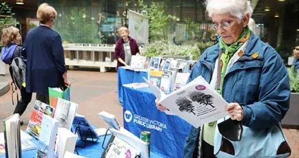
- JUSTIFICATION AND AUTHORITY
- FORM & CHARACTER OF DEVELOPMENT
- Mixed Residential
- Intensive Residential
- Neighbourhood Mixed Use
- Intensive Mixed Use
- ENVIRONMENTAL PROTECTION & NATURAL HAZARD DEVELOPMENT PERMIT AREAS
- Natural Watercourse & Shoreline Access
- Sensitive Terrestrial Ecosystems
- Natural Hazard Wildfire Interface
SCHEDULE C FORM & CHARACTER DEVELOPMENT PERMIT AREAS
SCHEDULE D ENVIRONMENTAL PROTECTION AND NATURAL HAZARD DEVELOPMENT PERMIT AREAS
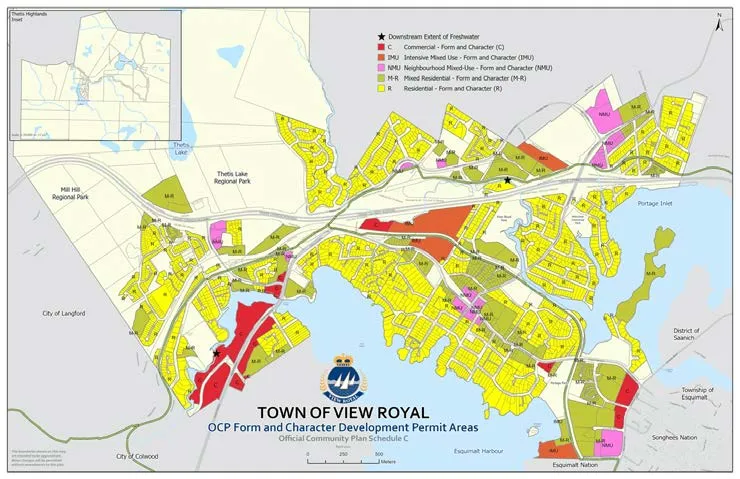
JUSTIFICATION AND AUTHORITY
The Local Government Act provides municipalities with the authority to establish a development permitting system. Unless exempted by this Plan or a zoning bylaw, any proposed building and subdivision within a Development Permit Area (DPA), shown on Schedule C or D, requires a development permit issued by the Town of View Royal. In accordance with the Local Government Act, this Plan sets out the special conditions that justify each DPA.
Development permits are one of the most effective legal tools for the protection of environmentally sensitive areas, avoiding development in hazardous conditions, and setting out expectations regarding “form and character” of development. Local governments may designate Development Permit Areas (DPAs) in an OCP. When an area is designated, the local government must describe the special site conditions or objectives that justify the designation and specify guidelines to achieve those objectives.
This section sets out a number of Development Permit Areas for View Royal and provides the justification for their designation.
The Town may designate Development Permit Areas under Section 488 (1) of the Local Government Act for the following purposes: a. Protection of the natural environment, its ecosystems and biological diversity; b. Protection of development from hazardous conditions; c. Protection of farming; d. Revitalization of an area in which a commercial use is permitted; e. Establishment of objectives for the form and character of intensive residential development; f. Establishment of objectives for the form and character of commercial, industrial or multi-family residential development; g. in relation to an area in a resort region, establishment of objectives for the form and character of development in the resort region; h. Establishment of objectives to promote energy conservation; i. Establishment of objectives to promote water conservation; and j. Establishment of objectives to promote the reduction of greenhouse gas emissions.
To ensure that the goals and objectives of View Royal regarding new development and natural areas are met, the OCP designates certain areas of the Town as Development Permit Areas as shown on Schedules C and D.
With respect to guiding form and character of development and promotion of energy conservation, four areas are designated as Development Permit Areas, consistent with the Land Use Designations shown on Schedule A:
- Residential
- Mixed Residential
- Neighbourhood Mixed Use
- Intensive Mixed Use
- Commercial
Two Development Permit Areas, as shown on Schedule D, have also been established for the protection of the natural environment and the protection of development from hazardous conditions:
- Natural Watercourse and Shoreline Areas
- Sensitive Terrestrial Ecosystem Areas
- Natural Hazard Wildfire Interface
FORM AND CHARACTER OF DEVELOPMENT
GENERAL GUIDELINES
General Guidelines apply to all Areas shown as Mixed Residential, Intensive Residential, Neighbourhood Mixed Residential Use, Neighbourhood Centre, Intensive Mixed Use, and Commercial on Schedule C of the OCP as designated Development Permit Areas as per the Local Government Act Section 488(1)(e), (f), (h), (i) and (j) for the establishment of objectives and the provision of guidelines for the form and character, water and energy conservation and reduction of GHG emissions.
EXEMPTIONS
In all areas designated Mixed Residential, Neighbourhood Mixed Residential Use, Neighbourhood Centre, Intensive Mixed Use, or Commercial, the following development is exempt from obtaining a Development Permit:
- Internal alterations to a building.
- Building additions, external building, or site alterations, not exceeding an estimated construction value of $75,000 which are so similar in their effect on the form and character of development as to not warrant an application in the opinion of the Director of Development Services.
- Detached residential buildings on lots greater than 360m2.
VARIANCES
i. Variances to building setbacks, building height, off site works, parking, and landscaped requirements may be considered where it can be shown that the variance does not impact substantial compliance with the intent of the guidelines.
GUIDELINES – LANDSCAPING
i. Retain mature trees and, wherever possible, established vegetation, especially around natural features (e.g., creeks, ponds, slopes, and rocky outcroppings) for visual interest and to limit disruption of natural systems. ii. Utilize native species wherever possible in site landscaping. Invasive species (e.g., English Ivy, Broom) should not be used. Plants should be chosen for seasonal interest and compatibility with the local climate. Large expanses of lawn are not encouraged. iii. Provide sufficient topsoil to promote well-rooted landscaping that requires less irrigation and stays green longer during drought conditions. iv. Plant trees and remove trees selectively to maximize passive solar gain, natural ventilation and natural cooling, and increase the entry of natural light into buildings. v. Plant trees and other vegetation around buildings to act as windbreaks against cold winter winds, and to direct cooling summer breezes. vi. Where possible, enhance the natural green network by increasing the quantity, density and diversity of trees. vii. Where applicable, plant trees in trenches rather than in large underground containers so trees live longer and grow larger as they mature. viii. Landscape design that emphasizes water conservation or “xeriscape” principles is strongly encouraged. This includes working with existing site elements and drainage, soil improvement, appropriate plant selection (drought tolerant, hardy flowers and shrubs), minimizing lawn area, efficient irrigation, and adequate mulching. ix. Space for private or communal gardening and the use of native plants, edible plants, berry bushes and fruit trees in landscaping is encouraged. x. Use a combination of soft and hard landscape elements to create functional and visually appealing private and semi-private outdoor space. xi. Location, height and spacing of retaining walls and fencing should refer to section 4.8 of the Town of View Royal Zoning Bylaw No. 900, 2014. xii. Use permeable or porous paving materials and/or light-coloured reflective paving materials (e.g., white asphalt, concrete made with white cement mixtures, light- coloured pavers) for sidewalks, driveways, roads, and parking lots. xiii. Limit impervious paving and/or dark-coloured absorptive materials for sidewalks, driveways, roads, and parking areas. xiv. Define the transition from public to private space with hard and/or soft landscape elements such as low hedging, low solid or a combination of permeable/transparent fencing (such as wrought iron above a solid base). xv. Landscaping of townhouse and apartment developments should contribute to a pedestrian friendly streetscape and used as a buffer between different uses, using street trees and other plantings to soften building edges, provide visual interest, transition, and establish a sense of pedestrian enclosure. xvi. Low-rise apartment should consider the inclusion of common gathering areas with age-appropriate features and sited in such a way as to maximize exposure to sunlight. xvii. Where applicable, landscaping should contribute to a pedestrian-friendly streetscape and may include street trees, planters, decorative paving, seating, and use of other materials or furniture to add interest and define the pedestrian realm. xviii. Landscape design strategies should be incorporated that minimize stormwater runoff and promotes the natural infiltration and cleaning of runoff. xix. Landscaping should incorporate an automatic irrigation system. xx. Tree species of sufficient height and canopy spread should be used to provide shade and improve the visual appearance of parking areas. xxi. Parking areas visible from streets and adjacent residential buildings should be screened with substantial landscaping. Surface parking areas should incorporate trees in planting islands to increase permeability and provide shade. xxii. Landscape design strategies should incorporate stormwater retention and infiltration areas to achieve a net zero site runoff from pre-development levels. xxiii. Use of naturalized ponds, bioswales or rain gardens to collect, store and/or attenuate the flow of rainwater and potentially re-use rainwater to irrigate non-edible plants and landscaping is encouraged. xxiv. All landscaping work and plant material shall conform to the most recent edition of the British Columbia Landscape Standard published by the British Columbia Society of Landscape Architects.
GUIDELINES – LIGHTING
i. Building and site lighting should be sufficient to ensure pedestrian and motorist safety. ii. Lighting fixtures that are “dark skies” friendly to limit light pollution at night are strongly encouraged. This includes fixtures that control the quantity, quality, and direction of night lighting. iii. Identify and light only areas where and when lighting is needed to meet safety purposes (e.g., parking lot, doorways, walkways, signage). iv. Limit light “trespass”, lighting that crosses property lines. Light levels at the property line should not exceed 0.1 footcandles (fc) adjacent to business properties, and 0.05 fc at residential property boundaries. v. Landscape and safety lighting should be “fully shielded” and directed downwards with “zero uplight” using professionally recommended type of light fixtures. vi. Sign lighting mounted above the sign is encouraged. Lighting should be aimed so that light falls entirely on the sign and positioned so that the light source (bulb) is not visible from any point off the property or into the roadway to reduce glare. No more than 200 lumens is necessary for good visibility. vii. A compact fluorescent (2700K or less) or High-Pressure Sodium lighting is recommended unless the light is motion sensor activated, in which case LED, incandescent, or the instant start compact fluorescent bulbs can be used. Metal Halide (due to its higher costs, energy use, impact on the environment, and greater contribution to "sky glow") is discouraged, as well as LED light sources rated over 2300 Kelvin. viii. Automatic controls that turn off lights (or sections of lights) when not needed are strongly encouraged. ix. Where pole-mounted lighting is necessary, light standard luminaries shall be no more than 40,000 lumens and mounted on poles no more than 5 metres high. x. Light fixtures should be consistent with the general design character of the building. xi. Use energy-efficient lighting or solar powered lighting exterior for walkways, driveways, entryways and general exterior lighting. xii. Where applicable, street lighting standards should be pedestrian scale, while providing sufficient light for automobile traffic. xiii. Where applicable, street light standards should be consistent with street furniture and garbage/ recycling receptacles. xiv. Where applicable, outdoor electrical outlets should be provided at regular intervals to facilitate the installation of seasonal/decorative outdoor lighting.
GUIDELINES – SAFETY
i. All developments should be designed for safety and security by incorporating Crime Prevention Through Environmental Design principles and guidelines with particular attention to passive surveillance, good site lines, appropriate lighting, clear definition of private, semi-private and public space, and appropriate access control measures.
GUIDELINES – OTHER
i. Implementation of “adaptable design standards” in residential development is encouraged to accommodate individuals with mobility challenges, and to facilitate “aging in place”. ii. Incorporate of Green Building strategies such as Leadership in Energy and Environmental Design (LEED®), Build Green® standards or Passive House Canada standards in the design and construction all buildings are highly encouraged. iii. Use of on-site renewable energy generation systems to supply electricity, heating and cooling energy to buildings and other structures, water pumps, sewage pumps and/or charging stations for electric vehicles is encouraged. iv. Incorporation of resource and energy efficiency into the siting, design, construction and maintenance of buildings and structures is highly encouraged. v. Incorporation of best practices for “bird friendly” building design is strongly encouraged to help reduce bird deaths caused by collisions with buildings at mature tree height, or up to the fourth floor of the building, whichever is highest. vi. Increase the visibility of window glass. This includes consideration for the type and extent of glass on the building façade, recessed windows, balconies and awnings and visual markers. vii. Apply visual markers to the exterior of glass surfaces with gaps between markers no greater than 5cm vertically or 10cm horizontally and interrupt reflective glass by increasing density of external visual markers, use of adapted fenestration patterns, external blinds, shutters, sunshades, grilles, louvers, or artwork. viii. Design corner windows, glass walkways, glass railings and other similar features to reduce the appearance of clear passage to sky or vegetation. ix. Dampening reflections through the use of canopies or sunshades to cover windows at ground level and the use of screens, drapes, or blinds to increase the opacity of clear glass are encouraged. x. Ventilation grates and drains should have openings no larger than 2 by 2 cm or 1 by 4 cm to ensure that birds cannot be trapped within and all ends of all open pipes, large and small, must be capped so that birds do not become entrapped when investigating these openings for nesting opportunities. xi. Where used, all signage should be architecturally compatible with the style, composition, materials, colours, and details of the buildings, with no internal illumination, and method of installation hidden.
DEVELOPMENT PERMIT AREA: MIXED RESIDENTIAL
Areas shown as Mixed Residential on Schedule C of the OCP are designated Development Permit Areas as per the Local Government Act Section 488(1)(e), (f) for the establishment of objectives and the provision of guidelines for the form and character of multi-unit residential development in the Town of View Royal.
JUSTIFICATION
Development of duplexes, multi-plex townhouses and low-rise apartments on existing multi-family sites and along key transportation corridors provides a variety of housing types, styles and costs. This variety ensures people of different ages, income levels and stage of life can find homes in View Royal. It also serves to:
- Transition between single detached housing and areas of higher density;
- Maintain character of existing neighbourhoods while accommodating population growth;
- Incrementally replace aging housing stock; and
- Efficiently use land in an unobtrusive manner.
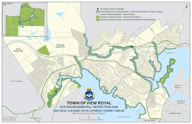
OBJECTIVES
The objectives of requiring a Development Permit in the areas identified as Mixed Residential are to:
- Create opportunities for higher density housing along busy corridors and within existing multi-family designated sites, with minimal the impact on the adjacent established single detached housing neighbourhoods;
- Ensure duplexes, multi-plex, townhouses and low-rise apartments; complement existing residential areas in terms of building style, visual character and scale;
- Ensure duplexes, multi-plex, townhouses and low-rise apartments contribute to a walkable public realm, and;
- Achieve a high standard of design.
GUIDELINES – DESIGN CHARACTER
i. Residential buildings should address the public realm, contribute to a positive pedestrian friendly streetscape, and provide “eyes on the street” for natural surveillance of the public realm through the provision of entrances, windows, patios, balconies, porches and decks facing public streets and spaces. ii. The exterior design and finish of new developments should be compatible with, and complementary to, existing housing in the neighbourhood. iii. Materials should be durable and of high quality, reflecting the natural surroundings of View Royal and a “West Coast” design character, and bring in elements of wood, stone and a natural colour palette. Natural materials are preferred. iv. On corners and at intersections, both public frontages should address the street and present a consistent design and use of materials, windows, articulation, and roof treatments. v. Ground floor units in townhouses and multi-unit buildings should have individual front doors that are directly accessible and visible from the street and emphasized with architectural detailing, glazing, colour, or other defining features. Weather protection should be incorporated into the entrances of multi-unit buildings. Ground floor units may be raised up to 0.6 metres (two feet) above grade to provide privacy for dwelling units. vi. Direct access to private outdoor space, some of it covered, should be provided for all units.
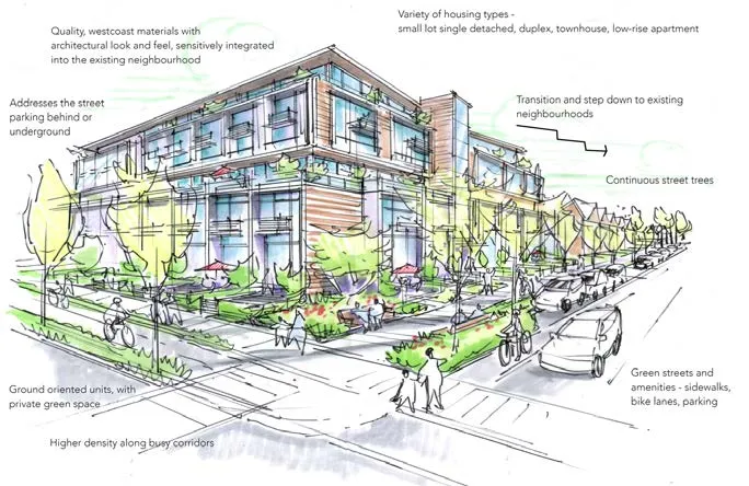
vii. Screening of mechanical equipment, vents, etc. on roof or inside yards is strongly encouraged. viii. Garage doors should not dominate the front elevation. ix. Development should fit with the neighbourhood character in building design, landscape design, and site design that respects the surrounding context.
GUIDELINES – SITING AND MASSING
i. Site design should respond to the topography and specific conditions of the site and retain/work with existing grades and natural features such as rock outcroppings, mature trees, and sensitive ecosystems such as Garry Oak meadow, riparian areas, and shorelines. ii. Residential development should be oriented towards the street, except where natural features (slopes, rocks, vegetation) prevent this configuration. iii. Where feasible, orient buildings to maximize winter solar gain and summer cooling. iv. New development that abuts existing detached residential houses, duplexes, townhouses, and low-rise apartments should transition between the two using a variety of means such as rooflines, building heights, building materials and landscaping. v. Create visual interest by providing variations in height, rooflines, massing. vi. Attempt to maintain important public views to natural areas and scenic vistas through careful siting, building design and landscaping. vii. Building siting and placement of balconies, decks and windows should limit overlook and shadowing impacts on neighbours. viii. Buildings over two-storeys should utilize setbacks and/or terracing above the second level to reduce massing impacts on the street and surrounding neighbours, preserve view corridors and provide visual interest. ix. Attempt to maintain important public views to natural areas and scenic vistas through careful siting, building design and landscaping.
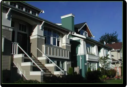
GUIDELINES – PARKING, ACCESS, AND CIRCULATION
i. Residential parking for townhouse and low-rise apartments should be located to the rear of the development or underground wherever possible. Residential surface parking shall be limited to detached and semi-detached dwellings. ii. Residential surface parking should incorporate permeable features such as pavers, pervious asphalt or concrete or reinforced paving/grass to increase permeability. Gravel driveways or parking areas are not permitted. iii. To enhance visual appeal, surface parking areas should include landscaping, screening, and decorative materials. iv. Shared driveways are encouraged, with specific conditions, where the number of entrance points to a street must be minimized, to reduce impervious surfaces, preserve existing vegetation, provide larger areas for landscaping, and limit the number of driveways crossing public sidewalks. v. Access to small lot residential lots should be through the lane, where a lane exists. vi. Driveways, pathways, and entrances on low-rise apartment sites should be accessible to all residents and visitors. vii. Underground parking should be designed and setback 3 meters from lot lines to facilitate the successful planting and development of mature trees. viii. In apartment developments, sheltered bicycle parking for visitors should be provided at an accessible location near the primary entrance and located so as to ensure passive surveillance.
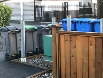
ix. Locate and screen off-site parking areas, garbage and recycling storage, vents, meters, and transformers to minimize their visual impact on the public realm and neighbouring properties.
DEVELOPMENT PERMIT AREA: INTENSIVE RESIDENTIAL
Areas shown as Intensive Residential on Schedule A of the OCP are designated Development Permit Areas as per the Local Government Act Section 488(1)(e)(f) for the establishment of objectives and the provision of guidelines for the form and character of small lot intensive and ground oriented multi-family residential development in the Town of View Royal.
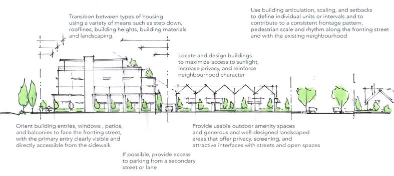
JUSTIFICATION
Development of single detached dwellings on small lots, carriage homes, duplexes, ground oriented multi-family, such as triplex, fourplex and courtyard housing, and townhouses in new and established residential neighbourhoods provides a variety of housing types, styles, and costs. This variety ensures people of different ages, income levels and stages of life can find homes in View Royal. It also serves to:
- Sensitively integrate new residential infill into existing neighbourhoods with predominantly single detached residential housing;
- Maintain character of existing neighbourhoods while accommodating some additional population growth;
- Incrementally replace aging housing stock, and;
- Efficiently use land and existing infrastructure in an unobtrusive manner.
OBJECTIVES
The objectives of requiring a Development Permit in the areas identified as Intensive Residential are to:
- Create opportunities to gently increase density with minimal impact on established neighbourhoods;
- Ensure small lot single detached housing, carriage homes, duplexes, ground oriented multi-family, and townhouses; complement existing residential areas in terms of building style, visual character and scale;
- Ensure small lot single detached housing, carriage homes, duplexes, ground oriented multi-family, and townhouses contribute to a walkable public realm, and;
- Achieve a high standard of design.
GUIDELINES – DESIGN CHARACTER
x. Residential buildings should address the public realm, contribute to a positive pedestrian friendly streetscape, and provide “eyes on the street” for natural surveillance of the public realm through the provision of entrances, windows, patios, balconies, porches and decks facing public streets and spaces. xi. The exterior design and finish of new developments should be compatible with, and complementary to, existing housing in the neighbourhood. xii. Materials should be durable and of high quality, reflecting the natural surroundings of View Royal and a “West Coast” design character, and bring in elements of wood, stone, and a natural colour palette. Natural materials are preferred. xiii. On corners and at intersections, both public frontages should address the street and present a consistent design and use of materials, windows, articulation, and roof treatments. xiv. Ground-oriented multi-family and townhouses should have individual front doors that are directly accessible and visible from the street and emphasized with architectural detailing, glazing, colour, or other defining features. Weather protection should be incorporated into the entrances of multi-unit buildings. Ground floor units may be raised up to 0.6 metres (two feet) above grade to provide privacy for dwelling units.
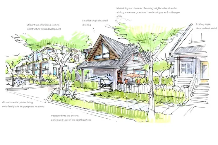
xv. Entrances to carriage homes should have direct pedestrian access from the street with a minimum 1-metre-wide pathway to access the unit. Where rear lanes exist, parking and access will be provided via the laneway. Doors and windows should be located to provide 'eyes on the lane' for security. xvi. Direct access to private outdoor space, some of it covered, should be provided for all units. xvii. For carriage homes, access to private outdoor space should be provided as a patio, deck or a balcony. If on a balcony or deck, this open space should be no less than 5 square metres. If at grade, the open space should be no less than 10 square metres. xviii. For carriage homes, upper-level decks, windows, balconies, and decks should be placed to reduce overlook on neighbouring properties. xix. Screening of mechanical equipment, vents, etc. on roof or inside yards is strongly encouraged. xx. Garage doors should not dominate the front elevation. xxi. Development should fit with the neighbourhood character in building design, landscape design, and site design that respects the surrounding context.
GUIDELINES – SITING AND MASSING
i. Site design should respond to the topography and specific conditions of the site and retain/work with existing grades and natural features such as rock outcroppings, mature trees, and sensitive ecosystems such as Garry Oak meadow, riparian areas and shorelines. ii. Residential development should be oriented towards the street, except where natural features (slopes, rocks, vegetation) prevent this configuration. iii. Massing and siting of small lot single detached, carriage homes and ground-oriented multi-family housing shall respect established neighbourhood patterns, including setbacks. iv. Duplexes should be located side by side, or where located on a corner, front both streets. Exceptions may be made at the discretion of the Director of Planning. v. Carriage homes are accessory to the principal use of a property and should be located to the rear of the principal dwelling. Exceptions may be made where a property borders a waterbody or is irregular in shape. vi. Where feasible, orient buildings to maximize winter solar gain and summer cooling. vii. Where new development abuts existing detached residential houses, duplexes, and townhouses, it should transition between the two using a variety of means such as rooflines, building heights, building materials and landscaping, with the goal to sensitively fit into the existing neighbourhood scale and pattern. viii. The design, siting and orientation of a carriage homes should reflect that of a secondary unit. Carriage homes should be smaller than and complement the scale, mass, built form and character of the principal dwelling unit. ix. Minimum separation between a principal building and a carriage house must be at least 4 metres. x. A minor variance to the maximum height requirement may be considered for carriage homes, if it can be shown that increasing the height of a carriage house will not negatively impact overall neighbourhood character, create overlook to other properties, or impact potential views from adjacent properties. xi. Create visual interest by providing variations in height, rooflines, massing. xii. Attempt to maintain important public views to natural areas and scenic vistas through careful siting, building design and landscaping. xiii. Carriage house orientation should maximize view opportunities while ensuring that view impacts on adjacent residential properties are minimized. xiv. Siting and placement of balconies, decks and windows should limit overlook and shadowing impacts on neighbours. Carriage homes should be positioned and scaled to minimize the impact of shadows on adjacent developed properties.
GUIDELINES – PARKING, ACCESS, AND CIRCULATION
i. Parking should be located to the rear of the development wherever possible. Residential surface parking shall be limited to detached and semi-detached dwellings. ii. Residential surface parking should incorporate permeable features such as pavers, pervious asphalt or concrete or reinforced paving/grass to increase permeability. Gravel driveways or parking areas are not permitted. iii. To enhance visual appeal, surface parking areas should include landscaping, screening, and decorative materials. iv. Shared driveways are encouraged, with specific conditions, where the number of entrance points to a street must be minimized, to reduce impervious surfaces, preserve existing vegetation, provide larger areas for landscaping, and limit the number of driveways crossing public sidewalks.
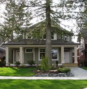
v. Access to small lot residential lots should be through the lane, where a lane exists. vi. Locate and screen off-site parking areas, garbage and recycling storage, vents, meters, and transformers so as to minimize their visual impact on the public realm and neighbouring properties. vii. Carriage houses should be provided with their own storage and collection areas for garbage and recycling, which should be sited away from the primary entrance of both the principal building and carriage home as well as screened from public views.
DEVELOPMENT PERMIT AREA: NEIGHBOURHOOD MIXED RESIDENTIAL USE
Areas marked Neighbourhood Mixed Use or Neighbourhood Centre on Schedule C of the OCP are designated Development Permit Areas as per the Local Government Act Section 488(1) (e) and (f) for the establishment of objectives and the provision of guidelines for the form and character of multi-unit residential and commercial development in the Town of View Royal.
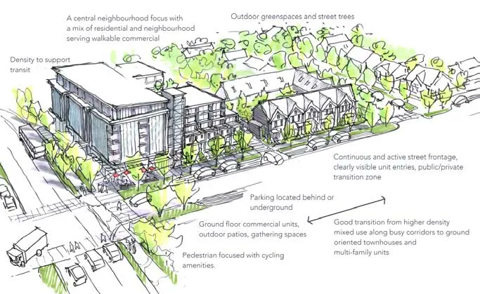
JUSTIFICATION
Neighbourhood mixed use areas will provide a central focus for neighbourhoods in View Royal. Offering a mix of residential, including detached residential, duplexes, multi-plex, townhouses, low-rise apartments, and mixed use residential with neighbourhood-serving commercial services, these areas will become compact, walkable, and cycling –friendly local activity hubs.
OBJECTIVES
The objectives of requiring a Development Permit in the areas identified as Neighbourhood Mixed Use or Neighbourhood Centre are to:
- Facilitate the orderly development of Neighbourhood Mixed Use areas and Neighbourhood;
- Centre areas and encourage compatibility in the scale and design character of buildings;
- Establish distinct neighbourhood centres offering a mix of retail services, employment opportunities, and a variety of housing types;
- Ensure neighbourhood centres are pedestrian-oriented and cyclist-friendly; and
- Achieve a high standard of design.
GUIDELINES – DESIGN CHARACTER, ALL DEVELOPMENTS
i. Buildings should address the public realm and promote “eyes on the street” for natural surveillance of the public realm through the provision of entrances, windows, patios, porches, and decks facing public streets and spaces thereby contributing to a safe and comfortable pedestrian-friendly streetscape. ii. Materials should be of durable, high-quality material and should reflect the natural surroundings of View Royal and a “West Coast” design character, bringing in elements of wood, stone and a natural colour palette. Natural materials are preferred. iii. Main entrances should be clearly identified in the streetscape. Entrances may be emphasized with lighting, architectural detailing, colour, special paving, landscaping, or other defining features. Weather protection should be incorporated into the entrances of multi-unit buildings. iv. Buildings should provide a sensitive transition to neighbouring properties by stepping down massing to create a more comfortable scale transition while providing reasonable side and rear lot setbacks. v. Long blank walls should be avoided. Public frontages should present a consistent and visually appealing design through use of materials, windows, articulation, and roof treatments. vi. Required roof elements, including mechanical equipment and vents, should be enclosed by roof parapets or other forms of solid screening. vii. Signage should be designed to be consistent with the overall architectural style, scale and materials. viii. Signs should be integrated into the detailing of the building, but subordinate to the overall building composition. ix. Signs should be visible from the street without being visually obtrusive. Signs should be designed so that the size, location, and information is oriented to pedestrians and cyclists, rather than motorists. x. Signs should add to the interest of the building and respect the historic character of the area, and not create visual clutter. xi. Design details such as street lighting standards and street furniture should be of a consistent design and contribute to an attractive streetscape. xii. Containers for garbage and recycling should be stored in a safe and convenient location and screened from view.
GUIDELINES – DESIGN CHARACTER, COMMERCIAL/RESIDENTIAL MIXED-USE
i. Incorporate weather protection along public sidewalks with awnings, canopies or other features. ii. Developments should include areas for outdoor seating. iii. Small, distinctive commercial units are preferred to long, uninterrupted commercial façades. iv. Provide distinction between ground floor commercial and upper levels of residential development through variation in materials, massing, architectural detailing or other elements.
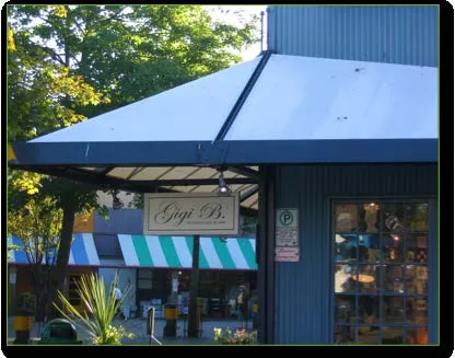
GUIDELINES – DESIGN CHARACTER, RESIDENTIAL
i. Ground floor units in townhouses and low-rise apartments should have individual front doors that are directly accessible and visible from the street. Ground floor units may be raised up to 0.6 metres (two feet) above grade to provide privacy for dwelling units. ii. Direct access to private outdoor space, some of it covered, should be provided to as many units as possible.
GUIDELINES – SITING, HEIGHT AND MASSING, ALL DEVELOPMENTS
i. New developments should respect the scale and general development pattern of the adjacent use. ii. Create visual interest by providing variations in height, rooflines, and massing. iii. Buildings over two-storeys should utilize setbacks and/or terracing above the second level to reduce massing impacts on the street and surrounding neighbours, preserve view corridors and provide visual interest. iv. Residential units and balconies should not protrude further than the commercial façade below. v. Buildings should be located to maximize winter solar gain and summer cooling to residential units, balconies and on-site common areas or outdoor seating areas. vi. Building siting and placement of balconies, decks and windows should limit overlook and shadowing impact on neighbours.
GUIDELINES – SITING, HEIGHT, AND MASSING, COMMERCIAL AND RESIDENTIAL MIXED USE
i. Buildings should be clustered on key roads and intersections to create a hub of residential density and services that is pedestrian-oriented and in keeping with the scale of the neighbourhood. ii. Buildings should be built to the front property line, articulated with generous areas of clear glass windows and doorway entrances set back into retail units.
GUIDELINES – PARKING, ACCESS AND CIRCULATION, ALL DEVELOPMENTS
i. Provide strong and safe linkages to surrounding parks, green corridors, trails, schools and other neighbourhood destinations and to encourage alternative modes of transportation. ii. Provide easy and convenient connections to transit services, neighbourhoods, commercial centres, cycling routes, sidewalks, trails, and other amenities, including existing green spaces and natural areas. iii. Access and circulation should be safe and convenient for pedestrians, cyclists, and vehicles. iv. Parking should be accommodated underground wherever possible. v. Surface parking should be limited to short term commercial or residential visitor parking and should be located to the rear of the building and suitably landscaped to screen parking areas from public roads and pedestrian routes. vi. Accessible and special needs parking should be adjacent to the primary entrance and ensure passive surveillance. vii. Sheltered bicycle parking for visitors should be provided at an accessible location near the primary entrance and located so as to ensure passive surveillance. viii. Provision of infrastructure that promotes the use of alternative transportation is encouraged.
GUIDELINES – PARKING, ACCESS, AND CIRCULATION, COMMERCIAL AND RESIDENTIAL/COMMERCIAL MIXED-USE
i. If not accommodated underground, commercial parking should be located behind buildings, wherever possible. ii. Servicing and loading areas should be located in a manner that does not negatively impact the pedestrian realm.
DEVELOPMENT PERMIT AREA: INTENSIVE MIXED-USE
Areas shown as Intensive Mixed-Use on Schedule C of the OCP are designated Development Permit Areas as per the Local Government Act Section 488(1) (d) and (f) for the establishment of objectives and the provision of guidelines for the form and character of multi-unit residential and commercial development in the Town of View Royal.
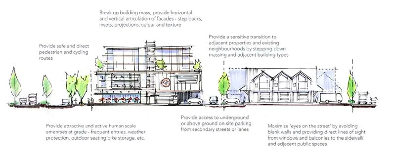
JUSTIFICATION
The Intensive Mixed-Use designation includes provision for commercial with townhouses and low-rise apartments and will be found in three key locations around View Royal. The Intensive Mixed-Use areas will provide a mix of residential, commercial services and public amenities in a compact manner. Detailed Design Guidelines should be developed for individual sites within the areas designated Intensive Mixed Use on Schedule C of this OCP.
OBJECTIVES
The objectives of requiring a Development Permit in the areas identified as Intensive Mixed-Use are to:
- Facilitate the orderly development of Intensive Mixed-Use areas and encourage consistency in the scale and design character.
- Promote development that concentrates residential density and commercial activity into an attractive, pedestrian oriented environment.
- Achieve a high standard of design.
GUIDELINES – DESIGN CHARACTER, ALL DEVELOPMENTS
i. Buildings should address the public realm and promote “eyes on the street” for natural surveillance of the public realm through the provision of entrances, windows, patios, porches and decks facing public streets and spaces thereby contributing to a safe and comfortable pedestrian-friendly streetscape. ii. Materials should be durable, high quality and should reflect the natural surroundings of View Royal and a “West Coast” design character, bringing in elements of wood, stone and a natural colour palette. Natural materials are preferred. iii. Main entrances should be clearly visible to vehicles and pedestrians. Entrances may be emphasized with lighting, architectural detailing, colour, special paving, landscaping or other defining features. Weather protection should be incorporated into the entrances of multi-unit buildings. iv. Long blank walls and faux windows should be avoided. All visible frontages should present a consistent and visually appealing design through use of materials, fenestration, articulation, roof treatments and landscaping. v. Unsightly roof elements, including mechanical equipment and vents, should be enclosed by roof parapets or other forms of solid screening. vi. Signage should be designed to be consistent with the overall architectural style, scale and materials. vii. Signs should be integrated into the detailing of the building, but subordinate to the overall building composition. viii. Signs should be visible from the street without being visually obtrusive. Signs should be designed so that the size, location, and information is oriented to pedestrians and cyclists, rather than motorists. ix. Signs should add to the interest of the building and respect the historic character of the area, and not create visual clutter. x. Design details such as street lighting standards and street furniture should be of a consistent design and contribute to an attractive streetscape. xi. Containers for garbage and recycling should be stored in a safe and convenient location and screened from view.
GUIDELINES – DESIGN CHARACTER, COMMERCIAL/RESIDENTIAL MIXED USE
i. Commercial/Residential mixed-use buildings should be clustered on key roads and intersections to create a hub of residential density and services that is pedestrian-oriented and neighbourhood scale. ii. Incorporate weather protection along public sidewalks with awnings, canopies or other features. iii. Small, distinctive commercial units are preferred to long, uninterrupted commercial façades. iv. Provide distinction between ground floor commercial and upper levels of residential development through variation in materials, massing, architectural detailing or other elements. v. Developments are encouraged to provide outdoor plazas and open spaces to serve as gathering places for residents, visitors and employees. Plazas and open spaces should include various opportunities for seating and incorporate substantial hard and soft landscaping. Additional elements such as pergolas, trellises, public art and water features are encouraged. vi. In addition to outdoor plazas and open spaces, there should be one primary gathering place in each individual Intensive Mixed-Use area.
GUIDELINES – DESIGN CHARACTER, RESIDENTIAL
i. Ground floor units in townhouses and low-rise apartments should have individual front doors that are directly accessible and visible from the street. Ground floor units may be raised up to 0.6 metres (two feet) above grade to provide privacy for dwelling units. ii. Residential units should be oriented to overlook adjacent parks, plazas, and other public open spaces. iii. Direct access to private outdoor space, some of covered, should be provided to as many units as possible.
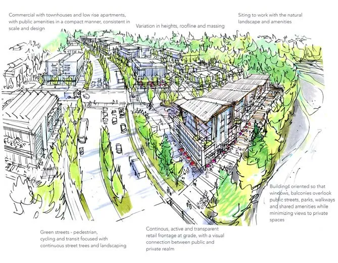
GUIDELINES – SITING, HEIGHT AND MASSING, ALL DEVELOPMENTS
i. New developments should respect the scale and general development pattern of adjacent land uses. ii. Create visual interest by providing variations in height, rooflines, and massing. iii. Buildings should be located to maximize winter solar gain and summer cooling to residential units, balconies and on-site common areas or outdoor seating areas. iv. Use terraced designs to preserve public views, where they exist.
GUIDELINES – SITING, HEIGHT, AND MASSING, COMMERCIAL/RESIDENTIAL MIXED-USE
i. Commercial units should be built to the front property line, articulated with generous areas of clear glass windows and doorway entrances set back into retail units. ii. Residential units and balconies should not protrude further than the commercial façade below.
GUIDELINES – PARKING, ACCESS AND CIRCULATION, ALL DEVELOPMENTS
i. Provide easy, safe, and convenient walking and cycling connections to transit services, neighbourhoods, commercial centres, schools, cycling routes, sidewalks, trails and other amenities, including existing parks, green spaces and natural areas. ii. Provision of infrastructure that promotes the use of alternative transportation is encouraged. iii. Sidewalks should be provided on public streets. iv. Access and circulation should be safe and convenient for pedestrians, cyclists, and people with reduced mobility as a priority, and then vehicles. v. Sheltered bicycle parking, including space for cargo bikes and bike trailers, should be provided at an accessible location near the primary entrance and located so as to ensure passive surveillance. vi. Accessible and special needs parking should be located adjacent to the primary entrance and ensure passive surveillance. vii. Parking should be accommodated underground wherever possible. viii. On-site surface parking should be limited to short term commercial or residential visitor parking and should be suitably landscaped to screen parking areas from public roads and pedestrian routes. ix. On-site surface parking should incorporate permeable features such as pavers, pervious asphalt, or pervious concrete to increase permeability and natural infiltration. x. Traffic calming measures, such as curb bump-outs, landscaped boulevards, street trees, street parking and raised or textured pedestrian crossings should be incorporated into internal circulation systems.
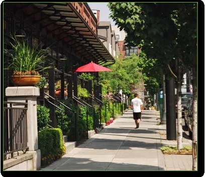
GUIDELINES – PARKING, ACCESS, AND CIRCULATION, COMMERCIAL/ RESIDENTIAL MIXED-USE
i. If not accommodated underground, commercial parking should be located behind buildings, wherever possible. ii. Servicing and loading areas should be located in a manner that does not negatively impact the pedestrian realm.
DEVELOPMENT PERMIT AREA: COMMERCIAL
Areas shown as Commercial on Schedule C of the OCP are designated Development Permit Areas as per the Local Government Act Section 919.1(1) (d) and (f) for the establishment of objectives and the provision of guidelines for the form and character of commercial development including: retail; office; technology; and service commercial in the Town of View Royal.
JUSTIFICATION
Commercial development includes retail, office, technology, mixed use, and service commercial. These uses provide services and employment opportunities for View Royal residents and contribute to a sustainable local economy. Much of View Royal’s commercial development is located in key gateway locations and should have a distinct and consistent character.
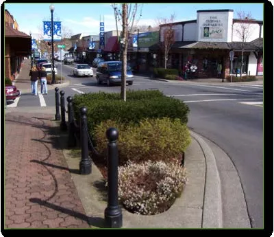
OBJECTIVES
The objectives of requiring a Development Permit in the areas identified as Commercial are to:
- Facilitate the orderly development of commercial areas and encourage consistency in the scale and design character.
- Ensure development is pedestrian oriented.
- Promote the revitalization of key commercial gateways in View Royal.
- Achieve a high standard of design.
EXEMPTIONS
In all areas designated Commercial the following development is exempt from obtaining a Development Permit:
- A proposed development is limited to subdivision.
- Internal alterations to a building.
- Building additions, external building, or site alterations, not exceeding an estimated construction value of $30,000, which are so similar in their effect on the form and character of development as to not warrant an application in the opinion of the Director of Development Services.
GUIDELINES – DESIGN CHARACTER
i. Buildings should address the public realm and contribute to a safe and comfortable pedestrian-friendly streetscape. ii. Materials should be durable, high quality and should reflect the natural surroundings of View Royal and a “West Coast” design character, bringing in elements of wood, stone, and a natural colour palette. Natural materials are preferred. iii. Main entrances should be clearly visible from streets and internal vehicle and pedestrian circulation routes. Entrances may be emphasized with lighting, architectural detailing, colour, special paving, landscaping, or other defining features. Weather protection should be provided at entrances. iv. Long blank walls and faux windows should be avoided. Public frontages should present a consistent and visually appealing design through use of materials, windows, articulation, and roof treatments. v. Unsightly roof elements, including mechanical equipment and vents, should be enclosed by roof parapets or other forms of solid screening. vi. Signage should be designed to be consistent with the overall architectural style, scale, and materials. vii. Signs should be integrated into the detailing of the building, but subordinate to the overall building composition.
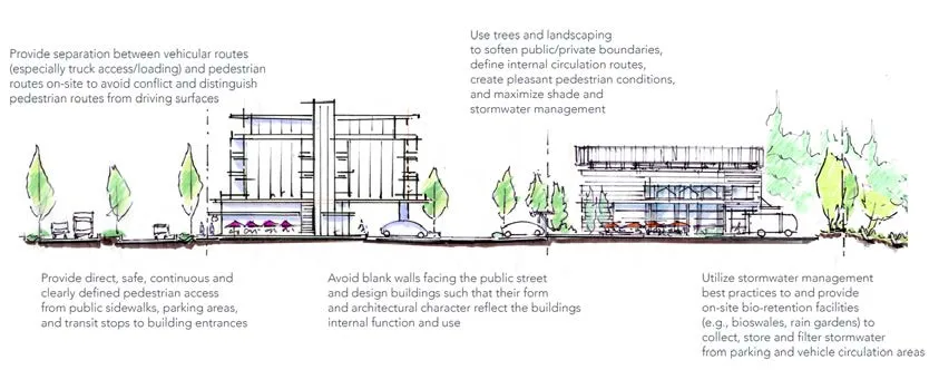
viii. Signs should be visible from the street without being visually obtrusive. Signs should be designed so that the size, location, and information is oriented to pedestrians and cyclists, rather than motorists. ix. Signs should add to the interest of the building and respect the historic character of the area, and not create visual clutter. x. Design details such as street light standards and street furniture should be of a consistent design and contribute to an attractive streetscape. xi. Containers for garbage and recycling should be stored in a safe and convenient location and screened from view. xii. Commercial units should incorporate substantial amounts of glazing along pedestrian routes. xiii. Developments are encouraged to provide outdoor plazas to serve as gathering places for employees and patrons. Plazas should include various opportunities for seating and incorporate substantial landscaping. Additional elements such as pergolas, trellises, public art, and water features are encouraged. xiv. Identify appropriate areas for gateway features and provide features that express the natural, heritage, cultural or economic identity of View Royal.
GUIDELINES – SITING, HEIGHT, AND MASSING
i. Buildings should be positioned to frame public streets and internal circulation routes. ii. New developments should respect the scale and general development pattern of adjacent land uses. iii. Create visual interest by providing variations in height, rooflines, and massing. iv. Buildings should be oriented to maximize winter solar gain and summer cooling on pedestrian routes and public plazas.
GUIDELINES – PARKING, ACCESS, AND CIRCULATION
i. Provide strong and safe linkages to surrounding parks, green corridors, trails, schools, and other neighbourhood destinations and to encourage alternative modes of transportation. ii. Provide easy and convenient connections to transit services, neighbourhoods, commercial centres, cycling routes, sidewalks, trails, and other amenities, including existing green spaces and natural areas. iii. Access and circulation should be safe and convenient for pedestrians, cyclists, people with reduced mobility and vehicles. iv. Provide safe and direct pedestrian access from parking areas to building entrances. v. Pedestrian routes and crossing areas should be defined with textured paving materials, patterns and/or colour. vi. Parking should be located underground, wherever possible. vii. Surface parking areas should be located behind buildings or in internal parking courts and should incorporate substantial landscaping and trees in planting islands to increase permeability, provide shade and improve the visual appearance of parking areas. viii. On-site surface parking should incorporate permeable features such as pavers, pervious asphalt or pervious concrete to increase permeability and natural infiltration. ix. Servicing and loading areas should be located in a manner that does not negatively impact the pedestrian realm. x. Sheltered bicycle parking for visitors should be provided at an accessible location near the primary entrance and located so as to ensure passive surveillance.
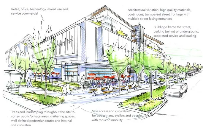
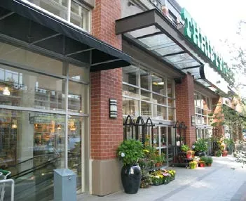
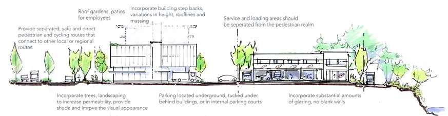
ENVIRONMENTAL PROTECTION & NATURAL HAZARD DEVELOPMENT PERMIT AREAS
This section of the OCP discusses the environmental protection areas in the Town of View Royal. All areas identified on Schedule D as being environmentally sensitive are hereby designated as Development Permit Areas, and as Development Approval Information Areas, for the purpose of flood hazard protection, fire protection and protection of the natural environment, its ecosystems and biological diversity from development.
DEVELOPMENT PERMIT AREA: NATURAL WATERCOURSE AND SHORELINE AREAS
Areas outlined in blue on Schedule D: Environmental Protection and Natural Hazard Development Permit Areas are designated as Development Permit Areas as per the Local Government Act Section 488(1) (a) for the establishment of objectives and the provision of guidelines for the purpose of protecting the natural environment, its ecosystems and biological diversity from development and section 488(1) (b) for the protection from hazardous conditions development on steep slopes or flood prone areas.
The Development Permit Area aims to address the requirements of the Riparian Areas Protection Regulation (RAPR) under the Riparian Areas Protection Act and Provincial Flood Hazard Area Land Use Management Guidelines which are based on anticipated Sea Level Rise of 0.5 m by 2050 and 1.0 m by 2022. It includes all land designated within a flood hazard area and within 30 metres of the natural boundary of streams and similar watercourses or within 30 metres of the top of bank of a ravine containing a watercourse, in each case as defined in the Riparian Areas Regulation, and all those upland and foreshore areas above and below and within 15 metres of the natural boundary of the sea, and Schedule D shall be interpreted in that manner.
Natural watercourses and shoreline areas include Esquimalt Harbour, Portage Inlet, Craigflower Creek and Millstream Creek. Guidelines also include requirements for private dock development for the federally controlled portion of Esquimalt Harbour.
Riparian areas and shorelines are important for their ecological value and contribution to the physical and cultural identity of View Royal. These areas support a rich diversity of flora and fauna and are integral elements of greater local and regional environmental systems. Unnecessarily disturbing these sensitive environments may cause an increased risk in flooding or harm their vitality and the ecological services they provide.
This Development Permit Area has been established to:
- Reduce or prevent injury, human trauma, and loss of life, and to minimize property damage during flooding events
- To ensure that the ecological value of sensitive watercourse and shoreline areas have been considered prior to development, and that measures will be taken to limit or avoid damage to these ecosystems.
To the fullest extent possible all shorelines and riparian zones should be kept in a natural state and restored if they have been disturbed by development intrusions or public activity. Owners of land within this Development Permit Area must not do any of the following without first obtaining a development Permit in accordance with the guidelines for this Development Permit Area:
- Alter lands, including soil-disturbing activities, clearing and removing or altering vegetation;
- Subdivide lands; or
- Construct or alter a building or structure.
OBJECTIVES
The objectives of requiring a Development Permit in the areas identified as Natural Watercourse and Shoreline Areas are to:
- Plan and regulate new development in a manner that preserves and protects the physical and ecological integrity of shorelines and watercourses.
- Protect endangered species and ecosystems.
- Guard against erosion and avoid damage to public property.
- Ensure public safety.
- Balance development opportunities with ecological conservation.
- To ensure compliance with the Riparian Area Regulations.
- To foster Development that follows recognized best management practices (BMPs) such as outlined in the B.C. Ministry of Environment’s Develop with Care manual and related publications.
EXEMPTIONS
The following do not require a development permit:
- Repair, maintenance, alteration, or reconstruction of existing legally or legally non-conforming sited buildings, structures or utilities provided there is no alteration of undisturbed land or vegetation.
- Repair or replacement of an existing dock for which there is no change in form and size.
- Emergency repairs to existing structures and public walkways where a potential safety hazard exists.
- Removal of trees deemed to be hazardous by a qualified arborist that threaten the immediate safety of life and buildings.
- Removal of hazardous trees with a valid Tree Alteration and Cutting Permit.
- Small-scale removal by hand (10m2 or less) of invasive species.
- Larger-scale removal of invasive species in accordance with a vegetation management plan prepared by a Registered Professional Biologist or other qualified professional.
- Within an existing landscaped area that is outside of a Streamside Protection and Enhancement Area, the placement of impermanent structures, such as benches, tables and garden ornaments and the gardening and yard maintenance activities, such as lawn mowing, tree and shrub pruning, vegetation planning and minor soil disturbances that do not alter the contours of the land.
- The construction of a small accessory building, such as a pump house, gazebo, garden shed or playhouse, if all the following apply:
- The building is located within an existing landscaped area;
- No native trees are removed;
- The building is located outside of a Streamside Protection and Enhancement Area, or a minimum of 10 metres from the high-water mark of the ocean; and
- The total area of small accessory buildings is less than 10m2.
- A one-time minor expansion of the existing building footprint such as the lesser of 20 m2 or 25% of the building footprint.
- Municipal public works, undertaken or authorized by the Town of View Royal.
- Park and works services, undertaken or authorized by the Town of View Royal, the Province of BC or the Capital Regional District.
- Emergency actions required to prevent, control or reduce an immediate threat to human life, the natural environment or public or private property including:
- Forest fire, flood, and erosion protection works;
- Protection, repair or replacement of public utilities;
- Clearing of an obstruction from a bridge, culvert, dock, wharf or stream;
- Bridge repairs; and
- Removal of hazardous trees.
GUIDELINES – GENERAL
i. Development in riparian and shoreline areas should ensure the natural (pre-development) hydrological cycle is maintained after development. ii. Development in riparian and shoreline areas where there is a risk of flood hazard should be aligned with the Provincial Flood Hazard Area Land Use Management Guidelines (2018). iii. Development should avoid or reduce the number of stream crossings to minimize impacts on aquatic habitats and keep the number of shoreline access points to a minimum. iv. Development in freshwater riparian areas – e.g., adjacent to streams, lakes, wetlands, and other freshwater watercourses –must comply with the requirements of the Riparian Area Regulations and the Provincial Flood Hazard Area Land Use Management Guidelines. v. Development of riparian and shoreline areas should be limited and not negatively impact the ecological health of the immediate area or impede public access. vi. Development should be located well away from floodplains and allow natural flooding cycles to occur so that flood-dependent ecosystems can persist. vii. Retention of existing healthy riparian and shoreline vegetation should be maximized with any paths, structures or other constructed areas sited to minimize impact on trees and sensitive areas. viii. Restoration of riparian and shoreline vegetation and habitat, including removal of invasive species, is encouraged for all properties within this Development Permit Area. ix. Development should result in a net increase in native vegetation in almost all circumstances including native trees, shrubs, such as willows, Red-osier Dogwood, and Hardhack, and grasses to stabilize banks and prevent bank erosion. x. Fence riparian buffers to discourage access by people and pets. xi. For shoreline areas heavily impacted by previous development, target the restoration of ecologically appropriate vegetation for an average 15m wide (minimum 5 m) shoreline zone over 50% of the shore length. xii. Riparian and shoreline area development should sensitively manage storm water, focusing on infiltration and release of storm water in ways and quantities that mimics natural patterns, avoids scouring and erosion and results in storm water free from pollutants. xiii. Do not fill or drain permanent or seasonally wet areas, as these are important breeding habitat for amphibians. Further guidelines on maintaining amphibian habitat are found in Guidelines for Amphibian and Reptile Conservation during Urban and Rural Land Development in British Columbia (2014). xiv. Shoreline protection measures should be limited to those necessary to prevent damage to existing structures or established uses on adjacent upland. xv. In the design of new developments or re-development, the use of soft engineered and innovative alternatives to stabilizing shorelines and preventing erosion, such as bioengineering rather than traditional hard engineered measures should be used. In general, the harder the construction measure, the greater the impact on shoreline process, including sediment transport, geomorphology, and biological functions. “Hard" measures refer to those with solid, hard surfaces, such as concrete bulkheads, while "soft" structural measures rely on less rigid materials, such as biotechnical vegetation measures or beach enhancement. There is a range of measures varying from soft to hard that include:
- Vegetation enhancement.
- Upland drainage control.
- Biotechnical measures.
- Beach enhancement.
- Anchor trees.
- Gravel placement.
- Rock (rip rap) revetments.
- Gabions.
- Concrete groins.
- Retaining walls or bulkheads. xvi. Where hard measures can conclusively be shown to be the only means of effectively preventing erosion, they should be designed in consultation with a registered professional biologist, qualified environmental professionals, and professional engineers, as appropriate. xvii. The preservation and enhancement of native trees and shrub clusters that overhang the waters edge is strongly encouraged as these provide shade, protection and feeding habitat for fish and wildlife. xviii. Any new public pathways or public access should be designed and constructed in consultation with a registered professional biologist or qualified environmental professional, as appropriate, and the Town of View Royal Parks Department. xix. All development should be aligned with requirements outlined in the Provincial Flood Hazard Area Land Use Management Guidelines (2018).
GUIDELINES – CONSTRUCTION OF NEW AND REPLACEMENT OF EXISTING DOCKS AND BOAT LAUNCH FACILITIES
i. Private docks and associated structures are intended for private moorage only and should consist of only one dock per property. Sharing a dock with adjoining waterfront properties or multiple users is permitted and encouraged. ii. Private docks should be oriented in a logical and unobtrusive manner which takes into account shoreline navigation, prevailing wind, tidal action, water depth and shoreline topography. iii. Docks and wharves should ensure that public access along the shore is maintained. iv. Design, size and location of docks and wharves should not limit opportunities for water access for neighbouring private properties. v. Should remain sensitive to views and impacts on neighbours and public viewpoints such as parks and roadways. vi. Not obstruct or impede pedestrian access along the foreshore unless reasonable alternative means of passage are made available (e.g., stairs over a dock or ramp). vii. Not unduly interfere with the navigation of the foreshore or of deep-water channels, particularly in coves and other narrow water bodies. viii. Private docks and wharves should be designed to provide access to the water and seasonal boating opportunities, rather than sized to facilitate year-round moorage of boats. ix. Docks and wharves should be sited to avoid impacts on sensitive ecosystems such as eelgrass beds, fish habitat, and natural processes such as currents and littoral drift. x. Docks should be constructed in a manner that permits the free flow of water beneath. Supports should be located on a hard substrate. xi. Be constructed and maintained to current best practices for marine structures. xii. Private docks are allowed small storage, to a maximum height of 1.5m. xiii. Floating docks should not rest on the bottom at any time and a minimal, moveable ramp should be utilized to connect the dock with the shore rather than a fixed wharf or pier. xiv. Piers and pilings and floating docks are preferred over solid-core piers. xv. Docks should be constructed of stable materials that will not degrade over time. The use of unenclosed plastic foam or the use of creosote treated pilings (which are toxic and harm fish populations) is strongly discouraged. xvi. Be lit with appropriate, directional lighting where lighting is required, which does not impact the character of the neighbourhood or unduly affect the use and enjoyment of adjacent properties or of the foreshore. xvii. Have ramps up to 1.6m in width and floats up to 12m in length that together extend not more than 25m from the natural boundary, only varying with careful consideration of the scale and shoreline conditions of the property they serve.
GUIDELINES - SPECIFIC OCEAN SHORELINE TYPES
Rocky shores consist primarily of rock platform and may include steep cliffs or shelves overlain with beach veneer of boulders, gravel, or rubble. While shore protection measures are generally not required on rocky shores as the bedrock provides adequate protection from erosion the following guidelines apply: i. Ensure that a minimum 15-metre setback for new buildings and structures, additions to existing buildings and structures or the placement and removal of fill is maintained. ii. A setback of less than 15-metres may be considered if it is supported by a report by a qualified coastal professional (for geotechnical and coastal process considerations) and a registered professional biologist (for biological/environmental considerations) and satisfies all of the guidelines associated with this development permit area. iii. Due to the inherently stable nature of this type of shoreline, applications for shore protection measures will generally not be accepted unless evidence is provided by a qualified coastal professional that there is a substantial risk of damage or loss of structures.
Beach shores may consist of broad silty/sandy beaches or gravely/blocky rubble beaches or mixed rock with beach sediment and may be classified as either a drift-sector or pocket beach. With this type of shoreline, the following guidelines apply: i. Ensure that a minimum 15-metre setback for new buildings and structures, additions to existing buildings and structures, or the placement and removal of fill is maintained. ii. Where shore protection measures are necessary, make use of “beach nourishment” designs, which add appropriately sized material to the upper beach, creating a natural beach slope and beach armour. iii. Use of seawalls and rip rap embankments are generally not acceptable except when no alterative shore protection design is possible.
Marsh shores include both mudflat and delta areas and are generally highly sensitive and productive natural areas. The intertidal (foreshore) zone in this area is typically dynamic, changing in response to large stream flows and storm events. Though dynamic, the shore zone in these areas is generally accreting rather than eroding. It is important to allow sufficient space to allow these natural sediment processes to occur. With this type of shoreline, the following guidelines apply: i. Provide a property-specific assessment with respect to building setbacks and shore protection designs, as stream sediment processes are important and will vary from site to site. ii. Dredging or filling of marsh shore should not be permitted. iii. Use of marsh shore areas should be limited to park or conservation uses that do not require structural intrusions. iv. Where shore protection measures are necessary, make use of “beach nourishment” designs, which add appropriately sized material to the upper beach, creating a natural beach slope and beach armour. v. Sea walls and rip rap embankments should not be used to protect these shoreline areas.
GUIDELINES FOR DEVELOPMENT APPLICATIONS
i. Development applications shall include an impact assessment report, following recognized best-management practices, prepared by a registered professional biologist with the following information:
- Detailed identification of all environmentally sensitive areas within the site;
- Criteria used to define the boundaries of ESAs;
- Inventory of significant fish species, red and blue list species, sensitive ecosystems wildlife trees and related habitat classification within the site;
- Impact statement describing effects of the proposed development on natural conditions;
- Recommendations for mitigating habitat degradation, including management of sedimentation and erosion, stabilization and re-vegetation of degraded or impacted areas, identification of areas that should remain free of development or be subject to special conditions, and recommendations as to any rearrangement of proposed development activities on the site that would be beneficial to the protection of ESAs Guidelines for mitigating habitat degradation, including limits of proposed leave strips and buffer zones.
- Recommended development permit conditions under s. 920(7) of the Local Government Act, to be considered by the Town in issuing a development permit, including any recommendations regarding the timing and sequence of development activities and the monitoring of those activities by the professional biologist. ii. In relation to watercourse areas, the impact assessment report shall be prepared by a qualified environmental professional in accordance with the assessment methods for riparian area assessments prescribed under the Riparian Areas Regulation and shall provide the information listed in the previous guideline. iii. Where development is within this Development Permit Area, design details of proposed mitigating measures are to be provided in an environmental management plan prepared by qualified project consultants with the assistance of a registered professional biologist. Minimizing sedimentation and erosion, stabilizing and re-vegetating impacted areas, and monitoring requirements must also be addressed in the management plan. iv. Where development is within this Development Permit Area, a storm water management plan must be prepared by a qualified engineer in consultation with a registered professional biologist. v. Where steep or unstable slopes exist or there is risk of flooding, a report from a geotechnical engineer must be provided. vi. Design details for all shoreline works must be submitted by qualified engineer.
FEDERAL REQUIREMENTS OF ALL DOCK APPLICATIONS
TRANSPORT CANADA MINOR WORKS EXEMPTIONS (if these are met, an application to Transport Canada is not required):
- Proposed works at least 5m from adjacent property boundaries and property line extensions;
- Proposed works are at least 10m from any dock, boathouse, or other structure that is in, on or over navigable waters;
- Extremity of the proposed works that is furthest from the land is at least 30m away from any navigation channel (note: there are no Transport Canada navigation channels within the View Royal portion of Esquimalt Harbour).
- Proposed works do not extend further in, on or over the navigable waters than adjacent docks;
- Proposed works are not associated with any other proposed works, such as launch ramps, breakwaters, landfill, dredging and marinas;
- Proposed works are not used for float planes or other aircraft equipped with floats.
DF WORKING NEAR WATER REQUIREMENTS
- DFO requires that fish habitat be protected through their Aquatic Affects Assessment process for dock construction in a marine environment.
- DFO requirements will include, but may not be limited to, consideration of:
- Filling/dredging below natural boundary;
- Spawning and nursery periods, and construction away from water whenever possible;
- Sensitive marine environments such as eelgrass and kelp beds.
DEPARTMENT OF NATIONAL DEFENSE LICENSE OF OCCUPATION
A License of Occupation ($250/year fee) must be obtained from CFB Esquimalt for permission to use Federal Crown land for marine structures.
DEVELOPMENT PERMIT AREA: SENSITIVE TERRESTRIAL ECOSYSTEMS
Those lands, as shown on Schedule D, are designated as a Development Permit Area for the protection of the natural environment in accordance with the Section 488(1)(a) of the Local Government Act.
JUSTIFICATION
These areas of View Royal consist of both large areas and small pockets of high value ecosystems beyond the boundaries of the Natural Watercourse and Shoreline Development Permit Area. These sensitive terrestrial features include remnants of terrestrial herbaceous, Garry Oak woodland and older forest ecosystems as well as relatively mature second growth forest with important natural and wildlife habitat values. It is in these areas where examples of threatened and endangered species are mostly to be found in View Royal.
- The area adjacent to Mill Hill and Thetis Lake Regional Park.
- All “wildland/urban interface” areas.
- Lands north of Thetis Lake Regional Park, in particular areas that are at a higher risk for wildfire.
Owners of land within this Development Permit Area must not do any of the following without first obtaining a development Permit in accordance with the guidelines for this Development Permit Area:
- Alter lands, including soil disturbing activities and removing or altering vegetation;
- Subdivide lands; or
- Construct or alter a building or structure.
OBJECTIVES
The objectives of requiring a Development Permit in the areas identified as Sensitive Terrestrial Ecosystem Development Permit Area are to:
- Plan and regulate new development in a manner that preserves and protects the physical and ecological integrity of sensitive ecosystems.
- Protect endangered species and ecosystems.
- Cluster development away from the most sensitive ecological areas.
- Ensure public safety.
- Balance development opportunities with ecological conservation.
- To foster Development that follows recognized best management practices (BMPs) such as outlined in the B.C. Ministry of Environment’s Develop with Care manual and related publications.
EXEMPTIONS
The following do not require a development permit:
- Repair, maintenance, alteration, or reconstruction of existing legally or legally non-conforming sited buildings, structures or utilities provided there is no alteration of undisturbed land or vegetation.
- Development, upon submission to the Director of Development Services of a written statement from a Qualified Environmental Professional (e.g., RPBio) with relevant experience confirming the absence of a sensitive ecosystem within the area that would be affected by the proposed work.
- Emergency repairs to existing structures and public walkways where a potential safety hazard exists.
- Construction of a fence so long as no native trees are removed, and the disturbance of native vegetation is restricted to 0.5 metres on either side of the fence.
- Removal of trees, deemed to be hazardous by a qualified arborist, that threaten the immediate safety of life and buildings.
- Removal of hazardous trees with a valid Tree Alteration and Cutting Permit.
- Repair and maintenance of existing roads, driveways, paths, and trails, provided there is no expansion of the width or length of the road, driveway, path or trail, and no creation of additional impervious surfacing, including paving, asphalting or similar surfacing.
- Small-scale removal by hand (10m2 or less) of invasive species or noxious weeds.
- Larger-scale removal of invasive species or noxious weeds in accordance with a vegetation management plan prepared by a registered professional biologist, with appropriate relevant experience.
- Gardening and yard maintenance activities within an existing landscaped area, such as lawn mowing, tree and shrub pruning, vegetation planting and minor soil disturbance that do not alter the general contours of the land.
- Forest harvesting and related activities that comply with the Private Managed Forest Land Act on properties assessed as Managed Forest under the BC Assessment Act.
- Within an existing landscaped area that is outside of a Streamside Protection and Enhancement Area, the placement of impermanent structures, such as benches, tables and garden ornaments and the gardening and yard maintenance activities, such as lawn mowing, tree and shrub pruning, vegetation planning and minor soil disturbances that do not alter the contours of the land.
- Municipal public works, undertaken or authorized by the Town of View Royal.
- Park and works services, undertaken or authorized by the Town of View Royal, the Province of BC or the Capital Regional District.
- The construction of a small accessory building such as a pump house, gazebo, garden shed or playhouse if all the following apply:
- The building is located within an existing landscaped area;
- No native trees are removed;
- The building is outside of a Streamside Protection and Enhancement Area, or a minimum of 10 metres from the high-water mark of the ocean; and
- The total area of small accessory buildings is less than 10 m2.
- Emergency actions required to prevent, control, or reduce an immediate threat to human life, the natural environment or public or private property including:
- Forest fire, flood, and erosion protection works;
- Protection, repair or replacement of public utilities;
- Clearing of an obstruction from a bridge, culvert, dock, wharf or stream;
- Bridge repairs; and
- Removal of hazardous trees.
GUIDELINES – GENERAL
The following guidelines apply to all development permit applications in all Sensitive Terrestrial Ecosystem Development Permit Areas: i. Identify critical areas containing important, rare, or fragile sensitive ecosystems or habitat. ii. Avoid locating development in areas containing important, rare or fragile sensitive ecosystems or habitat where reasonable alternative sites exist. iii. The area cleared and disturbed for development should be minimized. iv. Fewer, but larger, undisturbed areas should be retained, rather than small or isolated undisturbed areas. v. Buildings and associated infrastructure should be sited with sufficient undisturbed space around significant mature or established trees to protect root systems. vi. Undeveloped buffer areas should be retained around sensitive ecosystems, features or habitat where feasible. Buffer areas should be of sufficient width to limit access by invasive plants. vii. Natural features should be retained through incorporation into the design of the development. In particular, unique or special natural features such as native grasses, rare plants, unique land forms, rock outcroppings, mature trees, spits and dunes should be protected. viii. Connections and corridors should be maintained to provide continuity between sensitive ecosystems and important habitat. ix. Use of drought resistant and native plants in landscaping is encouraged. x. The planting or introduction of non-native or invasive plants should be avoided. xi. Soil removal or deposit within or adjacent to a sensitive ecosystems or habitat should be avoided. xii. Alteration of natural drainage systems in ways that increase or decrease the amount of water available to a sensitive ecosystem should be avoided. xiii. Septic fields should be located in such a manner to avoid the possibility of polluting sensitive ecosystems or habitat. xiv. Driveways and other accesses should be limited to the number required for safe access, with shared driveway access where feasible. Driveway lengths and widths should be limited to the minimum necessary. If possible, the use of impervious surfaces should be discouraged. xv. The permit conditions may include:
- Construction of permanent or temporary fencing around sensitive features;
- Fencing, flagging and posting of notices during construction;
- Limits on blasting in sensitive areas;
- Limits on construction timing;
- Provision of works to maintain or restore the quantity or quality of water reaching environmentally sensitive areas or habitat;
- Restoration or enhancement of disturbed sensitive ecosystems and habitat; and
- Registration of restrictive covenants.
GUIDELINES FOR DEVELOPMENT APPLICATIONS
xvi. Development applications shall include an impact assessment report prepared by a registered professional biologist with the following information:
- Detailed identification of all environmentally sensitive areas within the site.
- Criteria used to define the boundaries of ESAs.
- Inventory of red and blue list species and ecosystems and sensitive ecosystems within the site.
- Impact statement describing effects of the proposed development on natural conditions.
- Guidelines for mitigating habitat degradation, including limits of proposed no development zones and buffer areas. xvii. Where development is in proximity to this environmentally sensitive area, design details of proposed mitigating measures are to be provided in an environmental management plan prepared by qualified project consultants with the assistance of a registered professional biologist. Minimizing sedimentation and erosion, stabilizing and re-vegetating impacted areas, and monitoring requirements must also be addressed in the management plan. xviii. Where development will encroach on this Development Permit Area, a storm water management plan must be prepared by a qualified engineer in consultation with a registered professional biologist. xix. Where steep or unstable slopes exist or there is risk of flooding, a report from a geotechnical engineer must be provided. xx. Where required by the Riparian Area Regulations, the completion and submittal of a Riparian Area Assessment Report. xxi. In the area north of Thetis Lake Regional Park and the lands in the vicinity of Mill Hill Regional Park, a Wildland/Urban Interface Fire Smart risk assessment and management plan must be provided.
VARIANCES
The Town may consider variances to siting or size regulations where the variance could result in enhanced protection of an environmentally sensitive area.
DEVELOPMENT PERMIT AREA: NATURAL HAZARD FIRE INTERFACE ZONE
Those lands, as shown on Schedule D, are designated as a Development Permit Area for protection of development from natural hazards in accordance with the Section 488(1)(b) of the Local Government Act.
JUSTIFICATION
Our changing climate is continuing to increase the threat of wildfires each year. The threat of fire to residents of View Royal ranks among the most likely and dangerous types of emergencies. Fire in a residential, commercial, or institutional building could result in property damage and injury, especially in areas of higher density. In particular, residential areas directly adjacent to parkland, at the “wildland/urban interface”, are at highest risk.
OBJECTIVES
The objectives of requiring a Development Permit in the areas identified as the Natural Hazard Wildlife Interface Zone Development Permit Area are to:
- Minimize the threat of wildland fires and damage to property and public injury as a result of wildland fires;
- protect valuable parkland in View Royal;
- proactively manage conditions affecting potential fire behaviour, thereby increasing the probability of successful fire suppression and containment, and minimize adverse impacts, and;
- increase future resiliency and conserve the visual and ecological assets of parkland areas within View Royal for the benefit of present and future generations.
GUIDELINES – GENERAL
i. Building and site design should seek to minimize fire risk in the View Royal Community Wildfire Protection Plan area. ii. Applicants may be required to provide a fire risk assessment report prepared by a qualified professional. iii. Development at the wildland/urban and associated accessory buildings and structures should be located away from any contiguous undeveloped forested areas or areas containing hazardous forest fuel types or accumulations, as is reasonably possible or feasible. iv. Development in wildland/urban interface areas should follow BC FireSmart principles with specific consideration given to the following:
- Use tile, steel or other non-combustible or fire-retardant material for roofing. Include closed-in soffits.
- Keep roofing clear of combustible material accumulation.
- Use siding materials such as stucco, steel, aluminum, or cementitious material.
- Avoid decks and porches, or construct with non-combustible material. Alternatively, build using fire resistive decking materials, such as solid composite decking materials, or wood materials with underside fully enclosed.
- All eaves, attics, roof vents and openings under floors should be screened to prevent the accumulation of combustible material, using 3mm, non-combustible wire mesh, and vent assemblies should use fire shutters or baffles;
- All windows should be tempered or double-glazed to reduce heat and protect against wind and debris that can break windows and allow fire to enter the building or structure;
- Underground wiring should be installed for power supply to the building or structure. If overhead wires, avoid physical contact with adjacent trees.
- Ensure availability of water for entire building, exterior and roof.
- Ensure vehicle access to adjacent forest land. Avoid dead-end access roads with no turnaround provision. v. The following landscape and service conditions should be required in respect of subject development in, or within 10 metres of, a wildland/urban interface area:
- Establish a 10 metre fuel free zone around buildings, eliminate fuel and combustible debris, where landscaped, planted with lawn or native fire resistant species and irrigated.
- Firebreaks should be designed and installed, which may be in the form of cleared land, roads, or utility right-of-ways;
- Wildfire risk mitigation and landscaping should be designed and installed to protect, conserve and enhance natural features of the site and adjacent ecosystems in accordance with the Town of View Royal bylaws;
- If removal of trees or vegetation is deemed necessary by a qualified professional for the purpose of reducing wildfire risk, Town approval is required and replacement trees or vegetation may be required. vi. Development should avoid siting on steep slopes wherever possible, to minimize the risk of debris flow or slides. vii. Where steep slopes cannot be avoided, development should seek to minimize alteration of existing topography through excavation and blasting and employ building designs that work with existing topography. viii. All development on or adjacent to steep slopes must be certified safe by a geotechnical engineer.
GLOSSARY OF TERMS
A
Accessibility refers to the ability to access goods, services, places, people, or housing. In the context of transportation, accessibility is the ability to access transportation choices and easily get around without prohibitive mental, physical, or financial barriers.
Accessory Dwelling Unit See Secondary Suite.
Active Transportation refers to a means of transportation in which one uses their own power to get from one place to another.
Affordable Housing means housing where the rent or mortgage plus taxes is 30 percent or less of a household’s gross annual income. However, an individual’s and community’s housing needs are diverse and change over time. Affordability of housing also considers the availability and accessibility to the type of housing that an individual needs at a particular time in their life.
Agricultural Land Reserve refers to Agricultural land designated as an agricultural land reserve under the BC Agricultural Land Commission Act.
Aging-in-place means that an individual or group of people grows older without having to change their place of residence and/or community.
Amenities mean items that add to the physical, aesthetic, or functional appeal of a particular site, neighbourhood, or the community in general.
Asset-Based-Community Development ABCD emphasizes strengths, connections, citizen leadership, and individual gifts in approaching community change.
B
BC Building Energy Step Code is a performance-based regulation that requires that enhanced energy efficiency standards, or steps, be met over time. By 2032, all new construction in BC will be required to be net zero ready. Net zero buildings produce as much clean energy as they consume and are highly efficient.
Bed and Breakfast means the provision of sleeping accommodation, toilet facilities and a breakfast meal to paying guests as a home occupation.
Bioswale refers to a vegetated area used to retain and filter stormwater runoff.
Building Code of British Columbia is the legislation that regulates buildings standards in the Province of British Columbia.
C
Community Amenity Contribution Policy (CAC policy) which enables the provision of community amenities by a development proponent as voluntarily agreed to with the Town.
Carbon Neutral refers to achieving a balance between the amount of greenhouse gas emissions being produced and the amount of clean-energy or environmental rehabilitation projects being undertaken to offset those emissions.
Carpooling refers to an arrangement in which a group of people commute together by car also.
Carriage Houses refers to a legal, detached, ground-oriented rental suite located in the backyard of a property with a single-family home as its primary use.
Character refers to the distinct quality and appearance of a building or place that comes from a unique mix of defining physical and social attributes.
Climate Change refers to any long-term significant change in the average weather that a given region experiences. Average weather may include average temperature, precipitation and wind patterns. It involves changes in the variability or average state of the atmosphere over durations ranging from decades to millions of years. These changes can be caused by dynamic process on Earth (ocean processes, volcanoes), external forces including variations in sunlight intensity, and more recently by human activities.
Climate Change Adaptation refers to adjustments to processes, practices, and structures to moderate damages associated with climate change.
Climate Change Mitigation refers to avoiding and reducing emissions and stabilizing the levels of heat-trapping greenhouse gases in the atmosphere to slow the effects of climate change.
Critical Coastal Habitat refers to specific areas on the coast that are occupied by species that are essential to conservation.
Community Water System means a water system improvement district or water user's community under the Water Act, a water utility under the Water Utility Act, a water system local service provided by a regional district, a water system specified area provided by a municipality, or any other private water distribution system that serves five or more parcels that is constructed in accordance with Design Guidelines for Rural Residential Community Water systems as published by the Province of British Columbia.
Community Corridors refers to major transportation corridors that are change areas or major activity hubs.
Community Vision refers to an image of a community’s future.
Compact Neighbourhood refers to areas with higher-density development in which a variety of land uses are located such that residents and workers are within walking distance of many destinations.
Community Resilience refers to a measure of a sustained ability of a community to utilize available resources to respond to, withstand, and recover from adverse situations. It includes but is not limited to public health and emergency preparedness, climate adaptation, infrastructure protection, and economic recovery.
Complete Streets are streets that are safe for all users, regardless of age, ability, income, race, ethnicity, or mode of travel.
Co-operative Housing refers to a type of residential housing option that is actually a corporation whereby the owners do not own their units outright.
Crime Prevention through Environmental Design (CPTED) refers to a series of design interventions and strategies for reducing opportunities for crime and empowering legitimate users to feel ownership over both public and private space.
D
Density refers to the number of residential dwelling units allowed within one legal parcel based on its land area. In this Plan, all densities are net of roads, parks, utilities, and other non-residential, but complementary uses.
Density Transfer means the concept of transferring the right to create new parcels through subdivision of land from one location to another either within one property or between two properties, with the transfer registered on titles. The process involves the affected property owners’ negotiating an agreement to transfer the right of development in principle and then applying for a rezoning to implement the transfer.
Development Cost Charge means a levy applied by a municipality to new development to offset the long-term cost of providing new or extended services to the community.
Development Permit Area refers to area designated pursuant to the Local Government Act where approval of a development permit is required before a building permit can be issued or a subdivision is approved with specified exemptions.
District Energy System refers to centralizing the production of heating or cooling for a neighbourhood or community.
Dwelling Unit means one or more rooms which constitute a self-contained residential unit that is used or intended to be used by one household for living and sleeping purposes and includes only one room equipped for the preparation of food and at least one bathroom.
E
Ecological Development is development that embeds and values ecological health.
Ecosystem A complete system of living organisms interacting with the soil, land, water, and nutrients that make up their environment. An ecosystem is the home of living things, including humans. It can be any size, but it always functions as a whole unit. Ecosystems are commonly described according to the major type of vegetation, for example, an old-growth forest or a grassland ecosystem.
Eco-Tourism refers to tourism directed toward natural environments, intended to support conservation efforts, and observe wildlife.
Emergency Housing refers to facilities which are designed to meet the immediate needs of an unhoused population. Such short-term emergency housing types may target specific sub-populations, including women, families, youth, or Aboriginal persons, for instance.
Energy Efficiency refers to using less energy to perform the same activities.
Environmental Restoration refers to initiatives that promote ecosystem recovery following damage, degradation, or destruction.
Environmentally Sensitive Area (ESAs). A term often used loosely to mean a site or area that has environmental attributes worthy of retention or special care. ESAs are important in the management of all landscapes and their functioning condition. ESAs range in size from small patches to extensive landscape features. They can include rare or common habitats, plants, and animals. ESAs require special management attention to protect fish and wildlife resources and other implicit natural systems or processes. They have also been broadly defined to include other scenic, historic, or cultural values, and may also include hazard lands.
Equity-priority groups are people who often face discrimination or other forms of systemic disadvantage. They include, but are not necessarily limited to, persons of colour, persons with disabilities, Indigenous peoples, 2SLGBTQIAP individuals and women.
F
Fire-Smart refers to living with and managing for wildfire in your area and on your property.
Floor Space Ratio expresses the ratio of built (or buildable) area to land area.
Foreshore refers to the part of a shore between high- and low-water marks, or between the water and cultivated or developed land.
G
Garden Suite See Carriage Houses.
Green Building refers to a systems approach to building design and construction that uses techniques that minimize environmental impacts and reduce ongoing energy consumption while contributing to the health and productivity of its occupants.
Greenfield Sites refers to a site which has not previously been built on.
Greenhouse Gas (GHG) refers to gases present in the atmosphere, which reduce the Earth’s loss of heat into space and therefore contribute to global temperatures through the greenhouse effect. Greenhouse gases are essential to maintaining the temperature of the Earth, however, an excess of greenhouse gases can raise the temperature of a planet to uninhabitable levels. Current levels of CO2 are approximately 100 ppm higher than during pre-industrial times. Greenhouse gases include water vapour, carbon dioxide (CO2), methane (CH4), nitrous oxide (N2O), sulphur hexafluoride (SF6) and ozone (O3).
Green Infrastructure refers to the natural vegetation, soils, and bioengineered solutions that collectively provide a broad array of products and services for healthy living. Natural areas such as forests, wetlands and floodplains, and engineered systems like green roofs and rain gardens conserve natural resources and mitigate negative environmental effects, benefiting both people and wildlife.
Greenspace means any area that should be maintained in perpetuity because of its environmental, educational, scientific, recreational, or aesthetic qualities and may include trails, parks, reserves, natural forest, wetlands, and any other land set aside for such a purpose through agreement between the Town of View Royal and the property owner.
Greenway refers to linear greenspace corridors that connect natural areas and communities, associated with watercourses, trails, and transportation routes, which provide wildlife habitat and increase recreational opportunities.
Ground-oriented Housing means a residential unit with direct access to ground level outdoor space.
Growth Areas refers to an area designated for development with higher density.
H
Home Based Business means any business for gain or support clearly secondary to the principal residential use of a property but does not include occupations which may be permitted as principal uses of a property, or which are secondary to principal non-residential uses of a property (e.g., agricultural use on land zoned to allow agriculture as a principal use is not a home occupation).
I
Identity, See Sense-of-place.
Inclusive refers to services, programs, or infrastructure that welcomes individuals of all abilities, ages, genders, sexualities, ethnicities, socio-economic-statuses, etc.
Infill Development or Infill is new development within an already developed area.
Infiltration System refers to a device or practice that is designed specifically to encourage the entry and movement of surface water into or through underlying soil.
Intermittent or Seasonal Stream means a stream in contact with groundwater that flows only at certain times of the year, such as when the ground water table is high, and/or when it receives water from springs or from some surface source. The stream ceases to flow above the streambed when losses from evaporation or seepage exceed the available streamflow.
L
LEED® refers to the Leadership in Energy Efficient Design certification program that supports the design and development of energy efficient and ecologically sustainable buildings and neighbourhoods.
Light Pollution refers to brightening of the night sky caused by streetlights and other artificial sources, which has a disruptive effect on natural cycles and inhibits the observation of stars and planets.
Livability refers to the overall quality of life experienced in a given space. This might be a building, street, neighbourhood, an entire community, or a larger spatial area. Places that are considered to be livable are desirable because of their ease of mobility, access to amenities, aesthetic appeal and healthy lifestyle options.
Local Government Act is legislation enacted in British Columbia to establish, give powers to and regulate local governments. The Act provides regulation and guidance of the development and use of an Official Community Plan.
Local Improvements refers to those works and services that directly benefit a local area or neighbourhood and not necessarily the community at large.
Low Carbon Buildings refers to buildings designed and constructed to release very little or no carbon at all during their lifetime.
M
Missing Middle Housing refers to a range of house-scale buildings with multiple units—compatible in scale and form with detached single-family homes—located in a walkable neighborhood. While the ‘missing middle’ refers to a range of housing types, the popularity of the term has grown alongside the housing challenges facing middle-income households.
Mixed-use means development that combines two or more types of development: residential, commercial or community facility.
Mobility refers to the ability to move and travel easily.
Multimodal Transportation means the provision and accommodation of a variety of transportation modes including, but not limited to, walking, cycling and transit.
Multi-unit Dwelling means any building containing more than three (3) or more dwelling units.
N
Natural boundary means the visible high water mark of any lake, river, stream, ocean, or other body of water where the presence and action of the water are so common and usual and so long continued in all ordinary years as to make upon the soil of the bed of the lake, river, stream, ocean or other body of water a character distinct from that of the banks thereof, in respect to vegetation, as well as in respect to the nature of the soil itself (Section 1, BC Land Act).
Natural Hazard Area refers to vulnerable areas characterized according to natural hazards (all atmospheric, hydrologic, seismic, volcanic and wildfire phenomena that, because of their location, severity, and frequency, have the potential to seriously affect society).
Neighbourhood Centres refers to a place for local people to access a range of community services.
Node refers to an area with mixed-use development, similar to a centre.
Non-Market Housing refers to housing designed for independent living by single persons or families who cannot afford to pay market rents or who have needs that are not being met by the market, and where the housing units are owned and operated by a government agency or a not-for-profit society.
O
Open Ditch Drainage refers to a channel constructed to collect excess water and to conduct it to a safe outlet.
P
Parkland Development refers to the work required to ensure lands are suitable for development for park and other public recreation purposes.
Permanent Stream means a stream that flows continuously throughout the year.
Pervious Surface refers to a surface that allows the percolation of water into the underlying soil.
Placemaking refers to public space building that derives from community.
Public-Private-Partnership refers to collaboration between a government agency and a private-sector company that can be used to finance, build, and operate projects, such as public transportation networks, parks, and convention centers.
Qualified Professional refers to an applied scientist or technologist specializing in a particular applied science or technology including ecology, agrology, biology, chemistry, engineering, geology, or hydrogeology. A Qualified Professional must be a registered member of the appropriate professional organization in BC, adhere to that organization’s Code of Ethics and is subject to disciplinary action by that organization.
R
Rapid Transit Service refers to a form of high-speed urban passenger transportation such as a subway or elevated railroad system.
RUCSPA refers to the Regional Urban Containment Servicing Provision Area boundary established in the Regional Growth Strategy marking the limit between a defined urban containment and servicing provision area and other areas such as rural and resource area, where such urban growth is discouraged.
Renewable Resource refers to natural resources that can be replenished within the natural environment.
Rental Vacancy Rate refers to the percentage of all available (vacant) units in a rental property.
Residential, Apartment means a building divided into not less than three dwelling units with each dwelling unit having its principal access from a finished grade level entrance common to all dwelling units. When combined with a commercial use where permitted in this Bylaw, a building containing fewer than three dwelling units is an apartment, provided that it complies with the rest of this definition.
Residential, Detached means a building consisting of one dwelling unit having independent exterior walls but may include a second dwelling unit when secondary suite is a permitted accessory use.
Residential, Duplex means a building used or designed for use as two dwelling units, each with direct access to the outside at finished grade level, whether or not the units are connected above and below each other or side-by-side, and which excludes secondary suites.
Residential, Rowhouse means a building or buildings divided into not less than three dwelling units with each dwelling unit having direct access to finished grade level adjacent to a public highway.
Residential, Townhouse means a building or buildings divided into not less than three dwelling units with each dwelling unit having direct access to finished grade level.
Resource Centre means the use of a commercial or institutional building to provide counselling services and includes offices and meeting space as accessory uses.
Resource Area refers to an area with abundant natural resources designated for management.
Retrofitting refers to adding (a component or accessory) to something that did not have it when manufactured. It is often used in the context of energy efficiency.
Ridesharing refers to participate in an arrangement in which a passenger travels in a private vehicle driven by its owner, for free or for a fee, especially as arranged by means of a website or app.
Right-of-way means a defined easement or strip of land that allows passage of people, trails, roads, rail tracks, utilities, or other community services.
Riparian Area means a transitional zone between upland and freshwater ecosystems. The vegetation it supports is in contact with the stream, or is sufficiently close, to have a major influence on the total ecological character and functional processes of the stream.
Runoff refers to the draining away of water (or substances carried in it) from the surface of an area of land, a building or structure, etc.
S
Sea-Level Rise refers to an increase in the level of the world’s oceans due to climate change.
Secondary Suite means a secondary and subordinate dwelling unit that is entirely contained within, and is subordinate to, a detached residential building
Sense-of-place refers to the essential character of an area that makes it unique from other places. Physical, social, cultural, and economic elements contribute to an area’s sense-of-place.
Single Occupancy Vehicles refers to a privately operated vehicle whose only occupant is the driver.
Supportive Housing is designed to meet the needs of various ages, family types and incomes, including smaller 1-2 bedroom market units, purpose-built rental, townhomes, carriage homes, garden suites and supportive housing for specific demographics (e.g., seniors and families).
Solid Waste refers to any garbage or refuse, sludge from a wastewater treatment plant, water supply treatment plant, or air pollution control facility and other discarded material, resulting from industrial, commercial, mining, and agricultural operations, and from community activities.
Steep Slope refers to an incline of 20 percent or greater.
Stewardship refers to the job of supervising or taking care of something.
Stormwater refers to surface water resulting from heavy falls of rain or snow.
Storm Surge refers to a rising of the sea as a result of atmospheric pressure changes and wind associated with a storm.
Stream means a watercourse containing flowing water, at least part of the year, supporting a community of plants and animals within the stream channel and the riparian zone. Streams include ephemeral, intermittent or seasonal and permanent streams.
Sustainable Development refers to development that meets the needs of the present without compromising the ability of future.
Subdivision means a parcelization of land defined under the Land Title Act or the Strata Property Act.
T
Traffic Calming refers to engineering and urban design measures used to slow down the flow of traffic and create safer and more comfortable streets for pedestrians, cyclists, and adjacent residents.
Transition Areas are areas identified in the Community Development Framework as areas where land use and design character transition – or change – from one type to another in a desirable way. For example, from mixed-use development to single family style dwellings.
Transit-oriented Development (TOD) means mixed-use development clustered around a transit station or stop designed to encourage transit use. Many communities define the TOD area using a walking radius of ¼ mile or ½ mile from the transit station, and apply minimum residential densities required to support the form of transit.
Transportation Demand Management (TDM) refers to the use of strategies, incentives, and disincentives to reduce personal vehicle use, and encourage walking, cycling, transit and ridesharing.
Universal Design means designing buildings and environmental that are safe and useable to everyone regardless of their age or ability level.
Urban Agriculture refers to the cultivation, processing, and distribution of food within an urban area.
Urban Containment Boundary refers to a boundary that sets aside land to be protected from most forms of development.
Urban Design refers to the functionality, appearance, and arrangement of space within streets, neighbourhoods, and communities, with an emphasis on the relationship of elements within and visible from public space.
Walkability refers to the extent to which an area is safe, comfortable, and accommodating for pedestrians and cyclists.
Wastewater means the used or expelled water from homes, businesses, community uses and industry.
Watershed is a defined drainage and runoff area that contributes water to a particular body of water.
Wayfinding refers to all the ways in which people and animals orient themselves in physical space and navigate from place to place.
X
Xeriscaping means landscaping that uses native and drought-resistant plant species.