Draft Official Community Plan Strategic Review Presentation
Presentation slides summarizing the OCP strategic review process, community engagement feedback, major proposed land use and urban design changes, and project financial implications.
Town of View Royal OFFICIAL COMMUNITY PLAN DRAFT
JUNE 2022
PRESENTATION OVERVIEW:
- Update Council on the status of the Draft Official Community Plan (OCP) and legislative requirements
- Overview of Community Engagement
- Discuss the key project milestones
- Review the major changes
- Discuss the outstanding tasks

TIME CRITICAL:
- Current OCP adopted in 2011 with no major review or update in over 12 years
- Parks Master Plan (2017), Community Climate Action Strategy (2022), Housing Needs Assessment Report (2020), Land Economics Study (2021), and the draft Active Transportation Plan (completion in 2023)
- Local Government Act requirements
- OCP Update began in June 2021 and draft OCP was presented to Council in June 2022
LEGISLATIVE REQUIREMENT:
- Province’s Local Government Act (LGA) specifies requirements for every municipal government when adopting an OCP:
“An OCP is a statement of objectives and policies to guide decisions on planning and land use management, within the area covered by the plan, respecting the purposes of local government.”
COMMUNITY ENGAGEMENT:
- 10 Walkshops (75 participants) in September 2021
- Phase 1 Online Survey (169 participants) in Oct. - Nov. 2021
- Phase 2 Online Survey (307 participants) in February 2022
- 6 Online Workshops (80 participants) in November 2021 and February 2022
- Ongoing Consultation
- Ongoing Direct Mail, Newsletters and Advertisements, and Signage, and Online Engagement
- Ongoing Meetings with Council and the Public
COMMUNITY ENGAGEMENT: PHASE 1 FEEDBACK SUMMARY
- Pedestrian and cyclist focused streets: streets are places for playing and socializing. Concern that increased housing will bring increased vehicular traffic and on-street parking
- Affordable housing: more affordable housing particularly for young families and future generations. There is support for increased density in neighbourhoods and transition areas.
- Walkability: want to be able to walk to amenities in mixed-neighbourhood hubs
- Multi-modal Transportation: shift toward more transit options such as bus or rapid-transit systems and active transportation
- Placemaking: maintain a unique and cherished “View Royal” identity that has the small community feel, with green space, trees and space for neighbourly connections
- Parks, greenspace, and water access: parks and greenspace are valued, there is an interest in seeing more public access to the ocean and waterfront
COMMUNITY ENGAGEMENT: PHASE 2 FEEDBACK SUMMARY
- Neighbourhood nodes: creation of centralized neighbourhood nodes, increased density and growth in neighbourhood centres
- Gradual growth: strong support for gradual growth transitions that maintain character of View Royal’s existing neighbourhoods
- Connectivity: active and multi-modal connectivity is important, transportation options may be expanded to invite more users
- Green space: growth and development to occur while preserving green space and urban tree cover, parks are to be protected and well maintained
- Traffic/congestion: want to see reduced vehicle traffic and added measures put in place to ensure congestion does not occur in neighbourhoods as development and density increase
- Adequate access to amenities: support diversity of housing instead of single-family home, and interest in increased access to amenities and neighbourhood services, and more housing density
BACKGROUND:
| Date | Event | Achievement |
|---|---|---|
| June 15, 2021 | Council Meeting | Award of Contract to EcoPlan International |
| July 20, 2021 | Council Meeting | Staff report on legislative requirements |
| December 14, 2021 | Committee of the Whole | What We Heard Report #1 presentation |
| March 8, 2022 | Committee of the Whole | What We Heard Report #2 presentation |
| May 10, 2022 | Committee of the Whole | Draft OCP Presented |
| June 14, 2022 | Committee of the Whole | Revised Draft OCP Presented |
SCOPE OF OCP STRATEGIC REVIEW:
- Focus on housing, urban design, climate action, environment, transportation, economy, and First Nations reconciliation
- Incorporated new data provided from professional studies
- Revised existing Development Framework, Land Use Designations, and Development Permit Areas maps
Land Use & Urban Design - Major Changes
- Updated the Town’s land use objectives
- Provided updates to “infill” section by considering garden suites
- Updated the “Community Development Framework”
- Added “transition areas”
- Updated Neighbourhood Areas
- Updated Community Corridors and Neighbourhood Centres
Land Use & Urban Design
| Designation | Land Use, Form and Character | Density | Examples |
|---|---|---|---|
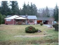
| Large-Lot Residential | • Detached Home • Large Lot and Yard |
Up to 40% lot coverage | 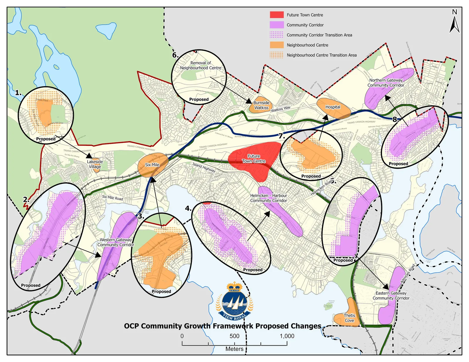 |
| Residential | • Predominantly Detached Houses and Townhouses | Currently: Max. FSR . 6 permitted for appropriate infill Proposed: Up to FSR 1.25 for appropriate infill |
|
| Mixed Residential | • Small Lot Detached Houses, Townhouses, and Low-Rise Apartments | Currently: Up to 3 Storeys/1.25 FSR Permitted & 4 Storeys/1.5 FSR Permitted for Apartment Dwellings Proposed: Small Lot Detached Houses, Townhouses and Low-Rise Apartment Up to 1.4 FSR & Up to 1.6 FSR for Apartments |
Land Use & Urban Design (Continued)
| Designation | Land Use, Form and Character | Density | Examples |
|---|---|---|---|
| Neighbourhood Mixed-Use | • Commercial with Townhouses and Low-Rise Apartments | Currently: 1.5 FSR Permitted Proposed: Up to 2.0 FSR Permitted |
|
| Neighbourhood Centre | • Commercial with Apartments | Up to 3.0 FSR | |
| Intensive Mixed-Use | • Commercial with Townhouses and Low-Rise Apartments | Up to 2.5 FSR |
Land Use & Urban Design (Continued)
| Designation | Land Use, Form and Character | Density | Examples |
|---|---|---|---|
| Commercial | • Retail, Office, Technology, and Service Commercial | Up to 2.5 FSR | |
| Parks, Open Space, and Recreation | • Local and Regional Parks and Trails • Protected Natural Areas and Open Space |
N/A |
Land Use & Urban Design (Continued)
| Designation | Land Use, Form and Character | Density | Examples |
|---|---|---|---|
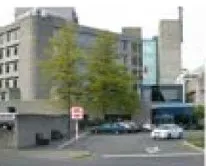
| Community Facility | • Government Buildings & Publicly Owned Facilities, including Schools • Community Centres |
N/A | |
| Rural | • Agricultural, Recreation and Large Lot Residential | 1 unit per 10 hectares |
Land Use & Urban Design
Proposed OCP Community Growth Framework
- Town Centre
- 4 Neighbourhood Centres
- Lakeside Village
- Six Mile
- Hospital
- Thetis Cove
- 4 Community Corridors
- Western Gateway
- Northern Gateway
- Helmcken-Harbour
- Eastern Gateway
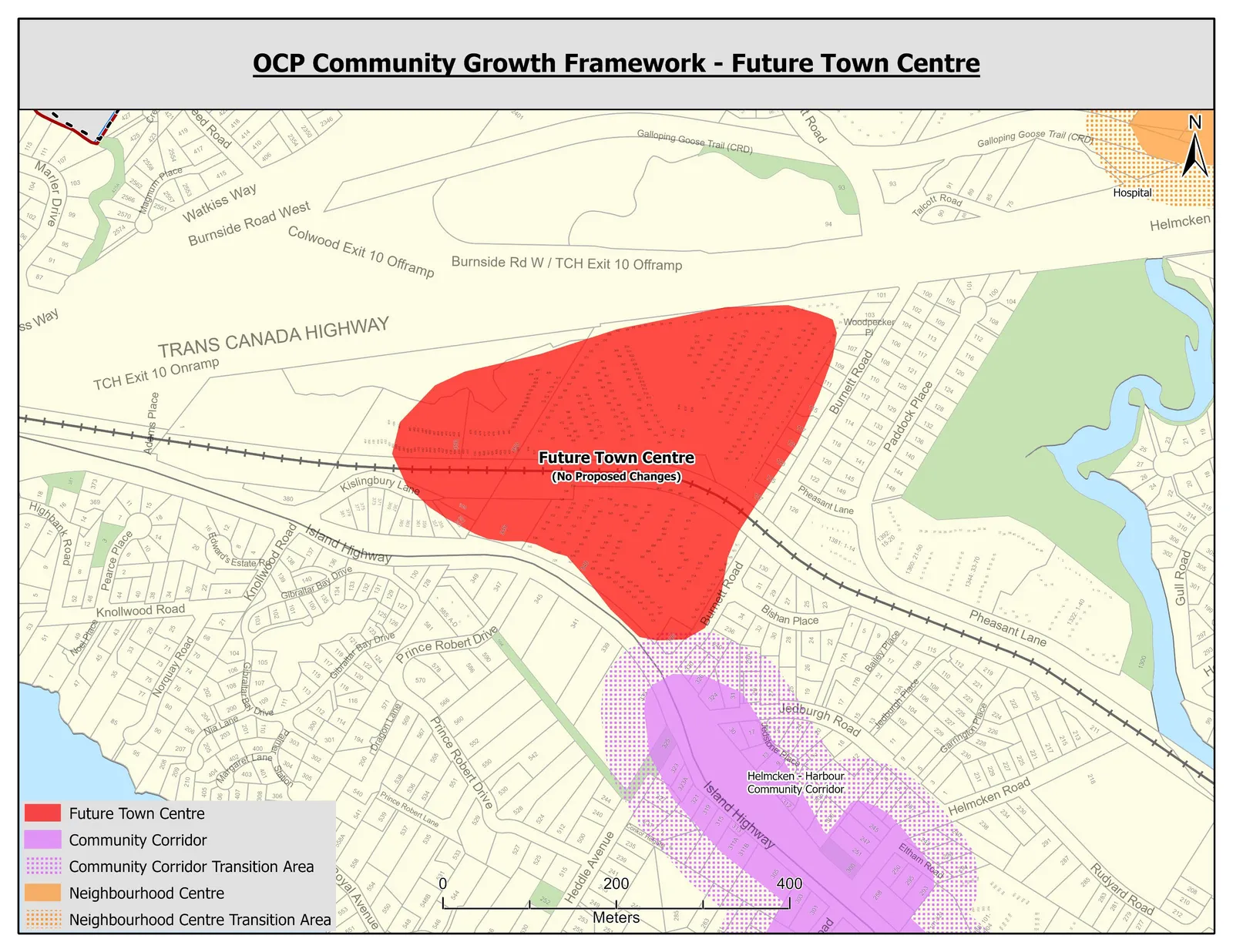
OCP Community Growth Framework: Future Town Centre (Unchanged)
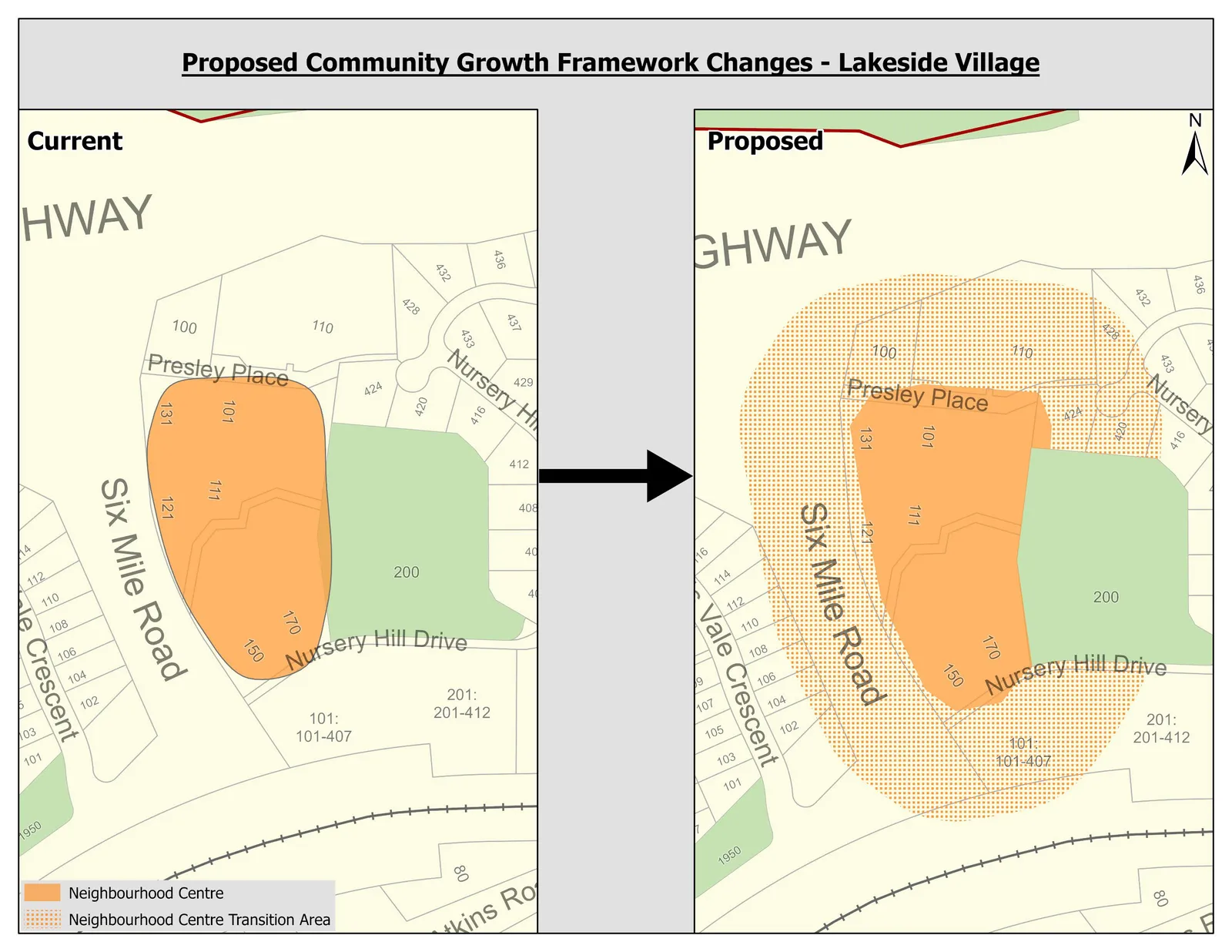
OCP Community Growth Framework: Lakeside Village Neighbourhood Centre
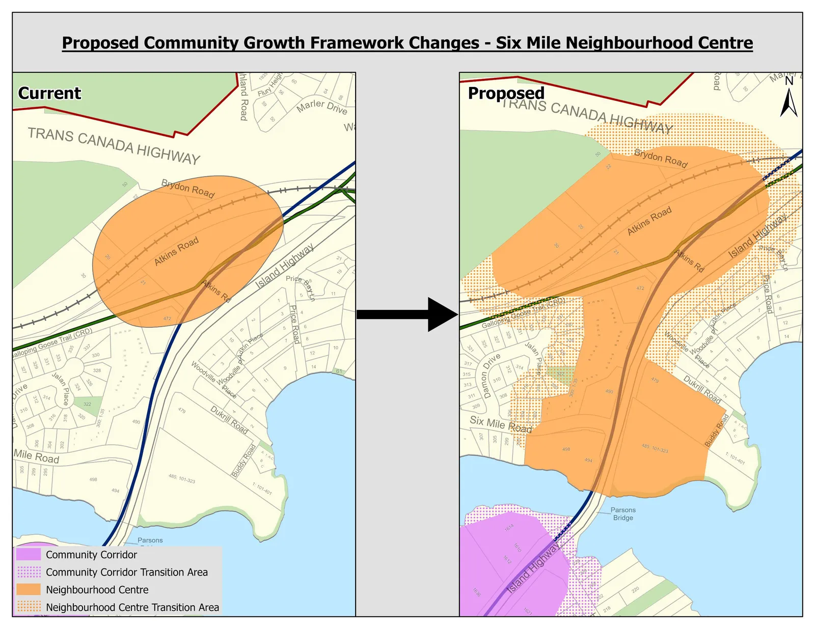
OCP Community Growth Framework: Six Mile Neighbourhood Centre and Transition Area
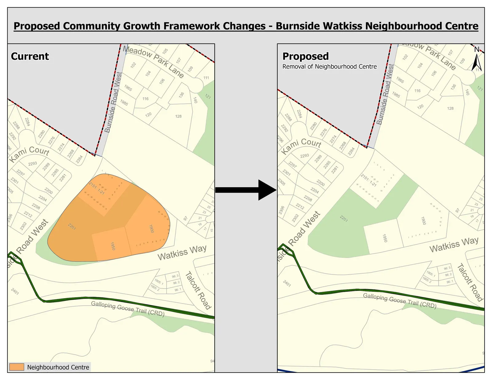
OCP Community Growth Framework: Burnside Watkiss Neighbourhood Centre
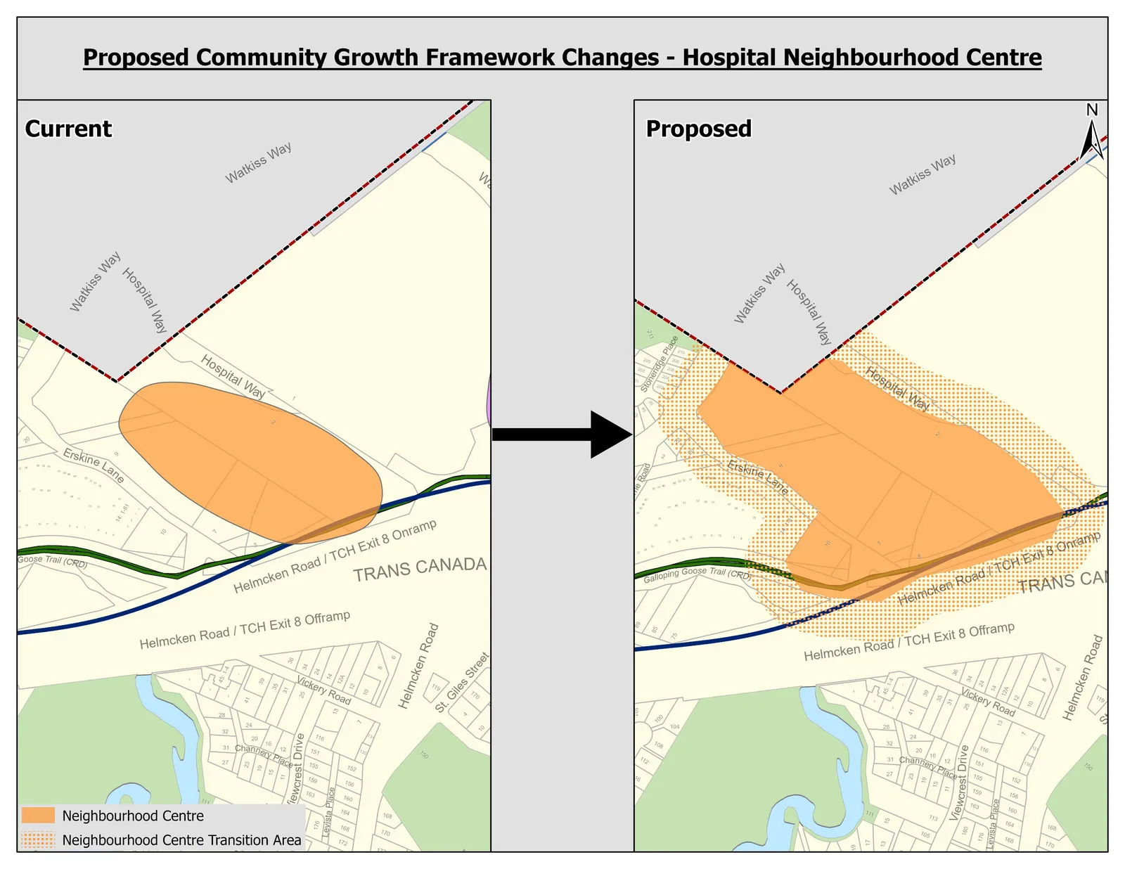
OCP Community Growth Framework: Hospital Neighbourhood Centre and Transition Area
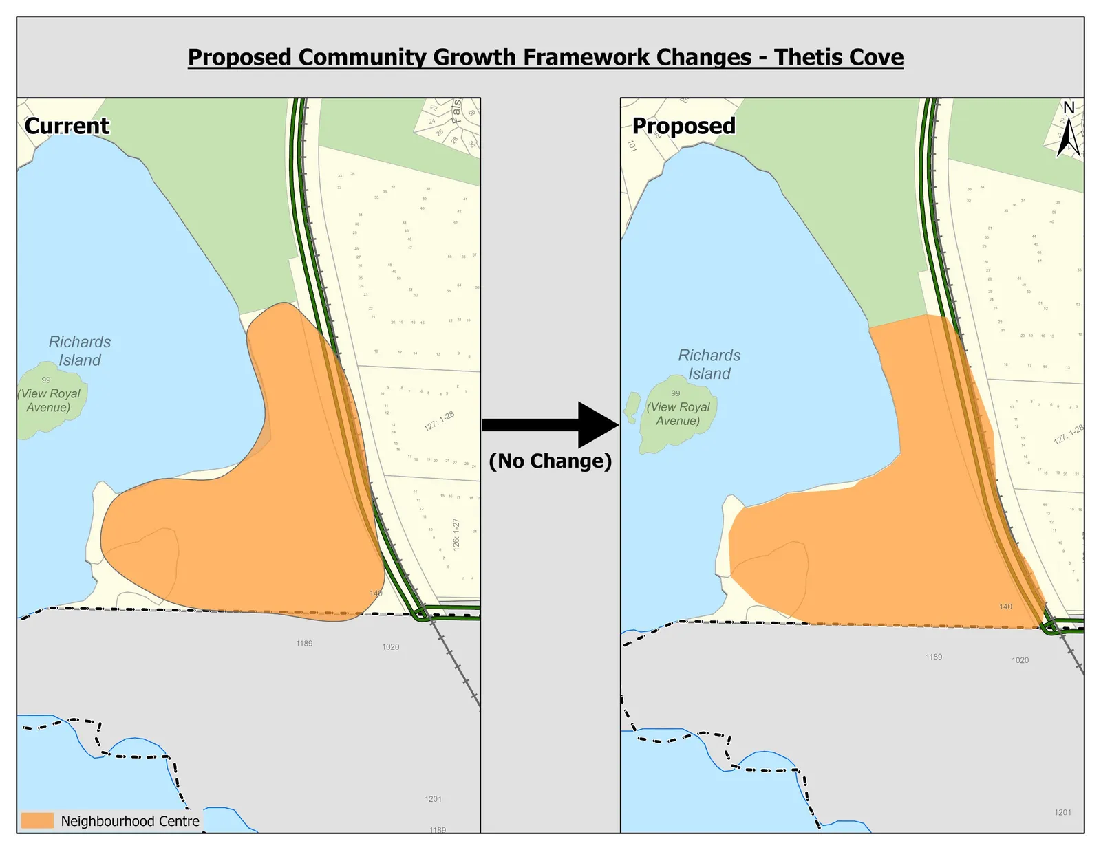
OCP Community Growth Framework: Thetis Cove Neighbourhood Centre
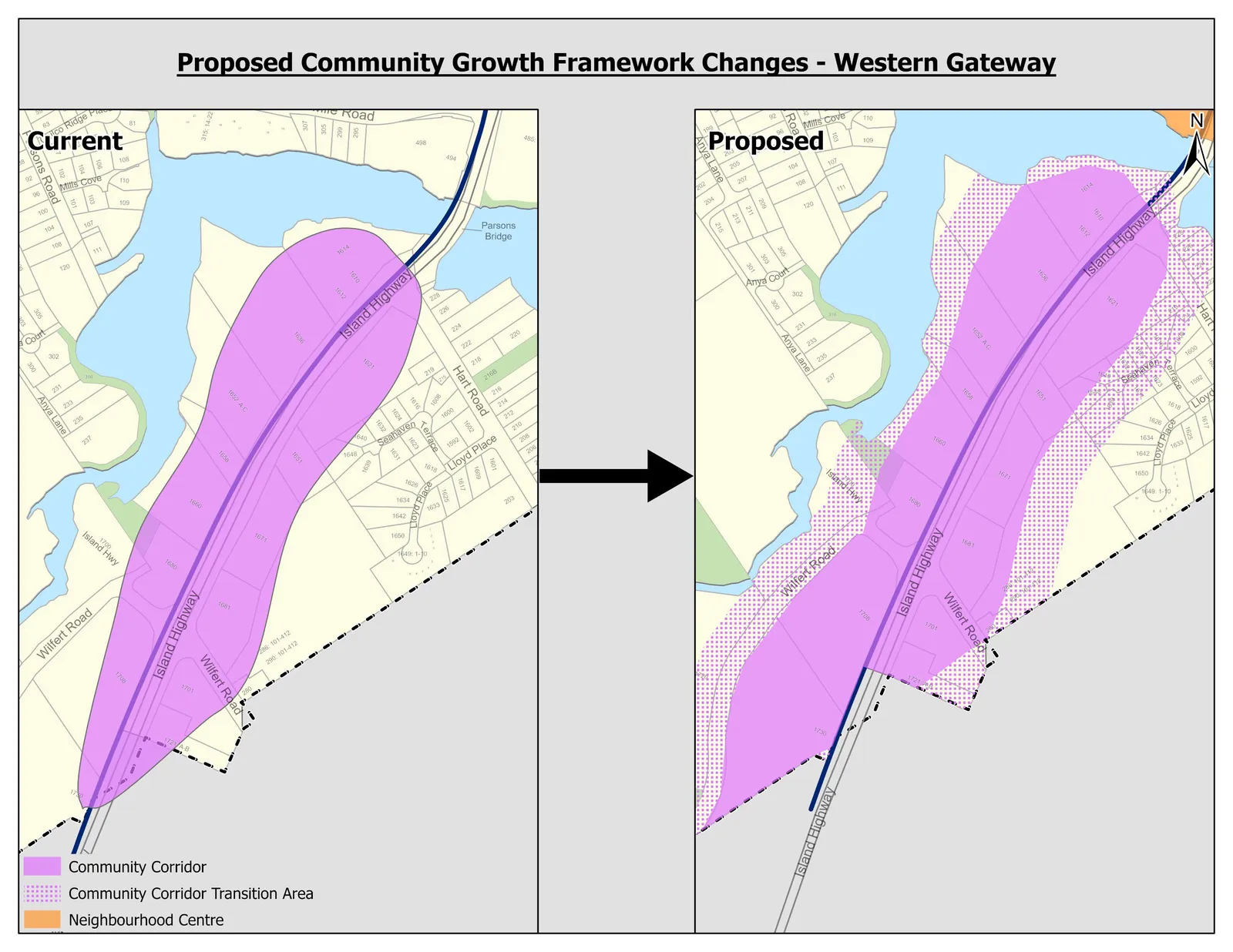
OCP Community Growth Framework: Western Gateway Community Corridor
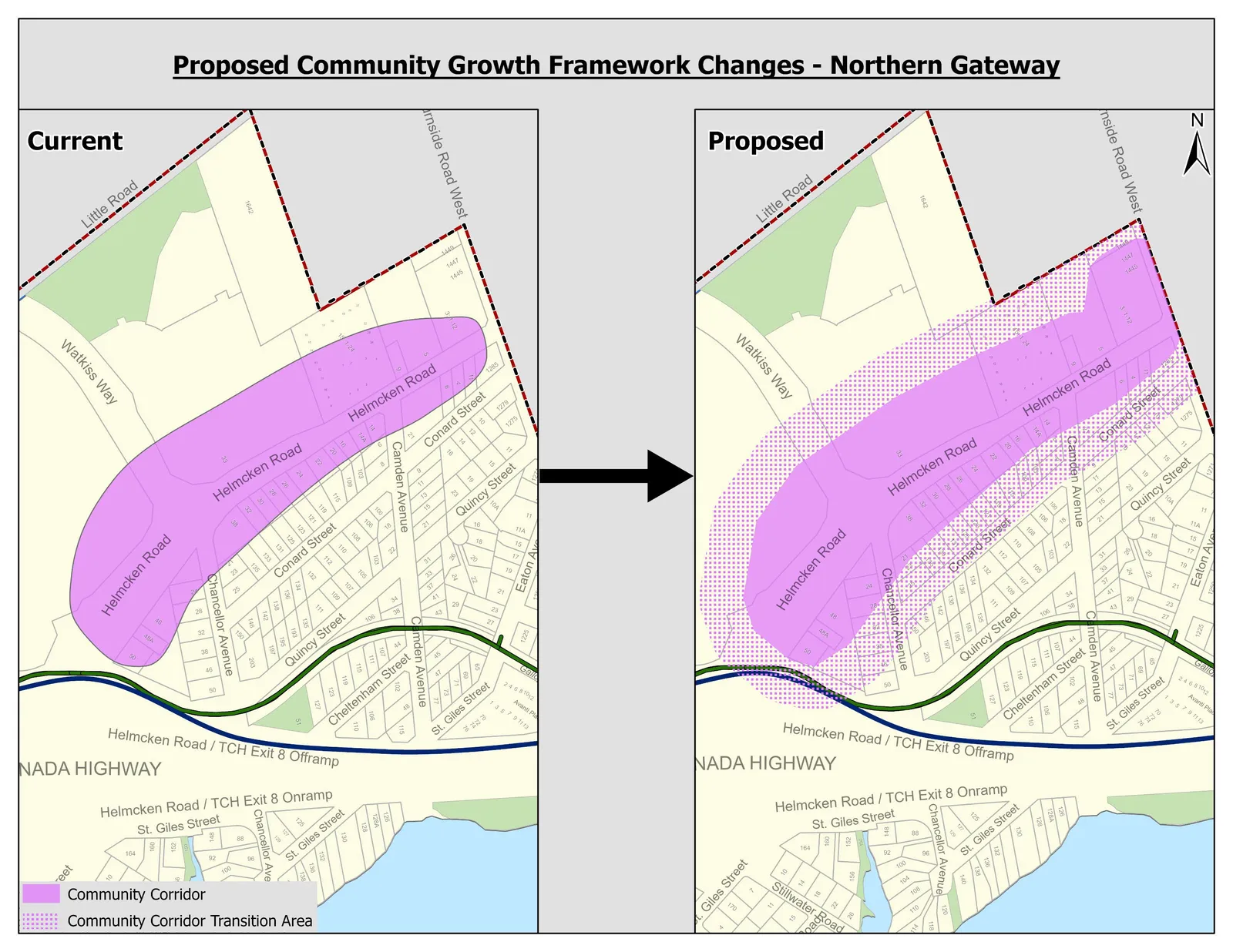
OCP Community Growth Framework: Northern Gateway Community Corridor
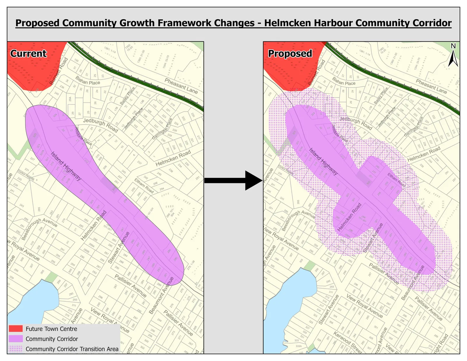
OCP Community Growth Framework: Helmcken Harbour Community Corridor
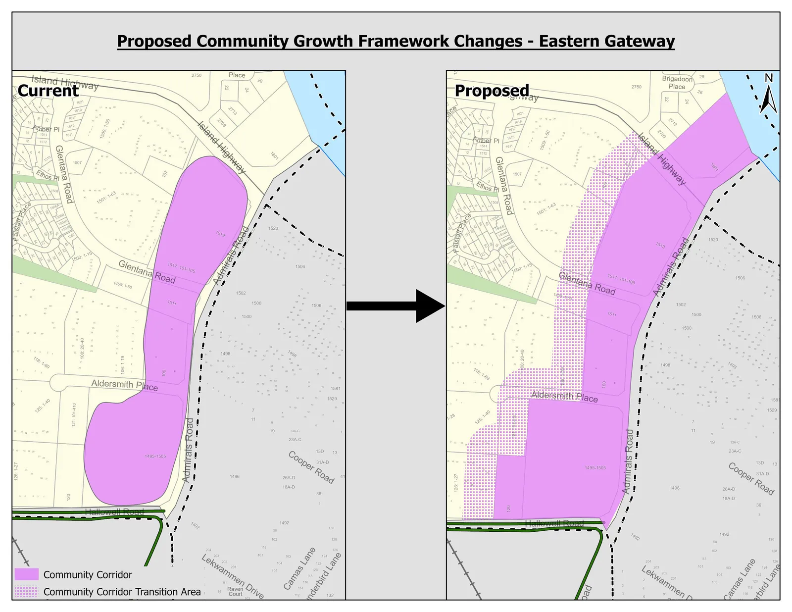
OCP Community Growth Framework: Eastern Community Corridor
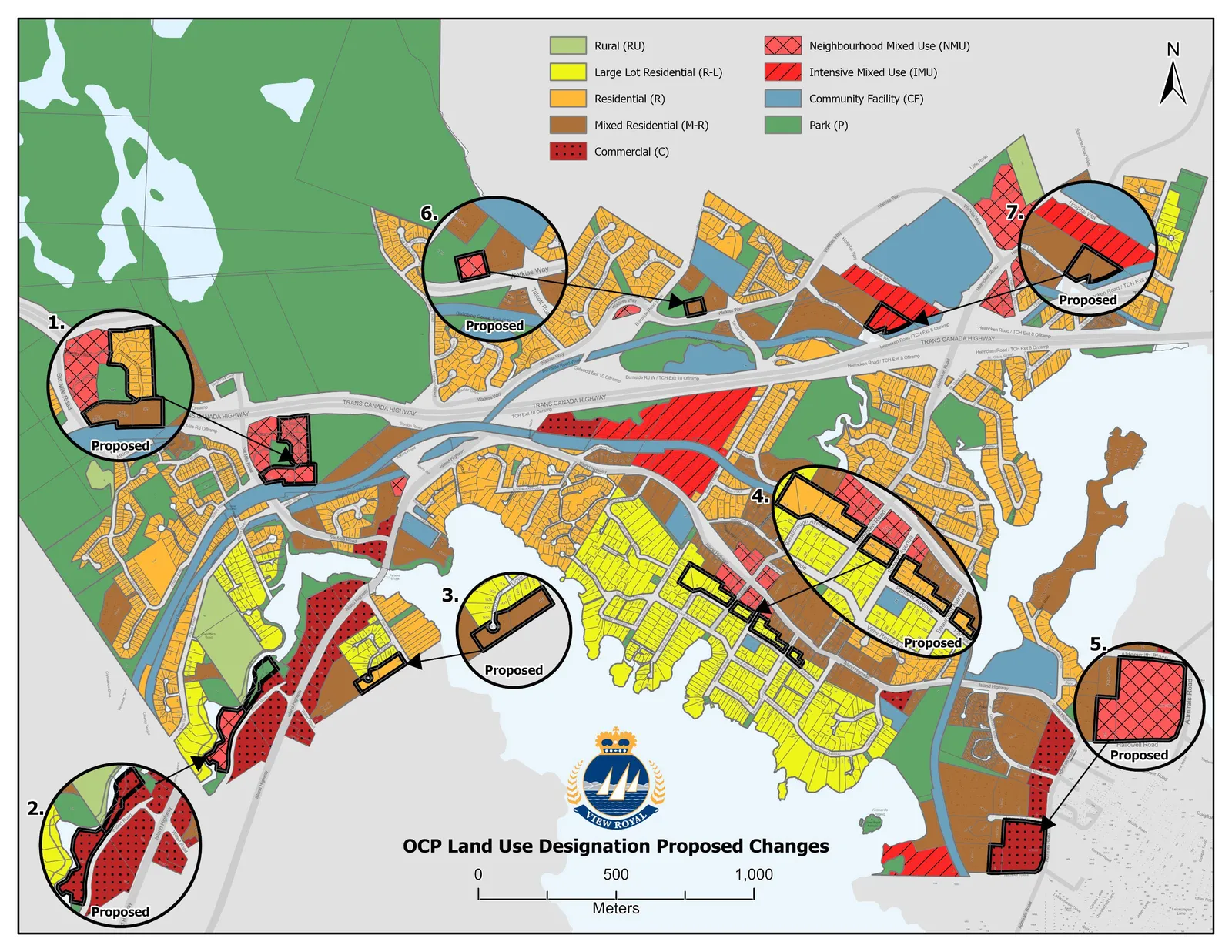
Land Use Designations
- Rural (RU)
- Large Lot Residential (R-L)
- Residential (R)
- Mixed Residential (M-R)
- Commercial (C)
- Neighbourhood Mixed Use (NMU)
- Intensive Mixed Use (IMU)
- Community Facility (CF)
- Park (P)
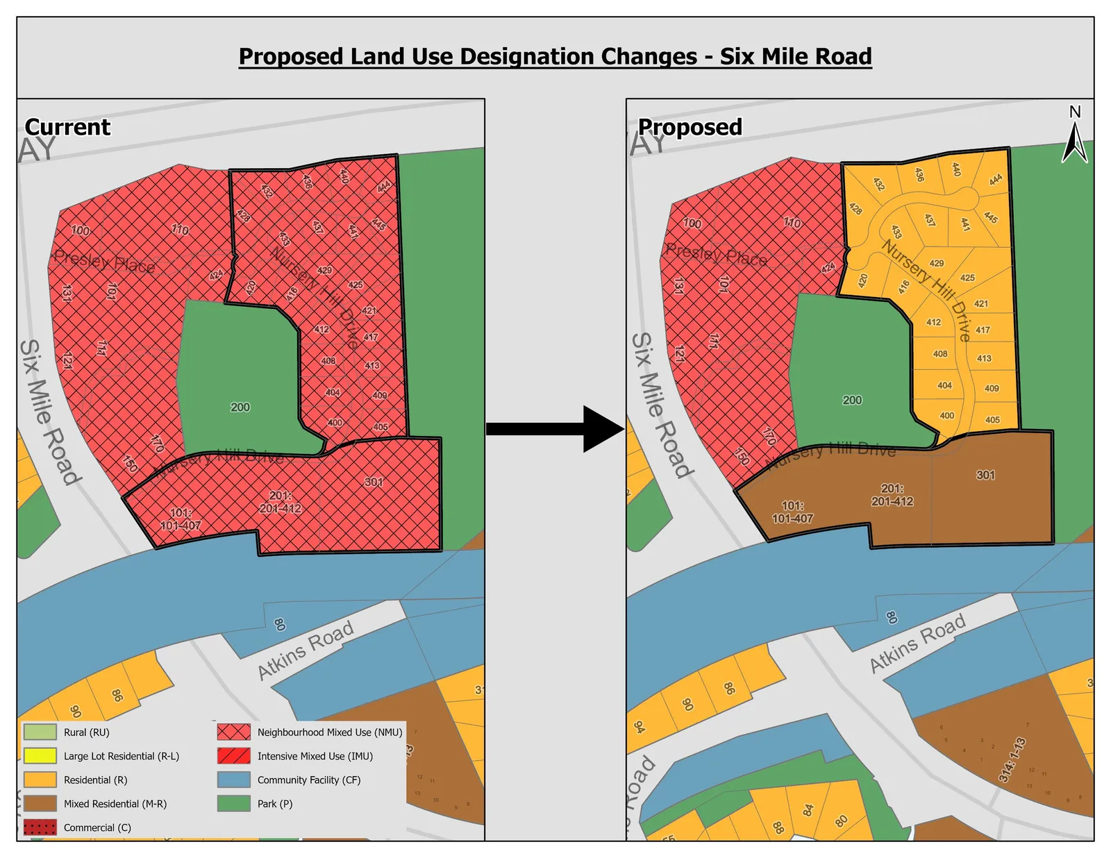
Proposed Land Use Designation Change: Six Mile Road Area
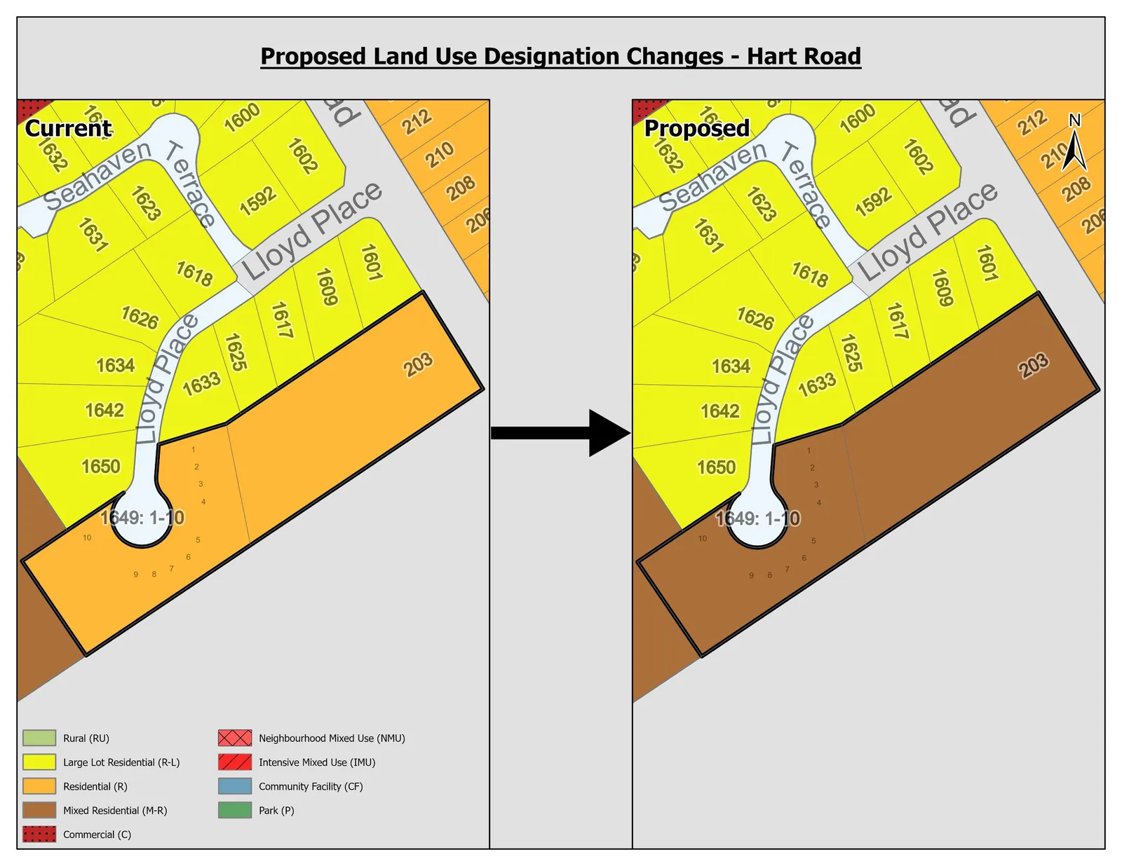
Proposed Land Use Designation Change: Hart Road Area
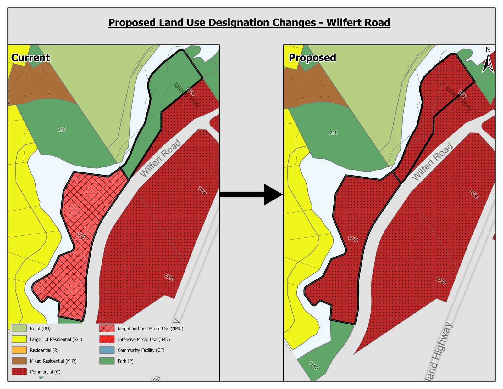
Proposed Land Use Designation Change: Wilfert Road Area
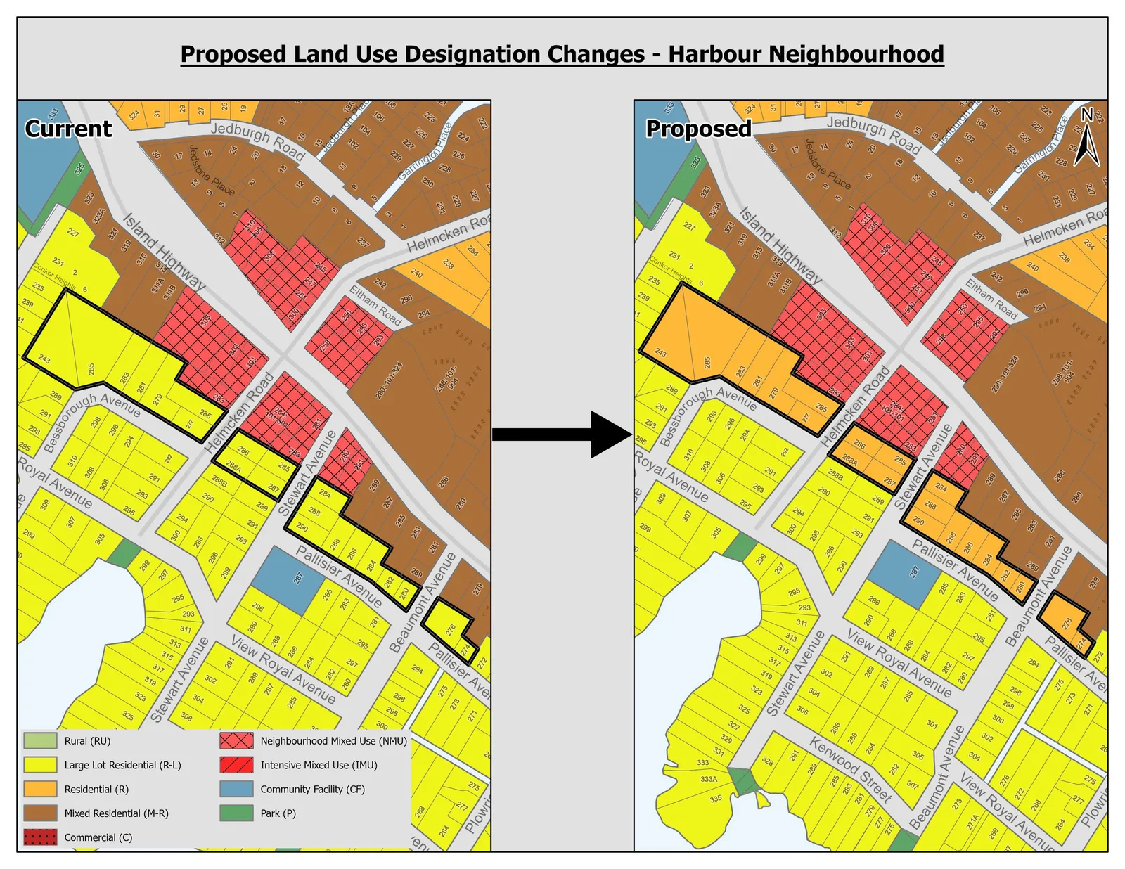
Proposed Land Use Designation Change: Harbour Neighbourhood Area
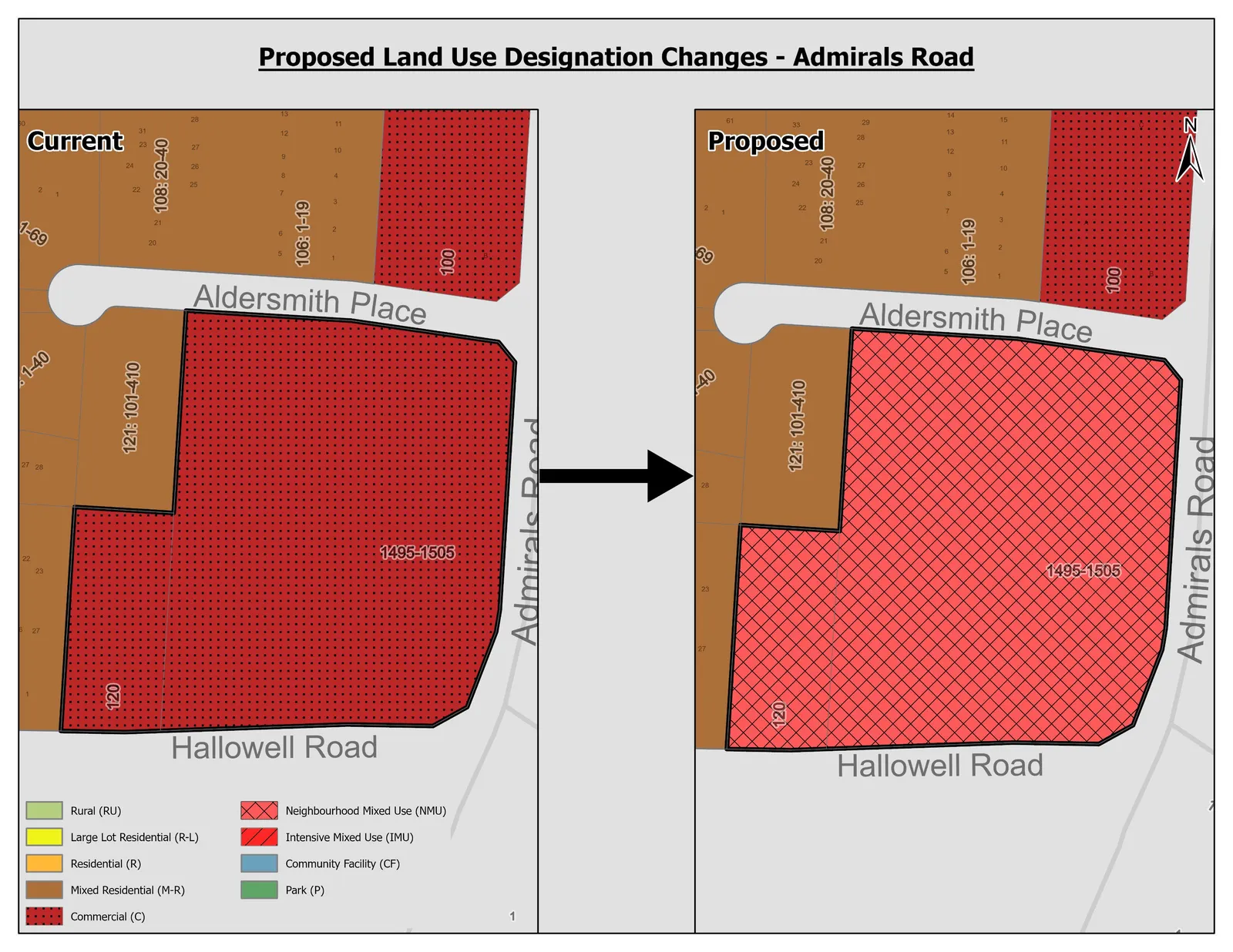
Proposed Land Use Designation Change: Admirals Road Area
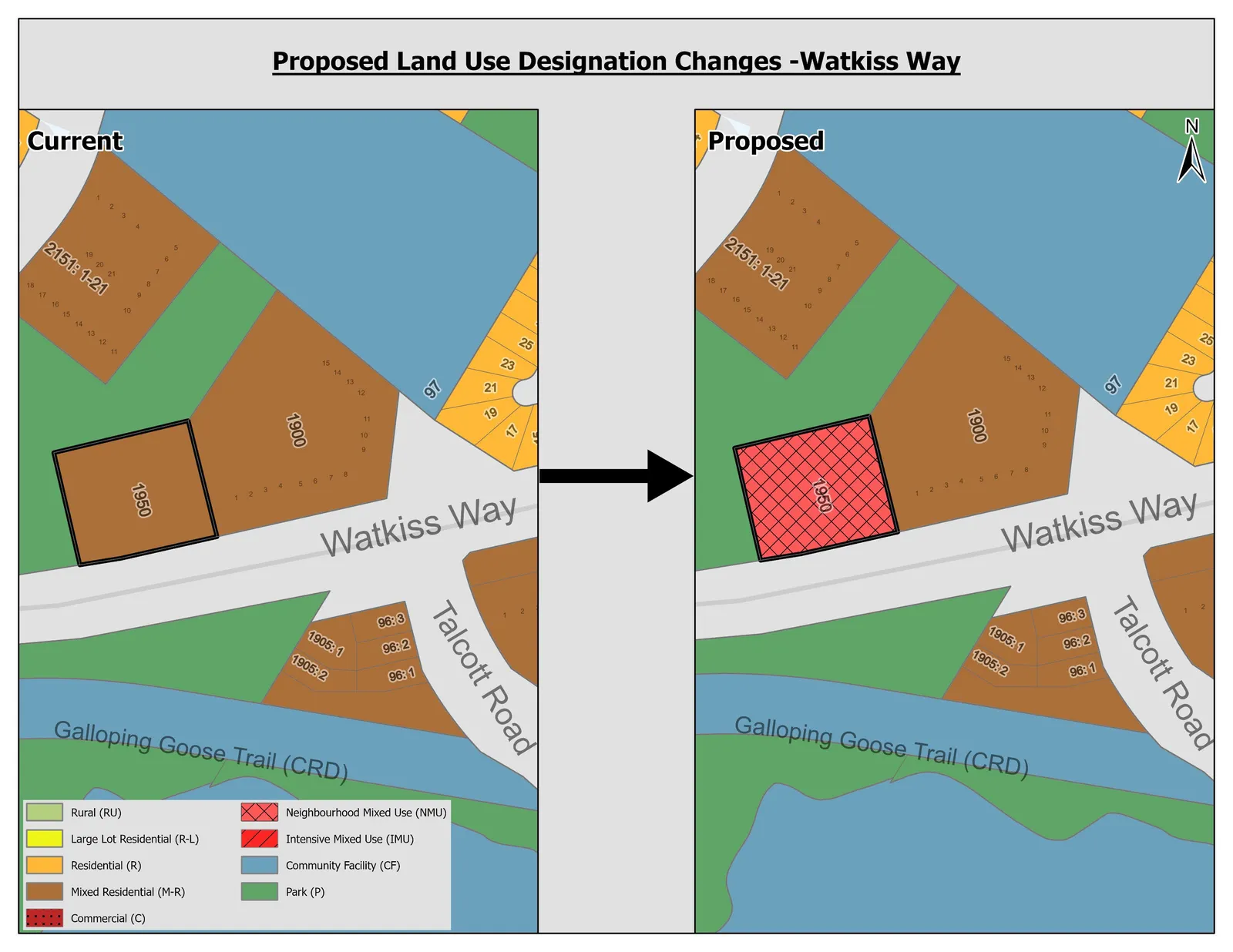
Proposed Land Use Designation Change: Watkiss Way Area
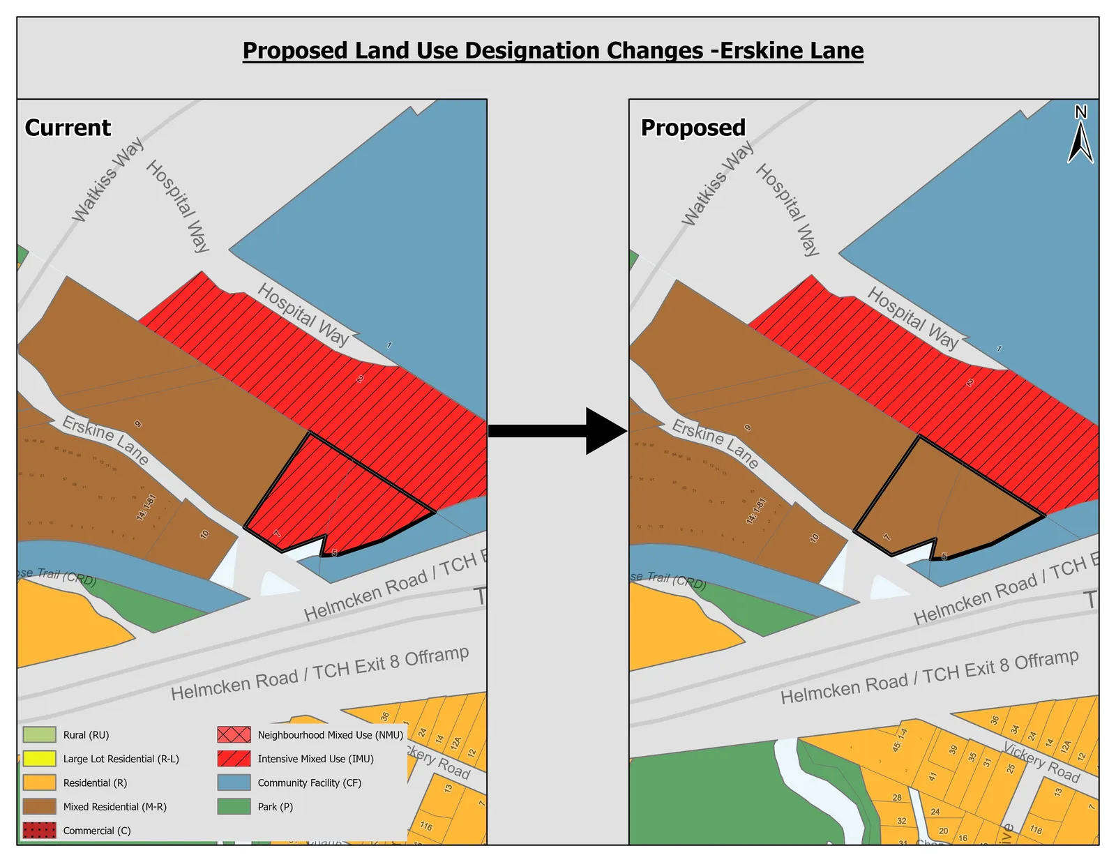
Proposed Land Use Designation Change: Erskine Lane Area
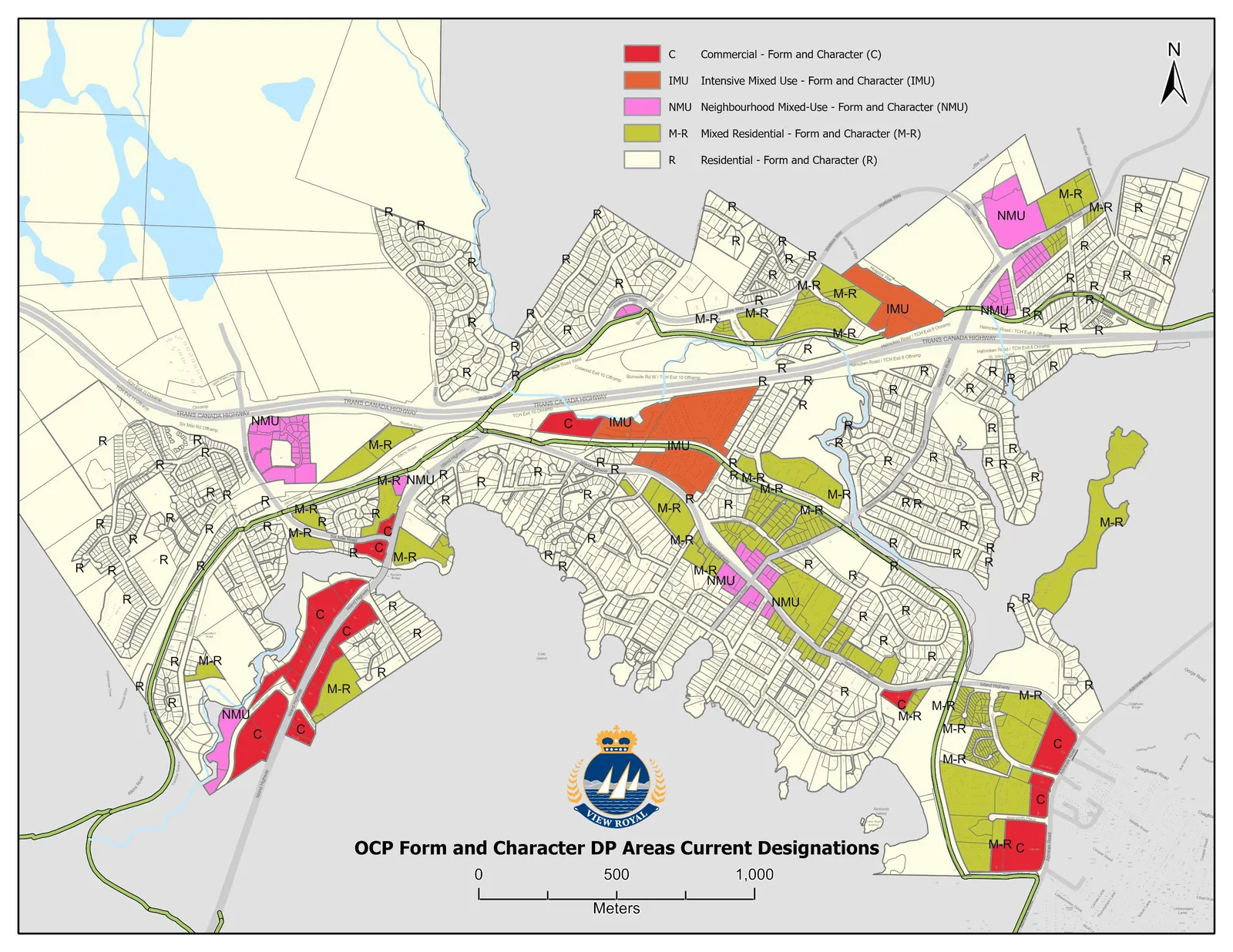
Development Permit Areas
Design Guidelines
- Consolidation of design guidelines from existing DPAs
- Incorporated new design guidelines that focus on Siting and Massing, Urban Design, and Sustainability
Existing Development Permit Areas
Development Permit Areas – Form & Character:
- Commercial
- Intensive Mixed Use
- Neighbourhood Mixed Use
- Mixed Residential
- Residential
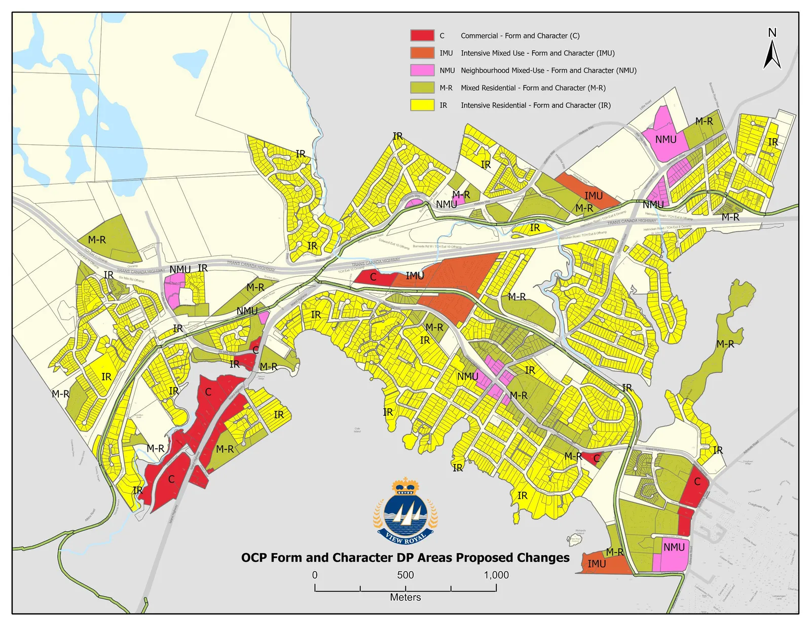
Proposed Development Permit Areas
Development Permit Areas – Form & Character:
- Commercial
- Intensive Mixed Use
- Neighbourhood Mixed Use
- Mixed Residential
- Intensive Residential (new)
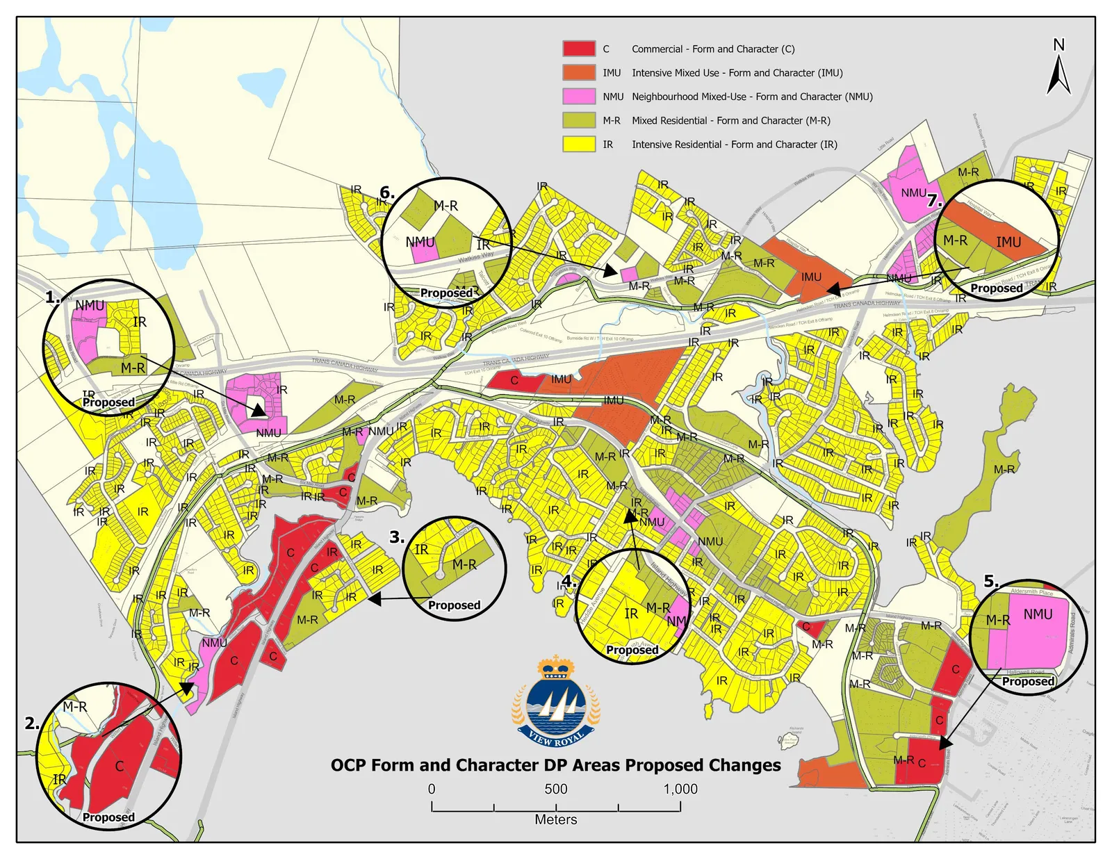
Proposed Changes to Development Permit Areas
Development Permit Areas – Form & Character:
- Commercial
- Intensive Mixed Use
- Neighbourhood Mixed Use
- Mixed Residential
- Intensive Residential (new)
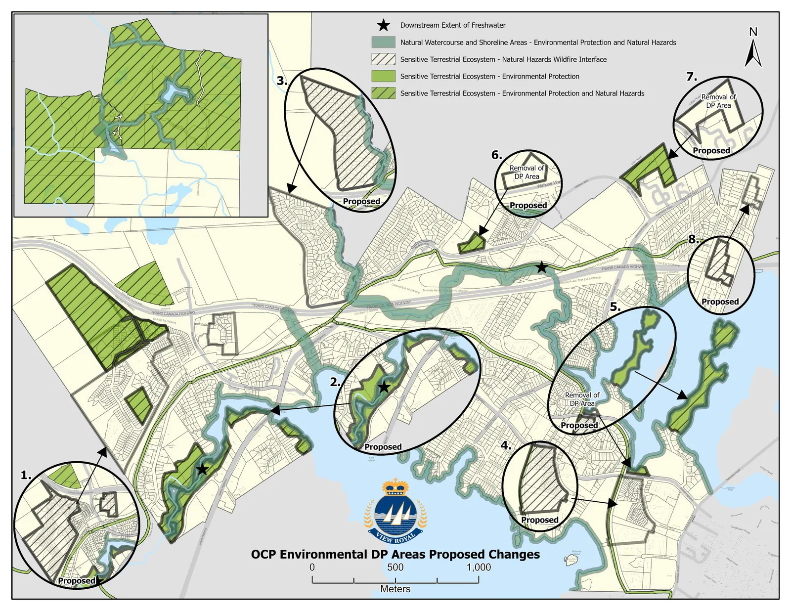
Development Permit Areas
Environmental Protection and Natural Hazard Development Permit Areas
- Created a new DPA – Natural Hazards Wildfire Interface
- Added additional guidelines to focus on fire prevention
- Added additional guidelines regarding federal and provincial regulations for docks
- Added additional guidelines to further environmental protection and preservation
Proposed Changes to Development Permit Areas
Development Permit Area – Environmental
- Natural Watercourse and Shoreline Area (Environmental Protection and Natural Hazards)
- Sensitive Terrestrial Ecosystem (Natural Hazards Wildfire Interface) (new)
- Sensitive Terrestrial Ecosystem (Environmental Protection)
- Sensitive Terrestrial Ecosystem (Environmental Protection and Natural Hazards)
NEXT STEPS AND OPPORTUNITIES FOR ENGAGEMENT:
To move forward with the final phase of the OCP update, the following work is planned to be completed:
- Two staff-driven public open houses
- Further consultation with the Esquimalt and Songhees Nations
- Further edits and refinements to policies following external agency, community and legal review and feedback
- Updates to the Development Permit Areas and associated design guidelines.
CONSIDERATION AND REVIEW PRIOR TO APPROVAL
- Council to review Draft OCP aligns with the Town’s Financial Plan and the CRD’s Waste Management Plan (after First Reading)
- Draft OCP may need to be referred to the Provincial Agricultural Land Commission (after First Reading)
- Public Hearing will be scheduled (after First and before Third Reading) to allow the public to provide comment on the OCP.
- Once the OCP is adopted, the Town will engage with the CRD Board of Approval on the Regional Context Statement.
FINANCIAL IMPLICATIONS
- The total project cost to date is $135,227.45
- The expected cost of an OCP re-write would be approximately $200,000, in addition to the funds already spent
- The expected time for completion is a minimum of 2 to 3 years
RECOMMENDATION:
THAT Council receive the report titled “Draft Official Community Plan Update – Restart Plan” dated January 27, 2023 from the Community Planner for information.
AND THAT Council restart the OCP update and move forward with the final phase of the project.
Document Images
(19)
Community engagement signage "What's Your View?" in a park setting
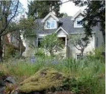
Large-lot detached home with mature garden
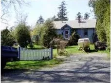
Large-lot detached home with white picket fence
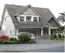
Craftsman-style detached home
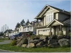
Two-story detached home
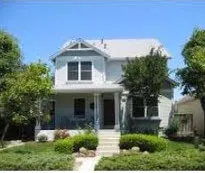
Contemporary small lot detached home
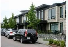
Modern townhouses with street-front parking
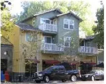
Multi-story mixed-use building with commercial base
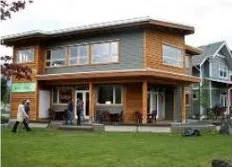
Mixed-use building with cafe and residential units
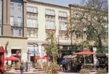
Urban streetscape with multi-story commercial and residential buildings
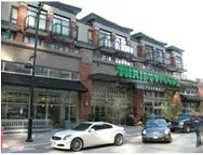
Large-scale urban mixed-use plaza
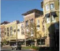
Modern multi-story apartment complex over retail

Urban residential block with courtyard and retail space
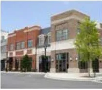
Professional office building with brick facade
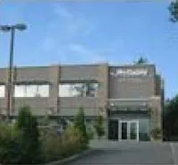
Modern glass and concrete commercial building
Crowded beach scene at a local park
People walking on a nature trail boardwalk
Modern hospital or large institutional building
Another view of a large institutional building