Wildfire Hazard Assessment: 3500 Highland Road
A professional assessment identifying the wildfire threat level for the subject property and recommending mitigation strategies.
Lot 1 and Lot 2 3500 Highland Road
Wildfire Hazard Assessment
Prepared for: Deborah Todd via Pamela Ubeda at Coast and Beam Pamela@coastandbeam.com
Prepared by: Strathcona Forestry Consulting PO Box 387 Stn Mn Duncan BC V9L 3X5 strathcona.fc@shaw.ca
27 September 2021
Executive Summary
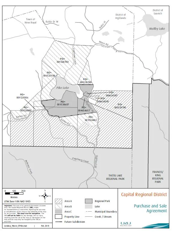
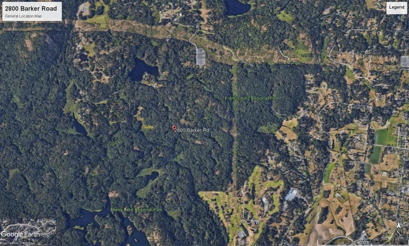
In accordance with the Town of View Royal’s Development Permit Guidelines for Wildfire, Pamela Ubeda, Principle/Architect, Coast and Beam Architecture, on behalf of Deborah Todd, Ashley Freeman and Dale Van Mol, property owners, 2800 Barker Road, retained Strathcona Forestry Consulting to conduct a wildfire hazard assessment of two new homes proposed at Parcel A, Sec. 2, Land District 24 (hereafter Lot 1) and Lot 1, Plan VIP 13849, Sec. 2, Land District 24 (hereafter Lot 2; 3500 Highland Road).
Assessment determined that the wildfire threat at the subject property is currently High. Main contributing factors are fuel loading (forest vegetation) loading in the general area, delayed response and lack of community fireflow at the site, elevated HeadFire Intensity, and intermix (> 1 structure/ha). Under the provincial Wildfire Threat Rating system, ratings must be moderate or less to be considered acceptable.
Living in a fire-prone ecosystem involves taking the necessary steps to protect homes, property, and community from wildfire. Development standards play a significant role in reducing the potential impact of wildfire. FireSmart strategies for wildfire prevention and preparedness are proven to prevent risk related losses to wildfire (FireSmartCanada.ca; FireSmartBC.ca).
In my professional opinion, compliance with the FireSmart strategies and recommendations contained in this report will ensure the risk of wildfire can be reduced to a level acceptable to ensure the safety of the intended development. The property owners recognize the importance of FireSmart plans, and having already undertaken a number of actions to reduce fire risk.
Fire prevention and protection in the interface zone are ongoing processes. Long-term implementation of FireSmart mitigation is essential to ensure protection for life, property, and ecological processes at the Town of View Royal’s wildland interface.
Introduction
In accordance with the Town of View Royals’ Development Permit Guidelines for Wildfire, Pamela Ubeda, Architect/Principle, Coast and Beam Architecture, on behalf of property owner, Deborah Todd, Ashley Freeman and Dale Van Mol retained Strathcona Forestry Consulting to conduct a wildfire hazard assessment of two new homes proposed at Lot 1 and Lot 2 (3500 Highland Road). (Lot 1 does not yet have a civic address.)
The interface (wildland urban interface/wildland residential interface) describes any area where combustible wildland fuels are found adjacent to homes or other buildings. Under Section 919.1(1) (a) of the Local Government Act, development permits may be designated where protection of Natural Hazard Lands is justified. Natural hazards, including wildfires, may put life and property, and local biodiversity, at risk if development is inappropriately situated and not well planned. Areas rated at high or extreme risk from wildfire are designated in a Development Permit Area (DPA). The objective of the DPA is to properly manage the risks associated with the hazard (interface wildfires).
Hazard Assessment
This report describes the vegetation, terrain, and infrastructure on and around the subject property, and provides recommendations to reduce the risk of wildfire. Assessment criteria are based on Rating Interface Wildfire Threats in British Columbia (https://www2.gov.bc.ca/), FireSmart (FireSmart, Protecting Your Community From Wildfire (Second Edition. Partners in Protection Partners in Protection, 2003 (https://www.firesmartcanada.ca/), and the Home Owners FireSmart Manual (BC Edition (https://www2.gov.bc.ca/assets/gov/public-safety-and.../homeowner-firesmart.pdf). Fire behavior modeling is standardized after the Canadian Forest Fire Danger Rating System (CFFDRS). Fuel Types listed in this assessment are customized from the CFFDRS Fuel Type list for applicability in south coastal BC. Wildfire threat assessment was conducted through an analysis of fuel threats in and adjacent to the proposed development, as described in the 2017 Wildfire Threat Assessment Guide and Worksheets (MFLNRO, 2017). This process, used by qualified environmental professionals, employs physical and biophysical factors, combined with fuel hazards, to determine the wildfire threat (low, moderate, high, or extreme). Fire risk is based on four classes: low, moderate, high, and extreme. Recommendations in this report conform to BC Building Code standards and fire hazard planning authorized by Section 3(2) of the BC Fire Services Act.
Field Inspection:
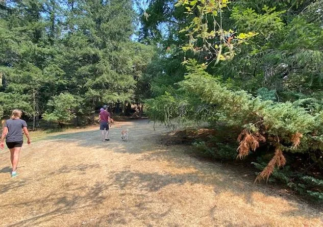
Deborah Todd and Dale Van Mol provided a site tour on August 12, 2021. Weather was warm and dry. Field investigation entailed an analysis of the interface fire hazard that the land is exposed to, from the perspective of the general area, local site, and proposed and existing structures in the general vicinity, up to 100+ m from property boundaries, where feasible.
Location and Description of Proposal:
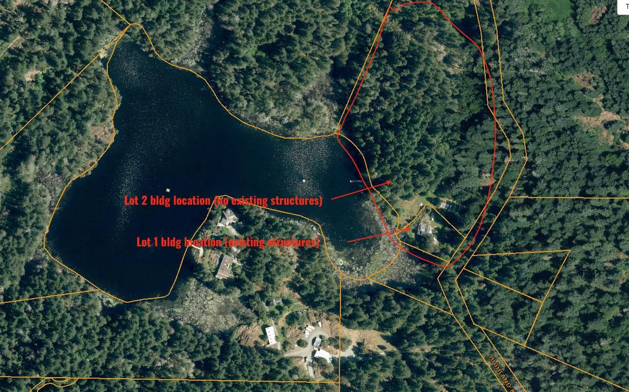
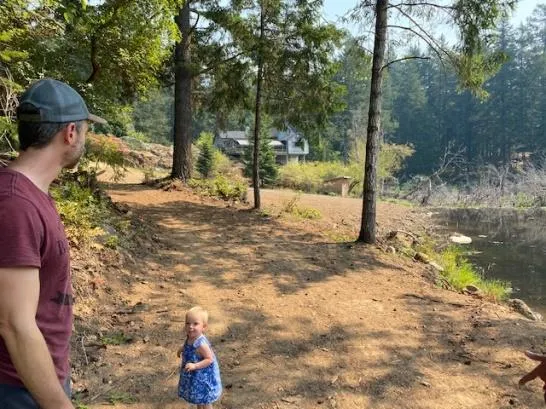
The subject property, which has been in the family for over a century, comprises two adjacent lots on Pike Lake. Two new, single level homes are planned to accommodate the family, one on each lot (see Site Plan and maps next pages). An existing older home at Lot 2 is to be replaced by a new home. Lot 1 is a new lot (approx. 12 acres), where a new single family home is proposed. The existing home and property are very well maintained. The property is private, with no public access.
Construction plans include fire resistant roofing (e.g., metal) and noncombustible siding (e.g. metal). Driveway access will include adequate turnaround.
Committed to maintaining the integrity of the lakeshore habitat, the owners are in the process of engaging a biologist and landscaper to rehabilitate a small foreshore area where vegetation has been negatively impacted due to the fluctuating water table at Pike Lake as a result of beaver activity. A number of dead/dying trees were observed along the shoreline of Pike Lake.
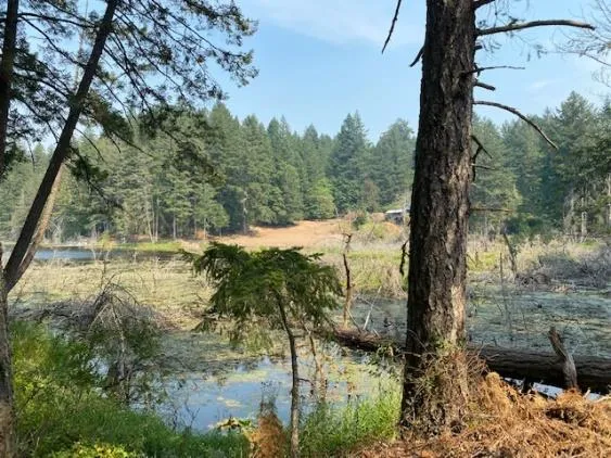
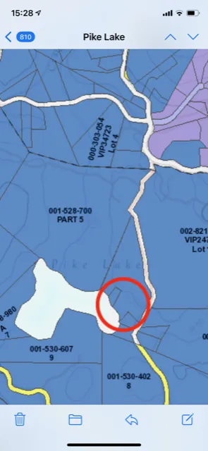
Subject property is located on the north/east side of Pike Lake in the Town of View Royal.
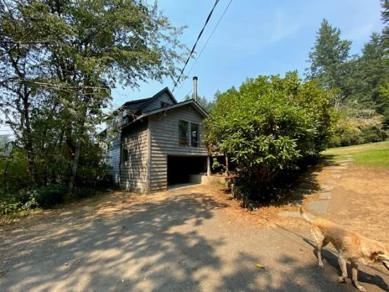
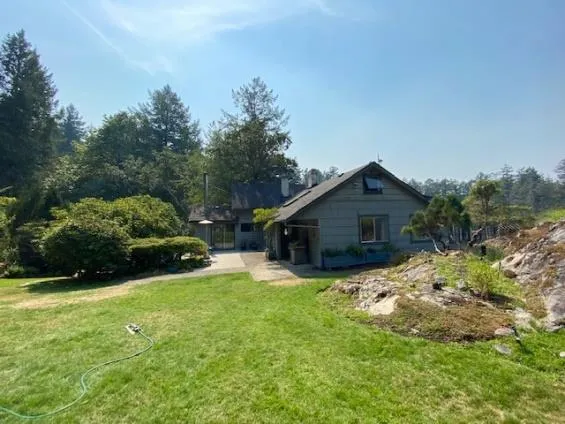
Top photos: Old home at Lot 2 will be replaced by new home. Bottom left: A new home is proposed at new Lot 1.