B.C. Land Surveyor's Certificate
A certificate from a British Columbia Land Surveyor identifying the foundation location on Lot B.
B.C. LAND SURVEYOR'S CERTIFICATE OF LOCATION OF FOUNDATION ON LOT B, SECTION 91, ESQUIMALT DISTRICT, PLAN 18407 EXCEPT PART IN PLAN 3768 RW.
I have examined the residential FOUNDATION shown and hereby certify that the said structure is situate with respect to nearby boundaries as shown. This document is prepared for building inspection or mortgage purposes only and is for the exclusive use of our client. This document is not valid unless originally signed and sealed. This document shall not be used to define property lines or property corners. Unregistered Interests have not been included or considered.
Peter I. M. Broeren, BCLS © 2021 Peter Broeren, BCLS
File: 37-BECKER-CO1
PETER BROEREN, BCLS PO Box 35067 Hillside Victoria, B.C. V8T 3A0 Tel 250.893.5313 peter.broeren1@outlook.com

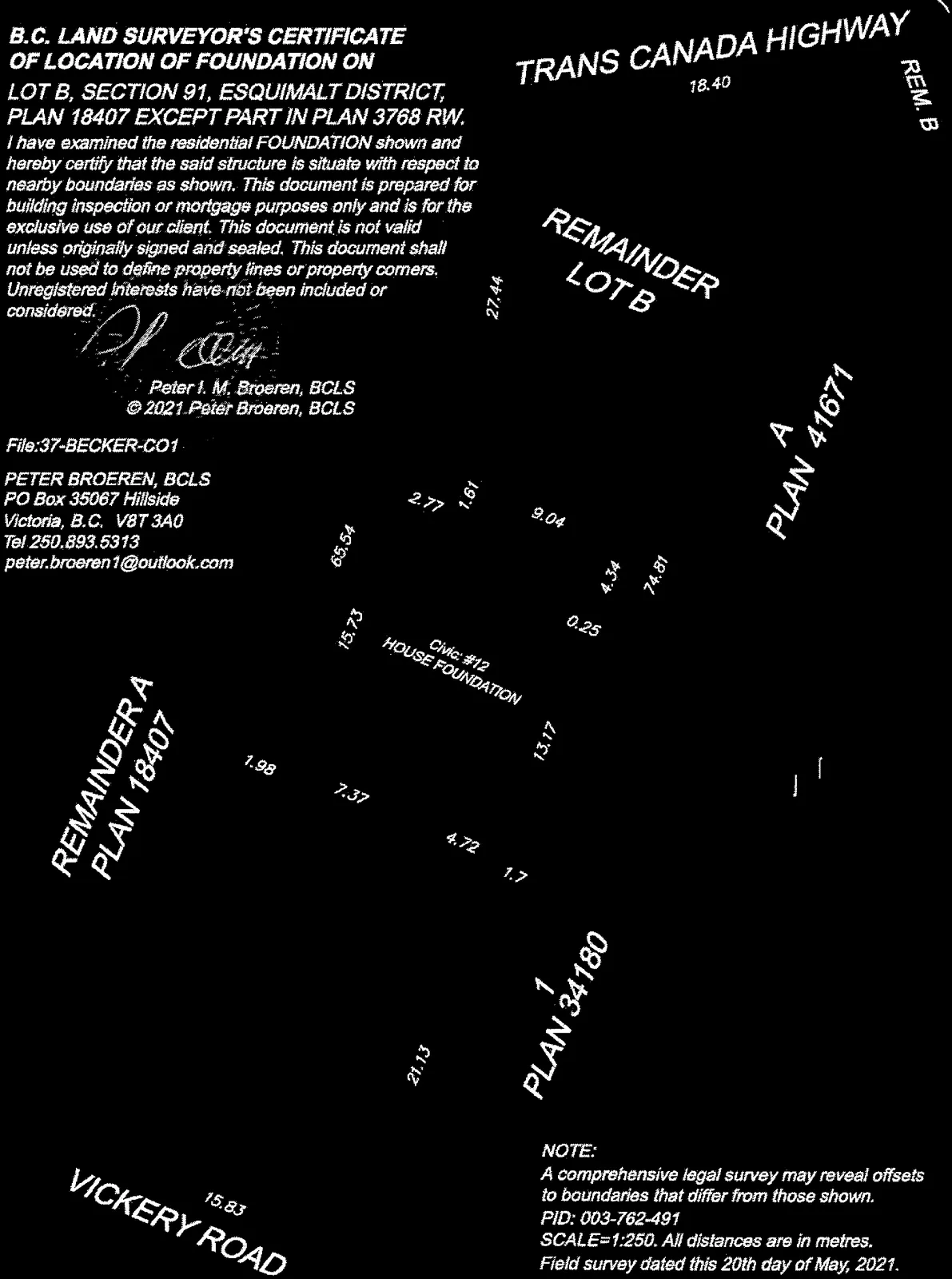
Site Plan Details:
- Property Labels: REMAINDER LOT B, REM. B, A PLAN 41671, 1 PLAN 34180, REMAINDER A PLAN 18407
- Adjoining Roads: TRANS CANADA HIGHWAY, VICKERY ROAD
- Subject Structure: Civic: #12 HOUSE FOUNDATION
- Distances and Dimensions (metres): 18.40, 27.44, 65.54, 15.73, 1.98, 7.37, 4.72, 1.76, 21.13, 15.83, 13.17, 0.25, 74.81, 4.34, 9.04, 1.61, 2.77
- Orientation: North arrow included
NOTE:
A comprehensive legal survey may reveal offsets to boundaries that differ from those shown. PID: 003-762-491 SCALE=1:250. All distances are in metres. Field survey dated this 20th day of May, 2021.