This site is in beta — data may be incomplete and features are still being added.
Council Meeting/Documents/CRD Regional Trails Widening Study - Pathway Design and Implementation Priorities (Appendix B)
Appendix

CRD Regional Trails Widening Study - Pathway Design and Implementation Priorities (Appendix B)

May 7, 2024Page 1392 sections

Visual overview of the proposed 6.5m pathway design and the order of implementation priorities.

1 CALL TO ORDER- Mayor Tobias called the meeting to order at 7:00 p.m.
4.0m Bike Path2.5m Walkway1st Priority: Selkirk Trestle area

APPENDIX B

Page 139

CAPITAL REGIONAL DISTRICT (CRD) REGIONAL TRAILS WIDENING STUDY

APRIL 28, 2020

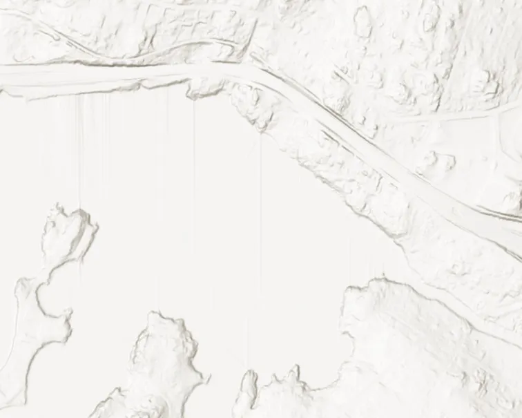
SEPARATED USE PATHWAY DESIGN

[Diagram: Separated Use Pathway Design cross-section showing a 4.0m Bike Path, a 2.5m Walkway, and 0.6m shoulders on either side. Scaling figures illustrate users including cyclists, a pedestrian, and a person in a wheelchair.]

IMPLEMENTATION PRIORITIES

Topographic map segment - northwest area
Topographic map segment - north-central area
Topographic map segment - northeast area
Topographic map segment - far-northeast area
Topographic map segment - west-central area
Topographic map segment - central area
Topographic map segment - east-central area
Topographic map segment - far-east-central area
Topographic map segment - lower-west-central area
Topographic map segment - lower-central area
Topographic map segment - lower-east-central area
Topographic map segment - far-lower-east-central area
Topographic map segment - southwest area
Topographic map segment - south-central area
Topographic map segment - southeast area
Topographic map segment - far-southeast area
Topographic map segment - southern coastal/waterfront area
Topographic map segment - southern shoreline area
Topographic map segment - southern peninsula area
Topographic map segment - far-southern coastal area

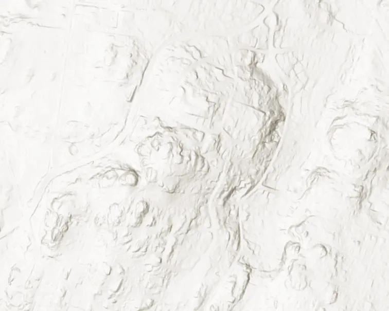
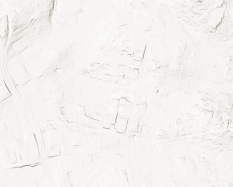
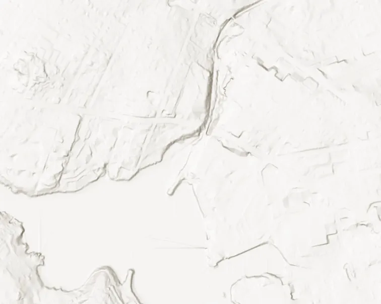
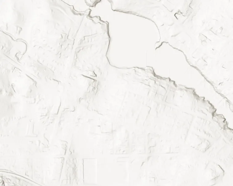
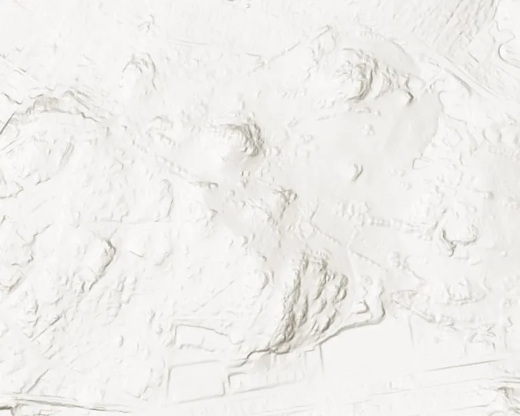
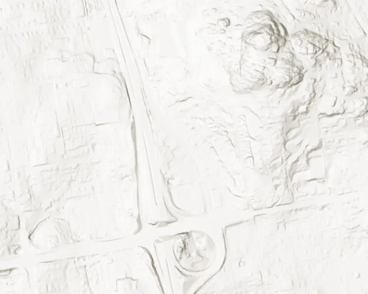
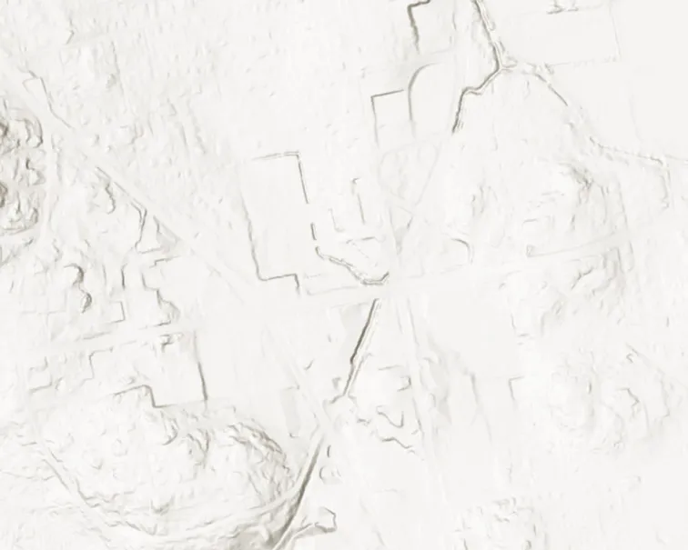
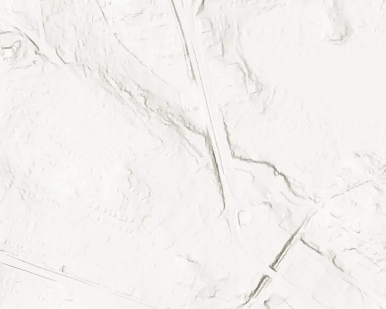
[Map: Implementation Priorities overview showing Sections A, B, and C, and highlighting trail segments by priority level from 1st to 5th.]

Priority Levels:

  • 1st Priority: Selkirk Trestle area (Dark Blue)
  • 2nd Priority: Section south of Swan Lake area (Light Blue)
  • 3rd Priority: Sections including Swan Lake Trestle and Brett Avenue Trestle (Red)
  • 4th Priority: Central section of Section C (Green)
  • 5th Priority: Western section of Section C (Orange)

Project Sections:

  • Section A: Southern trail corridor
  • Section B: Northeast trail corridor
  • Section C: Western trail corridor

Key Infrastructure:

  • Swan Lake Trestle
  • Brett Avenue Trestle
  • Switch Bridge
  • Selkirk Trestle

Regional Trails Widening and Lighting Project Definition (Selkirk, Swan Lake and Brett Avenue Trestles, and Sections A, B, and C)

Page 139
Extracted from: 2024 05 07 Council Agenda - Agenda - Pdf