Appendix
Natural Boundary Photograph Key (2012) - Attachment 4
September 1, 2015Page 432 sections
Survey map detailing the natural boundary and location of structures relative to the waterline and dock ramp.
October 29, 2012Brad Cunnin Land SurveyingFile 9492-36A
Oct 29/2012.
Page 43
Natural Boundary Photograph Key (2012)
Attachment 4
SCALE = 1 : 250 (All distances are in metres.)
Legend
- CamPos - denotes-Camera Position
- Visible marks on Pillar:
- Barnacle Mark = 1.05
- High Water Mark = 0.42
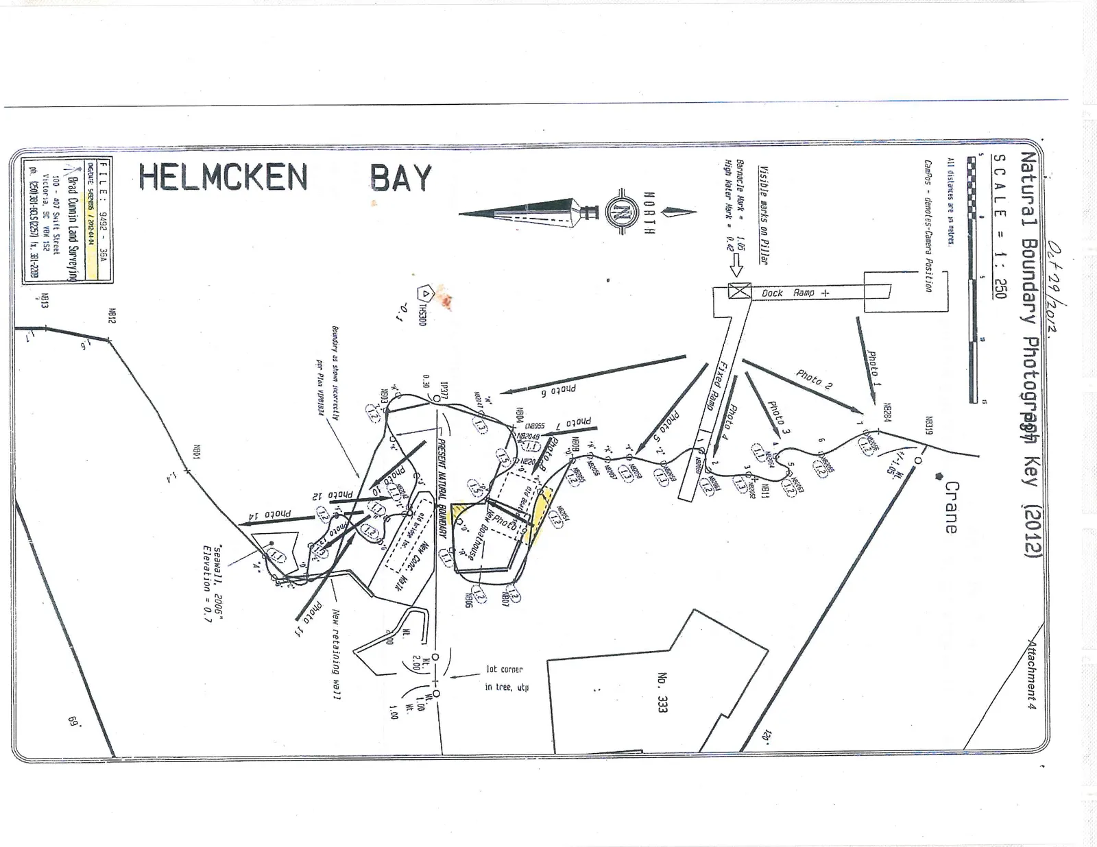
Map Features and Annotations:
- Crane (located near NB319)
- No. 333 (adjacent property)
- Dock Ramp +
- Fixed Ramp
- Old Boathouse (highlighted in yellow)
- New Boathouse
- New Conc. Walk
- Old bridge loc.
- New retaining wall
- "seawall, 2006" Elevation = 0.7
- Present Natural Boundary
- Boundary as shown incorrectly per Plan VIP81634
- Helmcken Bay
- Lot corner in tree, utp
Surveyor Information:
- FILE: 9492 - 36A
- DWG/DATE: 9492MBS / 2012-04-04
- Brad Cunnin Land Surveying
- 100 - 407 Swift Street, Victoria, BC V8W 1S2
- ph. (250) 381-8015 (2257) fx. 381-2209
Page 43
Extracted from: 2015 09 01 Council Agenda