Appendix
Drawing A1.1 - CONTEXTUAL ANALYSIS - Eagle Creek Village
September 1, 2015Page 831 section
Aerial contextual map showing the site's proximity to Victoria General Hospital, Galloping Goose Trail, and major transit routes.
February 4, 2013Shows hospital heliport and future transit station locations
EAGLE CREEK VILLAGE
CONTEXTUAL ANALYSIS
Watkiss Way & Helmcken Road, View Royal, BC
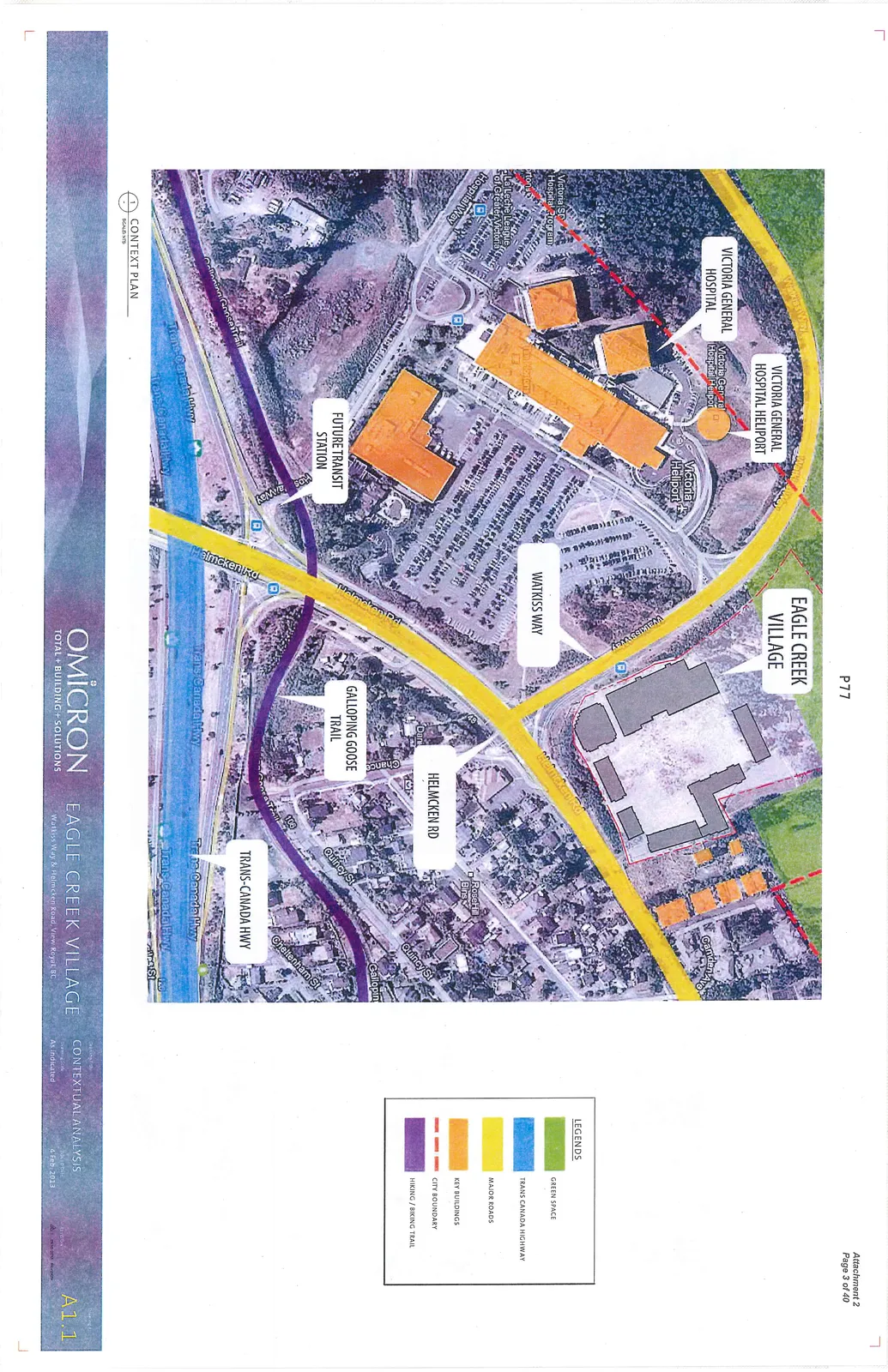
Legend
| Symbol | Description |
|---|---|
| Green Box | GREEN SPACE |
| Blue Box | TRANS CANADA HIGHWAY |
| Yellow Box | MAJOR ROADS |
| Orange Box | KEY BUILDINGS |
| Red Dashed Line | CITY BOUNDARY |
| Purple Line | HIKING / BIKING TRAIL |
Map Labels
- Victoria General Hospital Heliport
- Victoria General Hospital
- Victoria Heliport
- Eagle Creek Village
- Watkiss Way
- Helmcken Rd
- Galloping Goose Trail
- Future Transit Station
- Trans-Canada Hwy
- RoseHill Bins
- Quincy St
- Cheltenham St
- Victoria SD Hospital Program
- La Leche League of Greater Victoria
- Hospital Way
- Camden Ave
Project Information
- Drawing Title: CONTEXTUAL ANALYSIS
- Drawing No: A1.1
- Date: 6 Feb. 2013
- Scale: As indicated
- Firm: OMICRON (TOTAL + BUILDING + SOLUTIONS)
Page 83
Extracted from: 2015 09 01 Council Agenda