Council Meeting/Documents/Drawing A1.4 - PEDESTRIAN & VEHICLE CIRCULATION PLAN - Eagle Creek Village
Appendix
Drawing A1.4 - PEDESTRIAN & VEHICLE CIRCULATION PLAN - Eagle Creek Village
September 1, 2015Page 861 section
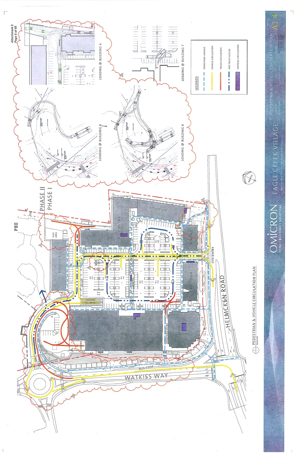
Site plan illustrating pedestrian linkages, vehicle circulation, truck circulation routes, and fire truck access.
February 4, 2013Specific details for loading at Buildings 4, 6, and 7
EAGLE CREEK VILLAGE
PEDESTRIAN & VEHICLE CIRCULATION PLAN
Project Information
- Project Name: EAGLE CREEK VILLAGE
- Location: Watkiss Way & Helmcken Road, View Royal, BC
- Firm: OMICRON (TOTAL + BUILDING + SOLUTIONS)
- Drawing Title: PEDESTRIAN & VEHICLE CIRCULATION PLAN
- Drawing Number: A1.4
- Date: 4 Feb, 2013
- Scale: As indicated
Circulation Legends
| Symbol Description | Legend Item |
|---|---|
| Blue dashed line | PEDESTRIAN LINKAGE |
| Yellow solid line | VEHICLE CIRCULATION |
| Red solid line | TRUCK CIRCULATION |
| Blue solid line with arrows | FIRE TRUCK ACCESS |
| Purple square | VERTICAL CIRCULATION |
Site Components and Identifiers
- Buildings: Building 1, Building 2, Building 3 & 4, Building 5, Building 6, Building 7, Building 8
- Access Roads: Watkiss Way, Helmcken Road
- Site Features: Site Entry, Site Plaza, Play Area, Bus Stop, Pedestrian Mews, Loading Areas
- Planning Zones: Phase I, Phase II, P80
Loading Circulation Detail Insets
Page 86
Extracted from: 2015 09 01 Council Agenda