Appendix
Drawing A1.5.2 - SHADOW STUDY - Eagle Creek Village
September 1, 2015Page 891 section
Shadow study analysis for March/September and June at multiple times of day, including a sun path chart.
February 5, 2013
EAGLE CREEK VILLAGE
Watkiss Way & Helmcken Road, View Royal, BC
SHADOW STUDY
Scaling Scale: 1:1400
Date: 05 Feb. 2013
Drawing No: A1.5.2
Location Information
- Location: Victoria Int'l. Airport
- Latitude: 48.65° N
- Longitude: 123.43° W
- Local Time Meridian: 120.00° W
Sun Paths Shown
- June 22
- March 22
- September 22
- January 1
- December 21
- December 22
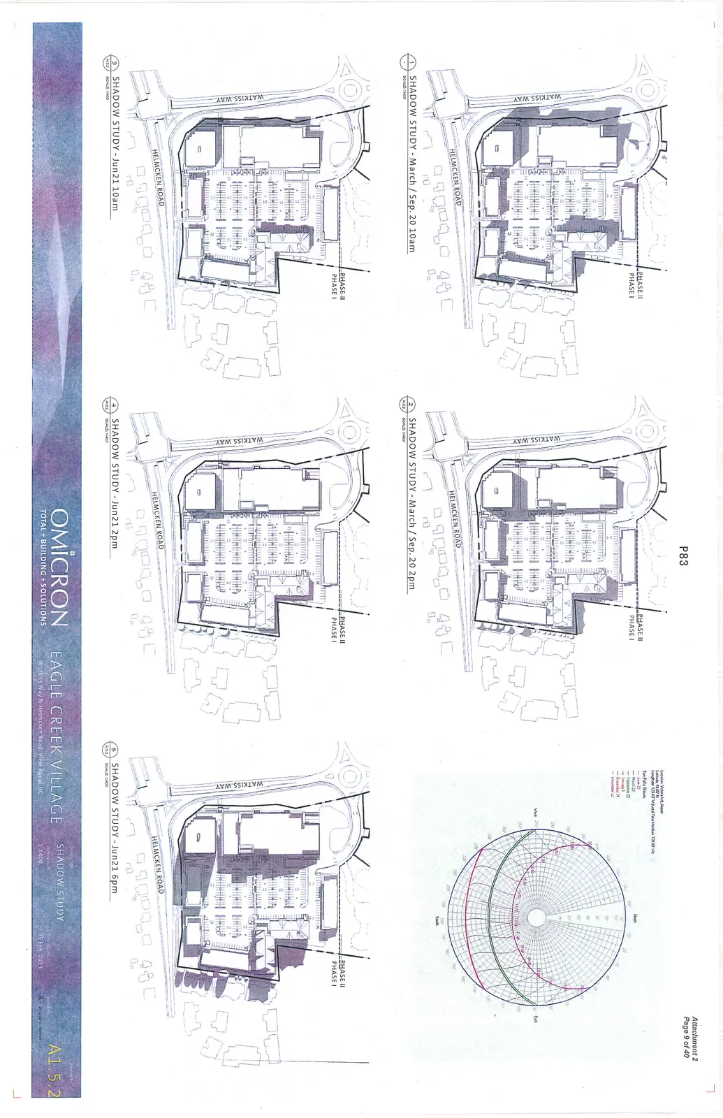
Shadow Study Diagrams
SHADOW STUDY - March / Sep. 20 10am
SHADOW STUDY - March / Sep. 20 2pm
SHADOW STUDY - Jun 21 10am
SHADOW STUDY - Jun 21 2pm
SHADOW STUDY - Jun 21 6pm
The diagrams identify the project site relative to Watkiss Way and Helmcken Road and distinguish between Phase I and Phase II of the development.
Page 89
Extracted from: 2015 09 01 Council Agenda