Appendix
Eagle Creek Village - Grading Plan
September 1, 2015Page 1191 section
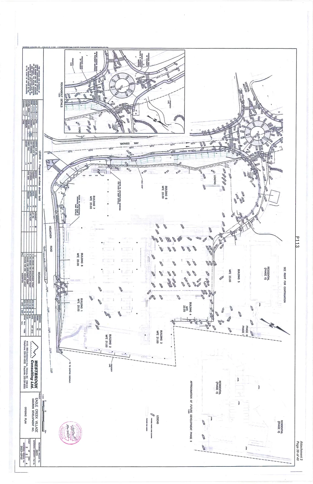
Civil engineering plan depicting proposed finished grades and rain garden locations for the development site.
Eagle Creek VillageWestbrook Consulting Ltd.May 2012
Eagle Creek Village Grading Plan
Project Information
- Project: Eagle Creek Village
- Developer: Omicron Development Inc.
- Title: Grading Plan
- Consultant: Westbrook Consulting Ltd.
- Address: #115 - 868 Goldstream Ave., Victoria, BC V9B 0J3
- Phone: 250-391-8592
- Facsimile: 250-391-8593
- Date: May 2012
- Project No: 2623
- Drawing No: 2623-DP02
- Sheet: 2 of 4
- Scale: Horiz. 1:500
Building Main Floor Elevations (MFE)
- Building 1: MFE 20.00
- Building 2: MFE 21.00
- Building 3: MFE 21.00
- Building 4: MFE 22.00
- Building 5: MFE 23.00
- Building 6: MFE 20.00
- Building 7: MFE 20.00
- Building 8: MFE 20.00
Revisions
| No. | Description | Date | Sign |
|---|---|---|---|
| 4 | RE-ISSUED FOR DEVELOPMENT PERMIT | 2015-02-20 | FC |
| 3 | RE-ISSUED FOR DEVELOPMENT PERMIT | 2013-10-25 | FC |
| 2 | ISSUED FOR DEVELOPMENT PERMIT | 2013-01-25 | FC |
| 1 | REVISED FOR NEW BUILDING LAYOUT | 2012-12-11 | FC |
Notes and Details
- General Note: The location and elevation of existing underground services on this drawing may not be accurate or complete. The actual horizontal and vertical locations must be confirmed by utility companies and the contractor prior to the start of any excavations.
- Roundabout Details (1:500 Scale): Inset showing Hospital Access, Watkiss Way, property lines, proposed edge of pavement, and instructions to remove existing island and pavement markings.
- Future Development:
- Residential (Phase II)
- Residential (Phase III)
- Approximation of future development Phase III (Scale 1:500)
- Additional Plan Notes:
- "Refer to architectural drawings for stair & ramp details."
- "Tie to existing sidewalk."
- "Loading" areas indicated near Buildings 5 and 6.
- "Bus Stop" indicated on Watkiss Way.
- "See right for continuation."
Legend
Proposed services shown bold.
- Utilities and Infrastructure:
- Water
- Sewer
- Drain
- Natural Grade
- Culvert
- Headwall
- Gas
- Curb
- Sidewalk
- Edge Pave
- Bushline
- Existing U/G Util.
- Proposed U/G Util.
- Symbols:
- Tree
- Light Standard
- Power Pole
- Anchor
- Manhole
- Cleanout
- Catchbasin
- Road Sign
- Hydrant
- Valve
- Meter
- Reducer
- Monument
- Lot Pin
- Lead Plug
- Grading Features:
- [Value in Box]: Proposed Finished Grade Elevation
- [Hatched Area]: Proposed Rain Garden
Page 119
Extracted from: 2015 09 01 Council Agenda