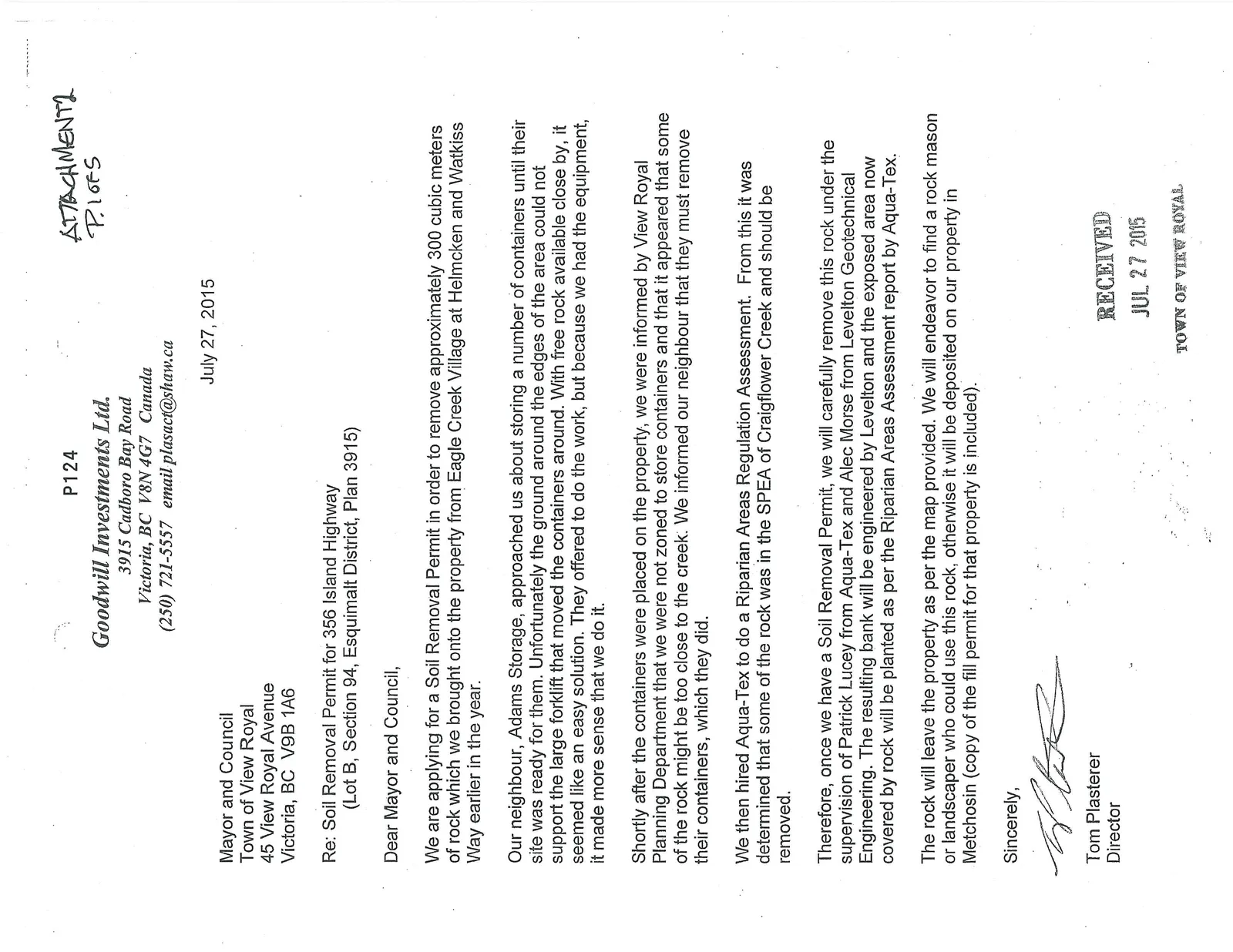
Attachment 2: Letter and Site Plans from Goodwill Investments Ltd.
Applicant's submission explaining the accidental deposit of rock fill in the riparian area and the proposed remediation plan, including truck routes.
Goodwill Investments Ltd.
3915 Cadboro Bay Road Victoria, BC V8N 4G7 Canada (250) 721-5557 email: plasact@shaw.ca
July 27, 2015
Mayor and Council Town of View Royal 45 View Royal Avenue Victoria, BC V9B 1A6
Re: Soil Removal Permit for 356 Island Highway (Lot B, Section 94, Esquimalt District, Plan 3915)
Dear Mayor and Council,
We are applying for a Soil Removal Permit in order to remove approximately 300 cubic meters of rock which we brought onto the property from Eagle Creek Village at Helmcken and Watkiss Way earlier in the year.
Our neighbour, Adams Storage, approached us about storing a number of containers until their site was ready for them. Unfortunately the ground around the edges of the area could not support the large forklift that moved the containers around. With free rock available close by, it seemed like an easy solution. They offered to do the work, but because we had the equipment, it made more sense that we do it.
Shortly after the containers were placed on the property, we were informed by View Royal Planning Department that we were not zoned to store containers and that it appeared that some of the rock might be too close to the creek. We informed our neighbour that they must remove their containers, which they did.
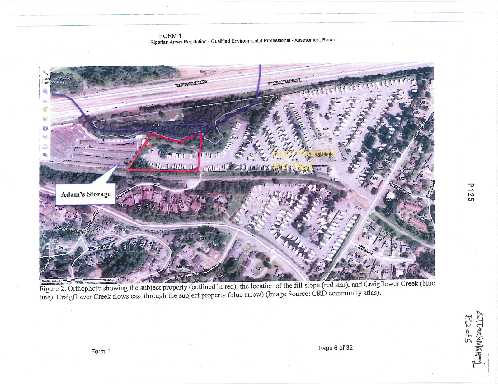
We then hired Aqua-Tex to do a Riparian Areas Regulation Assessment. From this it was determined that some of the rock was in the SPEA of Craigflower Creek and should be removed.
Therefore, once we have a Soil Removal Permit, we will carefully remove this rock under the supervision of Patrick Lucey from Aqua-Tex and Alec Morse from Levelton Geotechnical Engineering. The resulting bank will be engineered by Levelton and the exposed area now covered by rock will be planted as per the Riparian Areas Assessment report by Aqua-Tex.
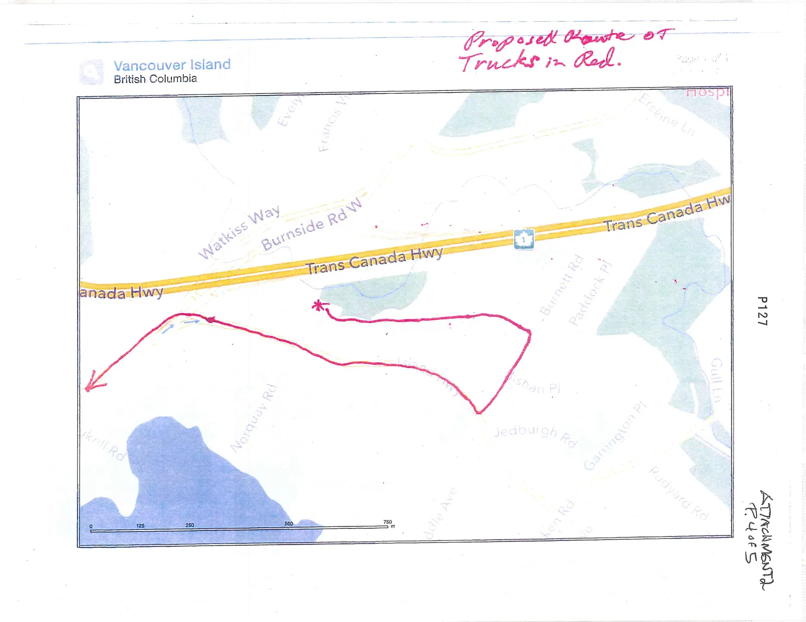
The rock will leave the property as per the map provided. We will endeavor to find a rock mason or landscaper who could use this rock, otherwise it will be deposited on our property in Metchosin (copy of the fill permit for that property is included).
Sincerely,
Tom Plasterer Director
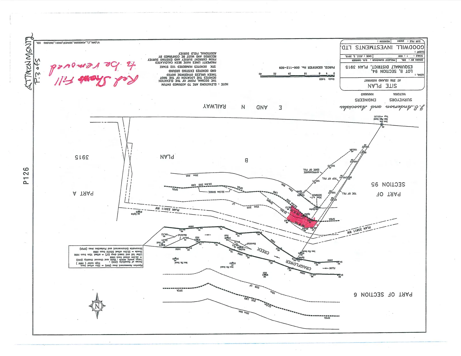
SITE PLAN AT 356 ISLAND HIGHWAY
LEGAL: LOT B, SECTION 94, ESQUIMALT DISTRICT, PLAN 3915 PARCEL IDENTIFIER No.: 006-112-609 SURVEYORS: J.E. Anderson and Associates DATE: JULY 2, 2015
Handwritten Note: Red Shows Fill to be removed
Proposed Truck Route
Document Images
(1)