Riparian Areas Regulation - Qualified Environmental Professional - Assessment Report (FORM 1)
A detailed technical environmental assessment for 356 Island Highway concerning the protection of Craigflower Creek and management of a fill slope within the riparian area.
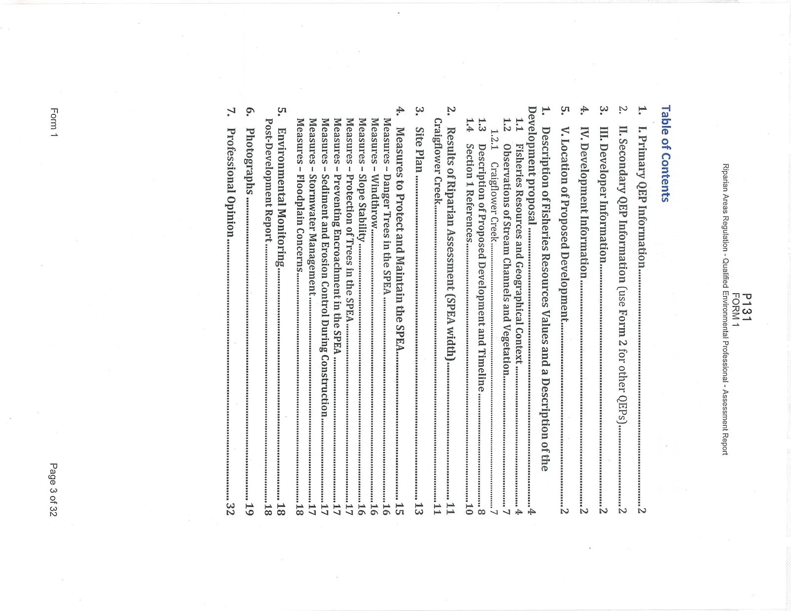
Table of Contents
- I. Primary QEP Information .......................................................................................... 2
- II. Secondary QEP Information (use Form 2 for other QEPs) ............................................ 2
- III. Developer Information .............................................................................................. 2
- IV. Development Information ......................................................................................... 2
- V. Location of Proposed Development ............................................................................ 2
- Description of Fisheries Resources Values and a Description of the Development proposal .......................................................................................................... 4 1.1 Fisheries Resources and Geographical Context ............................................................ 4 1.2 Observations of Stream Channels and Vegetation ........................................................ 7 1.2.1 Craigflower Creek ................................................................................................. 7 1.3 Description of Proposed Development and Timeline .................................................... 8 1.4 Section 1 References ................................................................................................. 10
- Results of Riparian Assessment (SPEA width) ............................................................. 11 Craigflower Creek ......................................................................................................... 11
- Site Plan ....................................................................................................................... 13
- Measures to Protect and Maintain the SPEA ................................................................ 15 Measures – Danger Trees in the SPEA ............................................................................... 16 Measures – Windthrow ..................................................................................................... 16 Measures – Slope Stability ................................................................................................ 16 Measures – Protection of Trees in the SPEA ...................................................................... 17 Measures – Preventing Encroachment in the SPEA ........................................................... 17 Measures – Sediment and Erosion Control During Construction ....................................... 17 Measures – Stormwater Management ............................................................................... 17 Measures – Floodplain Concerns ...................................................................................... 18
- Environmental Monitoring ............................................................................................ 18 Post-Development Report .............................................................................................. 18
- Photographs ................................................................................................................. 19
- Professional Opinion ..................................................................................................... 32
1. Description of Fisheries Resources Values and a Description of the Development proposal
1.1 Fisheries Resources and Geographical Context
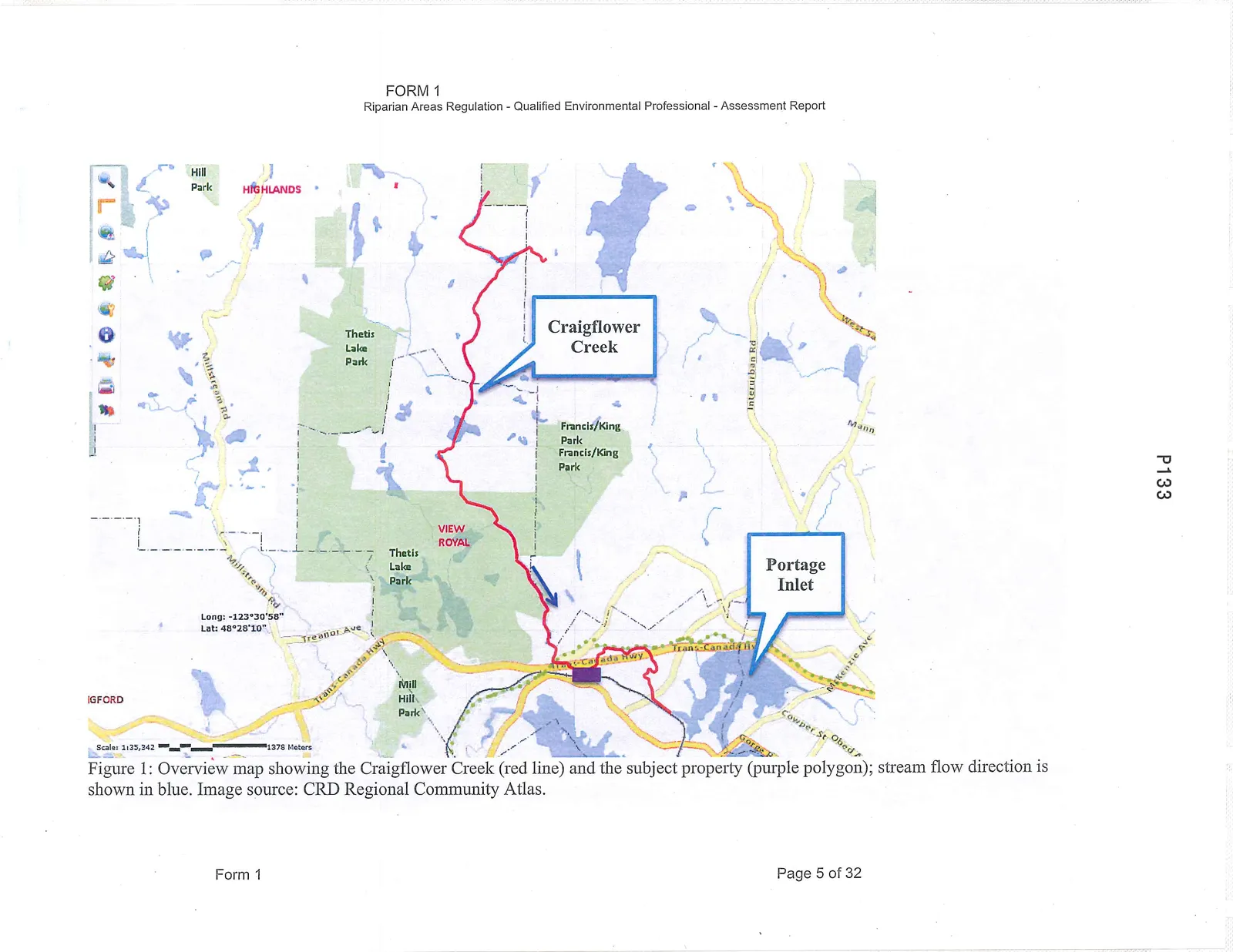
The Craigflower Watershed is located on Southern Vancouver Island within the Capital Regional District. The watershed covers an area of 24.37 km² within both the District of Highlands and the Town of View Royal. There are seven catchment areas comprising the watershed including Craigflower Creek, which is the main channel. The headwaters of Craigflower Creek form on the southeast slope of Mount Work and flow downstream through Eagles Lake, Pike Lake, Prior Lake, then adjacent to, and roughly parallel to, the Trans Canada Highway; the stream crosses under the Highway twice prior to its discharge point in Portage Inlet (SHIP Environmental Consultants Ltd., 1997) (Figure 1).
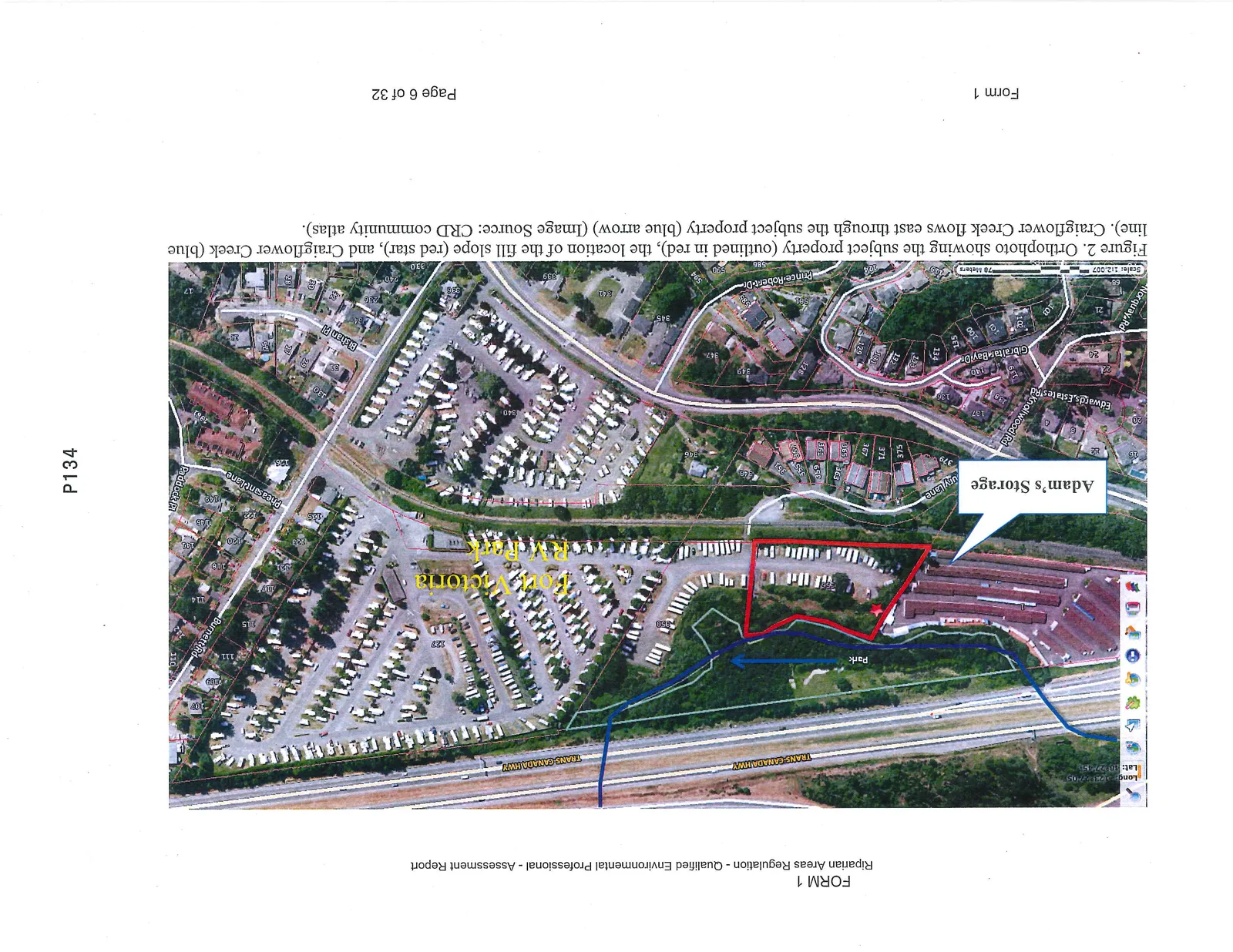
The subject property at 356 Island Highway is currently home to one segment of the Fort Victoria RV and Campground and lies within the Town of View Royal (Figure 2). The southern portion of the site is composed of a gravel pad used for RV storage, while the northern portion of the site consists of a slope down to an old floodplain terrace. The northern property boundary abuts a park and Craigflower Creek. This area of Craigflower Creek has been identified in past reports as an area subject to flooding; this includes the Marler Drive subdivision upstream of the subject property (SHIP Environmental Consultants Ltd., 1997). The flooding was historically due to undersized culverts and increased runoff from development within the upper reaches of the watershed subcatchments. In the past decade the key culverts have been replaced to accommodate revised flow volumes. The CRD has a major sewer main that is routed through the southern edge of the property, which parallels the stream channel alignment.
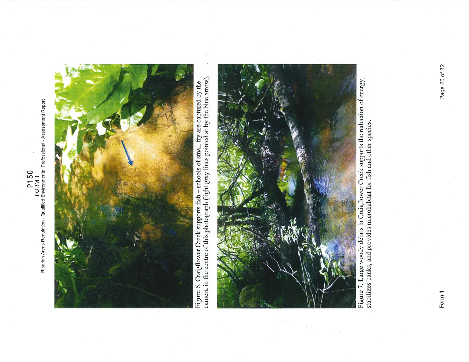
Craigflower Creek is a well-known fish-bearing system supporting cutthroat trout, rainbow trout, sculpin, steelhead, Coho salmon, smallmouth bass, pumpkinseed, and brown catfish (MOE, 2015). Dense schools of fry were observed in the stream channel at the time of assessment.
1.2 Observations of Stream Channels and Vegetation
1.2.1 Craigflower Creek
Craigflower Creek flows from west to east just beyond the northern property boundary of 356 Island Highway. The land between the subject property and the Trans Canada Highway is a park. This park encompasses Craigflower Creek, and its floodplain, until the creek flows north under the Trans Canada Highway east of the subject property.
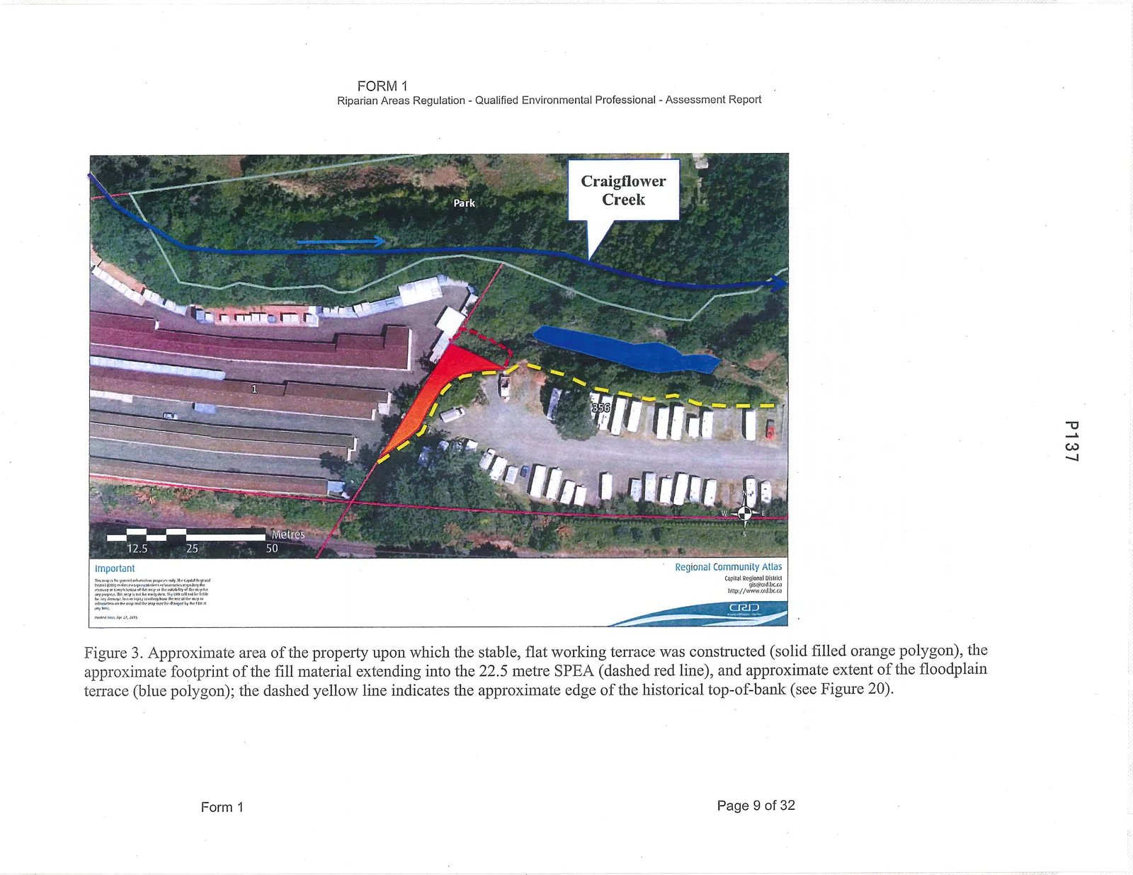
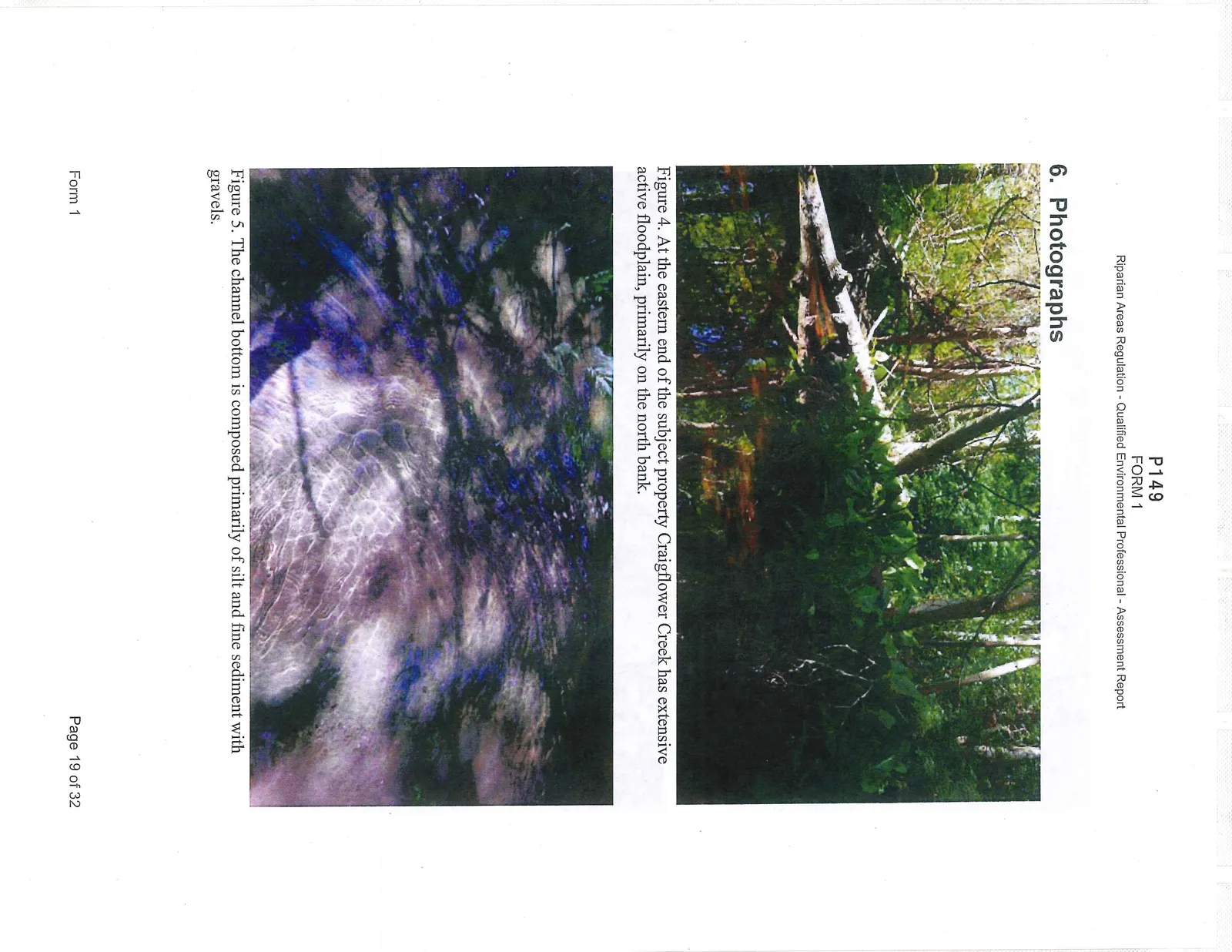
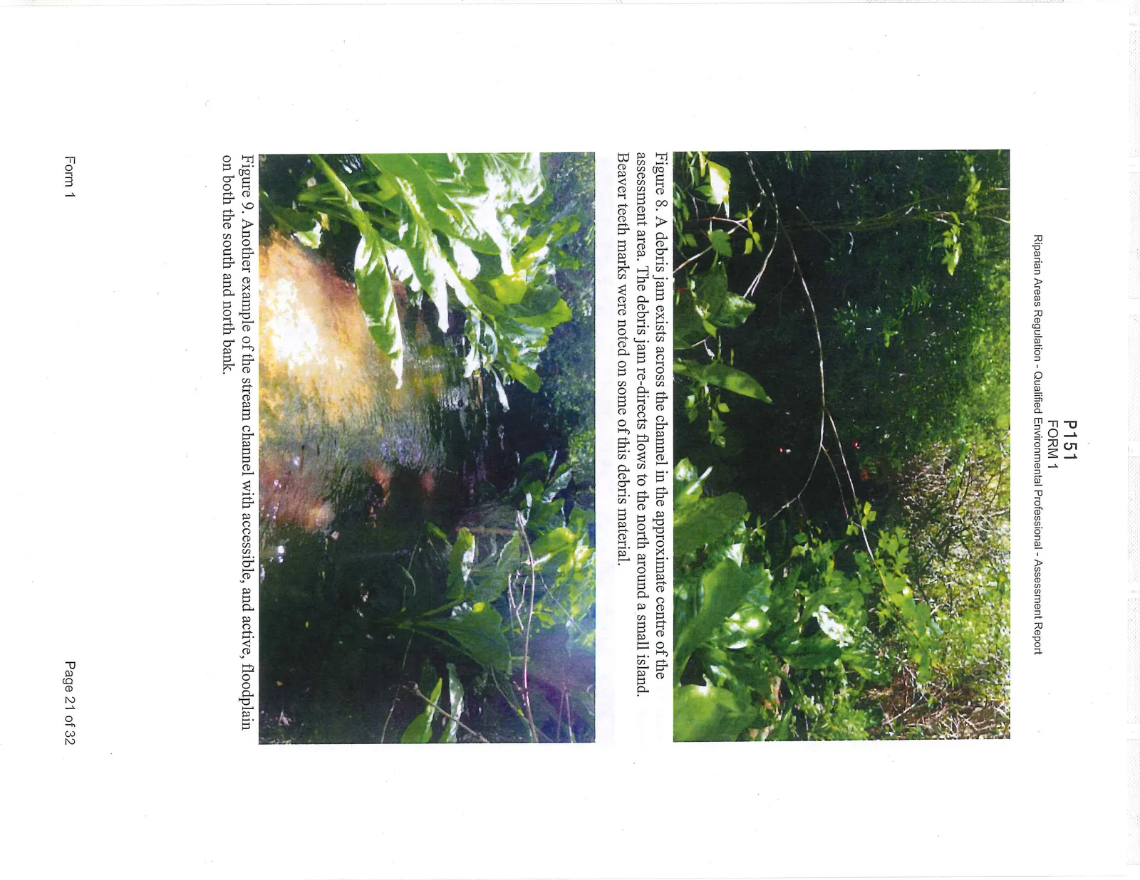
Craigflower Creek, in this vicinity, is primarily a single-thread, meandering channel with some areas where mid-channel islands have split the channel into two. Woody debris is abundant in the stream as are in-channel features such as islands and mid-channel bars. The channel bottom is composed primarily of fine silt and sediments with gravel. The stream channel on the east end of subject property has active floodplain zones. A debris jam was observed near the centre of the assessment area with materials that showed evidence of beaver activity; the debris jam was an abandoned beaver dam that had trapped materials flowing downstream during winter high water/flood events. Moving upstream the active floodplain areas decrease as a result of the proximity of the Highway to the north bank and historic land-use activities to the south. Near the western end of the subject property, and the neighbouring storage facility, these historic land-use activities included the addition of large boulders (i.e., rip-rap used as engineered, bank stabilizing structures) along the edge of the south bank and the in-filling of floodplain areas. An old floodplain terrace, inactive now except potentially for extremely high flow events, exists along the northern edge of the property. It consists of a grassed elongated ribbon, is kept mowed, and is used as a park area for the RV facility (Figure 3). This is the CRD Right-of-Way for a regional sewer main and has been used as a small programmed-access park for many years, predating the introduction of the RAR.
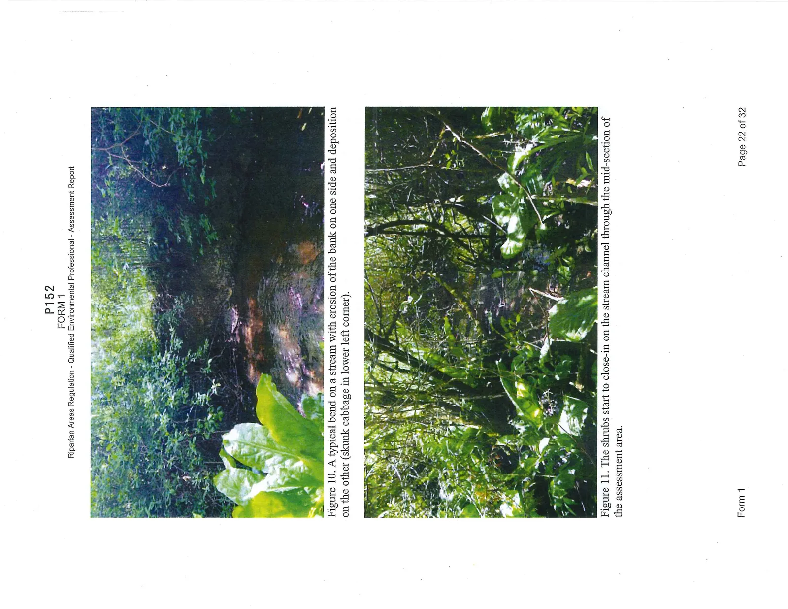
Vegetation along Craigflower Creek in the assessment area includes: western redcedar (Thuja plicata), Douglas-fir (Pseudotsuga menziesii), grand fir (Abies grandis), bigleaf maple (Acer macrophyllum), red alder (Alnus rubra), Indian-plum (Oemleria cerasiformis), red-osier dogwood (Cornus stolonifera), salmonberry (Rubus spectabilis), Pacific ninebark (Physocarpus capitatus), Pacific crab apple (Malus fusca), willow sp. (Salix sp.), Nootka rose (Rosa nutkana), lady fern (Athyrium filix-femina), skunk cabbage (Lysichiton americanum), fringecup (Tellima grandiflora), common horsetail (Equisetum arvense), Pacific water parsley (Oenanthe sarmentosa), creeping buttercup (Ranunculus repens), trailing blackberry (Rubus ursinus), Himalayan blackberry (Rubus armeniacus), honeysuckle (Lonicera ciliosa), and violet (Viola sp.).
Despite the extensive, historical modifications of this stream and its floodplain, this reach of Craigflower Creek is in Proper Functioning Condition and has a sufficient quantity of woody debris, vegetation, and floodplain access. Furthermore, the characteristics of this creek provide favourable microsite conditions to support productivity and biodiversity as evidenced by the numerous fry observed during the assessment.
Field trips were conducted on numerous occasions including, but not limited to, April 28, 2015, May 13 and 14, 2015, and July 7, 2015.
1.3 Description of Proposed Development and Timeline
This RAR assessment was triggered in the Spring of 2015 by the addition of fill and rock material within the outer edge of the 30m RAA of Craigflower Creek, at the northwest corner of the pre-existing gravel pad. At the property line between 356 Island Highway and Adam's Storage the toe of the slope is 17.5m from the high water mark while on the east side of the fill slope the toe is 14.5m from the high water mark (Figure 3).
This rock and soil fill was added to accommodate storage containers associated with the neighbouring company to the west of the subject property. The slope of the fill area has been covered with brush and no sediment concerns were identified. A silt fence had been installed beyond the toe-of-slope as an Erosion & Sediment Control measure. The intent of this RAR is to determine the required setback from Craigflower Creek and provide recommendations on managing the fill area.
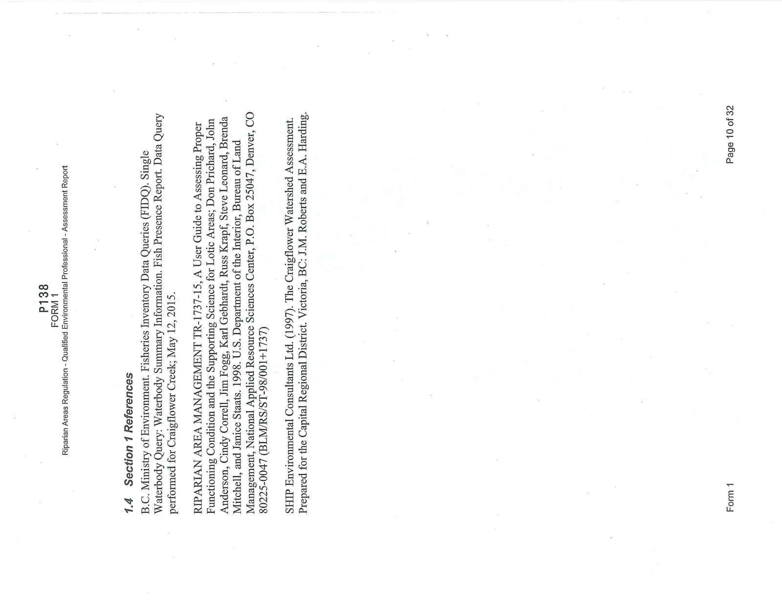
1.4 Section 1 References
B.C. Ministry of Environment. Fisheries Inventory Data Queries (FIDQ). Single Waterbody Query: Waterbody Summary Information. Fish Presence Report. Data Query performed for Craigflower Creek; May 12, 2015.
RIPARIAN AREA MANAGEMENT TR-1737-15, A User Guide to Assessing Proper Functioning Condition and the Supporting Science for Lotic Areas; Don Prichard, John Anderson, Cindy Correll, Jim Fogg, Karl Gebhardt, Russ Krapf, Steve Leonard, Brenda Mitchell, and Janice Staats. 1998. U.S. Department of the Interior, Bureau of Land Management, National Applied Resource Sciences Center, P.O. Box 25047, Denver, CO 80225-0047 (BLM/RS/ST-98/001+1737)
SHIP Environmental Consultants Ltd. (1997). The Craigflower Watershed Assessment. Prepared for the Capital Regional District. Victoria, BC: J.M. Roberts and E.A. Harding.
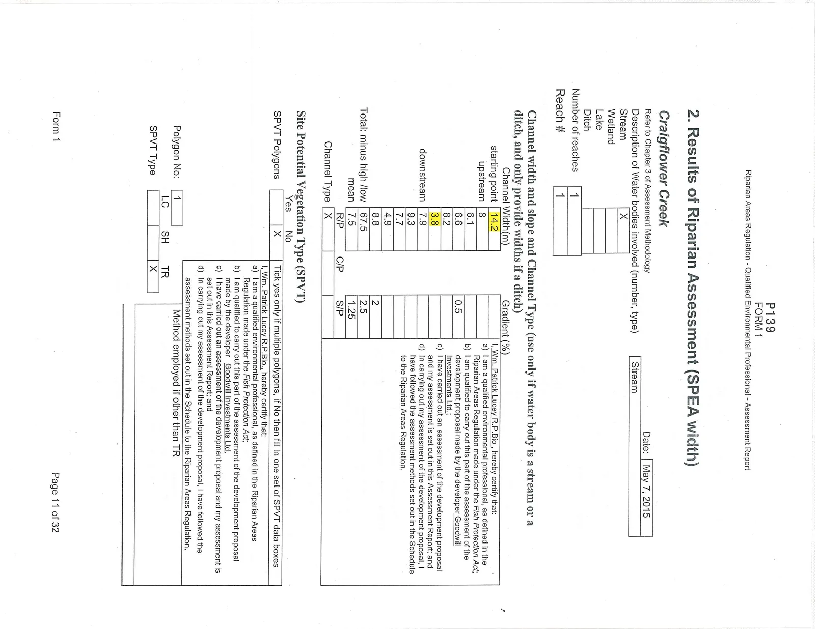
2. Results of Riparian Assessment (SPEA width)
Craigflower Creek Date: May 7, 2015
| Description of Water bodies involved (number, type) | |
|---|---|
| Stream | X |
| Wetland | |
| Lake | |
| Ditch | |
| Number of reaches | 1 |
| Reach # | 1 |
Channel width and slope and Channel Type (use only if water body is a stream or a ditch, and only provide widths if a ditch)
| Channel Width(m) | Gradient (%) | ||
|---|---|---|---|
| starting point | 14.2 | ||
| upstream | 8 | ||
| 6.1 | |||
| 6.6 | 0.5 | ||
| 8.2 | |||
| 3.8 | |||
| downstream | 7.9 | ||
| 9.3 | |||
| 7.7 | |||
| 4.9 | |||
| 8.8 | 2 | ||
| Total: minus high /low | 67.5 | 2.5 | |
| mean | 7.5 | 1.25 | |
| R/P | C/P | S/P | |
| Channel Type | X |
I, Wm. Patrick Lucey R.P.Bio, hereby certify that: a) I am a qualified environmental professional, as defined in the Riparian Areas Regulation made under the Fish Protection Act; b) I am qualified to carry out this part of the assessment of the development proposal made by the developer Goodwill Investments Ltd.; c) I have carried out an assessment of the development proposal and my assessment is set out in this Assessment Report; and d) In carrying out my assessment of the development proposal, I have followed the assessment methods set out in the Schedule to the Riparian Areas Regulation.
Site Potential Vegetation Type (SPVT)
| Yes | No | |
|---|---|---|
| SPVT Polygons | X |
I, Wm. Patrick Lucey R.P.Bio., hereby certify that: a) I am a qualified environmental professional, as defined in the Riparian Areas Regulation made under the Fish Protection Act; b) I am qualified to carry out this part of the assessment of the development proposal made by the developer Goodwill Investments Ltd.; c) I have carried out an assessment of the development proposal and my assessment is set out in this Assessment Report; and d) In carrying out my assessment of the development proposal, I have followed the assessment methods set out in the Schedule to the Riparian Areas Regulation.
| Polygon No: | 1 | Method employed if other than TR | |
|---|---|---|---|
| LC | SH | TR | |
| SPVT Type | X |
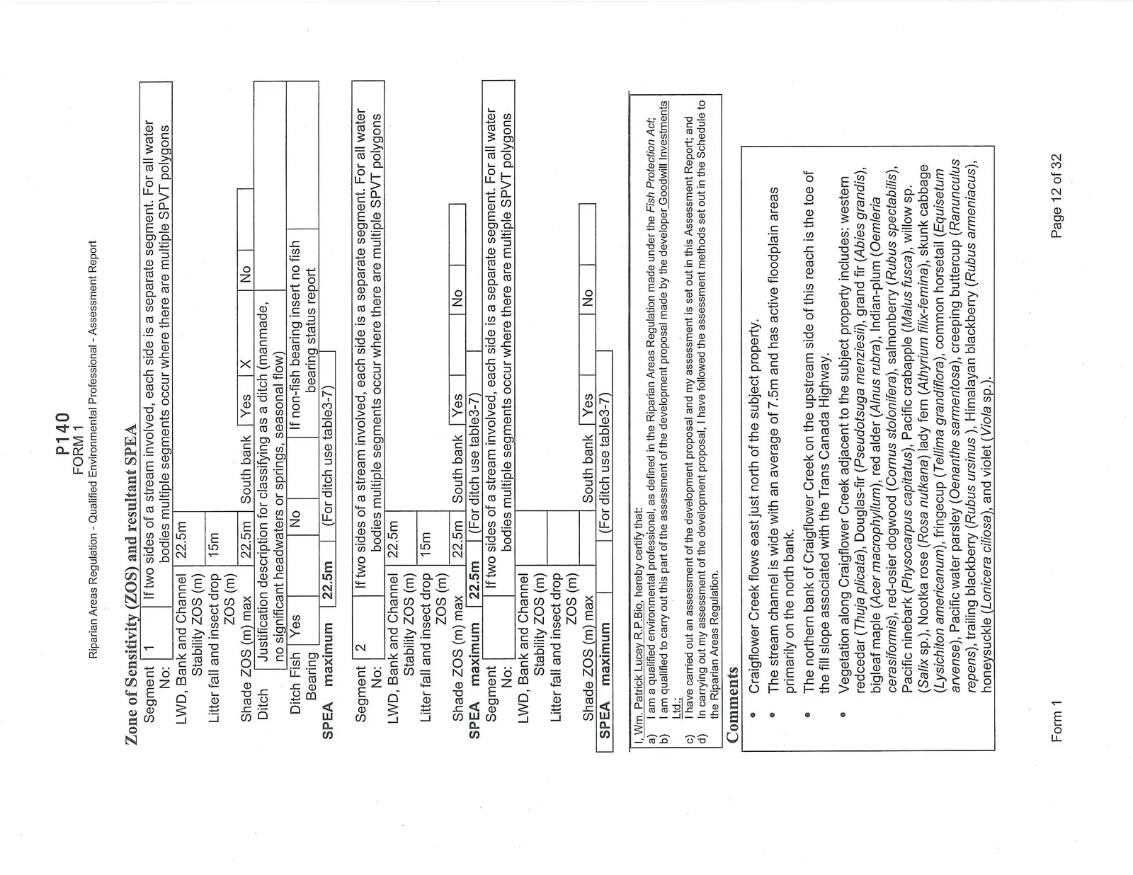
Zone of Sensitivity (ZOS) and resultant SPEA
| Segment No: | 1 | If two sides of a stream involved, each side is a separate segment. For all water bodies multiple segments occur where there are multiple SPVT polygons |
|---|---|---|
| LWD, Bank and Channel Stability ZOS (m) | 22.5m | |
| Litter fall and insect drop ZOS (m) | 15m | |
| Shade ZOS (m) max | 22.5m | South bank: Yes [X] No [ ] |
| Ditch | Justification description for classifying as a ditch (manmade, no significant headwaters or springs, seasonal flow) | |
| Ditch Fish Bearing | Yes [ ] No [ ] | If non-fish bearing insert no fish bearing status report |
| SPEA maximum | 22.5m | (For ditch use table3-7) |
| Segment No: | 2 | If two sides of a stream involved, each side is a separate segment. For all water bodies multiple segments occur where there are multiple SPVT polygons |
|---|---|---|
| LWD, Bank and Channel Stability ZOS (m) | 22.5m | |
| Litter fall and insect drop ZOS (m) | 15m | |
| Shade ZOS (m) max | 22.5m | South bank: Yes [ ] No [ ] |
| SPEA maximum | 22.5m | (For ditch use table3-7) |
I, Wm. Patrick Lucey R.P.Bio, hereby certify that: a) I am a qualified environmental professional, as defined in the Riparian Areas Regulation made under the Fish Protection Act; b) I am qualified to carry out this part of the assessment of the development proposal made by the developer Goodwill Investments Ltd.; c) I have carried out an assessment of the development proposal and my assessment is set out in this Assessment Report; and d) In carrying out my assessment of the development proposal, I have followed the assessment methods set out in the Schedule to the Riparian Areas Regulation.
Comments
- Craigflower Creek flows east just north of the subject property.
- The stream channel is wide with an average of 7.5m and has active floodplain areas primarily on the north bank.
- The northern bank of Craigflower Creek on the upstream side of this reach is the toe of the fill slope associated with the Trans Canada Highway.
- Vegetation along Craigflower Creek adjacent to the subject property includes: western redcedar (Thuja plicata), Douglas-fir (Pseudotsuga menziesii), grand fir (Abies grandis), bigleaf maple (Acer macrophyllum), red alder (Alnus rubra), Indian-plum (Oemleria cerasiformis), red-osier dogwood (Cornus stolonifera), salmonberry (Rubus spectabilis), Pacific ninebark (Physocarpus capitatus), Pacific crabapple (Malus fusca), willow sp. (Salix sp.), Nootka rose (Rosa nutkana), lady fern (Athyrium filix-femina), skunk cabbage (Lysichiton americanum), fringecup (Tellima grandiflora), common horsetail (Equisetum arvense), Pacific water parsley (Oenanthe sarmentosa), creeping buttercup (Ranunculus repens), trailing blackberry (Rubus ursinus), Himalayan blackberry (Rubus armeniacus), honeysuckle (Lonicera ciliosa), and violet (Viola sp.).
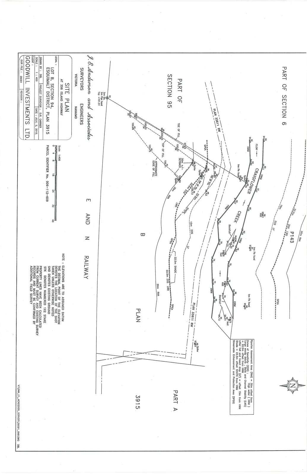
3. Site Plan
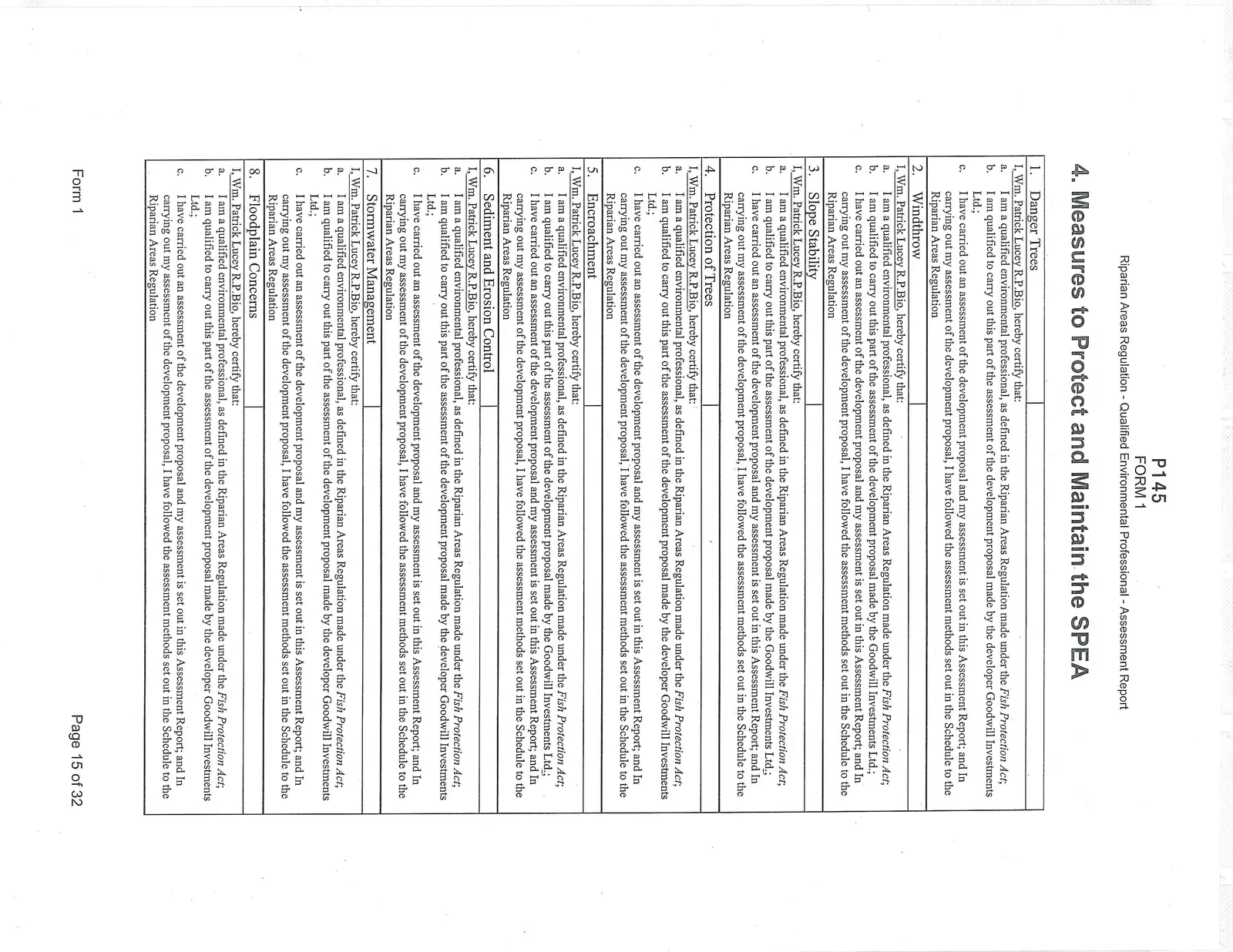
4. Measures to Protect and Maintain the SPEA
1. Danger Trees
I, Wm. Patrick Lucey R.P.Bio, hereby certify that: a. I am a qualified environmental professional, as defined in the Riparian Areas Regulation made under the Fish Protection Act; b. I am qualified to carry out this part of the assessment of the development proposal made by the developer Goodwill Investments Ltd.; c. I have carried out an assessment of the development proposal and my assessment is set out in this Assessment Report; and In carrying out my assessment of the development proposal, I have followed the assessment methods set out in the Schedule to the Riparian Areas Regulation
2. Windthrow
I, Wm. Patrick Lucey R.P.Bio, hereby certify that: a. I am a qualified environmental professional, as defined in the Riparian Areas Regulation made under the Fish Protection Act; b. I am qualified to carry out this part of the assessment of the development proposal made by the developer Goodwill Investments Ltd.; c. I have carried out an assessment of the development proposal and my assessment is set out in this Assessment Report; and In carrying out my assessment of the development proposal, I have followed the assessment methods set out in the Schedule to the Riparian Areas Regulation
3. Slope Stability
I, Wm. Patrick Lucey R.P.Bio, hereby certify that: a. I am a qualified environmental professional, as defined in the Riparian Areas Regulation made under the Fish Protection Act; b. I am qualified to carry out this part of the assessment of the development proposal made by the developer Goodwill Investments Ltd.; c. I have carried out an assessment of the development proposal and my assessment is set out in this Assessment Report; and In carrying out my assessment of the development proposal, I have followed the assessment methods set out in the Schedule to the Riparian Areas Regulation
4. Protection of Trees
I, Wm. Patrick Lucey R.P.Bio, hereby certify that: a. I am a qualified environmental professional, as defined in the Riparian Areas Regulation made under the Fish Protection Act; b. I am qualified to carry out this part of the assessment of the development proposal made by the developer Goodwill Investments Ltd.; c. I have carried out an assessment of the development proposal and my assessment is set out in this Assessment Report; and In carrying out my assessment of the development proposal, I have followed the assessment methods set out in the Schedule to the Riparian Areas Regulation
5. Encroachment
I, Wm. Patrick Lucey R.P.Bio, hereby certify that: a. I am a qualified environmental professional, as defined in the Riparian Areas Regulation made under the Fish Protection Act; b. I am qualified to carry out this part of the assessment of the development proposal made by the developer Goodwill Investments Ltd.; c. I have carried out an assessment of the development proposal and my assessment is set out in this Assessment Report; and In carrying out my assessment of the development proposal, I have followed the assessment methods set out in the Schedule to the Riparian Areas Regulation
6. Sediment and Erosion Control
I, Wm. Patrick Lucey R.P.Bio, hereby certify that: a. I am a qualified environmental professional, as defined in the Riparian Areas Regulation made under the Fish Protection Act; b. I am qualified to carry out this part of the assessment of the development proposal made by the developer Goodwill Investments Ltd.; c. I have carried out an assessment of the development proposal and my assessment is set out in this Assessment Report; and In carrying out my assessment of the development proposal, I have followed the assessment methods set out in the Schedule to the Riparian Areas Regulation
7. Stormwater Management
I, Wm. Patrick Lucey R.P.Bio, hereby certify that: a. I am a qualified environmental professional, as defined in the Riparian Areas Regulation made under the Fish Protection Act; b. I am qualified to carry out this part of the assessment of the development proposal made by the developer Goodwill Investments Ltd.; c. I have carried out an assessment of the development proposal and my assessment is set out in this Assessment Report; and In carrying out my assessment of the development proposal, I have followed the assessment methods set out in the Schedule to the Riparian Areas Regulation
8. Floodplain Concerns
I, Wm. Patrick Lucey R.P.Bio, hereby certify that: a. I am a qualified environmental professional, as defined in the Riparian Areas Regulation made under the Fish Protection Act; b. I am qualified to carry out this part of the assessment of the development proposal made by the developer Goodwill Investments Ltd.; c. I have carried out an assessment of the development proposal and my assessment is set out in this Assessment Report; and In carrying out my assessment of the development proposal, I have followed the assessment methods set out in the Schedule to the Riparian Areas Regulation
Measures – Danger Trees in the SPEA
There are few large trees within the SPEA area, and those that exist are closely associated with the HWM of Craigflower Creek. Those that exist appear to be in good health. There is not development proposed that would adversely affect the existing trees. Given the SPEA width of 22.5m from the HWM, the root zones of these trees will be protected and no measures are required at this time.
Measures – Windthrow
Windthrow (trees knocked over due to wind) can be a risk to people and property, and if excessive, can result in a loss of function of riparian vegetation in the SPEA. Windthrow is especially a risk where the adjacent forest has been cleared, leaving the remaining trees more vulnerable.
Possible strategies to prevent windthrow include protecting the root zones of large trees from compaction, and “feathering” or topping adjacent trees to provide a gradual slope for wind to pass over.
No measures are required at this time as SPEA trees are protected within the 22.5m setback. Furthermore, there is a substantial difference in elevation between the SPEA area and the RV rental plots located well above the SPEA area. The placement of the fill was across a narrow portion of the northwest corner of the property and did not affect any existing trees, as the larger trees are situated close to the stream bank, well away from the fill intrusion.
Measures – Slope Stability
There were no indicators of slope instability on the subject property. The fill slope is composed primarily of rock and any exposed soils have been covered with brush.
- We recommend that the toe of the fill slope be pulled back from its current position to accommodate the 22.5m SPEA.
- We recommend that the ground, from which the fill has been removed, be planted with fast growing species such as willow or red-osier dogwood. Planting should follow the BCSLA Guidelines for planting to ensure optimal plant survival.
- The slope reshaping can be designed, at the discretion of the property owner, to accommodate a number of different configurations:
- The slope could be a non-terraced slope of 2 : 1, or shallower, providing its final slope is geotechnically stable.
- The slope could be terraced with a planting terrace approximately 1/3 to 1/2 the vertical height of the slope (i.e., a stepped terrace in the form of a single stair).
- The facing of the slope could be constructed using a rock stack wall to create a near vertical wall, providing its final slope is geotechnically stable. The area north of the rock stack wall would be required to be replanted to re-establish a vegetated SPEA. This approximate 6 metre ribbon could be planted with fast growing species such as willow or red-osier dogwood on the bottom where the soils are moist.
Measures – Protection of Trees in the SPEA
This RAR is triggered by infill activity that has already occurred; no impact to trees within the SPEA is anticipated at this time. Furthermore, the SPEA trees are closely associated with the HWM of Craigflower Creek, thus, the 22.5m SPEA protects the root zones of the trees adjacent to the stream bank.
Measures – Preventing Encroachment in the SPEA
Encroachment refers to the problem of disturbance of the riparian vegetation in the SPEA by trampling, unsanctioned trails and dumping of yard waste, etc. Currently, the only activity proposed in the SPEA would be the removal of the fill. This would be completed from the top of the fill slope and would not result in any further encroachment into the SPEA than exists already.
A portion of the old floodplain terrace has picnic tables and is currently being mowed. It appears that the RV Park is utilizing this area as a recreational space. However, for the most part, there still exists a natural buffer between this area and the HWM – a thick Nootka rose thicket with some Himalayan blackberry brambles. There is one section of the south streambank in the northeast corner of the property where there is evidence of clearing and access to the HWM. This covers a small length, perhaps 10m. At this point in time there does not appear to be any harm to the function of Craigflower Creek; however, the landowner should consider restricting access to the edge of the bank and re-planting with appropriate native riparian species such as salmonberry, red-osier dogwood, Pacific ninebark, western redcedar, and bigleaf maple. This single point of intrusion constitutes a form of programmed access and with minimal modifications it will ensure public access (which will occur as demonstrated by the present trampling of a path to the stream bank) without permanent harm to the stream or its riparian zone. There is a small path that continues across the stream and up the opposite bank of the stream. This connects to a path that parallels the Highway, through the conifer copse of trees that forms a buffer between the Highway and the RV Park.
Measures – Sediment and Erosion Control During Construction
The only proposed activity on this site is the removal of fill from within the SPEA area. This activity would occur from the top of the slope and not result in any further encroachment into the SPEA than exists already. To prevent any sediment and erosion concerns, this work must be undertaken in dry weather. The area below the current toe of slope is flat and heavily vegetated meaning the chance of any sediment moving further into the SPEA area and into the stream is highly unlikely. Once the toe of the slope is moved out of the SPEA area, it is recommended that the property owner cover any soils exposed as a result of the material removal with brush (native species ONLY) or leaf mulch. To prevent the intrusion of invasive species it is recommended that the area be replanted with native vegetation such as, but not limited to, red-osier dogwood, Scouler's willow, Sitka willow, Nootka rose, mock-orange, red alder, and Douglas maple.
Measures – Stormwater Management
There is no plan at this time for any site changes beyond that of fill removal, thus, measures for stormwater management are not applicable at this time. However, should changes to the existing land use be planned for the future, the management of stormwater must be considered given that Craigflower Creek is at the bottom of the hydrological/gravity well.
Measures – Floodplain Concerns
Craigflower Creek has signification floodplain areas in the vicinity of this property, particularly along its northern boundary. An old floodplain terrace exists north of the current RV storage lots (Figure 3). There are no floodplain concerns.
5. Environmental Monitoring
While removal of the fill is not expected to be a high-risk activity, the site should be inspected/monitored during fill removal to ensure that no erosion or sedimentation is occurring and that the riparian zone and water quality of Craigflower Creek is protected. The use of Repeat Photography MUST be a core component of the environmental monitoring assessment to document changes to the landscape and that any such changes to the landscape have not resulted in harm to the SPEA or aquatic habitat.
- Since the removal of the fill will likely take less than 2 days monitoring could occur at the beginning of the operation and at its conclusion.
- The work shall be done during a dry period of no rainfall, to minimize the potential for sediment loading within the riparian management zone.
- The use of Photography shall be required to document the absence of sediment loading and to verify the Post-Construction compliance with the recommendations contained in this RAR report.
Post-Development Report
The developer is required under the RAR to have a QEP conduct a site assessment following development, at the developer's expense. This is to ensure that the developer has followed the recommendations and measures to protect the SPEA contained in this report. Ongoing monitoring during fill removal MUST form a component of the Post-development report.
A physical inspection of the site and the SPEA MUST be conducted, to ensure that no damage has occurred, or is anticipated, and the required management practices have been carried out. A checklist MUST be drafted, incorporating ALL of the measures and monitoring requirements listed above, and accompanying documentation MUST be attached, such as a summary of the results of the monitoring and repeat photographs.
The QEP MUST then file a post-development report on behalf of the developer, submitted through the Ministry of Environment Notification System, after the development has been completed. This report will document that the required measures and conditions outlined in this report have been implemented, as per Section 5(a) of the Riparian Area Regulation.
References: Hall, F.C., 2001. Ground-based photographic monitoring. Gen. Tech. Rep. PNW-GTR-503. Portland, OR: U.S. Department of Agriculture, Forest Service, Pacific Northwest Research Station. 340 p. http://www.fs.fed.us/pnw/pubs/gtr503/
6. Photographs
Document Images
(14)