Riparian Areas Regulation - Qualified Environmental Professional - Assessment Report (Form 1)
An environmental assessment report regarding the Craigflower Creek Riparian Area at the Fort Victoria RV Park, providing professional opinions and site photos.
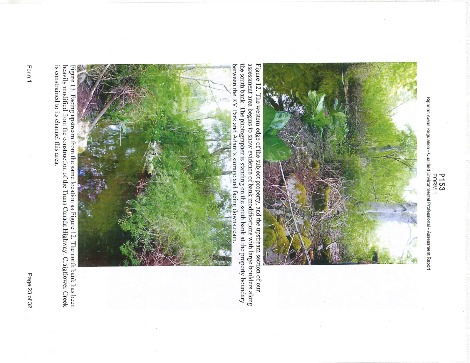
Figure 12. The western edge of the subject property, and the upstream section of our assessment area begins to show evidence of bank modifications with large boulders along the south bank. The photographer is standing on the south bank at the property boundary between the RV Park and Adam’s storage and facing downstream.
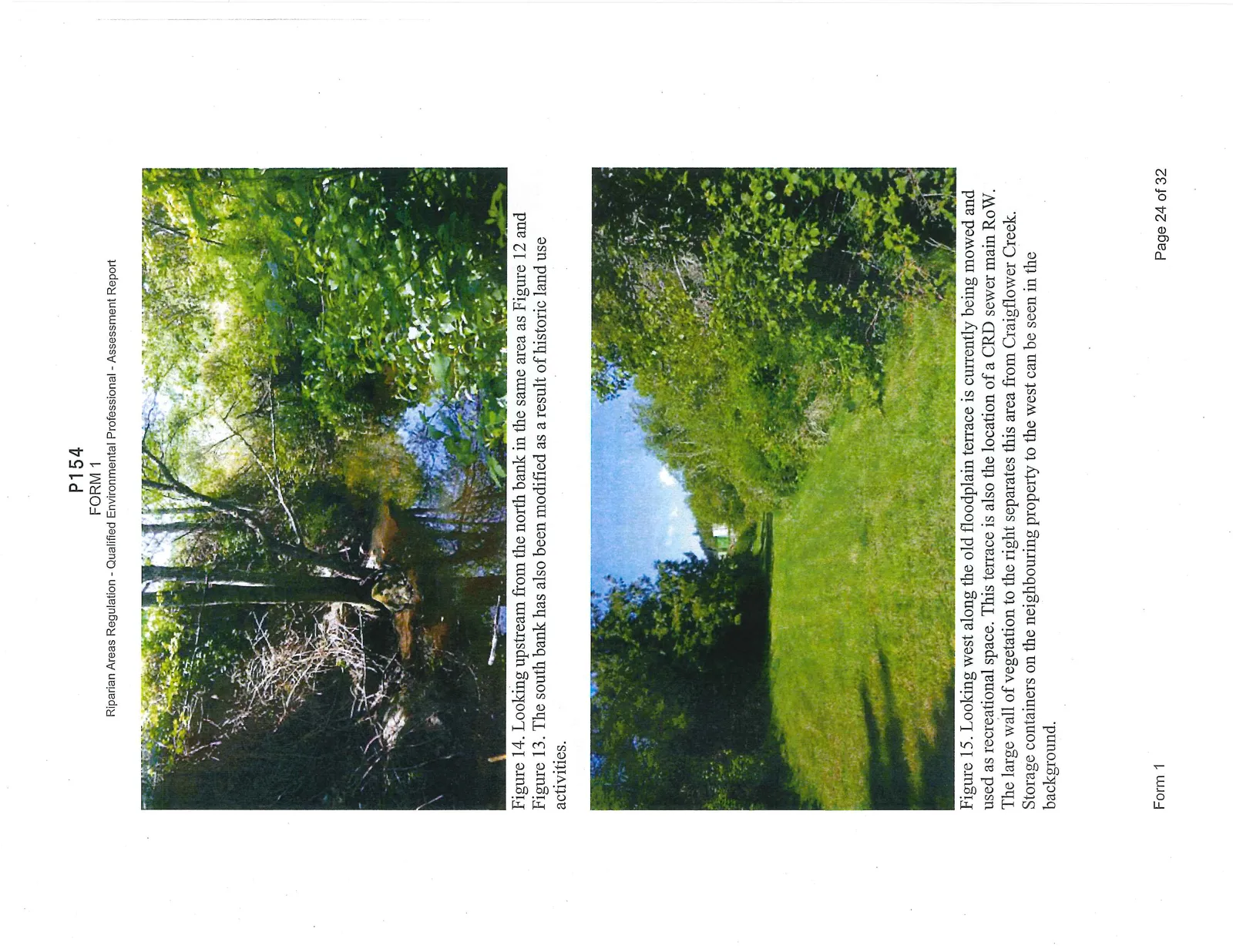
Figure 13. Facing upstream from the same location as Figure 12. The north bank has been heavily modified from the construction of the Trans Canada Highway. Craigflower Creek is constrained to its channel this area.
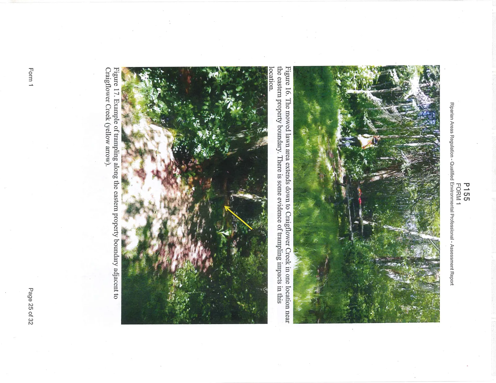
Figure 14. Looking upstream from the north bank in the same area as Figure 12 and Figure 13. The south bank has also been modified as a result of historic land use activities.
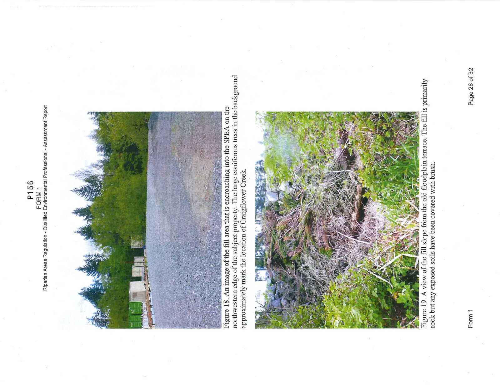
Figure 15. Looking west along the old floodplain terrace is currently being mowed and used as recreational space. This terrace is also the location of a CRD sewer main RoW. The large wall of vegetation to the right separates this area from Craigflower Creek. Storage containers on the neighbouring property to the west can be seen in the background.
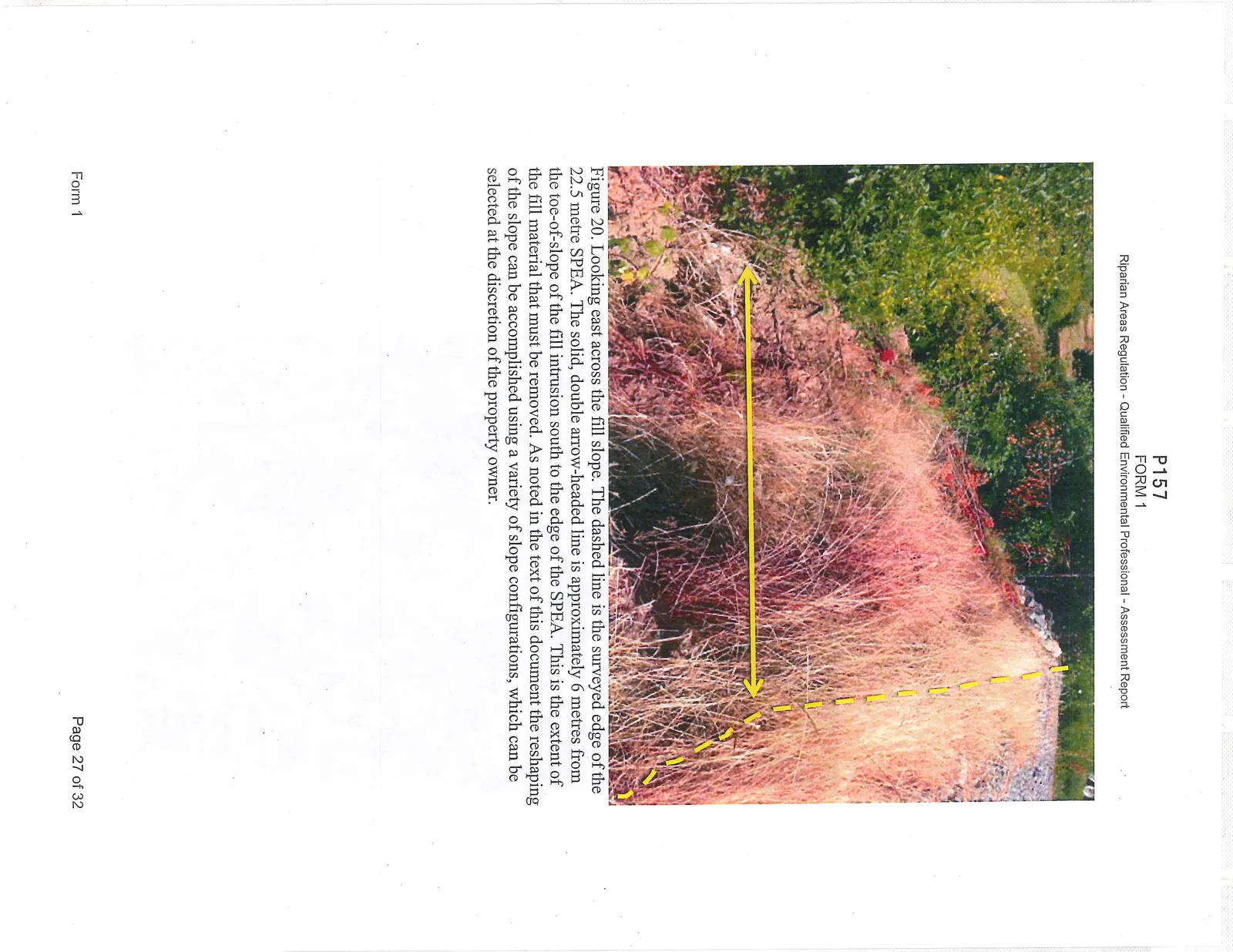
Figure 16. The mowed lawn area extends down to Craigflower Creek in one location near the eastern property boundary. There is some evidence of trampling impacts in this location.
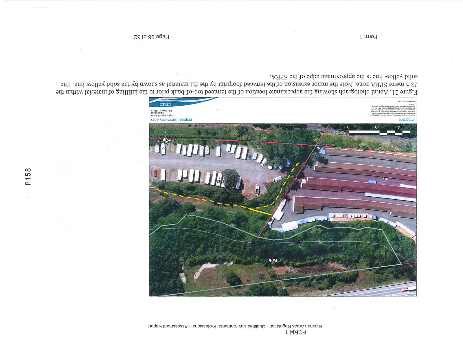
Figure 17. Example of trampling along the eastern property boundary adjacent to Craigflower Creek (yellow arrow).
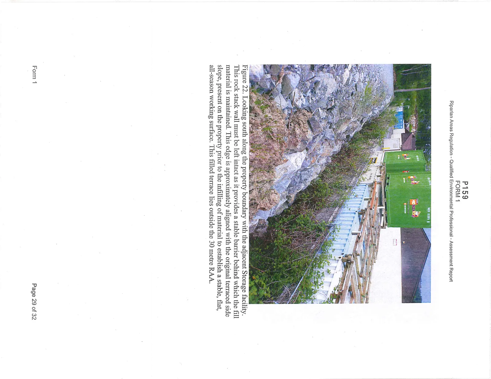
Figure 18. An image of the fill area that is encroaching into the SPEA on the northwestern edge of the subject property. The large coniferous trees in the background approximately mark the location of Craigflower Creek.
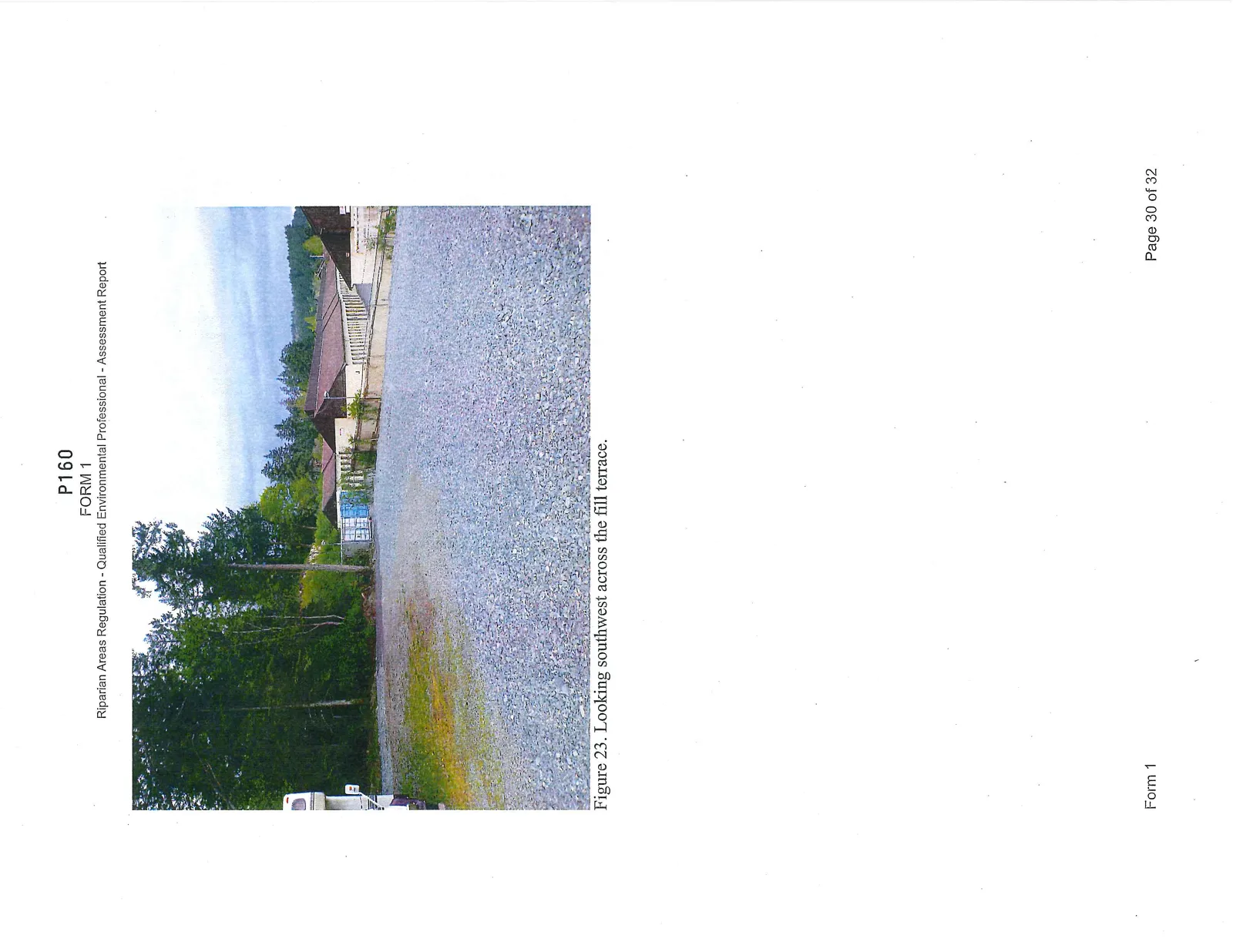
Figure 19. A view of the fill slope from the old floodplain terrace. The fill is primarily rock but any exposed soils have been covered with brush.
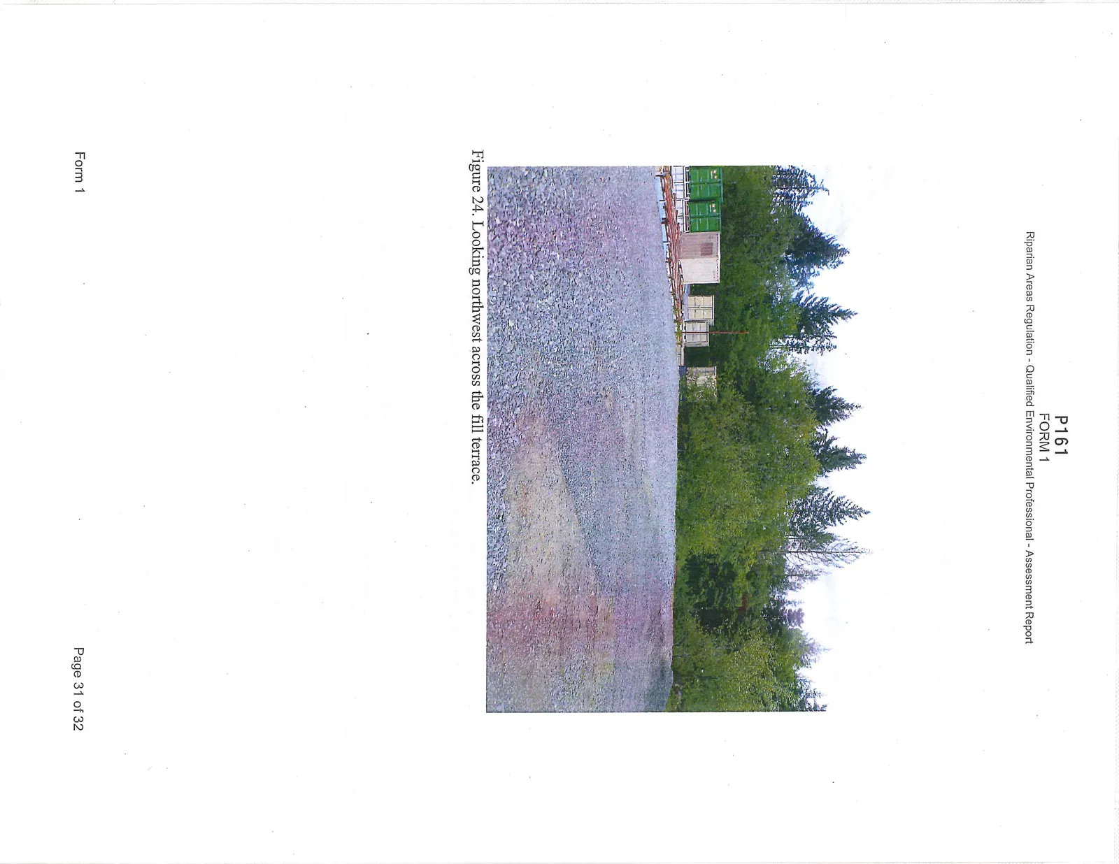
Figure 20. Looking east across the fill slope. The dashed line is the surveyed edge of the 22.5 metre SPEA. The solid, double arrow-headed line is approximately 6 metres from the toe-of-slope of the fill intrusion south to the edge of the SPEA. This is the extent of the fill material that must be removed. As noted in the text of this document the reshaping of the slope can be accomplished using a variety of slope configurations, which can be selected at the discretion of the property owner.
Figure 21. Aerial photograph showing the approximate location of the terraced top-of-bank prior to the infilling of material within the 22.5 metre SPEA zone. Note the minor extension of the terraced footprint by the fill material as shown by the solid yellow line. The solid yellow line is the approximate edge of the SPEA.
Figure 22. Looking south along the property boundary with the adjacent Storage facility. This rock stack wall must be left intact as it provides a stable barrier behind which the fill material is maintained. This edge is approximately aligned with the original terraced side slope, present on the property prior to the infilling of material to establish a stable, flat, all-season working surface. This filled terrace lies outside the 30 metre RAA.
Figure 23. Looking southwest across the fill terrace.
Figure 24. Looking northwest across the fill terrace.
7. Professional Opinion
Assessment Report Professional Opinion on the Development Proposal's riparian area.
Date July 21, 2015
- I/We Wm. Patrick Lucey R.P.Bio.
Please list name(s) of qualified environmental professional(s) and their professional designation that are involved in assessment.
hereby certify that: a) I am/We are qualified environmental professional(s), as defined in the Riparian Areas Regulation made under the Fish Protection Act; b) I am/We are qualified to carry out the assessment of the proposal made by the developer Goodwill Investments Ltd., which proposal is described in section 3 of this Assessment Report (the “development proposal”); c) I have/We have carried out an assessment of the development proposal and my/our assessment is set out in this Assessment Report; and d) In carrying out my/our assessment of the development proposal, I have/We have followed the assessment methods set out in the Schedule to the Riparian Areas Regulation; AND
- As qualified environmental professional(s), I/we hereby provide my/our professional opinion that: a) [ ] if the development is implemented as proposed by the development proposal there will be no harmful alteration, disruption or destruction of natural features, functions and conditions that support fish life processes in the riparian assessment area in which the development is proposed, OR (Note: include local government flex letter, DFO Letter of Advice, or description of how DFO local variance protocol is being addressed) b) [X] if the streamside protection and enhancement areas identified in this Assessment Report are protected from the development proposed by the development proposal and the measures identified in this Assessment Report as necessary to protect the integrity of those areas from the effects of the development are implemented by the developer, there will be no harmful alteration, disruption or destruction of natural features, functions and conditions that support fish life processes in the riparian assessment area in which the development is proposed.
[NOTE: "qualified environmental professional" means an applied scientist or technologist, acting alone or together with another qualified environmental professional, if (a) the individual is registered and in good standing in British Columbia with an appropriate professional organization constituted under an Act, acting under that association's code of ethics and subject to disciplinary action by that association, (b) the individual's area of expertise is recognized in the assessment methods as one that is acceptable for the purpose of providing all or part of an assessment report in respect of that development proposal, and (c) the individual is acting within that individual's area of expertise.
Document Images
(1)