This site is in beta — data may be incomplete and features are still being added.
Council Meeting/Documents/Subject Property Map - 1900 Watkiss Way
Appendix

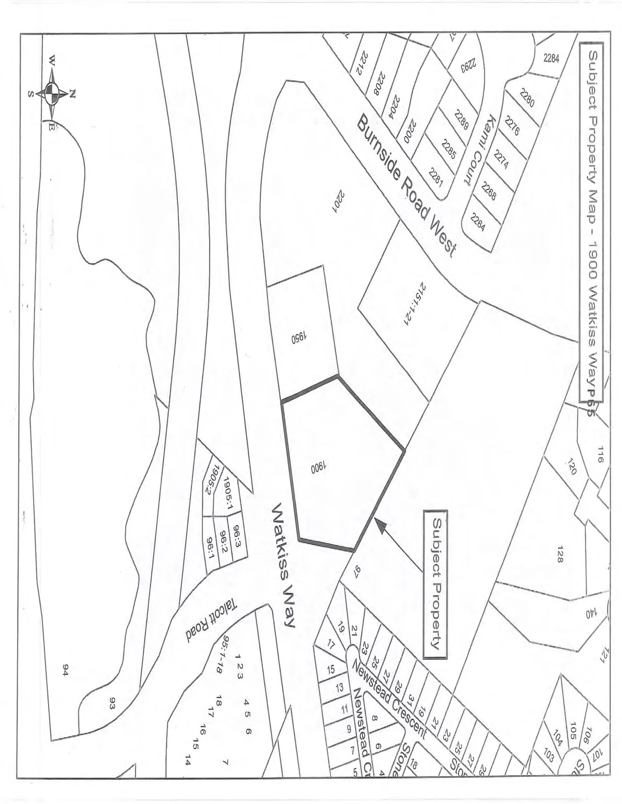
Subject Property Map - 1900 Watkiss Way

January 20, 2015Page 711 section

Property map indicating the location of 1900 Watkiss Way at the intersection of Burnside Road West and Watkiss Way.

1 CALL TO ORDER
1900 Watkiss Way

Subject Property Map - 1900 Watkiss Way

Subject property map highlighting the property at 1900 Watkiss Way. The map shows the parcel layout and surrounding streets, including Watkiss Way, Burnside Road West, Kami Court, Newstead Crescent, Newstead Ct, and Talcott Road. Numerous neighboring property addresses and lot numbers are labeled, such as 1950 Watkiss Way, 2151:1-21, and various lots along the adjacent residential streets.
Page 71
Extracted from: 2015 01 20 Council Agenda