Appendix
Attachment 2. Location Plan
March 20, 2012Page 281 section
Map showing the location of the subject property relative to Nursery Hill Park and the E&N Rail Corridor.
Subject Property MapTrans Canada Highway
Subject Property Map - 301 Nursery Hill
ATTACHMENT 2
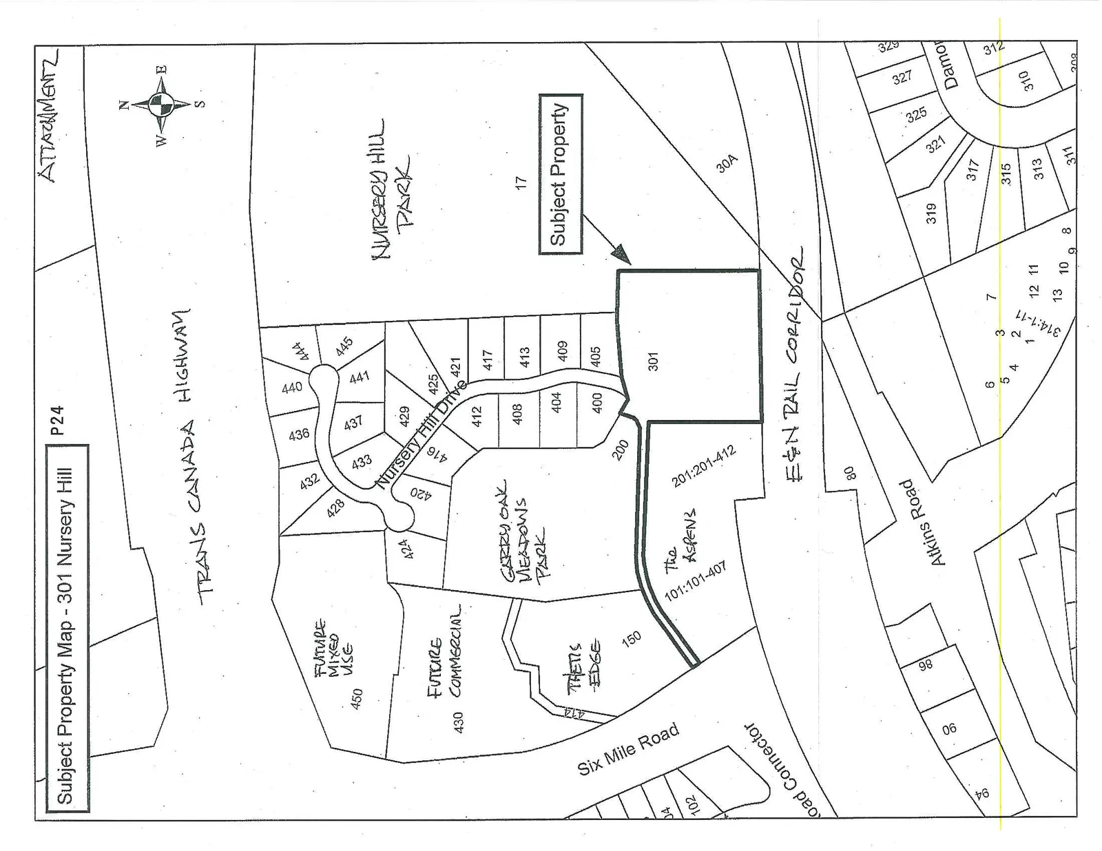
The map displays the following details and landmarks:
- TRANS CANADA HIGHWAY
- NURSERY HILL PARK (Lot 17)
- GARRY OAK MEADOWS PARK
- E&N RAIL CORRIDOR
- Subject Property: Lot 301
- Nursery Hill Drive: Serving lots 200, 400, 404, 408, 412, 416, 420, 424, 428, 432, 436, 440, 444, 445, 441, 437, 433, 429, 425, 421, 417, 413, 409, and 405.
- The ASPENS: Lots 101:101-407 and 201:201-412.
- FUTURE MIXED USE: Lot 450
- FUTURE COMMERCIAL: Lot 430
- THETIS EDGE: Lots 150 and 414
- Atkins Road: Serving lots 80, 86, 90, 94, and various smaller parcels including lots 1 through 13, 319, 317, 315, 313, 311, 321, 325, 327, 329, 310, 312, and 308.
- Other features: Six Mile Road, Road Connector, and Lot 30A.
Page 28
Extracted from: 2012 03 20 Council Agenda