REZONING – 229, 231, 235, and 241 Island Highway
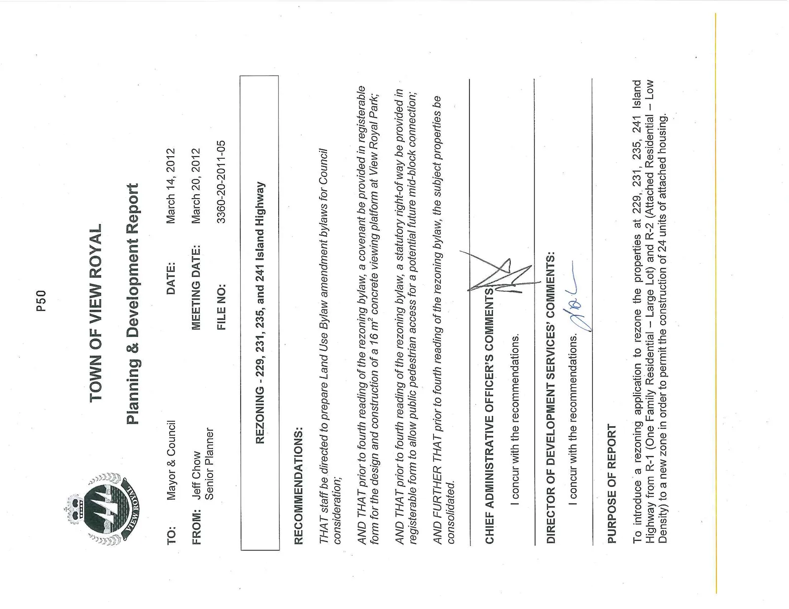
Planning report recommending the preparation of bylaws to rezone properties for a 24-unit townhouse development.
TOWN OF VIEW ROYAL
Planning & Development Report
TO: Mayor & Council DATE: March 14, 2012 FROM: Jeff Chow, Senior Planner MEETING DATE: March 20, 2012 FILE NO: 3360-20-2011-05
REZONING - 229, 231, 235, and 241 Island Highway
RECOMMENDATIONS:
THAT staff be directed to prepare Land Use Bylaw amendment bylaws for Council consideration;
AND THAT prior to fourth reading of the rezoning bylaw, a covenant be provided in registerable form for the design and construction of a 16 m² concrete viewing platform at View Royal Park;
AND THAT prior to fourth reading of the rezoning bylaw, a statutory right-of-way be provided in registerable form to allow public pedestrian access for a potential future mid-block connection;
AND FURTHER THAT prior to fourth reading of the rezoning bylaw, the subject properties be consolidated.
CHIEF ADMINISTRATIVE OFFICER’S COMMENTS
I concur with the recommendations.
DIRECTOR OF DEVELOPMENT SERVICES’ COMMENTS
I concur with the recommendations.
PURPOSE OF REPORT
To introduce a rezoning application to rezone the properties at 229, 231, 235, 241 Island Highway from R-1 (One Family Residential – Large Lot) and R-2 (Attached Residential – Low Density) to a new zone in order to permit the construction of 24 units of attached housing.
BACKGROUND
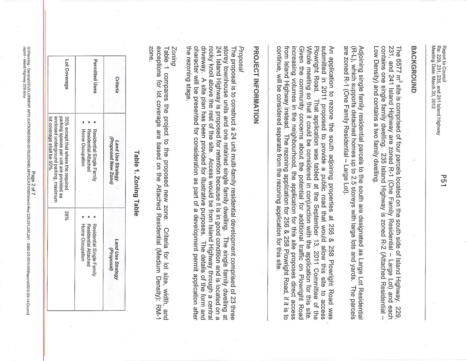
The 6577 m² site is comprised of four parcels located on the south side of Island Highway. 229, 231, and 241 Island Highway are zoned R-1 (One Family Residential – Large Lot) and each contains one single family dwelling. 235 Island Highway is zoned R-2 (Attached Residential – Low Density) and contains a two family dwelling.
Adjoining single family residential parcels to the south are designated as Large Lot Residential (R-L), which supports detached homes up to 2.5 storeys with large lots and yards. The parcels are zoned R-1 (One Family Residential – Large Lot).
An application to rezone the south adjoining properties at 256 & 258 Plowright Road was submitted in 2011 proposed to provide a public road that would allow this site to access Plowright Road. That application was tabled at the September 13, 2011 Committee of the Whole meeting so that it could be considered in conjunction with the application for this site. Given the community concerns about the potential for additional traffic on Plowright Road increasing volumes in the neighbourhood, the application for this site proposes direct access from Island Highway instead. The rezoning application for 256 & 258 Plowright Road, if it is to continue, will be considered separate from the rezoning application for this site.
PROJECT INFORMATION
Proposal
The proposal is to construct a 24 unit multi-family residential development comprised of 23 three storey townhouse units and one retained single family dwelling. The single family dwelling at 241 Island Highway is proposed for retention because it is in good condition and is located on a rocky knoll above the rest of the site. Access would be from Island Highway through a central driveway. A site plan has been provided for illustrative purposes. The details of the form and character will be presented for consideration as part of a development permit application after the rezoning stage.
Zoning
Table 1 compares the project to the proposed new zone. Criteria for lot size, width, and exceptions for lot coverage are based on the Attached Residential (Medium Density): RM-1 zone.
Table 1. Zoning Table
| Criteria | Land Use Strategy (Proposed New Zone) | Land Use Strategy (Proposal) |
|---|---|---|
| Permitted Uses | • Residential Single Family • Residential Attached • Home Occupation |
• Residential Single Family • Residential Attached • Home Occupation |
| Lot Coverage | 35% except that where the required parking spaces per unit are provided as enclosed underground parking, maximum lot coverage shall be 50%. | 28% |
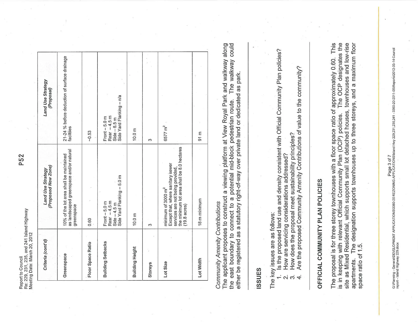
| Greenspace | 10% of the lot area shall be maintained as landscaped greenspace and/or natural greenspace | 21-24 % before deduction of surface drainage facilities |
| Floor Space Ratio | 0.60 | ~0.53 |
| Building Setbacks | Front – 5.0 m Rear – 4.5 m Side – 4.5 m Side Yard Flanking – 5.0 m |
Front – 5.0 m Rear – 4.5 m Side – 6.5 m Side Yard Flanking – n/a |
| Building Height | 10.0 m | 10.0 m |
| Storeys | 3 | 3 |
| Lot Size | minimum of 3000 m² Except that, where sanitary sewer services are not being provided, the minimum lot area shall be 8.0 hectares (19.8 acres) |
6577 m² |
| Lot Width | 18 m minimum | 91 m |
Community Amenity Contributions
The applicant proposes to construct a viewing platform at View Royal Park and walkway along the east boundary to connect to a potential mid-block pedestrian route. The walkway could either be registered as a statutory right-of-way over private land or dedicated as park.
ISSUES
The key issues are as follows:
- Is the proposed land use and density consistent with Official Community Plan policies?
- How are servicing considerations addressed?
- How does the proposal meet sustainability principles?
- Are the proposed Community Amenity Contributions of value to the community?
OFFICIAL COMMUNITY PLAN POLICIES
The proposal is for three storey townhouses with a floor space ratio of approximately 0.60. This is in keeping with relevant Official Community Plan (OCP) policies. The OCP designates the site as Mixed Residential, which supports small lot detached houses, townhouses and low-rise apartments. The designation supports townhouses up to three storeys, and a maximum floor space ratio of 1.5.
SERVICING CONSIDERATIONS
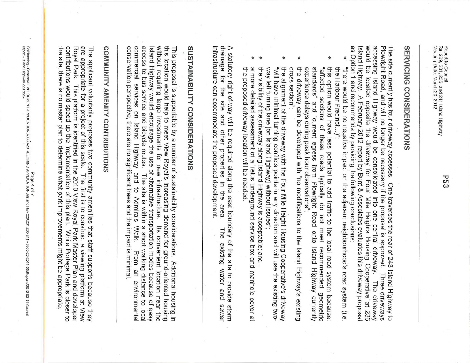
The site currently has four driveway accesses. One traverses the rear of 243 Island Highway to Plowright Road, and will no longer be necessary if the proposal is approved. Three driveways accessing Island Highway would be consolidated into one central driveway. The driveway would be located opposite the driveway for Four Mile Heights Housing Cooperative at 236 Island Highway. A February 2012 report by Bunt & Associates evaluates this driveway proposal as Option 1 and recommends by providing the following conclusions:
- “there would be no negative impact on the adjacent neighbourhood’s road system (i.e. the Harbour Precinct...)”;
- this option would have less potential to add traffic to the local road system because: “affected sections of these roads typically do not meet recommended geometric standards” and “current egress from Plowright Road onto Island Highway currently experience delays during peak hour observations”;
- the driveway can be developed with “no modifications to the Island Highway’s existing cross section”;
- the alignment of the driveway with the Four Mile Height Housing Cooperative’s driveway “will have minimal turning conflicts points in any direction and will use the existing two-way left turning lane [on Island Highway] without issues”;
- the visibility of the driveway along Island Highway is acceptable; and
- a more detailed assessment of a Telus underground service box and manhole cover at the proposed driveway location will be needed.
A statutory right-of-way will be required along the east boundary of the site to provide storm drainage for the site and other properties in the area. The existing water and sewer infrastructure can accommodate the proposed development.
SUSTAINABILITY CONSIDERATIONS
This proposal is supportable by a number of sustainability considerations. Additional housing in this location would help to meet View Royal’s increasing demand for ground-oriented housing without requiring large investments for new infrastructure. Its convenient location near the Island Highway would encourage the use of alternative transportation modes because of easy access to bus service and bicycle routes. The site is within a short walking distance to local commercial services on Island Highway and to Admirals Walk. From an environmental conservation perspective, there are no significant trees and the impact is minimal.
COMMUNITY AMENITY CONTRIBUTIONS
The applicant voluntarily proposes two community amenities that staff supports because they are appropriate for a project of this scale. The first is to construct a viewing platform at View Royal Park. This platform is identified in the 2010 View Royal Park Master Plan and developer contributions would speed up the implementation of this plan. While Portage Park is closer to the site, there is no master plan to determine what park improvements might be appropriate.
The proposed viewing platform would be suitable for viewing wildlife and is proposed to be constructed of concrete, which is more durable and stable than wood. It should be noted that approval from Fisheries and Oceans Canada will be required. It is recommended that the provisions for the design and construction of the viewing platform be secured in a covenant prior to fourth reading of the rezoning bylaw.
The second amenity would be a southbound walkway generally along the east boundary of the site. The purpose of this walkway is to provide for a potential long term mid-block walkway through the area and to improve neighbourhood pedestrian mobility. The walkway could either be registered as a statutory right-of-way over private land or dedicated as park. If the potential walkway is dedicated as park the proposed floor space ratio would increase because the site area would be reduced. Given that there is no plan in place for mid-block pedestrian route and there would be issues relating maintaining a dead-end trail for an undefined period, a statutory right of way is recommended.
STAFF RECOMMENDATION
Staff’s principle recommendation is based on the fact this proposal introduces new ground-oriented housing along a major road in accordance with the OCP’s Mixed Residential land use designation. Other reasons to support the proposal include the following:
- The site’s direct access to the Island Highway would not add vehicle traffic to the surrounding neighbourhood;
- The site is located very close to a bus stop for Route 14 (Vic General / UVic) and to new bicycle lanes and pedestrian sidewalk infrastructure on Island Highway;
- The site is within easy walking distance of View Royal Elementary School and to local commercial services on Island Highway and Admirals Road;
- The local area servicing can accommodate the proposal;
- The proposal would improve the streetscape by reducing the number of driveways along the Island Highway from three to one;
- The applicant proposes a community amenity contribution that is identified in the View Royal Park Master Plan.
- The applicant proposes a public walkway as an additional community amenity contribution that could allow the development of a long term pedestrian walkway part way through the block.
Consolidation of the lots prior to final reading of the rezoning bylaw is recommended in order to ensure the site is retained as one parcel and to prevent market forces from potentially compelling the sale of individual zoned lots.
ALTERNATIVES TO STAFF RECOMMENDATION
Alternative 1: THAT the application be referred to the Planning and Development Advisory Committee and/or the Parks, Recreation, and Environment Committee.
If Council considers that the proposed land use, density, access, or amenities merit additional discussion, the application could be referred to the appropriate advisory committees.
Alternative 2: THAT the application be declined.
If Council considers the proposed land use or density to be inappropriate to the local context, it could recommend to Council that the application be rejected. It should be noted that the application is in accordance with Official Community Plan policies.
ATTACHMENTS
- Subject Property Map
- Traffic Impact Assessment – Bunt & Associates (February 2012) – 27 pages
- Proposed Site Plan – Eric Barker Architects (June 29, 2011)
RECOMMENDATION
THAT staff be directed to prepare Land Use Bylaw amendment bylaws for Council consideration;
THAT prior to fourth reading of the rezoning bylaw, a covenant be provided in registerable form for the design and construction of a 16 m² concrete viewing platform at View Royal Park;
THAT prior to fourth reading of the rezoning bylaw, a statutory right-of way be provided in registerable form to allow public pedestrian access for a potential future mid-block connection;
AND THAT prior to fourth reading of the rezoning bylaw, the subject properties be consolidated.
SUBMITTED BY: Jeff Chow, Senior Planner
REVIEWED BY: Lindsay Chase, MCIP, Director of Development Services
Document Images
(6)