Appendix B: Staff input to CRD Questionnaire
Detailed staff technical input and context for each question in the CRD Transportation Governance questionnaire.
APPENDIX B: STAFF INPUT TO CRD QUESTIONNAIRE
RELEVANT TOWN OF VIEW ROYAL DOCUMENTS USED TO INFORM ON QUESTIONNAIRE RESPONSES:
[Diagram: A flowchart titled "Staff Input & Context" in a central yellow circle. Arrows point towards the center from various surrounding boxes:
- Active Transportation Network Plan (2023)
- ATNP Baseline Conditions Report (2023)
- Strategic Plan (2019-2022)
- Financial Plan (2023-2027)
- Transportation Master Plan Technical Update (2016)
- Other (BC Transit & MoTI projects and Plans, etc)]
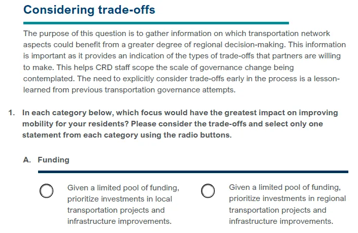
QUESTION 1A:
Staff Input
| Reference | Context |
|---|---|
| Active Transportation Network Plan (ATNP) | Section 5.4.1 of the ATNP identified several key local corridors that should be upgraded to improve mobility of pedestrians, cyclists and transit users within the Town. The top three (3) critical corridor improvement projects were: 1) Admirals Road (Island Hwy to Hallowell Rd) 2) Island Hwy (E&N Rail Trail to Admirals Rd) 3) Helmcken Interchange (Vickery Rd to Watkiss Way) These three corridors close significant gaps in the Town’s network, and focus active travel to regional trails such as the Galloping Goose Regional Trail and E&N Rail Trail. They border (or close to border) neighbouring municipalities, or are influenced by the Ministry of Transportation and Infrastructure’s roadway. Although these improvements are solely within the Town, the improvements also serve a regional context by improving active travel connectivity to the Town’s neighbours. |
| ATNP Baseline Conditions Report | Section 2.3 of the Baseline Conditions Report indicated that 14% of employed residents work within the Town, while the remaining 86% work outside of View Royal. It is indicated that AT planning cannot be done in isolation and that the Town must work with its neighbours to ensure there are safe and direct connections. |
| Transportation Master Plan: Technical Update | The report indicated that during peak commuting periods, most of the users of the Town’s major roadways like the Island Hwy are not residents of the Town and residents often experience significant delay. This is still the case today as the road corridor still observes significant regional use. |
QUESTION 1B:
Staff Input
| Reference | Context |
|---|---|
| Active Transportation Network Plan (ATNP) | Section 5.4.2 of the ATNP recommended an additional ten (10) short term improvements to improve active transportation mobility. These improvements benefit both intra-municipal and intra-regional travel: much like the critical improvements, many of the projects border neighbouring municipalities and close gaps in the network. However, these projects would also provide improved accessibility to the Town’s commercial centres, schools and regional parks. |
| ATNP Baseline Conditions Report | Per Section 2.3 of the Baseline Conditions Report, the 2017 CRD Origin – Destination Household Travel Survey indicated that of the 53,100 trips made within View Royal per day, 11% were made internally while the remaining 89% were going to or coming from other regions. Future Town OCP updates could change these numbers. However, the evidence at this time still indicate that intra-regional travel is more prevalent on Town collector and major roadways than intra-municipal travel. |
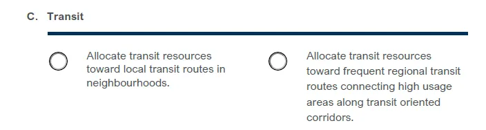
QUESTION 1C:
Staff Input
| Reference | Context |
|---|---|
| Other & 2023-2027 Financial Plan | BC Transit and the Ministry of Transportation and Infrastructure are already investing in regional transit routes within the Town, connecting high usage areas within the Island Highway and Helmcken Road (via Rapid “Blink” Transit improvements along the Island Hwy, and the Hwy 1 Bus on Shoulder Project). The Town currently has in its budget a bus shelter program that will see year to year installations of bus shelters within the municipality. |
| Active Transportation Network Plan (ATNP) & ATNP Baseline Conditions Report | Consistent with the Baseline Conditions Report in that most trips are intra regional, Section 5.4.4 of the ATNP stated that 79% of View Royal residents work outside of the Town. The ATNP recommends that the Town’s AT networks be integrated with public transit as a result. As mentioned above, BC Transit and MoTI are currently working on their respective Blink Transit and Bus on Shoulder projects, which are regional in nature, and the Town is improving its local bus stop experience through the installation of bus shelters. |
| Strategic Plan | Per the Strategic Plan Priority A, Goal 1b, the Town is to engage BC Transit to pursue commitment for a higher level of transit service, including improvements to underserviced areas. Service improvements to the Thetis Lake area have been implemented, and Council has advocated for the implementation of Route 40 per BC Transit’s Esquimalt-View Royal Local Area Transit Plan. As a result, the Strategic Plan and Council actions support both local and regional initiatives. |
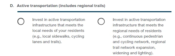
QUESTION 1D:
Staff Input
| Reference | Context |
|---|---|
| Active Transportation Network Plan (ATNP) | While the purpose of the Town’s ATNP was to identify active transportation improvements to meet the needs of View Royal residents, many of the critical and short term recommended projects could inherently improve regional needs (the top 3 critical projects also benefit neighbouring municipalities and provide continuous pedestrian and cycling networks). Furthermore, Section 5.5.2 of the ATNP indicated advocacy to improve regional trails to meet the regional needs of residents. This included advocating for wider regional trails with lighting, and separating pedestrians from cyclists on these trails. As a result, both local and regional needs are incorporated in the ATNP. |
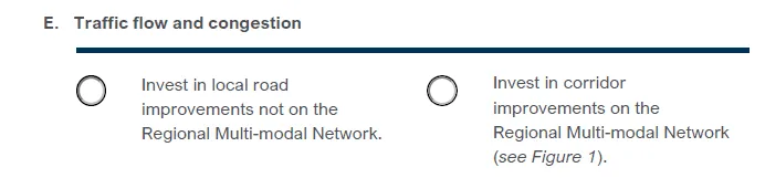
QUESTION 1E:
Staff Input
| Reference | Context |
|---|---|
| Active Transportation Network Plan (ATNP) | All of the ATNP’s top 3 critical road projects, major intersection improvements, and most of the minor intersection improvements are located within the regional multi-modal network (Admirals Rd, Island Hwy, Helmcken Rd). |
| Transportation Master Plan: Technical Update & Other | Helmcken Rd and the Island Hwy observe a high amount of commuter traffic during peak hours (and as indicated in the Technical Update, most commuters are non residents of View Royal). With the addition of BC Transit’s dedicated bus lanes on the Island Hwy for its “Blink” transit, as well as anticipated improvements to the Helmcken Interchange as part of the Bus on Shoulders project, it can be expected that the Town’s roadways identified within the Regional Multi-Modal Network will increase in utilization by both residents and the region. |
QUESTION 1F:
Staff Input
| Reference | Context |
|---|---|
| Active Transportation Network Plan (ATNP) & 2023-2027 Financial Plan | An RTP taking precedence and directing municipal transportation plans is consistent with a “Level 3 Governance Concept – New Authority, Streamlined Decision-Making and Investment”, as identified in the Introduction and Background section of the CRD Workshop Package. Level 3 is currently identified as the last step in the framework, and as such, would build upon the successes and feasibility demonstrated in the previous steps 1 and 2. At this time, steps 1 and 2 has not been implemented. View Royal recently completed their Active Transportation Network Plan in Spring 2023, and is scheduled to update its transportation master plan in 2024. Many surrounding municipalities have either recently completed, or is in the process of completing their updated Active Transportation Plans. If the CRD instead drew from many relevant plans that have already undergone engagement, analysis and stakeholder reviews, this could be consistent with a lower step level of Level 1 or Level 2 in the CRD framework. |
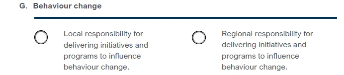
QUESTION 1G:
Staff Input
| Reference | Context |
|---|---|
| Active Transportation Network Plan (ATNP) | Per section 5.5 of the ATNP, most of the supporting programs that advocate for education and behavioural change are of a regional responsibility. This includes the Ready Step Roll Program, Bike to Work Week, bike skills training partnerships and mapping such as bikemaps and walkrollmap. The CRD also hosts the Walk and Wheel to School and GobyBike Week. The Town currently does not have the staffing to deliver additional initiatives and programs on its own. |
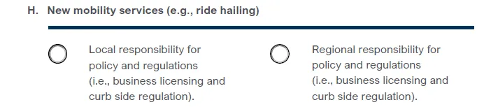
QUESTION 1H:
Staff Input
| Reference | Context |
|---|---|
| Other | It is unclear how a regional entity could take responsibility for policy and regulations such as business licensing and curb side regulation: these are typically administered by local government. Such legislative changes could be consistent with a “Level 3 Governance Concept – New Authority, Streamlined Decision-Making and Investment”. Additional information is required before staff can fully interpret the impacts of having a regional entity administer policy and regulations regarding new mobility services. |
QUESTION 1I:
Staff Input
| Reference | Context |
|---|---|
| Financial Plan & Active Transportation Network Plan | The Town’s funding structure for capital projects is predominantly supported through its Casino Revenue. Additional funding from the Province or Federal Government (Community Works Fund), as well as DCC funds, are also available. Recently, the Town has not been successful in obtaining grant funding to green light large scale road projects. This includes the Island Hwy Upgrades (Helmcken Rd to Beaumont Ave) project and the Atkins Rd Sidewalk (Anya Court to Langford Border). |
QUESTION 2A:
Staff Input
Staff is unable to provide input as the question is subjective in nature and the response requires an opinion on level of service.
QUESTION 2B:
Staff Input
Staff is unable to provide input as the response requires an opinion on level of service.
Per the Town’s ATNP, many of the short term and critical projects are located within the CRD’s Regional Multi-Modal Network. However, it is unknown how these projects are ranked versus other projects in the region.
QUESTION 2C:
Staff Input
Staff cannot provide input as the response must come from Council as the decision-makers in question.
QUESTION 2D:
Staff Input
Staff is unable to provide input as the question is subjective in nature and the response requires an opinion on level of service.
QUESTION 3:
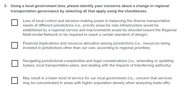
Staff Input
Staff is unable to provide input on loss of control and decision-making power and financial implications as this requires an opinion on level of service.
Changes to bylaws, local transportation plans, and transfer of authority may be considered a higher level Governance concept (Level 2 – Expanding CRD Authority, or Level 3 – New Authority). This phase would be complex as it could require the unification of many jurisdictional bylaws and plans in the region; the extent of work required would depend on the magnitude of the change.
QUESTION 4:
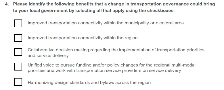
Staff Input
The Town’s Active Transportation Network Plan required engagement with internal and external stakeholders, including engagement with neighbouring municipalities and the CRD. The purpose of engaging these stakeholders was to ensure that the recommended improvements identified in the plans were consistent, or would connect well, with their respective plans.
Harmonizing design standards and bylaws across the region could be complex and the extent of work required could be significant depending on the magnitude of the changes.
QUESTION 5:
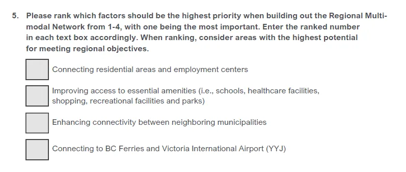
Staff Input
Priority A, Goal 1 of the 2019-2022 Strategic Plan aimed to shift the primary transport mode within View Royal away from vehicles to walking, cycling and transit. Its target was to have 25% of trips to work and school by transit / walking and cycling (based on Census data).
Section 4.0 of the Towns Active Transportation Network Plan outlined the plan’s framework. Within the framework is both the ATNP vision:
View Royal is a dynamic, inclusive, and connected community that recognizes the impacts of climate change. Its active transportation network allows residents and visitors alike to move around the community safely by walking, cycling, or rolling. The active transportation network connects neighbourhoods, schools, employment destinations, transit stops, natural environments including parks and green spaces, and with regional trails and neighbouring communities. A connected, compact, and safe network of active transportation facilities make driving the least attractive option and change the culture of transportation in View Royal, helping the town reduce GHG emissions, boost its local economy, and enhance its overall resilience-meeting the needs of the present and future generations.
Document Images
(1)