Appendix
DVP 2014/02 Technical Site Plans and Details
March 11, 2014Pages 167–1691 section
Surveyor's site plans and cross-sections showing fence heights and retaining walls.
December 13, 2013 survey date
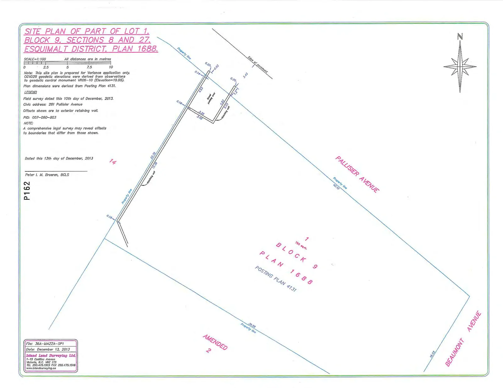
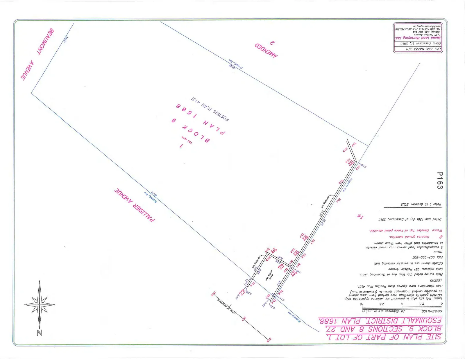
SITE PLAN OF PART OF LOT 1, BLOCK 9, SECTIONS 8 AND 27, ESQUIMALT DISTRICT, PLAN 1688.
SCALE=1:100 All distances are in metres
Project Identification
- Civic address: 281 Pallisier Avenue
- PID: 007-090-803
- File: 36A-MAZZA-SP1
- Date: December 13, 2013
- Surveyor: Peter I. M. Broeren, BCLS
- Lot Area: 1 (760 sq.m.)
- Block: 9
- Plan: 1688
- Posting Plan: 4131
Legend and Notes
- Note: This site plan is prepared for Variance application only. CGVD28 geodetic elevations were derived from observations to geodetic control monument VR06-10 (Elevation=10.99).
- Plan dimensions were derived from Posting Plan 4131.
- Field survey dated this 10th day of December, 2013.
- Offsets shown are to exterior retaining wall.
- A comprehensive legal survey may reveal offsets to boundaries that differ from those shown.
25.6Denotes ground elevation.TFenceDenotes Top of Fence panel elevation.
Fence Height Detail
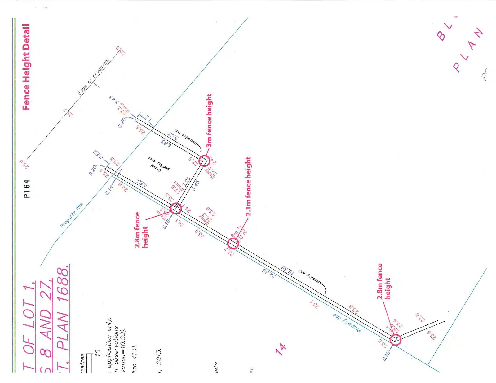
Notated Fence Heights:
- 2.8m fence height: Located at the southern end of the western property line (ground elevation 23.0, TFence 25.8).
- 2.1m fence height: Located along the western property line between the southern fence and the parking area (ground elevation 23.7, TFence 25.8).
- 2.8m fence height: Located along the western property line adjacent to the gravel parking area (ground elevation 24.1, TFence 26.9).
- 3m fence height: Located at the corner of the gravel parking area (ground elevation 24.5, TFence 27.5).
Other Property Dimensions:
- Property line along Pallisier Avenue: 40.10m
- Property line along Beaumont Avenue: 16.03m
- Southern property line: 38.59m
- Gravel parking area dimensions: 4.83m x 5.03m
Page 167–169
Extracted from: 2014 03 11 Committee of the Whole Agenda