This site is in beta — data may be incomplete and features are still being added.
Committee of the Whole/Documents/Zoning Map Snippet - Thetis Vale Area
Appendix

Zoning Map Snippet - Thetis Vale Area

December 9, 2014Page 601 section

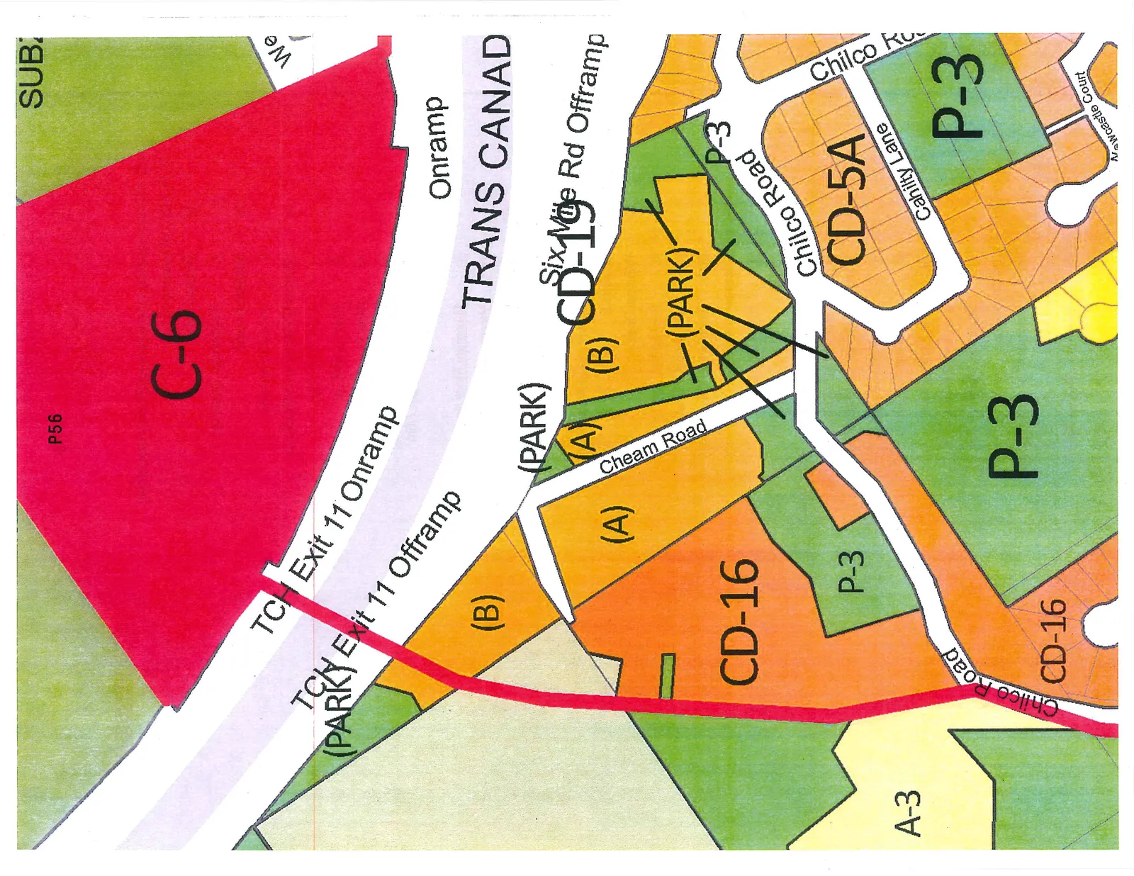
Color-coded map illustrating current zoning designations in the Phase 6 area of Thetis Vale.

2. APPROVAL OF AGENDA

Zoning Map

A land use and zoning map highlighting various designations near the Trans Canada Highway. The map features a large red area labeled C-6 (P56) north of the highway. South of the highway, designations include CD-19 (with sub-areas A and B along Cheam Road), CD-16 (orange areas), CD-5A (orange area along Cahilty Lane), P-3 (green areas, several labeled as PARK), and A-3 (pale yellow area). Roadways shown include the Trans Canada Highway, TCH Exit 11 Onramp and Offramp, Six Mile Rd Offramp, Cheam Road, Chilco Road, Cahilty Lane, and Newcastle Court.

Map Designations and Labels

  • C-6 (Red area)
  • CD-19 (Yellow/orange area with sub-sections (A) and (B))
  • CD-16 (Orange areas)
  • CD-5A (Orange residential area)
  • P-3 (Green areas, multiple locations)
  • A-3 (Pale yellow area)
  • (PARK) (Labels identifying specific green spaces)
  • TRANS CANADA (Highway)
  • TCH Exit 11 Onramp
  • TCH Exit 11 Offramp
  • Six Mile Rd Offramp
  • Cheam Road
  • Chilco Road
  • Cahilty Lane
  • Newcastle Court
  • P56 (Identifier within the C-6 zone)
Page 60
Extracted from: 2014 12 09 Committee of the Whole Agenda