Appendix: 291 Kerwood Street - Environmental Impact Assessment
Assessment report by Swell Environmental Consulting regarding the boathouse repair's impact on the foreshore and marine environment.
JC Scott 291 Kerwood Street Victoria, BC V9B 1A2
25 March 2015
RE: Environmental Impact Assessment for 291 Kerwood Avenue, Victoria, BC for Natural Watercourse and Shoreline Areas Development Permit Area (Town of View Royal)
On 19 March 2015, Sara Stallard, BSc, ASCT, Dipl.Env.Tech. of Swell Environmental Consulting Ltd. (Swell) visited the site at 291 Kerwood Avenue, Victoria, BC to evaluate the existing condition of the property in reference to a recently completed structural improvement to a boathouse deck within the Town of View Royal's Natural Watercourse and Shoreline Areas Development Permit Area (Figure 1). As discussed with View Royal planner, James Davison, a site visit was needed to evaluate whether the structural improvements had created additional impacts on the foreshore over previous conditions.
Site Conditions
The waterfront site is a heavily modified residential lot typical of the urbanised shoreline of this neighbourhood, with numerous patios, terraces, gardening and landscaping activities. A small one room structure with an attached deck is located over the foreshore on historic blast rock fill and is supported by wooden beams anchored on a number wood posts and concrete supports including a shoreline retaining wall (Photos 1-4).
The backshore consists of terraced landscaping and ornamental species to the west and a near vertical bedrock wall with non-native vegetation to the east. A large Garry oak is located on the neighbouring property high above the structure. The foreshore of this small cove consists of blast rock fill and inert building debris (bricks, concrete, marble slabs) under the structure, with a concrete retaining wall bridging the head of the cove between exposed bedrock outcrops. The beach material is sand mixed with shell hash and broken materials of anthropogenic source typical on Victoria beaches (pottery, glass). The blast rock and nearby bedrock has similar colonization by barnacles, blue mussels, limpets, and periwinkles with little to no algal attachments.
The structural improvements consisted of complete replacement of the beams, wooden posts, deck and saddles and utilised the identical attachment points to the existing concrete footings. As can be seen from the Before and After photos, no increase in structure size occurred. According to the owner an existing set of wooden stairs to the beach were removed entirely.
Impact of Work on Existing Natural Conditions
No sensitive ecosystems or red or blue listed species were located near or within the work site. Additionally, the CRD Natural Area Atlas harbour mapping shows no sensitive ecosystems at or adjacent to the subject site (Figure 2). The existing intertidal area has low biodiversity and very little to no algal species to be impacted by shading. Because of the historically highly disturbed nature of the subject site, both in the backshore and the foreshore, and the effort made to keep the structure within the current footprint, there has been no observed impact from the structural improvements on the current natural condition of the site.
Please do not hesitate to contact us with any questions you may have.
Sincerely,
Sara Stallard BSc, ASCT (#22338), Dipl.Env.Tech.
Lehna Malmkvist, MSc, RPBio (#1613)
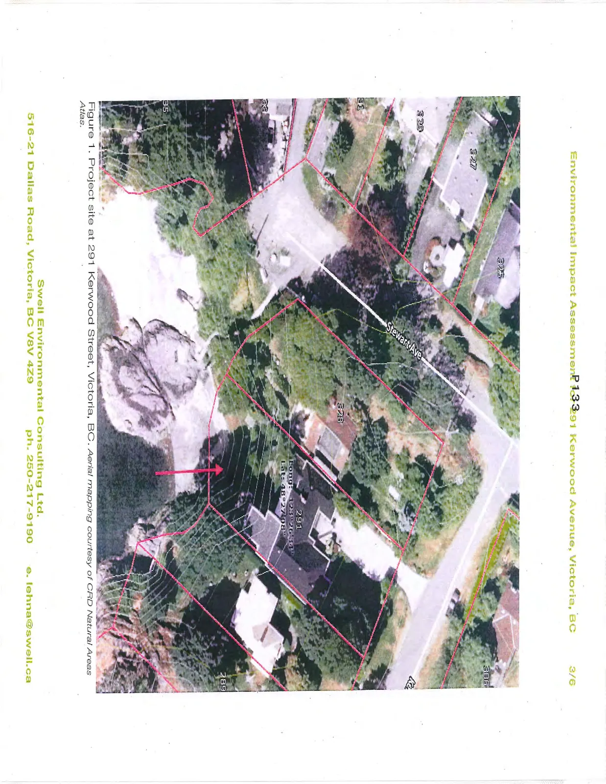
Figure 1. Project site at 291 Kerwood Street, Victoria, BC. Aerial mapping courtesy of CRD Natural Areas Atlas.
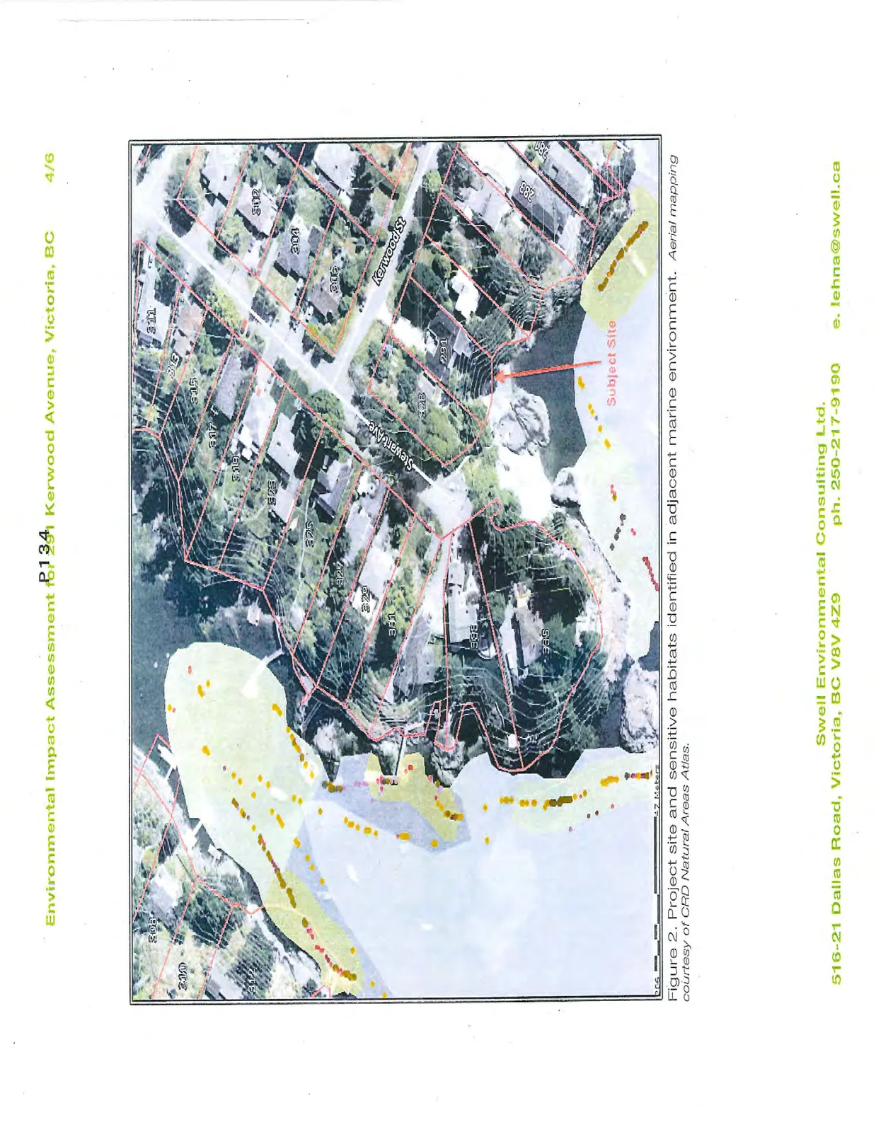
Figure 2. Project site and sensitive habitats identified in adjacent marine environment. Aerial mapping courtesy of CRD Natural Areas Atlas.
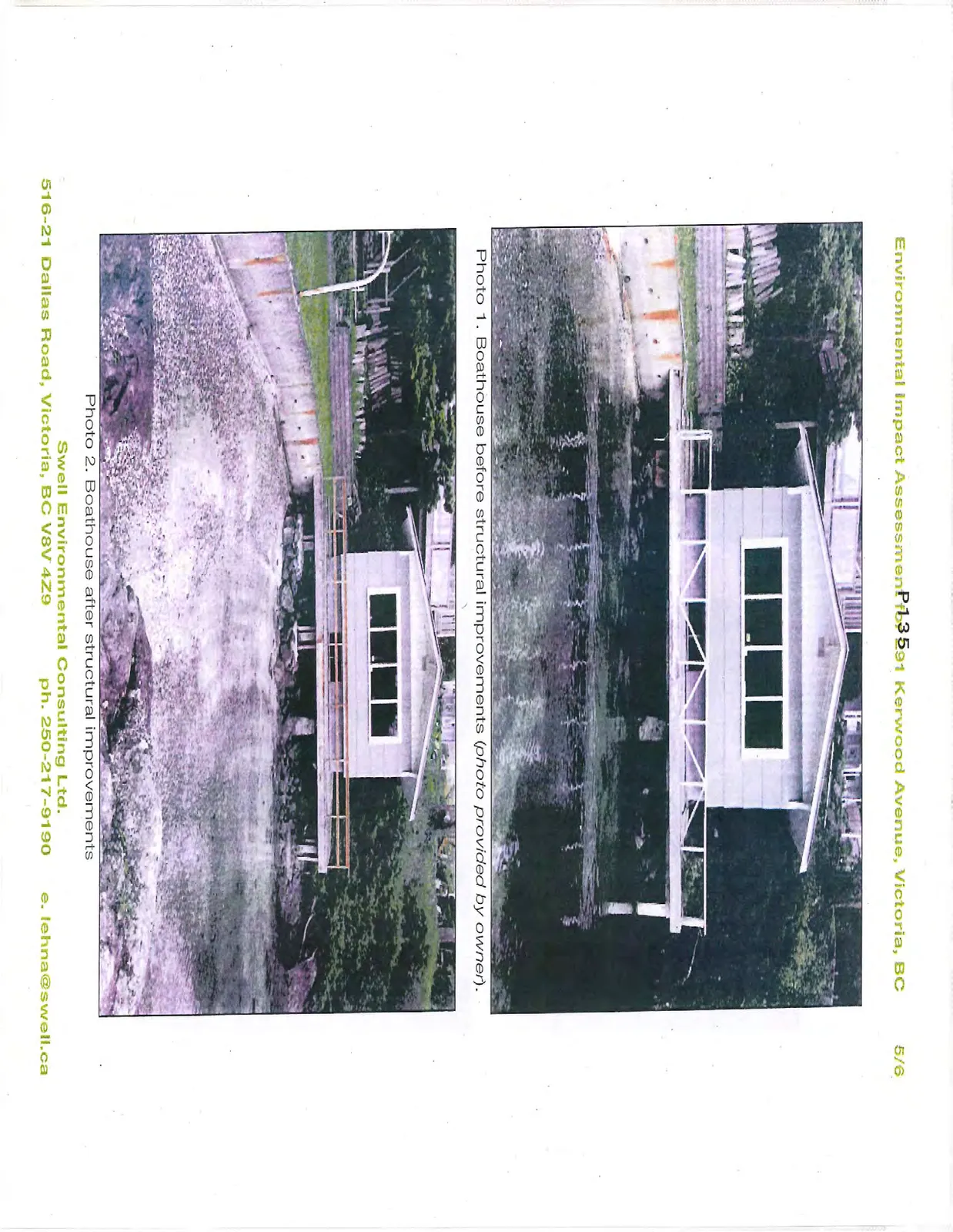
Photo 1. Boathouse before structural improvements (photo provided by owner).
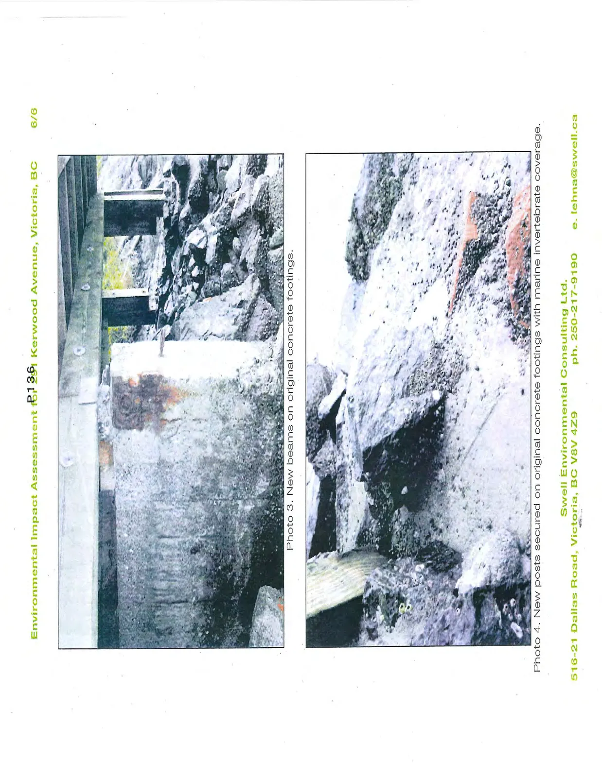
Photo 2. Boathouse after structural improvements
Photo 3. New beams on original concrete footings.
Photo 4. New posts secured on original concrete footings with marine invertebrate coverage.
Document Images
(2)