Appendix
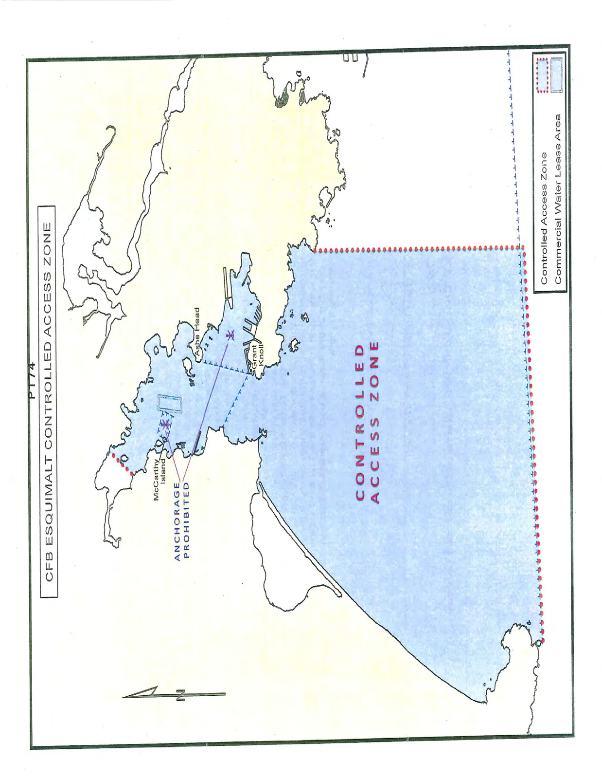
Map of CFB Esquimalt Controlled Access Zone
May 12, 2015Page 1791 section
Map showing the boundaries of the federal controlled access zone in the harbour.
Identifies areas where anchorage is prohibited
CFB ESQUIMALT CONTROLLED ACCESS ZONE
Legend
- Controlled Access Zone
- Commercial Water Lease Area
Map Labels and Annotations
- McCarthy Island
- Ashe Head
- Grant Knoll
- ANCHORAGE PROHIBITED: Indicated by dashed blue lines across the waterway.
- CONTROLLED ACCESS ZONE: Large text centered over the primary light-blue shaded water area.
Page 179
Extracted from: 2015 05 12 Committee of the Whole Agenda