This site is in beta — data may be incomplete and features are still being added.
Committee of the Whole/Documents/Subject Property Map - 17A Jedburgh Rd
Appendix

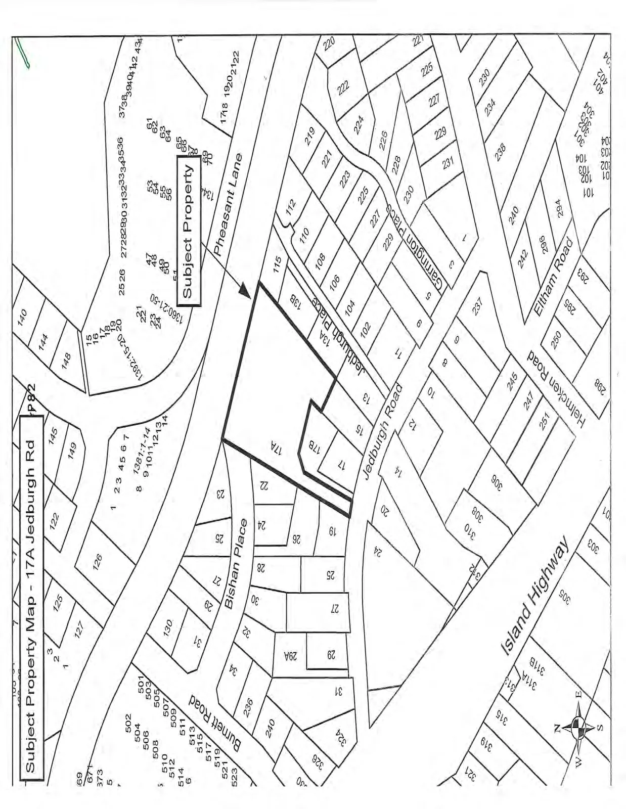
Subject Property Map - 17A Jedburgh Rd
February 10, 2015Page 861 section

Neighbourhood map identifying the specific subject property for the variance application.

9.2.3.b Development Variance Permit No. 2015/02 - 17A Jedburgh Road
17A Jedburgh RoadLocated north of Island Highway

Subject Property Map - 17A Jedburgh Rd

A map showing the subject property at 17A Jedburgh Rd outlined in bold, including surrounding residential lots and streets such as Jedburgh Road, Jedburgh Place, Pheasant Lane, Bishan Place, Burnett Road, and Island Highway.
Page 86
Extracted from: 2015 02 10 Committee of the Whole Agenda