Appendix
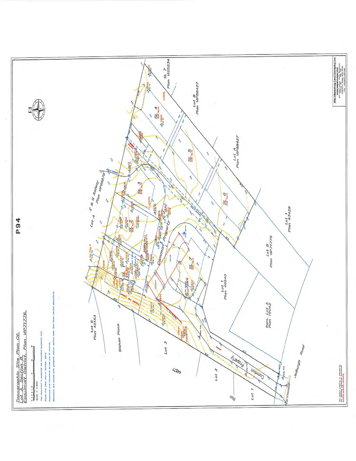
Topographic Site Plan - 17A Jedburgh Road
February 10, 2015Page 981 section
Survey plan showing elevation contours and existing features for 17A Jedburgh Road.
October 2014Scale 1:500
Topographic Site Plan Of: Lot A, Section 8, Esquimalt District, Plan VIP71776
Scale 1:500
This document is prepared for municipal purposes only.
Dated this 28th day of October, 2014.
Distances and elevations shown are in metres.
Elevations are based upon geodetic datum derived from View Royal Control Monuments.
Lot and Property Information
The plan displays the following lots and their respective areas:
- SL 1: 538 Sq.m
- SL 2: 508 Sq.m
- SL 3: 578 Sq.m
- SL 4: 629 Sq.m
- SL 5: 629 Sq.m
- SL 6: 629 Sq.m
- SL 7: 650 Sq.m
Adjacent properties and landmarks include:
- E & N Railway (Plan VIP66876)
- Lot 6 (Plan 45153)
- Lot 3
- Lot 2
- Lot 1
- Lot 1 (Plan 46640)
- Rem. Lot A (Plan 19042)
- Lot B (Plan VIP71776)
- Lot 1 (Plan 43429)
- Lot A (Plan VIP88427)
- Lot B (Plan VIP88427)
- SL 7 (Plan VIS5234)
Wey Mayenburg Land Surveying Inc. #1-2357 James White Boulevard Sidney, BC V8L 1Z5 Telephone (250) 656-3515 File 140304D-TOP.DWG
Page 98
Extracted from: 2015 02 10 Committee of the Whole Agenda