Appendix
Site Plan at 327 Bessborough Close (J.E. Anderson)
September 8, 2015Page 521 section
Technical site plan showing lot boundaries and the proposed wall location.
June 16, 2015
PLAN 1696
NOTE: ELEVATIONS ARE TO ASSUMED DATUM. THE DECIMAL POINT OF THE ELEVATION DENOTES THE LOCATION OF THE SHOT TAKEN UNLESS OTHERWISE NOTED. PROPERTY LINES HAVE BEEN CALCULATED FROM CURRENT SURVEY AND EXISTING SURVEY RECORDS.
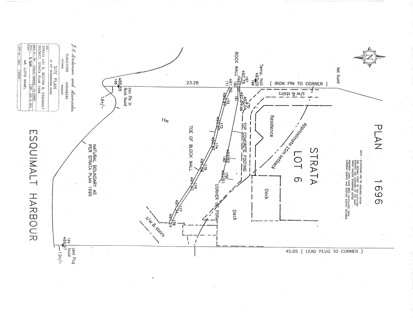
SITE PLAN
AT 327 BESSBOROUGH CLOSE
| Field | Detail |
|---|---|
| LEGAL | STRATA LOT 6, SECTION 8, ESQUIMALT DISTRICT, STRATA PLAN 1696 |
| DRAWN BY | GBL |
| PROJECT SURVEYOR | D.R. GARNER |
| SCALE | 1:100 |
| DATE | JUNE 16, 2015 |
| CLIENT | MR. LLOYD HAMEL |
| OUR FILE | 29093 |
Plan Annotations and Labels:
- STRATA LOT 6
- Residence
- Deck
- approximate 15m setback
- TOP CONCRETE FOOTING
- ROCK WALL
- TOE OF BLOCK WALL
- CORNER OF FORM
- NATURAL BOUNDARY AS PER STRATA PLAN 1696
- ESQUIMALT HARBOUR
- s/w & stairs
- Not found
- (IRON PIN TO CORNER) - 23.28
- (LEAD PLUG TO CORNER) - 45.05
- Iron Pin in Rock found (Point 165, Elevation 486.55)
- Lead Plug found (Point 164, Elevation 486.37)
- Temp. Nail (Point 166, Elevation 493.20)
Page 52
Extracted from: 2015 09 08 Committee of the Whole Agenda