Appendix
Attachment 1. Location Plan (33 Helmcken Road)
September 8, 2015Page 942 sections
Map showing the location of the Eagle Creek Village project.
Report to Committee of the Whole
Rezoning Application – 33 Helmcken Road Meeting Date: September 8, 2015
Page 94
Attachment 1. Location Plan
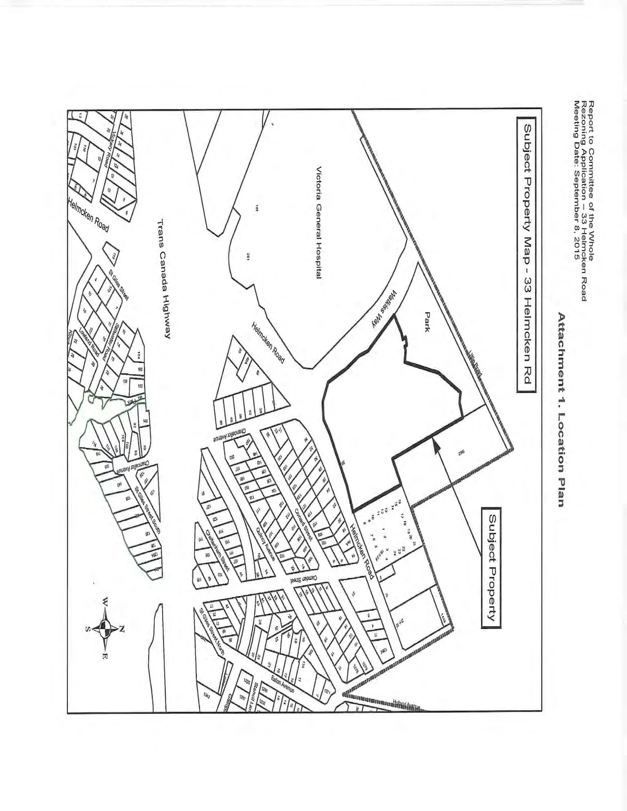
The Location Plan identifies the following landmarks and streets:
- Subject Property (33 Helmcken Road)
- Park
- Victoria General Hospital
- Watkiss Way
- Helmcken Road
- Trans Canada Highway
- Chancellor Avenue
- Conrad Street
- Quincy Avenue
- Cheltenham Street
- St Giles Street North
- Eaton Avenue
- Stancil Lane
- Lowland Road
- Stillwater Road
- St Giles Street
- Vickery Road
- St Giles Street South
Page 94
Extracted from: 2015 09 08 Committee of the Whole Agenda