This site is in beta — data may be incomplete and features are still being added.
Committee of the Whole/Documents/Appendices to 333A Stewart Avenue Dock Permit
Appendix

Appendices to 333A Stewart Avenue Dock Permit

January 13, 2015Pages 96–1015 sections

Site maps, orthophotos, and architectural plans for the 333A Stewart Avenue dock proposal.

9.2.3 b) Environmental Development Permit No. 2014/15 - 333A Stewart Avenue
Proposed dock area: 533 sq. metres (lot size)

Subject Property Map - 333A Stewart Ave
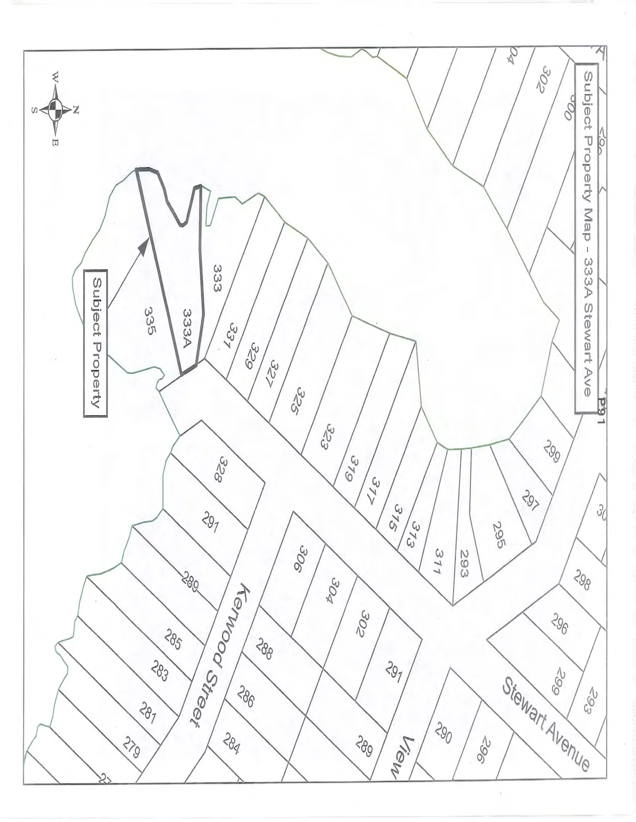
Subject Property Map showing lot 333A and surrounding properties along Stewart Avenue, Kerwood Street, and View Royal Avenue
Page 96–101

333A Stewart Ave Subject Property Orthophoto
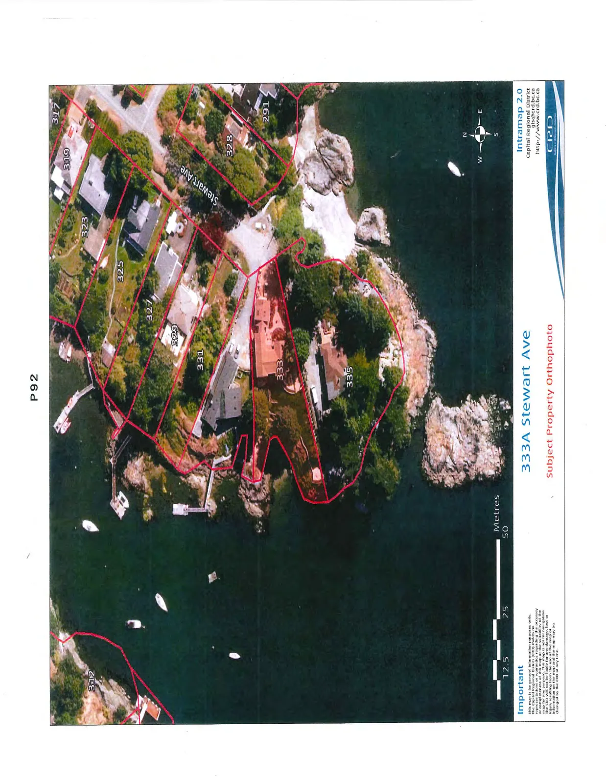
Aerial orthophoto showing 333A Stewart Avenue and adjacent properties with red parcel boundary overlays

November 14, 2014

Mayor and Council Town of View Royal 45 View Royal Avenue Victoria, BC, V9B 1A6

We propose to add a dock to our property at 333A Stewart Ave., following the guidelines issued by the town of View Royal, while respecting the wishes and restrictions of DND.

This dock will be complimentary and similar to the docks already in existence in the area. There will be no negative affect on our neighbours. There will be no removal of natural landscape.

The proposal will not require any additional public infrastructure.

The dock will be approximately 3.6m x 9m with a connecting gangway from our new wooden deck. It will be used for recreational boating, kayaking, etc.

We engaged a professional to perform an Environmental Assessment report on the immediate shoreline. He indicated that fish stock and natural habitat will not be negatively affected by our dock.

Sincerely,

Gary Mathies

Page 96–101

Proposed Dock - 333a Stewart Avenue

November 13, 2014

View looking to the North
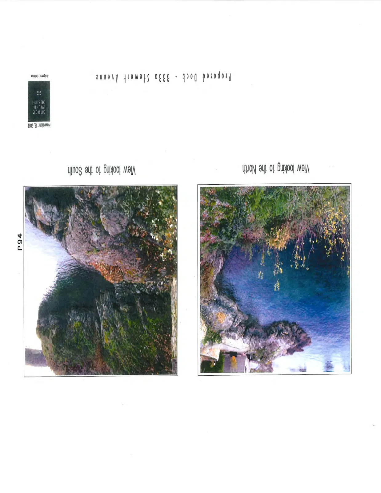
Photograph of the rocky shoreline and water at 333a Stewart Avenue looking North

View looking to the South

Page 96–101

Proposed Dock - 333a Stewart Avenue

November 13, 2014
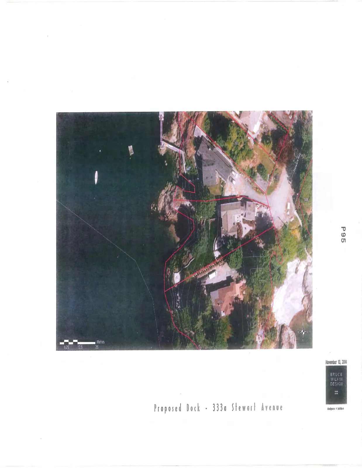
Detailed aerial orthophoto of 333a Stewart Avenue showing the residence, parcel boundaries, and topographic contour lines along the shoreline
Page 96–101

Proposed Dock - 333a Stewart Avenue

November 13, 2014

Site Plan

  • Scale: 1:100
  • Lot Area: 1533 sq. metres
  • Civic Address: 333a Stewart Avenue
  • Legal Description: Lot B, Section 8, Esquimalt District, Plan VIP 81834
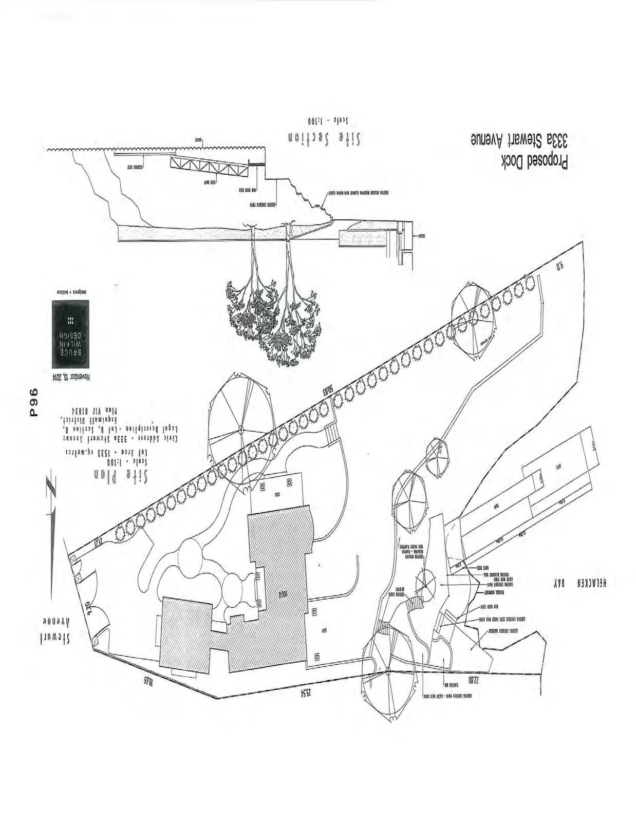
Site plan for 333a Stewart Avenue showing the house, property boundaries, and the proposed dock and gangway extending into Helmcken Bay

Site Section

  • Scale: 1:100
Page 96–101

Document Images

(1)
Document image
Extracted from: 2015 01 13 Committee of the Whole Agenda