EIA Photos and Restoration Plan for 77 Caton Place
Consultant's photos, native plant species lists, OCP excerpts, and a formal restoration commitment from the applicant.
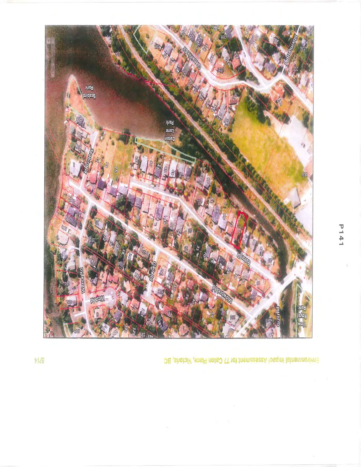
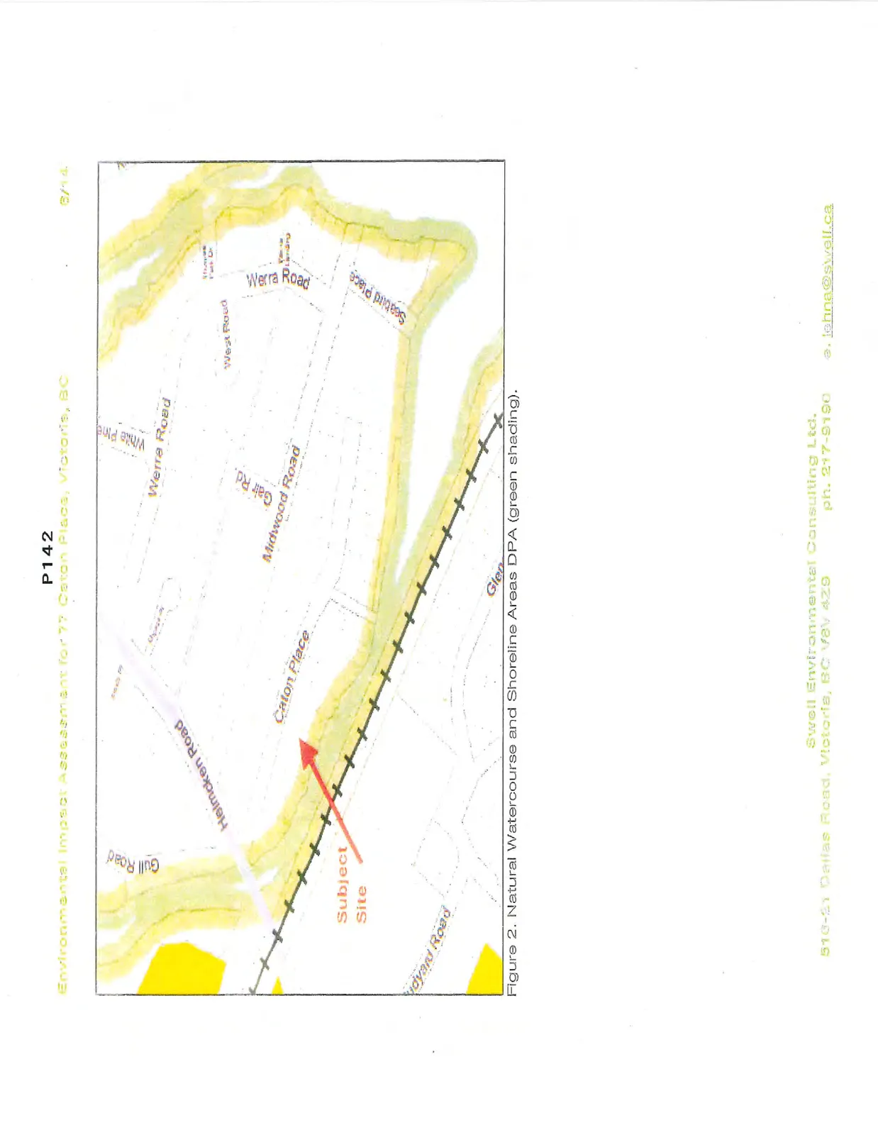
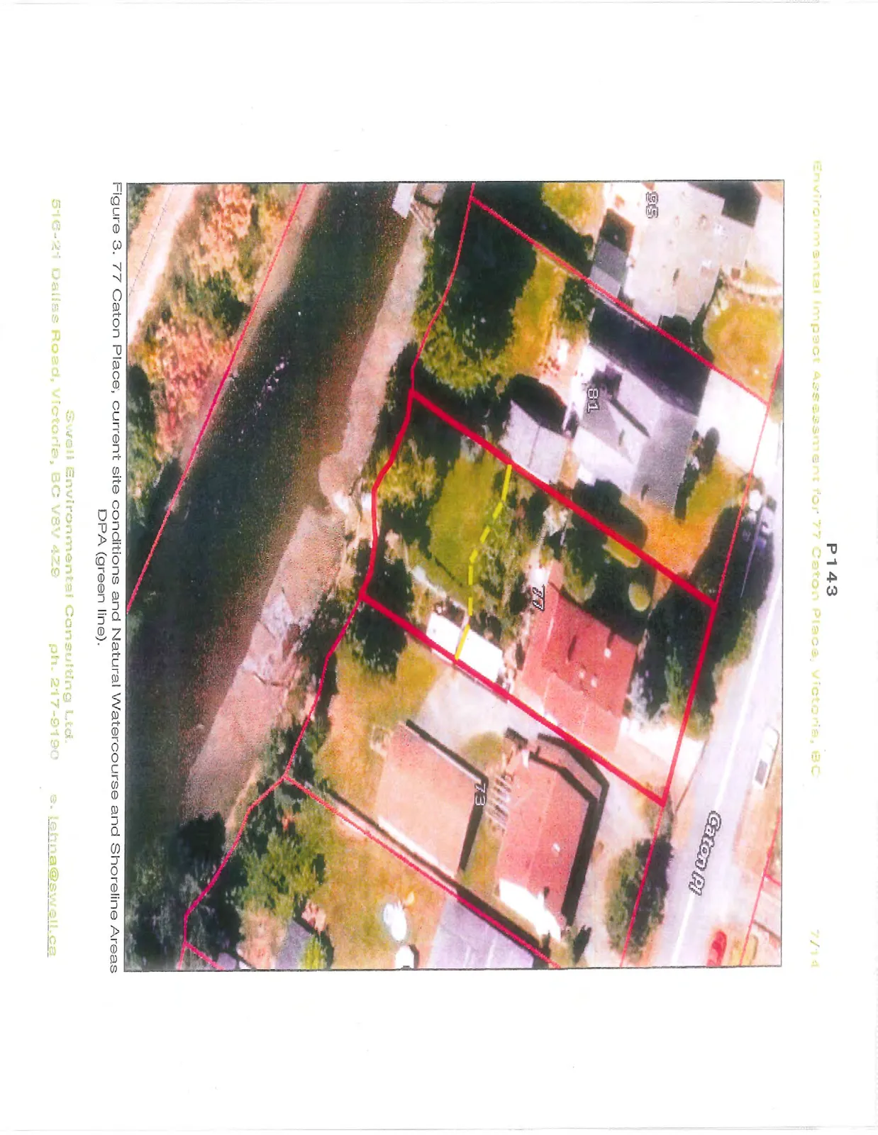
Environmental Impact Assessment for 77 Caton Place, Victoria, BC
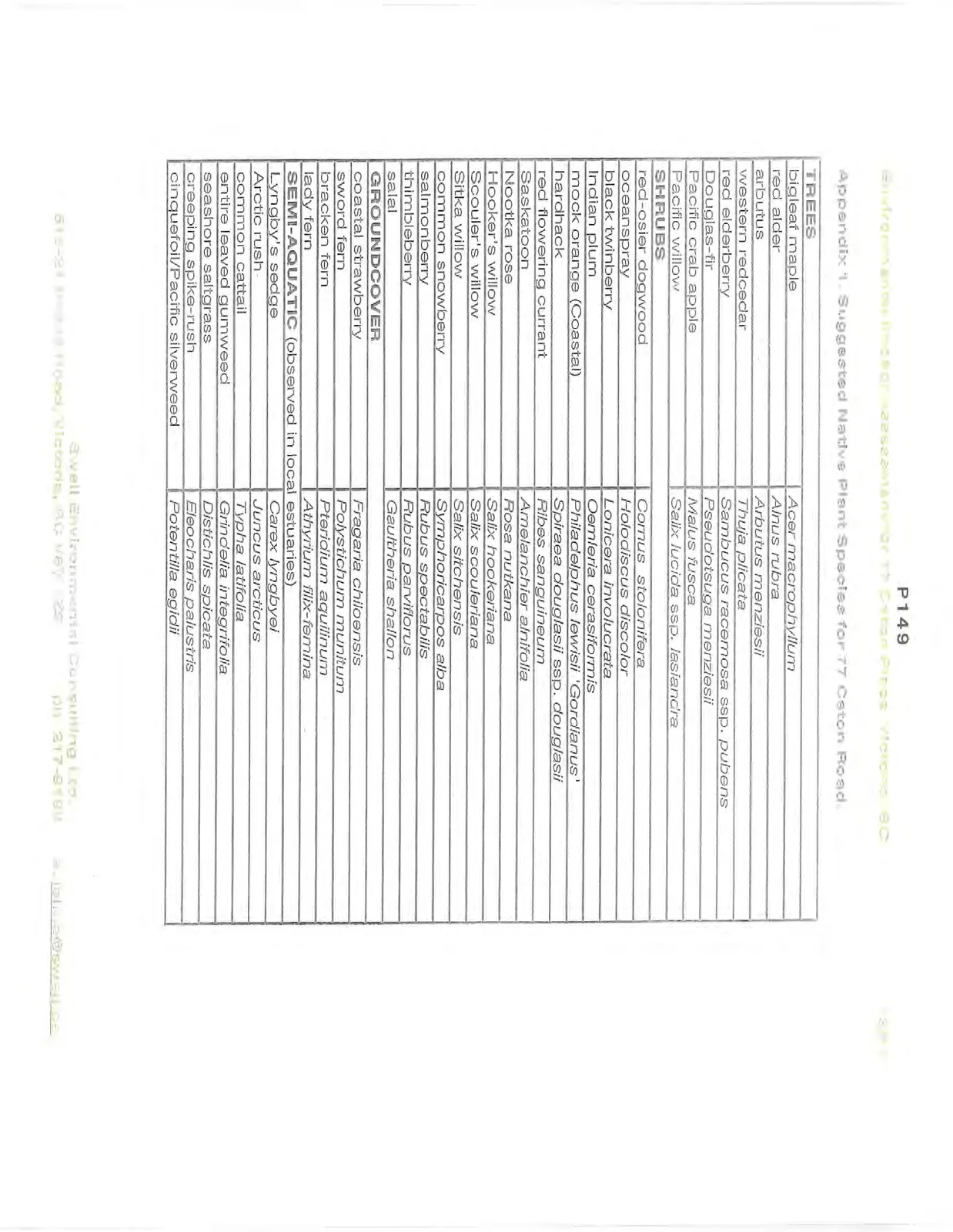
Appendix 1. Suggested Native Plant Species for 77 Caton Road.
| TREES | |
|---|---|
| bigleaf maple | Acer macrophyllum |
| red alder | Alnus rubra |
| arbutus | Arbutus menziesii |
| western redcedar | Thuja plicata |
| red elderberry | Sambucus racemosa ssp. pubens |
| Douglas-fir | Pseudotsuga menziesii |
| Pacific crab apple | Malus fusca |
| Pacific willow | Salix lucida ssp. lasiandra |
| SHRUBS | |
| red-osier dogwood | Cornus stolonifera |
| oceanspray | Holodiscus discolor |
| black twinberry | Lonicera involucrata |
| Indian plum | Oemleria cerasiformis |
| mock orange (Coastal) | Philadelphus lewisii 'Gordianus' |
| hardhack | Spiraea douglasii ssp. douglasii |
| red flowering currant | Ribes sanguineum |
| Saskatoon | Amelanchier alnifolia |
| Nootka rose | Rosa nutkana |
| Hooker's willow | Salix hookeriana |
| Scouler's willow | Salix scouleriana |
| Sitka willow | Salix sitchensis |
| common snowberry | Symphoricarpos alba |
| salmonberry | Rubus spectabilis |
| thimbleberry | Rubus parviflorus |
| salal | Gaultheria shallon |
| GROUNDCOVER | |
| coastal strawberry | Fragaria chiloensis |
| sword fern | Polystichum munitum |
| bracken fern | Pteridium aquilinum |
| lady fern | Athyrium filix-femina |
| SEMI-AQUATIC (observed in local estuaries) | |
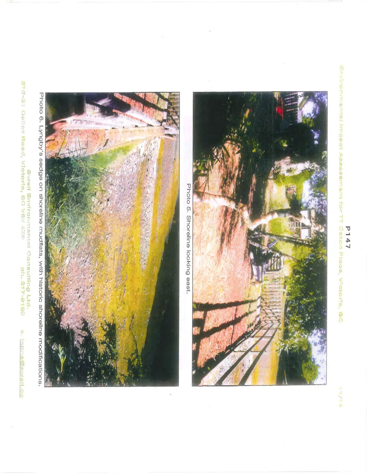
| Lyngby's sedge | Carex lyngbyei |
| Arctic rush | Juncus arcticus |
| common cattail | Typha latifolia |
| entire leaved gumweed | Grindelia integrifolia |
| seashore saltgrass | Distichlis spicata |
| creeping spike-rush | Eleocharis palustris |
| cinquefoil/Pacific silverweed | Potentilla egidii |
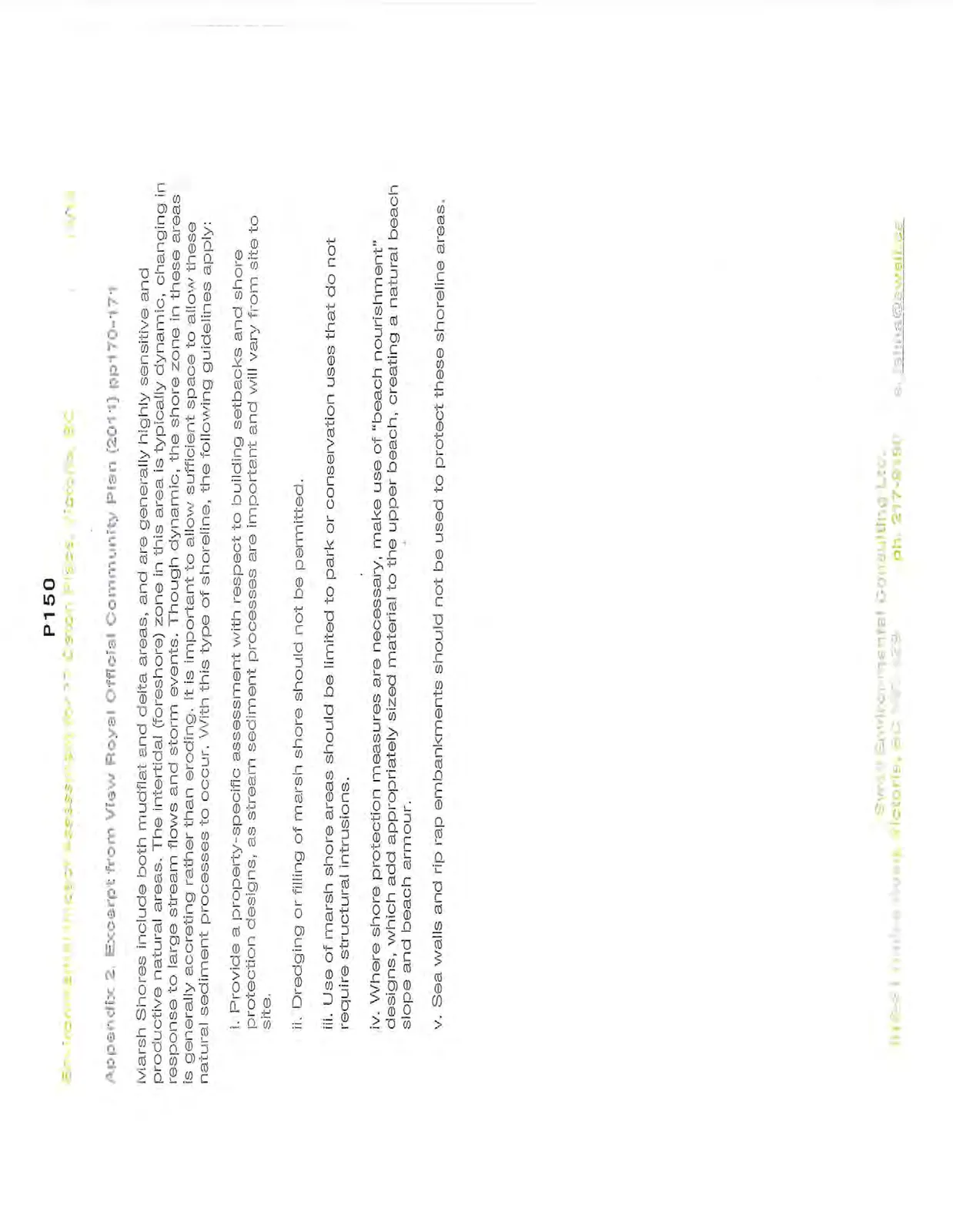
Appendix 2. Excerpt from View Royal Official Community Plan (2011) pp170-171
Marsh Shores include both mudflat and delta areas, and are generally highly sensitive and productive natural areas. The intertidal (foreshore) zone in this area is typically dynamic, changing in response to large stream flows and storm events. Though dynamic, the shore zone in these areas is generally accreting rather than eroding. It is important to allow sufficient space to allow these natural sediment processes to occur. With this type of shoreline, the following guidelines apply:
i. Provide a property-specific assessment with respect to building setbacks and shore protection designs, as stream sediment processes are important and will vary from site to site.
ii. Dredging or filling of marsh shore should not be permitted.
iii. Use of marsh shore areas should be limited to park or conservation uses that do not require structural intrusions.
iv. Where shore protection measures are necessary, make use of "beach nourishment" designs, which add appropriately sized material to the upper beach, creating a natural beach slope and beach armour.
v. Sea walls and rip rap embankments should not be used to protect these shoreline areas.
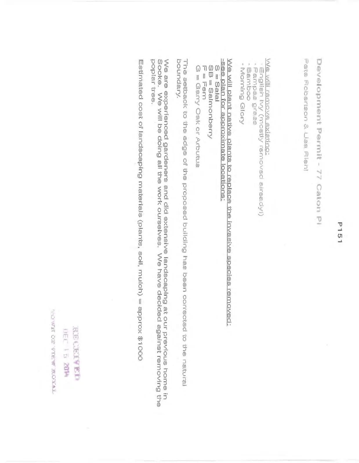
Development Permit - 77 Caton Pl
Pete Robertson & Lisa Riehl
We will remove existing:
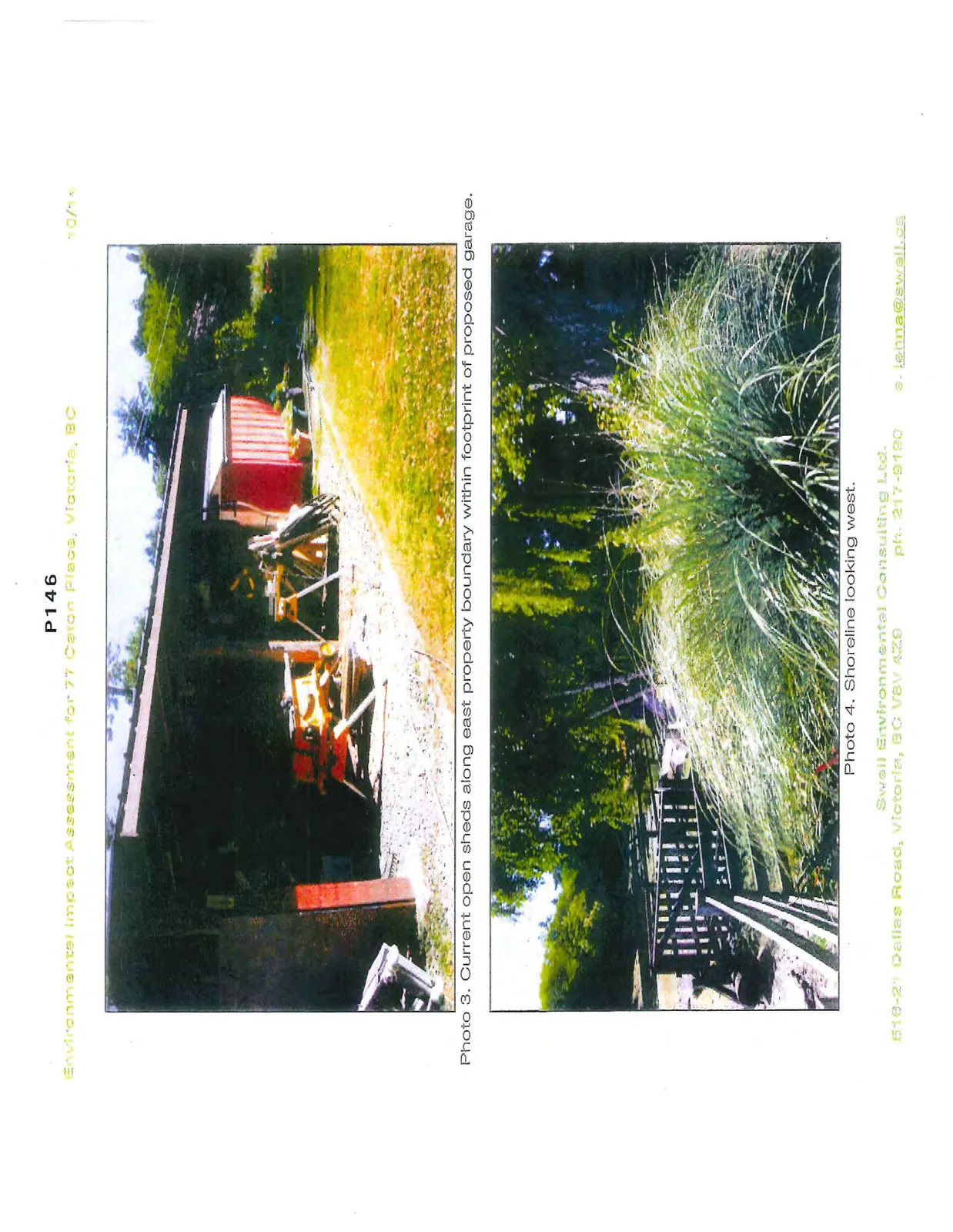
- English Ivy (mostly removed already!)
- Pampas grass
- Bamboo
- Morning Glory
We will plant native plants to replace the invasive species removed: -see plan for approximate locations: S = Salal SB = Salmonberry F = Fern G = Garry Oak or Arbutus
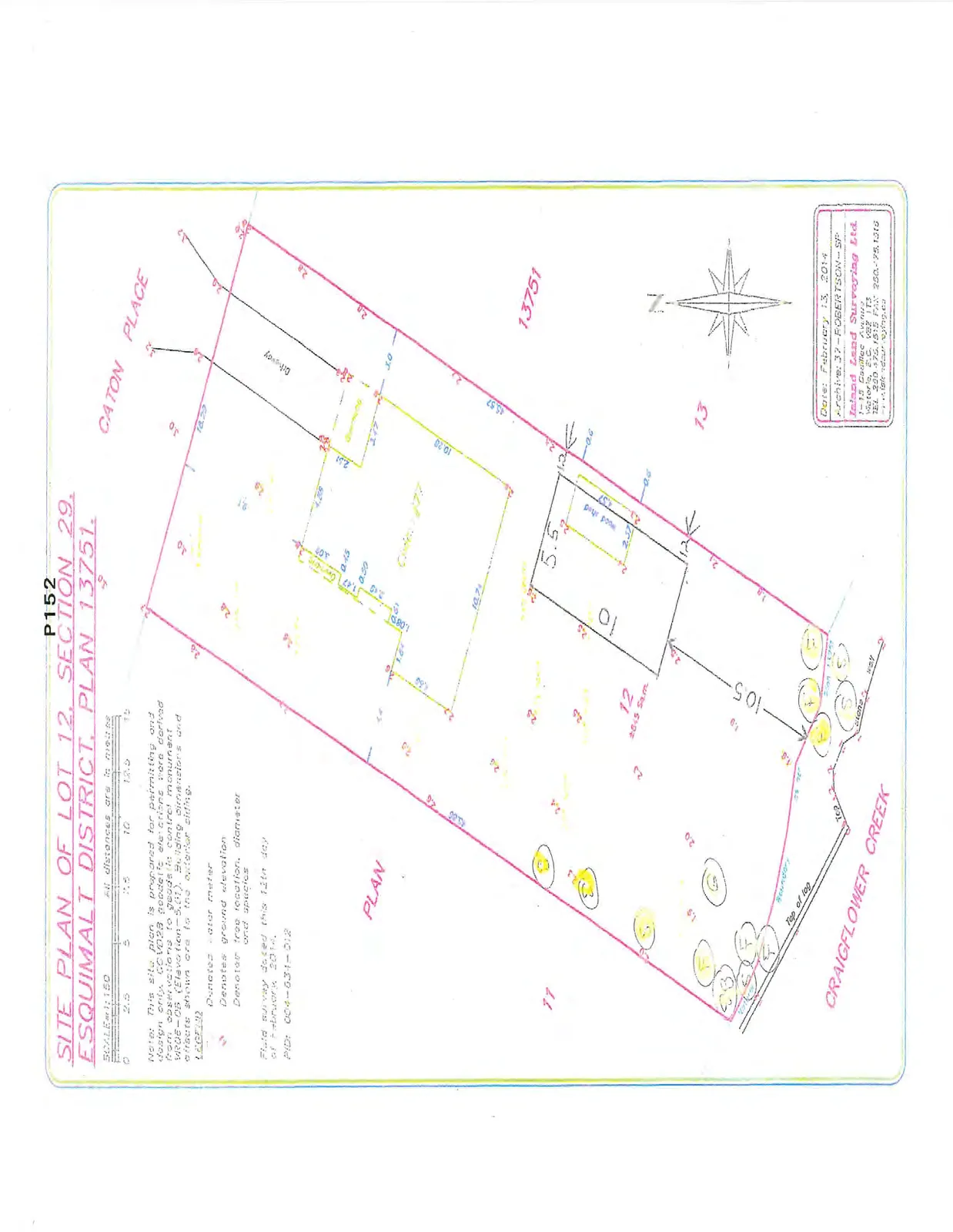
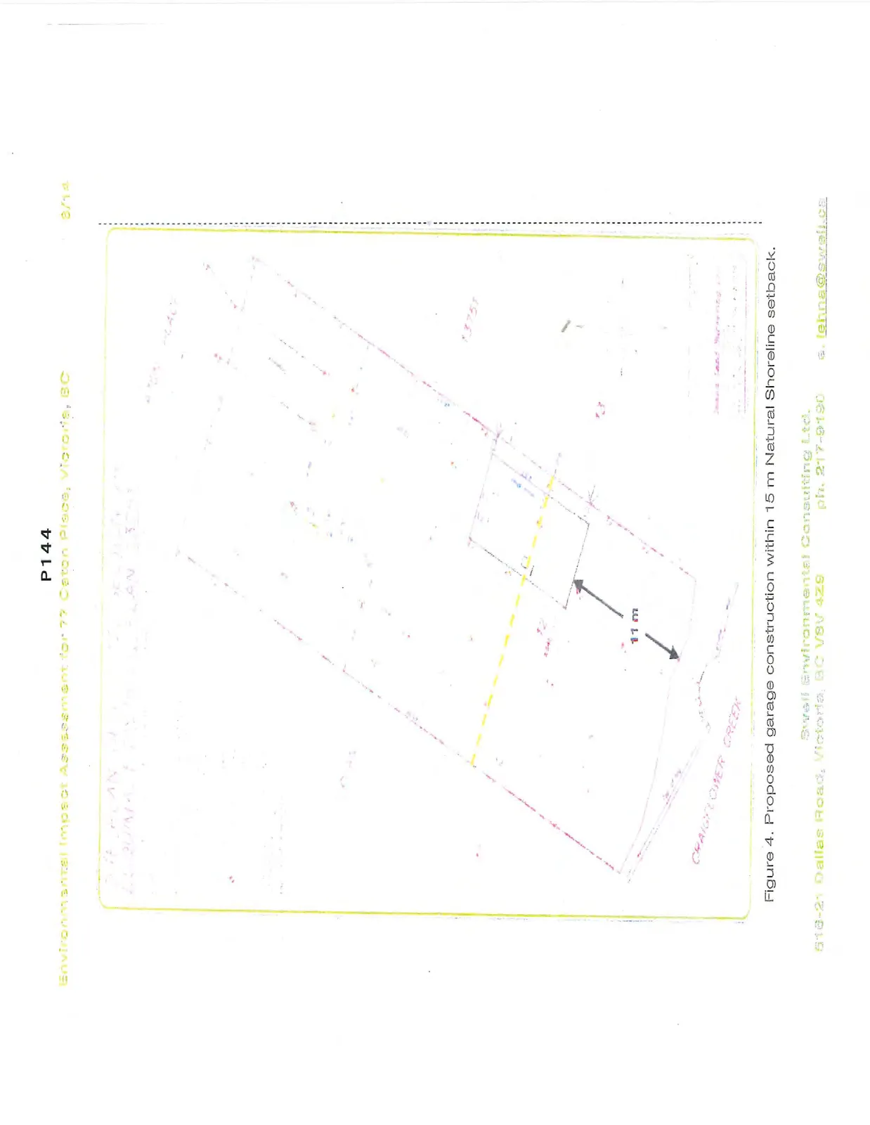
The setback to the edge of the proposed building has been corrected to the natural boundary.
We are experienced gardeners and did extensive landscaping at our previous home in Sooke. We will be doing all the work ourselves. We have decided against removing the poplar tree.
Estimated cost of landscaping materials (plants, soil, mulch) = approx $1000
SITE PLAN OF LOT 12, SECTION 29, ESQUIMALT DISTRICT, PLAN 13751.