This site is in beta — data may be incomplete and features are still being added.
Committee of the Whole/Documents/Appendix: Proposed Dock Site Plans - 333A Stewart Ave
Appendix

Appendix: Proposed Dock Site Plans - 333A Stewart Ave

June 9, 2015Pages 78–792 sections

Detailed technical drawings showing the layout, ramp, and floating dock positioning relative to the property lines and water level.

2. APPROVAL OF AGENDA
Surveyor: Wey Mayenburg Land Surveying Inc.Lot B, Section 8, Esquimalt District

Site Plan Of: Lot B, Section 8, Esquimalt District, Plan VIP81834.

Dated this 27th day of February, 2015.

Distances and elevations shown are in metres.

Elevations are based upon geodetic datum and referenced to OCM VR06-10. To obtain elevations based on chart datum add 1.9m.

Scale = 1" = 10.0'
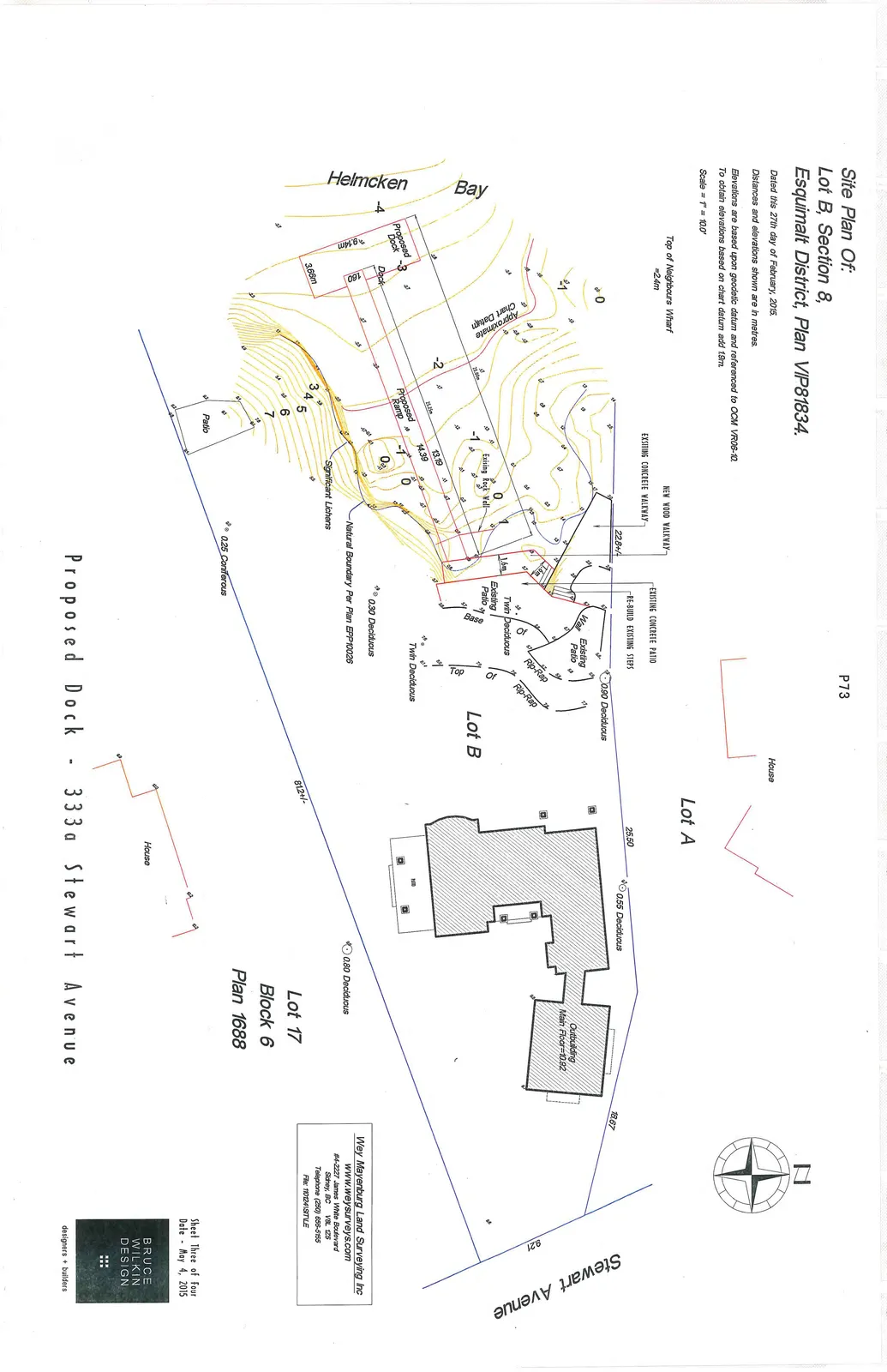
Site plan overview showing Lot B, neighboring Lot A, and Lot 17. The map details a proposed dock and ramp extending into Helmcken Bay, along with property boundaries, existing structures (House, Outbuilding), and vegetation (Deciduous and Coniferous trees).

Professional Information

Wey Mayenburg Land Surveying Inc www.weysurveys.com #4-2227 James White Boulevard Sidney, BC V8L 1Z5 Telephone (250) 656-5155 File: 1101241STILE

Sheet Three of Four Date - May 4, 2015

BRUCE WILKIN DESIGN designers + builders

Proposed Dock - 333a Stewart Avenue


Page 78–79

Proposed Dock - 333a Stewart Avenue
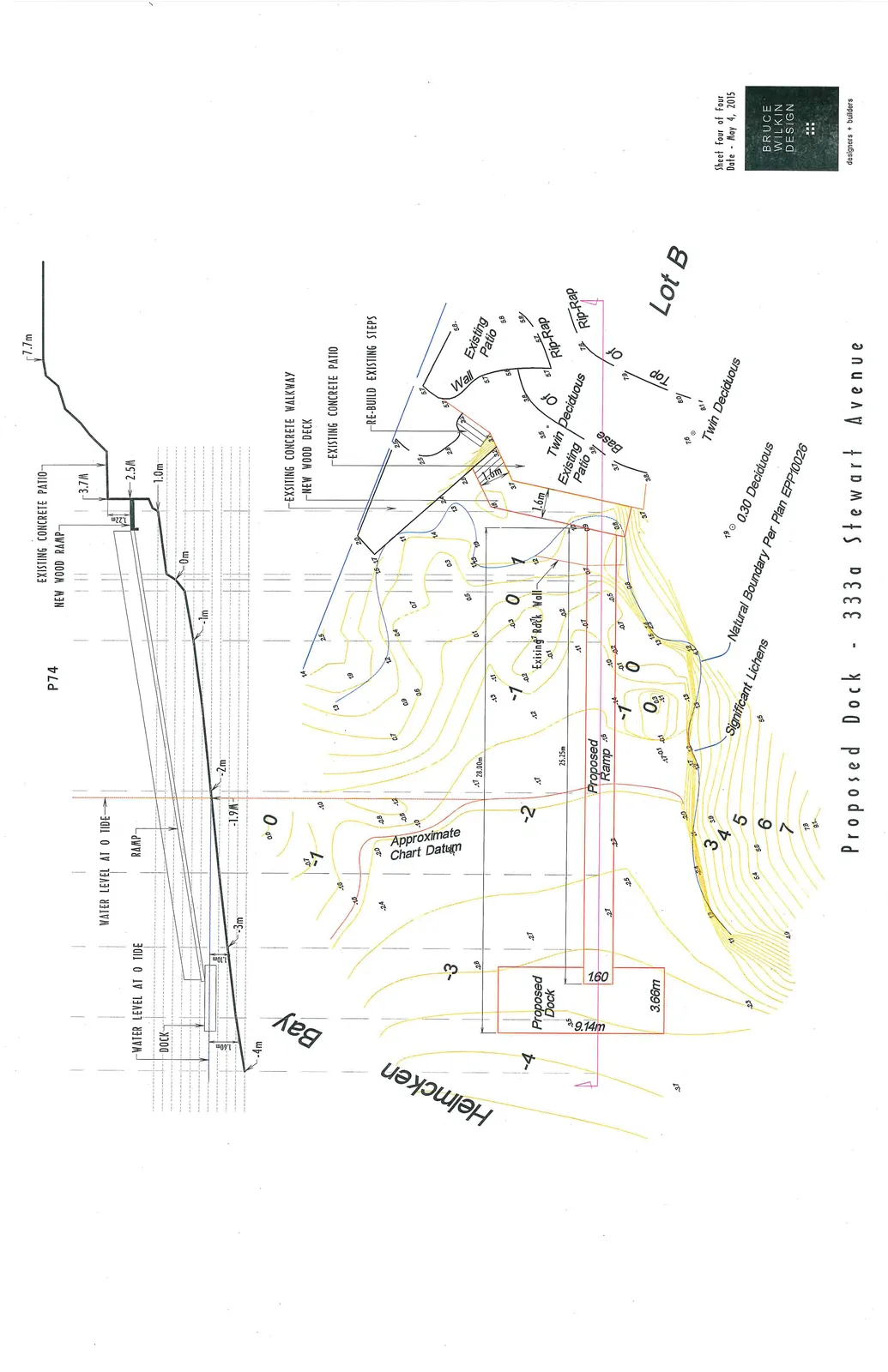
Technical drawing featuring a vertical elevation cross-section (top) and a detailed plan view (bottom) of the proposed dock and ramp at 333a Stewart Avenue. The elevation shows tide levels and bank height (up to 7.7m). The plan view details shoreline contours, existing rock walls, and natural boundaries.

Sheet Four of Four Date - May 4, 2015

BRUCE WILKIN DESIGN designers + builders

Page 78–79
Extracted from: 2015 06 09 Committee of the Whole Agenda